Capitol Reef
The desert keeps its old shorelines in the shape of its cliffs.
Also seen through Rivers & Canyons · all at Fruita →.
Why here
Capitol Reef is a desert with a crease running through it. The Waterpocket Fold bends layers of rock into a long step in the land, exposing old seafloors, river deposits, and cliffs that weather at different speeds. The payload’s Moenkopi Formation is one formal name for that older story, but the field lesson is plain: rock records the place it was made, and erosion opens the record later. Walk the overlooks and the fold becomes a landscape rather than a line on a map. The river, orchards, and desert plants all occupy the spaces the folded rock leaves behind.
The sites
The folded country
The Castle
38.2986, −111.2640
The Castle makes the folded rock easy to see as a form. Its cliffs stand above lower desert, and the layers remain visible because they resist weathering differently. Look for the horizontal bands and the breaks that cut through them. The desert’s color comes from material, not decoration. Each band is part of a longer history of sediment settling, hardening, and later being exposed by erosion.
Trace one layer across the cliff until a crack interrupts it. The continuous band is the old deposit; the crack is the later route water and weather use.
- AccessShort walk
- ExertionEasy
- TimeAn hour
Hickman Bridge Overlook
38.2915, −111.2325
Hickman Bridge Overlook shows what water does after the rock has been folded and exposed. A bridge is a gap left where erosion removes softer material while stronger rock remains above. The form is therefore both a piece of sandstone and an absence cut through it. Stand back far enough to see the opening as part of the larger cliff, then look at the thin edges where weather keeps working.
Find the narrowest part of the bridge and compare it with the thicker rock around it. The opening grows where erosion has found a weaker route through the layer.
- AccessShort walk
- ExertionModerate
- TimeHalf a day
Reading the layers
North Fruita Overlook
38.2871, −111.2373
North Fruita Overlook gives the Waterpocket Fold its long view. Ridges and valleys repeat through the desert, showing how a single bend in the crust can create many local slopes. Water collects in some of them, while exposed rock remains dry on the higher faces. Look for the contrast between the broad fold and the small drainages cutting it. Deep time is visible at both scales.
Follow a ridge down until it becomes a wash. The ridge is the folded rock; the wash is the present water route opening a smaller line through it.
- AccessDrive-up
- ExertionEasy
- TimeAn hour
South Fruita Overlook
38.2847, −111.2398
South Fruita Overlook turns the desert toward the living ground below the cliffs. Mule deer use open country, while plants gather where soil and water can stay. Fruita’s greener pockets are not separate from the fold. They are what happens when the folded rock directs water into lower ground. Look from the bare wall to the plants in the valley and keep the route between them in view.
Find the greenest strip below the overlook and trace it uphill. The strip follows water held by the folded land.
- AccessDrive-up
- ExertionEasy
- TimeAn hour
Desert life on old rock
Rim Overlook
38.2912, −111.2493
Rim Overlook is a place for the desert’s small answers to old rock. Roundleaf buffaloberry and showy milkweed use pockets of soil along the exposed slopes, while mule deer move through the larger openings. The plants make the geology visible by choosing different parts of it. Look for where roots can hold and where the rock sheds everything. Capitol Reef is not uniformly dry. Its folds create many small climates in a short distance.
Compare a plant-covered pocket with a bare ledge nearby. The difference in soil and runoff decides where desert life can take hold.
- AccessShort walk
- ExertionModerate
- TimeHalf a day
When it's best
Spring and fall are the most comfortable seasons for walking the exposed rock and canyon edges. Spring flowers and flowing water can animate the lower country, while fall brings cooler light to the cliffs. Summer mornings are best for open trails, with shade becoming important later. After storms, washes and slickrock can change quickly.
Go deeper
The names behind what you saw. The rock record includes the Moenkopi Formation and other Mesozoic sedimentary rocks. Mule deer, Odocoileus hemionus, and roundleaf buffaloberry, Shepherdia rotundifolia, are part of the living desert.
To read next. - Capitol Reef’s geological map — for the Waterpocket Fold and its rock layers. - The park’s natural-history material — for desert plants and animals along the fold.
The names behind what you saw
What lives here, and what it's called. Photographs from open collections — an aid to identification, not decoration.
-
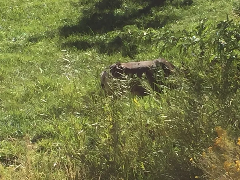
Mule Deer Odocoileus hemionus -
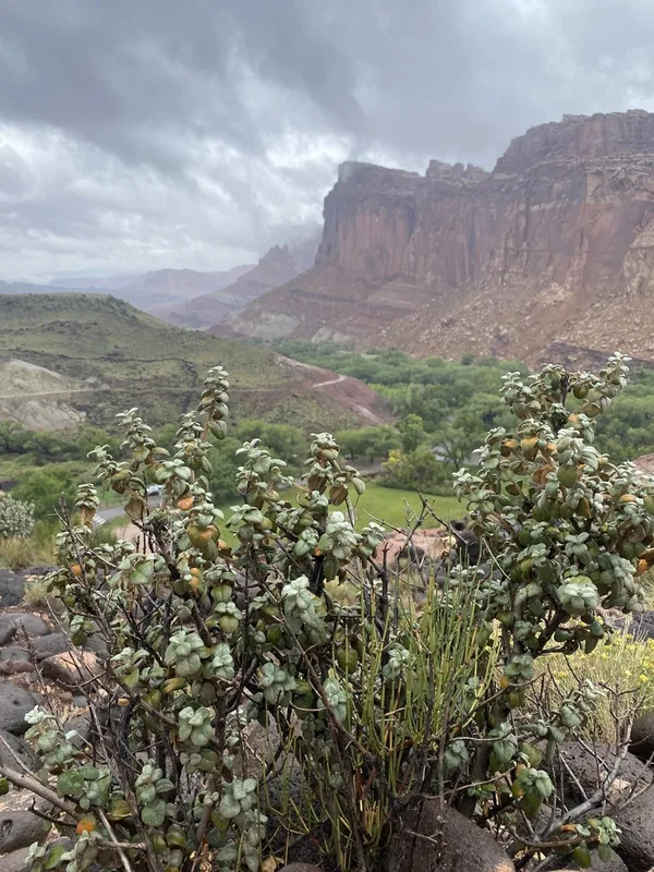
Roundleaf buffaloberry Shepherdia rotundifolia -
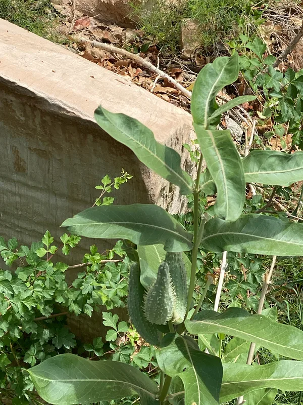
showy milkweed Asclepias speciosa -
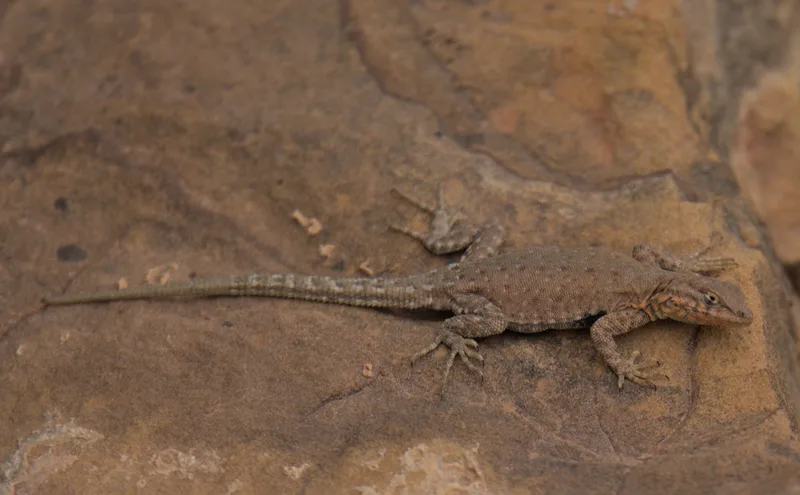
Common Side-blotched Lizard Uta stansburiana -
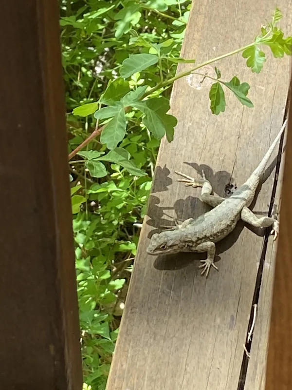
Plateau Fence Lizard Sceloporus tristichus -
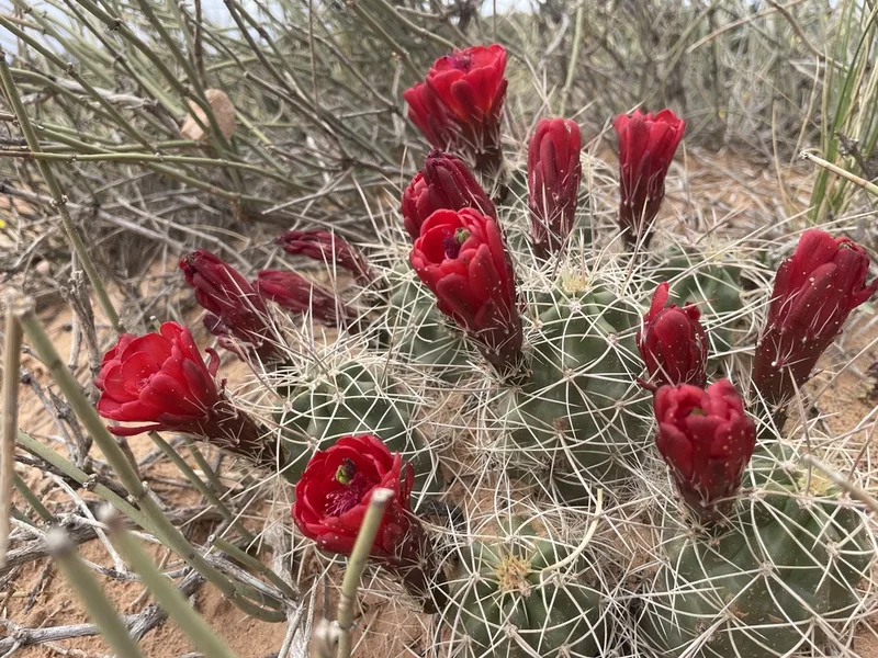
Kingcup Cactus Echinocereus triglochidiatus -
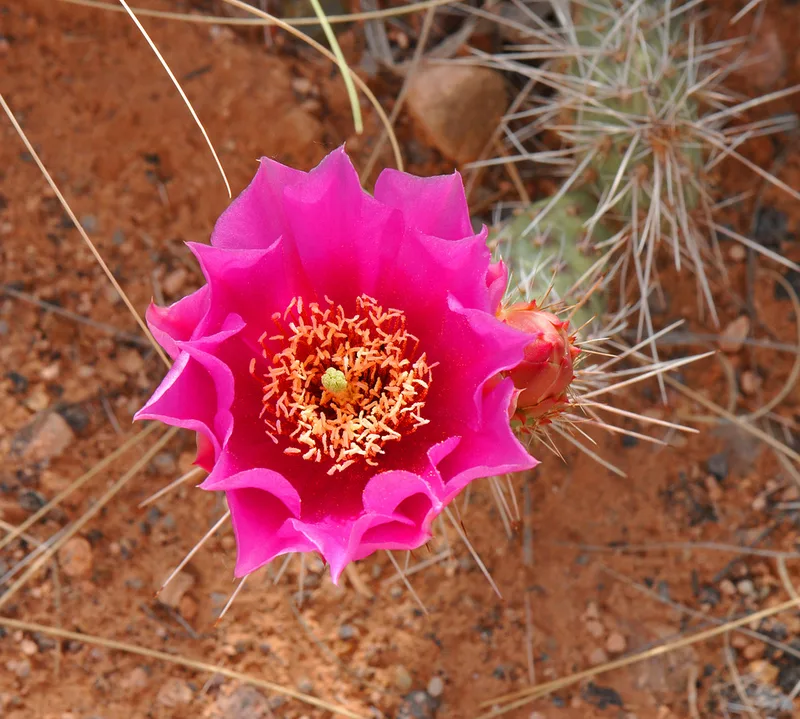
Plains Pricklypear Opuntia polyacantha -
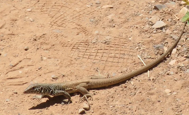
Western Whiptail Aspidoscelis tigris -
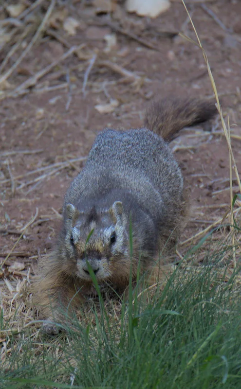
Yellow-bellied Marmot Marmota flaviventris -
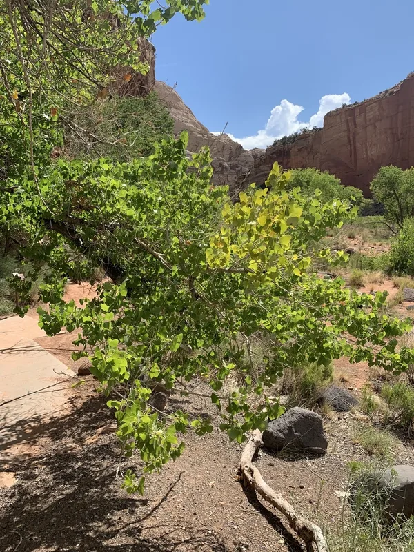
Frémont Cottonwood Populus fremontii -
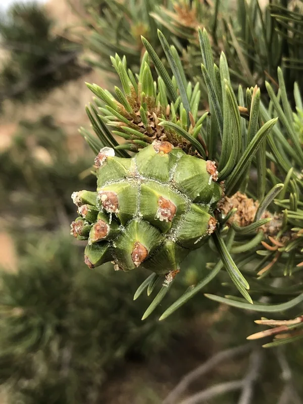
Colorado Pinyon Pinus edulis -
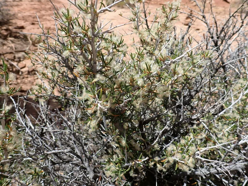
Littleleaf Mountain Mahogany Cercocarpus intricatus
Field Notes · Desert & Deep Time lens · Fruita · 38.2855, −111.2468