Cape Perpetua
Cape Perpetua North Marine Protected Area · Oregon, USA
The headland and the ocean have never agreed on where the edge belongs, and the coastline is just where that argument stands today.
Also seen through Fog Coast · all at Cape Perpetua North Marine Protected Area →.
Why here
Stand anywhere along Cape Perpetua and you are standing on the losing side of a very old argument. The headland looks solid on a map — a fixed green shoulder pushed out into the Pacific — but nothing about it has stayed still for long. The ocean spends every wave testing the rock for a weak seam, a crack, a soft layer, and when it finds one it does not let go; it goes back to that same spot, tide after tide, year after year, until the weak spot becomes a notch, the notch becomes an inlet, and the inlet becomes a name on a map. Higher up, the same contest runs slower and quieter: rain and fog work their way downhill through the forest, finding their own weak seams in the soil and duff, carrying the hillside toward the sea a little at a time. Different pace, same argument. This note follows that argument at both speeds — the fast one at the shoreline, the slow one in the trees above it — because at Cape Perpetua they turn out to be the same story.
The sites
Where the sea splits the rock
Cleft of the Rock Light
44.2905, −124.1108
The name here is the whole lesson, if you read it plainly: a cleft is a crack forced open in something that used to be whole. Long before any wave reached this stretch of coast, the rock of the headland was already broken along old lines of weakness, the kind that form quietly as rock cools, settles, or gets squeezed by forces that have nothing to do with the ocean. The sea does not care how a crack got there. It only cares that it is there, and it works every crack it finds harder than the solid rock around it, because a crack is where the water can get a grip. Over enough time, a fracture like this one widens into the kind of gap you can see from the road, and eventually into the kind of gap that can carry a name — and, in this case, hold a light to warn ships away from exactly the rock it is cut into. The lighthouse sits at the site of an old argument the ocean is still actively winning, one storm at a time. It is easy to look at a crack in a cliff and see only rock. Here, look at it instead as a record of a preference: water always finds the weak point first.
From the road, look for the narrow gap in the cliff face that the light stands beside. Compare the rock right at the opening — darker, more broken, often wet — with the drier, more solid rock a short distance away on either side; that difference marks how far the sea’s daily reach into the crack extends. Try to trace the line of the crack inland with your eye: a true fracture usually runs straight for some distance, cutting across the headland’s outer shape rather than following it.
- AccessDrive-up
- ExertionEasy
- TimeAn hour
Trail of the Restless Waters - West Trailhead
44.2837, −124.1104
The trail’s own name gives away what it leads to: a short walk from here brings you to Devils Churn, a narrow inlet where the ocean pushes in, finds no room to spread out, and answers by rising and boiling instead. A slot like this behaves differently from open water. When a wave enters a wide bay, its energy spreads sideways and the water simply rises a little. When the same wave enters a channel this narrow, the energy has nowhere to go but up, and the water surges and churns in a way the open ocean beside it never does — which is presumably how an inlet like this earns a name like that. It is one of the few places on the cape where you can watch erosion happening on something close to a human timescale rather than being told about it after the fact: the same wedge of rock worked at, wave after wave, for as long as you care to stand there. The walk in is short and easy, which is part of what makes this stop worth it — a slow argument, made visible, close enough to reach without much effort.
Follow the trail to where it opens onto the narrow inlet and pick one spot near, but well back from, the edge. Watch four or five wave cycles in a row rather than just one — notice how much the surge varies from wave to wave, and how the water in the channel keeps moving and churning even in the pause between incoming waves, unlike the calmer water in the open ocean just beyond the inlet’s mouth.
- AccessShort walk
- ExertionEasy
- TimeAn hour
The slow argument in the trees
Amanda's Trail - North Trailhead
44.2985, −124.1087
Not every argument between water and rock is loud. Up here, off the immediate coast, the same contest runs on a much quieter budget: rain, and the fog this stretch of coast pulls in through the warmer months, both find their way downhill through the forest a little at a time. You will not see a single obvious stream near this trailhead so much as a scattered network of small, half-hidden channels, each one carrying its own modest share of runoff toward the ocean below. The forest itself is built to hold onto some of that water rather than shed it all at once — thick moss, heavy duff, and a canopy that traps fog and drips it slowly rather than dumping it in one storm. That slowness is the whole point. A hillside like this one is being carried to the sea just as surely as the rock at the shoreline is, only stretched out over a timescale too long to watch directly. The trail crossing it is a good place to notice the evidence instead: the moisture that never quite dries out, the soft footing, and the plants that only grow where water lingers.
Walk a short distance in from the trailhead and look at the trail surface itself rather than the trees: after any rain, note how the water has cut several small, braided channels across the path rather than one clean line, a sign that runoff here disperses instead of following a single course. Look, too, at any nearby tree trunks or fallen logs for a fern growing directly out of the bark rather than the ground — likely leathery polypody, which anchors in moss and wood rather than soil, a good sign of how much moisture this forest holds even between storms.
- AccessShort walk
- ExertionModerate
- TimeAn hour
Amanda's Trail - South Trailhead
44.2875, −124.1054
Follow the same idea further along the flank of the cape and the pattern holds: this end of the trail sits lower on the slope, closer to where all those small drainages above have had more distance to gather themselves before reaching the water table. Lower ground like this tends to stay wetter for longer after a rain, and the plant life along the trail generally shows it — thicker moss, denser fern cover, and an understory built around plants that prefer damp, shaded ground, salal chief among them here. Overhead, Sitka spruce does some of the water-moving work before it ever reaches the ground: needled conifers like this one are unusually good at combing moisture straight out of fog and drizzle, letting it condense and drip from the canopy long after the rain itself has passed. None of this is dramatic to look at in the way a wave against a cliff is, but it is the same water, doing the same patient work, just recruiting the forest to help carry it downhill instead of carving the coast directly.
Compare the ground cover here with the higher trailhead earlier in the walk: look for a thicker, more continuous carpet of moss and salal, especially in any low or shaded dip in the trail, and take a moment under the tallest spruce nearby to see whether it is still dripping even on a day when it has not rained recently.
- AccessShort walk
- ExertionModerate
- TimeAn hour
The high vantage
Cape Perpetua Trailhead
44.2868, −124.1081
Everything the other stops on this note show up close is visible at once from the top of the climb that starts here: a headland that looks, from a distance, like a single solid shoulder of rock, but that up close is a coastline of points, notches, and inlets, each notch marking a spot where the rock was a little weaker than its neighbors. Seen from height, the whole cape reads less like a fixed shape and more like a shoreline still being negotiated, one storm and one rainy season at a time. Exposed, wind-scoured ground near the top favors plants that can take the salt and the open air; Sea Thrift, a low cushion plant common on bluffs like this one along the Pacific coast, is one of the more visible signs of just how harsh that edge habitat is compared with the sheltered forest lower down. The climb itself is the point as much as the top is: it traces, in miniature, the same gradient the water follows in reverse — from spray-soaked rock at the shore, through wetter forest, to the drier, wind-hardened ground above.
From the high point of the trail, look along the shoreline in both directions rather than straight out to sea: trace how the coast alternates between rounded points and sharper notches, and notice that the notches, not the points, are where you would expect to find an inlet like the one seen earlier on this note.
- AccessHalf-day hike
- ExertionModerate
- TimeHalf a day
When it's best
This coast never really stops testing itself, but the emphasis shifts with the seasons. Through the cool, wet months, storm swell tends to send the biggest water into the churns and clefts along the shore, throwing spray well up the rock and giving the clearest sense of the sea actually doing its work; the same rains swell the runoff crossing the forest trails above, so expect wetter footing and fuller drainages underfoot. In summer, the ocean generally quiets down, but the coastal fog it throws off keeps the forest damp even between rains, so the slower half of the argument never really pauses either. There is no single best month here so much as a choice of which half of the story you would rather watch.
Go deeper
The names behind what you saw — Sitka spruce, the conifer overhead on the forest trails, is Picea sitchensis; the fern rooted directly in wet bark rather than soil is leathery polypody, Polypodium scouleri; the shade-loving shrub underfoot lower on the slope is salal, Gaultheria shallon; the low cushion plant on the exposed bluff top is Sea Thrift, Armeria maritima. The rock record along this stretch of coast is mapped as the Central Coastal Range column, a composite that mixes old lava (basalt) with old seafloor deposits (sandstone, siltstone, mudstone) laid down over tens of millions of years — a regional record, not a claim about the rock at any single stop.
To read next - Wikipedia, “Devils Churn” — the clearest short account of the surge inlet the Restless Waters trail leads to. - Wikipedia, “Cape Perpetua” — the basic geographic and administrative frame for the whole headland. - Wikipedia, “Cleft of the Rock Light” — background on the lighthouse and its place on the cape. - Wikipedia, “Yachats River” — the short river at the cape’s foot, including what its name is said to mean. - Macrostrat column 266, “Central Coastal Range” — the raw regional rock record behind the plain-language version above, for anyone who wants the lithology directly.
The names behind what you saw
What lives here, and what it's called. Photographs from open collections — an aid to identification, not decoration.
-
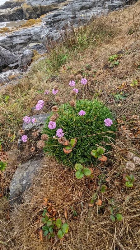
Sea Thrift Armeria maritima -
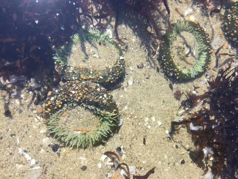
Giant Green Anemone Anthopleura xanthogrammica -
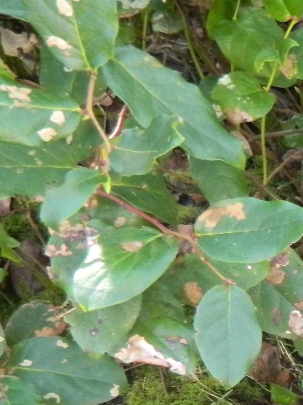
salal Gaultheria shallon -
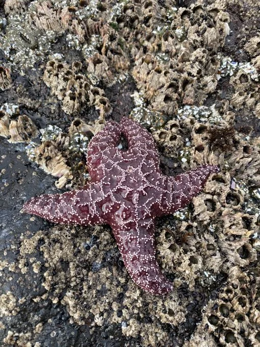
Ochre Sea Star Pisaster ochraceus -
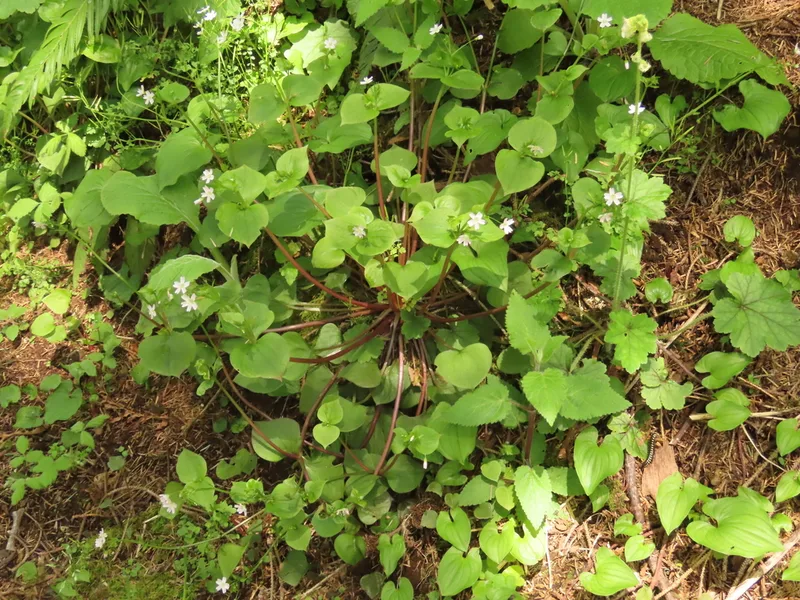
Candy Flower Claytonia sibirica -
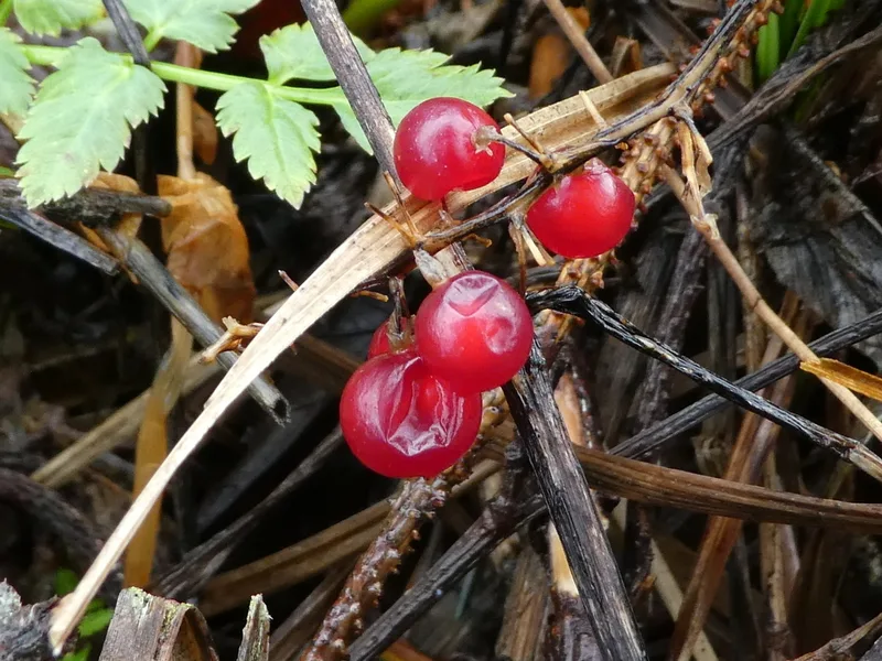
Western Lily of the Valley Maianthemum dilatatum -
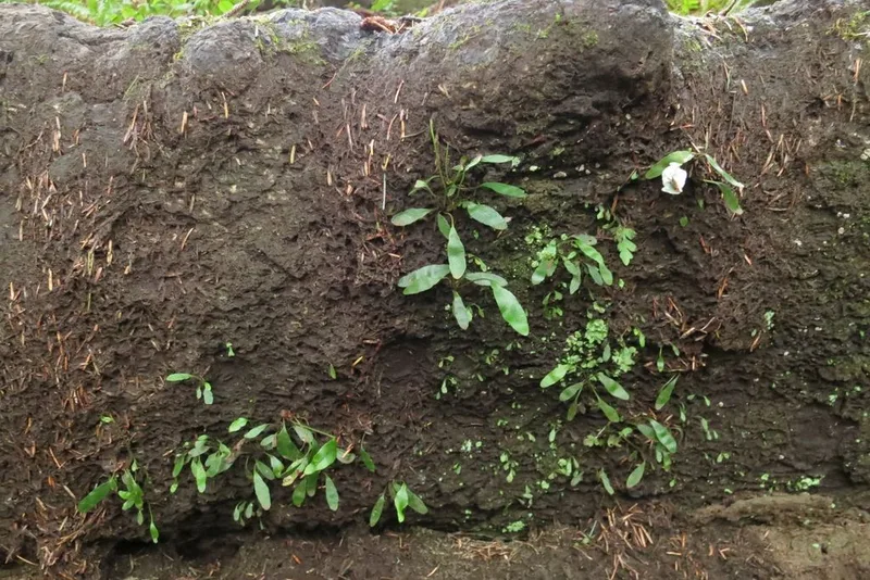
leathery polypody Polypodium scouleri -
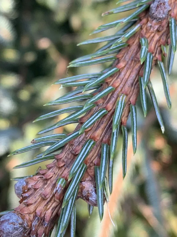
Sitka spruce Picea sitchensis -
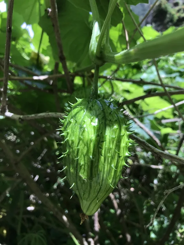
coastal manroot Marah oregana -
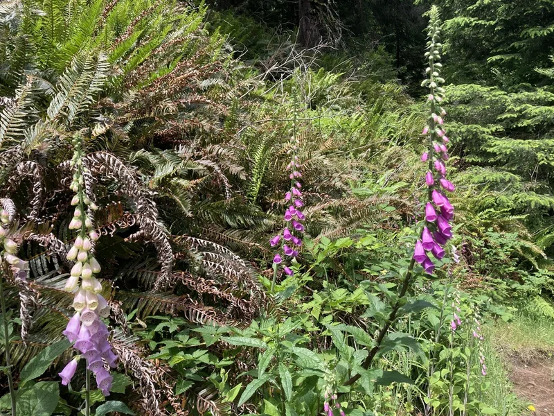
purple foxglove Digitalis purpurea -
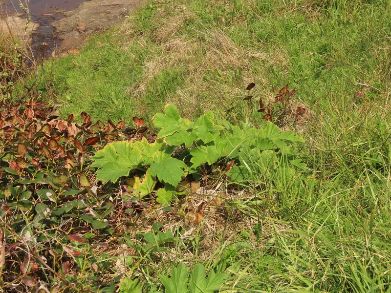
common cowparsnip Heracleum maximum -
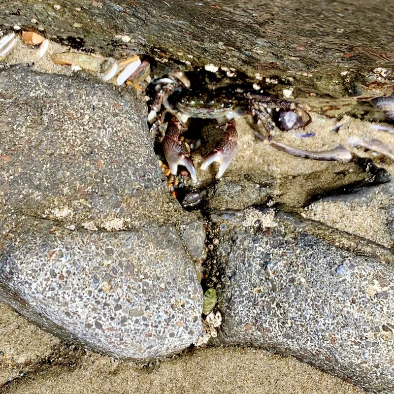
Striped Shore Crab Pachygrapsus crassipes
Field Notes · Rivers & Canyons lens · Cape Perpetua North Marine Protected Area · 44.3073, −124.1411