Cape Perpetua
Cape Perpetua North Marine Protected Area · Oregon, USA
The coast keeps its best work at the boundary between solid ground and moving water.
Also seen through Rivers & Canyons · all at Cape Perpetua North Marine Protected Area →.
Why here
Cape Perpetua is a coast of motion held in one place. Waves enter clefts, spray reaches the forest, and fog settles on plants above the shore. The named trails here follow restless water and loop through land that is never fully separate from the sea. That is the useful idea. A fog coast is not just a wet forest beside a beach. It is a single system in which ocean air, wave force, rock, and roots keep exchanging material. Walk the cape slowly and notice how the same weather appears in different forms: white water below, salt on the wind, and green cover inland. The coast stays alive because it never quite becomes still.
The sites
Water at work
Cleft of the Rock Light
44.2905, −124.1108
This light stands near a coast where the water’s force is easy to imagine. The name of the nearby cleft is a reminder that waves do not need to move a whole cliff at once. They enter openings, enlarge weaknesses, and keep the edge irregular. Fog softens the upper view while the surf keeps working below it. Stand far enough back to see the whole relationship: light, rock, spray, and forest. The coast’s drama is not separate from its living system. The same wet air that fills the view also reaches the plants above the wave line.
Look for a crack or cleft in the shore and watch several waves reach it. The repeated impact makes a small opening a place where the sea can keep working on solid rock.
- AccessDrive-up
- ExertionEasy
- TimeAn hour
Trail of the Restless Waters - East Trailhead
44.2836, −124.1100
The east trailhead leads into the coast’s central exchange: restless water below, fog above, and forest between. The trail is valuable because it lets you leave the overlook and enter the zone where moisture becomes habitat. Salal and other coastal plants hold the ground, while the exposed edge receives spray and wind. Listen for the water even when trees block the view. The sound keeps the ocean present as the trail turns inland. Cape Perpetua is a place where the sea remains close even when it disappears from sight.
Find a plant with wet leaves under the forest canopy and look toward the open coast. Fog and spray carry ocean moisture inland even where the waves are hidden.
- AccessShort walk
- ExertionModerate
- TimeHalf a day
The fog-fed forest
Amanda's Loop Trail - South Trailhead
44.2870, −124.1083
Amanda’s Loop makes the fog coast a walking circuit rather than a single vista. As the trail changes direction, notice how the forest closes and opens. Dense green cover holds moisture after the fog lifts, while exposed turns let wind and salt show themselves more directly. Salal is one of the plants that makes this coast look persistently green, but the important fact is the relationship rather than the species list. The forest is fed by air arriving from the ocean. Its leaves are part of the coast’s weather gauge.
Touch nothing, but look closely at the leaves along the trail. The glossy, persistent cover is adapted to a coast where moisture often arrives from fog as well as rain.
- AccessShort walk
- ExertionModerate
- TimeHalf a day
Amanda's Trail - North Trailhead
44.2985, −124.1087
The north trailhead offers a second way into the same forest, useful for noticing how quickly coastal conditions can change with elevation and exposure. Near open ground, wind shapes plants and keeps the air moving. Under trees, fog becomes a lingering film of moisture and the forest floor stays darker. Walk slowly enough to hear the transition in the canopy. The cape is not a line dividing ocean from land. It is a gradient, and the gradient is what keeps the land alive.
Stop where the trail passes from open exposure into trees. Compare the wind and moisture on your face; the forest begins where the fog can stay longer.
- AccessShort walk
- ExertionModerate
- TimeHalf a day
The intertidal edge
Trail of the Restless Waters - West Trailhead
44.2837, −124.1104
The west trailhead returns the story to the waterline. Here the shore is a changing surface, sometimes covered and sometimes exposed, where anemones, sea stars, and other intertidal life use cracks and pools between waves. The coast asks for patience. One view may show only foam; a later one may reveal a small animal holding to stone. Keep your distance from the most exposed edge and read the water’s pattern first. The living sea is easiest to understand when you see the conditions it must endure.
At a safe distance, find a pool that remains wet as the surrounding rock drains. That small pocket is what lets anemones and other shore life persist between tides.
- AccessShort walk
- ExertionModerate
- TimeHalf a day
When it's best
Fog and low cloud are most common in the cooler, wetter part of the year, while summer often offers longer views between marine layers. Low tide exposes more of the rocky edge and makes the tide pools easier to read. Winter surf can make the coast louder and more dangerous around exposed points. Keep to the trails and let conditions decide how close you get to the water.
Go deeper
The names behind what you saw. The ecology payload includes sea thrift, Armeria maritima, giant green anemone, Anthopleura xanthogrammica, salal, Gaultheria shallon, and ochre sea star, Pisaster ochraceus.
To read next. - The coastal geology and natural-history material for Cape Perpetua — for the relationship between wave-cut shore and fog-fed forest. - The tide-pool guidance for the area — for reading the intertidal life without disturbing it.
The names behind what you saw
What lives here, and what it's called. Photographs from open collections — an aid to identification, not decoration.
-
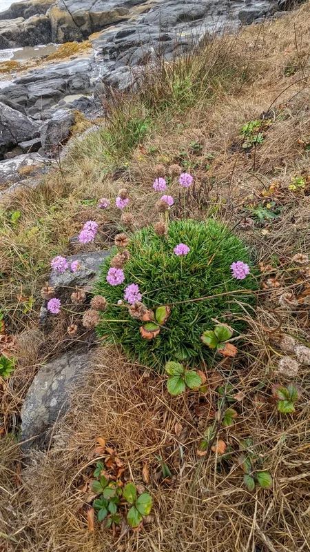
Sea Thrift Armeria maritima -
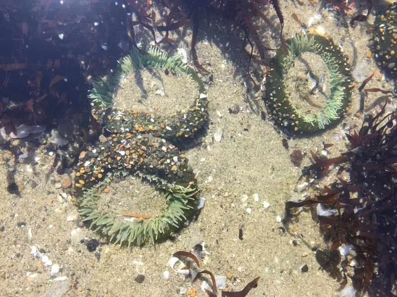
Giant Green Anemone Anthopleura xanthogrammica -
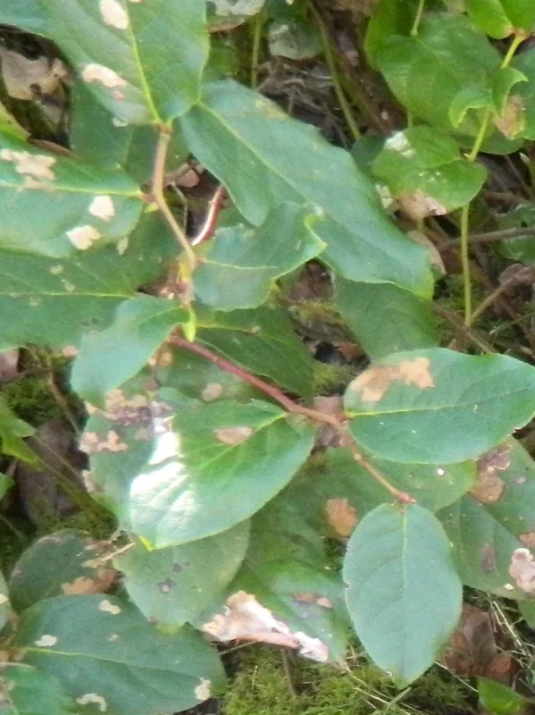
salal Gaultheria shallon -
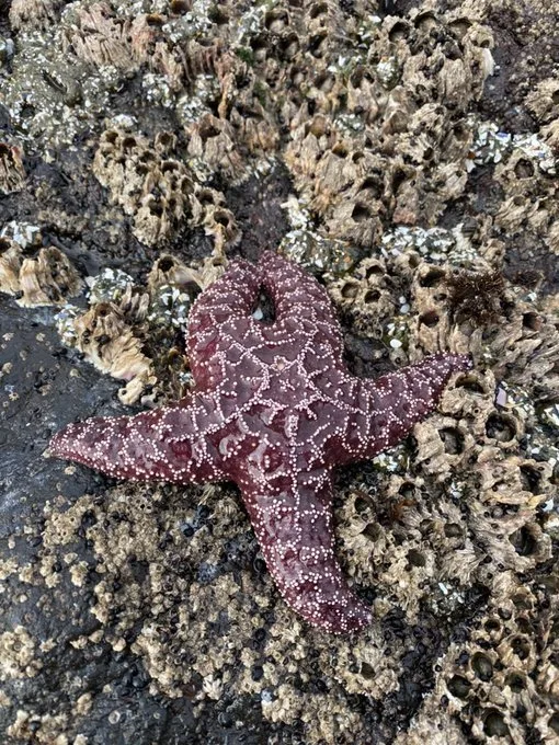
Ochre Sea Star Pisaster ochraceus -
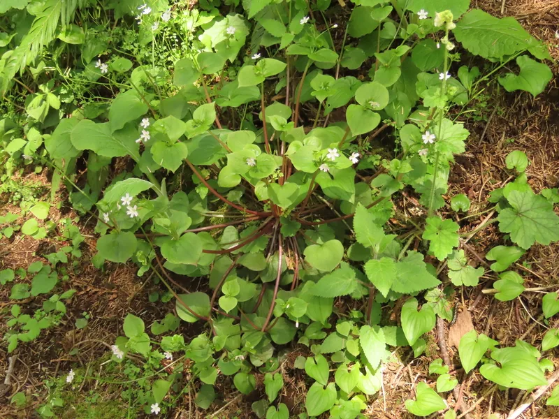
Candy Flower Claytonia sibirica -
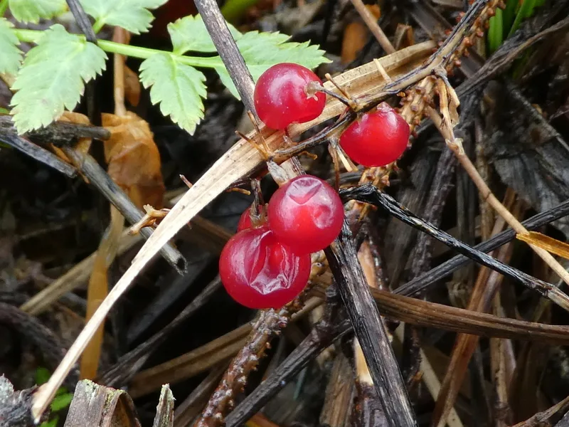
Western Lily of the Valley Maianthemum dilatatum -
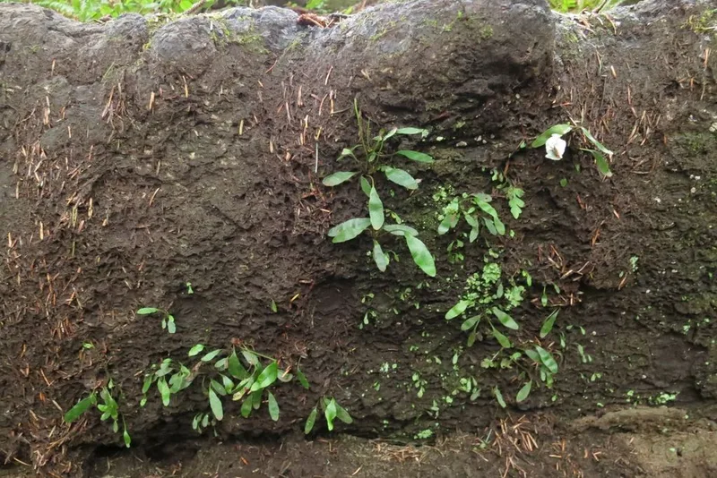
leathery polypody Polypodium scouleri -
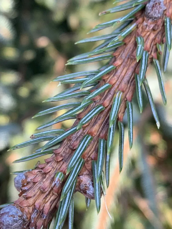
Sitka spruce Picea sitchensis -
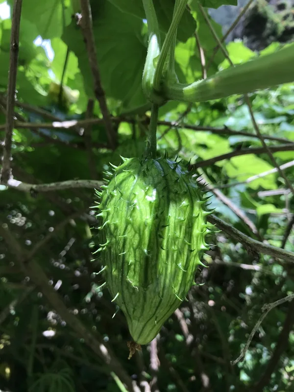
coastal manroot Marah oregana -
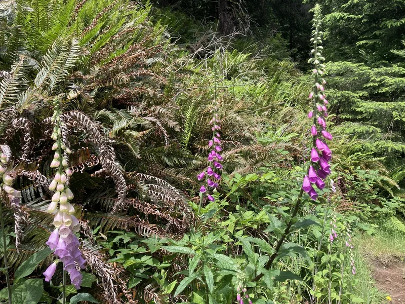
purple foxglove Digitalis purpurea -
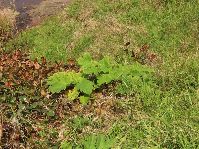
common cowparsnip Heracleum maximum -
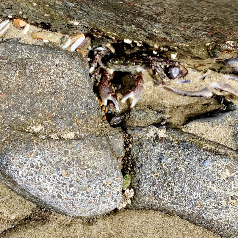
Striped Shore Crab Pachygrapsus crassipes
Field Notes · Fog Coast lens · Cape Perpetua North Marine Protected Area · 44.3073, −124.1411