Canyonlands
Two rivers went to work on a single tableland, and what they left standing came to be called an island.
Also seen through Desert & Deep Time · all at Island in the Sky →.
Why here
Stand at the edge of the mesa and you are standing on an island — not one of water, but of rock, with empty air on nearly every side. Two rivers made it. The Colorado and the Green run through this country toward each other, and for a very long time they have done one patient thing: cut down. As they sank into the flat-lying stone, they carried away everything between them and left the ground you stand on stranded high above their canyons. That is why this district is called the Island in the Sky. Below the rim the rock falls away in giant steps — a broad pale bench partway down, then another drop to the water still working at the bottom. The buttes scattered across the view are the last pieces of a surface that once ran unbroken; the rivers took the rest. Everything here follows from that slow removal. Spend a few days on the rim and the canyons stop being scenery and become the record of a long argument the water is still winning.
The story
Start with the rock, laid down flat. Much of what the rivers cut through began as sand — some of it wind-blown dune, piled up in a desert about 170 million years ago and later buried and pressed into pale, slant-lined stone. Layer sat on layer, and far beneath them all lies an old buried basin still holding beds of salt. Then the two rivers arrived and spent millions of years sawing down through the stack, leaving the mesa, the benches, and the scattered buttes as what remained.
Life here reads the rock. Along the cliff walls a canyon wren sends its song falling note by note down the stone, and white-throated swifts pour off the rim in fast dark arcs, using the drop as a runway. On the warm rim, cliffrose and pricklypear hold the thin soil, lizards bask on sun-heated ledges, and after a wet winter the ground puts up lupine and other low desert flowers, gone again by summer.
People came late and left light marks. In the 1950s prospectors cut a long dirt road along the pale middle bench, chasing uranium for the Cold War; the ore proved thin and the mines were abandoned. A decade later, in 1964, the canyons around the rivers were set aside as a national park. The record here is quiet on who lived on this dry tableland before them.
The sites
Reading the rivers from the rim
Green River Overlook
38.3880, −109.8860
The Green River Overlook looks west and down onto the Green River’s canyon and the tangle of benches it has carved. From here the two-step shape of the whole country is plain to read: the flat mesa top where you stand, a wide pale bench well below it, then a deeper trench where the river still runs. Often you cannot even see the water — it hides in its own inner gorge — yet everything in the view is arranged by it. The broad bench is a single hard layer that the softer rock above has worn back from, and the river sets the low point that all this ground drains toward and wears down to. Stand a while and the scene sorts itself into a sequence: the higher, softer stone gives way first, the harder ledges hold, and the river keeps the base of the whole system dropping. A recent geology paper is built around this exact overlook, working through the stack of rock from top to bottom, which is the right way to look at it — as a column you read downward toward the water.
Look for the wide pale bench partway down, running level for miles below the rim. It is one hard layer of rock the softer stone above has crumbled back from; find the place where that crumbling edge is clearest and you are seeing the difference in hardness that gives this country its steps.
- AccessDrive-up
- ExertionEasy
- TimeAn hour
Mesa Arch
38.3880, −109.8634
Mesa Arch sits right at the lip of the mesa, a thin band of stone bridging open air with the canyons falling away behind it. A short, near-level trail loops out to it from the road. The arch is worth the walk not only for the frame it makes but for what it shows about how this rock comes apart: water works into the sandstone, freezes, and pries grains loose along cracks, and where a slab is undercut from below the rest hangs on as an arch until it too lets go. The view through the opening runs east across a field of buttes and towers, each one a leftover of rock the rivers have otherwise carried off. It is a small thing standing at the edge of a very large emptiness, and the two scales are the point — the same slow removal that hollowed the arch is the removal that emptied the canyons beyond it. Come early; this east-facing edge draws a crowd at first light.
Crouch and look through the arch at the far buttes and towers. Each standing rock is a piece of a surface that once ran unbroken across the whole view; the empty gaps between them are exactly what the rivers have removed.
- AccessShort walk
- ExertionEasy
- TimeAn hour
The rock left standing
Aztec Butte
38.3973, −109.8747
Aztec Butte is a rounded white dome standing a little above the surrounding mesa, and a trail climbs its bare sandstone flank to the top. The rock is old dune sand — wind-piled desert from about 170 million years ago, later buried and hardened, its slanting internal lines still plain where you scramble up. This is some of the same pale stone that caps the buttes out in the canyons; here you can put your hands on it. From the summit the ground falls away into the drainages that feed the rivers, and the arrangement makes sense underfoot: the higher, harder dune rock resists while the softer layers below it wash out and away, leaving the dome standing. The climb is short but steep and exposed on open rock, and the top rewards a slow look rather than a quick photo. Think of the butte as a held position in a long retreat — a scrap of high ground the rivers and their side canyons have not yet reached.
On the way up, look at the rock face for long slanting lines that cut across the flatter layers. Those are the fronts of old sand dunes, frozen in stone — the way they lean records the direction the desert wind was blowing when this was loose sand.
- AccessShort walk
- ExertionModerate
- TimeHalf a day
Muffin Butte
38.3776, −109.8743
Muffin Butte stands off on the western side of the district, a small flat-topped summit above the basin where the Green River swings by. Reaching it is a long, unmarked effort across open country, and it rewards mostly those already out on the benches below the rim rather than anyone starting from the road. What it offers is perspective. From here the Island in the Sky reads as exactly that — a high tableland cut off on its flanks — and the Green River’s work on the softer ground of the basin is spread out plainly below. Like the other buttes scattered through these canyons, it is a remnant: a scrap of higher ground the rivers have not yet taken down. Standing on one such leftover looking across at the others is the clearest way to grasp how much rock is simply gone. Go only prepared for rough, waterless travel with your own navigation, and treat the distance with respect.
From any high point out here, pick out the separate flat-topped buttes standing above the basin and line up their tops by eye. They sit at nearly the same height because each is a surviving piece of one former surface that the rivers have since cut apart.
- AccessExpedition
- ExertionStrenuous
- TimeA full day
Onto the island and under it
White Rim Road
38.2748, −109.8632
The White Rim Road is a long dirt track that runs the pale bench partway down between the mesa rim and the rivers, looping most of the way around the district. Prospectors cut it in the 1950s to reach uranium they hoped lay in the rock; the ore proved thin and the mines closed, but the road remains as a way onto the bench itself. Down here the two-step country makes bodily sense: the mesa wall rises on one side, the rivers’ inner canyons drop away on the other, and you travel along the hard layer that holds them apart — the very bench you saw as a thin pale line from the rim above. It is slow, rough four-wheel-drive travel, waterless and remote, better measured in days than in hours. From the bench the rock stands over you in the order the rivers exposed it, bottom to top, and the sheer height of the wall above is the plainest measure of how much the water has removed to make room for the canyon at your other hand.
Down on the bench, look up at the mesa wall and pick out the layers stacked in order. The pale rock you are driving on is one hard band the softer stone above has worn back from; that single difference in hardness is why the country falls away in steps instead of one smooth slope.
- AccessExpedition
- ExertionStrenuous
- TimeWorth two days
When it's best
This is high desert, and the shoulder seasons treat it best. In spring the days turn mild while the nights still drop to around freezing, and the little rain that falls does nothing to slow a walk; after a wet winter the rim flowers — lupine and low desert blooms — come and go quickly, usually spent by early summer. Summer days on the open rim run hot with almost no shade, so early morning is the time to be out. Canyon wrens and swifts work the cliffs through the warm months, easiest to hear in the still air at dawn. Carry your own water in any season.
Go deeper
The names behind what you saw. The pale, wind-piled dune rock at the tops of the buttes is the Navajo Sandstone, part of the Glen Canyon Group — search either name for the cross-bedded-dune story it records. The broad middle step below the rim is the White Rim, held up by the White Rim Sandstone. Far beneath everything lies the Paradox Basin, an ancient buried basin still holding beds of salt. The bird whose song falls down the cliff is the canyon wren, Catherpes mexicanus; the fast dark arcs off the rim are white-throated swifts, Aeronautes saxatalis, and the tumbling black birds are common ravens, Corvus corax. The rim shrubs are Stansbury’s cliffrose, Purshia stansburyana, and plains pricklypear, Opuntia polyacantha; the blue spikes after a wet winter are silvery lupine, Lupinus argenteus.
To read next. Verified reading on this exact ground is thin, but one piece fits closely: a Geological Society of America abstract, Geology from the Green River Overlook, Island in the Sky District, Canyonlands National Park (2025), which walks through the very stack of rock you see from that overlook and how the rivers laid it bare. Beyond that, the honest answer is that little else in our pre-checked shelf speaks directly to this district — the formation and species names above are the better thread to pull.
The names behind what you saw
What lives here, and what it's called. Photographs from open collections — an aid to identification, not decoration.
-
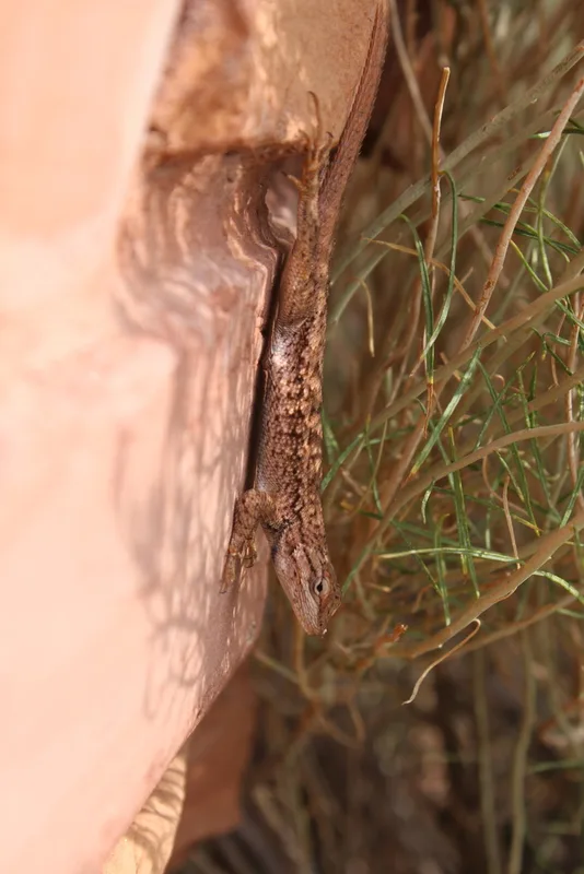
Plateau Fence Lizard Sceloporus tristichus -
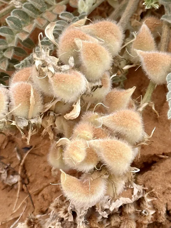
Woolly Locoweed Astragalus mollissimus -
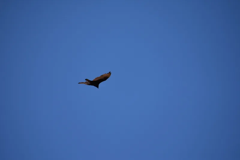
Turkey Vulture Cathartes aura -
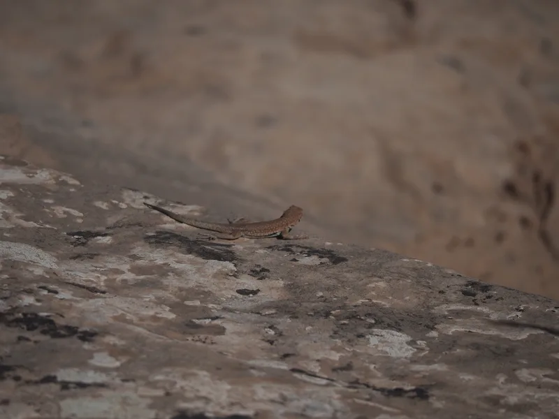
Common Side-blotched Lizard Uta stansburiana -
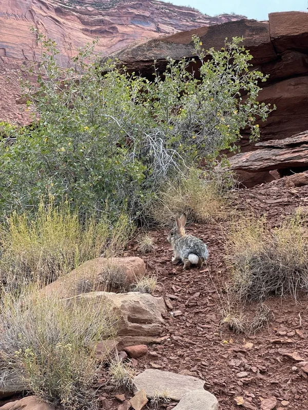
Desert Cottontail Sylvilagus audubonii -
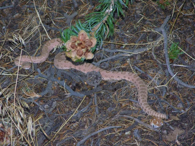
Western Rattlesnake Crotalus oreganus -
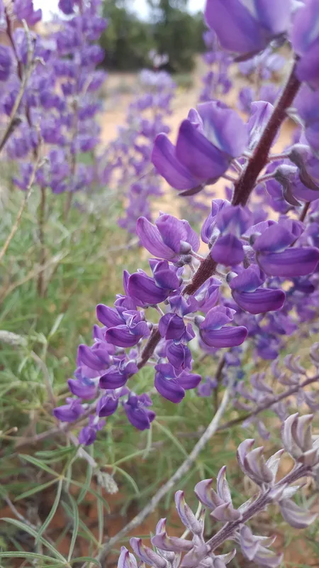
silvery lupine Lupinus argenteus -

Rose Heath Chaetopappa ericoides -
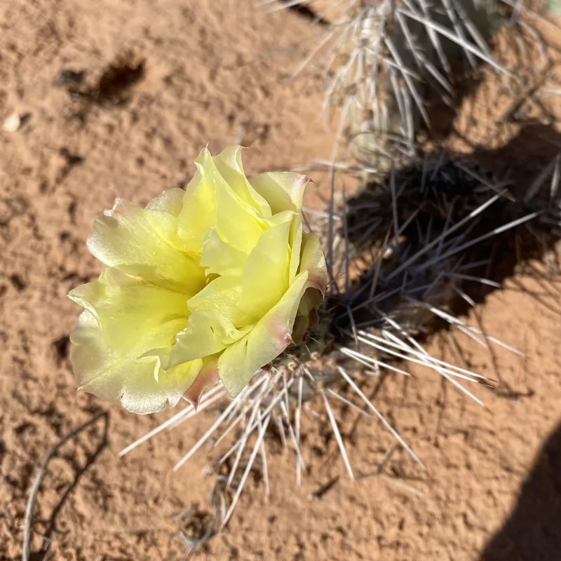
Plains Pricklypear Opuntia polyacantha -
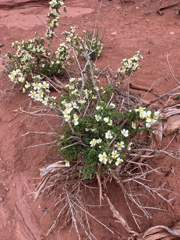
Stansbury's Cliffrose Purshia stansburyana -
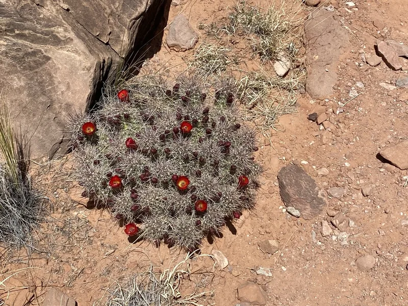
Kingcup Cactus Echinocereus triglochidiatus -
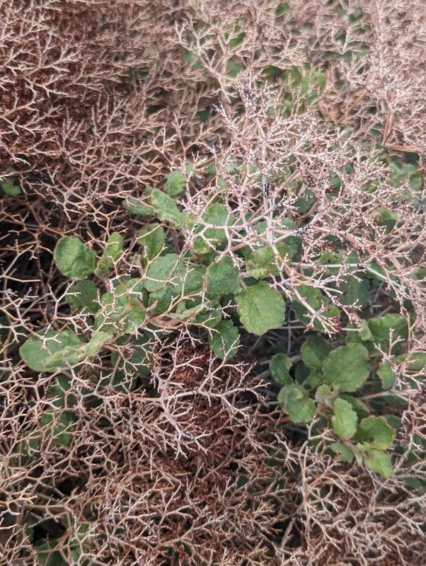
crispleaf buckwheat Eriogonum corymbosum
Field Notes · Rivers & Canyons lens · Island in the Sky · 38.3360, −109.8746