Canyonlands
The desert here hoards nothing: layer on flat layer, oldest at the bottom, the rock lies open like a book left face-up in the sun.
Also seen through Rivers & Canyons · all at Island in the Sky →.
Why here
Stand at the rim here and you are standing on the top page of a book that reads straight down. Island in the Sky is a high, flat tableland, and on every side the ground falls away from it in giant steps — ledge below cliff below ledge — until it reaches the rivers far below. Each step is a different layer of rock, and the layers lie almost perfectly flat, stacked one on the next like boards in a pile. Nothing since has tilted or crumpled them. The Colorado and the Green, meeting somewhere out in the haze, have spent an unhurried eternity cutting down through the whole stack, and in doing so they have laid its pages open to the eye. What makes it all so easy to read is the desert itself: thin soil, few trees, bare stone between the scattered shrubs, so the boundary between one layer and the next runs clean and unbroken for miles. Youngest rock under your boots, oldest down by the water. Everywhere this note takes you, you are learning to read that stack in order, top to bottom.
The story
Read from the bottom up, this country keeps its history in order. The deepest rock reaches back an almost unthinkable distance — the whole column beneath the park runs back some two billion years — and near its base lies a buried bed of salt, left when an ancient sea dried away and then pressed down under everything piled on top. Above it the layers accumulated one flat sheet at a time. In Jurassic times, roughly a hundred and seventy million years ago, a desert of wind-driven dunes spread across the region; the wind piled the sand into ridges, and the ridges hardened, curves and all, into pale sandstone. More layers came and went. Then the Colorado and the Green went to work, cutting down through the stack over a vast stretch of time to open the canyons you now look into.
On the bare stone, life takes hold in the cracks. Pale cliffrose and low pricklypear root wherever a seam holds a little soil; in spring the kingcup cactus opens its red cups. Side-blotched lizards bask on sun-warmed rock, ravens ride the updrafts along the cliffs, and canyon wrens send their falling song down the walls.
People read this ground too. In the 1950s, prospectors cut a rough road along a pale bench below the mesa, searching the rock for uranium to feed Cold War weapons. The ore proved thin and the mines were soon abandoned; the road remains, the plainest mark people have left on the layered country.
The sites
The stack, read whole
Mesa Arch
38.3880, −109.8634
A short, easy trail leads to a low arch set right at the lip of the mesa. What makes it a first stop for reading the rock is not the arch itself but what it frames: through the opening the land falls away in a series of flat steps, each a different layer of stone, dropping toward the canyon floor and the mountains beyond. You are standing on the youngest rock, the top of the pile; everything you see through the window is older, and it gets older the farther down your eye travels. The layers lie almost dead flat, stacked like boards, because nothing has tilted or folded them since they were laid down. That flatness is the whole trick of this place — it lets you read the stack in order, top to bottom, without a geologist to sort it out. The arch is a thin lip of sandstone worn through where water collects and freezes in a shallow basin; it will widen and one day fall, the same slow work going on across the whole park. Come at first light if you can, when the low sun throws the far cliffs into relief and every separate layer stands out as its own band of shadow and color.
Stand back from the arch and look through it as if through a window. Count the flat steps dropping away below — each ledge and cliff is a separate layer of rock, laid down at a different time and left lying flat. Pick the lowest bench you can see, and know you are looking at rock far older than the ground under your boots.
- AccessShort walk
- ExertionEasy
- TimeAn hour
Green River Overlook
38.3880, −109.8860
From this railing at the mesa’s western edge you look down onto a broad pale bench far below, and beyond it the Green River winding through its own deeper canyon. The overlook is worth the short walk because it lays the layered stack out sideways for you, like a diagram. Near your feet is the top of the pile; a long way down, that flat pale shelf is a single hard layer of sandstone that the softer rock above has worn back from, leaving it standing out as a bench; below that, the river has cut on down through still older rock to reach where it flows today. Each level is a different age, and because the desert grows so little here — thin soil, scattered shrubs, bare stone everywhere between — nothing hides the boundaries between them. You can trace one layer for miles along the canyon wall, a continuous line, and know it was all laid down as one flat sheet before the rivers went to work. A geologist’s field report was written from this exact overlook; you are reading the same page they read.
Find the wide, flat pale shelf partway down the canyon, well below the rim and well above the river. It is one hard layer of rock left standing out because softer layers above it wore back faster. Follow its edge as far along the canyon as you can see, and notice it holds the same level the whole way — the sign the stack was laid down flat.
- AccessDrive-up
- ExertionEasy
- TimeAn hour
A single page, up close
Aztec Butte
38.3973, −109.8747
A steeper trail climbs onto Aztec Butte, a rounded dome of pale rock standing above the mesa. Up close the stone tells you exactly what it used to be. Look at the long, sweeping curves banded through it — sets of slanting lines that arc and cut across one another. Those are the faces of sand dunes, frozen in place. In Jurassic times, roughly a hundred and seventy million years ago, this whole country was a desert of wind-driven dunes, a sea of sand spread across much of the region. The wind piled the sand into ridges, and the slanting layers are the old dune faces, buried, pressed, and cemented into solid rock without ever losing their shape. The dome’s rounded knobs and the checkered grooves weathering across them are the signature of this particular layer wherever it surfaces in the park. It is one page of the book you can walk up to and lay your hand on. Standing here on hardened dunes, with the flat-lying younger rock stripped away around you, you get the plainest lesson the park offers: solid stone was once as loose and restless as a windblown beach.
On the bare rock underfoot and in the low walls of the butte, look for long slanting lines that sweep in curves and cut across one another at angles. Each set is the buried face of a sand dune. Trace one curve with your eye, and you are following the shape of a ridge of sand the wind built and then walked away from.
- AccessShort walk
- ExertionModerate
- TimeAn hour
White Rim Road
38.2748, −109.8632
Far below the mesa rim runs a broad, pale bench of rock, and along its top threads a rough unpaved road — the White Rim Road, named for the layer it follows. That pale shelf is a single hard band of sandstone, tougher than the softer rock above and below it, so it stands out all the way around the Island in the Sky as a continuous ledge, a stair-step partway down the canyon walls. It is one of the clearest single layers in the whole stack: you can pick it out from almost any overlook on the mesa as one unbroken line circling the canyons below. The road itself carries a harder history. It was cut in the 1950s by the Atomic Energy Commission so prospectors could search this rock for uranium to feed Cold War weapons. The deposits proved thin, the mines produced little, and they were abandoned; the road they left behind is now the way down into the layered country for those with a rugged vehicle or a bicycle and several days. From above, though, you need none of that — the layer it rides is plain to read straight from the rim.
From any mesa overlook, find the pale, flat bench that runs partway down the canyon walls, well below you and above the rivers. It is one hard layer of rock standing out from softer stone. Trace it around the curves of the canyon and notice it stays at roughly the same level the whole way — one flat sheet, laid down all at once.
- AccessExpedition
- ExertionStrenuous
- TimeWorth two days
The rivers doing the reading
Muffin Butte
38.3776, −109.8743
Out toward the western edge of the mesa country stands Muffin Butte, a small flat-topped summit looking down over Soda Springs Basin and, beyond it, the Green River. It is a remote perch, well off the paved road and reached only by long backcountry travel, and it earns the effort by showing you the other half of the story. The overlooks along the rim show you the flat layers, stacked and waiting; from a place like this you see the tool that opened them. The Green River, joined not far off by the Colorado, has spent an immense stretch of time cutting down through the whole stack, carrying the loosened rock away grain by grain and leaving these canyons behind. Soda Springs Basin below is a wide bowl the river’s tributaries have hollowed out of the softer layers. Stand here and hold both ideas at once: the land was built upward, flat sheet on flat sheet, over hundreds of millions of years, and then the rivers took the same long patience to carve back down through it. The book was written from the bottom up and is being read from the top down.
Look down at the wide basin below the butte and follow it out to the Green River. Notice how the softer, lower layers have been scooped into broad open bowls while the harder layers stand up as ledges and walls. That difference — soft rock worn back, hard rock left standing — is what shapes every step and bench you have been reading all day.
- AccessExpedition
- ExertionStrenuous
- TimeA full day
When it's best
This is high, dry country, and the season you choose changes the trip more than any trail does. Spring and fall are the kind seasons: days run cool to mild, and the desert stirs — cliffrose and cactus color up the ledges once the first real warmth settles in, best caught in the weeks after the cold lets go. The nights, though, stay cold well into spring, often dropping below freezing, so carry more layer than the midday sun suggests. Summer turns hard: the bare rock soaks up the heat, there is next to no shade on the mesa, and no water up top at all — bring your own, always, and more than you think. Rain is scarce in any season, which is part of why the rock stays so bare and so easy to read. And because there is little town glow for a long way in every direction, the nights here are genuinely dark, the layered rim standing black against a crowded sky.
Go deeper
The names behind what you saw. The tableland you stand on is Island in the Sky. The pale, cross-bedded domes and knobs — the old dunes at Aztec Butte among them — are Navajo Sandstone, laid down in a Jurassic sand sea. Below the rim, the sheer red cliff is the Wingate Sandstone and the ledgy steps beneath it the Kayenta Formation; together with the Navajo these make up the Glen Canyon Group. The broad pale bench far below, the one the four-wheel-drive road follows, is the White Rim Sandstone. All of it sits over the Paradox Basin, a rock column reaching back some two billion years and still holding a buried bed of salt — halite — near its base. The pale five-petaled shrub on the ledges is Stansbury’s cliffrose, Purshia stansburyana; the red spring cactus is kingcup cactus, Echinocereus triglochidiatus; the low spiny pads are plains pricklypear, Opuntia polyacantha. The lizard on the warm rock is the common side-blotched lizard, Uta stansburiana. The big black bird on the updraft is the common raven, Corvus corax; the falling song off the cliffs is the canyon wren, Catherpes mexicanus.
To read next. - Geology from the Green River Overlook, Island in the Sky District (Geological Society of America, 2025) — a geologist’s reading of the exact stack you see from that railing. - Macrostrat’s Paradox Basin column (col. 495) — the full layer list, bottom to top, back some two billion years; the book’s table of contents as raw data. - Wikipedia, White Rim Road — the full Cold War uranium story behind the road on the pale bench.
The names behind what you saw
What lives here, and what it's called. Photographs from open collections — an aid to identification, not decoration.
-
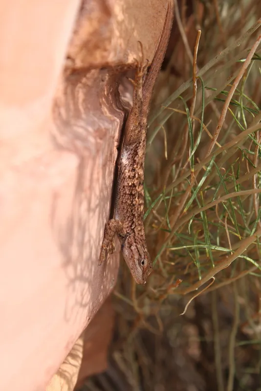
Plateau Fence Lizard Sceloporus tristichus -
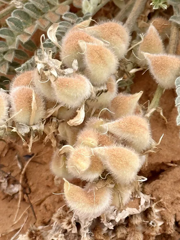
Woolly Locoweed Astragalus mollissimus -
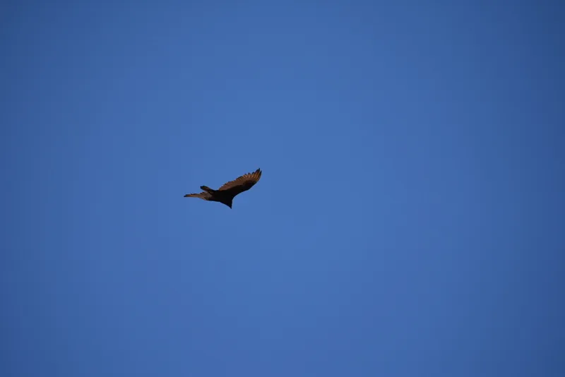
Turkey Vulture Cathartes aura -
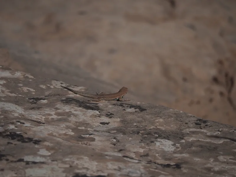
Common Side-blotched Lizard Uta stansburiana -
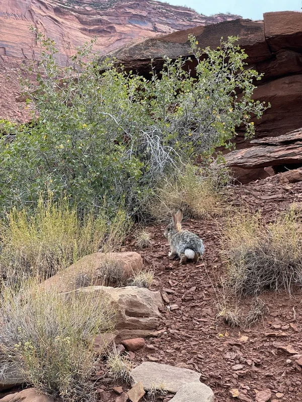
Desert Cottontail Sylvilagus audubonii -
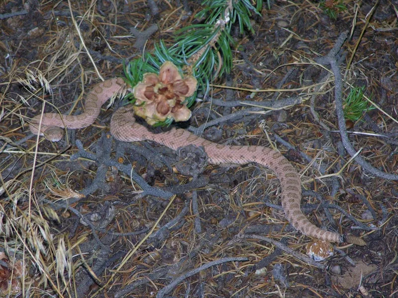
Western Rattlesnake Crotalus oreganus -
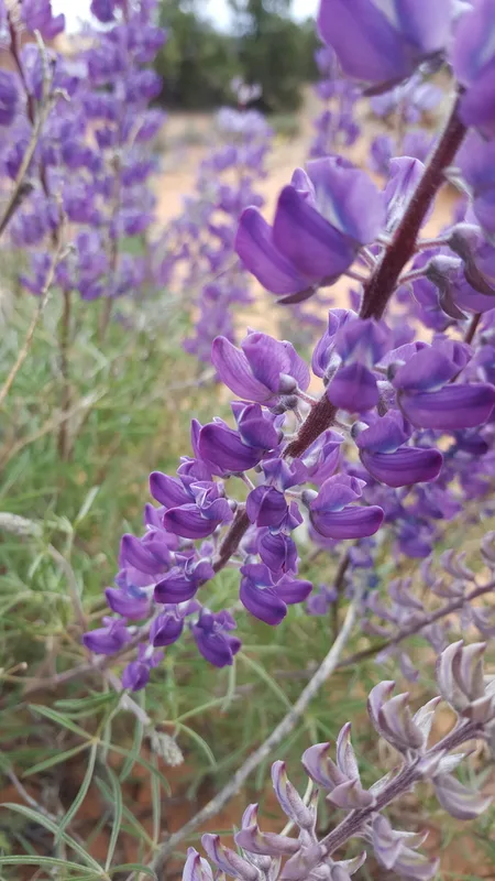
silvery lupine Lupinus argenteus -

Rose Heath Chaetopappa ericoides -
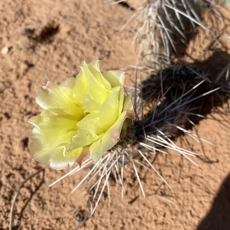
Plains Pricklypear Opuntia polyacantha -
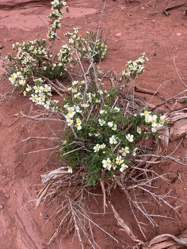
Stansbury's Cliffrose Purshia stansburyana -
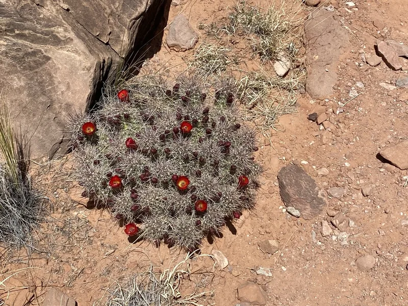
Kingcup Cactus Echinocereus triglochidiatus -
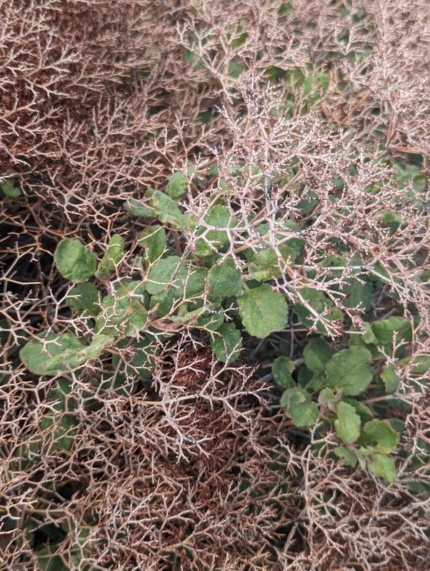
crispleaf buckwheat Eriogonum corymbosum
Field Notes · Desert & Deep Time lens · Island in the Sky · 38.3360, −109.8746