Bryce Canyon
Bryce Canyon National Park · Utah, USA
High on the plateau, after the last color leaves the rock, the oldest thing in sight is the light still coming down.
Also seen through Desert & Deep Time · all at Bryce Canyon National Park →.
Why here
Everyone comes to Bryce for the rock. Come back after the sun is gone. The crowds thin, the color drains from the stone spires below the rim, and the sky above the plateau fills in with more stars than most people ever see at once. Bryce sits high — the rim stands close to nine thousand feet — where the air is thin and dry and there is little nearby to throw up light. That combination is what makes a dark sky: height to get above the haze, dry air to keep it clear, and distance from the glare of any town. What arrives overhead on a night like that is old. Starlight travels for a very long time before it reaches your eye, so the light you catch left its star ages ago — it is, in a real sense, the oldest view there is. Everything at Bryce is a record of deep time: rock laid down in vanished seas and lakes, trees that have stood for ages. The light is the oldest record of all.
The story
The rock under your feet is a stack of old worlds. The colored stone of the amphitheaters was laid down in quiet lakes and streams, long after warm shallow seas had come and gone across this corner of the continent — you are standing on the floors of vanished waters, lifted high and then carved into spires by frost and running water. On top of that old rock grows something almost as patient: bristlecone pine, a wind-bent tree of the high, poor ground that lives a very long time, holding on where little else will. And over both, every clear night, comes the oldest layer of all. The rock is old; the trees are older than any human memory; the starlight is older still, having crossed a distance the mind can barely hold before landing on the rim. People came late to this story. Crews built the trails below the rim within the last century, opening the amphitheaters to anyone willing to walk down into them. But the thing worth timing a night around was here long before the trails, and will outlast them — the slow arrival of light that set out on its journey before any of this rock wore its present shape.
The sites
Where the dark comes down
Sunset Point
37.6226, −112.1660
Despite the name, Sunset Point is worth staying at after the sun is gone. The overlook stands right on the rim above the main amphitheater, where the pale, close-packed spires drop away below you in tiers. As the light fails, watch those spires lose their color and flatten into a dark, jagged line — a horizon you can hold onto while the sky above it fills in. Because the overlook faces out over open air, there is nothing close by to block the low sky, so stars come up early over the amphitheater’s far edge. The short paved approach and railing make it an easy place to stand in the dark, which matters when your eyes are still adjusting and you would rather not be picking your way over rough ground. Give yourself a good while here before deciding the show is over; the faintest stars only arrive once your eyes have let go of the last daylight, and the field of stone below turns the whole scene into a foreground you can name.
Face the amphitheater as the last color drains from the spires. Pick one tall rock on the skyline and hold your eye near it; the first stars will appear just above that fixed edge, and the longer you wait — give it twenty minutes or more — the more of them fill in as your eyes adjust to the dark.
- AccessDrive-up
- ExertionEasy
- TimeAn hour
Upper Inspiration Point
37.6136, −112.1690
Upper Inspiration Point sits a little higher along the rim than the busier overlooks, on the topmost of a short series of viewpoints stepped up the slope. The extra height buys you a wider, cleaner arc of sky and a longer look down the amphitheater’s crowded field of stone. By day this is a place to study the spires; by night it becomes a place to study the dark. Standing higher means fewer trees and rim edges between you and the low horizon, so more of the sky is available all the way down to where it meets the rock. The climb up from the lower viewpoints is short but real, and worth doing before the light goes so you can find your footing. The busier overlooks lower down draw most of the crowd, so a few steps of extra climbing usually leaves you more room and more dark to work with. Once you are settled, the reward is simple: a broad, open bowl of sky over a broad, open bowl of stone, with very little in the way.
From the high point, sweep slowly from one side of the sky to the other, low down near the rim rather than straight overhead. The open bowl here lets you see stars almost to the horizon, where haze usually hides them; the lowest ones you can still pick out are a fair measure of how clear the night is.
- AccessShort walk
- ExertionEasy
- TimeAn hour
Bryce Point
37.6058, −112.1574
Bryce Point is the high southern corner of the main amphitheater, a promontory that pushes out over the rim so the stone drops away on more than one side. That geometry is what makes it worth a night visit: with the ground falling away around you, the sky seems to wrap further down toward the horizon than it does at a flat overlook, and the amphitheater’s spires stand below you as a deep, dark foreground. Because it sits near the top of the plateau’s edge, the air is thin and the view long. The overlook is fenced and reached by a short walk from the parking area, so it is a manageable place to be after dark, though the exposure means wind and cold arrive easily here — bring more warmth than you think you need. Come for the wide horizon and the sense of standing out ahead of the land, with the old spires as a floor and the older sky as a ceiling. It rewards patience more than a quick look.
Stand at the point and notice how far around you the sky reaches, with the land dropping away on both sides. Trace the band of faint, hazy light that may cross the sky overhead on a dark night; that soft glow is the combined light of our own crowded star-city, seen edge-on from inside it.
- AccessShort walk
- ExertionEasy
- TimeAn hour
The far south rim, oldest light on oldest trees
Rainbow Point
37.4760, −112.2407
Rainbow Point marks the high, far end of the park’s rim road, near the top of the plateau. Getting here means a drive to the road’s end, and the height is the reason to make it: the air up here runs thinner, cooler, and cleaner. Fewer people linger this far out after dark, so the overlook is quiet, and the quiet is part of the experience — a dark, still place with a long view over ranks of lower country. By night the reward of the elevation is a sky with less air between you and the stars, which tends to mean steadier, sharper points of light. The trade is cold: nights at this height run sharp even when the days are mild, so treat it as a place you dress for well beyond what the drive up suggests. Arrive before dark to settle in, then let the sky come up over the layered land below.
Look low toward the drop over the lower country and watch the stars there. Because you are looking across the long slope of the land, those low stars shine through more air than the ones overhead; compare how they flicker and dim against the steadier stars straight above you.
- AccessDrive-up
- ExertionEasy
- TimeAn hour
Yovimpa Point
37.4724, −112.2402
Yovimpa Point shares the road’s-end area with Rainbow Point but faces the other way, opening a long southward view over step after step of receding country falling away toward the far horizon. That long, low sightline is what makes it a night-sky post: with the land dropping and no near ridge to block the view, the sky reaches well down toward the south, where stars and slow-moving planets ride low. In daylight the layered land is the draw; after dark it becomes a dark base under a deep sky. The overlook is a short walk from the parking area at the end of the road, which makes the high, remote setting reachable without a real hike. As at the whole south end of the plateau, the height brings cold and clear air together — the same thin, dry air that sharpens the stars will also chill you quickly once the sun is down. Stay long enough for full dark, and the southern sky opens up.
Face south over the falling land and watch the horizon there through the evening. The lowest bright point that holds steady and does not twinkle is likely a planet rather than a star; planets shine by steadier reflected light and sit near the sun’s path, low in the south after dusk.
- AccessShort walk
- ExertionEasy
- TimeAn hour
Bristlecone Loop Trailhead
37.4753, −112.2396
This trailhead, at the high south end of the park, is the start of a short loop out to a stand of bristlecone pine — a wind-bent, sparse-limbed tree of the highest, poorest ground, and among the longest-lived things alive. The trees make this the truest stop for a note about old views. Walk the loop by day to meet them; return to the trailhead as the light fails and you can stand beneath the same ancient trees while the oldest light of all comes down through their branches. It is a short, easy walk, but it sits near the top of the plateau, so it is cold and the air is thin — take it slowly and dress for the height. The pairing is the point: a living thing that has held this ground through more winters than anyone can count, standing under starlight that set out on its journey longer ago still. Old wood below, older light above.
Stand under a bristlecone pine after dark and look up through its branches at the stars caught in the gaps. The tree beside you has held this exposed ground for a very long time; the light reaching you through its limbs has traveled far longer — old wood in the foreground, older light behind it.
- AccessShort walk
- ExertionEasy
- TimeAn hour
Quiet pullouts for a clear horizon
Natural Bridge Overlook
37.5318, −112.2602
Natural Bridge Overlook is a roadside pullout partway along the rim road, named for the broad span of rock arching over a gully just below the railing. As a night-sky stop it earns its place by being simple: you park, you step to the rail, and you have open sky over a striking, solid foreground. The arch itself is a lesson in the same slow work that made everything here — softer rock worn away from beneath a harder cap until only the span was left standing. After dark it becomes a heavy black shape against the stars, a piece of the land you can name and hold in view while the sky moves behind it. Because it is a drive-up pullout with no walking required, it is an easy place to stop for a while on a clear night without committing to a hike in the cold. Let the arch anchor the bottom of the view and give the sky above it your patience.
Frame the dark arch against the sky and watch one star just above it over several minutes. The star will drift slowly past the rock as the earth turns; the fixed stone makes that motion, usually too slow to notice, easy to catch.
- AccessDrive-up
- ExertionEasy
- TimeAn hour
Farview Point
37.5445, −112.2469
Farview Point is named for exactly what it offers: a long, open look out over lower country to a distant horizon. That reach is its value after dark. Where a tight overlook boxes in the sky, this one gives you a low, uncluttered edge, so the sky is available well down toward the ground where most viewpoints lose it to trees and ridges. It is a drive-up pullout along the rim road, easy to reach and easy to leave, which makes it a good place to stop and test the night before committing to the colder, higher overlooks farther on. The far horizon here is also where you are most likely to notice the faint dome of light from distant towns, low on the skyline — a plain reminder of what real darkness costs and how much of it this high, remote rim still keeps. Look past that low glow to the clean dark overhead.
Look low along the far horizon for any faint, pale glow, then tip your head straight up. The dome near the ground is distant town light scattered in the air; the darkness overhead, well away from it, is where the faintest stars live — compare the two and you can see how much clearer the sky gets the higher you look.
- AccessDrive-up
- ExertionEasy
- TimeAn hour
When it's best
The darkest skies come near a new moon, when there is no moonlight to wash out the faint stars — that holds true in any month, so it is worth checking the moon before choosing a night. The high, dry air here means clear nights are common, most reliably outside of summer, when afternoon storms can build and cloud the sky. Nights run cold at this elevation and colder still in the winter half of the year, so plan to dress well past what the daytime suggests. Whenever you come, give your eyes a good while in the dark before judging the sky.
Go deeper
The names behind what you saw. The colored rock of the amphitheaters is the Claron Formation, laid down in ancient lakes and streams. The spires worn from it are hoodoos, shaped by frost weathering — water freezing and prying at cracks — together with stream erosion. The high tableland the park rides on is the Paunsaugunt Plateau. The ancient, wind-bent tree at the south end is Great Basin bristlecone pine, Pinus longaeva; its frequent neighbor on that high ground is limber pine, Pinus flexilis.
To read next. - The Geology of Bryce Canyon National Park, Robert C. Lindquist — a park-focused account of how the rock was laid down, lifted, and carved into the amphitheaters you stand above. - Geologic Map of Bryce Canyon National Park and Vicinity (1991) — the detailed map behind the formation names, for tracing each layer across the real ground. - Ancient Landscapes of the Grand Canyon Region — sets Bryce beside Zion and the Grand Canyon in one long deep-time story of the wider plateau country, the frame that makes “the oldest view” make sense.
The names behind what you saw
What lives here, and what it's called. Photographs from open collections — an aid to identification, not decoration.
-
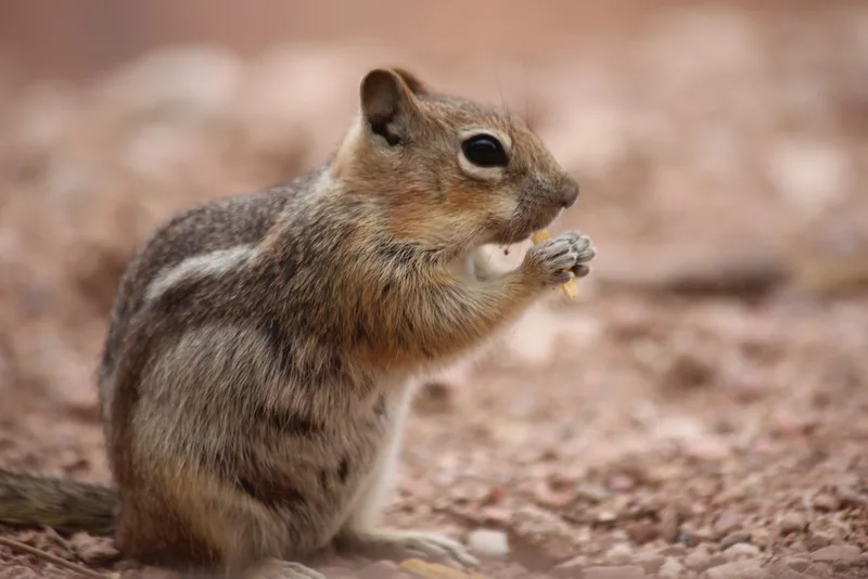
Common Golden-mantled Ground Squirrel Callospermophilus lateralis -
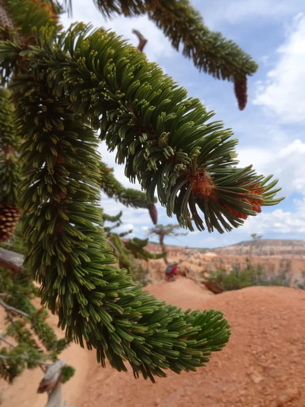
Great Basin bristlecone pine Pinus longaeva -
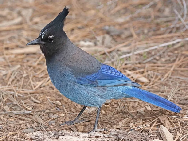
Steller's Jay Cyanocitta stelleri -
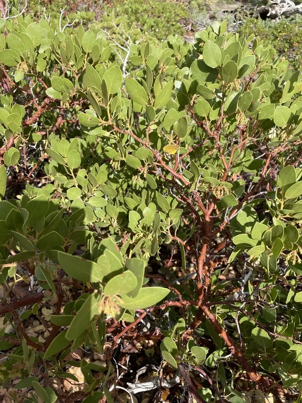
greenleaf manzanita Arctostaphylos patula -
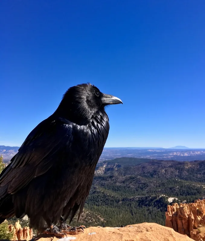
Common Raven Corvus corax -
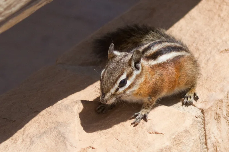
Uinta Chipmunk Neotamias umbrinus -
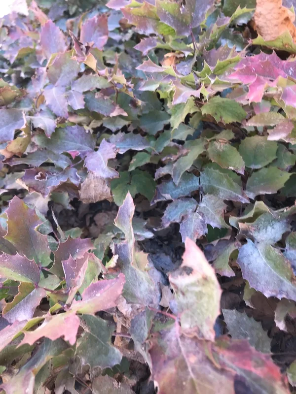
creeping mahonia Berberis repens -
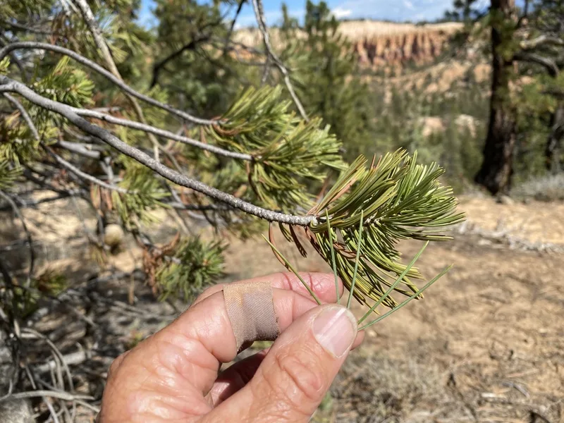
limber pine Pinus flexilis -
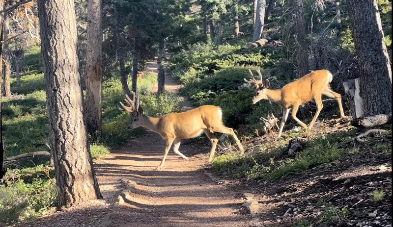
Mule Deer Odocoileus hemionus -
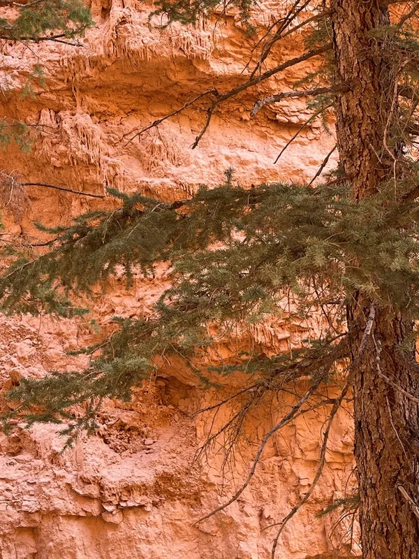
Douglas-fir Pseudotsuga menziesii -
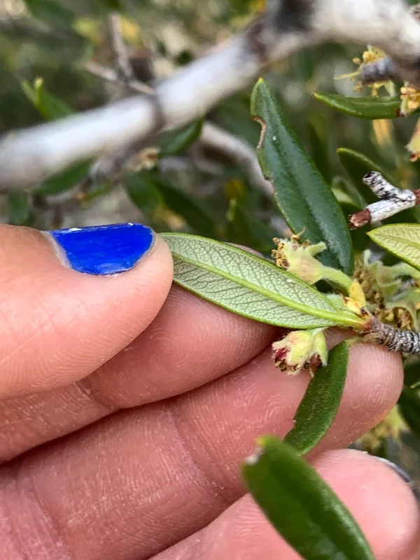
Curlleaf Mountain Mahogany Cercocarpus ledifolius -
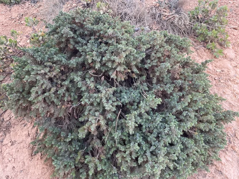
common juniper Juniperus communis
Field Notes · Night Sky lens · Bryce Canyon National Park · 37.5708, −112.1856