Bryce Canyon
Bryce Canyon National Park · Utah, USA
The hoodoos are what a plateau becomes when water is allowed to work on every weakness.
Also seen through Night Sky · all at Bryce Canyon National Park →.
Why here
Bryce Canyon is not a canyon in the river’s usual sense. It is a high plateau being taken apart from its edge, leaving walls of narrow spires and columns behind. The rock record is sedimentary, but the shapes come from water entering cracks, freezing, thawing, and carrying pieces away. That is why the hoodoos stand in crowds. Each one is a remnant, protected for a while by a harder cap and eventually returned to the slope. Walk the rim and then descend among the forms. From above they look like a pattern; from below they show the individual work of weather.
The sites
A plateau coming apart
Bristlecone Point
37.6245, −112.1337
Bristlecone Point lets you see the amphitheaters as an edge process. The plateau continues behind you, while water and frost have removed its front in a field of columns. Look for the cap rocks that protect some spires and the gaps where others have already gone. The rim is a moving boundary, even when the view looks still. High-elevation bristlecone pine adds another kind of time to the scene, growing slowly on the same exposed ground.
Find a hoodoo with a darker cap and compare it with a nearby broken column. The cap slows erosion, while the unprotected form is already being taken apart.
- AccessShort walk
- ExertionEasy
- TimeAn hour
Fairyland Loop Trailhead (North)
37.6496, −112.1475
Fairyland Loop begins above a crowd of spires. The trail makes the formations larger by bringing you into the gaps between them, where each wall has its own ledges, seams, and color. Walk slowly enough to see how water moves through the rock after a storm. The hoodoos are not carved statues. They are the pieces left between channels, each temporarily protected by differences in hardness.
Look for a narrow vertical seam in a wall and follow it upward. Water and frost use such cracks to divide a larger mass into separate pillars.
- AccessHalf-day hike
- ExertionModerate
- TimeA full day
Water and frost
Queen's Garden Trailhead
37.6284, −112.1630
Queen’s Garden Trailhead descends into the weathered rock. From below, the plateau edge becomes a collection of walls and passages, and the sky is framed by columns rather than by one continuous rim. This is where the process becomes physical. The trail follows ground that water has lowered, while the remaining spires rise on either side. Look for the difference between a narrow hoodoo and the broader rock that supports it.
Stand beside a hoodoo and find the point where it widens into the wall. The narrow form is the remnant; the wall is the material still waiting for weather to separate it.
- AccessHalf-day hike
- ExertionModerate
- TimeHalf a day
Peekaboo Loop / Hat Shop / Under-the-Rim Trailhead
37.6043, −112.1569
This trailhead gives access to the interior of the amphitheaters, where the hoodoos stop being a distant pattern. The trail moves among fins, gullies, and columns, making the role of water easier to see. Every turn presents a surface at a different stage of weathering. Some walls are broad and intact; others have narrowed into rows of spires. The desert’s dryness does not stop erosion. It simply makes each stage visible.
Compare a broad wall with a row of thin columns. The row has more exposed cracks and edges, giving frost and runoff more ways to remove rock.
- AccessHalf-day hike
- ExertionStrenuous
- TimeA full day
Life on the high rim
Boat Mesa
37.6416, −112.1408
Boat Mesa keeps attention on the high plateau around the hoodoos. Bristlecone pine and golden-mantled ground squirrels use the rim’s thin soil, cold air, and open light. Their presence is another record of time. The trees grow slowly while the amphitheaters change below, and the squirrels use the edges where rock and vegetation meet. Look across the hoodoos, then back at the living surface beneath your feet.
Find the oldest-looking bristlecone nearby and compare its slow, twisted shape with the quickly changing hoodoos below. Both are shaped by exposure, but on different clocks.
- AccessShort walk
- ExertionEasy
- TimeAn hour
When it's best
Spring and fall give the best balance of cool air and open views, while summer offers long access to the high rim. Snow can make the hoodoos more graphic and close some trails in winter. Early light brings long shadows into the amphitheaters; storms can change the footing quickly. The formations are readable in every season, but the trail surface may not be.
Go deeper
The names behind what you saw. The payload includes the Straight Cliffs Formation, John Henry Member. Great Basin bristlecone pine, Pinus longaeva, and golden-mantled ground squirrel, Callospermophilus lateralis, live on the high rim.
To read next. - Bryce Canyon’s geological map — for the sedimentary layers and weathering that make the hoodoos. - The park’s natural-history material — for high-elevation plants and animals around the amphitheaters.
The names behind what you saw
What lives here, and what it's called. Photographs from open collections — an aid to identification, not decoration.
-
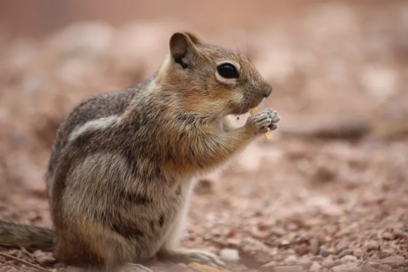
Common Golden-mantled Ground Squirrel Callospermophilus lateralis -
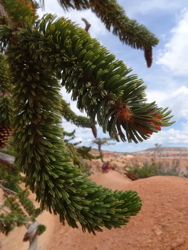
Great Basin bristlecone pine Pinus longaeva -
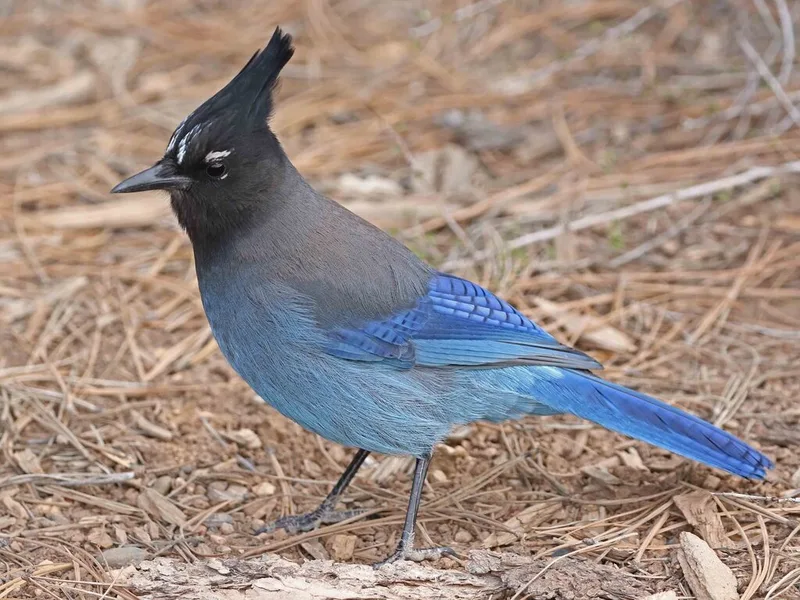
Steller's Jay Cyanocitta stelleri -
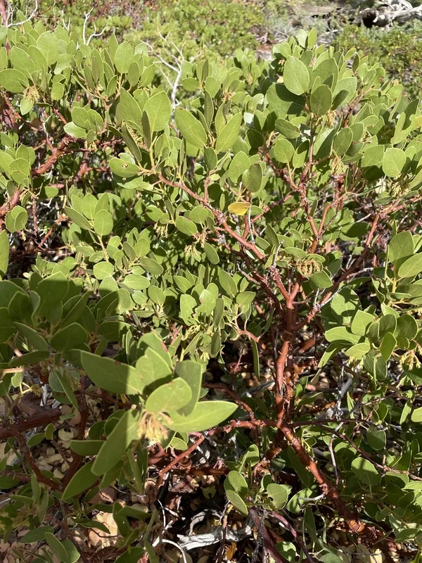
greenleaf manzanita Arctostaphylos patula -
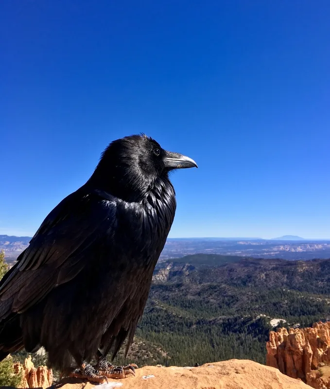
Common Raven Corvus corax -
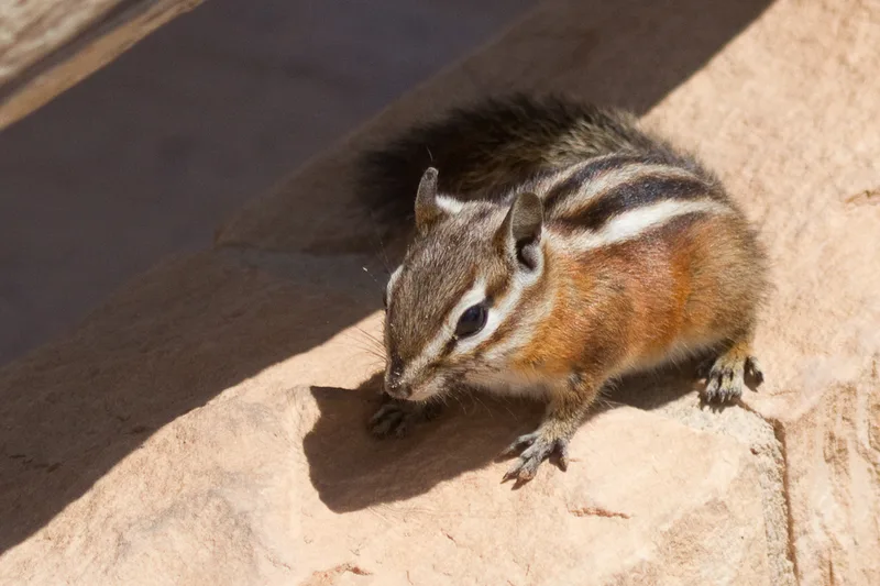
Uinta Chipmunk Neotamias umbrinus -
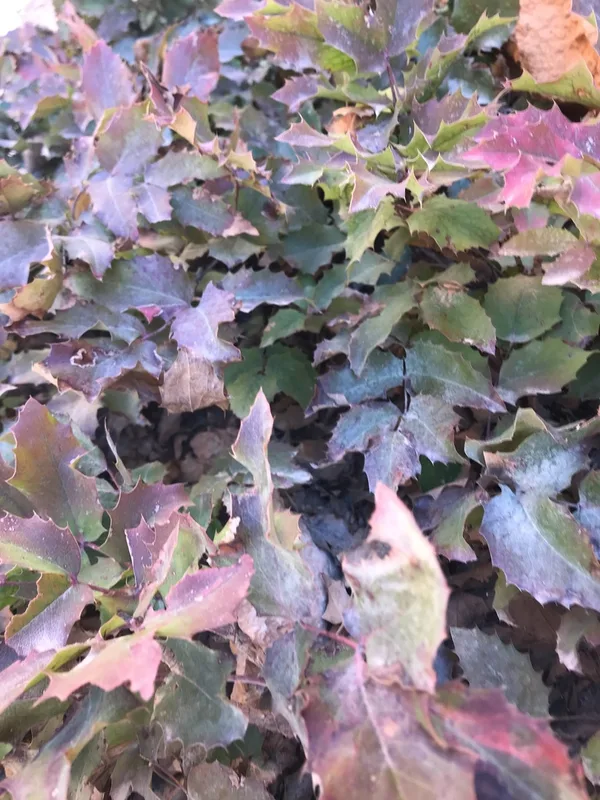
creeping mahonia Berberis repens -
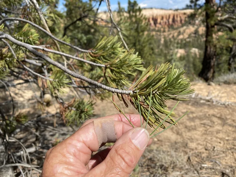
limber pine Pinus flexilis -
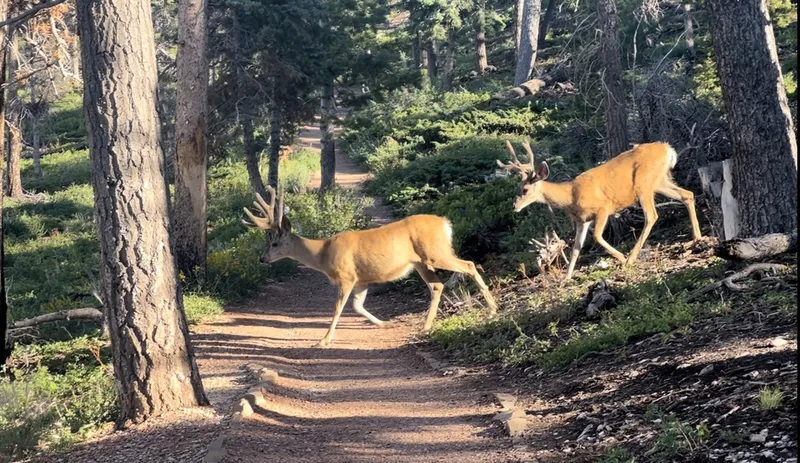
Mule Deer Odocoileus hemionus -
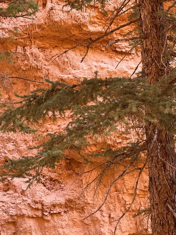
Douglas-fir Pseudotsuga menziesii -
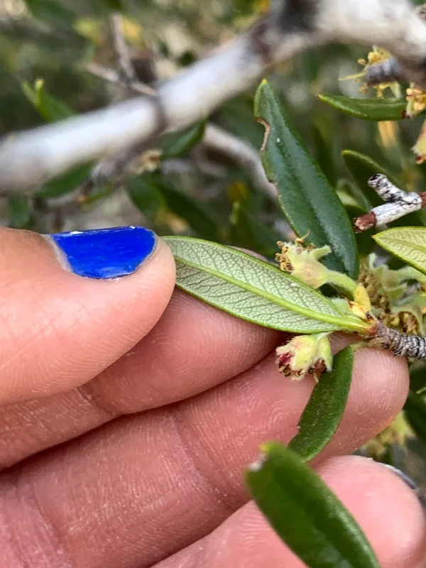
Curlleaf Mountain Mahogany Cercocarpus ledifolius -
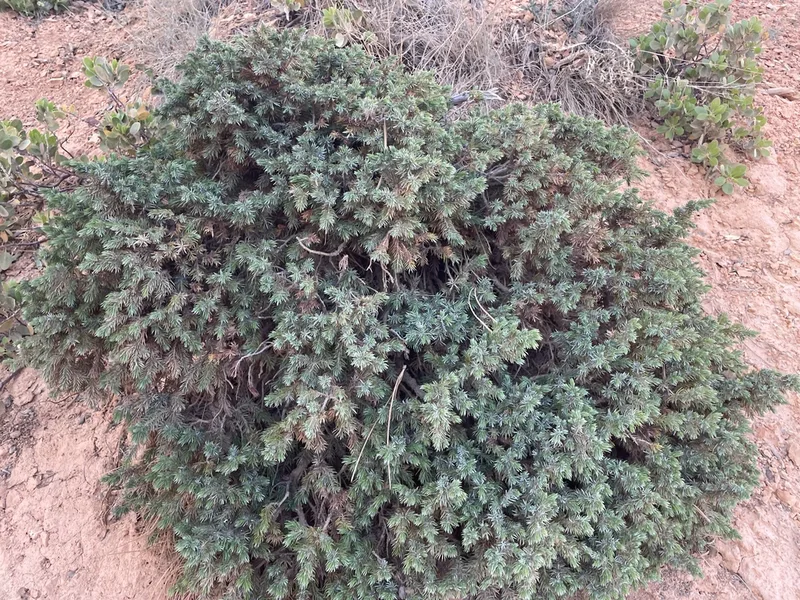
common juniper Juniperus communis
Field Notes · Desert & Deep Time lens · Bryce Canyon National Park · 37.5708, −112.1856