The Black Canyon
Black Canyon of the Gunnison National Park · Colorado, USA
The river makes the canyon narrow by refusing to stop cutting.
Also seen through Desert & Deep Time · all at Black Canyon of the Gunnison National Park →.
Why here
The Black Canyon is a river’s argument compressed into steep walls. The Gunnison cuts through old crystalline rock, leaving a narrow passage where the river is often hidden below the rim. That hidden water is the key to the place. The canyon looks like a wall, but it is a route, and the route is still being deepened by the river. Stand on the ridges and let the eye move downward from exposed rock to shadow. The land is old, the cut is younger, and the water keeps the sequence active. These stops follow the canyon’s edge and the smaller drainages that feed it.
The sites
The narrow cut
Signal Hill
38.5311, −107.6919
Signal Hill gives the canyon a high, open edge. The river is often far below, but the dark line of the gorge shows where water has removed rock over time. Look at the wall as a sequence of resistance: some surfaces stand steeply, while others break into slopes and gullies. The canyon’s shape is the result of that difference, repeated along the river’s route.
Trace the canyon downward until the river disappears into shadow. The unseen water is still the line organizing the walls above it.
- AccessShort walk
- ExertionEasy
- TimeAn hour
Deadhorse Gulch
38.5452, −107.6520
Deadhorse Gulch shows how smaller water joins the main canyon story. A side drainage cuts into the rim and carries loose material toward the river, creating a narrower route inside the larger one. Walk the edge with attention to the change in scale. The Gunnison makes the canyon; gullies like this supply its detail.
Find the point where the gulch joins the larger canyon. The meeting shows how runoff from the rim contributes sediment and shape to the river’s cut.
- AccessShort walk
- ExertionModerate
- TimeHalf a day
Rock above water
Poison Spring Hill
38.5556, −107.6431
Poison Spring Hill keeps the eye on the rock above the water. Crystalline metamorphic rock can stand as a steep wall, but cracks still give weather and runoff a route. Look for small patches of soil and vegetation in those weaknesses. The canyon is not lifeless stone. It is a set of narrow opportunities arranged by the river and the weather.
Look for a plant in a crack on the exposed slope. The crack holds the small amount of soil and water that makes life possible above the canyon.
- AccessShort walk
- ExertionEasy
- TimeAn hour
Grizzly Ridge
38.5748, −107.6765
Grizzly Ridge opens the canyon into a wider mountain setting. The rim country appears broad, but the river has gathered it into one deep line below. Compare the open ridge with the narrow shadowed canyon. The difference is the scale of water’s work: rain and snow shape the upper country, while the Gunnison keeps cutting at the base.
Find the broadest drainage entering the canyon from the ridge. Its route shows how surface water is collected and delivered to the deeper river cut.
- AccessHalf-day hike
- ExertionModerate
- TimeHalf a day
The river's persistence
Coffee Pot Hill
38.5075, −107.6459
Coffee Pot Hill is a place to let the canyon’s persistence do the work. The river may be too distant to hear clearly, yet the steep walls and narrow gorge keep its presence obvious. Water does not need to be visible to be the canyon’s cause. Look at the route the gorge takes through the high country and imagine the small cuts that join it after every storm. A long argument is made from many short ones.
Follow the canyon line toward the horizon and count the side gullies entering it. Each is a smaller contribution to the river’s longer cut.
- AccessShort walk
- ExertionEasy
- TimeAn hour
When it's best
The warmer months offer the easiest access to the rim and longer time in the open country. Spring runoff can make the river’s work more audible, while fall brings clearer air and cooler light. Winter can close high routes and sharpen the contrast between rock and snow. Wind is strong on exposed overlooks in every season.
Go deeper
The names behind what you saw. The canyon cuts Paleoproterozoic crystalline metamorphic rocks. The geological map is the best next step for understanding why the river follows this narrow line.
To read next. - Black Canyon’s geological material — for the old rock and the river-cut gorge. - The park’s river and rim ecology material — for life on the steep canyon edges.
The names behind what you saw
What lives here, and what it's called. Photographs from open collections — an aid to identification, not decoration.
-
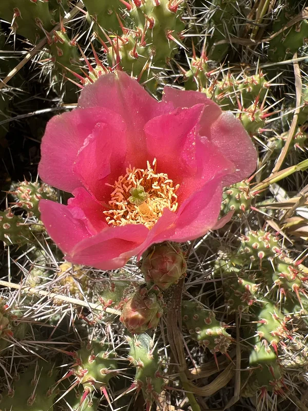
Brittle Pricklypear Opuntia fragilis -
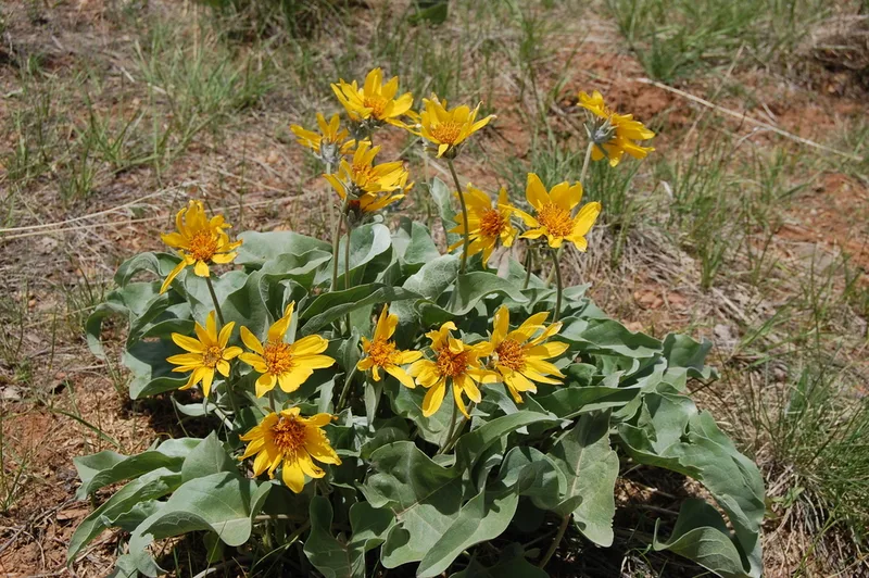
arrowleaf balsamroot Balsamorhiza sagittata -
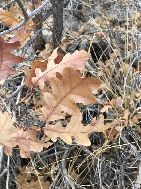
Gambel Oak Quercus gambelii -
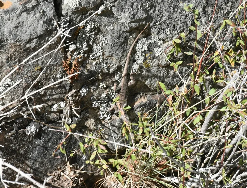
Plateau Fence Lizard Sceloporus tristichus -
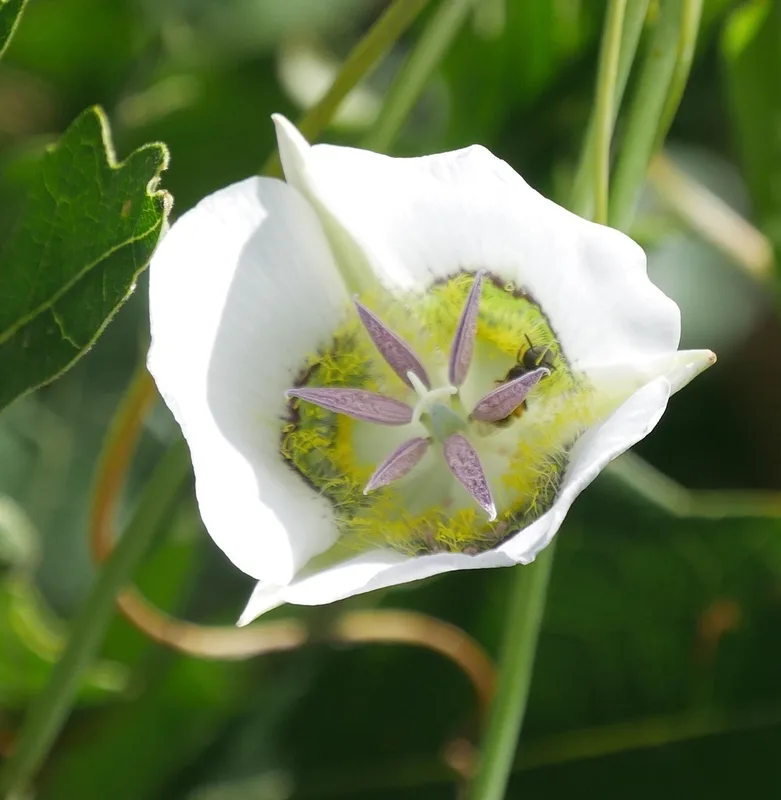
Gunnison's Mariposa Lily Calochortus gunnisonii -
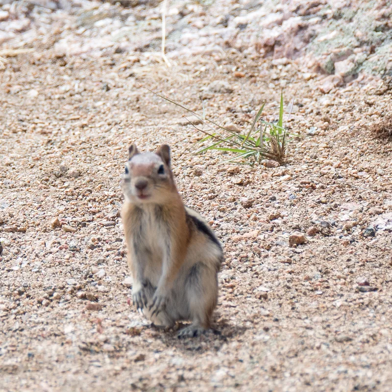
Common Golden-mantled Ground Squirrel Callospermophilus lateralis -
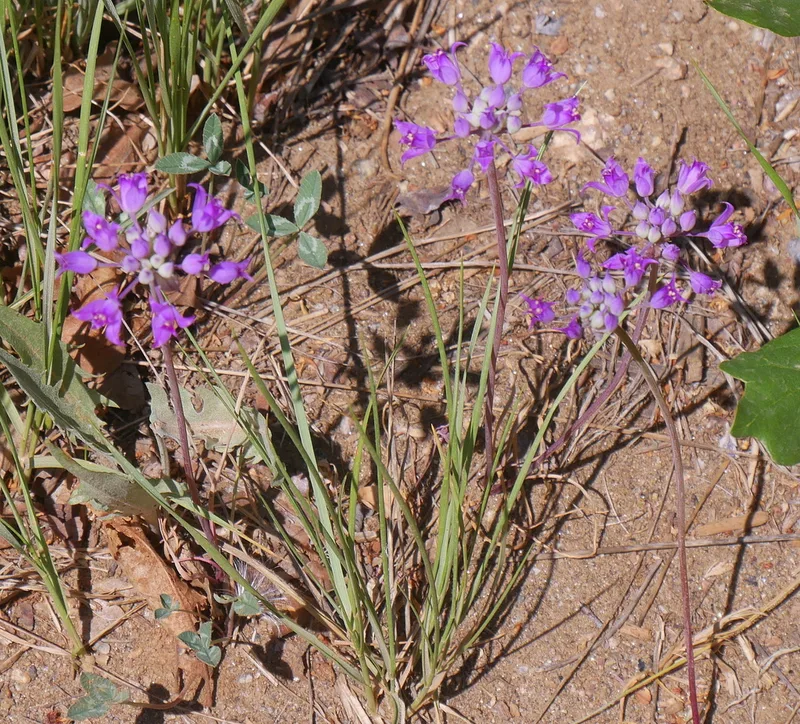
Hooker's onion Allium acuminatum -
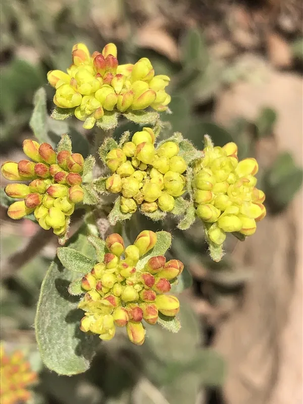
sulfur buckwheat Eriogonum umbellatum -
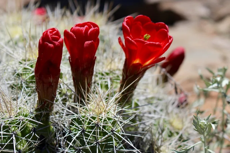
Kingcup Cactus Echinocereus triglochidiatus -
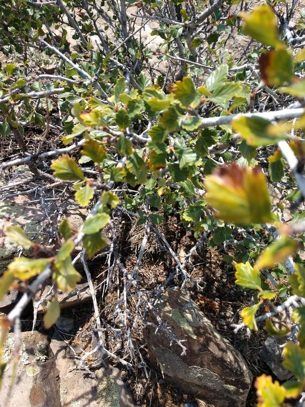
Alderleaf Mountain Mahogany Cercocarpus montanus -
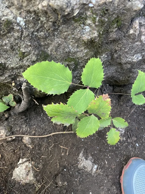
creeping mahonia Berberis repens -
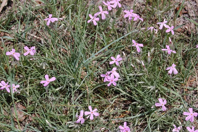
Longleaf Phlox Phlox longifolia
Field Notes · Rivers & Canyons lens · Black Canyon of the Gunnison National Park · 38.5798, −107.7437