The Black Canyon
Black Canyon of the Gunnison National Park · Colorado, USA
The dark rock in this canyon was already ancient when the rest of the story began.
Also seen through Rivers & Canyons · all at Black Canyon of the Gunnison National Park →.
Why here
Every overlook along this rim looks two ways at once: down into a gap barely wide enough for the river, and across a wall of rock old enough that it stood here before there was a fish alive to swim past it. That is the trick of the Black Canyon. From a distance it reads like scenery — cliffs, shadow, a green ribbon of water far below. Get close and the walls turn into something closer to a very old book, its pages made of banded gneiss and schist that were folded, cooked, and squeezed together while they were still miles underground, long before any canyon existed to expose them. The river gets credit for the view, and it earns it — but the rock itself is the deeper story. It is basement rock, the ancient floor that younger country elsewhere in Colorado quietly sits on top of, laid bare here only because the river cut straight down through everything softer above it and kept going. Every site ahead is a chance to read a little more of that floor up close, one page of very old rock at a time.
The story
The land here began about as deep in time as Colorado rock gets: crystalline rock — gneiss, schist, and migmatite — formed when older material was buried, heated, and folded far below the surface, long before there was a canyon, a river, or a Rocky Mountain uplift to eventually expose it. That deep burial is the first turning point: rock that started as something else recrystallized entirely under pressure. The second is erosion patient enough to strip away everything laid on top of it and then keep cutting down into the ancient rock itself, carving a gorge narrow enough that its own walls still shade each other through much of the day.
Life on the rim today is built for extremes rather than comfort: hardy shrubs and cactus rooted in thin soil, wildflowers timed to a short mountain spring, and lizards that bask directly on sun-warmed rock because there is little else here to hold heat. None of it is soft country, and none of it pretends to be.
The record is quieter on the people who first stood at these rims and looked down. What survives here is mostly administrative: a national monument declared in 1933, a national park redesignated decades later, boundaries drawn around a canyon that had already been ancient for longer than any of that paperwork can measure. Whoever first found the nerve to look over this edge left the rock to do the talking instead — which, read carefully, it still does.
The sites
Where the ancient rock first shows itself
Tomichi Point
38.5503, −107.6865
Close to the south rim entrance, Tomichi Point is often the first place travelers actually look down into the canyon, and it sets the terms for everything that follows. The walls across the gap are dark, steep, and strikingly uniform for the kind of rock most Colorado overlooks show off — no neat horizontal stripes of one layer sitting on the next, the way a mesa or a road-cut through sedimentary rock reads. That is because this is not sedimentary rock at all. It is old crystalline basement — gneiss and schist, somewhere between one and a half and two and a half billion years old — recrystallized deep in the crust under heat and pressure rather than laid down bed by bed at the surface. What look at first like layers are something else: bands born of squeezing and folding while the rock was still miles underground, long before there was a canyon here to hold it up to the light. Take a minute before moving on. The rest of the sites ahead are really just closer readings of the same old page you are looking at right now.
Look at the far wall for pale and dark bands running through the rock at an angle, not stacked flat like shelves. Trace one band with your eye — where it bends or pinches, that is the ghost of folding that happened while this rock was still soft with heat, deep underground, long before it was ever exposed to open air.
- AccessDrive-up
- ExertionEasy
- TimeAn hour
Gunnison Point
38.5557, −107.6864
Gunnison Point sits close enough to the rim that the drop feels immediate rather than scenic. Look straight down and the Gunnison River appears as a thin green thread, pinched between walls that barely seem to widen the whole way to the bottom. That narrowness is itself a clue about the rock. Rivers cutting through soft rock wander and widen, carving broad valleys as the banks slump and erode sideways. A river cutting through rock this old and this hard does something else: it goes down and stays down, unable to make much headway sideways against basement rock that resists weathering far better than the younger, softer rock buried elsewhere under most of the surrounding country. The shape of the gorge, in other words, is a kind of portrait of the rock’s toughness, written by the one tool patient enough to test it. Stand here a while and the canyon stops looking like a view and starts looking like a measurement — river against rock, worked out one increment at a time over a span of time that is difficult to hold in the mind for long.
Look at how little the gorge widens between the rim where you stand and the river far below — note whether the walls above the water look near-vertical rather than sloped like a valley’s sides. That steepness is the rock’s own account of how hard it fought the river down.
- AccessDrive-up
- ExertionEasy
- TimeAn hour
Bare rock, read like a book
Painted Wall View
38.5809, −107.7182
This is the wall the whole rim is really built to show off — an enormous face of the same dark, ancient basement rock, but streaked through with paler bands that wander and branch rather than running straight. Those pale streaks are a second chapter, added long after the first: lighter-colored rock that was once molten, forced up into cracks in the already-solid dark rock and left to cool in place. The result is two different histories stacked in the same wall — one written slowly, under heat and pressure, deep in the crust; the other written faster, as liquid rock finding the weak seams in something that had already gone hard. Nothing about the pattern is decorative, even though it can look that way from a distance. Every pale line marks a place where the older rock had already cracked, and every dark interval between the lines marks rock that held. Give this wall more time than the others on this rim. It repays a slow look far more than a quick photograph does, and the story it is telling only gets clearer the longer you trace the lines.
Find one of the pale streaks crossing the dark wall and follow it with your eye from top to bottom. Notice that it cuts across the older dark banding at an angle rather than running parallel to it — a sign that the pale rock arrived later, forcing its way through rock that had already finished forming.
- AccessShort walk
- ExertionEasy
- TimeAn hour
Cross Fissures View
38.5712, −107.7020
Named for what you can see cutting across the rock here, this overlook is a good place to notice that the canyon walls are not one solid, unbroken slab. Look closely and the ancient rock is laced with fractures running in more than one direction, breaking the face into blocks and slabs rather than one continuous sheet. Fractures like these are part of how very old, very deep rock behaves once it is finally relieved of the enormous weight that used to sit on top of it. Rock that formed miles underground was squeezed on every side by everything above it; strip that weight away slowly, through the endless work of erosion, and the rock expands just slightly and cracks along regular lines, the way a sealed jar releases pressure once it is opened. Those fractures are also where the canyon does its slow, ongoing work today — not by the river cutting sideways anymore, but by blocks along old cracks like these eventually letting go and falling into the gorge, one rare event at a time, on a schedule far too slow for any visit to witness.
Look for straight-edged cracks breaking the wall into distinct blocks and slabs, running in more than one direction rather than just one. See if you can spot a crack that has widened enough to show daylight or shadow behind a block — that gap is where a future rockfall is already, very slowly, being prepared.
- AccessShort walk
- ExertionEasy
- TimeAn hour
Chasm View
38.5814, −107.7144
This is close to the point where the canyon pulls in tightest, rim to rim, while still holding onto real depth beneath you — the combination the whole park is best known for. Look down and there is little sense of the wall changing character as it falls away toward the river; the rock near your feet and the rock at the waterline read as the same story, not as a stack of different chapters the way a canyon cut through layered sedimentary rock usually does. That sameness is the point. Almost everything visible in this cross-section is the same ancient crystalline basement, top to bottom, which means the whole visible face is really one long passage of a single old story rather than several shorter ones piled up. Most canyons let you read time in horizontal slices, youngest at the rim, oldest at the river. Here, rim and river are close to the same age, and the depth you’re looking at is really a measure of how much of that one old rock the river has managed to remove, not how many different rocks it cut through to get there.
Compare the color and texture of the rock near the rim to the rock down at river level. Notice how little it changes — unlike a canyon cut through stacked, layered rock, where the top and bottom usually look like two different places entirely.
- AccessShort walk
- ExertionEasy
- TimeAn hour
Old rock, new shapes
Balanced Rock View
38.5762, −107.6972
From here, look across the canyon for a block of rock that appears to be resting on a narrower base than its size would suggest it should need — rock balanced, rather than simply piled. It is not an accident of stacking; it is what is left after uneven erosion did its slow work on rock that was never uniform to begin with. Even ancient basement rock like this is a mix — tougher bands of one mineral makeup next to softer ones, some more resistant to weather and freeze-thaw than others. Given enough time, the softer material wears back faster, undercutting the tougher rock above it and leaving odd, top-heavy shapes standing in its place. What you are looking at, in other words, is a rough map of hardness within rock that looks uniform from a distance but is not uniform at all up close. Every balanced block and narrow pedestal on this rim is really the ancient rock grading itself, one exposed edge at a time, and this one has simply survived long enough — so far — for someone to give it a name.
Find the narrowest point supporting the balanced block above it, and notice whether it looks like a different texture or color than the rock resting on it. That narrower rock is the weaker layer, worn back faster by weather than the tougher block it is still, for now, holding up.
- AccessShort walk
- ExertionEasy
- TimeAn hour
Kneeling Camel View
38.5619, −107.6778
The name asks you to find a shape in the rock across the canyon, and most people can, with a little squinting — a hump, a bowed neck, something animal enough to earn a name that has stuck. The shape itself is not the geology, though; it is a coincidence of the geology, the kind of pattern the human eye is quick to find in almost anything irregular. What actually produced it is the same uneven erosion at work throughout this canyon: bands of old rock with slightly different toughness wearing back at slightly different rates, over a span of time too long to picture directly, until the remaining high points happen to resemble something familiar. Once you notice that, the whole far wall opens up. Other shapes are there too, unnamed, made by exactly the same process — just without a name attached to catch the eye. Scan the wall a little further past the camel shape itself and see how many other odd silhouettes you can pick out, each one a small, accidental record of which rock here has resisted the weather best.
Once you’ve found the camel-like shape across the canyon, keep scanning the wall on either side of it for other irregular silhouettes. Each one marks a spot where slightly tougher rock has worn back more slowly than the rock around it — the same process at work, just without a name.
- AccessShort walk
- ExertionEasy
- TimeAn hour
When it's best
There isn’t a wrong season to read this rock — it’s exposed every month of the year, and the ancient banding and fractures don’t go anywhere. What changes is the light. Low, raking sun in the cooler months, with hard overnight cold typical of a Colorado high-desert spring, throws long shadows into every crack and ledge, and any dusting of snow on a rim shelf reads as bright contrast against the dark old rock, making the banding easier to trace by eye than it is under the flatter light of a summer midday. The one firm seasonal limit worth planning around is the north rim entrance, which typically closes for winter — if a side-by-side look at both rims matters to you, aim for a season when both are open.
Go deeper
The names behind what you saw. The dark canyon-wall rock is mapped as Paleoproterozoic crystalline basement — gneiss, schist, and migmatite, recrystallized deep in the crust rather than deposited as sediment, and roughly one and a half to two and a half billion years old. The lizard sunning on open rock is the Plateau Fence Lizard (Sceloporus tristichus); the ground squirrel is the Common Golden-mantled Ground Squirrel (Callospermophilus lateralis).
To read next. - Geologic map of the Black Canyon of the Gunnison River and vicinity, western Colorado (USGS, 1971) — the original detailed field mapping of exactly which ancient rock sits where along the rims, for anyone who wants to match a wall to a formation name. - Geologic and physiographic highlights of the Black Canyon of the Gunnison River and vicinity, Colorado (1981) — a shorter synthesis that walks through the named highlights — the same overlooks the pullouts are titled for — in plain geologic terms. - “Black Canyon of the Gunnison National Park,” Wikipedia — background on the park’s boundaries, its two separate rim entrances, and how much of the canyon actually falls inside the park versus in the conservation lands upstream and down. - The Piceance Basin stratigraphic column (Macrostrat) — a record of everything laid down in this part of Colorado since the basement rock formed, useful for grasping how much younger rock has since been stripped off these rims by erosion.
The names behind what you saw
What lives here, and what it's called. Photographs from open collections — an aid to identification, not decoration.
-
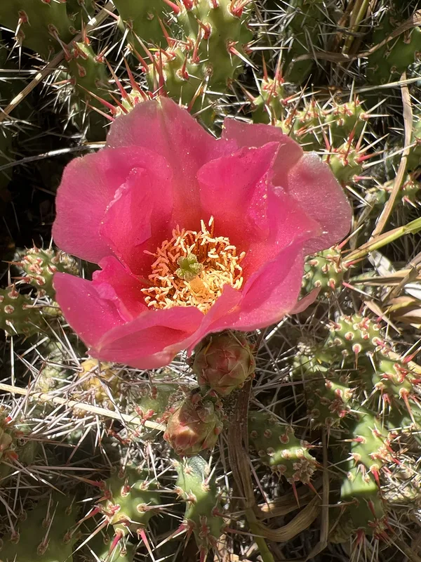
Brittle Pricklypear Opuntia fragilis -
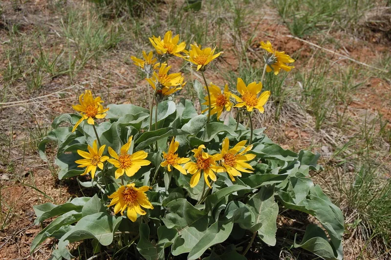
arrowleaf balsamroot Balsamorhiza sagittata -
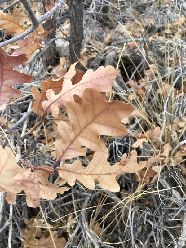
Gambel Oak Quercus gambelii -
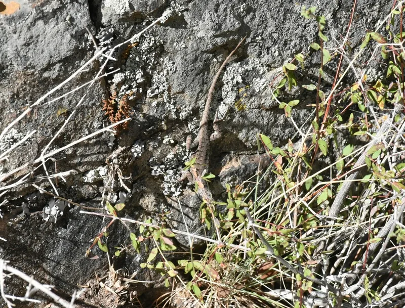
Plateau Fence Lizard Sceloporus tristichus -
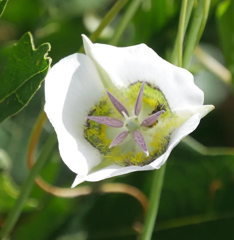
Gunnison's Mariposa Lily Calochortus gunnisonii -
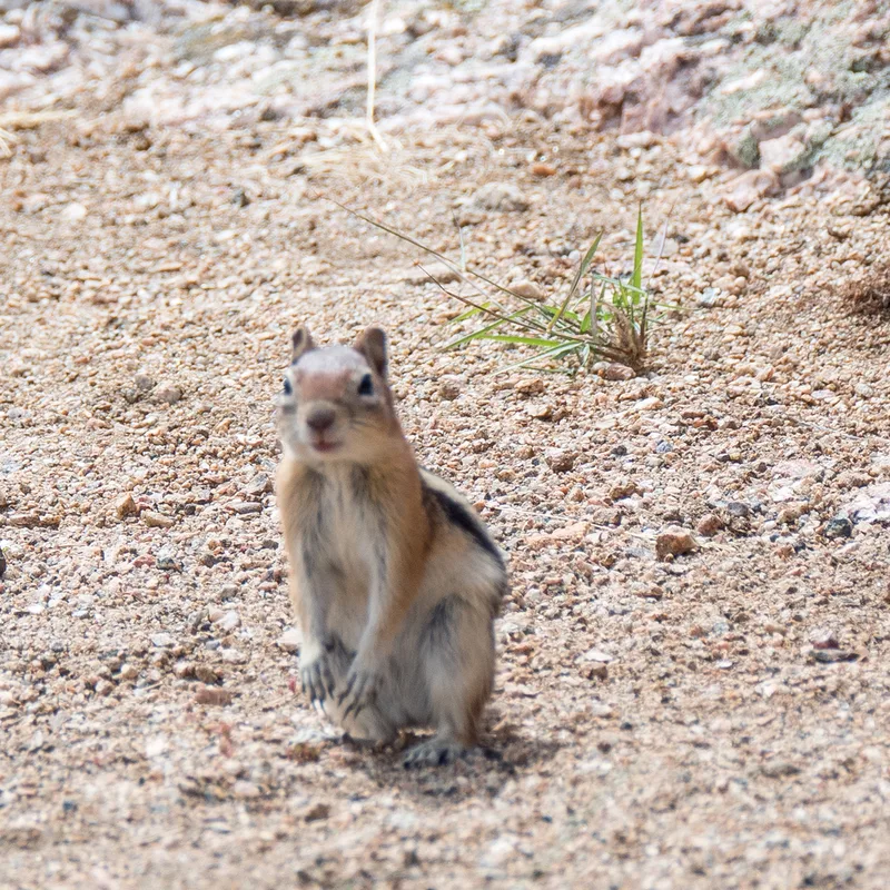
Common Golden-mantled Ground Squirrel Callospermophilus lateralis -
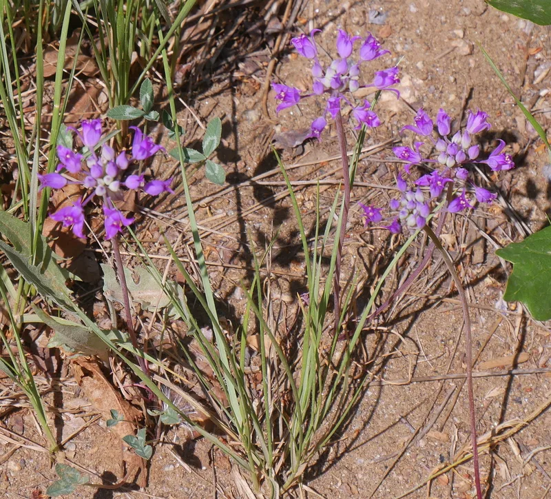
Hooker's onion Allium acuminatum -
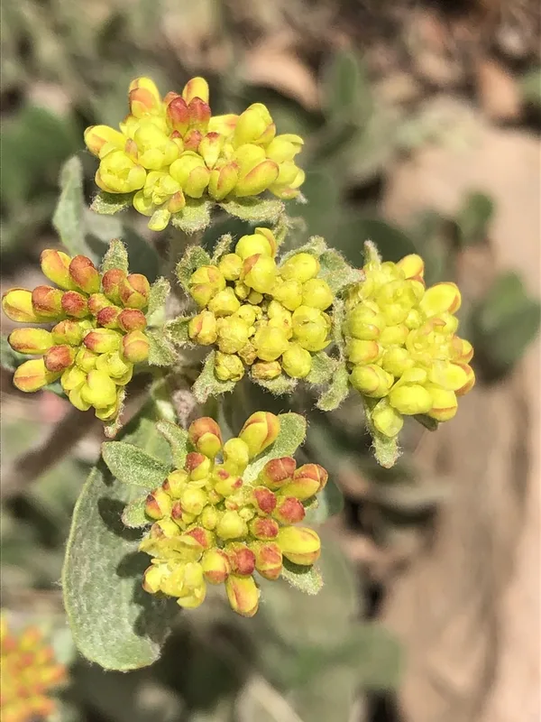
sulfur buckwheat Eriogonum umbellatum -
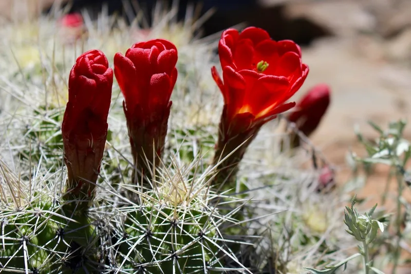
Kingcup Cactus Echinocereus triglochidiatus -
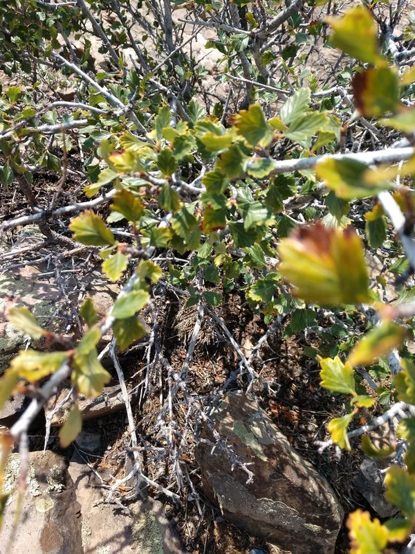
Alderleaf Mountain Mahogany Cercocarpus montanus -
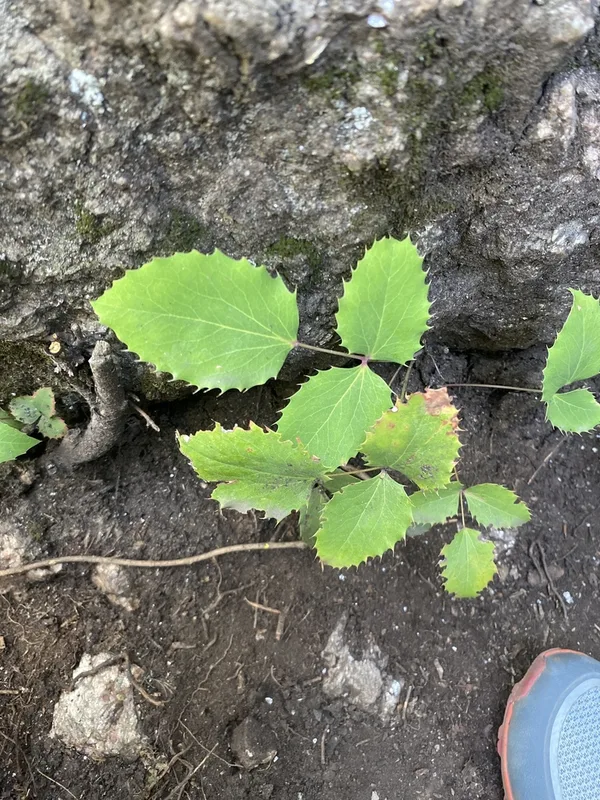
creeping mahonia Berberis repens -
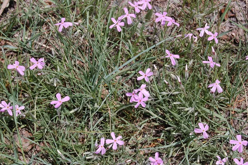
Longleaf Phlox Phlox longifolia
Field Notes · Desert & Deep Time lens · Black Canyon of the Gunnison National Park · 38.5798, −107.7437