Big Sur
Pfeiffer Big Sur State Park · California, USA
The mountains here rise, and the rivers cut, and neither one has ever really stopped.
Also seen through Fog Coast · all at Pfeiffer Big Sur State Park →.
Why here
At McWay Falls, a creek that has spent its whole life going downhill finally runs out of ground — and simply keeps falling, off a cliff and into the ocean. That is not a fluke of one waterfall; it is the whole story of this coast. These mountains are built from a rough mix of old sea floor and hard buried granite, shoved up out of the Pacific and still climbing. Its rivers and creeks are cutting down through that same rock just as fast as the mountains rise, which leaves them almost no room to spread out or slow down before they reach the sea. The result is a shoreline of short, steep watersheds that behave more like staircases than rivers, dropping through narrow canyons in a hurry, sometimes straight over the edge. The Big Sur River, the one exception with room enough to widen, still carved a valley steep-walled enough to earn a comparison to Yosemite. Everywhere here, the argument between rising land and falling water is still being decided, and the water keeps winning the small battles even as the mountains win the war.
The story
Start with the rock: this stretch of coast is a patchwork of old sea floor and hard buried granite, thrust up along the edge of the continent and still rising. The rivers and creeks draining it have to cut down through that mix just to keep up, which is why so many of them run in narrow, steep canyons instead of easy valleys.
Those same canyons keep the coast redwoods alive here, well south of where they grow easiest. Redwood sorrel, Pacific trillium and wild iris crowd the shaded ground beneath them, usually greening up and blooming in spring; a good rain brings the banana slugs out onto the wet canyon floor. All of it depends on the cool, damp air a narrow canyon holds onto long after the open slopes above have dried out for the year.
People followed the same water inland. A homesteader named John Pfeiffer settled along the Big Sur River, and Pfeiffer-Redwood Creek, one of its feeder streams, still carries his name. Down the coast, a rancher named Julia Pfeiffer Burns lived on this land for much of her life, into the late 1920s; the park later named for her holds McWay Creek and the falls at its mouth, and the creek’s own name comes from yet another settler who homesteaded its canyon. The record here stays quiet on who lived along these creeks earlier still, but the names left on the water are telling the story that came after.
The sites
The river's long cut inland
Big Sur Trailhead
36.2462, −121.7801
This unassuming trailhead is where the Big Sur River’s canyon opens enough to let a road and a parking area in, and where the walking begins if you want to follow the water upstream instead of just admiring it from the road. The trail tracks the river closely at first, through redwood shade, before climbing into steeper country. It keeps going for a long way: about ten miles upstream, hikers reach Sykes Camp, a scatter of campsites strung along both banks of the river, well inside the narrowing canyon the water has been cutting for longer than any of the trees around you have been alive. You don’t need to walk that far to feel what this lens is about. Even the first mile shows the pattern: a river squeezed by canyon walls close enough that road, trail and water all have to share the same narrow floor. Everything else on this list — every bridge, overlook and waterfall — is a different stretch of water doing the same job: cutting down through this coast about as fast as the mountains rise.
Walk down to the river’s edge before you start up the trail, and follow the sound of moving water with your ears until you find the exact stretch making it loudest. A riffle over stone sounds different from the same water sliding through a still pool a few steps away; the difference is the slope of the streambed under your feet, and this short canyon packs in one grade change after another.
- AccessDrive-up
- ExertionModerate
- TimeHalf a day
Pfeiffer Big Sur State Park
36.2476, −121.7820
Pfeiffer Big Sur State Park is built entirely around one river. The Big Sur River runs the length of it, and the canyon it has cut is deep and steep-walled enough that the park has picked up an unofficial nickname: a mini Yosemite. That comparison is about the shape of the place, not its history; this valley was cut by the river itself, working through hard rock a little at a time, not carved out in one dramatic event. The reward for all that patient work is visible along the canyon floor: an old-growth grove where some of the coast redwoods have been standing for more than a thousand years, sheltered by canyon walls that keep the air cool and moist even when the ridges above dry out for the season. Walk the loop trails near the river and you are walking the very floor the water made room for. It is one of the clearest places on this coast to see a river’s full-time job, carrying itself downhill and taking the mountain with it, one grain of sand at a time, laid out at an easy, walkable scale.
Find a spot where the trail runs close to the river and look at the water itself, not just the trees around it. Watch for the alternation between shallow, fast riffles over gravel and deeper, slow-moving pools; a river never treats its whole bed the same way. The pools are where sediment settles and the redwoods’ roots stay wettest longest, and the riffles are where the river is still actively cutting.
- AccessDrive-up
- ExertionEasy
- TimeHalf a day
Where short creeks win fast
Bixby Creek Bridge
36.3714, −121.9020
Bixby Creek Bridge exists because Bixby Creek cut a canyon too steep and too sudden for a coast road to simply follow down and back up. Instead, the highway leaps the gap in one long arc, high above the creek itself. Stand at the rail and the geometry does the explaining: a modest, unremarkable stream at the bottom, and an outsized canyon around it. That mismatch is the whole argument this lens is making. Water this size does not carve a canyon this size quickly; it takes a very long run of ordinary days, one at a time, cutting a little deeper each winter, to open a gap wide enough to need a bridge instead of a ford. The bridge is a human answer to a geological problem: the mountains here rise fast enough, and the rock is hard enough, that even a small creek has to fight for every foot of downward progress, and the fight shows in the depth of the canyon rather than the size of the water making it.
Lean on the rail and look straight down into the canyon rather than out at the ocean view. Follow the creek at the bottom with your eyes and compare its size to the width of the gap you’re standing over. A stream that small cutting a canyon that wide is a sign of how much time, not how much water, this coast has had to work with.
- AccessDrive-up
- ExertionEasy
- TimeAn hour
McWay Falls
36.1586, −121.6717
McWay Creek is a short stream, flowing swiftly down from a canyon high in the coastal mountains, through Julia Pfeiffer Burns State Park, and finally over McWay Falls into Waterfall Cove, where the ocean meets it directly. Most rivers slow down before they reach the sea; the ground flattens, the current spreads out, and the water builds itself a wide mouth, a delta, or a lagoon out of everything it has been carrying downstream. McWay Creek never gets that chance. The land runs out before the water can slow, so instead of widening into an easy river mouth, it simply keeps falling, off a cliff and into the cove below. Waterfalls that empty straight into salt water like this are uncommon on most coastlines, where a river usually has room to slow first. Here, it doesn’t — one more sign of a coast still being shaped faster than its rivers can smooth it out.
Watch the creek in the last stretch before it goes over the edge, rather than the fall itself. Most streams widen and slacken as they near the ocean; this one doesn’t get the chance, and the water is still moving at roughly the same speed right up to the point where the ground simply stops. Try to spot exactly where stream becomes waterfall; there is less warning than you would expect.
- AccessShort walk
- ExertionEasy
- TimeAn hour
Julia Pfeiffer Burns State Park
36.1681, −121.6700
Julia Pfeiffer Burns State Park holds most of the McWay Creek watershed, from the high canyon where the creek starts to the falls where it ends, and that whole range is on display within a short walk. Near the park’s edges, the slopes are open and wind-scoured, covered in low coastal scrub. Step down into the creek canyon itself and the vegetation changes abruptly: this is where the park’s redwoods grow, some of them enormous, among the largest and oldest on this stretch of coast. They don’t grow on the open bluffs above, only in the sheltered canyon, because the canyon walls block the wind and trap fog and moisture long after the exposed slopes have dried out for the year. The park is named for Julia Pfeiffer Burns, a rancher who spent much of her life on this coast; the land she knew as open range now shelters, in its lowest and wettest fold, some of the oldest living things in the region. The canyon didn’t just carry the water downhill — it built the one place on this slope cool and damp enough for these trees to last as long as they have.
Walk from the open bluffs at the park’s edge down into the creek canyon and notice exactly where the vegetation changes, not just that it does. The line is usually sharp rather than gradual; coastal scrub gives way to redwoods within a matter of steps, right where the canyon walls start blocking the wind. That sudden line is the boundary of the canyon’s own private climate.
- AccessShort walk
- ExertionEasy
- TimeAn hour
When it's best
Come when the rains are still falling. Late winter into spring is when these canyons are at their fullest: cold, damp air pooled under the redwoods, creeks running high, and the shaded forest floor turning over stretch after stretch of wildflowers, with trillium, wild iris, and columbine each taking their turn as the weeks warm. Wet ground brings the banana slugs out onto the trail after rain. By summer the creeks quiet down and the flowers are gone, but the canyons themselves — the falls, the bridges, the narrow river valley — hold their shape and reward a visit in any season.
Go deeper
The rock underfoot spans two very different times: a broad sheet of Miocene-age marine sandstone, mudstone and shale laid down roughly ten to thirteen million years ago, resting against much older Cretaceous-age granite and other plutonic rock, alongside Cretaceous sedimentary rock, both on the order of seventy to a hundred and forty million years old. The stretch of coast around here is catalogued geologically as the Carmel Valley column. The redwoods are coast redwood, Sequoia sempervirens. The shaded understory in this note is redwood sorrel (Oxalis smalliana), Pacific trillium (Trillium ovatum), Douglas iris (Iris douglasiana) and western columbine (Aquilegia formosa); the wet-weather forager is the banana slug, Ariolimax stramineus.
To read next. Only one further reading is on record for this spot, but it earns its place: Gordon B. Oakeshott’s Guide to the Geology of Pfeiffer Big Sur State Park, Monterey County, California (1951) — a park-specific field geology guide, written for exactly the question this note raises: why the rock underfoot looks the way it does.
The names behind what you saw
What lives here, and what it's called. Photographs from open collections — an aid to identification, not decoration.
-
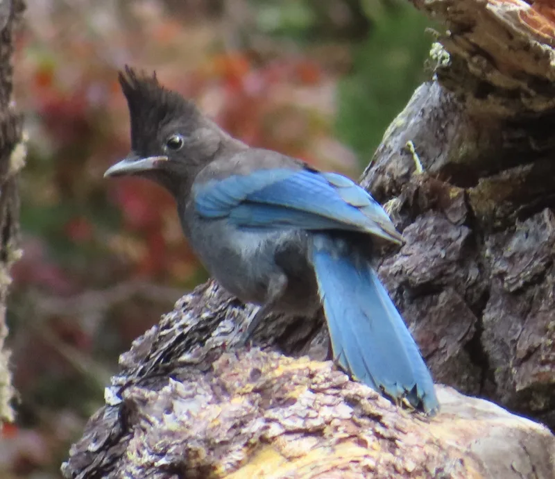
Steller's Jay Cyanocitta stelleri -
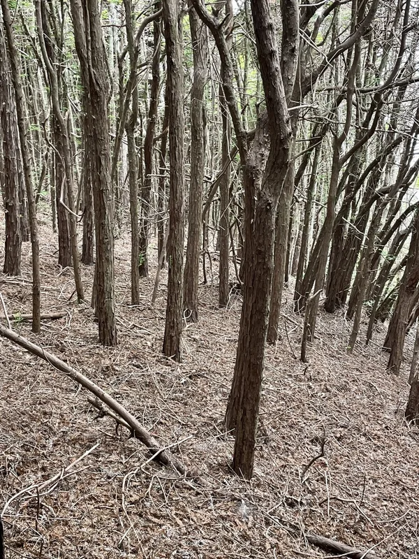
coast redwood Sequoia sempervirens -
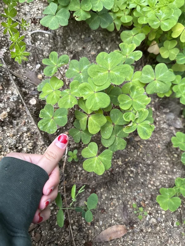
Redwood Sorrel Oxalis smalliana -
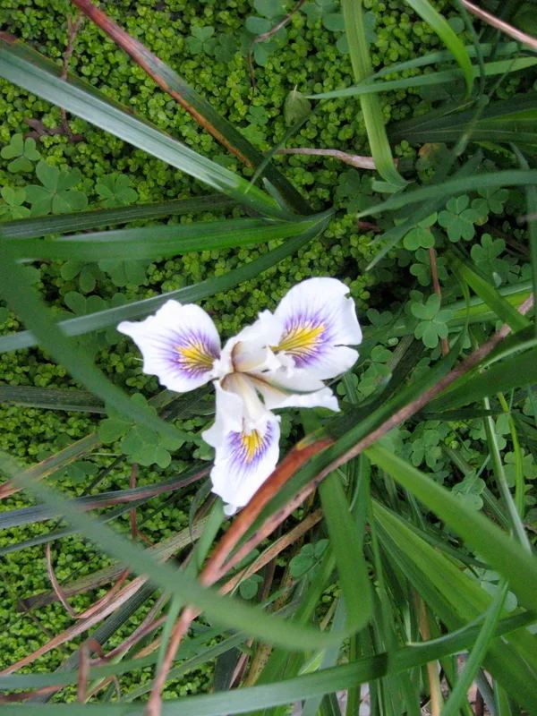
Douglas iris Iris douglasiana -
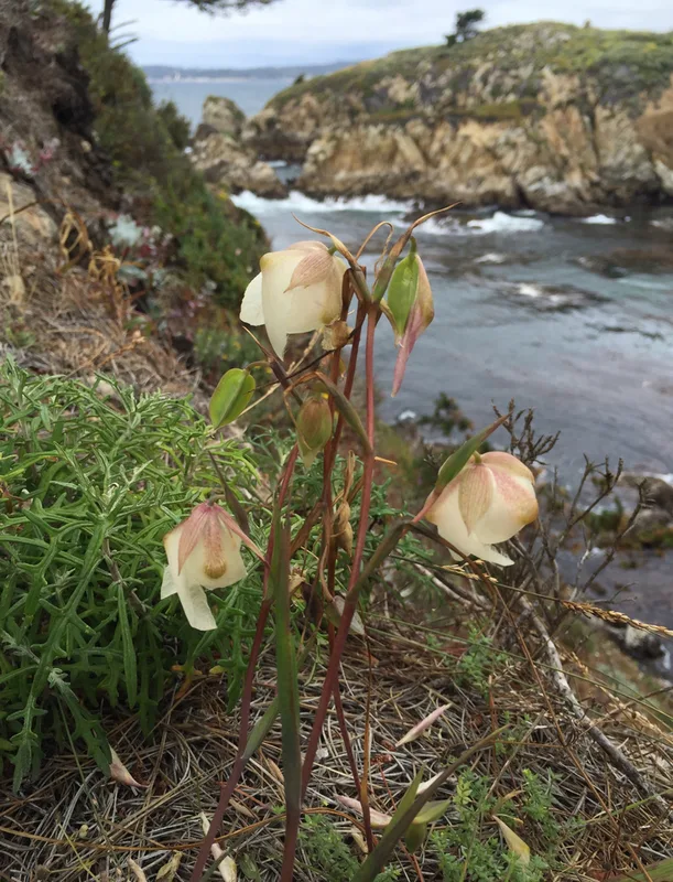
White Globe Lily Calochortus albus -
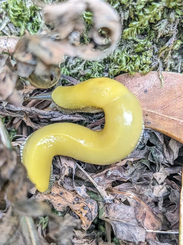
Southern Pacific Banana Slug Ariolimax stramineus -
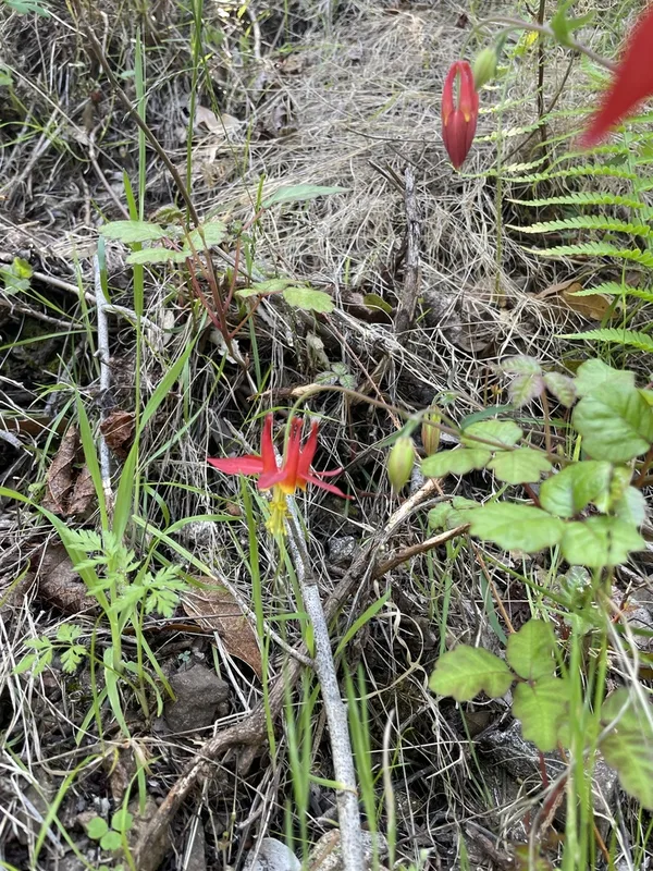
western columbine Aquilegia formosa -
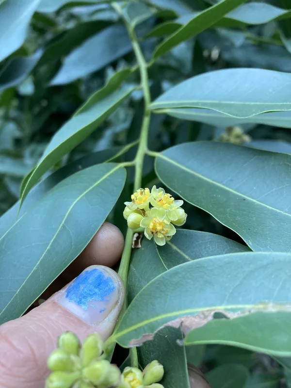
California bay Umbellularia californica -
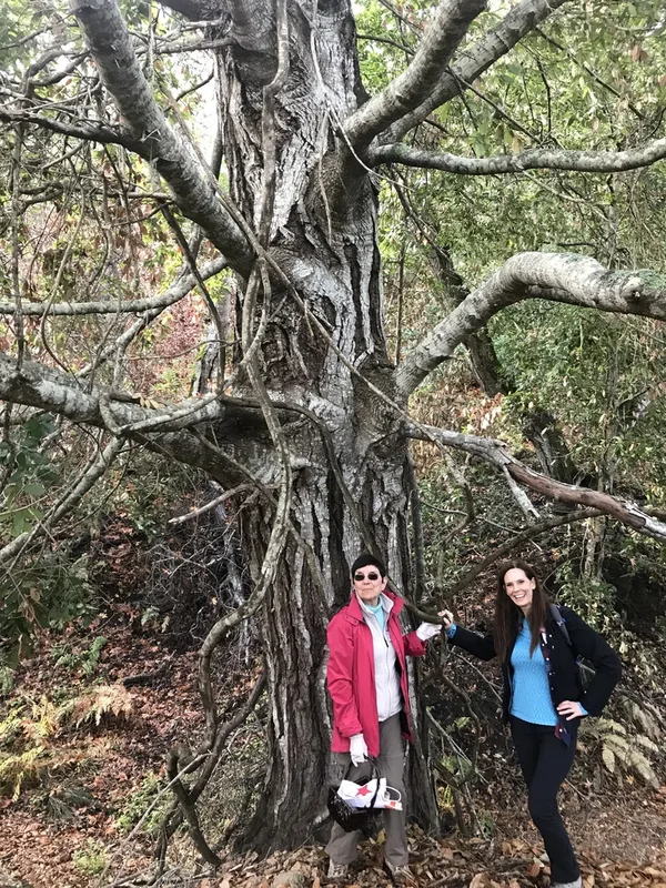
Tanoak Notholithocarpus densiflorus -
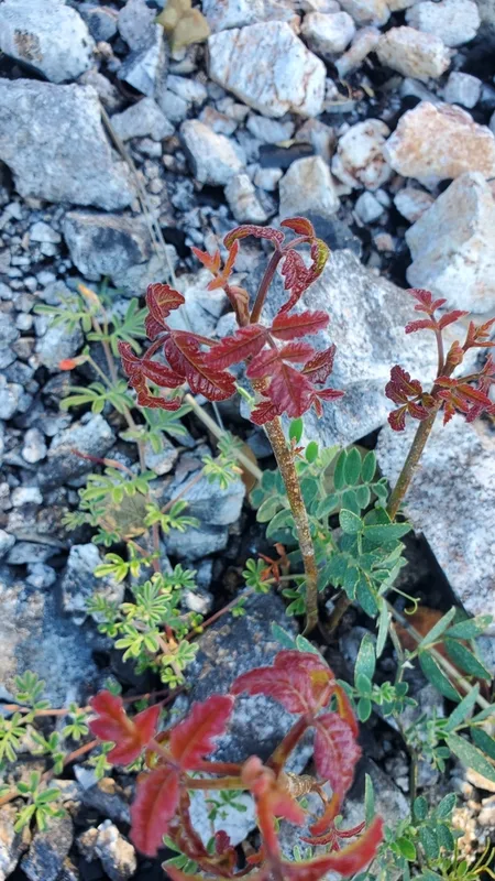
Pacific poison oak Toxicodendron diversilobum -
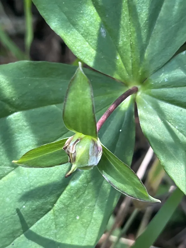
Pacific trillium Trillium ovatum -
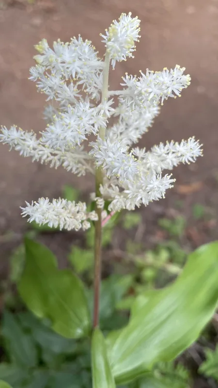
Solomon's plume Maianthemum racemosum
Field Notes · Rivers & Canyons lens · Pfeiffer Big Sur State Park · 36.2533, −121.7833