Big Sur
Pfeiffer Big Sur State Park · California, USA
The sea here makes its own weather, and the forest drinks it.
Also seen through Rivers & Canyons · all at Pfeiffer Big Sur State Park →.
Why here
On a warm summer afternoon, a valley or two inland, the hills go gold and dry. Here, on the same afternoon, the tallest trees on the coast are being watered — not by rain, but by fog. All summer the cold Pacific breathes a low grey ceiling over this shore, and the redwoods comb it out of the air, drinking through their needles and dripping the rest onto their own roots. It is why a forest that should have burned brown by August instead stays dark and wet and green, a few ridgelines back from the surf.
The whole coast runs on this bargain. The sea cools the air; the fog feeds the trees; the wet ground feeds the ferns and sorrel and slugs beneath them; and where the fog thins, the forest stops and the open bluff begins. Read the coast this way and everything lines up. The sea is not the edge of this place. It is the thing keeping it alive.
The story
Start with the rock, because the rock came first. The bones of this coast are old: granite pushed up hot from deep underground, and beside it the hardened floor of an ancient sea — sandstone and shale laid down grain by grain when this was all underwater. The mountains they now hold up rise straight from the surf, steep enough to catch the wind off the water and wring it dry.
That wringing is what the life runs on. Cold ocean, summer fog, and the redwoods that drink it — the tallest of them here have been standing for well over a thousand years, and in the sheltered canyons to the south, longer than two thousand. Beneath them the wet ground grows its own quiet crowd: redwood sorrel folding its clover leaves against the light, trillium and iris opening in the spring shade, banana slugs working the leaf litter after rain.
People came late and held on hard. Homesteading families like the Pfeiffers and the Posts settled these canyons generations ago and worked the forest edge and the coastal grass, one of them building a home that stood through five generations. A rancher named Julia Pfeiffer Burns lived out most of her life on this coast, and a park of two-thousand-year-old redwoods now carries her name. The record here is quiet on who walked these groves before them.
The sites
The forest the fog keeps green
Pfeiffer Big Sur State Park
36.2476, −121.7820
This is the easiest place to stand inside the forest the whole lens is about, and the best place to start. The park follows the Big Sur River up a valley of old-growth redwoods so steep and green it has been called a mini Yosemite. One tree here has been standing for more than a thousand years — already old when the first ranchers settled these canyons. Come off the road and into the trees and you feel the change before you can name it: the temperature drops, the light turns an underwater green, and the rush of the river takes over from the traffic. This is the fog’s dividend, banked over centuries. A redwood cannot live on rain alone through a rainless California summer; it lives because the sea sends fog, and the tree drinks it straight from the air. Everything soft and green on this valley floor — the ferns, the sorrel, the moss on the bark — is here on the same terms. Stand in it a while before you go looking for the coast. This is what the coast is keeping alive.
Stand at the base of one of the big redwoods, look up the trunk, then down at the ground around it. The green clover-leaved carpet is redwood sorrel, which folds its leaves shut in bright light and opens them in shade — a live measure of how little sun reaches this floor. Look for the darker, wetter soil directly under the biggest crowns, where the tree drips its own fog-water down onto its roots.
- AccessShort walk
- ExertionEasy
- TimeHalf a day
Julia Pfeiffer Burns State Park
36.1681, −121.6700
A dozen miles down the coast, this park climbs from the surf straight up into a canyon holding some of the oldest trees in the region — redwoods that have stood here for more than two thousand years. It takes some standing-still to absorb that: a living thing already ancient before most of recorded history, kept alive this whole time by fog off the same ocean you can hear from its roots. The park is named for Julia Pfeiffer Burns, a rancher who lived most of her life on this coast in the early part of the last century. What makes the place worth a stop for this lens is the range packed into a short walk: open surf and salt wind at the bottom, then bluff, then the deep, still, fog-fed forest above — the whole gradient from sea to sheltered grove stacked up one hillside. You can walk from one world into the other in a few minutes and feel exactly where the sea stops battering the land and starts feeding it.
Walk from the sea edge up into the canyon and notice where the trees change. Down low, wind and salt keep growth short and tough; a few hundred steps up, out of the salt wind and into the fog’s catchment, the redwoods take over and the air turns still and cool. The line between the two is the coast’s whole bargain, drawn on a single slope — find where it falls.
- AccessShort walk
- ExertionEasy
- TimeHalf a day
Big Sur Trailhead
36.2462, −121.7801
For a longer walk into the forest, this trailhead starts the Pine Ridge Trail, which runs up the Big Sur River into the backcountry; a streamside camp sits about a day’s walk in. You do not have to go far to learn what it teaches. The trail begins in deep redwood shade along the river and climbs, and as it climbs it dries out — the big trees fall away, the canopy opens, and hard-leaved shrubs and oaks take over the sunny slopes. That change is the fog’s reach running out in front of you. The redwoods hold the low, shaded, damp folds the marine air can reach; a few hundred feet higher and a ridge or two inland, the fog no longer gets there, and a tougher, drier forest takes the ground. Even a half-day sample up and back shows it plainly. Stay on the path as you go: poison oak lines these trails, low and easy to brush against, and it holds its bite in every season.
As you climb, watch the trees change with the ground. The redwoods hold the shaded, north-facing folds where the fog and creek keep things damp; on the sun-baked south slopes they give way to hard-leaved shrubs and oaks that can take the dry. You are walking out of the fog’s territory in real time — mark the spot where the last big redwood gives out.
- AccessHalf-day hike
- ExertionModerate
- TimeA full day
Where the land trades places with the sea
McWay Falls
36.1586, −121.6717
A short, level walk from the road ends at an overlook above a waterfall that drops straight off a cliff onto the sand and surf — roughly eighty feet of McWay Creek meeting the Pacific in a single fall. There are not many places where a creek reaches the ocean quite so abruptly, and it makes an unusually clean picture of the whole idea behind this coast. Water gathers in the hills — pulled from the air by the forest, filled out by winter rain — collects into this small creek, and is handed straight back to the ocean it evaporated from in the first place. The cove below is closed to visitors, which spares the beach and keeps the scene whole. You come for the drop; you stay for the loop it completes, sea to fog to forest to creek to sea again, all visible from one railing.
From the overlook, follow the water backward with your eye — from the cove, up the fall, into the notch of the canyon behind it. That canyon is where the fog and rain collect before the creek carries them here. You cannot reach the beach, so watch instead how the fall’s plume bends and frays with the wind coming off the water.
- AccessShort walk
- ExertionEasy
- TimeAn hour
Pfeiffer Beach
36.2386, −121.8175
Down a narrow, winding side road, this pocket beach sits where a creek breaks through to the sea and the coast’s hard rock stands just offshore as sea stacks the waves have not finished taking apart. It is a good place to feel the raw machinery of the coast with nothing between you and it. The wind here is nearly constant, funneled straight off the water — and it is worth feeling on your face, because that onshore wind is the delivery system for everything this lens is about. The same air pushing sand into your socks is the air that carries the cold sea’s fog up and over the ridges to the redwoods inland. Here you meet it as raw weather; a few miles into the hills the trees meet it as their water supply. Come on a windy afternoon rather than a calm one — the coast is more honest about itself when the wind is up.
Stand where the creek crosses the sand to the surf and watch the water pour through the gaps between the offshore rocks. Those rocks are the beach’s own past — the harder cores of a headland the sea has cut away around them. Then note the wind direction: onshore, off the water, is the wind that gathers the fog the forest lives on.
- AccessShort walk
- ExertionEasy
- TimeAn hour
Garrapata State Park
36.4694, −121.9100
At the north end of this stretch of coast, Garrapata is open bluff and rocky headland, the place where the mountains meet the sea with barely a beach between them. Trails run out along the cliff tops and drop into small coves. This is the open half of the coast’s story — where the fog thins, the wind wins, and the forest gives way to grassland that can take the salt. In spring the exposed bluffs carry Douglas iris and other coastal wildflowers built for exactly these conditions: full sun, hard wind, thin soil, no shelter. Set against the fog-fed redwood groves to the south, Garrapata shows you the other end of the same gradient — what grows where the sea batters the land instead of feeding it, and how sharply the two worlds sit side by side on one coast.
Walk the bluff edge and look low in the coastal grass for Douglas iris, a pale blue-purple flower best in spring. It grows out here in the wind and salt where the redwoods cannot — a plant built for the open coast rather than the sheltered forest, marking the far end of the same gradient the fog draws.
- AccessShort walk
- ExertionModerate
- TimeHalf a day
The long view of the coast
Point Sur Light Station
36.3050, −121.8986
A lighthouse stands on a high rock that rises off the shore, tied to the coast only by a low neck of sand and rubble. It was put there to read the one thing that makes this coast beautiful and dangerous at the same time: the fog. The cool marine air that keeps the redwoods watered can close over open water in minutes, turning a clear afternoon into a wall of grey, and for generations a light and a horn on this rock were the coast’s answer to it. For this lens, the rock is a reading station. From it, the fog is not a mood but a working part of the coast — the same cold breath that feeds the forest is the one that once wrecked ships. Same weather, two faces. The station sits behind a gate and keeps limited access, but the rock and the moving air read plainly from the road.
From the highway pullouts near the rock, watch the marine air move against the land, especially in the morning. When the grey ceiling sits low over the water and spills through the coastal gaps, you are seeing the fog exactly as the lighthouse keepers did — the coast’s weather being made offshore and pushed onto the land.
- AccessDrive-up
- ExertionEasy
- TimeAn hour
Point Lobos State Natural Reserve
36.5171, −121.9430
At the northern edge of the coast, Point Lobos is a headland reserve of rocky points, hidden coves, and unusually clear water where kelp grows thick just offshore. Gulls and cormorants crowd the outer rocks, and at low water the tidepools open along the ledges. If the redwood groves show the fog feeding the land, Point Lobos shows the other half of the bargain up close: the cold, food-rich sea the fog is actually made from. The ocean here does not just sit offshore looking scenic — it is upwelling cold water from below, and that cold is what chills the summer air into fog and what packs these rocks and pools with life. Spend an hour watching the water and the birds and you are watching the source. Everything green and standing a few ridges inland begins out here, in this cold water and the grey air it breathes onto the shore.
At low tide — check a tide table before you come — work slowly along a rocky ledge and look into the still pools left behind. The cold, food-rich water here is the same upwelled ocean that cools the air into fog. Turn over no rocks, but watch for anemones and crabs below, and the dark cormorants drying their wings on the points above.
- AccessShort walk
- ExertionEasy
- TimeHalf a day
When it's best
The forest is worth a visit in any season — the fog and the shade keep it green when the inland country has long gone brown. Spring is the quiet showpiece on the forest floor: trillium, Douglas iris, and western columbine come up in the damp shade, usually at their best through the middle of spring and gone by summer. Look for banana slugs on the trail after any rain, and expect the grey summer fog to sit thickest along the coast in the mornings, burning back by afternoon. Winter brings the rain that fills the creeks and the falls. Come then for water, in spring for flowers, and in summer for the fog itself.
Go deeper
The names behind what you saw
- The redwoods are coast redwood, Sequoia sempervirens.
- The green clover-leaf carpet is redwood sorrel, Oxalis smalliana; the three-petaled spring flower is Pacific trillium, Trillium ovatum; the blue-purple bluff flower is Douglas iris, Iris douglasiana; the nodding red-and-yellow one is western columbine, Aquilegia formosa.
- The big yellow slug on the trail is the Southern Pacific banana slug, Ariolimax stramineus; the loud blue-black bird of the redwoods is Steller’s jay, Cyanocitta stelleri.
- The rock beneath it all: the granite is Cretaceous granitic rock, and the “ancient sea floor” is a body of Miocene marine sandstone and shale (the Monterey Formation and its relatives), with older Mesozoic sedimentary rock below.
To read next
The record here holds a single verified guide — Gordon B. Oakeshott’s Guide to the Geology of Pfeiffer Big Sur State Park (1951), a short local field guide to the rock beneath the redwoods and a good starting point if the granite-and-old-sea-floor story caught you. The sources are otherwise quiet on vetted further reading; for the fog-and-forest side of the lens, a general guide to the coast redwood is the direction to look, though none is named in these sources.
The names behind what you saw
What lives here, and what it's called. Photographs from open collections — an aid to identification, not decoration.
-
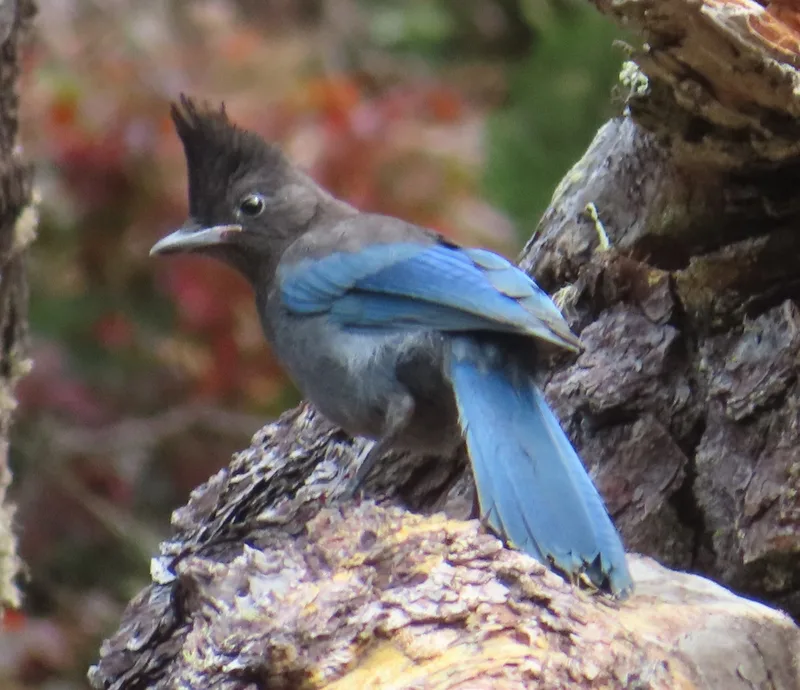
Steller's Jay Cyanocitta stelleri -
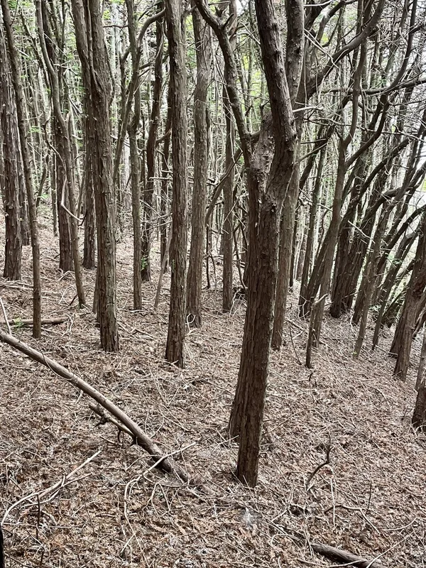
coast redwood Sequoia sempervirens -
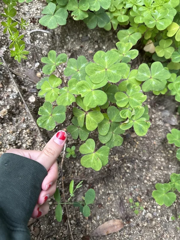
Redwood Sorrel Oxalis smalliana -
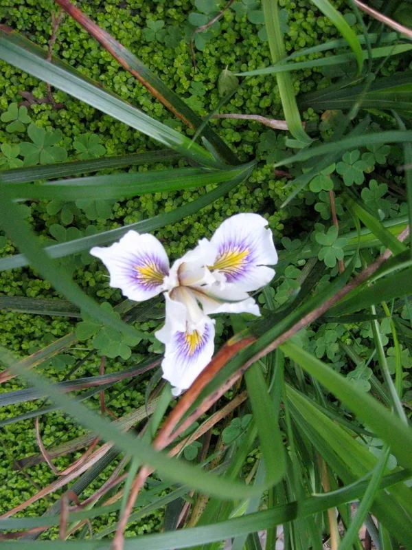
Douglas iris Iris douglasiana -
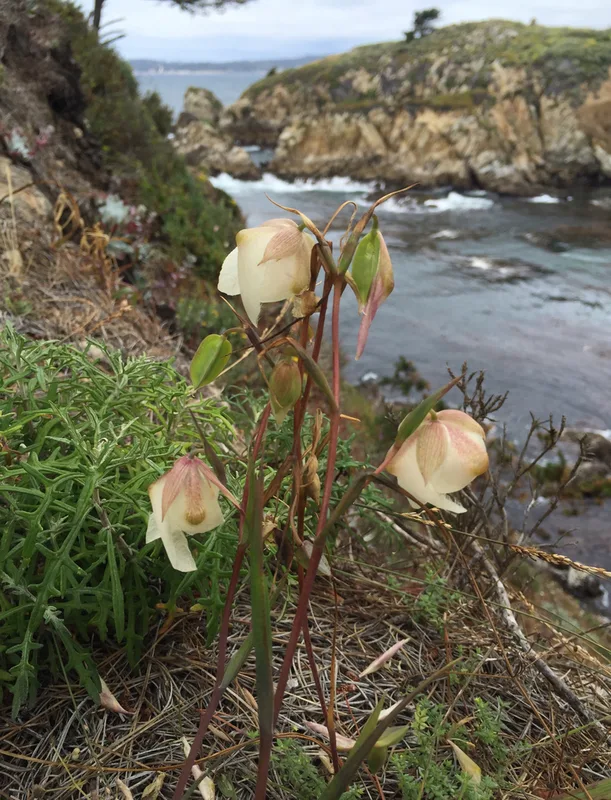
White Globe Lily Calochortus albus -
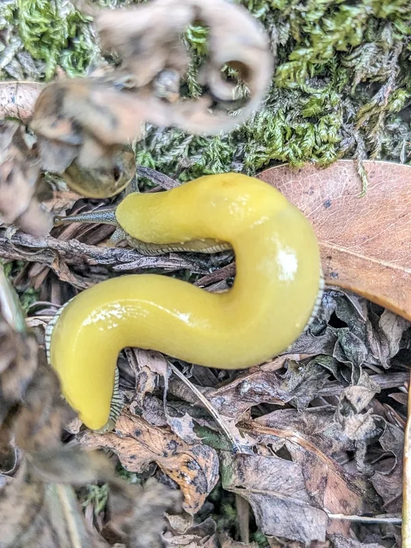
Southern Pacific Banana Slug Ariolimax stramineus -
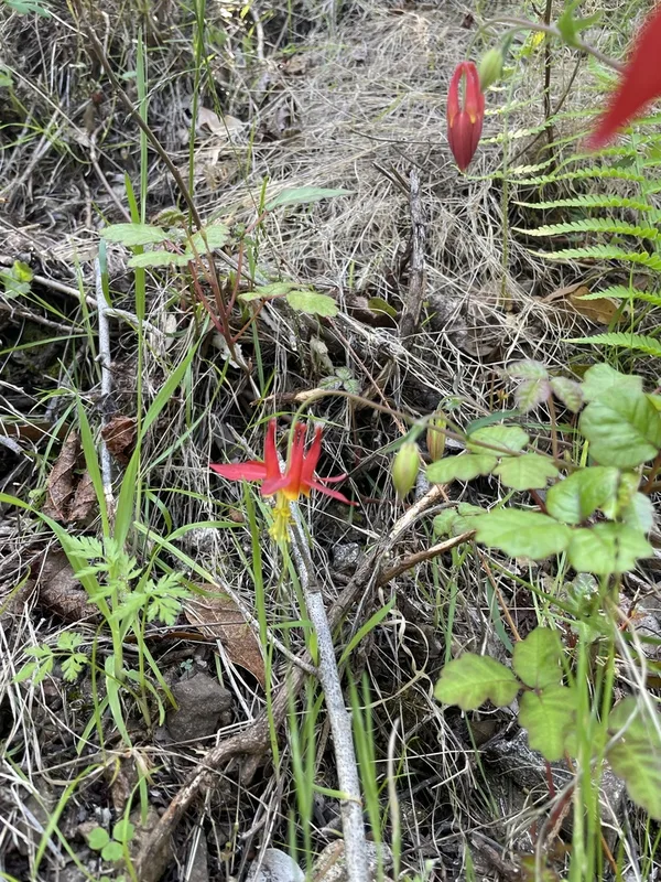
western columbine Aquilegia formosa -
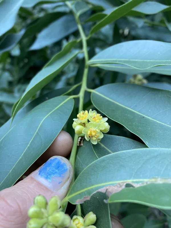
California bay Umbellularia californica -
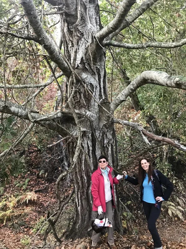
Tanoak Notholithocarpus densiflorus -
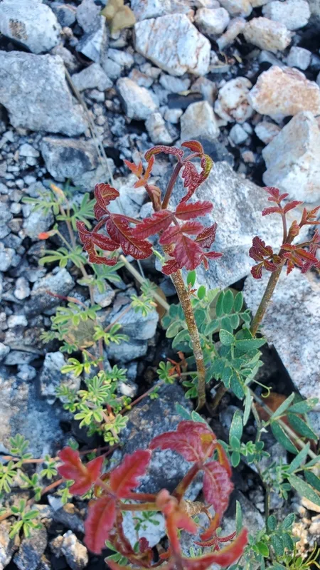
Pacific poison oak Toxicodendron diversilobum -
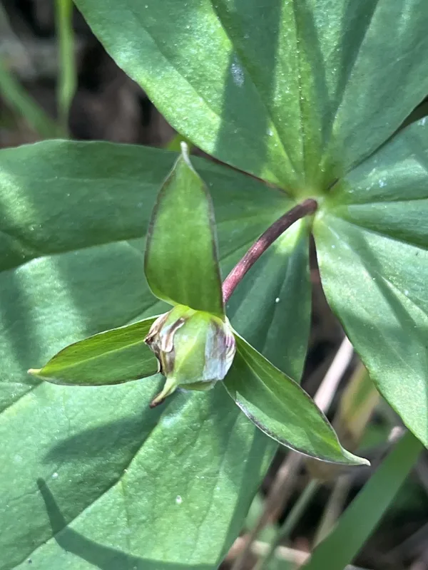
Pacific trillium Trillium ovatum -
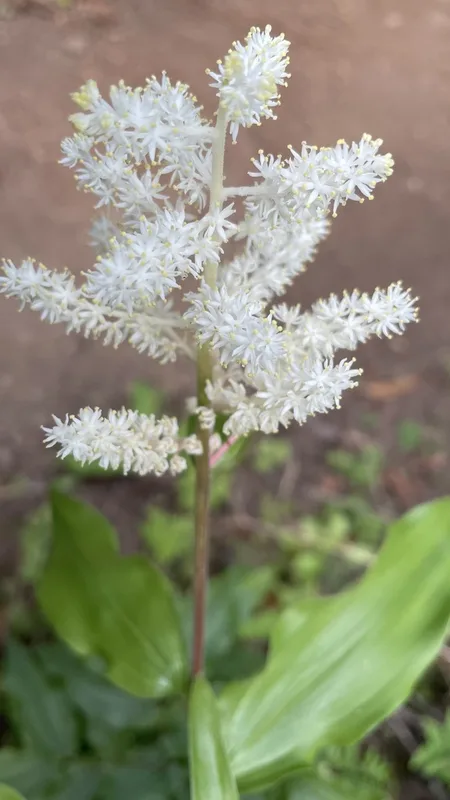
Solomon's plume Maianthemum racemosum
Field Notes · Fog Coast lens · Pfeiffer Big Sur State Park · 36.2533, −121.7833