Banff
The mountains here used to be seafloor. The lakes are where that argument is still being settled.
Also seen through Ice & Glaciers · all at Lake Louise →.
Why here
The color comes first, always. Look at Lake Louise or Moraine Lake in midsummer and it seems impossible — too blue-green to be real, like something dyed. It isn’t. It’s rock, ground so fine by moving ice that it stays suspended in the water and scatters the light back at you as turquoise. That’s the whole argument this place has been having with itself for a very long time, condensed into a color you can see from the shore. Long before there were mountains to carve, this stretch of the Rockies was seafloor — a great depth of sediment settling out of shallow ancient seas, one thin layer at a time, until it hardened into rock. Then ice took over the job, grinding that same rock back down and carrying the powder into basin after basin, lake after lake. The glaciers overhead are still doing it. Every site in this note is a chapter in that same water story: patient sediment first, patient ice second, and meltwater still finishing the sentence each summer.
The sites
Where the ice is still winning
Bow Glacier
51.6464, −116.5111
Ice looks like it’s standing still, but it isn’t. Bow Glacier is a slow river in its own right, moving downhill under its own weight, and everywhere it drags across bedrock it grinds the rock beneath it into powder. That powder — fine enough to stay suspended in water rather than settle to the bottom — is what eventually turns the lakes below this glacier that unmistakable pale blue-green. None of that color exists without this ice doing the grinding first.
Meltwater leaves the glacier’s toe as a braided, milky stream, carrying the freshest rock flour the glacier has to offer. Follow it and you’re walking the very beginning of a water story that ends up, eventually, running past the town of Banff itself as part of the Bow River. It’s easy to think of a glacier as scenery. It’s more accurate to think of it as upstream — the source, still working, of every argument the water has downstream with the rock in its path.
Glaciers like this one have been retreating for generations, leaving fresh, unvegetated rock exposed at their edges — a rough record of how far the ice has pulled back, written directly on the ground.
Look at the meltwater stream leaving the ice. It typically runs milky rather than clear — that cloudiness is fine rock flour, ground straight off the bedrock by the moving glacier above. Follow the stream with your eye toward Bow Lake and watch the water start to change character as it travels.
- AccessHalf-day hike
- ExertionModerate
- TimeHalf a day
Mount Victoria
51.3769, −116.3067
Stand at the shore of Lake Louise and Mount Victoria is the wall of ice and rock closing off the far end of the lake — a glaciated peak whose ice has been doing to the rock above the lake exactly what Bow Glacier is doing upstream. The mountain carries its own hanging glacier high on its flanks, and meltwater running off it is one of the direct sources feeding the lake below.
It’s worth remembering that the mountain itself is not the origin of the story — it’s rock that was already old and already layered long before any glacier arrived to work on it, sediment laid down in ancient seas and later folded and lifted into peaks. The ice on Mount Victoria’s upper slopes is simply the latest tool applied to that older rock, still cutting, still feeding fresh mineral powder into the lake below every summer.
Watching this one mountain, then, is really watching two timescales at once: the slow, patient one that built the rock over a very long stretch of Earth’s history, and the faster, ongoing one of ice grinding it back down in front of you.
From the lakeshore, trace the ice visible on Mount Victoria’s upper slopes down toward the water. Notice how the lake’s color shifts subtly closer to that end — the meltwater arriving there carries the freshest rock flour, before it has had time to spread and settle through the rest of the lake.
- AccessDrive-up
- ExertionEasy
- TimeAn hour
Lakes that catch the argument mid-sentence
Bow Lake
51.6644, −116.4486
Bow Lake collects what Bow Glacier sends down, and in doing so it becomes something more than scenery: the headwaters of the Bow River, the same river that later runs past the town of Banff on its way out of the mountains. Everything downstream — the whole river valley the park’s main town sits in — starts, in a sense, right here, as glacial meltwater settling into a still basin.
The lake’s color is a direct readout of how much rock flour is currently suspended in it, which changes through the season as melt rates rise and fall. Early in the season, expect the water closer to milky than blue, thick with sediment freshly delivered from the glacier above. Given time and calmer conditions, the flour settles into a more even suspension, the color deepening toward the turquoise the area is known for.
It is a short walk from a pullout to the shoreline, and an easy place to sit and watch a river being born — not with drama, just a glacier patiently adding meltwater to a basin, one summer at a time, until it has somewhere to go.
Walk to the outlet where the lake narrows back into a stream — that’s the infant Bow River leaving the basin. Compare the water clarity there to the water near the glacier-facing shore; the sediment often hasn’t mixed evenly, so the color can shift visibly across short distances.
- AccessShort walk
- ExertionEasy
- TimeAn hour
Peyto Lake
51.7250, −116.5222
Peyto Lake sits lower in the same valley system, catching meltwater and rock flour delivered from glaciers upstream, and the geometry of its basin lets sediment settle into a wide, shallow, even suspension — the conditions that tend to produce a strong, saturated color, rather than a murky or overly diluted one.
The lake is long and narrow, following the shape of the valley the ice carved to hold it, and from above — the usual vantage point, a short walk from a parking area — that shape reads clearly: not a round bowl but an elongated trough, a river valley the ice widened and deepened before retreating and leaving water to fill it.
Like every lake in this note, Peyto’s color is not fixed. It responds to how much meltwater is arriving, how recently, and how much time the sediment has had to settle. A lake that looks impossibly saturated one week can look paler and greener a few weeks later, simply because the glacier upstream is having a different kind of day.
From the overlook, follow the lake’s outline. Note how it narrows and elongates rather than pooling into a circle — that elongated shape is the ghost of the valley the ice carved before it retreated and let water take over the space.
- AccessShort walk
- ExertionEasy
- TimeAn hour
Lake Louise
51.4117, −116.2281
Lake Louise is a clear proof of this note’s whole argument: a basin scooped by ice, now fed by glacial meltwater running off Mount Victoria and the ridgelines around it, its color changing with how much rock flour is currently in suspension.
The lake sits in a bowl of much older rock — layered marine sediment that was laid down at the bottom of ancient seas long before there were mountains here at all, later folded, lifted, and finally carved into its current shape by ice that has mostly since retreated. What’s left is water sitting where ice used to be, still being topped up by what little ice remains above.
It’s easy, standing at the shore, to see only the color and miss the story underneath it: rock born underwater, raised into a mountain wall, ground back down by ice, and now held as a lake that is, in its own way, still underwater rock — just suspended instead of solid, and lit from within by whatever the glaciers upstream sent down that week.
Look closely at the water near the shoreline versus out toward the center of the lake. The color is rarely perfectly uniform — shallower water near shore often reads a lighter, brighter green, while deeper water toward the center shifts toward blue. That’s light interacting differently with the same suspended rock flour at different depths.
- AccessDrive-up
- ExertionEasy
- TimeAn hour
The valley and the wall damming it
Moraine Lake
51.3225, −116.1856
Moraine Lake sits behind a natural dam of jumbled rock at its outlet — a wall of debris left by the same forces that carved the valley around it — and that dam is the reason there’s a lake here at all rather than a river running freely through. Water arrived, found its path blocked, and simply pooled up behind the obstruction until it found a new way through or over.
The lake takes its color from the same source as the others in this note: fine rock flour delivered by meltwater from the glaciers and snowfields feeding the valley above. Because the outlet is constrained, the water here can sit longer before moving on, often giving the color extra time to settle into its most saturated form.
It’s a small, local illustration of a much larger pattern this whole note is built around: water doesn’t always win by simply cutting through. Sometimes it wins by waiting — filling in behind whatever blocks it until the obstacle is submerged, overtopped, or made irrelevant.
Find the rockpile at the lake’s outlet end. Climb it if you’re able, and look back at the lake from above — from here you can see the dam itself, the debris that turned a valley into a basin, holding the water back long enough to let its color develop.
- AccessDrive-up
- ExertionEasy
- TimeAn hour
Valley of the Ten Peaks
51.3494, −116.1597
Look up from Moraine Lake and the valley holding it becomes obvious: a broad, flat-floored trough walled by a row of peaks, far too wide and too evenly shaped to have been cut by a single stream. Rivers carve narrow V-shaped notches. This is something else — a U-shaped valley, the signature left behind when ice, not water alone, did the widening.
The difference matters. A river cuts down; a glacier, moving as a thick mass rather than a thin current, scours sideways as well, planing off the valley walls and squaring off the floor as it grinds forward. What’s left once the ice retreats is a valley shaped less like a knife cut and more like a bathtub — which is exactly the shape now holding Moraine Lake at its base.
Standing at the lake and looking up the length of this valley is one of the clearest places in the area to see the difference between water’s two tools: the patient carving of a river, still visible in narrower side-drainages, and the blunter, wider work of ice, visible in the main trough itself.
Compare the cross-section of the main valley to any narrow side-drainage or gully cutting into its walls. The side-drainages tend toward a narrow V shape — classic river-cut — while the main valley is broad and flat-floored: the shape only a glacier, not a stream, can leave behind.
- AccessShort walk
- ExertionModerate
- TimeAn hour
When it's best
These lakes change character over the year more than most. In winter, the argument freezes solid — the water disappears under snow-covered ice and the color goes with it, replaced by a wind-scoured white you can walk out onto. As the melt season builds through late spring, the lakes often run cloudier, thick with fresh rock flour still finding its way down from the glaciers above. By high summer that flour has usually spread out and settled into suspension just right, and the color the lakes are known for tends to be at its most intense — though a heavy melt week can cloud it over again with little warning. There’s no wrong time to see the process at work, only a different stage of it: frozen argument, cloudy argument, or the clear blue-green one everybody photographs.
Go deeper
The names behind what you saw
- The pale, layered rock exposed around these lakes belongs mostly to the Miette Group — a formation laid down as sand, mud, and gravel in shallow-to-deep marine water long before the Rockies existed (macrostrat:unit:691076).
- The local rock record — a mix of gravel, sand, shale, sandstone, and a large share of limestone and dolomite — spans from the Cambrian period up through today, a long run of mostly marine deposition before any mountain building began (macrostrat:col:1639).
- The suspended rock powder that gives these lakes their color is called glacial flour, or rock flour: fine sediment ground off bedrock by moving ice.
- The broad, flat-bottomed valleys these lakes sit in are glacial troughs — river valleys later widened and deepened by ice into a characteristic U shape, distinct from the narrower V-shaped cuts a river makes on its own.
To read next
- Geology of Lake Louise (East Half), Alberta, Geological Survey of Canada — the original field mapping of the rock units directly underfoot on this side of the divide.
- Geology of Lake Louise (West Half), British Columbia, Geological Survey of Canada — the companion map covering the ground on the other side of the range.
- A Geological Guide Along the Highways between Drumheller – Calgary – Lake Louise (1970) — a road-formatted guide that connects the flatter geology of the plains to the folded rock of the mountains here.
- Sixth International Palynological Conference: Geological Guidebook 3: Geology of the Southern Rocky Mountains (1984) — widens the frame to the geology of the whole southern Rockies corridor this area sits within.
The names behind what you saw
What lives here, and what it's called. Photographs from open collections — an aid to identification, not decoration.
-
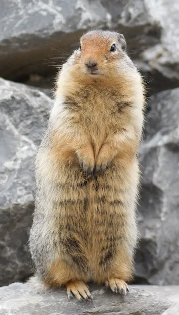
Columbian Ground Squirrel Urocitellus columbianus -
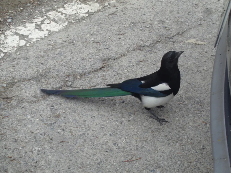
Black-billed Magpie Pica hudsonia -
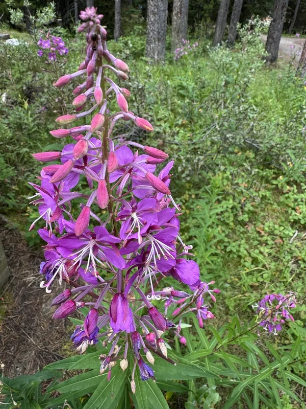
fireweed Chamaenerion angustifolium -
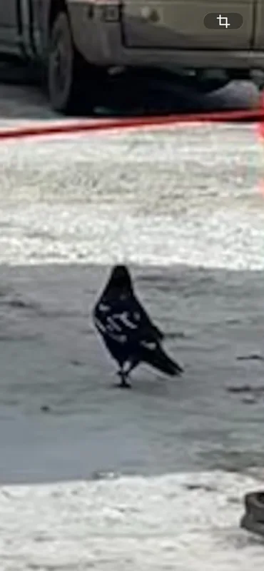
Common Raven Corvus corax -
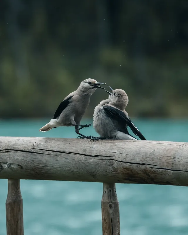
Clark's Nutcracker Nucifraga columbiana -
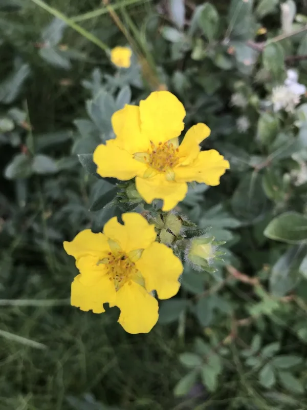
shrubby cinquefoil Dasiphora fruticosa -
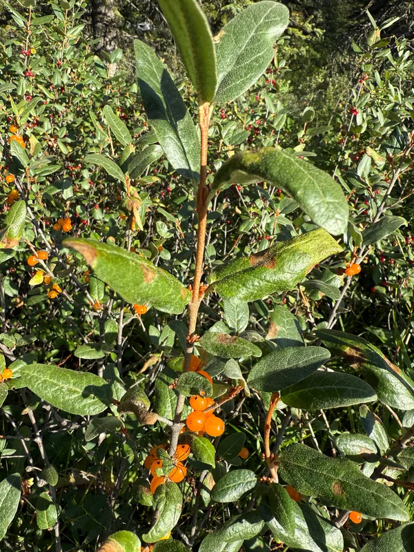
Canadian buffalo-berry Shepherdia canadensis -
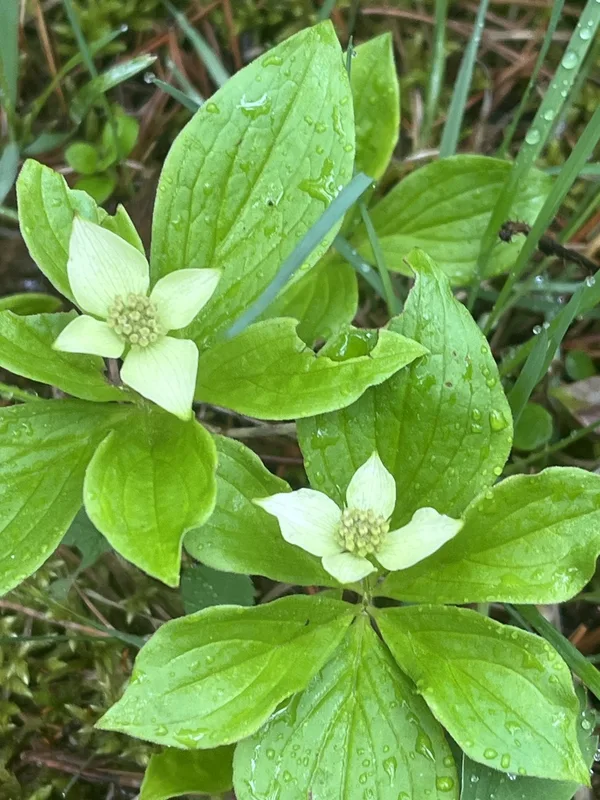
Canadian bunchberry Cornus canadensis -
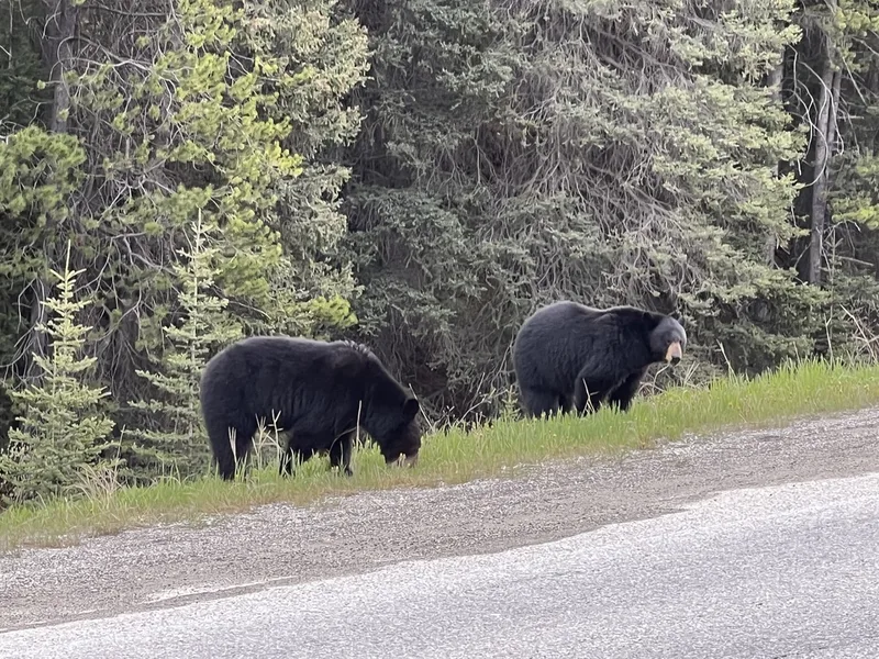
American Black Bear Ursus americanus -
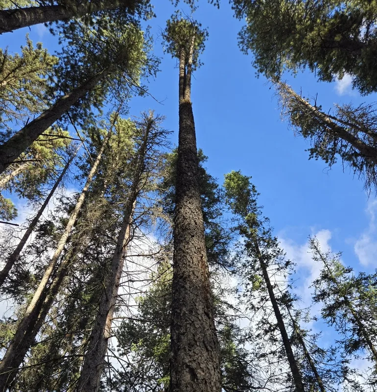
lodgepole pine Pinus contorta -
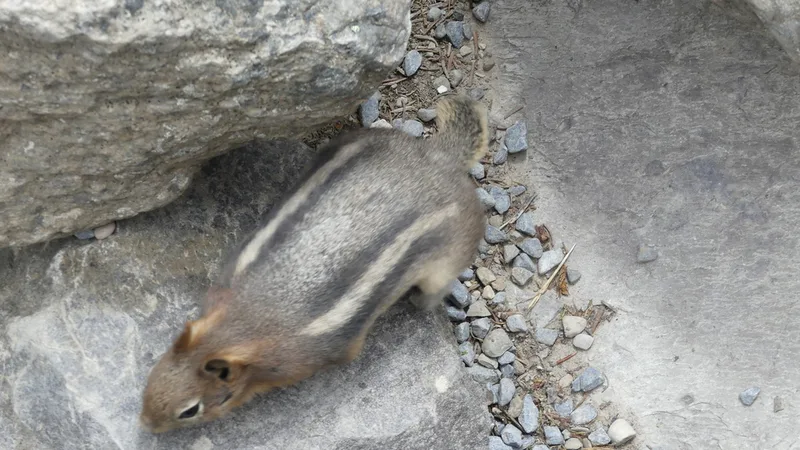
Common Golden-mantled Ground Squirrel Callospermophilus lateralis -
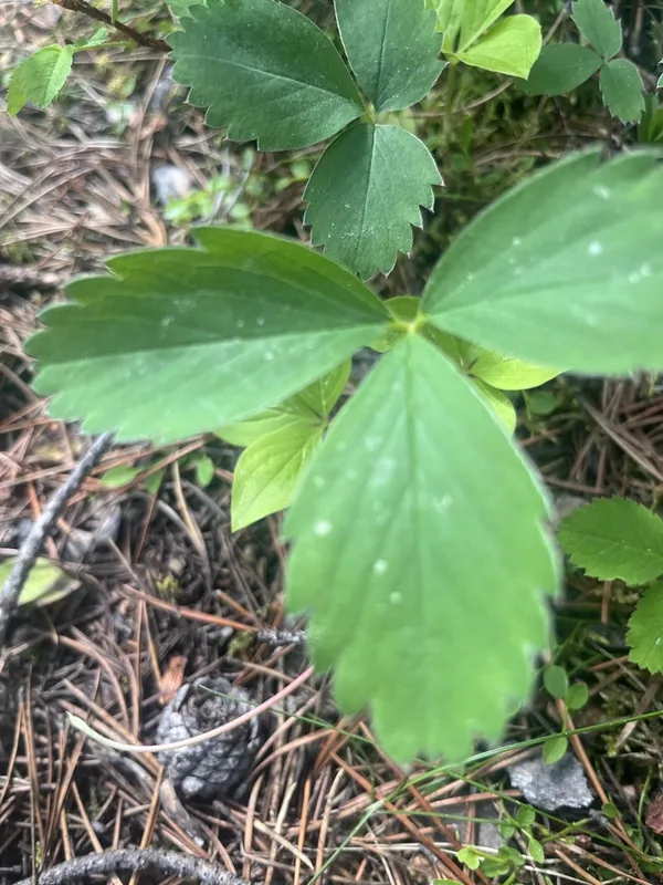
Virginia strawberry Fragaria virginiana
Field Notes · Rivers & Canyons lens · Lake Louise · 51.4250, −116.1775