Banff
The color in the water is rock, ground fine by ice.
Also seen through Rivers & Canyons · all at Lake Louise →.
Why here
Stand at the edge of Lake Louise and the first thing you notice is the color — a turquoise too bright to look natural. It isn’t a trick of the light, and it isn’t the sky. The color is rock. High above the lake, ice grinds against stone and turns it to a fine powder, and the meltwater carries that powder down into the water, where it hangs suspended and scatters the light back blue-green. The ice made the color, and the ice made everything else here too. It scooped the basins these lakes sit in, banked the ridges of rubble along the valleys, and sharpened the peaks into the blades on the skyline. Most of the great carving is finished — the glaciers that shaped this valley were far larger than the patches of ice left today. But the work hasn’t stopped. Ice still clings to the high faces, still grinds, still feeds the lakes their color. Read this place as a record of ice, and the whole landscape falls into order.
The story
The rock came first, and it came from the bottom of a sea. The oldest layers here were laid down as sand and mud on a shallow ocean floor, hundreds of millions of years before there were mountains — later pressed into sandstone, slate, and thick beds of limestone. Slow collisions in the crust lifted that old sea floor into the Rocky Mountains. Then the ice took over. Through the last ice ages, glaciers filled these valleys and did the carving that gives the place its shape — the bowls, the sheer faces, the U-shaped troughs — before shrinking back to what remains today.
Life followed the retreating ice into thin mountain soil. Lodgepole pine covers the lower slopes; Clark’s Nutcracker and the Common Raven work the high country, and black bears move through the valleys. It is a short, bright growing season wedged between long winters.
People came late, and came for the ice-made scenery. The Canadian Pacific Railway reached this valley in the 1880s and built an outpost below the lake, named for Princess Louise. The settlement sits at about 1,600 metres — the highest community in Canada. In 1885 the government drew a protective boundary around this stretch of the Rockies and created the country’s first national park. Nearly everything that brings people here now — the lakes, the color, the walls of rock — is the ice’s doing, dressed up with a railway and a chateau.
The sites
The basins the ice scooped out
Lake Louise
51.4117, −116.2281
The lake fills a basin gouged out of solid rock by a glacier that has since melted back into the peaks above. The color is clearest here because that ice still sends a steady load of ground stone down into the water. Walk the flat shoreline path along the north side and the peaks close in around the far end like the walls of a bowl — which is roughly what they are.
Kneel at the water’s edge and look straight down into the shallows near shore. The pale, milky green close in is the rock flour still settling out; follow it with your eye toward deeper water and watch the color turn from milk to deep turquoise as the powder thins.
- AccessDrive-up
- ExertionEasy
- TimeHalf a day
Moraine Lake
51.3225, −116.1856
This lake sits in a high valley ringed by a row of steep peaks, the kind of tight rock amphitheater only ice can carve. Its water runs the same improbable blue as Lake Louise, and for the same reason — meltwater loaded with glacial flour. The setting is all ice-work: sheer walls, a jumble of fallen rock, and a lake held in the hollow below.
From the low rise of broken rock at the lake’s outlet, look up at the surrounding peaks and find the shallow, bowl-shaped scoops high on their faces. Each is a cirque — the seat where a small glacier once sat and slowly ate backward into the mountain.
- AccessDrive-up
- ExertionEasy
- TimeHalf a day
Lake Agnes
51.4147, −116.2472
Lake Agnes hangs in a rock bowl set high above Lake Louise, reached by a climb through forest. It is a cirque lake — water collected in the hollow a small glacier carved near a mountaintop, left perched above the bigger valley the main ice cut below. Through much of the year it stays frozen long after the lower lakes have opened.
At the lake, turn and look back down the way you came. The main valley drops away well below your feet — a sign you’ve climbed into a hanging valley, a smaller ice-carved trough left stranded above the deeper one the larger glacier gouged.
- AccessHalf-day hike
- ExertionModerate
- TimeHalf a day
Where the ice is still working
Peyto Lake
51.7250, −116.5222
Peyto Lake shows the rock-flour color at full strength — a dense, opaque turquoise that looks almost painted. It sits below high ice, and in the warm months the meltwater pours in carrying so much ground stone that the whole lake goes bright. Earlier in the year, before the melt gets going, the color is far weaker.
Find a spot on the overlook where you can see the pale, braided stream entering the lake at its upper end. That inflow is the meltwater delivery — watch how the milky, sediment-heavy water fans out and colors the clearer lake it drains into.
- AccessShort walk
- ExertionEasy
- TimeAn hour
Bow Lake
51.6644, −116.4486
Bow Lake lies along the valley below a band of standing ice, and its water carries the same glacial color, paler than Peyto’s but from the same source. This is the headwater country of the Bow River — the river that runs down past Lake Louise and on toward the plains. The meltwater off the ice above collects here first.
Stand at the lakeshore and trace where the water leaves at the outlet. This is near the start of the Bow River; from this cold, rock-fed pond it runs for hundreds of miles. Watch the outflow and you’re watching a mountain river begin.
- AccessDrive-up
- ExertionEasy
- TimeAn hour
Bow Glacier
51.6464, −116.5111
Bow Glacier is the real thing — a body of ice still sitting on the mountains above the lake that shares its name. Reaching its foot means a walk up the valley from the lake. This is what did the carving everywhere else in this note, seen up close and still at work, grinding the rock it rests on into the flour that colors the water below.
At the glacier’s lower edge, look for where clear ice meets bare, freshly scraped rock, often streaked gray with rock dust. Listen for running water under or beside the ice — that’s the melt carrying ground stone downhill, the same process that tints every lake here.
- AccessHalf-day hike
- ExertionModerate
- TimeHalf a day
Mount Victoria
51.3769, −116.3067
Mount Victoria stands at the far end of Lake Louise, closing off the valley in a wall of layered rock. Peaks like this one hold the last of the area’s high ice on their upper faces, where snow never fully leaves. From the lakeshore it reads as a single great backdrop, but it is really the head wall of the bowl the ice carved — the point where the glacier began its work.
From the near end of Lake Louise, look across the water to the peak at the head of the valley. Trace any snow and ice lingering high on its face, then follow the rock straight down to the lake — you’re looking along the path the glacier took as it flowed out and dug the basin at your feet.
- AccessShort walk
- ExertionEasy
- TimeAn hour
The rock the ice left behind
Valley of the Ten Peaks
51.3494, −116.1597
A single row of steep summits lines this valley, one after another, each sharpened to a rough pyramid. That shape is ice-work: when glaciers grind at a peak from several sides at once, they cut it down to a blade or a horn. The whole skyline here is a lesson in what moving ice does to a mountain.
Scan along the ridgeline and pick out the sharp notches between neighboring peaks. Those low points are where two glaciers, working from opposite sides, met and gnawed the ridge thin between them.
- AccessShort walk
- ExertionEasy
- TimeAn hour
Mount Temple
51.3506, −116.2067
Mount Temple is the giant of this group, a broad mountain whose face shows its history in stacked horizontal bands. Those bands are layers of old sea-floor rock — limestone and other sediments laid flat long before the mountains rose, then lifted whole and left standing. Ice has since worked the summit and upper slopes, holding snow near the top through the year.
Look at the great cliff face and count the horizontal layers stepping up it. Each line marks a different sheet of sediment laid down on an ancient sea floor; read the rock from oldest at the bottom to youngest near the top, a stack the ice later cut into and exposed.
- AccessDrive-up
- ExertionEasy
- TimeAn hour
When it's best
The color is a summer thing. These lakes spend much of the year frozen and buried under snow, and the turquoise only comes on once the ice high above starts melting in earnest and sends its rock powder down — strongest through the warm months and into early fall, then fading as the melt slows. Come in spring and you may still find the lakes locked in ice and the high trails deep in snow; the season arrives late up here and leaves early. Winter locks the higher lakes under ice and quiets the valleys, though ravens work the cold air year-round. If you want both the color and open trails to reach the smaller lakes and the standing ice, the middle of the warm season is the safe bet. Earlier and later, plan around snow.
Go deeper
The turquoise comes from glacial rock flour — fine sediment ground under moving ice and held in suspension in the meltwater. The bowls the high lakes sit in are cirques; a smaller side valley left perched above the main one, like Lake Agnes, is a hanging valley; the ridges of loose rock a glacier bulldozes and drops are moraines.
The oldest rock here belongs to the Miette Group — Neoproterozoic sandstone, conglomerate, siltstone, and slate — overlain by thick Cambrian and younger beds of limestone and dolomite, the stacked layers you read on the face of Mount Temple. Lake Louise itself is a glacial lake in the strict sense.
The signature living things: lodgepole pine (Pinus contorta), Clark’s Nutcracker (Nucifraga columbiana), Common Raven (Corvus corax), and American Black Bear (Ursus americanus).
To go further: - Geological Survey of Canada, Geology of Lake Louise (East Half), Alberta, and its companion West Half volume — the detailed map of the ground under these lakes. - A Geological Guide Along the Highways between Drumheller – Calgary – Lake Louise (1970) — reads the rock from the road in. - Geology of the Southern Rocky Mountains: Calgary–Lake Louise–Radium–Fernie (Geological Guidebook 3, 1984) — the wider mountain-building story these valleys sit inside.
The names behind what you saw
What lives here, and what it's called. Photographs from open collections — an aid to identification, not decoration.
-
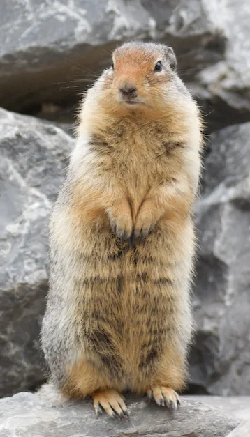
Columbian Ground Squirrel Urocitellus columbianus -
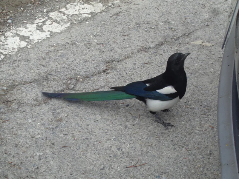
Black-billed Magpie Pica hudsonia -
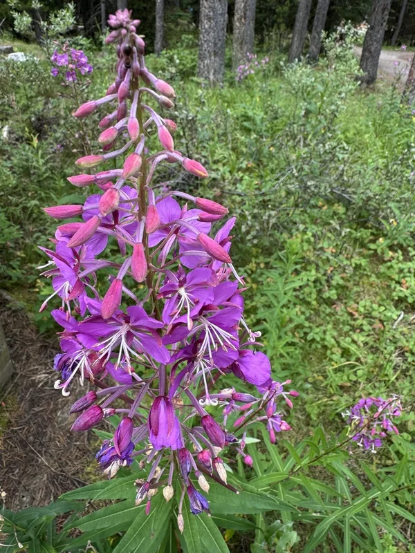
fireweed Chamaenerion angustifolium -
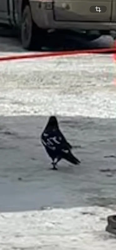
Common Raven Corvus corax -
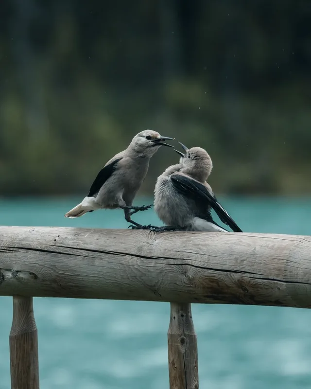
Clark's Nutcracker Nucifraga columbiana -
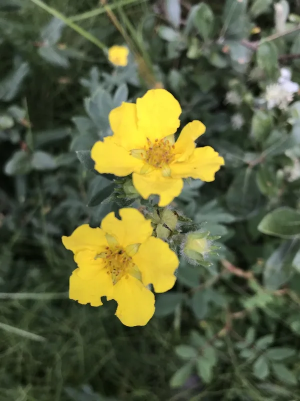
shrubby cinquefoil Dasiphora fruticosa -
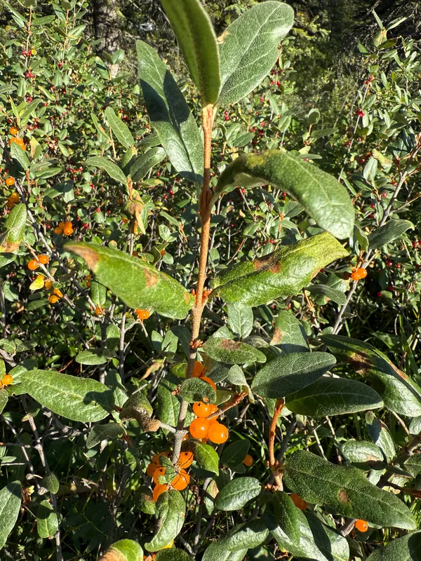
Canadian buffalo-berry Shepherdia canadensis -
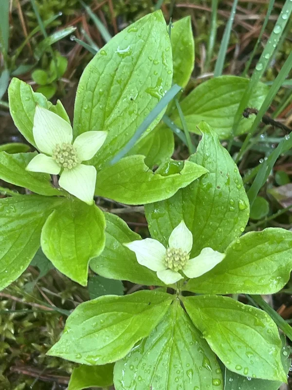
Canadian bunchberry Cornus canadensis -
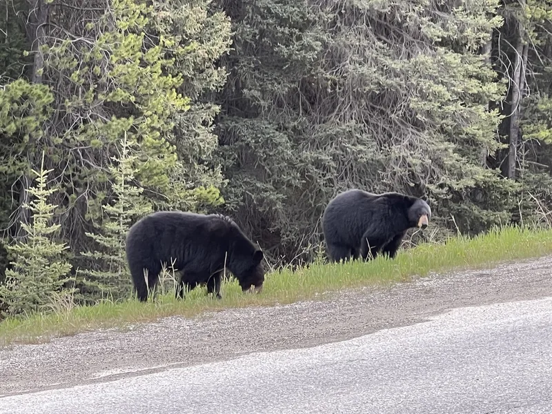
American Black Bear Ursus americanus -
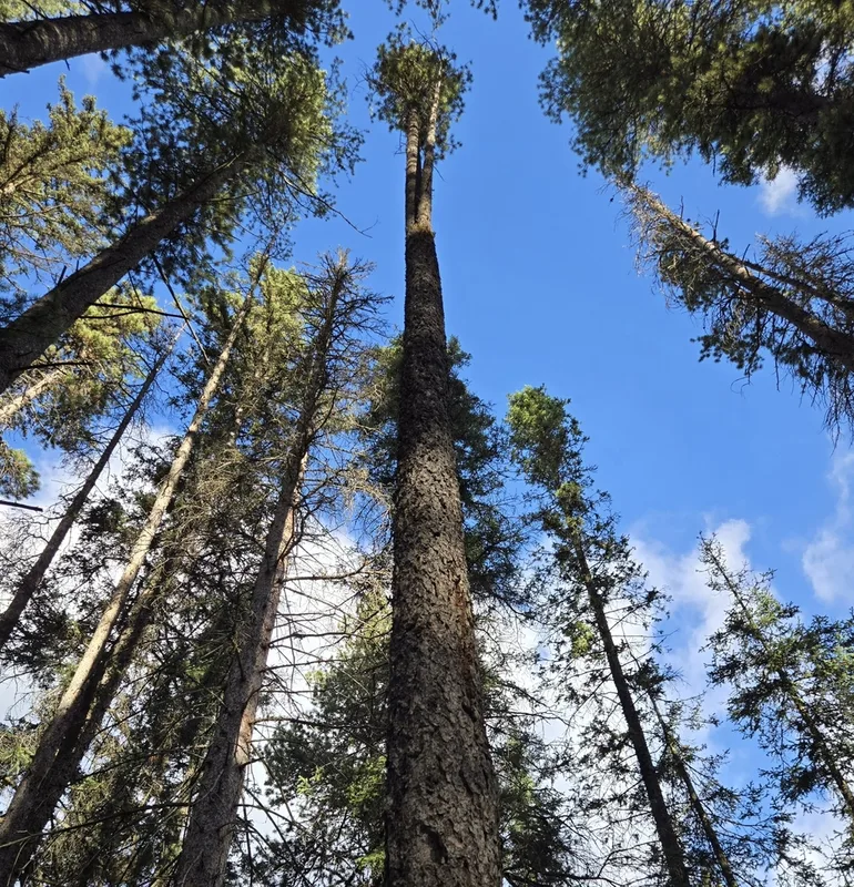
lodgepole pine Pinus contorta -
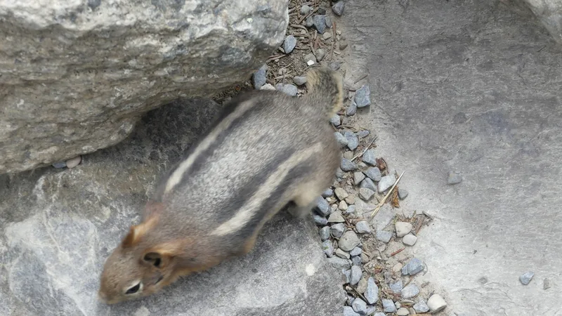
Common Golden-mantled Ground Squirrel Callospermophilus lateralis -
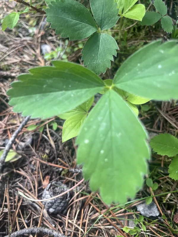
Virginia strawberry Fragaria virginiana
Field Notes · Ice & Glaciers lens · Lake Louise · 51.4250, −116.1775