The Atacama
Reserva Nacional Los Flamencos · Antofagasta, Chile
Where no rain falls, nothing grows to hide the ground — and so the desert keeps its whole story out in the open.
Also seen through Night Sky · all at Reserva Nacional Los Flamencos →.
Why here
Stand almost anywhere in the Atacama and the ground tells its story with nothing in the way. Rain here is so rare that days pass — whole seasons pass — without enough to wet the dust. Where no rain falls, no soil forms; where there is no soil, nothing green grows to draw a curtain over the rock. So the land stays open. The volcanoes of the high Andes stand with their raw lava and ash on show, built over the long last chapter of geologic time and, in places, only lately cooled. Old lakes leave their salt in bright pans across the valley floors. Wind does the carving that rivers do in wetter country, cutting the ground into ridges and hollows you can read at a glance. Everything a greener land would bury, this one leaves in plain sight. Come to the Atacama to practice reading rock — and every stop in this note is another page left open.
The story
Start with fire. The mountains ringing this desert are volcanoes, and the rock underfoot is what they threw out — lava and ash piled up over the long last chapter of the Earth’s story, some of it so recent it has barely begun to weather. Between the volcanoes the ground sagged into basins with no way out to the sea. Water ran in, sat, and left the way water does under a hard sun. What it left behind is salt, and the pale pans on the valley floors are the ghosts of lakes that dried.
Life works the thin margins where a little water lingers. On the salt lagoons, flamingos wade and sift the brine, straining out the tiny life that tints their feathers pink; more than one kind feeds here. Up on the dry slopes, vicuña graze — small wild relatives of the llama, in a thick, fine coat against the cold that returns every clear night. Lizards work the sun-warmed rock, quick in the morning and gone once the heat comes.
The human story here is faint in the record we hold. Water and salt surely drew herders and travelers across a long span of time, but this note’s sources are quiet on who they were and what they made. What this desert keeps best is not the people’s story but the rock’s — and that it keeps almost perfectly legible, out where anyone can read it.
The sites
The young mountains
Volcán Colachi
−23.2407, −67.6458
Look east from the salt basin and the skyline is a wall of volcanoes. Colachi is one of them, a high cone rising from the same volcanic chain that rings this basin. This matters because the whole desert is built from what mountains like this one erupted — the pale, hard rock underfoot everywhere below, from the valley floors to the ridgelines, is old lava and ash from the Andean volcanoes, laid down over the long last stretch of geologic time and, in places, only recently cooled. What makes Colachi worth finding is not that it is unusual but that it is honest: with almost no rain to wear it down, the cone keeps close to the clean lines it had when it was built. A volcano this age in a wet country would be softened, gullied, and hidden under green. Here it stands as its own diagram. Reaching the summit is a serious high-altitude undertaking; most readers will simply read this peak off the desert floor, as one clear page in a long row of them, which is more than enough.
From the basin floor, trace the eastern skyline and count the separate cones standing shoulder to shoulder. Each is its own volcano, and the clean, ungullied lines you see are the work of dryness — with almost no rain to carve them, these mountains still wear close to the shape they were built with.
- AccessDrive-up
- ExertionEasy
- TimeAn hour
Cerro Chajnantor
−22.9868, −67.7420
High on the open plateau north of the salt basin, Cerro Chajnantor rises over some of the driest, highest ground in the desert. The rock is the same volcanic stone that built the whole region, but the reason to make for this ground is what happens overhead. Air this high holds little moisture and little haze, and the empty desert below throws almost no light of its own into the night. On a clear, moonless night the sky here goes deeply dark, and the stars hold steady rather than swimming the way they do through thicker, wetter air. By day the ground itself is the lesson: no soil, no shrubs, just rock and gravel and the long, uninterrupted views that only bare country allows. Nothing softens the distance, so the mountains read sharp and close even when they are far. This is expedition terrain — thin air, hard cold, real distance — and it pays back patience rather than speed. Come with time, layers, and a plan for the altitude.
On a moonless night, give your eyes a full twenty minutes in the dark with no light of any kind, then look for the pale band of the Milky Way standing up from the horizon. It shows so plainly here because the high, dry air holds almost no haze and the empty desert below throws up almost no glow of its own.
- AccessExpedition
- ExertionStrenuous
- TimeWorth two days
Water on its way to salt
Laguna Cejar
−23.0635, −68.2137
Out on the great salt flat, the crust opens into pools of vivid blue-green water, and Laguna Cejar is one of them. This is the salt flat’s own logic on plain display: over a very long time, water gathered in this basin, found no way out to the sea, and left behind everything it carried as the sun drew the water back into the air. What stays is salt, more and more of it, concentrated in the water and crusted white along every edge. Around the pool the salt builds into brittle ridges that crack and crunch underfoot. This is a lake caught partway through the long process that ends as a dry pan. Handle the crust gently; it breaks easily and takes a long time to rebuild.
Kneel at the water’s edge and look at the white crust ringing the pool, then rub a little between your fingers — it is salt. That rim is salt left behind as water evaporates faster than it arrives, and each band of white marks an older waterline, the flat quietly writing down every dry spell.
- AccessShort walk
- ExertionEasy
- TimeHalf a day
Salares
−23.2888, −68.1768
This viewpoint opens onto the salt flat itself — the pale, crusted floor left where standing water dried away. From a distance it reads as an off-white plain running out to the foot of the volcanoes; up close it is a rough crust of salt, buckled into ridges and knobs that turn an ankle. Almost nothing grows, because salt this concentrated is a hard place to make a living. What you are looking at is the end state of the desert’s water: rain and snowmelt off the high volcanoes runs down into this basin, which has no outlet to the sea, and leaves its salt behind when the sun takes the water back up. The mountains give, the sun takes, and the salt simply stays. Of all the open pages in this desert, the salt flat is one of the plainest — the whole story of where the water went, written flat across the ground for anyone standing here to read.
Look across the flat toward the volcanoes and follow the ground down from the mountain slopes to the white pan. The salt sits at the very lowest point because water always ran downhill to here and then had nowhere to go but up into the air, leaving on the floor everything it had carried.
- AccessDrive-up
- ExertionEasy
- TimeAn hour
Laguna Miscanti
−23.7384, −67.7902
High above the salt flat, in a bowl among the volcanoes, sits a blue lake shaped like an arrowhead. Laguna Miscanti has no river running into it and none running out; it is fed and drained through the ground itself, by springs and slow seepage, holding its level in a place where almost no rain falls. The water is brackish — part salt already, on its long, slow way toward becoming the kind of dry pan you find down on the basin floor. What makes this a page worth reading is the wall to the south. A tongue of old lava runs between Miscanti and its smaller neighbor, a single flow that came down and split what had been one basin into two separate lakes. Flamingos work the shallows, sifting the brine, and on the dry slopes around the water vicuña come down to drink. It is the whole desert in one view: young volcanic rock, standing water going slowly to salt, and the handful of animals that make a living at its edge.
Stand at the lake’s edge and look south to the low, dark ridge that walls this water off from the smaller lake beyond. That ridge is a single flow of old lava — one eruption, cooled where it stopped — that divided what had been a single basin into the two lakes in front of you.
- AccessDrive-up
- ExertionEasy
- TimeHalf a day
Laguna Miñiques
−23.7571, −67.7920
Just south of the arrowhead lake, across the wall of old lava, lies its smaller twin. Miñiques and Miscanti were once a single body of water; then a flow of lava came down between them and divided the basin, and the two have sat apart ever since. Two lakes now sit where the land might have held one, kept separate by a low ridge of cooled rock. This is deep time made simple enough to take in over an afternoon — a single event, one eruption, rearranging a whole landscape, and the result still lying there in plain view for you to walk up to. The bowl is high, cold, and thin-aired, ringed by volcanoes and very quiet. Standing water is rare in this desert; here it comes doubled, and the reason for the doubling is written plainly in the dark ridge between the two shores.
From the shore of the smaller lake, look back north at the dark lava ridge that walls this water off from Miscanti. One flow of rock came down and divided what had been a single lake into two — a whole landscape rearranged by a single eruption, still plain to read.
- AccessDrive-up
- ExertionEasy
- TimeHalf a day
Ground left open
Valle de la Luna
−22.9168, −68.2406
West of the oasis town, a low range of ridges and hollows has been stripped down to bare, folded rock and salt. The valley reads as raw ground — no plants, no soil, only stone, white salt seams, and the shapes that weather leaves behind. In most of the world, ground like this is quickly softened by rain and hidden under a skin of green. Here it stays open, and what does the shaping is wind, and the slow work of salt crystals prying the rock apart grain by grain, in a place where liquid water almost never falls. The result is a terrain of sharp crests, deep hollows, and pale crusted seams you can walk among and read directly, with nothing grown over to hide it. Late in the day the low sun rakes sideways across the ridges and every fold throws its own long shadow, and the shape of the ground comes clear all at once.
Walk up to a ridgeline and run a hand along the rock; much of it is crusted or streaked with white. In a place with almost no rain, salt does the carving that water does elsewhere — it grows in the cracks as brine dries and pries the rock apart flake by flake. The crumbling edges under your fingers are that slow work still going on.
- AccessShort walk
- ExertionModerate
- TimeHalf a day
Valle de Marte
−22.9058, −68.2463
A short way from the moon valley, another stretch of bare ground turns red. Valle de Marte is a run of ridges and a broad dune where the rock and sand carry a rust-red color, the ground stripped down and left open the way everything is in this desert. With no plants to hold it in place and no rain to pack it down, the loose surface here is at the mercy of the wind — sand climbs the slopes into dunes and slides back down them, and the bare ridgelines stay hard-edged against the sky. It is about as plain a demonstration as the desert offers of how a landscape behaves once you take away water and greenery and leave only rock, sand, sun, and moving air. Come toward the end of the day, when the low light deepens the red and the dune’s long shadow spills across the valley floor and the whole slope seems to lean.
Find the big dune and look at its two faces — one a long, gentle slope, the other a steep drop. The gentle side faces the wind that built the dune grain by grain; the steep side is where sand spills over the crest and slides. Watch which way the loose sand moves and you are reading the wind straight off the ground.
- AccessShort walk
- ExertionModerate
- TimeHalf a day
Quebrada de Jere
−23.1899, −67.9958
Almost everything in this note is about bareness — rock left open because nothing grows across it to hide it. This ravine is the exception that explains the rule. Where a thread of water works its way to the surface, green crowds in: a ribbon of trees and brush following the water down a narrow gorge cut into the dry hills, startling against the bare rock on either side. The lesson is the same one the open desert teaches, only seen from the other face of it — here, life reaches exactly as far as the water reaches and stops hard at its edge, with nothing in between. Where the water runs, the ravine is close, shaded, and alive; a step up the bank, and you are back in bare, silent stone. It is a small place, and the whole rule of the desert is legible in the few steps between its two sides.
Stand where the green of the ravine meets the bare hillside and look at how sharp the border is. There is no slow fade from garden to desert — the plants stop exactly where the water stops, in the space of a single step. That hard line is the whole desert’s rule drawn out at your feet.
- AccessShort walk
- ExertionEasy
- TimeAn hour
When it's best
The desert is dry and open in every season, so there is no wrong time to come and read the rock. Days run mild and nights turn cold, often below freezing up on the high ground, so you pack for both in the same day. The salt lagoons hold flamingos sifting the shallows, vicuña at the water’s edge, small shorebirds working the mud — though numbers rise and fall from year to year and nothing is promised. For the night sky, season hardly matters; choose the nights around a new moon, when the dark runs deepest and the dry air lets the stars carry.
Go deeper
The names behind what you saw. The young rock under the whole desert is mapped as Cenozoic volcanic rock — intermediate-to-felsic lavas and ash built by the volcanoes of the Central Andes over roughly the last stretch of geologic time. The tall, pale wading birds are the Andean Flamingo (Phoenicoparrus andinus) and James’s Flamingo (Phoenicoparrus jamesi), alongside the more widespread Chilean Flamingo (Phoenicopterus chilensis). The wild grazer of the high slopes is the vicuña (Lama vicugna), and the quick lizards on the sun-warmed rock are smooth-throated lizards (Liolaemus fabiani and Liolaemus constanzae).
To read next. This note’s own sources don’t come with a vetted reading list, so these durable pointers pick up where it leaves off: - The Wikipedia entry for Laguna Miscanti — the source behind the arrowhead lake and the lava flow that split it from Miñiques. - Any overview of the Central Andean volcanic zone — for how a line of young volcanoes came to build an entire desert’s worth of ground. - The iNaturalist pages for the three high-country flamingos — a living, dated record of when and where they turn up on the lagoons. - The iNaturalist page for the vicuña — for the wild camelid that makes a living on this cold, dry high ground. - A general reference on how closed desert basins and their salt flats form — for the water-in, salt-stays story you read across the basin floor.
The names behind what you saw
What lives here, and what it's called. Photographs from open collections — an aid to identification, not decoration.
-
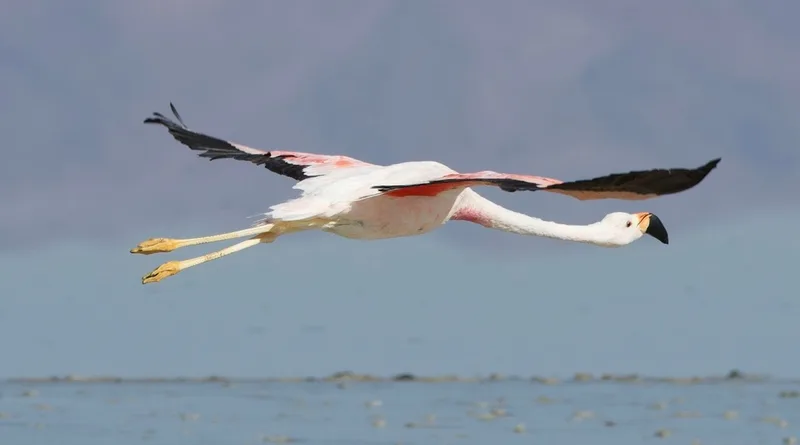
Andean Flamingo Phoenicoparrus andinus -
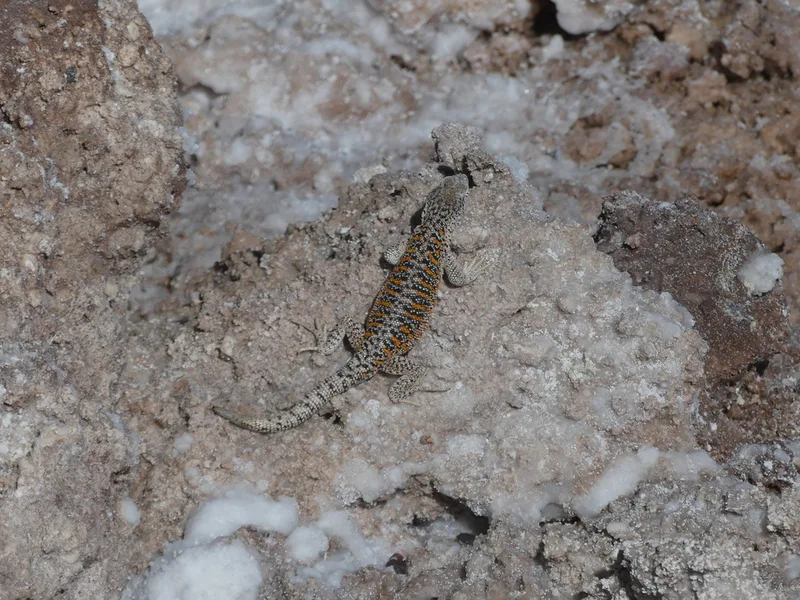
Llano de Vilama Smooth-throated Lizard Liolaemus fabiani -
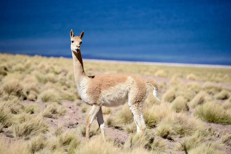
Vicuña Lama vicugna -
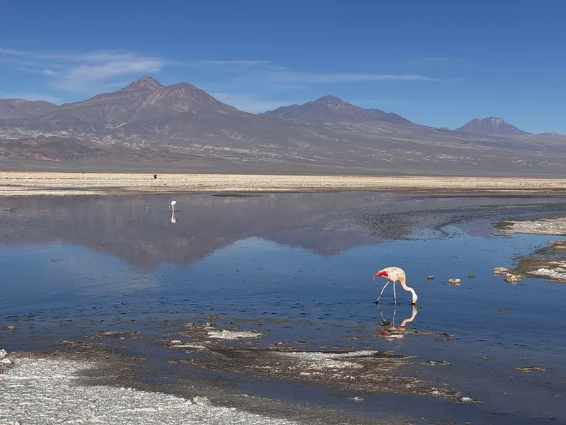
Chilean Flamingo Phoenicopterus chilensis -
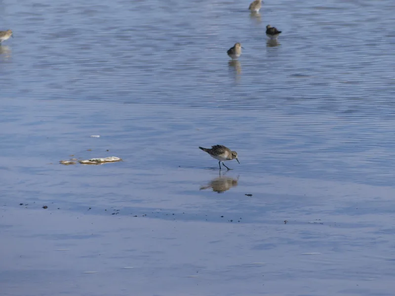
Baird's Sandpiper Calidris bairdii -
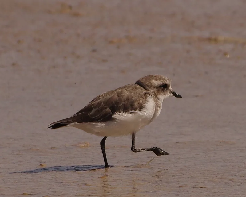
Puna Plover Anarhynchus alticola -
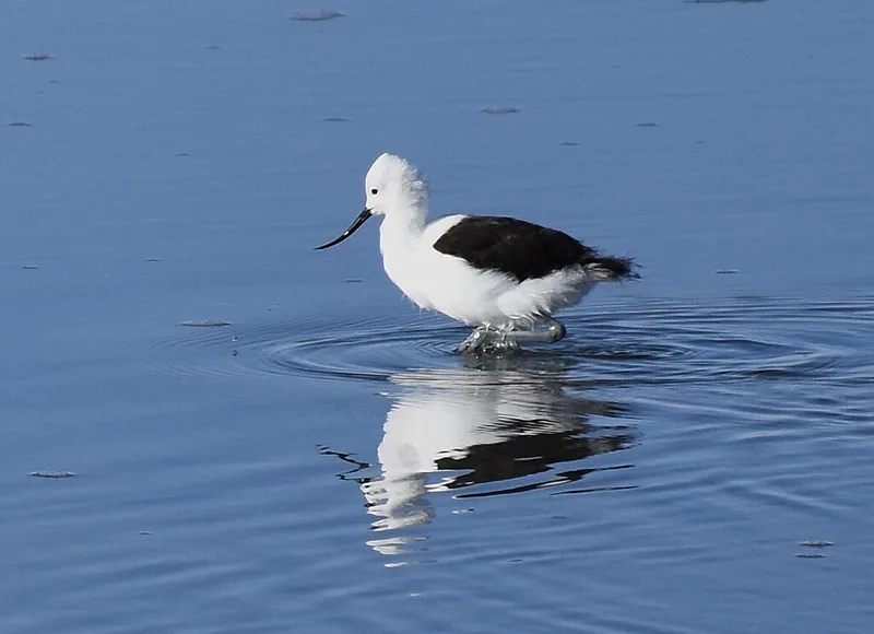
Andean Avocet Recurvirostra andina -
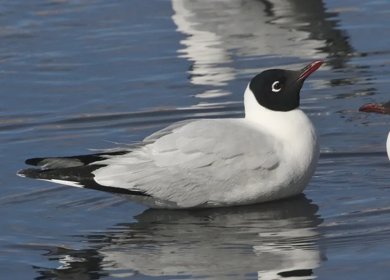
Andean Gull Chroicocephalus serranus -
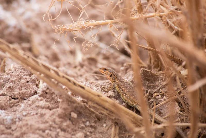
Antofagasta Smooth-throated Lizard Liolaemus constanzae -
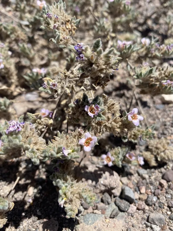
Tiquilia atacamensis -
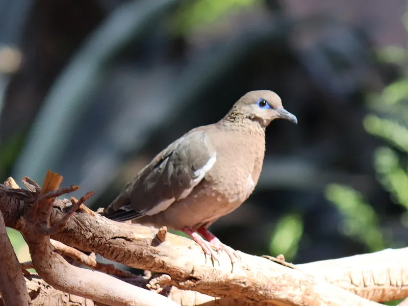
West Peruvian Dove Zenaida meloda -
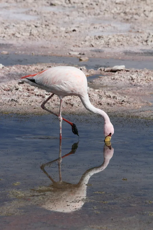
James's Flamingo Phoenicoparrus jamesi
Field Notes · Desert & Deep Time lens · Reserva Nacional Los Flamencos · −23.0433, −67.3199