Arches
Arches National Park · Utah, USA
The rock did not carve itself. Somewhere beneath every fin and arch, an old bed of salt gave a little, and water has been finishing the sentence ever since.
Also seen through Desert & Deep Time · all at Arches National Park →.
Why here
Arches looks, at a glance, like a monument to wind: bare rock, no year-round streams, sand blowing across a road that seems too dry for anything to have been carved rather than simply worn away. Look closer at the rock itself and a different story turns up. The shale and conglomerate exposed nearby recorded ancient channels, floodplains, and lake margins — a river system solid enough to leave its own layer in the ground, long before a single arch existed. Underneath everything, a buried bed of salt has spent an immense stretch of time shifting and slowly dissolving, cracking the rock above it into long, parallel joints running the same direction across miles of ground. Neither the ancient rivers nor the salt actually cut an arch. What did the cutting was ordinary water — rain, snowmelt, ice in a crack — finding every joint the salt had opened and patiently widening it, freeze by freeze, storm by storm, for longer than any human account can shorten into a sentence. This note follows that water: where it worked, what it opened, and what it’s still doing to the rock today.
The story
The land’s water story starts long before the arches did. The Chinle and Shinarump rock exposed in the park’s lower canyons was laid down by real rivers, floodplains, marshes, and lake edges — a wetter, more permanent water system than anything visible at the surface now. Later, a deep bed of salt began the slow work of shifting and dissolving underground, cracking the rock above into the parallel joints that would eventually decide where every fin and arch could form. Water did the rest, entering those cracks over an enormous stretch of time and widening them until stone stood apart from stone.
Life here still keeps closer to water than the dry surface suggests. Ravens and side-blotched lizards turn up everywhere, but the birds noted along the park’s washes and river edges recently — great blue herons, killdeer, a pied-billed grebe, a pair of ducks — belong to a much narrower, wetter slice of this landscape, the wash bottoms and river margins where moisture actually collects.
People followed the same logic. A rock art panel sits above Courthouse Wash, placed where anyone traveling the easiest route through this broken country would have passed it. Who made it, and exactly when, isn’t preserved in what’s known here — the record is quiet on that — but the choice of location speaks for itself: water, however scarce, decided where people went, and where they thought it worth leaving something behind.
The sites
The river that started it all
Colorado River Overlook
38.6075, −109.5354
The Colorado River runs along the park’s edge, and it is easy to visit Arches and never really look at it. That’s worth correcting here. Everything smaller within the park — every wash, every crack widening in a fin, every grain of sand loosened from a canyon wall — eventually answers to this river. It is the base level, the lowest point all the local water is working toward, and it has been patient. Long before the fins and arches took their current shape, rivers and floodplains laid down much of the rock those features are carved from; the shale and conglomerate exposed in nearby canyon walls recorded channels, marshes, and lake edges from a much older water system than the one you can see today. Stand here and you’re looking at the modern version of an old relationship: water moving sediment, cutting down, carrying away. The river doesn’t touch most of the park’s famous rock directly, but nothing in Arches erodes without eventually feeding this channel. It is less a sculptor of arches than their accountant, receiving everything the wind and the smaller washes eventually let go of.
Look at the river’s color against the canyon walls and note which bank shows fresher, less-vegetated sediment — a sign of where the channel has shifted within recent memory, still finding its position in the rock.
- AccessShort walk
- ExertionEasy
- TimeAn hour
Grandstaff Canyon Trailhead
38.6098, −109.5336
This trailhead marks a different kind of water story than the fins and arches upcountry. Where most of the park’s washes run dry for the better part of a year, canyons that open directly onto the Colorado River tend to hold on to moisture longer, sheltered and shaded enough that pools can survive well after a storm has passed. Walk in a short way and notice how the canyon narrows and deepens compared to the broad washes near the visitor areas — a sign of water working a single line again and again rather than spreading thin across open ground. The walls near the canyon floor are often smoother and more undercut than the rock higher up, evidence that water has spent more time working closer to the bottom, patiently lowering the whole system toward the river it eventually joins. It’s a reminder that not all the park’s water erosion looks the same: the open desert country nearby is shaped mostly by wide, occasional sheets of runoff, while a canyon like this one is shaped by water concentrated and returning to the same narrow course, again and again, until the rock has nowhere left to argue from.
Walk a short way into the canyon and compare the rock texture at your feet to the rock at eye level on the walls — smoother and more rounded low down, rougher above, a rough record of how high the water usually reaches.
- AccessShort walk
- ExertionModerate
- TimeAn hour
Washes that write the first lines
Courthouse Wash Trailhead
38.6493, −109.5983
A wash is a dry riverbed with an alibi: no water most days, but built entirely by water on the days it runs. Courthouse Wash carries almost nothing through most of a normal year and then, on the rare afternoon a storm sits over the right stretch of the plateau, moves a great deal at once, fast enough to reshape its own bed by the following morning. That rhythm is small-scale rehearsal for something much older, recorded in the rock nearby: shale and conglomerate laid down when this region held real channels, floodplains, marshes, and lake margins, a river system with actual permanence rather than a wash’s occasional fury. The wash below you and the ancient river system in the rock are doing the same job at different speeds — moving sediment downhill, sorting coarse from fine, cutting where the ground allows it. Stand at the trailhead and you’re at the boundary between two kinds of water record: the slow, buried one written in stone, and the fast, ongoing one still writing itself in sand and gravel underfoot.
Walk into the wash bed and look closely at the ground: patches of fine wind-blown sand next to patches of coarser gravel mark where flowing water, not wind, did the sorting — running your hand across both textures makes the difference obvious.
- AccessShort walk
- ExertionEasy
- TimeAn hour
Courthouse Wash Rock Art Panel
38.6071, −109.5809
The panel sits above the wash, not in it — a practical choice as much as anything else. In dry canyon country, a wash is a route: the easiest way to move through broken ground, and often the most reliable place to find water at all, however briefly. People traveling or living in this landscape would have known the wash the way anyone knows the roads near their home, and a panel placed where it could be seen from that route makes sense whether or not its makers ever explained why. The record here is quiet on who made these images or when, but the relationship between the art and the water below it is visible without any caption. Look down at the wash from the panel and the logic holds: this is a place people passed through often enough, and depended on water scarce enough, that marking the spot meant something. The rock has kept the marks considerably longer than it has kept any water in the wash below.
From the panel, look down at the wash and trace the easiest walking line along it in both directions — the same route reasoning that likely shaped where people traveled and where they chose to leave a mark.
- AccessShort walk
- ExertionEasy
- TimeAn hour
Water in the cracks: fins into arches
Park Avenue Viewpoint
38.6253, −109.5998
Park Avenue earned its name from a resemblance: a walk between tall fins that stand like buildings along a boulevard. It never carried a river the way the name might suggest. Instead, it’s cut along a set of parallel cracks in the rock, cracks that opened first for reasons buried underground and were then widened, one freeze and one storm at a time, by water finding its way in and refusing to leave quietly. Rain and snowmelt settle into a crack, and where they freeze, they expand it a little; where they simply sit and evaporate, they leave the rock slightly weaker than before. Repeated over a very long stretch of time, that process turns a hairline crack into a gap wide enough to walk through, and a slab of rock into two separate fins standing apart. Nothing about the process required a stream. It required patience, a lot of cracks running the same direction, and water willing to use every one of them. Walking the length of the fins is walking along the shape that patience left behind.
Look at how consistently the fins run in one direction, then look for the narrow parallel gaps between them — each gap is a single crack that water has been widening for longer than any of the fins have stood alone.
- AccessShort walk
- ExertionEasy
- TimeAn hour
Devils Garden Trailhead
38.7829, −109.5951
This is the densest concentration of fins and arches in the park, and the trailhead is a good place to see why cause and effect run so deep here — literally. An old bed of salt lies buried far beneath this ground, and the rock above it has spent a very long time responding to what that salt does: shifting, dissolving, settling unevenly. That slow, uneven movement below cracked the rock above into long parallel joints, running the same direction across a wide stretch of the park. None of that cracking, on its own, makes an arch. It only opens a door. Water is what walks through it — rain, snowmelt, ice — working every one of those joints wider, year after year, until slabs of rock stand apart as separate fins, and some of those fins, undercut in just the right place, end up as arches. The salt below picked the fight by cracking the rock in a particular pattern. Water has been finishing it ever since, one joint at a time, in exactly the kind of place you’re standing.
At the trailhead, find a single joint running through a nearby slab of rock and follow it as far as you can with your eyes — that same kind of line, widened by many seasons of water, is what eventually separates one fin from the next.
- AccessShort walk
- ExertionModerate
- TimeHalf a day
Fiery Furnace Viewpoint
38.7423, −109.5647
The Fiery Furnace is a maze of narrow sandstone canyons, fins, and arches near the center of the park, and this viewpoint is the place to see the maze as a whole before, or instead of, getting lost inside it. Each of those narrow canyons began the same way as the wider corridors elsewhere in the park: as a crack, then a joint water could enter. What sets this stretch apart is how tightly packed the joints run, so tightly that the fins between them stayed thin and closely spaced instead of standing apart as isolated towers. Water finished carving canyons instead of open ground between statues. From a distance, the result reads as a solid mass of orange rock; look for more than a moment and the shadow lines resolve into separate, narrow corridors, each one still deepening on its own schedule, worked by whatever rain reaches its particular slot. It’s the same long argument between water and rock as the rest of the park, only conducted in a much tighter space, with far more winners than losers so far.
From the viewpoint, count how many distinct shadow lines you can trace running into the formation — each is a separate narrow canyon, and the number visible from here is only a fraction of the maze actually cut into the rock.
- AccessShort walk
- ExertionEasy
- TimeAn hour
The valley where salt gave way
Salt Valley Overlook
38.7402, −109.5710
Salt Valley is named for what lies beneath it, not what’s visible on the surface, and the overlook is the place to connect the two. Deep under this stretch of the park sits an old layer of salt, and salt behaves unlike most rock: it moves, and where water can reach it, it dissolves. As that hidden salt bed has shifted and thinned in places over a very long time, the rock sitting on top of it has had less and less support, sagging gently into the low, wide trough you can see from here. That sag did the same thing to the rock above it that the parallel joints do everywhere else in the park: it cracked things, and cracked them in a consistent pattern that water was then free to widen. Several of the park’s fin-and-arch areas sit along this valley’s margins, not by coincidence — the same underground process that lowered the valley also opened the cracks those areas depend on. It’s the clearest single place in the park to see that the arches above ground and the salt working invisibly below it are part of one long, connected argument.
Look along the length of the valley for its long, straight trend, then look to either side for the rows of fins standing near its edges — both are surface signs of the same crack pattern opened by the ground settling below.
- AccessDrive-up
- ExertionEasy
- TimeAn hour
When it's best
The clearest seasonal signal here is the modest, uneven rain: late winter into spring brings the best chance of measurable moisture, often as a cool, drizzly spell rather than a downpour, and it’s the water most likely to leave a thin, short-lived sheet moving through the larger washes. Later in the year, canyon country through this region is prone to sudden, localized thunderstorms that can fill a dry wash fast and without much warning, so it’s worth checking the sky, not just the forecast, before walking into any narrow canyon. Neither season is required to appreciate the arches and fins themselves — their shaping is a story of a very long stretch of time, not the past week’s weather — so the valley overlooks, the fin corridors, and the river all reward a visit in any season. Only the washes ask you to pay attention to what the sky is doing right now.
Go deeper
The names behind what you saw
The lower canyon rock carrying the ancient river record is mapped as the Chinle Shale and its Shinarump Conglomerate Member — continental deposits from old channels, floodplains, marshes, and lake margins. The younger material moving across the park’s surface today, part water-carried and part wind-blown, is mapped simply as mixed eolian and alluvial deposits. Underground, the rock column here belongs to the Paradox Basin, whose stack of layers includes a bed of halite — rock salt — identified as the trigger for the cracking and settling that shapes the park’s arches, fins, spires, and balanced rocks. Birds noted recently along the park’s washes and river edges: great blue heron (Ardea herodias), killdeer (Charadrius vociferus), pied-billed grebe (Podilymbus podiceps), wood duck (Aix sponsa), mallard (Anas platyrhynchos).
To read next
- “The geologic story of Arches National Park” (USGS Bulletin, 1975) — a dedicated account of how this park’s rock and features formed, from geologists who worked the ground directly.
- Wikipedia, “Arches National Park” — the clearest short summary of how the buried salt layer connects to the surface arches, spires, and fins.
- Wikipedia, “Fiery Furnace (Arches National Park)” — background on the park’s densest maze of narrow canyons, worth reading before or after the overlook.
- Wikipedia, “Natural Bridge (Virginia)” — a natural arch cut directly by a single named creek, a useful contrast to how water works here: indirectly, through cracks a salt bed opened first.
The names behind what you saw
What lives here, and what it's called. Photographs from open collections — an aid to identification, not decoration.
-
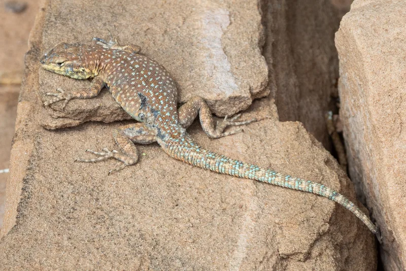
Common Side-blotched Lizard Uta stansburiana -
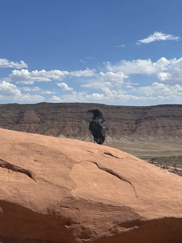
Common Raven Corvus corax -
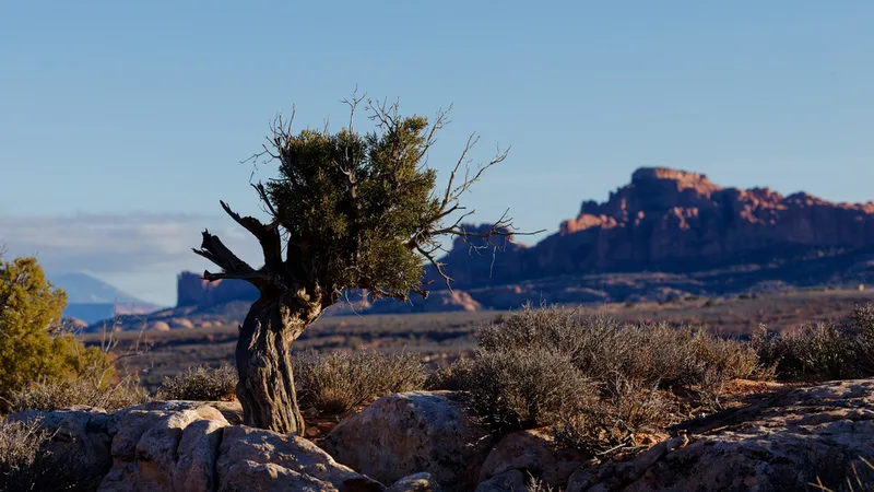
Utah Juniper Juniperus osteosperma -
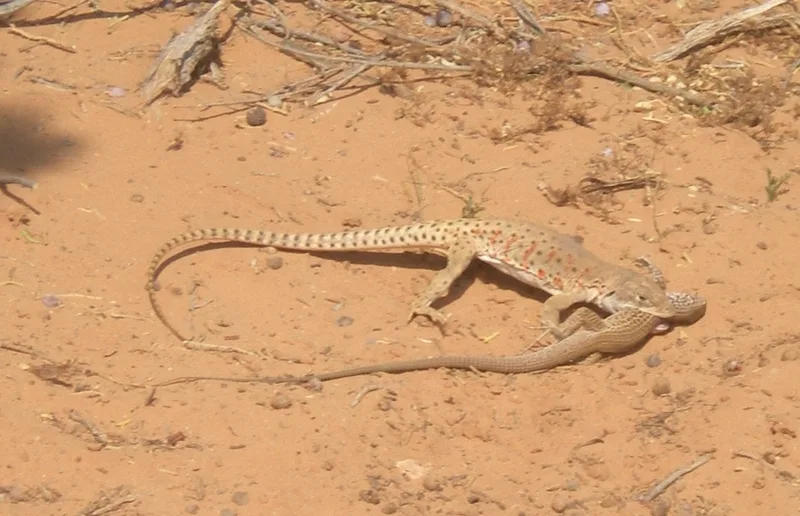
Western Whiptail Aspidoscelis tigris -
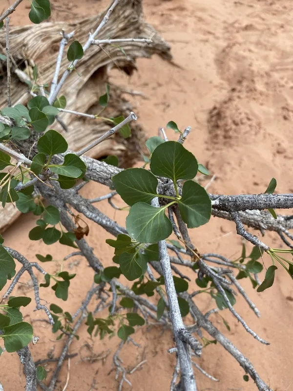
single-leaf ash Fraxinus anomala -
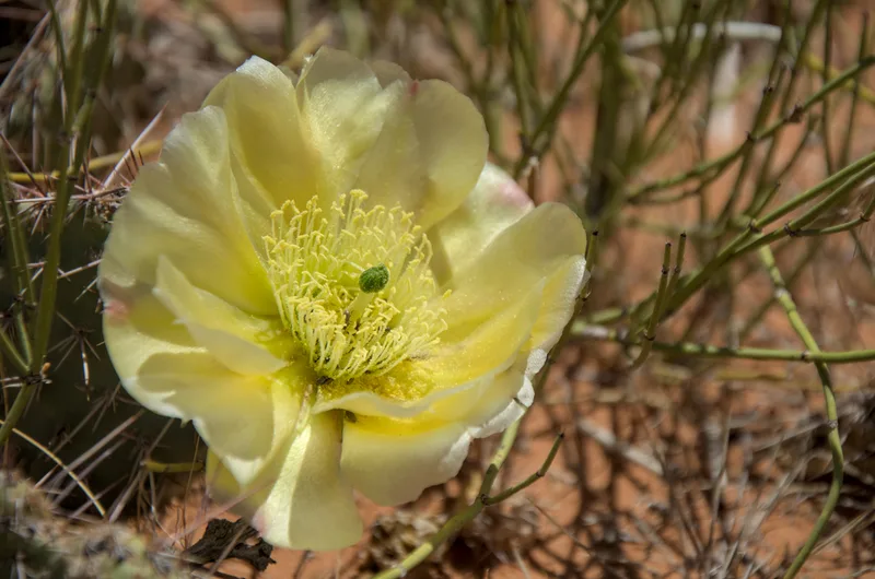
Plains Pricklypear Opuntia polyacantha -
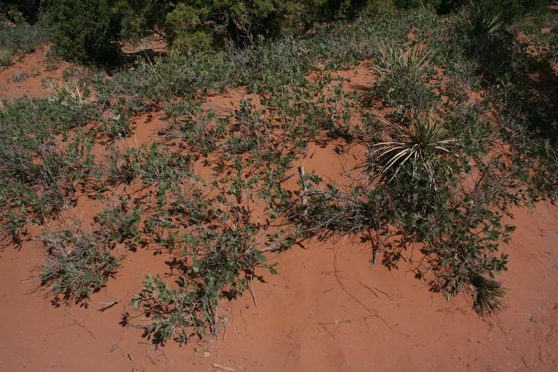
Tucker Oak Quercus welshii -
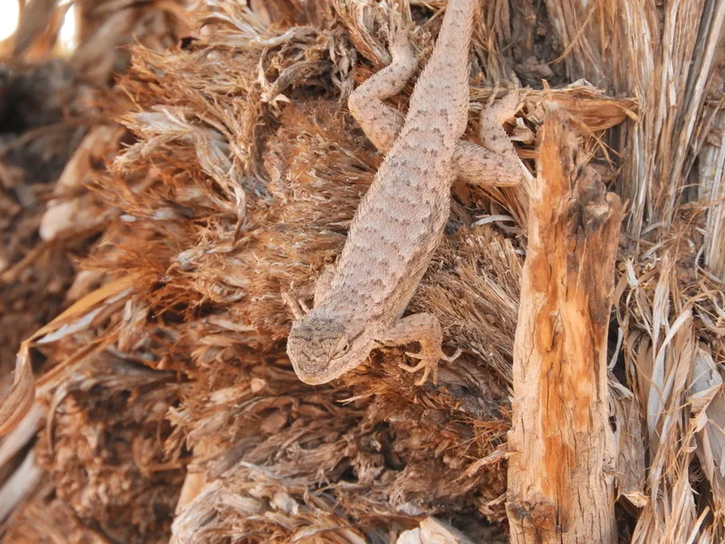
Plateau Fence Lizard Sceloporus tristichus -
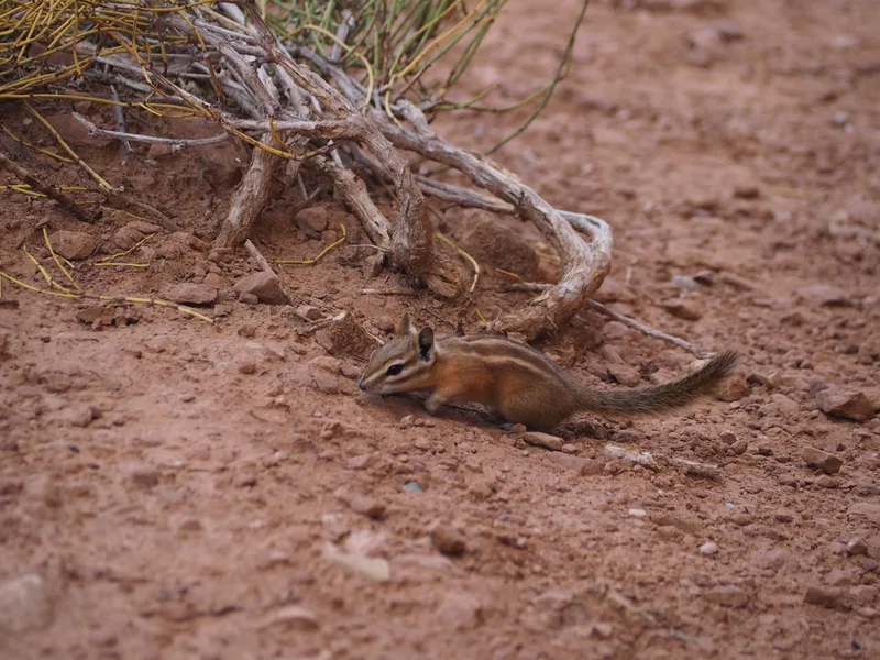
Hopi Chipmunk Neotamias rufus -
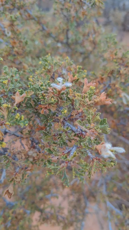
Stansbury's Cliffrose Purshia stansburyana -
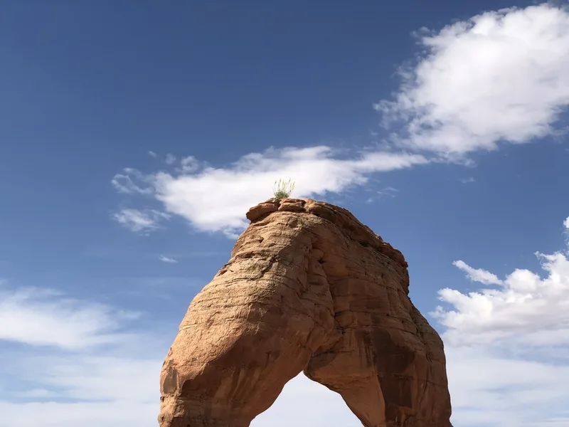
Desert Prince's Plume Stanleya pinnata -
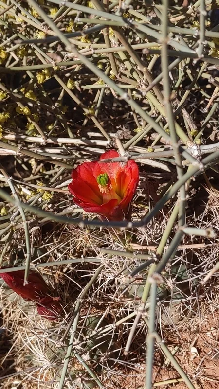
Kingcup Cactus Echinocereus triglochidiatus
Field Notes · Rivers & Canyons lens · Arches National Park · 38.7265, −109.5630