Aoraki-Mackenzie
Aoraki / Mount Cook · Canterbury, New Zealand
The mountains are old, and the rock they are cut from older still. The light overhead has been traveling longer than either.
Also seen through Ice & Glaciers · all at Aoraki / Mount Cook →.
Why here
Look up on a clear night here and the oldest thing in view is not the mountains, and not the ancient rock they are cut from. It is the starlight. Every point of light overhead left its star long ago and has been crossing empty space ever since; some of it set out before there were mountains here at all. This is a high, thinly settled valley at the end of a single road, with one small village and little else to burn a light. Cold, dry mountain air holds few clouds and little haze. Wrap those together — few lights below, clear air above, long nights in the cold months — and the dark that returns here each evening is close to the sky people watched for most of human history. The country’s highest peak stands at the head of the valley, its glaciers pale even by starlight. But the reason to stay out after dark is overhead: a sky doing what it has nearly forgotten how to do above brighter, busier places. Everywhere you stand in this valley, the same old light is waiting.
The story
Start with the rock, because the dark begins with the land. The mountains at the head of this valley are built from stone that was once mud and sand on a sea floor, laid down and pressed hard more than two hundred million years ago. Slowly, where two of the earth’s plates grind together, that old sea floor was crumpled and shoved upward into the Southern Alps, the spine of the island. Then the ice went to work. Glaciers ground down the valleys and are grinding still — the country’s largest glacier lies just to the east — and their meltwater fills the pale lakes below, milky with rock they have crushed to flour. Ice still covers much of the park.
Little grows easily up here. On the stony ground you find the golden spaniard, a spiky yellow plant that looks more like a weapon than a flower, and matagouri, a low thorned shrub built to hold its ground. Small birds like the tomtit work the scrub, and down on the braided riverbeds the black stilt, a rare wading bird, still nests. The cooler autumn months are a quiet, clear time to find them.
People have always passed through lightly. Ngāi Tahu, the iwi who hold this land, know the mountain as Aoraki; it carries that name and Mount Cook together now, and they help care for the park. A small village sits at the road’s end, and climbers have long come for the high peaks. Every one of them looked up at nearly the same stars. The sky has outlasted all of it.
The sites
The valley floor, after dark
Camping area Registration
−43.7191, 170.0932
An information board at the valley’s campground, where you sign in to stay the night — and, for a stargazer, the simplest dark-sky spot of all, because you are already standing in it. The ground here is open and flat, ringed by mountains but wide to the sky, and there is almost nothing nearby to throw light back up: one small village, a scatter of buildings, and then the dark. That is the whole advantage of this place. You do not have to climb for the sky; you have to wait for it, and let your eyes do the rest. Human eyes take a surprisingly long time to reach their full night vision — roughly twenty minutes of true dark, ruined in a second by a glance at a phone. Give them that time here, lying back with the mountains as a rough black rim around you, and the sky fills in far past what it showed at first: not dozens of stars but thousands, with the pale band of our own galaxy laid across the middle of them. Stay a night, or two; the dark is free and it comes back every clear evening.
Lie back on the open ground after full dark and give your eyes twenty honest minutes without a single glance at a lit screen. Watch the sky thicken as your vision adjusts — faint stars appearing in the gaps between the bright ones, until the whole dome is crowded. The change is not the sky getting darker; it is your own eyes finally catching up to how dark it already was.
- AccessDrive-up
- ExertionEasy
- TimeWorth two days
Foliage Hill
−43.7207, 170.0940
A low rise just above the valley floor, a short scramble that lifts you clear of the buildings and puts a clean line of horizon most of the way around. Height helps a night sky less than distance from lights does, but even this modest climb trades the glow of the village below for a wider, darker bowl overhead. What you have come up to see is the Milky Way — not a single object but the combined light of the galaxy we live inside, seen edge-on as a pale band stretching across the sky. In a dark sky it is not smooth. Dark lanes cut through it where clouds of dust block the stars behind, and the band brightens and thins along its length. This is also the plainest place to feel the note’s one idea. The light gathering into that band began its journey long ago — thousands of years for the nearer stars, far longer for the faint glow between them. You are looking at the past, arriving all at once. Come up before the last light goes so you can find your footing, then stay while the band emerges overhead.
Once the sky is fully dark, find the pale band of the Milky Way and follow it from one horizon toward the other. Look for the darker lanes cutting along it — those are clouds of dust between us and the stars behind, not empty gaps. Pick one dark patch and hold your eye just beside it, where the faintest light lands best, and watch how much more of the band appears.
- AccessShort walk
- ExertionModerate
- TimeAn hour
Mueller Lake Lookout
−43.7167, 170.1027
A short walk from the valley’s end brings you to this lookout over Mueller Lake, a pale sheet of water fed by melting ice and colored a milky grey-green by the rock flour the glaciers grind and wash into it. By day the color is the draw. After dark, on a still night, the lake becomes something better: a mirror. Mountain basins like this one often go glassy once the day’s wind drops, and a calm lake under a clear sky holds a second sky inside it, the brighter stars and the rim of the mountains doubled on the water. It is a quieter way to watch the night than craning your neck — the sky brought down to eye level, laid on the surface. The same stillness that mirrors the stars also mirrors the mountains, so on the best nights you get the black wall of the range and its reflection meeting at the shoreline, with stars above and below the seam. Come when the air is calm; a breath of wind scatters the whole thing into ripples, and it is gone until the water settles again.
On a windless night, stand at the lookout and look down at the lake instead of up. Find the brightest stars mirrored on the still water, doubled below the black line of the mountains. Then wait for a gust to cross the surface and watch the whole reflected sky break apart into ripples — proof of how perfectly flat the water had to be to hold it.
- AccessShort walk
- ExertionEasy
- TimeAn hour
Higher into the dark
Red Tarns
−43.7479, 170.0985
A steep climb up the valley’s eastern wall to a set of small mountain ponds — tarns, the little pools that collect in hollows scooped by old ice. The walk up is a real effort, gaining height quickly, but it lifts you well above the village and its lights and turns you to face the big peaks across the valley. That height and that turning-away are what a stargazer comes for. With the glow of the buildings now below and behind you, the southern sky opens clean. From this far south, two faint patches hang in it that most of the world never sees: soft smudges of light, easily mistaken for stray cloud, that are in fact whole separate galaxies — near neighbors to our own, drifting alongside it. They circle low in the southern sky and, from this latitude, never dip below the horizon, so any clear night will show them. Time the climb so you reach the tarns with daylight to spare, settle in as the sky darkens, and carry a good light and warm layers for the walk down, which will be fully dark and cold.
Once you are settled at the tarns and the sky is fully dark, face south — away from the valley — and let your eyes adjust. Look low for two faint, soft patches that look like torn scraps of cloud but never move or fade. Those are two small galaxies traveling near our own, visible only from the southern half of the world; hold your gaze just to one side of each to bring it out.
- AccessHalf-day hike
- ExertionStrenuous
- TimeHalf a day
Sebastopol
−43.7532, 170.0994
A peak on the ridge above the village, reached by a stiff climb that rewards the effort with a high, open perch and a horizon that drops away on nearly every side. By day it is a vantage over the whole valley and its glaciers. By night it becomes a platform under an unobstructed sky, high enough to sit above the last of the valley’s haze. This is the place to sort out the southern sky’s oddity: there is no bright star marking south. In the northern half of the world a single steady star sits almost exactly above the pole, and the whole sky turns around it. The south has no such marker — the sky here pivots around an empty patch of dark. To find that point you borrow a small, tilted cross of four bright stars low in the south — the Southern Cross — and follow its long axis down toward the horizon. Sailors and travelers have steered by that cross for as long as people have crossed these southern seas. Give the climb most of a day, plan to be down or well-lit before full dark, and dress for a cold, exposed summit.
From the summit after dark, find the four bright stars of the Southern Cross standing low in the south, tilted like a kite. Trace an imaginary line out through its long axis, down toward the horizon, and stop about four cross-lengths on — that empty patch of sky is very near due south. There is no star there to help you; the cross is how the southern half of the world has always found its bearings.
- AccessHalf-day hike
- ExertionStrenuous
- TimeA full day
When it's best
The sky is darkest on the nights around a new moon, when nothing up there washes out the faint light — the one thing most worth timing. The Southern Cross and the two dim smudges of the Magellanic Clouds ride the southern sky on any clear night of the year, since from this far south they never set. The bright heart of the Milky Way climbs highest on winter evenings, though winter here is genuinely cold and the weather near big mountains turns quickly, so any season really comes down to catching a clear, moonless night. Even in the milder months the dark hours turn cold; bring more warmth than the daytime suggests.
Go deeper
The names behind what you saw. The mountains are built of a hard grey sandstone and mudstone geologists call the Torlesse Supergroup — an old sea floor, laid down over two hundred million years ago and later crumpled up into the Southern Alps. The spiky yellow plant on the stony ground is golden spaniard, Aciphylla aurea; the low thorned shrub is matagouri, Discaria toumatou; the big white mountain daisies are Celmisia semicordata; the small bird working the scrub is the tomtit, Petroica macrocephala, and the rare wading bird of the braided rivers is the black stilt, Himantopus novaezelandiae. Overhead, the two faint patches low in the south are the Large and Small Magellanic Clouds, companion galaxies to our own Milky Way; the little cross of four stars is Crux, the Southern Cross; and the dark blot beside it, where dust hides the stars behind, is the Coalsack.
To read next. - Any overview of the Torlesse Supergroup and the rise of the Southern Alps — the story of how a sea floor became a mountain range, and why the range is still growing. - The Department of Conservation’s pages for Aoraki / Mount Cook National Park — the plainest guide to the park’s glaciers, its tracks, and the care it is under. - On the dual name and Ngāi Tahu as guardians of this land — worth reading for why the mountain carries two names, Aoraki and Mount Cook, at once. - A southern-hemisphere star chart, or a planisphere set for this latitude — the fastest way to turn the patches and crosses overhead into names you can find again. - The iNaturalist page for the region — a living record of what is flowering and who has been seen lately, month by month.
The names behind what you saw
What lives here, and what it's called. Photographs from open collections — an aid to identification, not decoration.
-
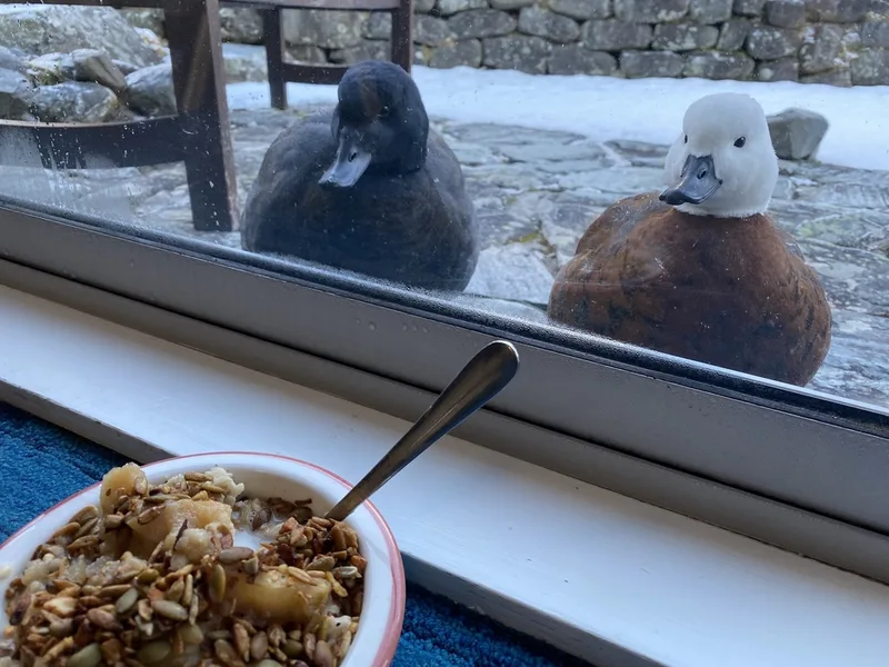
Paradise Shelduck Tadorna variegata -
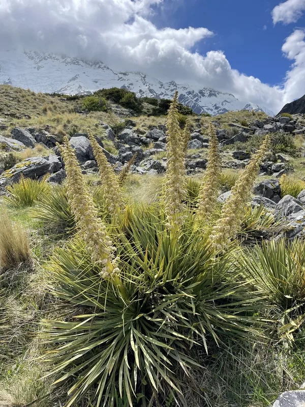
Golden Spaniard Aciphylla aurea -
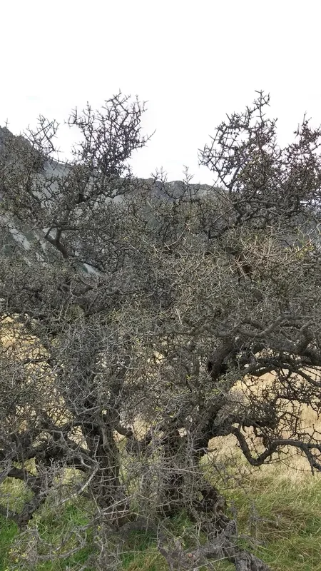
Matagouri Discaria toumatou -
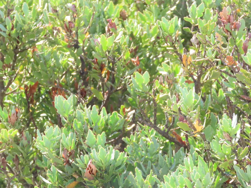
mountain toatoa Phyllocladus alpinus -
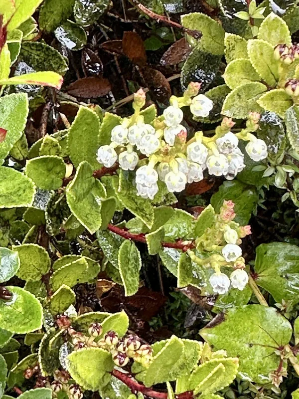
Scarlet snowberry Gaultheria crassa -
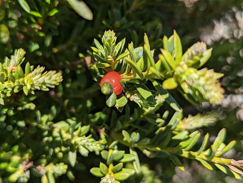
snow totara Podocarpus nivalis -
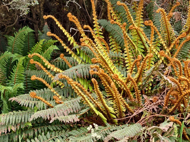
Prickly Shield Fern Polystichum vestitum -
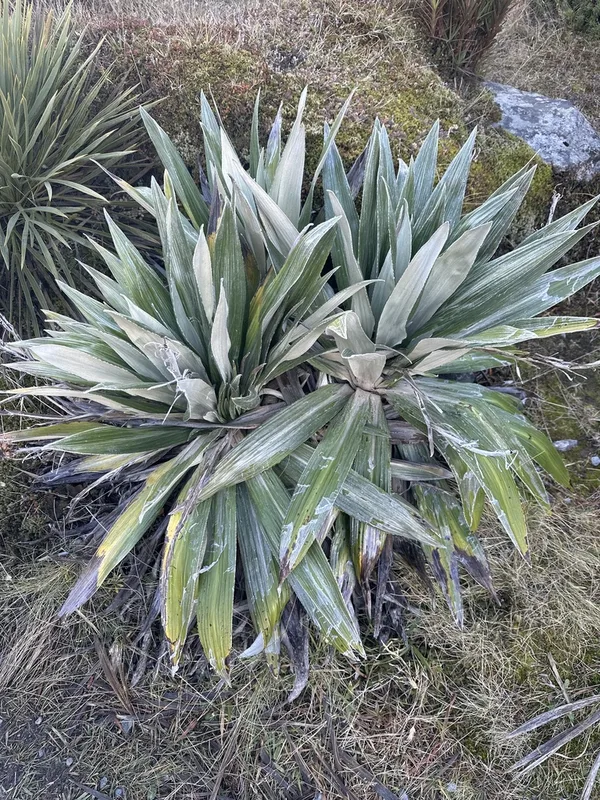
Large Mountain Daisy Celmisia semicordata -
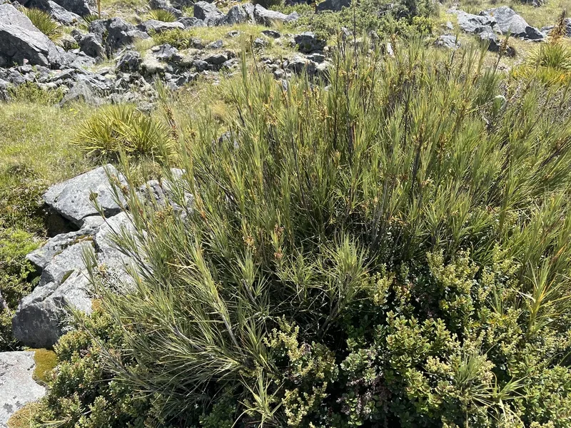
Inaka Dracophyllum longifolium -

Tomtit Petroica macrocephala -
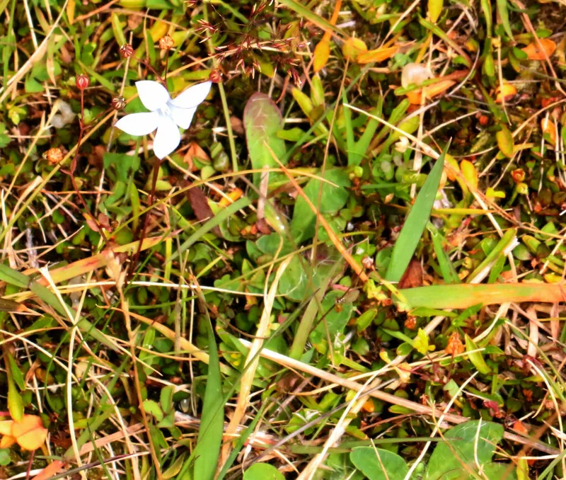
New Zealand Harebell Wahlenbergia albomarginata -
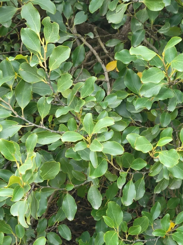
New Zealand Broadleaf Griselinia littoralis
Field Notes · Night Sky lens · Aoraki / Mount Cook · −43.7349, 170.0977