Aoraki-Mackenzie
Aoraki / Mount Cook · Canterbury, New Zealand
The highest point in New Zealand is built from the floor of a vanished sea, and the ice is still taking it apart.
Also seen through Night Sky · all at Aoraki / Mount Cook →.
Why here
The highest mountain in New Zealand is built from the floor of an ocean that closed hundreds of millions of years ago. Long before there was ice here, sand and mud and scraps of old seabed were folded and jammed together where two pieces of the earth’s crust met, then slowly lifted into the sky as the Southern Alps. Ice took it from there. Through repeated cold ages, glaciers ground into that folded rock, gouging basins, steepening ridgelines, and dragging gravel down into the valley below, and today glaciers still cover 40% of the park, including the country’s largest. What you see driving into the Mackenzie Basin — the smooth-sided peaks, the milky lakes, the flat gravel plain the road crosses — is a landscape still being built by ice, on top of rock the ice found ready-made. Every stop in this note is either the raw material the glaciers worked on, or the basin and gravel they left when they pulled back. Keep that pairing in mind and the whole valley reads as one long process, still not finished.
The story
Before there were mountains here, this rock was ocean floor — sand, mud, and scraps of old seabed, scraped up and jammed together where two pieces of crust met, then slowly pushed skyward into the range that holds New Zealand’s highest peak. Ice took over from there, grinding into that folded rock through repeated cold ages, carving basins and dragging the ground-up debris down into fans of gravel that are still building the valley floor today. Into that bare, ice-scoured country came a tough handful of plants built for wind and thin soil: matagouri, a thorned shrub that grips the driest slopes; snow totara and mountain toatoa, low conifers that hold their shape through the cold; and golden spaniard, a spiky rosette armored enough to survive grazing animals this landscape never evolved alongside. Birds followed the plants — shelducks working the valley floor, tomtits along the scrub edge. People came later still. The park around the mountain was set aside in the twentieth century to protect this landscape and its cover of plants, and it is managed today alongside Ngāi Tahu, the iwi who hold mana whenua — customary authority — in the region. The order matters: the rock came first, then the ice shaped it, then the plants and the animals moved in on what the ice left, and only after all of that did anyone decide the place was worth protecting.
The sites
Peaks built from an ancient sea
Sebastopol
−43.7532, 170.0994
Sebastopol is one of the lower peaks ringing the Mackenzie Basin, and its slopes are a plain look at the rock the ice has been working on for hundreds of thousands of years. The layered sandstone and mudstone that make up this ridge were once sand and mud settling on an ocean floor, later folded and jammed together where two pieces of crust collided, then lifted with the rest of the Southern Alps into the range you see today. Ice did the rest: repeated glacial advances ground into rock like this, steepening its faces, stripping away the softer material, and leaving the harder, well-bedded layers standing as ridgelines and summits. Sebastopol’s modest height, next to Aoraki towering above the basin, is itself a clue — not every piece of uplifted seafloor survived the ice equally well. Look toward it from the valley floor, or climb it, and you are looking at the raw material every other site in this note assumes: old ocean sediment, folded once by plate collision and shaped a second time by ice. It is a useful first stop for that reason alone, a plain introduction to the rock before the more dramatic basins and lakes the glaciers carved into it.
Look at the exposed rock on Sebastopol’s flank for its layering — bands of lighter and darker stone stacked at an angle rather than lying flat. Each band was once a separate layer of sand or mud settling on an ancient seafloor; the tilt shows where the whole stack was folded when it was pushed up out of the sea.
- AccessHalf-day hike
- ExertionModerate
- TimeHalf a day
Foliage Hill
−43.7207, 170.0940
Foliage Hill sits lower and gentler than its neighbors, and it shows what happens once ice-scoured ground is left alone for a while. The rock underneath is the same folded seafloor sandstone and mudstone as the higher peaks, but at this elevation enough soil has gathered in the cracks to support a real plant community, the kind of tough, ground-hugging cover that moves in on any slope the ice has let go of. Look for matagouri, a thorned shrub that grips the driest, most exposed ground, and golden spaniard, a spiky rosette built to survive wind, cold, and grazing animals it never evolved alongside. Both are common on slopes like this one across the Mackenzie country. Low conifers such as snow totara and mountain toatoa hold their shape through the cold months rather than dying back, which is why this hillside keeps some color and structure even in the leanest part of the year. None of it is dramatic from a distance; Foliage Hill will not stop traffic the way the peaks above the basin do. But up close it is the clearest place in this note to see the second act of the ice story: not the carving, but what grows back once the carving stops.
Crouch near any exposed rock on Foliage Hill and look for golden spaniard’s stiff, spike-tipped rosette. The spikes are a real defense, evolved against grazing birds that no longer share this ground with the plant.
- AccessShort walk
- ExertionEasy
- TimeAn hour
The basins and gravels the ice left
Mueller Lake Lookout
−43.7167, 170.1027
From this lookout, the ground drops away into a basin holding a lake the color of the glacial silt suspended in it, a fine, ground-up rock flour that never quite settles, the reason alpine lakes like this stay a milky blue-green rather than clearing like a mountain stream. The basin itself is a glacial signature: ice does not erode evenly, and where it moves in force over softer or more fractured rock it can gouge out a depression deep enough to hold water once the ice retreats. What you are looking at is a bowl scooped from the same folded, ancient-seafloor rock as the peaks around it, now filled by meltwater and rain. The lookout asks nothing strenuous of you: walk to the edge, look down, and you are seeing a landform ice built by taking away rather than adding, the reverse of the gravel fans and moraines it leaves elsewhere in this basin. Give yourself a few minutes here rather than a glance. The color of the water and the shape of the basin around it are easier to read slowly, and the light changes how visible the suspended silt is through the day.
Look at the color of the lake rather than its shape. The pale, milky blue-green comes from rock flour — rock ground fine enough by moving ice to stay suspended in the water instead of sinking, which is why glacial lakes rarely run clear.
- AccessShort walk
- ExertionEasy
- TimeAn hour
Red Tarns
−43.7479, 170.0985
Red Tarns are a smaller version of the same story as the lake at Mueller Lookout: a handful of shallow ponds sitting in rock basins that ice carved out of the mountainside, higher up and smaller than the main glacial lakes below. A tarn like this typically fills a hollow scoured by a smaller body of ice, or by ice moving over a patch of rock that fractured and eroded more easily than the ground around it, the same uneven excavation, just at a smaller scale. Because the tarns sit above the main valley, they also offer one of the more direct sightlines back to Aoraki and the ridgeline around it, a chance to see in one view both the highest point the old seafloor rock reached and the small carved basins that show how ice has been quietly working that same rock ever since. It is a walk with real elevation gain, not a roadside stop, so budget real time and expect wind.
Look closely at the water’s edge for low, reddish-toned plants growing in the boggy margin — the likely source of the tarns’ name, and a sign of how little soil ice-scoured ground like this holds onto.
- AccessHalf-day hike
- ExertionModerate
- TimeHalf a day
Camping area Registration
−43.7191, 170.0932
This registration point sits on the valley floor, and the ground underfoot here is some of the youngest material in this note: loose gravel, sand, and silt built up in fans by rivers carrying meltwater and ground rock down from the glaciers and snowfields above. Unlike the folded, ancient seafloor rock in the peaks, this gravel has not had time to weather or compact; it is still being added to, fan by fan, wherever a braided river slows down enough to drop its load. That is the practical reason this flat, open valley floor exists at all for a track and a campground to sit on: ice and meltwater have been filling this basin with sediment for a long stretch of geological time, smoothing what would otherwise be a much rougher landscape. Stopping here to register is a logistical necessity, but it is worth a minute of attention too. This is the end point of everything else in the note, the place where the rock the peaks are made of, ground down by ice, finally comes to rest. Everything the glaciers carve upslope eventually washes down to a spot very much like this one.
Look at the gravel underfoot rather than past it. Rounded stones of different colors and rock types, mixed together with no obvious layering, are a sign of fast-moving meltwater rivers rather than a slow-settling lake or sea — deposited, not eroded in place.
- AccessDrive-up
- ExertionEasy
- TimeAn hour
When it's best
Most of what’s recorded here about the mountain’s living things comes from early autumn, when tomtits and shelducks (Tadorna variegata) are easy to find on the valley floor and the alpine shrubs still hold their late-season color. Days are still mild and nights are cool, with a real chance of rain even mid-visit, so pack for both. There’s no autumn-only case for the ice itself, though — the peaks and the basins below them are worth walking to in any season. How much bare ice or fresh snow you find on a given day has more to do with how far the year has turned than with the calendar date.
Go deeper
The names behind what you saw
The folded, ancient-seafloor rock that makes up the peaks and basins in this note is the Rakaia Terrane, part of the Torlesse Supergroup — quartz-rich sandstone and mudstone, with minor conglomerate, basalt, limestone, and chert, laid down as sediment roughly between the Guadalupian and Triassic and later folded into the Southern Alps. A younger, related slice of the same Torlesse Supergroup, spanning the Triassic into the Jurassic, is made up of mafic volcanic rocks and basalt, with chert, greywacke, argillite, and limestone. The loose gravel, sand, and silt under the valley floor and the campground is mapped as the Springston and Nine Mile Formations, Holocene fan deposits. The plants and birds named in plain language above are matagouri (Discaria toumatou), golden spaniard (Aciphylla aurea), snow totara (Podocarpus nivalis), mountain toatoa (Phyllocladus alpinus), the shelduck Tadorna variegata, and tomtit (Petroica macrocephala).
To read next
- Aoraki / Mount Cook (Wikipedia) — the clearest overview of the mountain’s three summits and the two glaciers, Tasman and Hooker, that flank them.
- Aoraki / Mount Cook National Park (Wikipedia) — covers the park’s nineteenth-century origins, its glacier cover, and its management alongside Ngāi Tahu.
- Te Wāhipounamu (Wikipedia) — the World Heritage listing that sets this ice-carved country in the context of the whole southwest corner of the South Island.
- Tasman Glacier (Wikipedia) — New Zealand’s largest glacier, flowing out of the same range into the basin this note sits in.
The names behind what you saw
What lives here, and what it's called. Photographs from open collections — an aid to identification, not decoration.
-
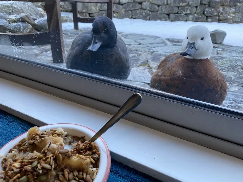
Paradise Shelduck Tadorna variegata -
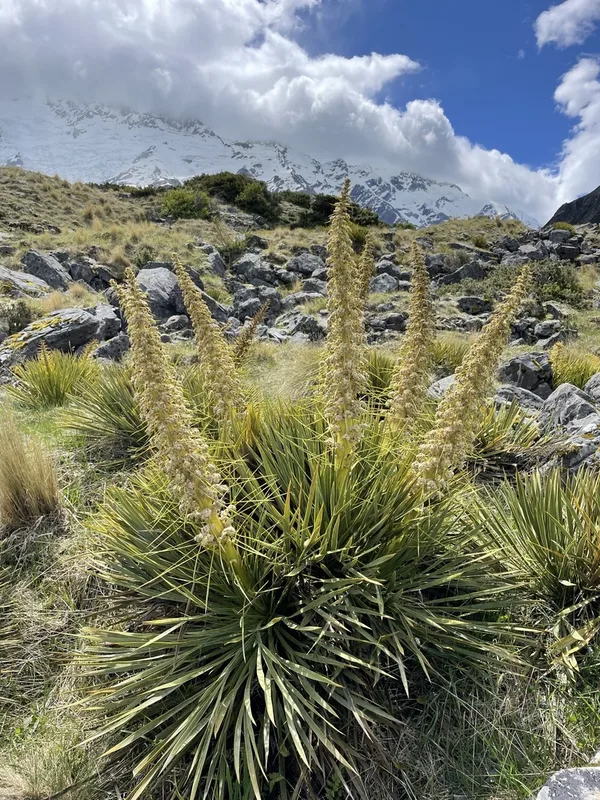
Golden Spaniard Aciphylla aurea -
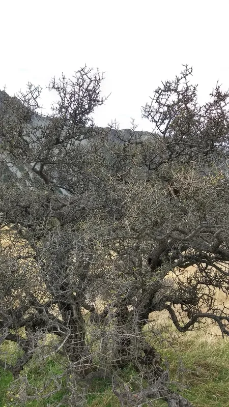
Matagouri Discaria toumatou -
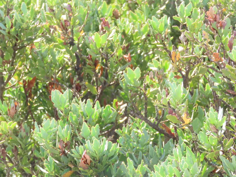
mountain toatoa Phyllocladus alpinus -
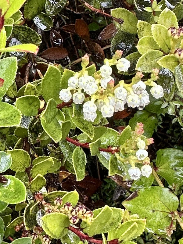
Scarlet snowberry Gaultheria crassa -
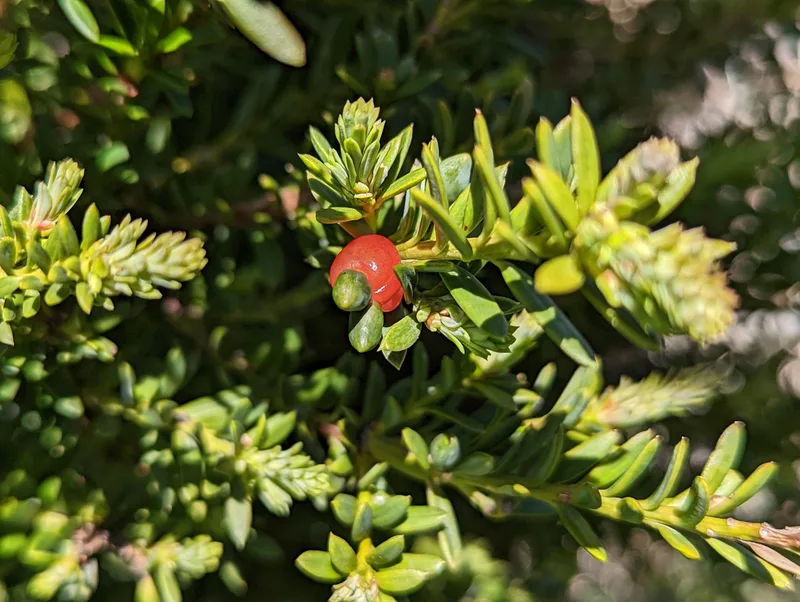
snow totara Podocarpus nivalis -
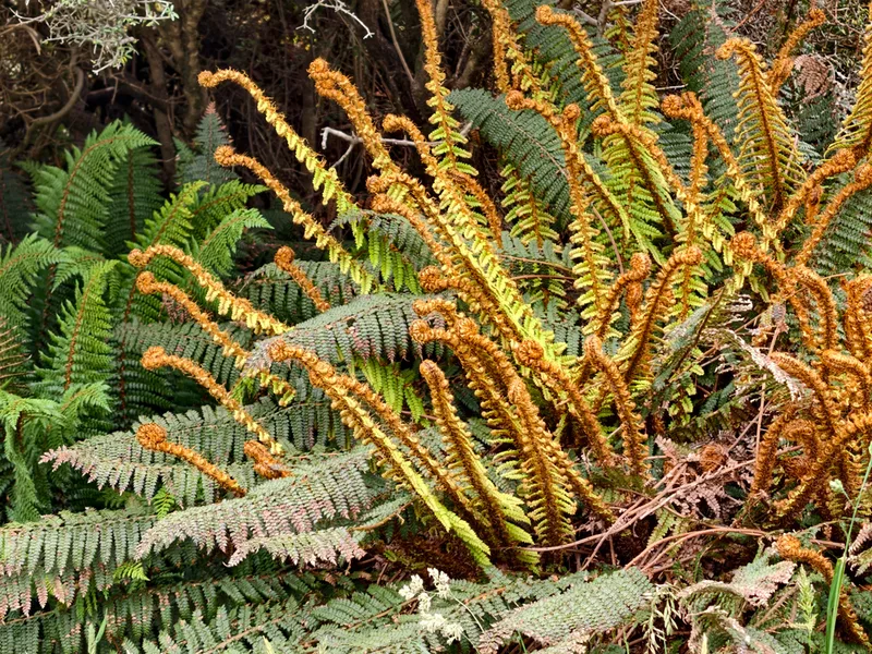
Prickly Shield Fern Polystichum vestitum -
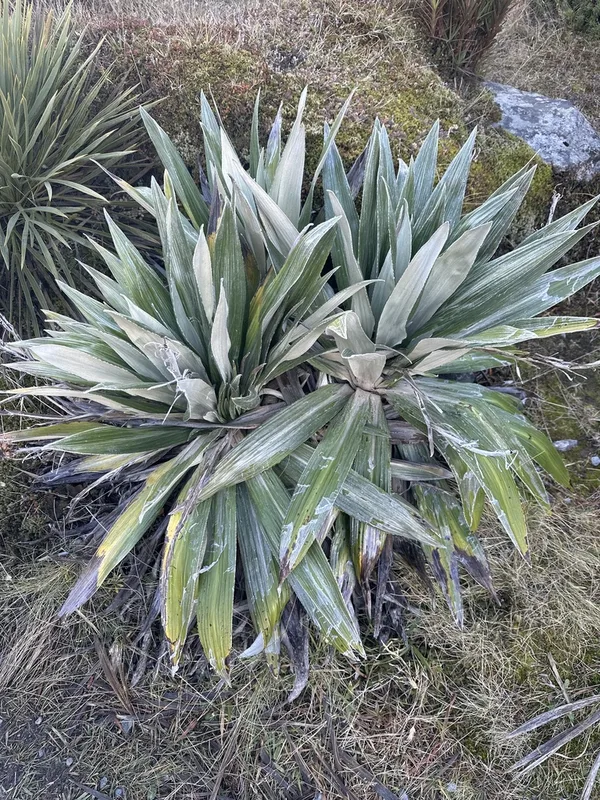
Large Mountain Daisy Celmisia semicordata -
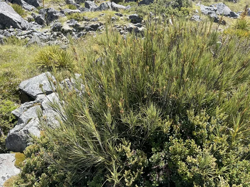
Inaka Dracophyllum longifolium -
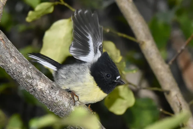
Tomtit Petroica macrocephala -
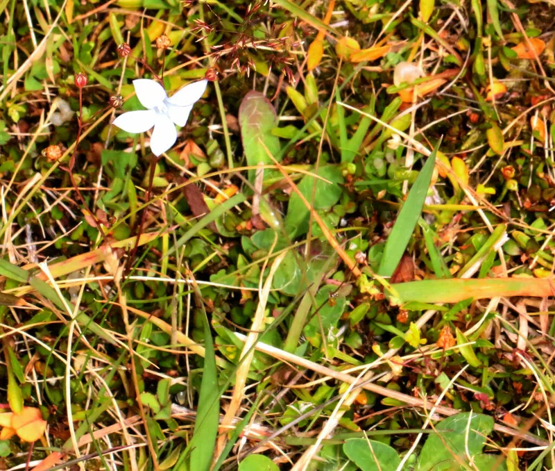
New Zealand Harebell Wahlenbergia albomarginata -
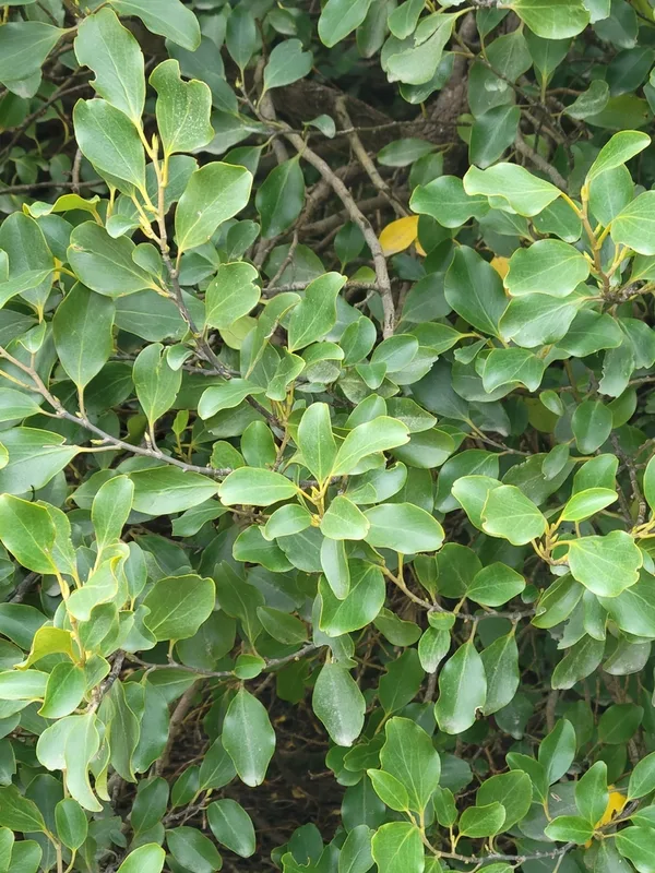
New Zealand Broadleaf Griselinia littoralis
Field Notes · Ice & Glaciers lens · Aoraki / Mount Cook · −43.7349, 170.0977