Acadia
Mount Desert Island · Maine, USA
At Acadia, the sea works slowly enough for a person to watch the shore change.
Also seen through Fog Coast · all at Mount Desert Island →.
Why here
Acadia is a marine note that begins above the tide line. Granite headlands meet moving water, islands break the horizon, and the shore keeps offering small places for life to hold on. The geology is old and hard, but the coast is not fixed. Waves exploit cracks, tides fill pools, and salt reaches into the plants above the rocks. Walk from a mountain or island access to the shore and the relationship stays visible: the same land that gives the eye a long view also creates ledges, sheltered pockets, and tide-pool habitat below. Acadia rewards looking at the boundary, where ocean and granite keep making room for one another.
The sites
Granite at the waterline
Bar Island Trail Access
44.3920, −68.2101
Bar Island begins with a changing connection. The shore and island are joined and separated by the tide, so the marine landscape supplies its own timetable. Watch the waterline before you move. Pools, ledges, and seaweed appear as the tide falls, then disappear again under the returning water. The crossing is not the whole point. It makes the sea’s reach visible, turning a familiar path into a temporary part of the ocean’s edge.
Look at the strip of exposed shore between land and island. The changing width is the simplest visible record of the tide moving across granite and sediment.
- AccessShort walk
- ExertionEasy
- TimeHalf a day
Big Rocks
44.2434, −68.3361
Big Rocks gives the coast a close, physical scale. Granite blocks hold cracks, ledges, and small pools where water remains after waves pull back. The surface is hard, but the life on it is not fixed. Gulls pass overhead, shore animals use the wet pockets, and salt-tolerant plants occupy the higher edge. Read one rock slowly from top to bottom. The pattern of dryness, spray, and standing water tells you which part of the tide’s reach you are seeing.
Find a rock with a dry top and a wet lower crack. The difference marks how long each surface remains covered or shaded between tides.
- AccessShort walk
- ExertionEasy
- TimeAn hour
The coast from above
Acadia Mountain
44.3234, −68.3230
Acadia Mountain makes the marine landscape legible from height. The ocean is not only the line at the horizon; it is the force that has cut and polished the lower edge of the land. From the mountain, bays and islands show how water occupies every weakness in the granite. Then look down at the forest and open rock around the trail. The mountain’s ecology follows the same exposure gradient as the shore, from sheltered growth to wind-shaped surfaces.
Trace a bay inland from the open water. Its shape follows places where water could enter the rock, making the coastline a map of weakness and resistance.
- AccessHalf-day hike
- ExertionModerate
- TimeHalf a day
Bald Mountain
44.2945, −68.3842
Bald Mountain opens another high view over the marine edge. Exposed rock and low plants occupy the summit, while lower ground carries more cover. The change is a local version of the coast’s larger pattern: wind and salt limit growth, shelter allows it. The sea keeps influencing the land even when it is far below your feet. Use the mountain as a place to compare horizons. One is the broad water surface; the other is the narrow line where granite meets it.
Compare the low plants on the exposed summit with taller cover below. Wind and salt make the high surface more like the marine edge than the sheltered forest.
- AccessHalf-day hike
- ExertionModerate
- TimeHalf a day
Small life between tides
Barr Hill
44.3014, −68.2499
Barr Hill brings the coast back to its smaller living details. The view is open, but the useful evidence is in the places water can pause: rock hollows, damp margins, and sheltered sides. Anemones and crabs make a living from those brief protections, while gulls use the larger shore. Do not hurry across the surface. The intertidal zone is a set of short-lived habitats, each tied to how far the water reaches and how long it stays.
Search the sheltered side of a rock first. Small intertidal animals need the damp, protected surface that remains after the exposed top has dried.
- AccessShort walk
- ExertionEasy
- TimeAn hour
When it's best
The warmer months bring the easiest access and the most visible shoreline life. Low tide reveals pools and ledges, while spring and early summer bring activity in the coastal plants and birds. Autumn changes the land color without quieting the sea. Storms can make exposed rocks unsafe, so the marine story is best read from a stable point when the water is moving hard.
Go deeper
The names behind what you saw. The bedrock includes Paleozoic intrusive rocks and Devonian granite. The ecology payload includes American herring gull, Larus smithsonianus, three-toothed cinquefoil, Sibbaldiopsis tridentata, and European green crab, Carcinus maenas.
To read next. - Acadia’s geological material — for the granite and coastal forms beneath the trails. - Acadia’s intertidal ecology material — for the animals living between tides.
The names behind what you saw
What lives here, and what it's called. Photographs from open collections — an aid to identification, not decoration.
-
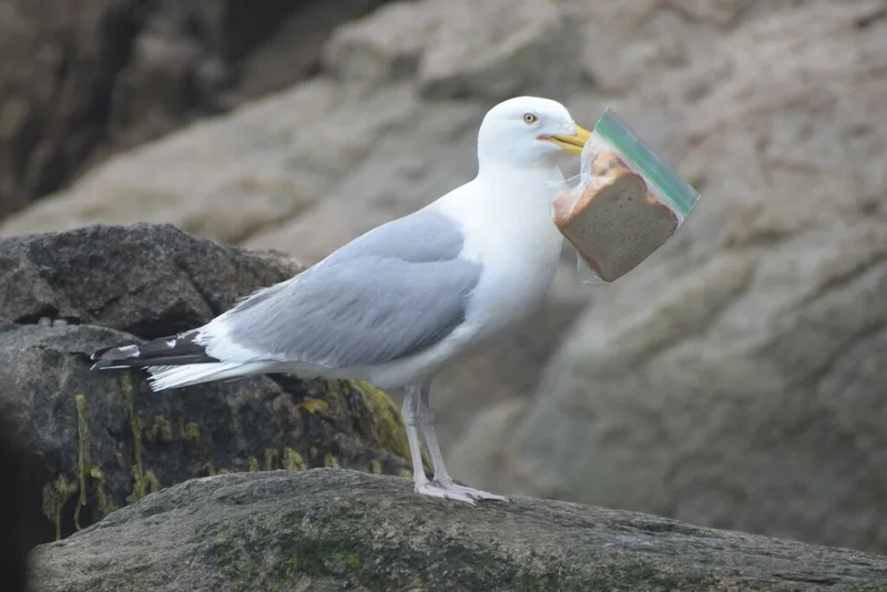
American Herring Gull Larus smithsonianus -
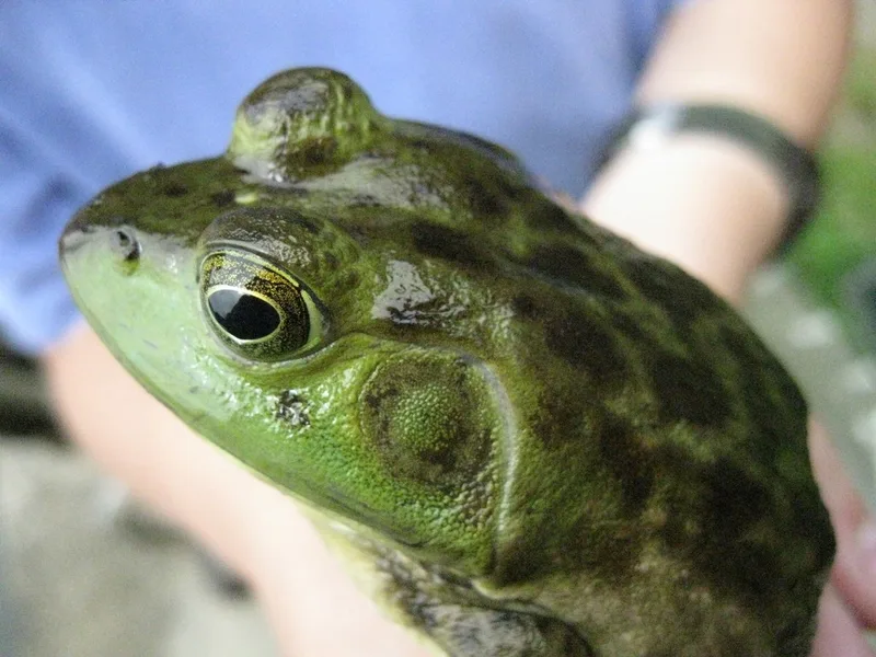
American Bullfrog Lithobates catesbeianus -
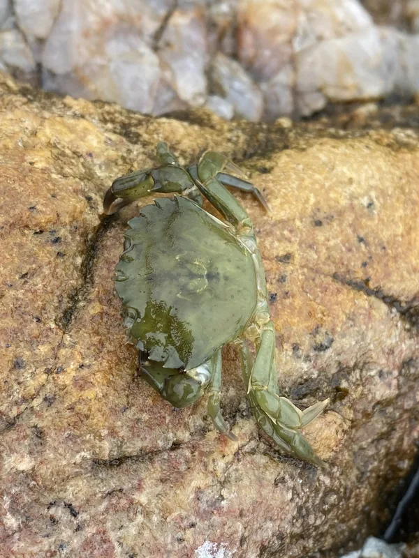
European Green Crab Carcinus maenas -
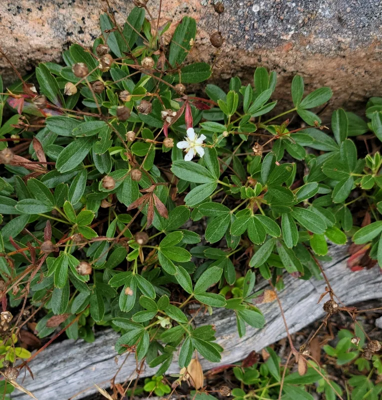
three-toothed cinquefoil Sibbaldiopsis tridentata -
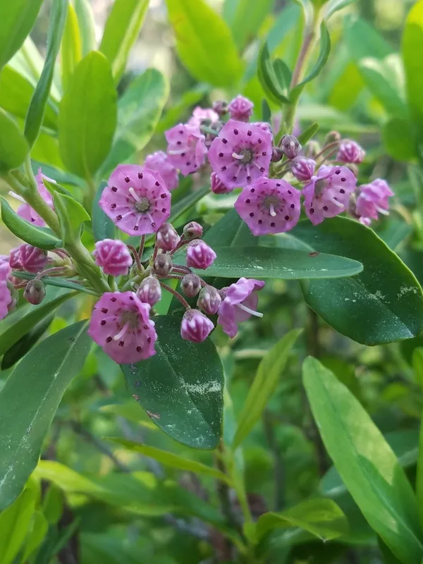
sheep laurel Kalmia angustifolia -
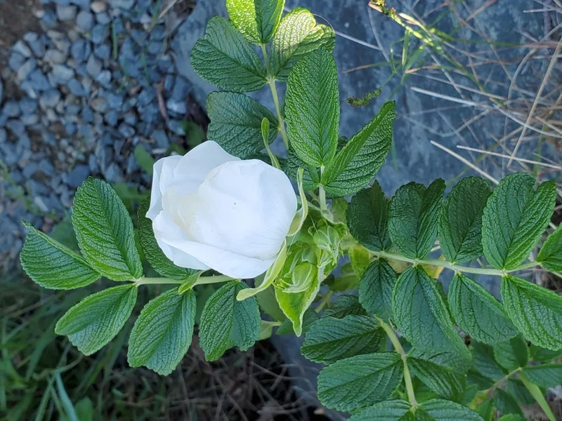
rugosa rose Rosa rugosa -
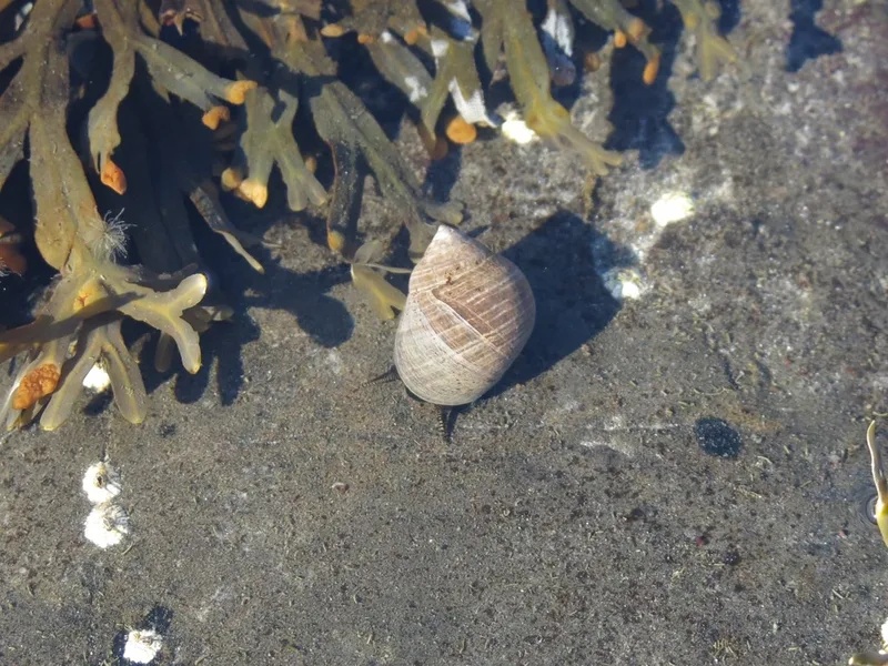
Common Periwinkle Littorina littorea -
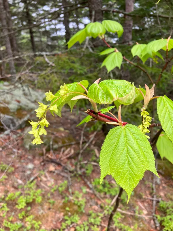
striped maple Acer pensylvanicum -
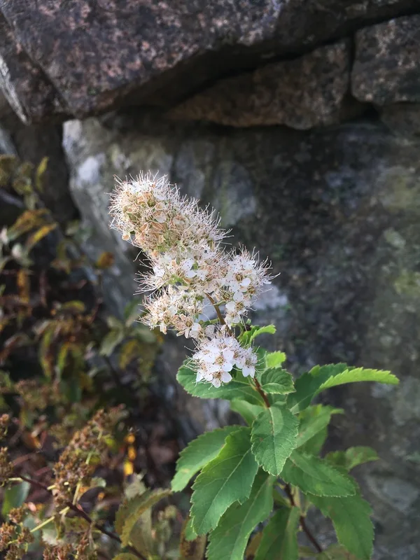
white meadowsweet Spiraea alba -
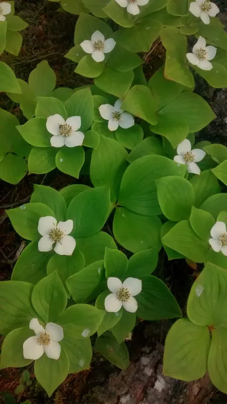
Canadian bunchberry Cornus canadensis -

American Red Squirrel Tamiasciurus hudsonicus -
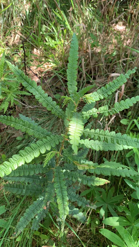
sweetfern Comptonia peregrina
Field Notes · Marine lens · Mount Desert Island · 44.3331, −68.2408