Acadia
Mount Desert Island · Maine, USA
The mountains here stand with their feet in cold water, and the sea decides what will grow on their bare stone.
Also seen through Marine · all at Mount Desert Island →.
Why here
On a clear day the granite summits of these mountains stand open to the sky, pink rock scraped clean and dry. Then the sea sends up its answer. Cold water lies just offshore through the summer, and when warm air drifts across it the moisture wrings out into fog that rolls up the slopes and settles on the stone. That cool, wet breath is the whole secret of the place. It keeps the exposed tops from baking, so plants that usually need real mountains — low, cold-country cushion plants rooted in cracks in the rock — can hold on here almost within sight of the waves. The same sea air keeps the heath and the low woods damp through the dry months, and it keeps the shore itself cold enough to carry more life than bare granite should. Mountain and tideline look like different worlds, but both run on the same engine: a cold sea breathing on the land. Read Acadia that way and a bare summit and a wet ledge at the waterline start to tell one story.
The story
Start with the rock. Acadia’s mountains are granite, molten stone that cooled slowly deep underground before it was lifted and stripped of everything that once lay above it. Then came the ice. A great sheet ground over the island and scraped the summits down to bare, rounded rock, leaving them open to the weather in a way a forested peak never is.
Onto that bare granite the sea went to work. Cold water offshore feeds a steady summer fog, and the plants that took hold are the ones that can stand cold and wet and wind — low mats of three-toothed cinquefoil rooted in the seams, sheep laurel and sweetfern across the open heath, and Canadian bunchberry carpeting the damp woods below. Herring gulls ride the updrafts along the ridges; from the ponds a common loon calls. It is a northern, cool-country community living close to the shore because the sea keeps it cool.
People have known this coast a long time. The island lies in the homeland of the Wabanaki, whose living cultures its museum works to keep at the center of the story. Later the shore drew summer colonies to harbors like Bar Harbor and Northeast Harbor, and today the island draws millions who come to walk the same bare tops. What holds it all together is the cold water offshore, still doing the work it has always done.
The sites
The bare summits the sea keeps cold
Cadillac Mountain
44.3529, −68.2239
Cadillac Mountain is a broad, open summit of pink granite, scraped clean and left to the weather. A road and trails reach the top, so it is the easiest place to stand fully in the sea’s climate — nothing overhead but sky, and often, in summer, nothing around you but fog. The bare rock is the point. Where a forest would hold the warmth and cut the wind, this stripped summit takes the full force of the cool, wet air rolling off the water, and the plants that live in its cracks are the ones built for cold and exposure. Look for low green mats pressed into the seams of the granite, and for the open heath of low shrubs that colors the mountain’s shoulders. On a foggy morning the sea makes its presence felt directly: the stone darkens with damp, the horizon vanishes, and the whole broad top goes quiet and gray. This is the fog coast carried up onto bare mountain, the ocean’s breath laid over stone.
Kneel at a crack in the open granite and find the low mat of three-toothed cinquefoil growing in it — small leaves in threes, white flowers in summer. It roots in the seam because that is where a little soil and the fog’s moisture collect, letting a cold-country plant hold on at the top of a mountain that stands barely above the sea.
- AccessDrive-up
- ExertionEasy
- TimeHalf a day
Dorr Mountain
44.3546, −68.2162
Dorr Mountain rises just east of Cadillac, a long bare ridge of the same pink granite, reached by climbing rather than driving. The climb keeps you on exposed rock most of the way, so you feel the change the sea works on a mountaintop — cooler, wetter, and windier than the sheltered woods below. Trees thin and then give out as you climb, not because the ground runs out but because the maritime air is too raw and salt-touched for them to hold the high, open rock. What takes their place is a low community of heath and cushion plants that can. From the ridge the water is nearly always in view, and on many summer mornings its fog is not a distant thing at all but the very air you are standing in. Dorr teaches the same lesson as its taller neighbor, earned on foot: the sea decides what grows on the bare tops.
As you climb, watch for the height where the trees give out and the open heath takes over. That line is drawn by the sea — above it the cool, salty, fog-laden air is too harsh for the forest, and only the low, wind-hardy plants carry on to the summit.
- AccessHalf-day hike
- ExertionStrenuous
- TimeHalf a day
Pemetic Mountain
44.3352, −68.2455
Pemetic Mountain is a long spine of open granite running down the middle of the island, its top a bare walkway of rock with water in view on both sides. The climb passes through cool woods before breaking out onto the exposed ridge, where the trees fall away and the mountain becomes stone and low plants. Set between two valleys, Pemetic catches the marine air from either side, and its bare crest stays cool and damp when the lowlands have dried. That is why the summit reads as a piece of higher, colder country set down near the coast — the sea holds the temperature and the moisture that such plants need. Walk the open top slowly and the ground tells the story: mats and cushions rooted in the rock seams, heath shrubs where a little soil has gathered, and bare polished granite everywhere between. It is a mountaintop the ocean keeps in a climate all its own.
On the open crest, notice how the plants hug the rock and grow only ankle-high, even where there is room to grow taller. Wind and salt off the sea keep them down; growing flat against the granite is how they survive the exposure the ocean imposes on this ridge.
- AccessHalf-day hike
- ExertionModerate
- TimeHalf a day
Penobscot Mountain
44.3329, −68.2667
Penobscot Mountain is a broad shelf of open granite on the island’s western side, its long summit ridge running bare above the woods and above the clear water of the pond below. Like its neighbors it was scraped down to rock and left open, and like them it lives in the sea’s weather — the ridge is often the first ground the morning fog reaches and the last it leaves. The exposed granite carries the same low, cold-country plants as the other summits, holding to cracks and hollows where soil and moisture gather. What Penobscot adds is the long view down to the water and out beyond it, a chance to see how the bare tops and the wet lowlands belong to one system fed by the same cool sea. Trees crowd the sheltered slopes; the open crest keeps them off. Between the two runs the line the ocean draws.
From the open ridge, look down at the dark woods filling the valley, then back at the bare rock under your feet. The forest stops where the exposure begins — the same cool, wet sea air that feeds the woods below is too raw for the trees on the open summit, so the top stays a garden of low plants instead.
- AccessHalf-day hike
- ExertionStrenuous
- TimeHalf a day
Where the fog comes ashore
Great Head
44.3283, −68.1746
Great Head is a blunt granite headland thrust out into the open water on the island’s eastern shore, one of the first places the sea’s air comes ashore. The rock here meets the water head-on, and the cliffs take the full weight of the surf and the incoming fog alike. Standing at the edge you are at the source of the whole system this note follows — the cold water below, the cool damp air lifting off it, the mist that will roll inland and up the mountains behind you. The plants clinging to the headland are the coast’s front line: salt-tolerant, wind-clipped, low to the rock. It is a short walk out to the point through woods that shorten and toughen as they near the exposed edge, a visible preview of what the sea does to everything it touches on this coast. From here the ocean is not scenery but a working engine.
Stand at the cliff edge and feel the air coming off the water — cooler and damper than the air in the woods behind you. That difference is the fog machine at work: warm summer air chilled over the cold sea gives up its moisture as mist, the same mist that feeds the forests and the bare summits inland.
- AccessShort walk
- ExertionEasy
- TimeHalf a day
Schooner Head
44.3445, −68.1750
Schooner Head is another granite promontory on the eastern shore, a wall of rock standing straight out of the surf. Reached by a short walk to an overlook, it is a place to watch the sea meet the land at full force — waves working into every crack and joint in the granite, slowly widening them into clefts and hollows. This is the coast’s raw edge, where the same cold water that breathes fog onto the mountains also grinds patiently at the rock itself. The exposed face carries only the toughest plants, salt-sprayed and clipped by the wind, holding in seams above the reach of the waves. Look north and south along the shore and the pattern repeats headland after headland: hard granite standing, softer ground worn back between. Schooner Head is a good place to feel how thoroughly the ocean rules this coastline, shaping both what grows on it and what wears away.
Watch the surf hit the base of the cliff and find the vertical cracks running up the rock face. The sea drives water and air into those joints under pressure, prying the granite apart along its weaknesses — the slow work that turns a solid headland into clefts and hollows over time.
- AccessShort walk
- ExertionEasy
- TimeAn hour
The sea reaching inland
Bar Island Trail Access
44.3920, −68.2101
Bar Island sits just off the harbor at Bar Harbor, joined to the town by a bar of gravel that the sea covers and uncovers twice a day. At low water you can walk straight across; as the tide returns, the path disappears and the island is an island again. It is the plainest possible demonstration of the sea’s reach into the land — a piece of ground that belongs to the ocean for half of every day. Cross it and the cold water is all around you, the same water that feeds the fog and fills the tide pools; weed-draped ledges and shallow pools open along the bar as it drains. Unlike the exposed summits, this is the sea’s influence met at ground level, close and immediate. Time the crossing to the falling tide and keep an eye on the water, because the way back closes on the ocean’s schedule, not yours.
Look at the strip of wet gravel between the town and the island and note how far the water has drawn back to expose it. Check a tide table before you start across. That bar is the tide’s own record — dry ground only for the hours around low water, its seaweed and barnacles marking exactly how high the returning sea will reach.
- AccessShort walk
- ExertionEasy
- TimeAn hour
Flying Mountain
44.3020, −68.3145
Flying Mountain is a low summit reached by a short, steep climb to a rocky knob that stands over a long, narrow arm of the sea. What makes it worth the note is the setting: the ocean reaches far inland here, filling a deep passage between wooded walls of granite well away from the open coast, and Flying Mountain looks straight down on it. From the top you can see how thoroughly the sea penetrates the land — cold saltwater lying between forested slopes in the heart of the island. The same maritime air that governs the outer shore fills this inner passage, so the fog and the cool damp reach deep inland along the water. The climb is short but the payoff is a clear reading of the whole system: mountain, forest, and a finger of the sea threaded between them. Even here, far from the surf, the ocean sets the terms.
From the summit, trace the long narrow arm of the sea running deep inland below you, dark water walled by granite on both sides. The ocean has flooded a valley here, carrying its cold water and its fog far from the open coast — a reminder that on this island the sea’s reach is not only the outer shore, but wherever the land gave it an opening.
- AccessShort walk
- ExertionModerate
- TimeAn hour
When it's best
Summer is the fog season, when the cold sea does its quiet work — mornings often open gray and close, the mist burning off by midday if it burns off at all — and the open tops and the heath are at their greenest. It is also when the summit plants flower: the small white blooms of three-toothed cinquefoil in the rock cracks, the pink of sheep laurel across the barrens, usually through the early summer weeks. Autumn turns the low woods and heath to color without quieting the sea. Winter is cold and hard on the exposed ridges. In any season a low tide bares far more of the shore than a high one, so where you mean to walk the waterline a tide table is worth more than a forecast.
Go deeper
The names behind what you saw. The pink summit rock is a Devonian granite, part of the island’s older Paleozoic intrusive rocks — search either name for how the molten stone cooled and was later laid bare. The smooth, rounded tops the ice left behind are roche moutonnées. The cushion plant in the cracks is three-toothed cinquefoil, Sibbaldiopsis tridentata; the pink-flowered heath shrub is sheep laurel, Kalmia angustifolia, growing beside sweetfern, Comptonia peregrina, and, in the damp woods, Canadian bunchberry, Cornus canadensis. The gulls riding the ridge updrafts are American herring gulls, Larus smithsonianus; the bird calling from the ponds is the common loon, Gavia immer.
To read next. - Carleton A. Chapman, The Geology of Mount Desert Island, Maine (1962) — a full account of how the island’s granite formed and came to stand where it does. - The Geology of Mount Desert Island: A Visitor’s Guide to the Geology of Acadia National Park (1988) — a trailside guide to the rock beneath the summits. - Surficial Geology of Mount Desert Island (2016) — for the ice sheet that scraped the tops bare and left the loose stone behind. - N. S. Shaler, The Geology of the Island of Mount Desert, Maine (1889) — the earliest close survey of this ground.
The names behind what you saw
What lives here, and what it's called. Photographs from open collections — an aid to identification, not decoration.
-
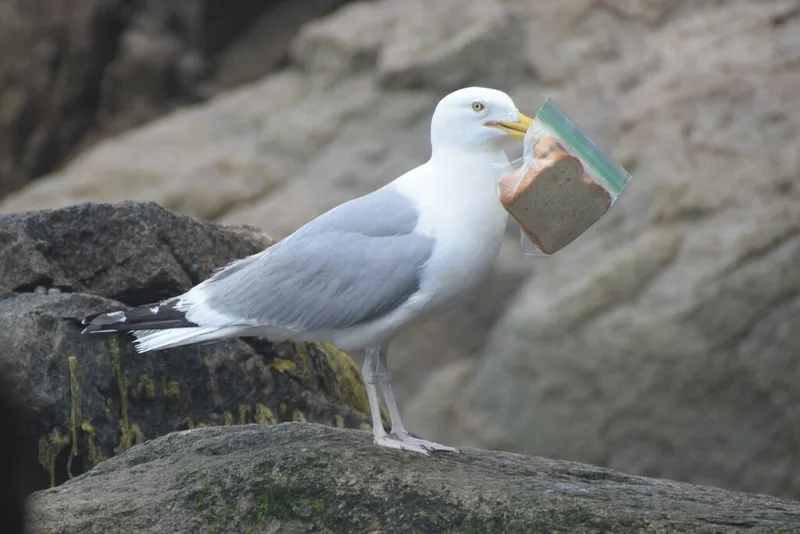
American Herring Gull Larus smithsonianus -
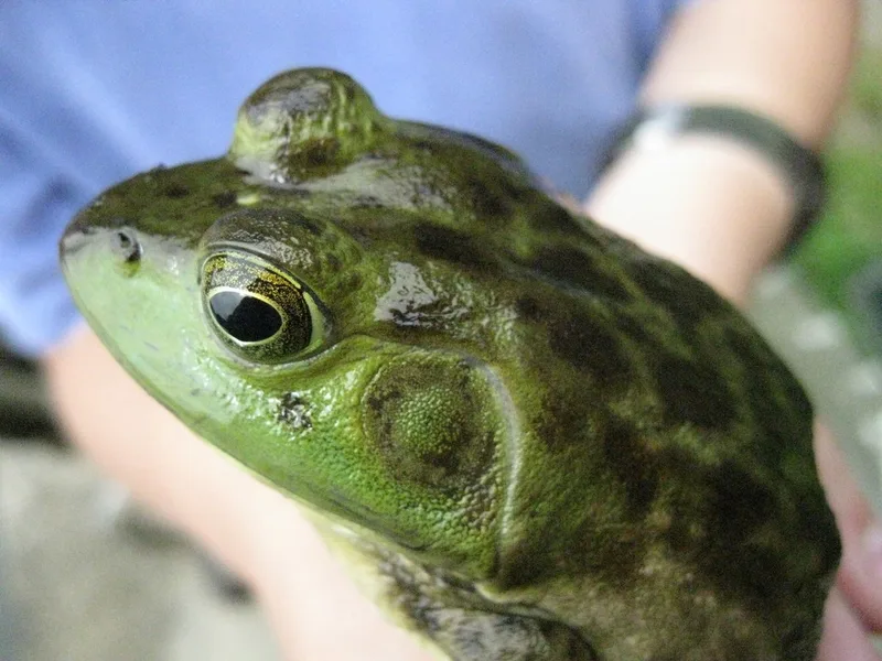
American Bullfrog Lithobates catesbeianus -
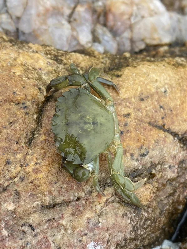
European Green Crab Carcinus maenas -
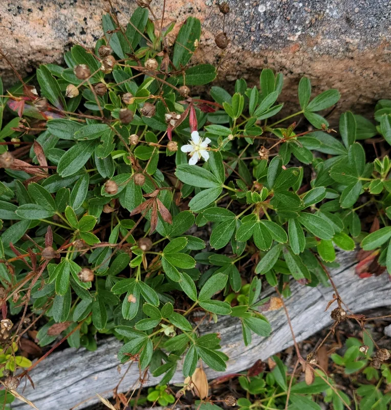
three-toothed cinquefoil Sibbaldiopsis tridentata -
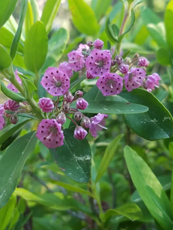
sheep laurel Kalmia angustifolia -
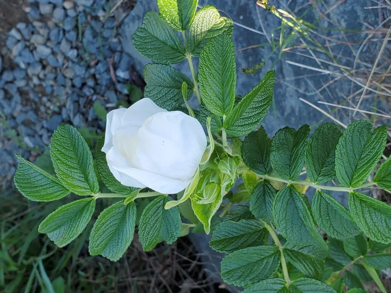
rugosa rose Rosa rugosa -
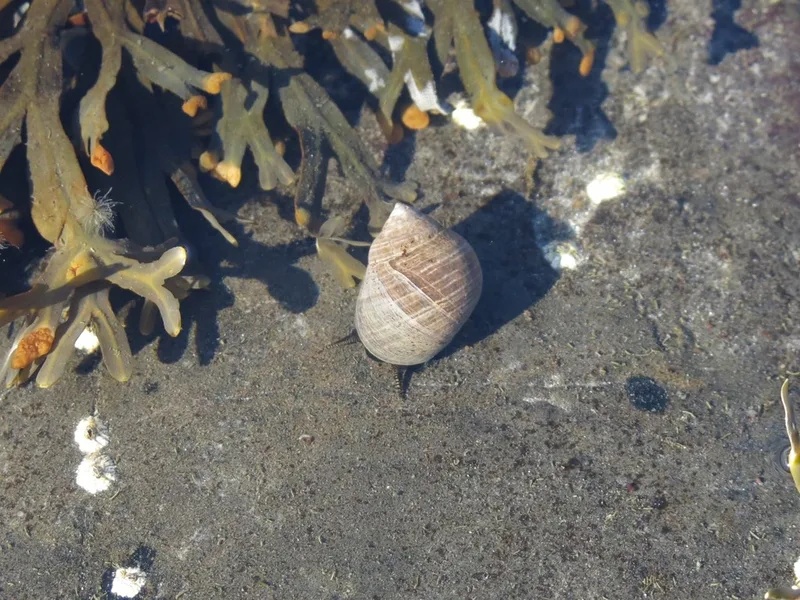
Common Periwinkle Littorina littorea -
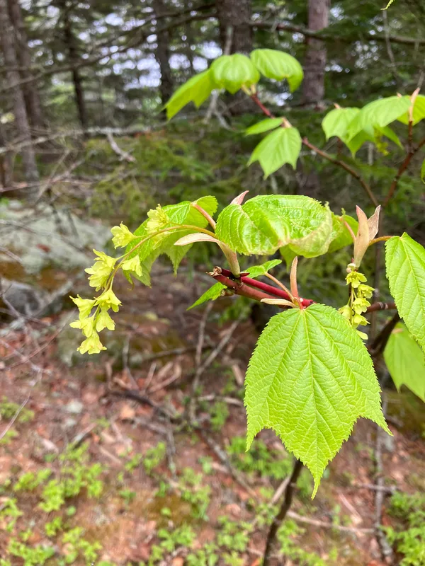
striped maple Acer pensylvanicum -
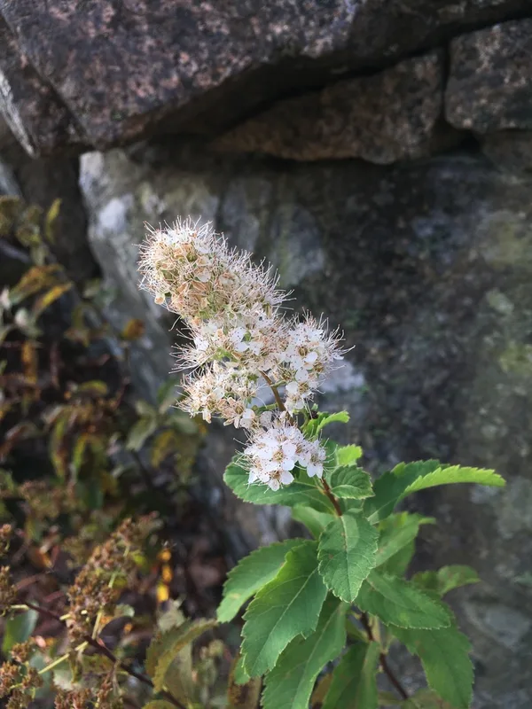
white meadowsweet Spiraea alba -
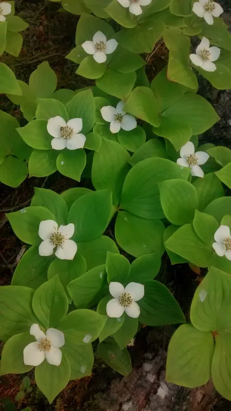
Canadian bunchberry Cornus canadensis -
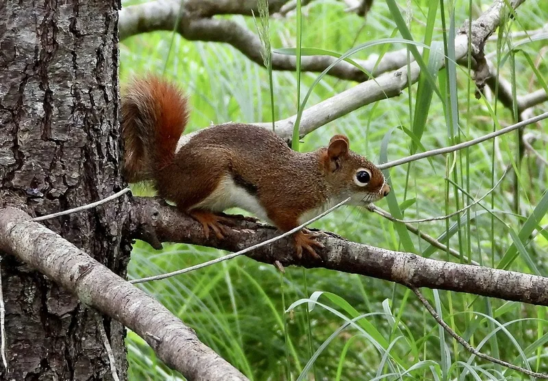
American Red Squirrel Tamiasciurus hudsonicus -
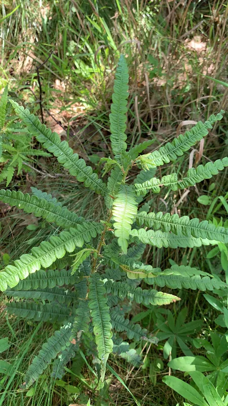
sweetfern Comptonia peregrina
Field Notes · Fog Coast lens · Mount Desert Island · 44.3331, −68.2408