Zhangye Danxia
The stripes on these hills were laid down flat. Something tilted the whole page so you could read it.
Why here
The hills at Zhangye look painted — bands of rust red, cream, ochre, and grey running in parallel across slope after slope. Nothing painted them. Each band is a single layer of sediment: sand and mud dropped by rivers and shallow lakes, one load at a time, over spans of time the mind doesn’t really hold. Laid down, they were flat and stacked, the oldest at the bottom, the way pages sit in a closed book. What makes this place worth the trip is what happened next. As the mountains to the south pushed up, they tilted the whole stack, so the layers that formed dead level now run at an angle across the hillsides. The book fell open. Instead of looking down at the top page, you look sideways at the whole sequence at once, every layer a different color depending on the iron and minerals sealed inside it when it turned to stone. Everything in this note comes back to that one trick of angle: flat history, tilted into view.
The story
The land came first, and it came from water in a dry place. Long before this was desert, rivers and shallow lakes spread across a sinking basin here, dropping their loads of red sand and pale mud season after season. Iron in that sediment did the coloring: where it sat in air and oxidized it went red and rust; where it stayed buried and starved of oxygen it held greens and greys. Buried and cemented into stone, then lifted and tilted as the mountains grew, the layers were finally attacked by the one force this dry country still has in quantity — sudden, hard rain, funneling down the slopes and cutting the gullies that expose the colors today.
Little lives on the bare rock. The beds hold almost no soil, and what rain comes runs straight off, so the famous slopes stay nearly plantless — the starkness is part of what makes the layering so easy to read.
People have moved along the foot of these hills for a very long time. This is the Hexi Corridor, the narrow inhabited strip between the mountains and the northern deserts that carried the Silk Road west out of China, and the city of Zhangye grew on that traffic. The colored hills themselves were quiet backcountry until recent decades, when the park boardwalks went in and the view most people now come for was finally made easy to reach.
The sites
Reading the tilted layers
Cloud-Sea Terrace (七彩云海台)
38.9679, 100.0330
Start here with the single fact that explains everything else you’ll see: the colored bands run at a slant, not level. That slant is the whole story. Every one of these layers was laid down flat, sand and mud settling at the bottom of ancient water — flat is how sediment always settles. So when you look across these hills and see the stripes climbing diagonally up one slope and down the next, you are looking at layers that were tilted long after they turned to stone, heaved out of level as the mountains to the south rose and dragged the whole region up with them. The angle you see is the exact angle of that tilt. It is also why you can see so many layers at once: on flat-lying rock you would only see the top one, like the cover of a closed book. Tilted, the book lies open, and every page shows its edge.
Pick one slope and follow a single colored band with your eyes from bottom to top. Notice it doesn’t stay level — it climbs or dips at a steady angle. That angle is the tilt the whole landscape was lifted into. Come in the first or last hour of daylight, when low sun rakes across the slant and throws each layer into relief.
- AccessShort walk
- ExertionEasy
- TimeAn hour
Fairyland Terrace (七彩仙缘台)
38.9747, 100.0405
This is the highest of the boardwalk viewpoints, and the one to come to for the long view. From up here the individual hills stop reading as separate mounds and start reading as what they are: one thick stack of layered rock, sliced into ridges by erosion but originally continuous, every ridge sharing the same bands in the same order. That order is the point. In undisturbed layered rock the oldest material sits at the bottom, and each layer above it is younger than the one beneath — a plain rule that turns a striped hillside into a timeline you can read from the ground. Here, with so much of the sequence in view at once, you can trace a single distinctive band — a bold red one, say, or a pale creamy seam — across ridge after ridge and watch it hold its place in the stack every time. The colors are not laid on the surface. They go all the way through, one whole layer at a time.
Pick one clearly colored band — the boldest red is easiest — and follow it across several separate ridges. Notice it keeps the same neighbors above and below it on every ridge. That repetition is proof the ridges were once a single connected mass, later cut apart, not built up separately.
- AccessShort walk
- ExertionEasy
- TimeAn hour
Brocade Terrace (七彩锦绣台)
38.9608, 100.0543
The name points at the colors, and this is a good place to ask where they come from. The short answer is iron, mostly one metal doing different things. Iron is scattered all through this sediment, and its color depends on the air and water it met as the mud turned to stone. Where iron oxidized — met oxygen and rusted — it stained the rock the reds and rich oranges that dominate here. Where it stayed buried, starved of oxygen, it held greens and greys instead. Traces of other minerals tint the paler creams and yellows. So each band’s color is really a record of the conditions in that particular layer when it formed: a wetter spell, a drier one, a stretch with more oxygen reaching down or less. Read that way, the stripes are not just pretty. They are a strip of climate history, each color a different chapter in how this basin filled.
Find two bands touching each other with very different colors — a deep red against a pale grey or green is common. You are looking at the boundary between two different conditions in the ancient basin: rusted, oxygen-rich sediment beside sediment that stayed buried and starved of air. The sharper the line between them, the more abruptly conditions changed.
- AccessShort walk
- ExertionEasy
- TimeAn hour
Flying-Glow Terrace (七彩飞霞)
38.9672, 100.0355
By now you’ve read what the layers are and why they’re colored. This viewpoint is a good place to watch what’s taking them apart. Look at the slopes and you’ll see they aren’t smooth — they’re combed top to bottom with narrow gullies and sharp little ridges, all running straight downhill. That texture is the work of water, and specifically of rare, heavy rain. This is dry country; rain comes seldom, but when it comes it comes hard, and with almost no plants to slow it, it sheets straight down the bare rock, cutting the same downhill grooves a little deeper each time. Softer bands wear back faster and become the gullies; harder bands stand out as the ridges between them. The whole carved, fluted surface that makes these hills so distinctive is younger than you’d guess — not the deep past of the layers themselves, but the ongoing present, still being shaped by the next storm.
Trace one gully from the top of a slope to the bottom. Notice it follows the steepest line straight down, and that the ridges on either side tend to be a slightly different color from the gully floor. The gully has found a softer band to cut into; the ridges are the harder layers resisting.
- AccessShort walk
- ExertionEasy
- TimeAn hour
A different Danxia, next valley west
Binggou Danxia (冰沟丹霞)
38.9665, 99.9081
The colored ridges are only half of what this region’s rock does. Come to Binggou, a separate scenic area over the next valley to the west, and the Danxia rock takes a completely different shape: instead of smooth, low, brightly banded slopes, here it stands up in cliffs, spires, and blocky forms that people have long compared to castles and city walls. The rock is close kin to the colored beds, the same broad family of red-bed sandstone, but harder and more thickly bedded — so where the softer colored layers erode into rounded stripes, this stiffer rock breaks along vertical cracks and keeps its height, weathering into towers rather than ridges. The color here is quieter, mostly greys and ochres rather than the reds next door. Seeing both in one trip is the real lesson of the place: same rough age, same dry-country erosion, but the shape the land takes depends entirely on how hard the particular rock is and how it’s stacked.
Look at how this rock breaks compared to the colored hills: here it stands in tall, flat-sided towers and walls with sharp vertical edges. Those edges follow cracks in the rock, called joints. Harder, thicker rock like this breaks along joints and keeps its height, which is why it makes castles here and rounded stripes back at the colored slopes.
- AccessShort walk
- ExertionEasy
- TimeAn hour
When it's best
The rock is here all year, and the layering reads in any weather. What changes is the color’s intensity and your comfort. The bands look their most saturated in two conditions, both worth planning around: right after rain, when wet stone deepens every hue, and in the low, raking light of early morning or the hour before sunset, when the sun crosses the tilted layers instead of flattening them from overhead. Rain is uncommon in this dry corridor, so wet-rock color is a matter of luck; low light you can plan for simply by going early or staying late. For plain comfort, late spring through early autumn brings the mildest weather; midsummer runs hot and can turn hazy enough to mute the distances. Winter is cold and the crowds thin, and the colors, though quieter under a low pale sun, still read layer by layer. If you time anything, time your hour on the boardwalks to the ends of the day, not the middle.
Go deeper
The names behind what you saw The striped and pillared rock here belongs to a class geologists call Danxia landform — red-bed sandstone and mudstone, laid down in continental basins and later cut into cliffs, ridges, and towers. In the geologic record the beds fall under the broad heading Cenozoic sedimentary rocks. The protected area itself is the Zhangye National Geopark, spanning parts of Linze and Sunan counties; the colored ridges sit in the Linze section, the castle-like forms at Binggou in the Sunan section.
To read next - “The Geologic Origins of Danxia and Colorful Hills Landform of Zhangye in China” sets out how these particular beds formed and took on their colors. - “Geologic origins of Danxia and colorful hills of Zhangye,” compared with the Danxia landform of southern China, places Zhangye’s dry, colorful version beside the wet, forested Danxia of the country’s south — same rock class, very different look. - A study of tourism pressures at the geopark documents what heavy visitation does to a landform this fragile, and the measures taken to protect it. - Wikipedia’s entry on Zhangye National Geopark gathers the park’s boundaries, sections, and designation history in one place.
The names behind what you saw
What lives here, and what it's called. Photographs from open collections — an aid to identification, not decoration.
-
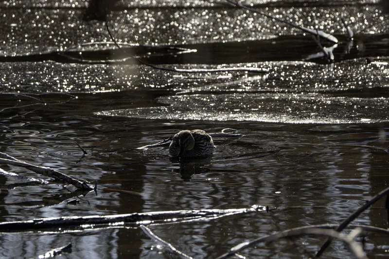
Mallard Anas platyrhynchos -
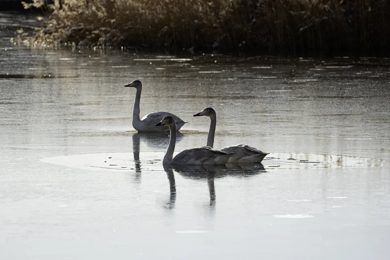
Whooper Swan Cygnus cygnus -

Great Crested Grebe Podiceps cristatus -
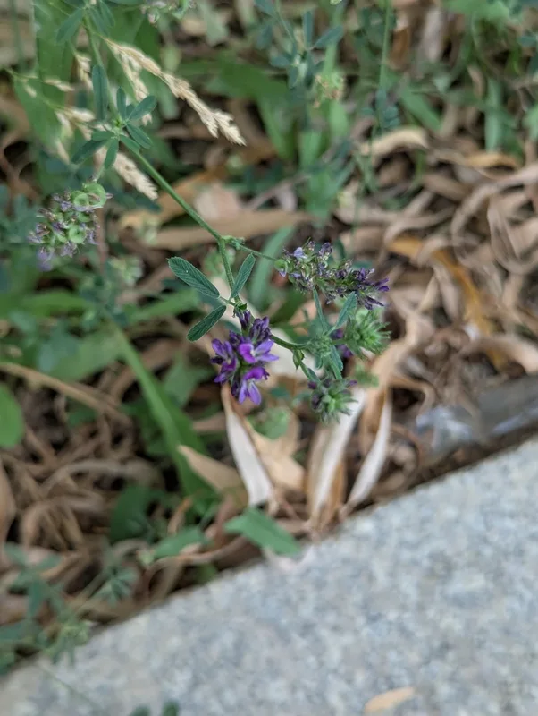
Alfalfa Medicago sativa -
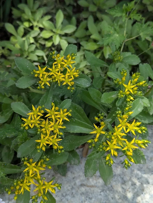
Aizoon Stonecrop Phedimus aizoon -

Common Tern Sterna hirundo -

Black-winged Stilt Himantopus himantopus -
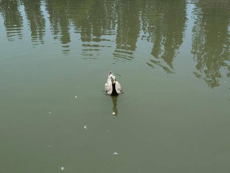
Bar-headed Goose Anser indicus -
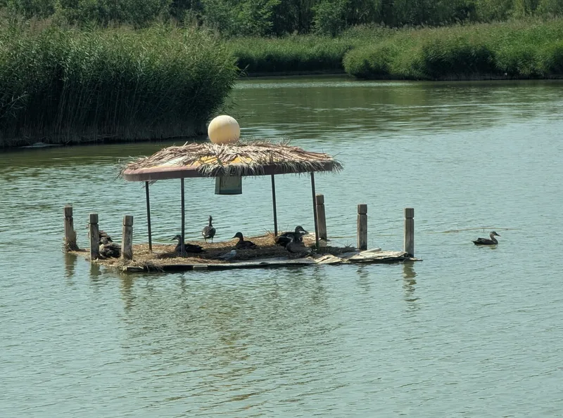
Eastern Spot-billed Duck Anas zonorhyncha -
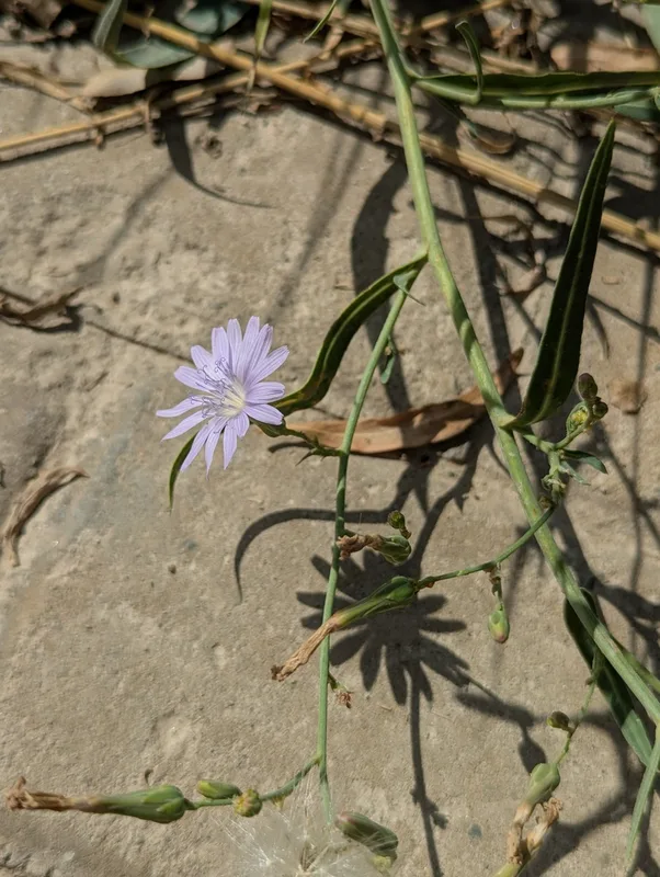
tatarian blue lettuce Lactuca tatarica -
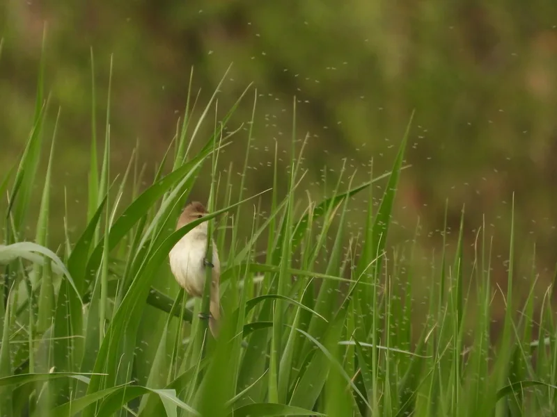
Oriental Reed Warbler Acrocephalus orientalis -
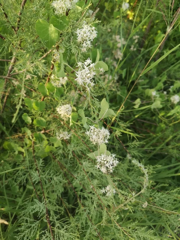
Cynanchum chinense
Field Notes · Desert & Deep Time lens · Zhangye Danxia · 39.3311, 100.1792