Franz Josef Glacier
Franz Josef Glacier · West Coast, New Zealand
Ice that runs down through the rainforest, until moss meets the moraine.
Why here
Most glaciers keep to bare rock and thin air, retreating higher as the world warms. This one runs the other way: down through rainforest, its ice dropping to within a few hundred metres of the sea while ferns and moss grow almost within reach of it. That closeness is the whole story here. The Southern Alps rise fast enough, and the West Coast rains hard enough, that a river of ice can still push down into forest country most glaciers would never survive in. Everything you will see around Franz Josef follows from that one fact: rock ground smooth by ice moving downhill, a valley planed flat and straight where a river alone would have cut a narrower notch, and a coastline of forest steadily reclaiming ground the ice has given up in living memory. Walk the valley floor and you are walking on what the glacier left behind, some of it recent enough to still be bare. This note keeps returning to that same handoff — ice retreating, forest following — at every stop.
The story
The rock under this valley is old ocean floor, pressure-cooked deep in the earth into schist, then thrust skyward as the Southern Alps rose. Ice took that raised rock and reworked it: grinding the valley floor flat, rounding what it rode over, leaving cliffs where it sheared past unyielding ground. The forest arrived after, and arrives still, spreading onto ground the ice only recently gave up — kidney fern and mountain toatoa low down, giving way higher up to mountain daisy, golden Spaniard, and the Mount Cook lily on the open scree and tussock above the treeline. Kea work the same high ground, curious and unbothered by cold; New Zealand pigeon and tomtit hold the forest lower down. People read this landscape as a record almost as soon as Europeans arrived: the surgeon and mountaineer Ebenezer Teichelmann photographed these mountains and glaciers from a full-plate glass camera hauled up peak after peak, and those photographs helped win conservation protection for this stretch of coast. A nearby church built in 1931 was positioned deliberately for its view of the glacier from the altar — a view the ice has since pulled back out of, less than a century later.
The sites
The valley the ice cut
Franz Josef Glacier / Kā Roimata o Hine Hukatere Viewpoint
−43.4434, 170.1724
This is the plainest place to take in the whole shape of the thing: a broad, flat-bottomed valley running back into cloud, with the glacier itself at the head of it. Franz Josef is a temperate glacier, meaning it is warm enough at its base to slide rather than freeze fast to the rock beneath — which is exactly why it moves as much as it does, and why it can still reach so far downhill into forest country. From here the valley’s proportions do the explaining an information panel might otherwise attempt: wide, straight-sided, floored flat rather than notched into a V. That shape is not what a river cuts. It is what a body of ice, filling the whole valley and grinding at floor and walls together, leaves behind once it retreats.
Come with low expectations of a close encounter and this spot delivers more than most: distance, scale, and a clean read of the landscape’s grain.
Look partway up the valley walls for a change in the rock’s colour or in how much vegetation clings to it — a rough line running along the slope. That line marks roughly how high the ice used to sit before it thinned; above it the rock has weathered in open air for longer, below it the ice’s polish and cover are more recent.
- AccessShort walk
- ExertionEasy
- TimeAn hour
Sentinel Rock
−43.4250, 170.1689
Sentinel Rock stands where the ice used to grind past rather than over, a stub of the same old schist bedrock left standing proud of the valley floor. Rock like this — hard, well-anchored, harder to shift than the loose debris around it — tends to survive glacial scouring while softer ground nearby gets carried away, leaving isolated knobs and ridges dotted through a valley long after the ice that shaped them has gone. Up close the schist itself is worth a slow look: pale, foliated rock, once ordinary seafloor mud and sand, folded and recrystallised under the Southern Alps before ever being exposed to weather or ice.
The name suits the position — a fixed point in a valley where almost everything else, ice included, has been on the move. Rock like this is easy to walk past without a second look from the main track, but it repays a slower pass: the same schist that forms the high peaks above, brought down to eye level and worn into a shape you can actually read with your hands.
Run a hand or eye along the rock’s lower faces where they are smoothest. Ice dragging rock debris across a surface leaves it polished and sometimes finely scratched in one consistent direction — a record of which way the glacier was moving when it last rode over this stone.
- AccessShort walk
- ExertionModerate
- TimeAn hour
Alex Knob
−43.4277, 170.1513
Alex Knob rewards the climb with the view every valley glacier deserves: from above, rather than from the floor looking up. The ascent runs from dense rainforest into increasingly open, wind-pruned country, a gradient that tracks the mountain’s own climate as much as its elevation. From the top, the glacier valley below reads as a single clean trough — flat-bottomed, straight-walled, U-shaped in cross-section rather than the narrow V a river alone would carve. That difference in shape is one of the most reliable signatures ice leaves on a landscape, visible from no vantage as clearly as from directly above.
It is a long day out, and cloud can close the view without warning on this coast, but a clear window here is one of the better returns on effort in the valley. Few other points along the valley let you compare the ice-cut trough below with the sharper, still-eroding peaks above it in a single turn of the head.
From the summit, trace the valley’s cross-section with your eye rather than your feet: a flat floor meeting steep, near-vertical walls, with almost no gradual slope between them. That abrupt junction is the ice’s signature — a river valley would round the transition instead.
- AccessHalf-day hike
- ExertionStrenuous
- TimeA full day
Roberts Point
−43.4459, 170.1781
The track to Roberts Point climbs along the true right wall of the gorge, close enough across the valley to watch the glacier’s icefall — the section where the ice, forced to drop steeply over an uneven bed, breaks apart into blocks, seracs, and crevasses rather than flowing smoothly. It is a different kind of view from the valley-floor lookouts: side-on, elevated, and close enough to hear the ice at work rather than just see it. The schist wall the track follows shows the same signs of glacial handling as the rock lower in the valley — smoothed and rounded where ice once pressed against it, rougher and more broken above the height the ice reached.
Weather on this coast turns quickly, and the exposed sections of this walk are no place to be caught in it; check conditions and go prepared. The reward for the climb is a vantage most visitors never get: level with the ice rather than looking up at it from the valley floor.
Watch the icefall itself for a few minutes rather than photographing it once and moving on. Listen as much as look — the occasional crack and rumble is ice breaking under its own weight as it drops over the steeper ground beneath.
- AccessHalf-day hike
- ExertionStrenuous
- TimeHalf a day
What the ice left behind
Reading the glacier's memoirs
−43.4251, 170.1689
This interpretive stop reads the valley floor the way a geologist would: as a page still legible if you know what the marks mean. Ridges of loose, unsorted rock and gravel mark old moraines, dropped wherever the glacier’s edge held steady long enough to pile debris there before retreating again. Isolated boulders sitting alone on open ground, sometimes a rock type unlike anything nearby, are erratics — carried inside or beneath the ice from higher in the catchment and simply left where the ice finally let go of them. None of it looks deliberate from a distance, but each feature marks a specific, readable moment in the glacier’s advance and retreat.
Once you know to look for moraine ridges and erratic boulders, they turn up everywhere in this valley, not just at the marked stops. It is a small shift in attention that changes how the whole walk reads, from scenery to a sequence of specific, dateable events.
Find one boulder sitting alone on otherwise open ground and look closely at its rock type against the valley walls around it. If it does not match, it likely rode here inside the ice from somewhere upvalley and was dropped when the ice beneath it melted away.
- AccessShort walk
- ExertionEasy
- TimeAn hour
What goes up must come down – a land in motion
−43.4311, 170.1691
The Southern Alps are still rising, pushed up by the same forces that make this whole coast prone to earthquakes, and they are being worn down just as fast by rain, rivers, and ice. That balance — rock rising about as quickly as weather and gravity can remove it — is why these mountains stay so sharp and young-looking instead of softening into rounded hills the way old, stable ranges do. Ice is one of the more effective tools in that erosion: a glacier grinds and plucks rock from its bed far faster than a river of the same size could manage, feeding the boulders and gravel that choke the rivers running off this range.
It is a useful thing to hold in mind at every other stop in this valley: nothing here is finished settling, and the sharp, unworn look of the peaks overhead is itself evidence of how recent and ongoing that contest still is.
Look for pale, fresh scree fans spilling from gullies on the valley walls, distinct from the older, darker, more vegetated slopes around them. A fresh fan is recent rockfall — this landscape actively shedding material as fast as it is pushed upward.
- AccessShort walk
- ExertionEasy
- TimeAn hour
A shadow of its former self…
−43.4250, 170.1689
This stop marks how far the ice has pulled back, and the evidence is the bare, rubble-strewn ground stretching between the marker and wherever the glacier’s face currently sits. A nearby church, built in the early twentieth century with its altar deliberately facing the glacier, once had that view filled with ice — recorded on a stamp printed in the years just after the Second World War. The glacier has since drawn back out of that view entirely. Retreat like this is not unique to Franz Josef, and it is not a straight line: temperate glaciers here can readvance in colder, wetter years even while the long-term trend runs the other way. But the ground exposed here, all of it under ice within less than a century, makes the pace of change plain in a way that is hard to argue with.
The forest at the valley’s edges is already moving onto this newly bare ground, the first stage of reclaiming what the ice has given up.
Look at the bare rock and rubble immediately around this point for the earliest signs of plant life returning: mosses first, then small hardy shrubs. The closer to the current ice edge, the younger and sparser that colonising growth will be.
- AccessShort walk
- ExertionEasy
- TimeAn hour
When it's best
The payload here is thinnest on seasons, and honestly the valley rewards most times of year for different reasons. This is a wet coast in any month — rain is frequent and can arrive without much warning, so cloud hiding the high peaks is normal rather than a sign of bad luck. Late summer and early autumn tend to bring cooler, still-changeable weather rather than reliable warmth, so come for the landscape rather than banking on sun. What stays constant is the ice itself: it is a year-round feature, not a seasonal one, and the valley’s carved shape and the marks the glacier left are just as legible in any month. If there is a single thing worth timing a visit around, it is patience with the weather rather than the calendar — a clear window here, whenever it comes, is worth waiting out a run of grey days for.
Go deeper
The names behind what you saw - The bedrock is schist of the Rakaia Terrane, part of the Torlesse Supergroup (also mapped locally as Haast Schist) — old seafloor sediment metamorphosed deep in the crust. - Mount Cook lily, the largest buttercup in the world by common reputation, is Ranunculus lyallii. - Kea, the alpine parrot seen working the high ground here, is Nestor notabilis. - New Zealand pigeon, common in the lower forest, is Hemiphaga novaeseelandiae. - Kidney fern, one of the valley’s signature low-forest plants, is Hymenophyllum nephrophyllum. - Golden Spaniard, the spiky subalpine plant on the open scree, is Aciphylla aurea.
To read next - Wikipedia’s entry on Franz Josef Glacier — the baseline facts on its length and its unusually low, forest-adjacent terminus. - Wikipedia’s entry on Fox Glacier — its larger neighbour to the south, useful for comparison and for understanding this is a system of glaciers, not one isolated ice tongue. - Wikipedia’s entry on the Little Ice Age — background on the broader cold period during which many of the world’s temperate glaciers, this one included, last held their ground furthest downvalley. - Wikipedia’s entry on Ebenezer Teichelmann — the mountaineer-surgeon whose glass-plate photographs of these mountains helped win conservation protection for the coast. - Wikipedia’s entry on St James Church, Franz Josef — the small building whose altar view of the glacier, once real, is now the clearest local measure of how far the ice has withdrawn.
The names behind what you saw
What lives here, and what it's called. Photographs from open collections — an aid to identification, not decoration.
-
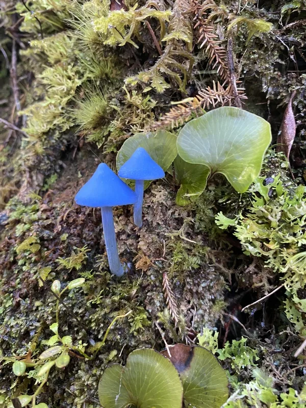
blue pinkgill Entoloma hochstetteri -
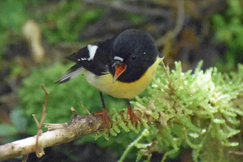
Tomtit Petroica macrocephala -

Kea Nestor notabilis -
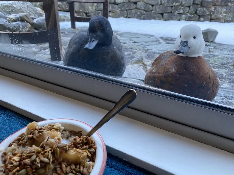
Paradise Shelduck Tadorna variegata -
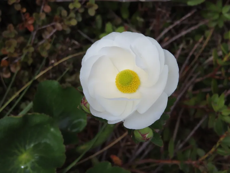
Mount Cook lily Ranunculus lyallii -
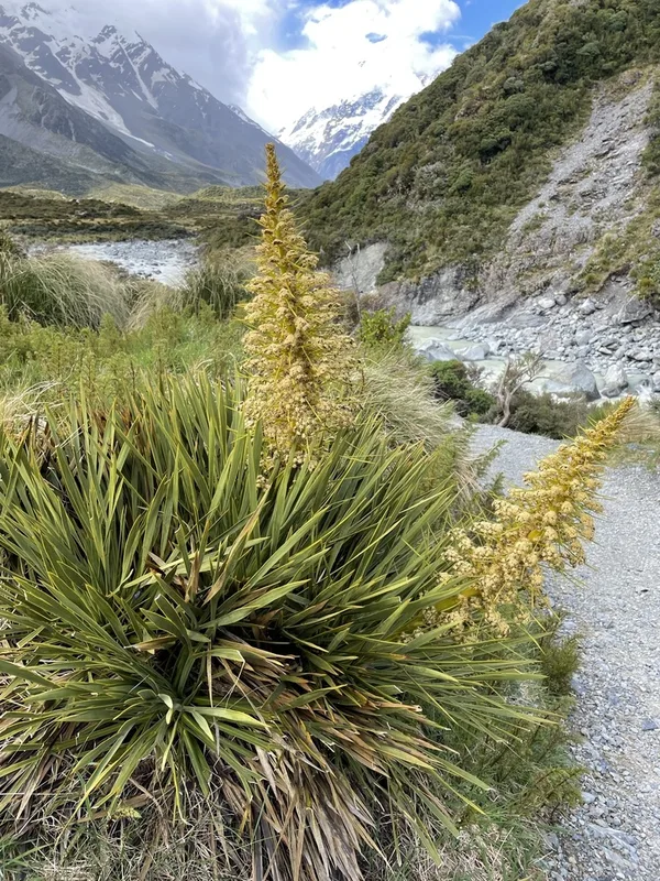
Golden Spaniard Aciphylla aurea -
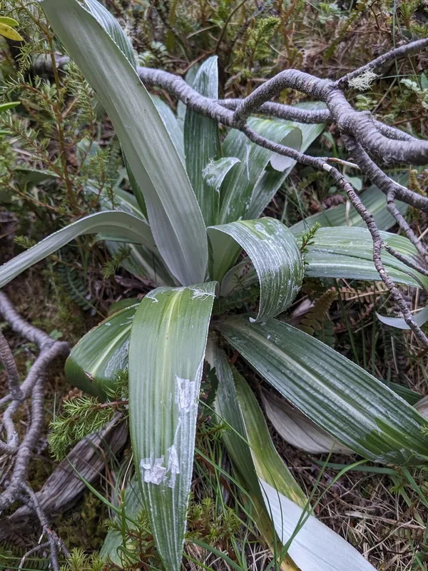
Large Mountain Daisy Celmisia semicordata -
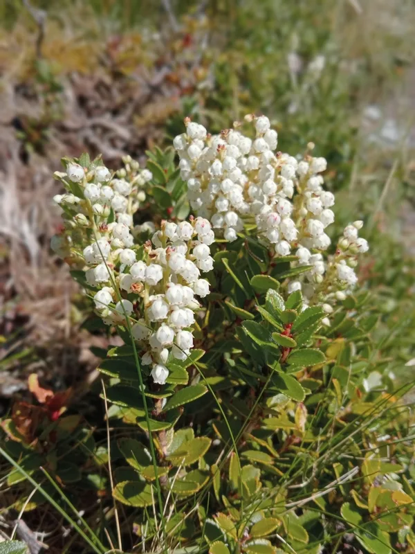
Scarlet snowberry Gaultheria crassa -
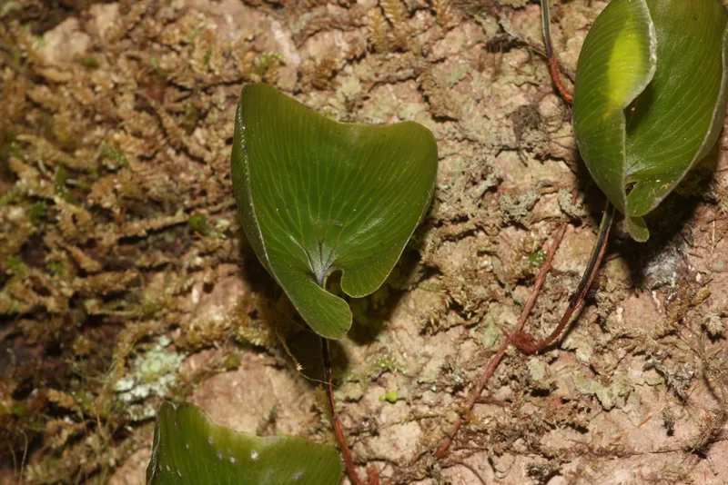
kidney fern Hymenophyllum nephrophyllum -
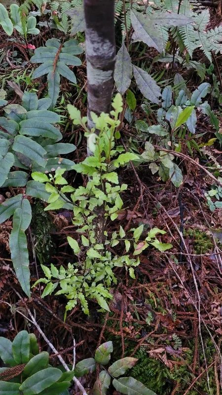
mountain toatoa Phyllocladus alpinus -
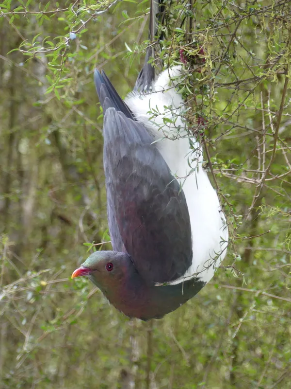
New Zealand Pigeon Hemiphaga novaeseelandiae -
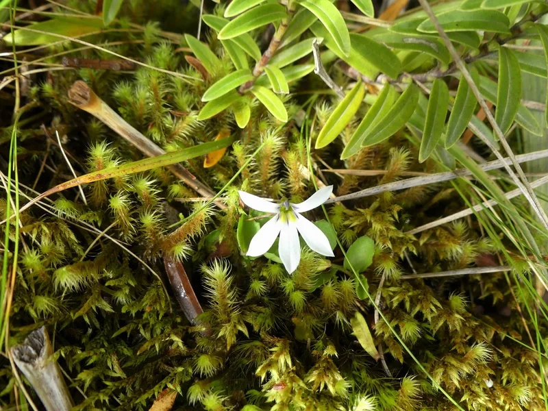
pānakenake Lobelia angulata
Field Notes · Ice & Glaciers lens · Franz Josef Glacier · −43.5235, 170.0881