Victoria Falls
Victoria Falls · Southern Province, Zambia
The Zambezi crosses miles of level rock without hurry, then meets a crack in it — and falls through, one straight line of weakness at a time, for as long as anyone has stood here to watch.
Why here
Stand at any viewpoint along the falls and you are looking at only the newest round of an argument the river has been having with this rock for longer than anyone has kept score. The Zambezi crosses a plateau of ancient lava that cooled, long ago, into blocks separated by cracks — and rivers, given a crack, will always take it over solid rock. Each fall along this stretch is the same river working a different crack in that same old grid: undercutting the rock below a lip until it finally gives way, then stepping back one line and starting the identical process against the next crack upstream. The zigzag gorge you can see from Knife Edge Bridge and the bridge crossing is not scenery — it is the discarded record of every position the falls have already abandoned on their way to where they stand now. This note keeps returning to that one shape, over and over: a straight drop, a sharp turn, another straight drop — the visible signature of water winning one long argument against rock, one crack at a time, in installments that are still being paid out today.
The story
The plateau here is old lava, laid down sheet after sheet long before the Zambezi existed to fall over it. When that lava finally cooled, it cracked into blocks along a grid of fractures, and when a river arrives on top of rock like that, it doesn’t choose its own path — it takes the path the rock already offers. Every fall along this stretch is the current river exploiting the next crack in that grid: undercutting a lip until it collapses, then retreating one line upstream and starting the same argument again against the next crack in the sequence. The zigzag gorge below the falls is nothing mysterious — it is simply the discarded record of where the falls used to stand.
The spray thrown off by that ongoing collapse waters its own strip of forest cut into otherwise dry country, part of why this stretch of the Zambezi is markedly richer in plant and animal life than the plateau around it.
People have had two responses to the river’s work: naming it, and building around it. Long before Europeans arrived, it was known locally as Mosi-oa-Tunya, “the smoke that thunders” — a description of the spray column, not the water. In 1855 a European traveler gave it the name still used internationally today. Decades later, engineers crossed the gorge itself at its narrowest point rather than fight the river directly. The record is otherwise quiet on how earlier communities used this stretch of river day to day.
The sites
Where the plateau lets go
3. Devil's Cataract
−17.9236, 25.8475
This is one of the falls’ several channels. The Zambezi does not drop here as one broad sheet the way it does further along the line; it is forced through a tighter seam in the old lava, and a river squeezed into a narrow gap always falls harder for its width than one spread wide. That concentrated force has worked the rock below into a deep, turbulent plunge pool, and the spray column here tends to stand taller and thicker than its neighbors even when the flow elsewhere looks modest. Every one of the falls along this stretch is really the same river meeting a different crack in the same old rock, and Devil’s Cataract is a clean example of what happens when the crack is tight: less width, more violence, faster work. Stand here and you are watching the river’s most concentrated argument with the plateau, in the smallest space it has to make it. The far bank belongs to Zambia; this stretch is one of the clearest places to see that the falls are not a single wall of water but a set of separate, related decisions the river keeps making.
Look at the width of this channel against the volume of spray it throws up. Notice how a narrow gap seems to make the water angrier than a wide one nearby — that is simple physics, not mood, and it is the same reason narrow slot canyons carve faster than broad ones.
- AccessShort walk
- ExertionEasy
- TimeAn hour
8. Main Falls
−17.9241, 25.8498
This section runs as a continuous curtain, the closest the Zambezi gets here to falling as one uninterrupted sheet rather than a set of separate channels. It is a useful place to reset your sense of scale before working out toward the narrower falls on either side: this is what the river looks like where the crack it is following runs long and straight, instead of broken into short offset segments. The rock face opposite is the far wall of the gorge the river has already cut and abandoned upstream of here — the same kind of cliff this current lip will eventually become, once this crack fails the way the older ones did. Nothing here is static; the curtain in front of you is simply the newest working edge of a process that has been retreating upstream, section by section, for longer than the falls have carried the name people use for them now. The width and constancy of the drop at this one spot make it the natural anchor for comparing every other stop on this note against.
Find the point where the falling water looks least broken — where it drops as one sheet rather than separate ropes or columns. That is where the crack in the rock below runs longest and straightest; note how the water changes character within a few hundred meters in either direction as the crack pattern changes with it.
- AccessShort walk
- ExertionEasy
- TimeAn hour
13 Horse Shoe Falls
−17.9254, 25.8550
Named for its shape, this section curves rather than running straight, which is a small clue that the crack it follows bends here instead of cutting cleanly across the plateau. Not every joint in the old lava runs parallel to its neighbors, and where two intersect or one curves, the river’s edge takes the same shape. This stretch also tends to run thinner than the wide sheets nearby, since a curved seam concentrates less of the total flow than a long straight one draining the same stretch of river above. In drier stretches of the year the horseshoe shape becomes easier to pick out, since less water is masking the rock behind it; in fuller periods it can disappear almost entirely into a single continuous roar shared with its neighbors. Either way, the shape itself is a small, readable record of what the rock underneath is doing — proof that the falls are not one uniform wall but a long negotiation between a river and whatever crack pattern it happens to be following at each point along its width.
Trace the curve of the falling water with your eye rather than looking straight down. A bend in the falls means a bend in the crack beneath it — try to guess, before reading further, whether the rock upstream of the bend looks older or newer than the rock just past it.
- AccessShort walk
- ExertionEasy
- TimeAn hour
14 Rainbow Falls
−17.9258, 25.8566
This is a tall single drop, and the spray thrown back up meets sunlight here to produce the color the name promises. That is a simple matter of geometry and timing rather than anything special about the water itself: a taller fall throws finer spray higher into the air, and fine, high spray is exactly what bends light into color. The height here is another way of reading the crack pattern below — a deeper, more sheer break in the rock than at the shallower sections nearby, letting the river fall further before it meets anything solid again. Because the drop is so vertical, this stretch can produce a near-continuous curtain of mist that soaks the footpath and the far viewpoints regardless of how the flow looks elsewhere along the line. It rewards patience: the rainbow itself depends on the sun’s angle, not on the water, so the same spot can look entirely different an hour apart.
Watch the spray rather than the falling water. If the sun is behind you, look for a rainbow low in the mist, and notice how it shifts position as you move a few steps — it isn’t fixed to any rock or landmark, only to the angle between you, the sun, and the water droplets.
- AccessShort walk
- ExertionModerate
- TimeAn hour
The gorge the river is still cutting
Knife Edge Bridge
−17.9265, 25.8616
This footbridge crosses a narrow spine of rock between the modern falls and the gorge the river has already carved below, and it earns its name honestly — the ridge it sits on is thin, exposed on both sides, and often running with spray. Standing here puts you inside the river’s argument rather than watching it from a distance: on one side, the current lip of the falls; on the other, the zigzag gorge that marks where earlier lips used to stand before each one was undercut and collapsed in turn. The bridge is a useful place to see that the gorge below does not run straight toward the horizon the way you might expect a river channel to. It bends sharply at intervals, each bend marking a different crack the falls once followed before retreating past it to the next one upstream. Spray here can be constant enough to soak through clothing quickly, which is itself a small demonstration of how much force is being spent just downstream of where you stand.
Look down into the gorge on the side away from the current falls and trace its path as far as visibility allows. Count the sharp bends rather than following the smooth curve you might expect — each bend is a fossil position of the falls, a place the river used to fall from before moving on.
- AccessShort walk
- ExertionModerate
- TimeAn hour
Boiling Pot
−17.9282, 25.8594
Below the falls, the river narrows hard and turns, and the water here does not simply flow past — it circles, folds back on itself, and surges up from underneath in slow, heavy boils that give the pool its name. This is what a river looks like when it has more force to spend than the channel can carry away smoothly: rather than speeding up in a straight line, it turns the extra energy into rotation. Debris and foam can spend long stretches turning in place here before the current finally releases them downstream. The pool sits well below the level of the plateau above, in the gorge the falls have already abandoned, which makes the walk down and back the most physically demanding stop on this note — worth it for a close, ground-level sense of how much the falls have already carved, and how violently the river still behaves once it is loose inside that older cut.
Watch a patch of foam or a floating leaf rather than the main current. Time how long it takes to complete one full circuit of the pool before finally breaking free downstream — that lag is the river working off energy it couldn’t spend falling straight down.
- AccessShort walk
- ExertionStrenuous
- TimeAn hour
Danger Point
−17.9270, 25.8592
This viewpoint sits at an exposed edge of the gorge with little to soften the drop, and the name is a plain, practical warning rather than a marketing flourish. It is a good place to look back along the line of cliffs you have already walked and see the falls and gorge together as one continuous system rather than a series of separate stops. From here the relationship is easiest to read: a straight run of cliff, a sharp turn, another straight run — the same zigzag pattern visible at Knife Edge Bridge, repeated at a larger scale in the gorge walls stretching away from you. The rock at your feet is the same old lava the falls are cutting through everywhere else on this note, exposed and undercut at this particular point because the river’s former position ran directly beneath it. Wind and spray can make the footing here more slippery than it looks, especially where rock has been polished smooth by centuries of mist.
From the edge, follow the gorge wall with your eye in both directions and count how many distinct straight segments you can pick out before the view is blocked. Each segment is a separate crack the river once followed; the corners between them are where it jumped to the next one.
- AccessShort walk
- ExertionModerate
- TimeAn hour
Marks the river has left behind
Victoria Falls Bridge
−17.9267, 25.8620
The bridge crosses the gorge where the walls stand close enough together that spanning them was practical rather than merely ambitious. It is worth reading as a direct answer to the river’s own work: engineers picked this crossing precisely because the Zambezi had already done the hard part, cutting a slot narrow enough to bridge instead of a valley wide enough to require something longer and lower. Stand on it and you are suspended over the same zigzag gorge visible from Knife Edge Bridge and Danger Point, at a spot where the walls are near-vertical on both sides — a good indication of how cleanly the rock breaks along its cracks rather than crumbling gradually. Spray from the falls upstream can drift as far as the bridge on a humid day, and the gorge below carries the river on toward the rest of its course, well downstream of the falls that made this crossing possible in the first place.
Look straight down at the gorge walls rather than out at the falls. Notice how vertical and clean-edged they are compared to a valley cut by ordinary weather and rain — that straightness is the signature of rock breaking along an existing crack rather than eroding grain by grain.
- AccessShort walk
- ExertionEasy
- TimeAn hour
Flood of 1958 Monument
−17.9119, 25.8643
This monument marks a flood remembered as exceptional even against a river whose normal seasonal swings are already large. It is a useful corrective to the idea that the falls’ story is only ancient history written in rock: the Zambezi’s argument with its channel is still ongoing, and some years it pushes harder than others in ways people who live along it remember and mark. Standing here after walking the gorge viewpoints, it is worth remembering that everything you have seen — the zigzag walls, the undercut lips, the deep plunge pools — was shaped gradually, over a great deal of time, but flood years like the one remembered here are when a disproportionate share of that shaping actually happens. Slow retreat and sudden flood are not two different stories; they are the same river working at two different speeds. The marker itself is modest, more a record kept by people than a monument built to impress, which fits a place where the more dramatic evidence is the landscape itself.
Read the marker, then turn back toward the gorge and try to picture the river at whatever higher level the flood it commemorates would have reached. Ask what a single flood season, rather than centuries of ordinary flow, might be capable of doing to rock this exposed.
- AccessShort walk
- ExertionEasy
- TimeAn hour
When it's best
The Zambezi’s flow here swings hard with the rains upstream, and that swing changes the whole character of the falls rather than just their volume. When the river is running high, the spray can thicken into a wall that hides the individual channels and named cataracts from each other almost entirely — dramatic to stand near, but not the best time to pick out the details this note keeps pointing to. As the river drops later in the year, the curtain thins enough that the separate falls, the crack lines between them, and the gorge walls below all become easier to read as distinct features rather than one continuous roar. Neither extreme is the “right” one — a full river shows you the force involved, a lower one shows you the structure that force has been working on — so the honest answer is that the choice depends on which story you want to see first. The gorge itself, and the zigzag walk between Knife Edge Bridge and the bridge crossing, rewards a visit in any season.
Go deeper
The names behind what you saw. The plateau the Zambezi falls through is mapped as Mesozoic volcanic rocks — mafic lava of Jurassic age, the kind geologists call flood basalt when it comes in stacked sheets like this. The crocodile sometimes visible in the calmer gorge pools is Crocodylus niloticus.
To read next. - “I.—Notes on the Geological History of the Victoria Falls” (Geological Magazine, 1905) — one of the earliest attempts to explain the falls’ zigzag retreat in print, useful for seeing how the modern account was built. - “The Geology of the Victoria Falls” (Journal of the Royal Anthropological Institute, 1936) — the fuller, still-cited account of how the gorge’s joints and lava layers shaped the falls’ history. - “New Fossil Elephant Remains from the Victoria Falls, Northern Rhodesia” (Transactions of the Royal Society of South Africa, 1939) — ties the gorge deposits to an older, wetter Zambezi and the animals that lived along it. - Wikipedia, “Zambezi” — places Victoria Falls as one moment in a much longer river’s course, with its own upstream and downstream falls. - Wikipedia, “Mosi-oa-Tunya National Park” — for how the falls and gorge are shared and named across the Zambia–Zimbabwe border.
The names behind what you saw
What lives here, and what it's called. Photographs from open collections — an aid to identification, not decoration.
-
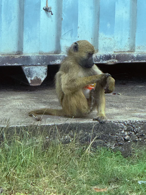
Chacma Baboon Papio ursinus -
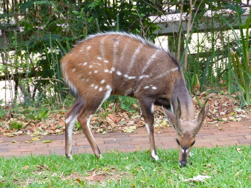
Southern Bushbuck Tragelaphus sylvaticus -
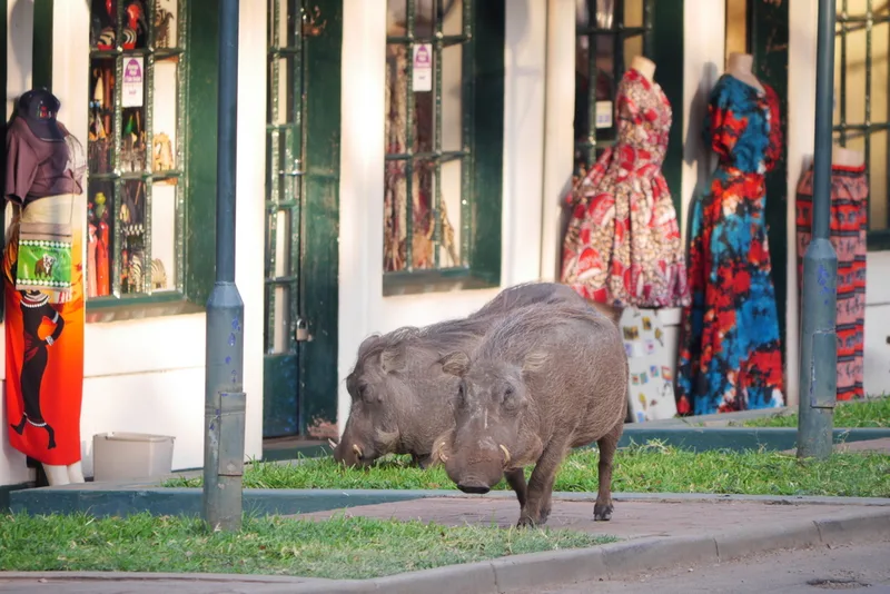
Common Warthog Phacochoerus africanus -
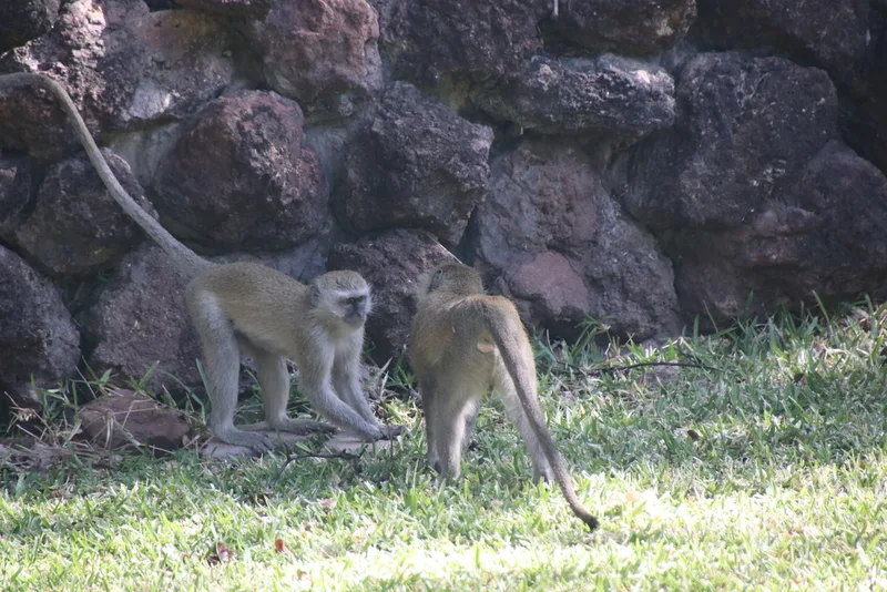
Vervet Monkey Chlorocebus pygerythrus -
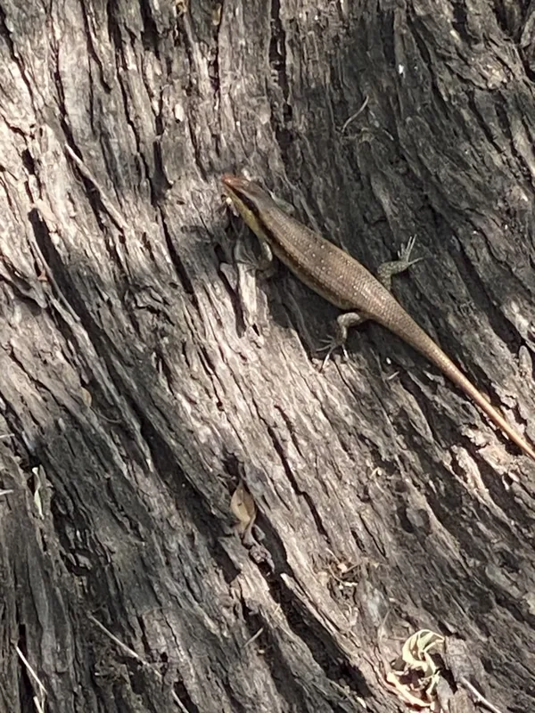
Wahlberg’s Striped Skink Trachylepis wahlbergii -
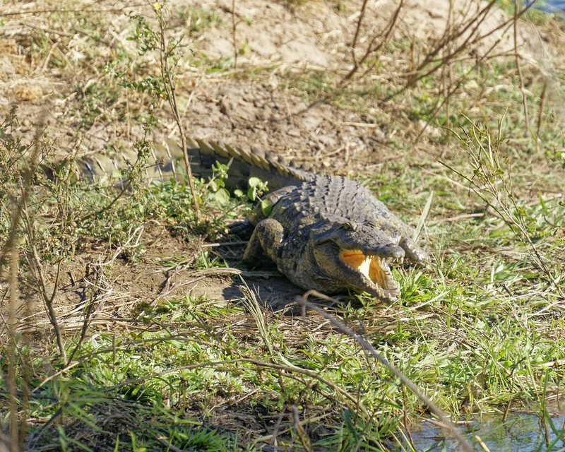
Nile Crocodile Crocodylus niloticus -
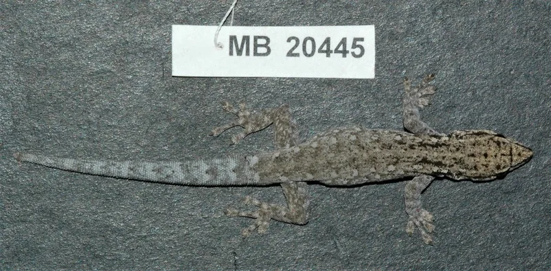
Chobe Dwarf Gecko Lygodactylus chobiensis -
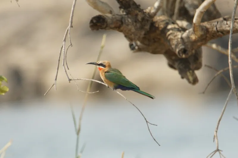
White-fronted Bee-eater Merops bullockoides -
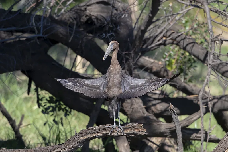
African Openbill Anastomus lamelligerus -
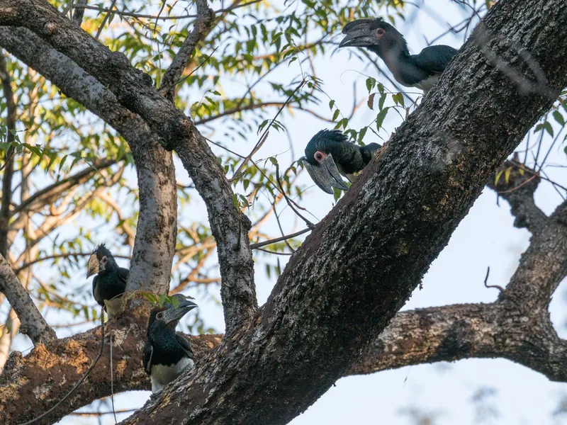
Trumpeter Hornbill Bycanistes bucinator -
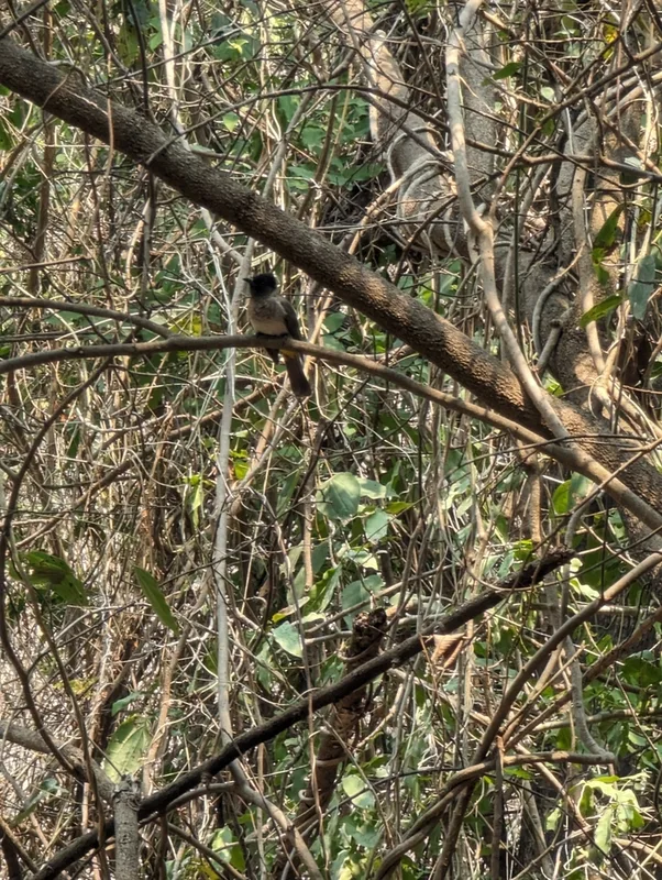
Common Bulbul Pycnonotus barbatus -
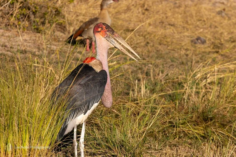
Marabou Stork Leptoptilos crumenifer
Field Notes · Rivers & Canyons lens · Victoria Falls · −17.8939, 25.8426