Vesuvius
A new mountain, still rising inside the broken ring of the older one it replaced.
Why here
The mountain you climb here is not the mountain that once stood here. Long ago a taller volcano rose on this spot, and in some violent chapter it emptied itself and fell inward, collapsing into a great broken ring. What you see now is two mountains at once — the curved, steep remnant crest of the old one, and a younger cone rising inside it, still active, still adding to itself.
Geologists have a plain description for this arrangement: a new cone growing inside the collapsed ring of an older volcano. Stand at the summit and it is laid out all around you, the ruined rim on one side and the ash-dark cone that replaced it on the other.
This whole note is a way of reading that double mountain. Everywhere you go — up the young cone, along the old rim, down where the eruptions reached the towns at its foot — you are watching the same thing: land still in the act of being made.
The story
Deep under the Bay of Naples, the plate carrying Africa presses against Europe, and that slow collision feeds a line of volcanoes along this coast. Vesuvius is one of them. It did not rise all at once. An older, higher mountain stood here first, built cone on cone until, in some violent chapter, it emptied itself and collapsed inward, leaving a broken ring of its former self. Inside that ring the mountain began again, raising the ash-dark cone that carries the name today. Its rock is dark and unusual — lava cooled from a melt rich in the light, alkali-bearing minerals that give this coast’s volcanoes their particular chemistry.
Life on new volcanic ground comes slowly, and the record here is thin; a few tough plants take hold on weathered ash, and the slopes belong mostly to birds now — swifts and swallows working the warm updrafts, a kestrel or a peregrine hanging almost still over the cone.
People have lived at the mountain’s foot for a very long time, close to ground that is rich precisely because it is volcanic. They have also learned what that nearness costs. Two towns at the mountain’s base, Pompeii and Herculaneum, were buried whole under its ash and debris and lay hidden for centuries before they were dug back out. Vesuvius keeps remaking the land beneath the people who live on it, and they keep living on it anyway.
The sites
A young cone inside an old ring
Mount Vesuvius
40.8226, 14.4292
This is the young cone, the mountain still at work. Where an older, higher volcano once stood, this one has risen inside the ruin it left behind — a steep pile of dark ash and cinder built by eruption after eruption, and not yet finished. A trail climbs the upper slope to the rim of its summit crater, a deep bowl bitten into the top of the cone.
Nothing you walk on here is old. The ground is loose, dark, sharp-edged rubble, thrown out of the mountain and barely weathered, the raw material of a peak that is still adding to itself. Look into the crater and you are looking down the throat of an active volcano — quiet for now, but only for now, on a coast that stays restless with earthquakes and eruptions.
Of all the stops in this note, this is the one where the idea behind it stops being an idea. You are standing on land that was made recently, by the same process still going on beneath your boots, and will be made again.
At the crater rim, look at the ground you crossed to get here — loose, dark, sharp cinder with almost nothing growing in it. That is fresh volcanic rubble, thrown out and dropped close to the vent, too young for soil to have formed. Then look down into the crater walls for thin wisps of steam rising from cracks; with luck you will catch the mountain quietly breathing.
- AccessShort walk
- ExertionModerate
- TimeHalf a day
Mount Somma
40.8217, 14.4261
Mount Somma is the other half of the story: the old mountain, the one that came before. It survives as a long, curved ridge — steep on its inner face, sloping away on the outside — that wraps partway around the young cone like the wall of a broken bowl. This is what is left of a taller volcano that stood here first and then collapsed inward, and the ridge you walk is a section of its former rim, still holding the curve of the vanished summit.
From up here the double mountain is plain to see. On one side falls the old, weathered, green-cloaked slope of a volcano long past its violent chapter; on the other rises the bare, ash-dark cone that replaced it. Two mountains, two ages, one place — the ruin and the thing built inside the ruin, side by side.
Somma is the quieter walk of the two, older ground with soil and trees, and the best vantage for understanding what Vesuvius actually is.
Stand on the ridge and trace its curve with your eye, both ways along the crest. Notice how it bends to enclose the younger cone — you are standing on a surviving piece of the rim of an older, larger mountain, and the arc of the ridge still remembers the circle that summit once made.
- AccessHalf-day hike
- ExertionModerate
- TimeHalf a day
The whole complex, at walking pace
Vesuvius National Park
40.8170, 14.4270
The park is the whole complex held in one boundary — the old rim, the gap behind it, and the young cone rising from that gap. Its trails are the way to walk the story on foot rather than see it from a single point: paths run along the weathered outer slopes, into the trough that separates the old mountain from the new, and up onto the cone itself.
Walking the gap between the two is the quiet revelation. Behind you the softened, wooded rim of the collapsed mountain; ahead the raw, dark flank of its replacement, with barely a plant on it — the same place, centuries apart, in a few steps.
The park also protects how this volcanic ground recovers: bare cinder first, then tough scattered plants, then, given long enough undisturbed, real woodland on the older slopes. It is the one stop that lets you move through the whole idea at walking pace instead of taking it in all at once.
Walk into the low ground between the old rim and the young cone and look at your feet, then at each wall of the trough. On one side the rock is weathered and greened, soft with age; on the other it is dark and raw and nearly bare. The floor you cross is the seam between an old mountain and the new one growing out of its ruin.
- AccessHalf-day hike
- ExertionModerate
- TimeA full day
Where the making reached the towns
Pompeii
40.7506, 14.4897
Pompeii is where the making of this land reached people, and where you can see the eruption itself as rock. The town sat at the foot of the mountain and was buried whole under what the volcano threw out — a deep blanket of pale pumice and grey ash that sealed the streets and stayed for centuries before the town was dug back out from under it.
Through the volcanic lens, the ruins are almost beside the point; the real exhibit is the material that covered them. In the walls of the excavation you can read the eruption as a layer of ground, laid down in a single catastrophic episode — exactly the kind of fresh volcanic deposit this whole note is about, only here it fell on a living town.
It is the clearest place to feel the stakes of a mountain that is still building itself: the same process that raises the cone can, and did, bury a city at its base.
At the edge of an excavated street, look up at the height of the surrounding ground above the old Roman paving. That thickness of pale pumice and grey ash is a single eruption made solid — the volcanic blanket that buried the town, now cut through so you can stand at the bottom of it.
- AccessDrive-up
- ExertionEasy
- TimeA full day
Herculaneum
40.8061, 14.3475
Herculaneum is Pompeii’s smaller companion in the same disaster, closer to the mountain’s seaward side. It too was buried by the eruption, but under a different and deeper kind of volcanic deposit, packed so hard and so high that the modern town now stands well above the ancient one.
That height difference is the lesson here. To reach the old streets you look down into a deep, quarried pit, and the sheer wall between the Roman rooftops and the present-day pavement is all volcanic material — the depth the mountain added to the coast in one event.
Where Pompeii shows the eruption as a layer you can read across a field, Herculaneum shows it as sheer thickness, a measure of how much new ground a single episode can lay down. Standing at the rail and looking from the modern edge down to the excavated town is a way of seeing, in one glance, how much land the mountain made when its eruption reached this shore.
Stand at the railing above the site and look from the modern street down to the ancient one at the bottom of the pit. Measure that drop with your eye. The whole wall between them is volcanic deposit — a plain measure of how much new ground the mountain piled onto this coast in a single eruption.
- AccessDrive-up
- ExertionEasy
- TimeHalf a day
When it's best
High on the cone, early spring is still a cold-season affair — the nights up top can sit right around freezing even as the lowlands warm, so the summit walking is easier and safer once the season has turned. Rain is light through the spring, and clear days open the long view over the bay that makes the climb worth it. The slopes are busiest with birds in the warmer months, when swifts and swallows pour over the ridge on the updrafts and a kestrel hangs above the cone. There is no bad season for the geology; the mountain reads the same in any weather, and a clear, mild day is all it asks.
Go deeper
The names behind what you saw. The dark young lava of the cone is Quaternary tephrite, with basanite and lesser phonolite and leucite-rich rocks mixed through it; the older volcanic rock beneath the complex dates to the Pliocene. The type of mountain itself — a young cone rising inside the collapsed ring of an older volcano — is a somma-stratovolcano, and Mount Somma is the remnant rim the term describes here.
To read next. The vetted reading list for this region is still short, so this is an honest hand-off to the sources behind the note: - Enhancing Social Resilience Through Fruition of Geological Heritage in the Vesuvio National Park (Geoheritage, 2019) — on how the park turns its volcanic geology into something the public can walk, read, and value. - Wikipedia, Mount Vesuvius — the somma-stratovolcano setting, and the collapse of an earlier, higher structure that shaped what you see. - Wikipedia, Mount Somma — the old rim treated as its own mountain, and its place in the wider Campanian volcanic arc. - Macrostrat — the mapped rock units of the complex, if you want to see the lava sorted by age and type. - eBird — a living record of what flies these slopes now, useful for timing the swifts and raptors of the warm months.
The names behind what you saw
What lives here, and what it's called. Photographs from open collections — an aid to identification, not decoration.
-
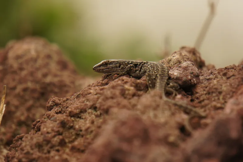
Italian Wall Lizard Podarcis siculus -
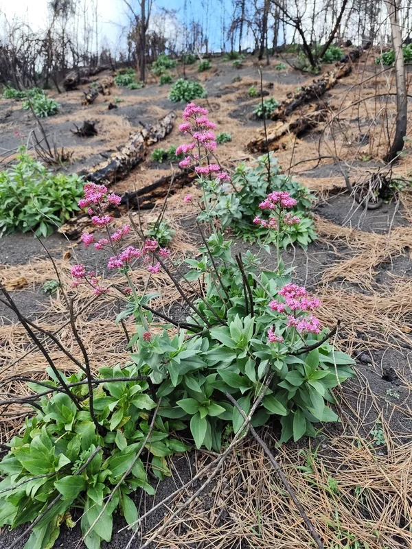
Red Valerian Centranthus ruber -
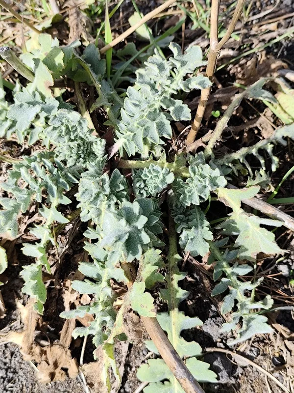
Yellow Horned Poppy Glaucium flavum -
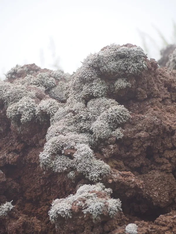
Variegated Foam Lichen Stereocaulon vesuvianum -
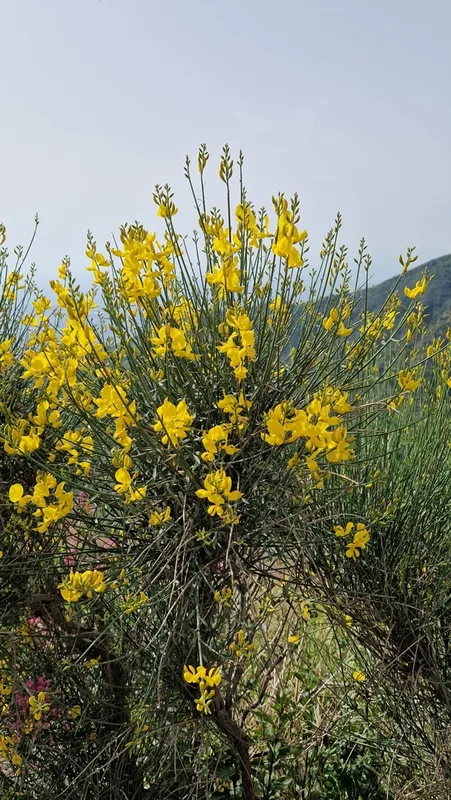
Spanish Broom Spartium junceum -
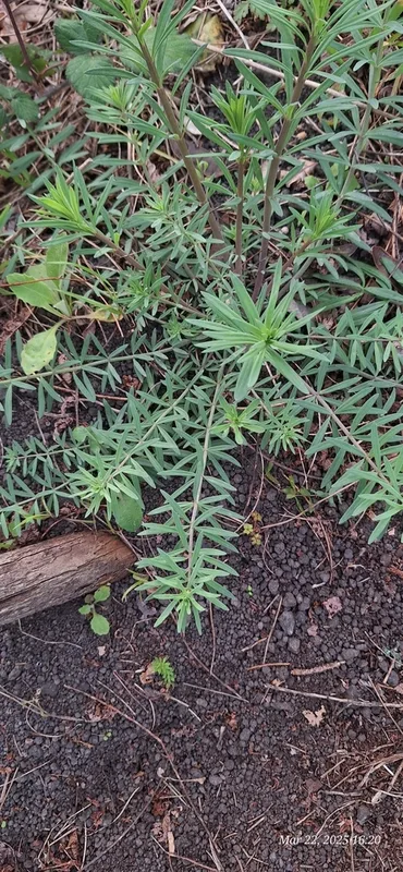
Purple Toadflax Linaria purpurea -
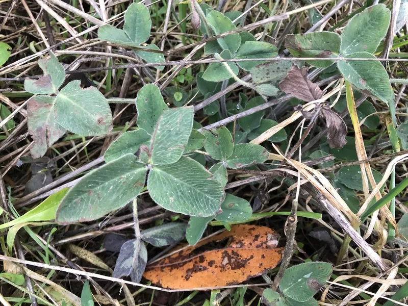
Red Clover Trifolium pratense -
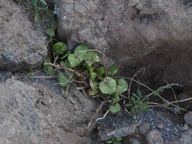
French Sorrel Rumex scutatus -
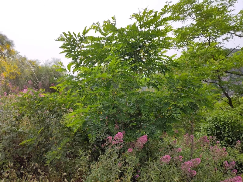
black locust Robinia pseudoacacia -
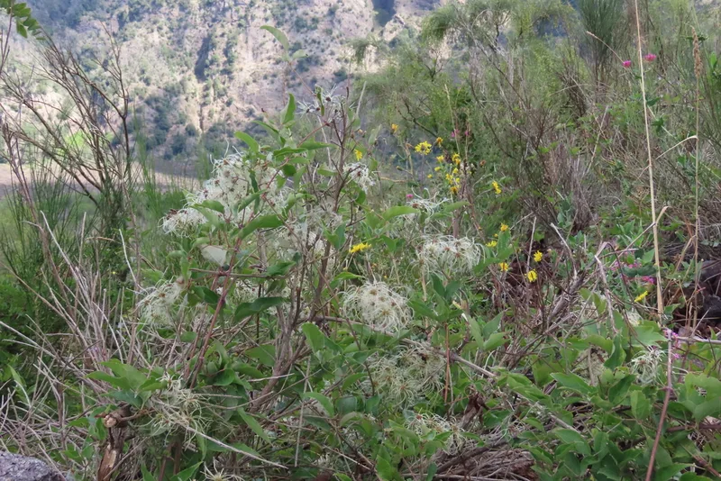
Old man's beard Clematis vitalba -
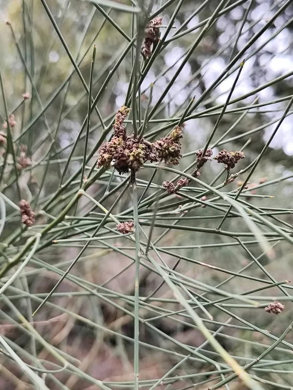
Mount Etna Broom Genista etnensis -
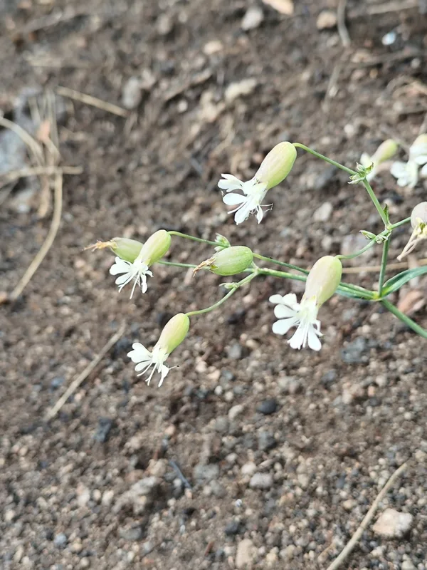
bladder campion Silene vulgaris
Field Notes · Volcanic lens · Vesuvio · 40.8214, 14.4262