Valley of Fire
Valley of Fire State Park · Nevada, USA
Sandstone remembers the wind that first moved it, then the water that cut it open.
Why here
Valley of Fire is a desert of red sandstone made visible by erosion. The rock began as sand, hardened, and later rose into a landscape where wind and water could expose its cross-bedded layers. The color draws the eye, but the useful detail is in the shape: fins, domes, and hollows are all different answers to the same weather. Walk from a mesa to the smaller forms and the valley becomes a history of material moving twice, first as sediment and later as eroded rock. Bighorn sheep and pricklypear use the spaces between those forms. The desert is an open book because the pages are still being turned.
The sites
Sandstone opened by weather
Silica Dome
36.4518, −114.4988
Silica Dome is a close view of sandstone shaped into a rounded form. Look for the layers within the larger mass. Their angles preserve the way sand was deposited before the rock became part of the desert. Water then found weaknesses and softened the edges. The dome is not a single event but a sequence: sand, stone, uplift, and erosion. Stay with one face long enough to see its grain and its larger curve together.
Find a slanted layer inside the dome and follow it toward the surface. The angle is a trace of the original sand beds, preserved in the rock.
- AccessShort walk
- ExertionEasy
- TimeAn hour
Beehive Rock
36.4091, −114.5503
Beehive Rock shows how wind and water can turn a solid sandstone mass into a surface of hollows and ridges. The rock keeps its red color, but the details are all weathered edges. Look at the upper curves and the lower pockets. Water gathers where it can, while wind abrades exposed faces. The desert’s most expressive forms are records of those small differences in exposure.
Compare a sheltered hollow with an exposed ridge. The hollow catches water and dust, while the ridge receives more wind and keeps a sharper surface.
- AccessShort walk
- ExertionEasy
- TimeAn hour
Desert from above
Baseline Mesa
36.4483, −114.4775
Baseline Mesa gives the red rock a broader setting. From above, fins and domes appear as pieces of a continuous sandstone country, and washes draw pale lines through the lower ground. The view makes water’s role clear without requiring a river. A storm can carry sediment through a wash and leave the mesa walls standing. The desert keeps its large forms because different materials resist weathering at different speeds.
Trace a wash from the mesa toward the lower valley. Its course is the present water route through a landscape built from older sand.
- AccessDrive-up
- ExertionEasy
- TimeAn hour
Blue Point
36.3905, −114.4408
Blue Point opens a longer view of the valley’s sedimentary layers. The desert floor carries loose material, while the mesas hold older sandstone above it. Look for the repeated transition from solid wall to open wash. Each is part of the same erosion system, with weather carrying pieces downhill and leaving resistant rock as the higher forms. The landscape reads like a cross-section when you let the eye move from horizon to ground.
Find one high wall and the pale fan or wash below it. The lower ground is the material the wall has shed and water has carried outward.
- AccessDrive-up
- ExertionEasy
- TimeAn hour
Life among the fins
Overton Mesa
36.5219, −114.4661
Overton Mesa brings the living desert into the sandstone story. Bighorn sheep use steep ground and broken rock, while pricklypear keeps a lower profile among the exposures. Their locations follow the forms of the mesa. Animals need ledges and escape routes; plants need soil pockets and water that does not immediately run away. Look at the rock as habitat, not only as scenery. The desert’s life is arranged by the same erosion that shaped the view.
Scan the broken slope for a bighorn sheep before looking across the open flat. Steep rock provides both travel and shelter that the flat desert cannot.
- AccessShort walk
- ExertionModerate
- TimeHalf a day
When it's best
Cooler seasons are easiest for exploring the exposed sandstone, with spring bringing a chance of flowers and active wildlife. Summer heat makes early hours important. Storm light can deepen the red rock and slick the surfaces, while winter shadows make the forms stark. Stay attentive to heat, shade, and footing as you move among the fins.
Go deeper
The names behind what you saw. The main rock in the payload is Aztec Sandstone. Life includes bighorn sheep, Ovis canadensis, and beavertail pricklypear, Opuntia basilaris.
To read next. - The geological map of Valley of Fire — for the sandstone and its desert landforms. - The park’s natural-history material — for bighorn sheep and desert plants among the rocks.
The names behind what you saw
What lives here, and what it's called. Photographs from open collections — an aid to identification, not decoration.
-
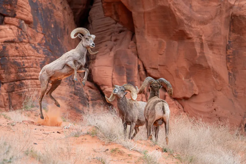
Bighorn Sheep Ovis canadensis -
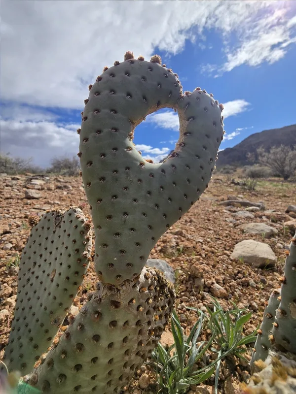
Beavertail Pricklypear Opuntia basilaris -
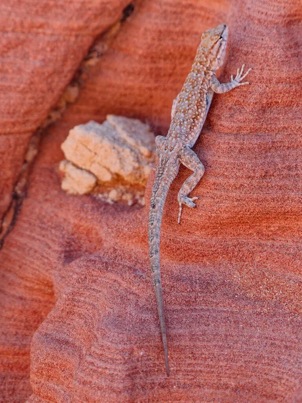
Common Side-blotched Lizard Uta stansburiana -
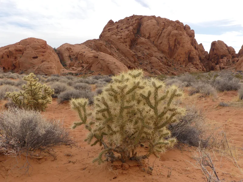
Silver Cholla Cylindropuntia echinocarpa -
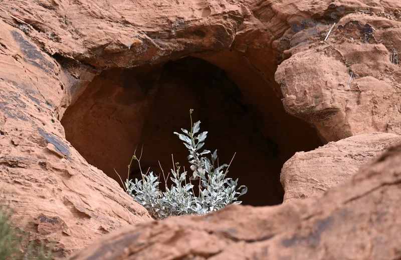
Brittlebush Encelia farinosa -
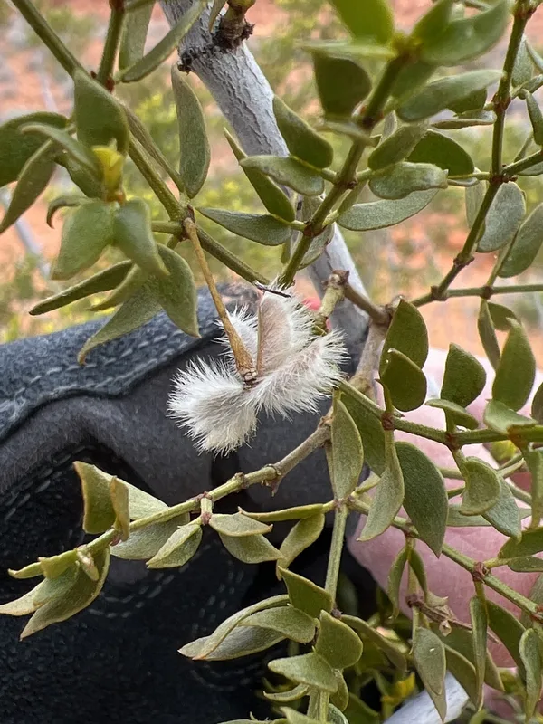
Creosote Bush Larrea tridentata -
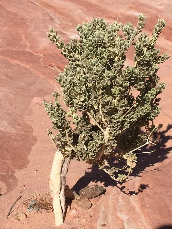
Utah Mortonia Mortonia utahensis -
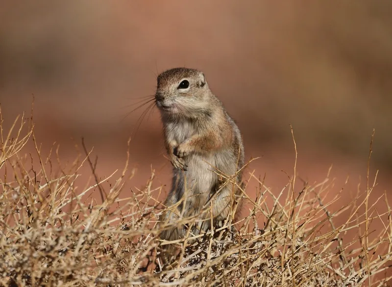
White-tailed Antelope Squirrel Ammospermophilus leucurus -
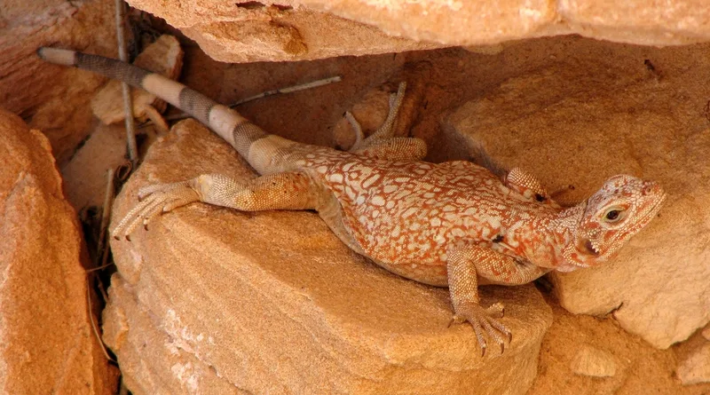
Common Chuckwalla Sauromalus ater -
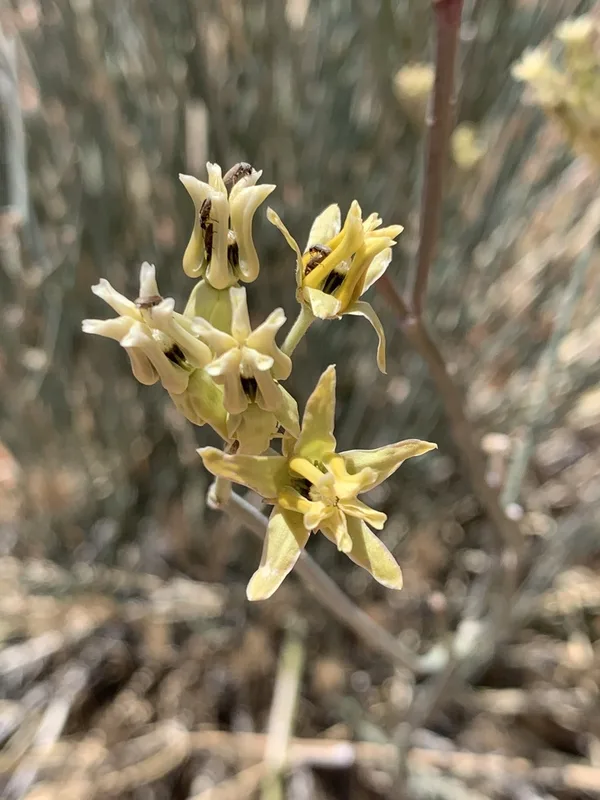
rush milkweed Asclepias subulata -
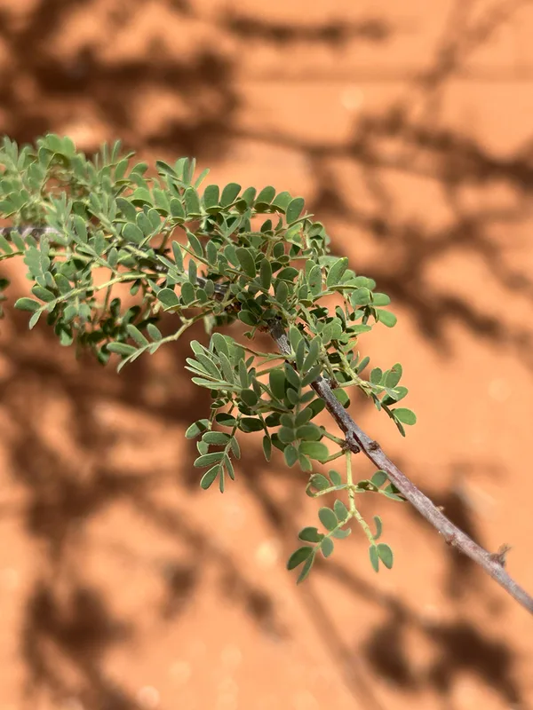
Catclaw Acacia Senegalia greggii -
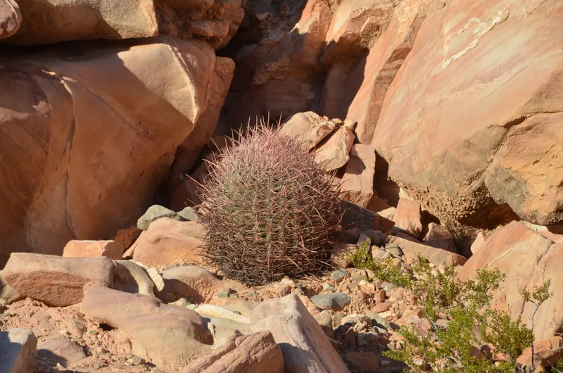
California Barrel Cactus Ferocactus cylindraceus
Field Notes · Desert & Deep Time lens · Valley of Fire State Park · 36.4989, −114.5341