Torres del Paine
Torres del Paine · Magallanes, Chile
Half of what makes this park look the way it does is ice that hasn't finished working.
Why here
Stand at the shore of Lago Grey and you’re not looking at a finished landscape — you’re watching one still being made. Icebergs drift past, calved that same week from a glacier that is, at this very moment, still pushing down out of the mountains behind it. That’s the thing to hold onto here: almost everything dramatic about Torres del Paine’s shape — the sheer granite towers, the horn-shaped peaks, the wide U-cut valleys, the strange pale-turquoise color of half the lakes — was carved, ground, or tinted by ice, and a meaningful amount of that ice is still here and still working. Older glaciers finished their sculpture long ago and retreated, leaving only the shapes behind for you to read like a story. Younger, smaller ones — hanging off cliff faces, tucked into shaded valleys — are still actively shrinking, cracking, and occasionally falling while you watch. This note follows both halves: the ice that already left, and the ice that hasn’t.
The sites
The ice that's still there
Mirador Grey
−51.0022, −73.1826
From this overlook the glacier fills the far end of the lake, a broad tongue of blue-white ice pushed down out of the mountains until it finally meets water. Watch it long enough and you’ll see why the lake below is scattered with icebergs of every size, from gravel-sized chips to house-sized blocks: ice this heavy cannot stop at the shoreline. It keeps flowing, cracks under its own weight, and where it meets the lake, pieces break away and float free — calving, in the plain sense of the word. The color does the rest of the explaining. Compressed glacier ice looks blue because it has squeezed out the air bubbles that make new snow look white; the deeper and older the ice, the more of that blue survives. What you’re looking at is not a static wall of ice but the visible end of a slow river, still arriving, still leaving pieces behind. Come back on a still day and you may hear it before you see anything change — a crack, then a low roll of sound crossing the water, evidence that a piece just let go somewhere out of sight.
Watch the face of the glacier for several minutes rather than glancing once. Look for a patch of deep, saturated blue rather than white — that’s older ice that has had the air pressed out of it. If the water is calm, listen for a crack or a low rumble: a sign that a piece of the glacier has just broken away somewhere along the face.
- AccessShort walk
- ExertionModerate
- TimeHalf a day
Mirador Isla de los Hielos
−51.1110, −73.1159
The name of this viewpoint gives away what you’re here for: a lake surface broken up by drifting ice rather than open water. Icebergs calved from the glacier upstream travel down the lake on wind and current, grounding on shallows or clustering against the shoreline until they finally melt out of existence. Each one is on a one-way trip — nothing here replaces them except more ice breaking free upstream. Look closely and you’ll notice the bergs aren’t all the same color: some startling blue, some milky white, some grayed with rock dust the glacier picked up scraping along its bed. That grit isn’t decoration. It’s the same material — ground-up stone — that gives many of the park’s glacial lakes their pale, chalky-turquoise cast, suspended finely enough in the water to scatter light instead of sinking. Standing here, you’re looking at two stages of the same process at once: the ice still holding together as a berg, and the fine rock flour already dispersed invisibly through the water around it.
Pick one iceberg and watch its color rather than its shape. A grayish, gritty tint means the ice picked up rock ground from the floor of the glacier on its way down; find a berg that looks purer blue or white by comparison and you’re looking at ice that broke from higher, cleaner layers.
- AccessShort walk
- ExertionEasy
- TimeAn hour
Mirador Lago Grey
−51.0401, −73.1472
From here the lake opens out below you, long and pale, walled in by steep slopes on both sides. The shape is the giveaway: this is a glacially carved trough, cut by ice that once filled the whole valley floor to ceiling and ground it into the deep U you can trace with your eye from wall to wall. Rivers only manage a V; only ice, moving as a solid mass and scouring rather than trickling, can leave a valley this wide and flat-bottomed. The glacier that did the carving has since retreated up-valley, out of sight from this exact spot, leaving the lake to fill the space it vacated. Everything downstream of here — the river, the wetlands, eventually the sea — is fed by water that started as ice. Look at the far walls of the valley for changes in vegetation or bare rock; these can mark how far up the slopes the ice used to reach before it thinned.
Trace the shape of the valley with your eye from one wall to the other. A rounded, flat-bottomed U rather than a narrow V is the signature of ice, not water — only a glacier is wide and heavy enough to grind a valley into that shape.
- AccessShort walk
- ExertionEasy
- TimeAn hour
What the ice carved
Mirador Cuernos
−51.0483, −73.0123
The Cuernos — the horns — are the clearest lesson in this park on how ice sculpts a mountain rather than simply wearing it down. A horn peak forms when several glaciers gnaw into the same mass of rock from different sides at once, each carving its own bowl-shaped hollow, until what’s left between them is a narrow, faceted spire — the leftover core nothing had a chance to erode. The dark cap visible on parts of these peaks is old seafloor sediment, hardened over a very long stretch of time before this land was ever above water, let alone glaciated. Everything about the shape you’re looking at — the sharpness, the layering, the near-vertical faces — is the result of ice removing material rather than depositing it. This is erosion working like a sculptor, not a bulldozer.
Look for the line partway up where the rock changes from pale to dark. That boundary marks two different rock types meeting; ice exposed it by carving away whatever once sat on top, leaving the join visible from the outside for the first time.
- AccessHalf-day hike
- ExertionModerate
- TimeHalf a day
Valle del Francés
−51.0082, −73.0530
This valley runs straight and steep-walled between two mountain groups, and if you spend an afternoon here you’ll likely hear why it’s worth the walk before you see it: a distant crack, then a rumble, as ice or snow lets go somewhere on the slopes above. Hanging glaciers cling to the upper walls on both sides — smaller ice bodies stranded high on the cliffs, too small or too steep to reach the valley floor the way the larger glaciers elsewhere in the park do. When a piece breaks free, it doesn’t creep; it falls, often as a small avalanche, and the sound carries a long way in a quiet valley. The valley floor itself, wide and flat between walls that rise almost straight up, is doing the same work the lake basins elsewhere in the park are doing: showing where a much larger glacier used to sit, thick enough to fill the space from wall to wall before it thinned and withdrew. What hangs above now is what’s left of that larger mass, stranded on ledges too high and too small to keep flowing.
Stop walking for a few minutes and just listen. In a quiet stretch of the valley, an occasional crack or rumble from the slopes above is ice or snow breaking loose from one of the hanging glaciers — a sound worth waiting for, since you can rarely see the fall itself before you hear it.
- AccessHalf-day hike
- ExertionStrenuous
- TimeA full day
Where the ice still rules
Mirador Británico
−50.9827, −73.0538
This is as far into the mountains as most people get on foot, and it earns the walk: an amphitheater of peaks with hanging ice on nearly every wall around you. From most viewpoints in the park you see one glacier, or one face of one mountain. From here you’re standing in the middle of a ring of them, close enough to watch cloud shadow move across individual ice patches on rock faces that from a distance would look identical to snow. It’s a useful spot to notice the difference between the two: snow is soft, seasonal, and disappears in a thaw; the pale-blue, denser ice clinging to ledges and gullies around you has survived enough summers to compact into something closer to solid, something that persists rather than melts away each year. Not every icy patch on these walls will still be there in a hundred years, and not every one is retreating at the same pace — some little glaciers hang on in shaded gullies long after open slopes nearby have gone bare. Give this spot time rather than a glance; the light changes faster than the ice does, and both are worth watching.
Scan the surrounding walls and try to tell snow from glacier ice. Snow looks matte and sits in a soft blanket that follows the slope; glacier ice, where you can see it, looks denser and often faintly blue, wedged into gullies and ledges where it has persisted year after year rather than melting off each summer.
- AccessHalf-day hike
- ExertionStrenuous
- TimeA full day
Cerro Paine Grande
−50.9951, −73.0867
This is one of the massif’s tallest peaks, and one glance at its silhouette explains where a lot of the park’s ice comes from. Its upper slopes and ridgelines hold onto snow and ice long after the surrounding lower peaks have gone bare for the season, simply because height means cold, and cold is what keeps ice from becoming water. Several of the glaciers you’ll see elsewhere in the park — feeding lakes, filling valleys, hanging on cliff faces — trace back to ice fields on or near this mountain’s flanks. Think of the peak less as a single feature and more as a kind of reservoir: snow accumulates high on its slopes, compacts into ice under its own weight over years, and then begins the slow work of flowing downhill as a glacier, following whichever valley offers the easiest path. Everything downstream — the carved troughs, the icebergs, the meltwater rivers — starts, in some sense, up there, out of sight from most of the trails below.
Look for the line where bare rock gives way to persistent white on the upper slopes. That boundary — higher in some spots, lower in shaded ones — roughly marks where it stays cold enough, even in warmer months, for snow to survive long enough to become glacier ice rather than melting away.
- AccessShort walk
- ExertionEasy
- TimeAn hour
Paso John Garner
−50.9409, −73.1857
The climb to this pass is a long one, and the view from the top is the reward the whole route has been building toward: for the first time, the mountains part and you’re looking out over ice that has nothing to do with any single glacier you passed on the way in. What spreads out below and beyond is a far larger, flatter mass of permanent ice — a highland of white that swallows the horizon rather than filling a single valley. Every glacier you’ve walked past elsewhere in the park is best understood as an outlet of something like this: an arm of ice pushed out from a much bigger reserve, squeezed down a valley by gravity until it thins, cracks, and eventually gives way to bare ground or open water. Weather changes fast up here, and the ice field makes its own; a clear window can close within the hour. When it’s open, though, this is the one place in the park where the scale of the ice stops being abstract — where you can see, all at once, how much more of it there is than what reaches down to where people usually stand.
On a clear stretch, look past the nearest ridgeline rather than at it. Where the land seems to just run out into flat white rather than rising into another peak, you’re looking at the edge of a much larger ice mass than any single glacier — worth noting how quickly clouds can close that view back up.
- AccessExpedition
- ExertionStrenuous
- TimeWorth two days
When it's best
There’s no bad season to see the ice itself — glaciers don’t take a season off, and the biggest ones here are visible in some form year-round. What changes is how comfortable you’ll be looking at them, and how clearly. The warmer months bring steadier trail access and longer daylight for reaching the farther viewpoints, but also the strongest and most unpredictable Patagonian wind, which can close out a clear view of the high ice within an hour. The cooler shoulder months tend to be calmer and quieter, with a real chance of stiller air over the lakes — good for both listening for calving and getting a clean reflection — though access to the higher passes gets less reliable as the weather turns. If timing a trip around one thing, a stretch of calm, cold, clear weather matters more than the specific month; ask locally what the last few weeks have been doing, since conditions here vary more year to year than the calendar does.
Go deeper
The names behind what you saw - The dark rock capping parts of the Cuernos and other peaks belongs to what geologists file as Mesozoic–Cenozoic sedimentary rock — marl, shale, and sandstone laid down as seafloor sediment over a very long stretch of time, from roughly the age of dinosaurs into a far more recent geological past, long before any of it was lifted or carved. (macrostrat:unit:3188411) - Paine, the name behind the whole massif, means “blue” in the language of the Aonikenk (Tehuelche) people who lived in this region — worth remembering next time you’re standing over one of the pale, glacier-fed lakes.
To read next - Torres del Paine National Park (Wikipedia) — the clearest overview of the park’s geography and its 1959 founding, a good map to have before going deeper on any single feature. - Cordillera Paine (Wikipedia) — a reminder that even the mountains’ exact elevations are contested; a useful check against over-trusting any single number you read about this range. - Hiking in Chile (Wikipedia) — places Torres del Paine’s glaciers and fjords in the context of the extraordinary range of climates packed into one country. - Nordenskjöld Lake (Wikipedia) — follows the water, and the ice that feeds it, one step further downstream from the viewpoints in this note.
The names behind what you saw
What lives here, and what it's called. Photographs from open collections — an aid to identification, not decoration.
-
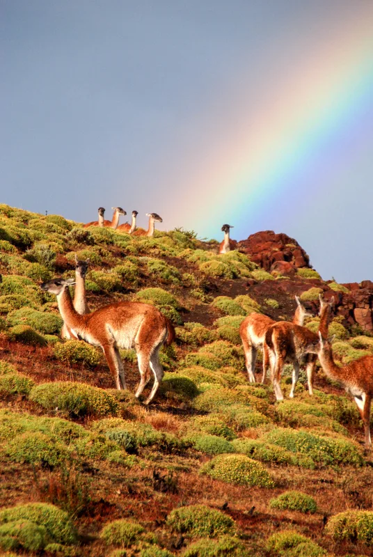
Guanaco Lama guanicoe -
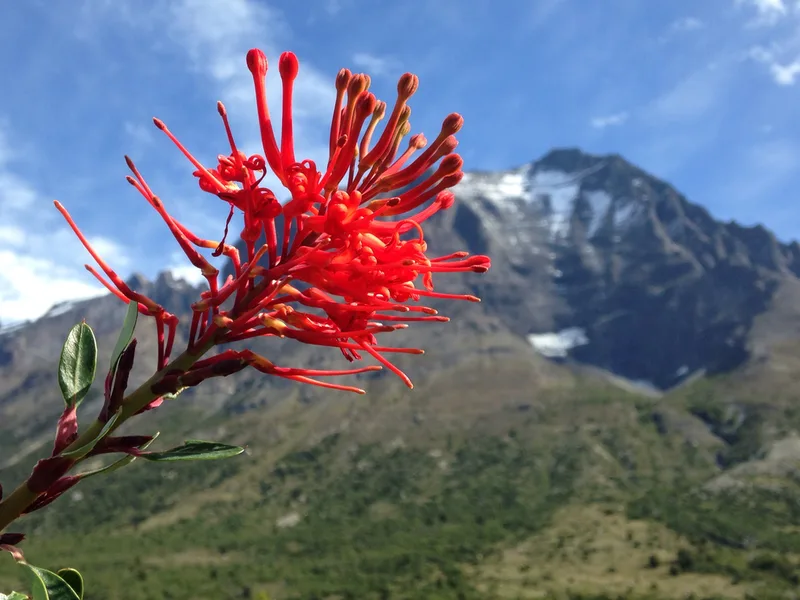
Chilean fire bush Embothrium coccineum -
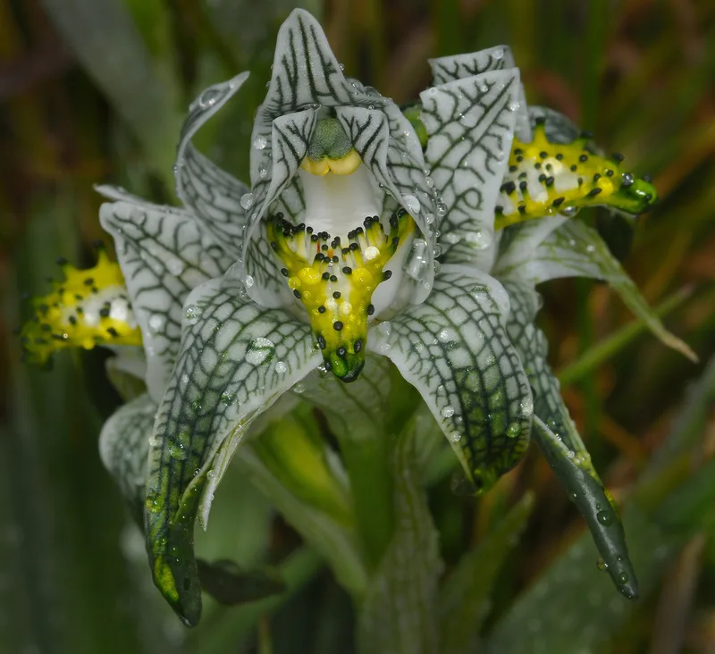
Porcelain orchid Chloraea magellanica -
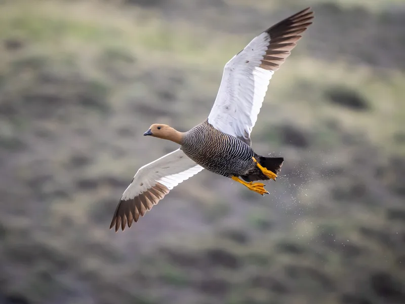
Upland Goose Chloephaga picta -
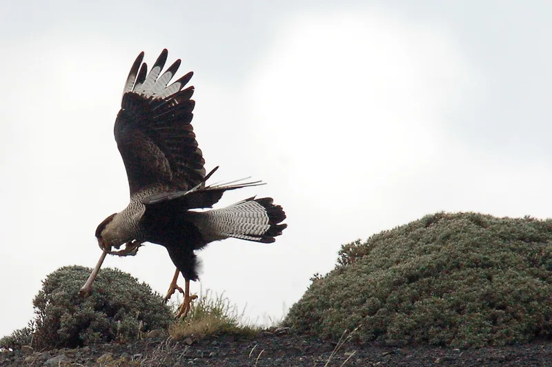
Crested Caracara Caracara plancus -
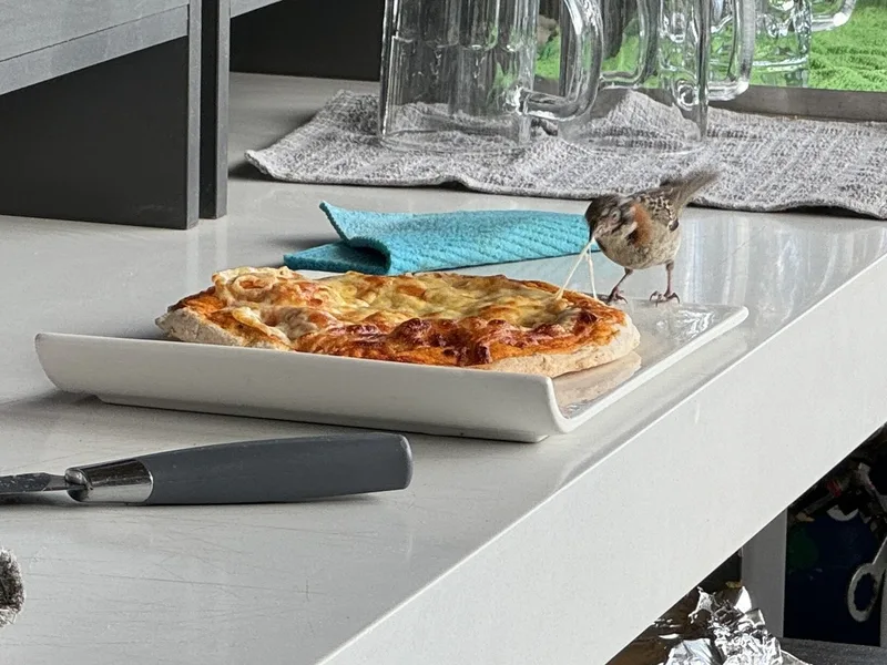
Rufous-collared Sparrow Zonotrichia capensis -
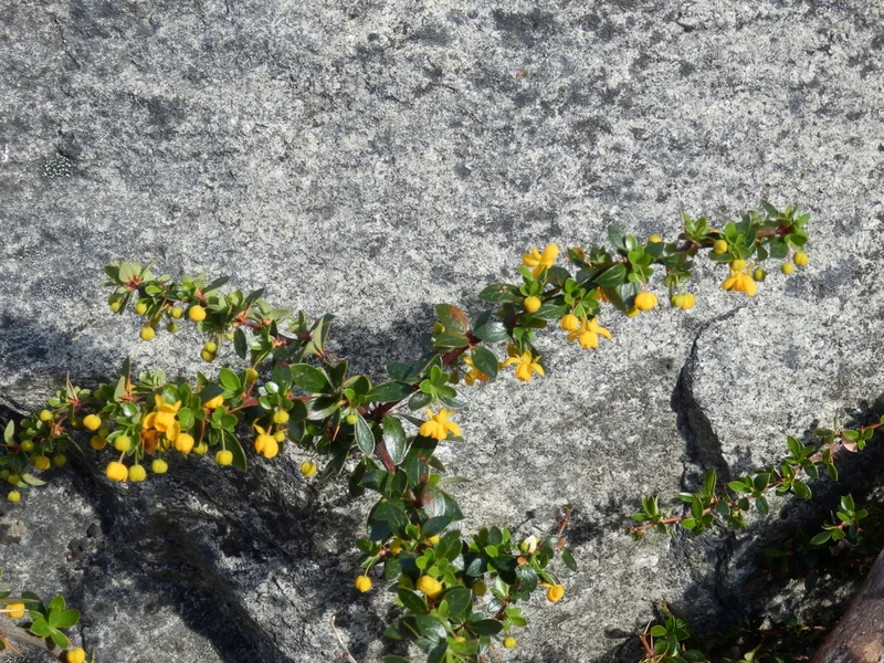
Calafate Berberis microphylla -
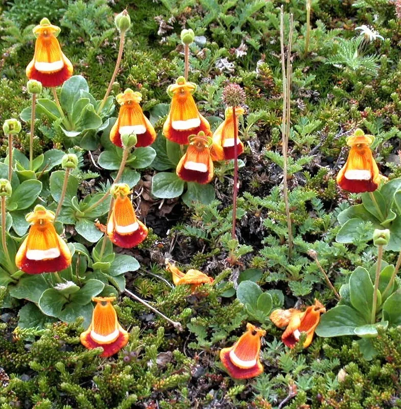
Darwin's Slipper Calceolaria uniflora -
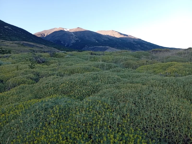
Mother-in-law Cushion Azorella prolifera -
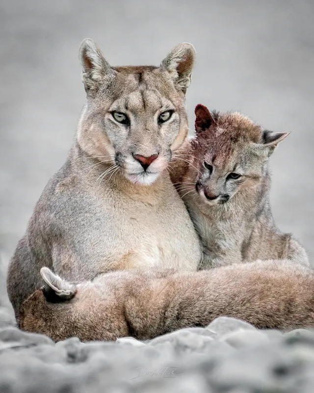
Mountain Lion Puma concolor -
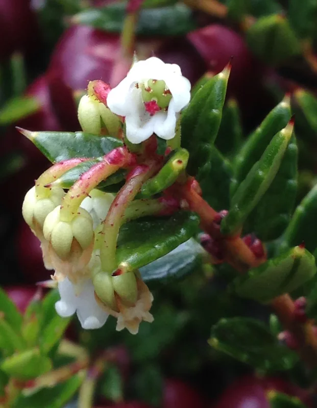
Prickly Heath Gaultheria mucronata -
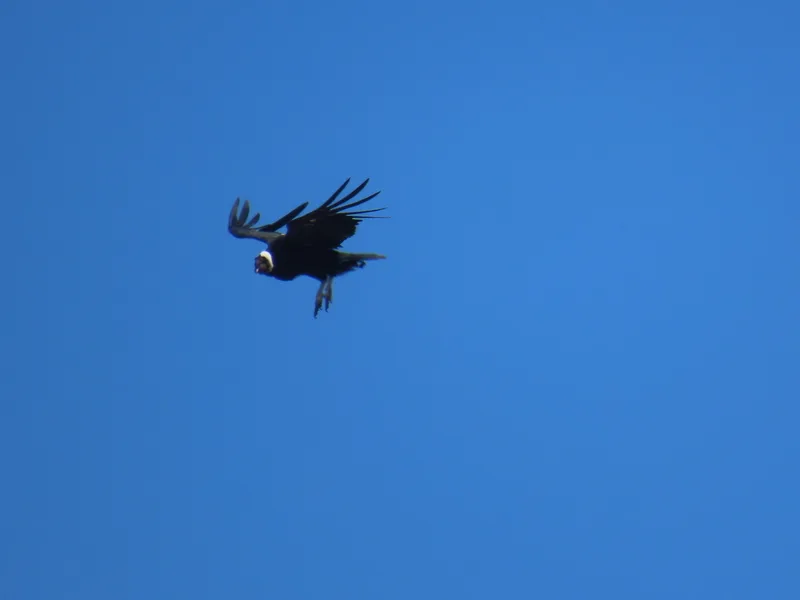
Andean Condor Vultur gryphus
Field Notes · Ice & Glaciers lens · Torres del Paine · −51.0406, −72.9845