Taroko Gorge
Taroko Gorge · Hualien, Taiwan
The marble never agreed to move. The river went through it anyway.
Why here
Stand at almost any rail in this gorge and you’re looking at an argument the water has been winning for a very long time. Marble is about as stubborn as rock gets — dense, hard, the kind of stone masons choose because it resists wearing down. The Liwu River did not care. It kept moving, year after year, and the marble kept losing ground it never intended to give up. The result is one of the few gorges anywhere cut clean through solid marble from wall to wall, a fact that puts this valley in the company of only a couple of others on the planet. Nothing about that outcome was fast or dramatic in the moment — no single flood did this. It is the accumulated weight of a river simply refusing to stop. Walk the corridor with that in mind and the cliffs stop looking like scenery and start looking like a scoreboard. Every stop ahead keeps showing the same match still being played.
The story
The rock here started as something else entirely: limestone, laid down in a shallow sea long before there was a Taiwan to speak of. The regional bedrock mapped along this stretch dates back tens of millions of years, to the Paleogene, long before the collision that eventually pushed this coastline into mountains. That same collision squeezed the old limestone under heat and pressure until it recrystallized into marble — dense, pale, tightly grained. The river did not wait for the uplift to finish. It cut down through the rising rock at close to the same pace the rock rose, which is the plain reason the walls here run so steep and so deep: two forces working against each other for a very long time, at close to a draw.
People arrived and stayed close to that same water. Xiulin Township, which holds nearly the whole gorge, is today home mostly to the Indigenous Truku community — and the valley carries their name, Taroko, the same as they do. The record doesn’t spell out who first found a way through these cliffs, but the shared name is itself worth noticing: gorge and people, called the same thing.
The sites
The narrows, where the marble closes in
峽谷景觀
24.1714, 121.6160
This pull-off looks straight down the throat of the gorge, where the walls close in tight enough that the road and the river have to share the same narrow slot of space. Look at the rock on both sides: the same pale, tightly grained stone, cut clean through rather than crumbled or slumped, which is the signature of marble giving way to water rather than to gravity. From here the scale is easiest to read — walls rising steeply on either side of a channel that, at points, is barely wider than the river itself. The cut is not uniform; some stretches are close and sheer, others open briefly before narrowing again, tracking exactly where the rock happened to be softer, more fractured, or more exposed to the current’s full force. There is no dramatic single moment to point to. What you’re seeing is the compounded result of a very long, very patient disagreement between stone that does not want to move and water that never stopped asking it to. Give the view a few minutes rather than a glance — the longer you look, the more the walls read less like a backdrop and more like a record.
Look at the gorge walls directly across from you and trace where the rock face is smoothest and most vertical versus where it juts or steps. The smooth, sheer sections are where the river has been cutting fastest and most recently; the stepped or angled sections mark spots where a joint or crack in the marble gave the water an easier line to follow. Try picking out one clear joint line and following it up the wall with your eyes.
- AccessShort walk
- ExertionEasy
- TimeAn hour
立霧溪觀景台
24.1573, 121.6224
This platform looks directly onto the Liwu River, the single stream responsible for the entire gorge above and below you. It is easy to forget, standing over a channel this narrow, that one river alone did this — no glacier, no ancient sea, just a modest amount of moving water working continuously over a very long stretch of time. Watch how the current behaves against the marble: where the channel narrows, the water speeds up into white water and standing waves; where it briefly widens, it slows and clears. That relationship between channel width and water speed matters — a river tends to cut fastest exactly where it is already narrowest, which helps explain why the tightest stretches of this gorge have stayed tight rather than gradually widening out. The water’s color and volume are not fixed either: expect it clearer and lower after dry stretches, higher and cloudier after rain, sometimes dramatically so. Whatever you see the day you visit is one frame of a process that has been running, essentially unchanged in method, for a very long time before you arrived, and will keep running after you leave.
Watch the river’s surface where the channel is narrowest below you and look for the standing waves and white water that show the current picking up speed. Then find a wider, calmer stretch nearby and compare how much slower and clearer the water looks there. Time how long it takes a floating leaf or piece of debris to cross your field of view in each spot, if any passes by.
- AccessShort walk
- ExertionEasy
- TimeAn hour
休憩平台
24.1574, 121.6248
This rest platform sits close enough to the river viewpoint just before it that it’s worth treating the two as one longer pause rather than two separate errands. Where that stop sets up the big relationship between water and channel, this spot rewards a closer look at the rock itself. Marble, unlike the coarser stone in most river cuts, tends to show fine banding and veining where the source limestone was compressed and recrystallized unevenly — pale bands running at slight angles to each other, sometimes threaded with thinner streaks of a different mineral. None of it is dramatic from a distance, but at close range on a still stretch like this, the walls read almost like grain in wood: a pattern laid down by pressure rather than growth, then sliced open by the river to show it. Give your eyes time to adjust to the scale — much of the banding is subtle, and easy to miss if you’re scanning for something bigger. Bring the pace down before you keep walking; the rock rewards patience more than distance covered.
Step close to the cliff face if the rail allows and look for pale bands running through the rock at a slight angle to each other. Run your eyes along one band as far as you can trace it. That banding is leftover structure from the original limestone, warped and compressed rather than erased.
- AccessShort walk
- ExertionEasy
- TimeAn hour
The route cut along the cliff
錐麓古道步道入口
24.1729, 121.5667
The trailhead here opens onto the Zhuilu Old Trail, a narrow route that runs along the face of the gorge rather than down in the riverbed with the road. Where every other stop on this note looks at the marble from below or across, this one puts you on it — a path following whatever ledge and bench the rock offered, well above the water, rather than a route engineers chose from scratch. Walking it reframes the whole gorge: instead of looking up at sheer walls, you are standing partway up one, with the river reduced to a distant, quieter line far below and the opposite wall close enough to study in real detail. The exposure is the point — there is no way to appreciate how steep this cut is without being partway up its side. This is also the one stop on this note that asks something of you before it gives anything back: solid footing, comfort with heights, and enough time to go slowly. It rewards that investment with the clearest possible sense of scale in the entire gorge, from a vantage the river itself never intended anyone to reach.
From the trail, look down at the river far below and then across at the opposite wall at your own height. Notice how much closer and more detailed the far wall looks from partway up it, compared to any of the road-level viewpoints. Try to spot a single ledge or bench on the far wall that looks like it could be a continuation of the path you’re standing on.
- AccessHalf-day hike
- ExertionStrenuous
- TimeHalf a day
流籠中繼站
24.1618, 121.6235
This spot takes its name from a relay stop along what was once a cableway — a suspended line used in Taiwan’s mountain interior to move people or goods across ground too steep and abrupt for a road to reach. The style of infrastructure was common wherever a river cut down faster than any road crew could follow, and this gorge, sliced deep through solid marble, is as strong a candidate for that problem as any valley in the country. Standing here, look at the walls on either side and imagine the alternative a cableway was built to avoid: an exhausting climb down to the river and back up the other side, on foot, every time someone needed to cross. Whatever the exact story behind this particular relay point, the logic is durable and easy to read from the rock itself — a gorge this narrow and this steep turns even a short trip across it into serious work, and people have always looked for a shortcut over the drop rather than through it. It’s a reminder that the marble’s long argument with the water wasn’t only a geological one; it shaped every human attempt to get from one side of this valley to the other.
From this stop, look across the gorge for anything on the opposite wall that could have served as a fixed anchor point — a cleared ledge, a squared-off notch — roughly level with where you stand. A line like this needed solid anchors on both sides to stay taut, so a matching feature across from you would mark roughly where the crossing used to land. See if you can find it.
- AccessShort walk
- ExertionModerate
- TimeAn hour
The river's wider reach
立霧山
24.1781, 121.6419
This peak carries the river’s name, a small but telling detail: even the high ground here is identified by the water below it rather than the other way around. From up here the perspective flips again — instead of standing in the slot the river cut, you’re looking down on the whole corridor from outside it, watching the gorge relax as it nears the coast. Upstream, the walls stay tight and steep for a long run; here, closer to where the Liwu River eventually reaches the sea, the land opens by comparison, the marble giving way to gentler terrain. That shift is worth registering: everything the earlier stops emphasize about narrow, sheer confinement is a mid-gorge condition, not the river’s permanent state. Rivers don’t stay hemmed in forever — they cut hardest where the rock resists most and ease off once it stops resisting. From this height, that whole arc is visible at once instead of pieced together stop by stop, which is the main reason this climb earns its place on a note otherwise spent down at water level.
From the peak, look back the way the river has come and trace the line of the gorge with your eyes as far upstream as visibility allows. Notice where the terrain around the river looks steep and tight versus where it opens out — that shift roughly marks where the hard marble underneath gives way to softer ground. See if you can find the point where one changes into the other.
- AccessHalf-day hike
- ExertionStrenuous
- TimeHalf a day
觀景平台
24.1783, 121.4757
This platform sits well upstream and inland from the main gorge corridor, in country where the Liwu River’s drainage begins pulling together out of steeper, higher ground. The character of the valley here is different from the lower gorge: rather than one clean slot cut through a single rock type, the terrain reads as younger and less finished, still being assembled by smaller tributary streams finding their own paths downhill before joining the main channel. It’s a useful corrective to the rest of this note, which spends most of its time in the most dramatic, most finished-looking stretch of the gorge. Up here, you’re watching an earlier stage of the same basic process — water finding the lowest available path, over and over, at a scale too small and too gradual to produce anything as clean as a marble slot canyon, at least not yet. Given enough time, some of what’s happening here could eventually look like what you saw lower down. Given how slowly rock yields to water, enough time is doing a great deal of quiet work in that sentence.
Look at the smaller streams or gullies feeding into the main valley from the surrounding slopes, if any are visible from here. Compare how narrow, straight, and cut-down the main channel looks against the smaller descents beside it. The difference in how finished each looks is a rough measure of how much longer the main river has been cutting.
- AccessShort walk
- ExertionEasy
- TimeAn hour
When it's best
Early-to-mid spring here tends to run cool and showery — expect crisp air by day, a chill after dark, and a decent chance of rain sometime during any week-long stretch, so the river you see may be running a little higher and cloudier than photographs suggest. Later in the year, into typhoon season, heavy rain further upstream can turn the same water fast and turbid within a day, which is worth keeping in mind if you’re drawn to the riverside stops rather than the high viewpoints. There isn’t a single best month so much as a trade: quieter, cooler water in spring against a livelier, occasionally dramatic river later in the warm season. Either way, the marble itself keeps the show going year-round.
Go deeper
The names behind what you saw
- The pale, dense rock forming the gorge walls is marble — limestone later heated and compressed until it recrystallized. Taroko Gorge is counted among only three gorges in the world cut entirely through pure marble, alongside Bhedaghat Gorge (India) and Trigrad Gorge (Bulgaria).
- The river doing the cutting is the Liwu River, contained entirely within Xiulin Township.
- Regional bedrock mapped near the gorge is logged as Cenozoic sedimentary rock, Paleogene in age — roughly 66 to 23 million years old (Macrostrat unit 3184145).
To read next
- Wikipedia, “Taroko National Park” — the source for the marble-gorge comparison to Bhedaghat and Trigrad, useful for placing this valley among its only two global peers.
- Wikipedia, “Liwu River” — short, but precise on how completely the river and its gorge sit inside one township.
- Wikipedia, “Xiulin, Hualien” — the population figures behind the Truku/Taroko naming link raised above.
- Wikipedia, “Hualien County” — for orienting the gorge within Taiwan’s largest, most mountainous county.
- Macrostrat unit record 3184145 — for readers who want the raw stratigraphic dating behind the “old rock” claim.
The names behind what you saw
What lives here, and what it's called. Photographs from open collections — an aid to identification, not decoration.
-
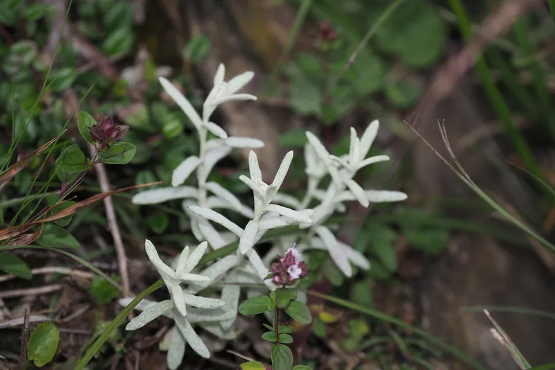
Mount Yushan Pearly Everlasting Anaphalis morrisonicola -
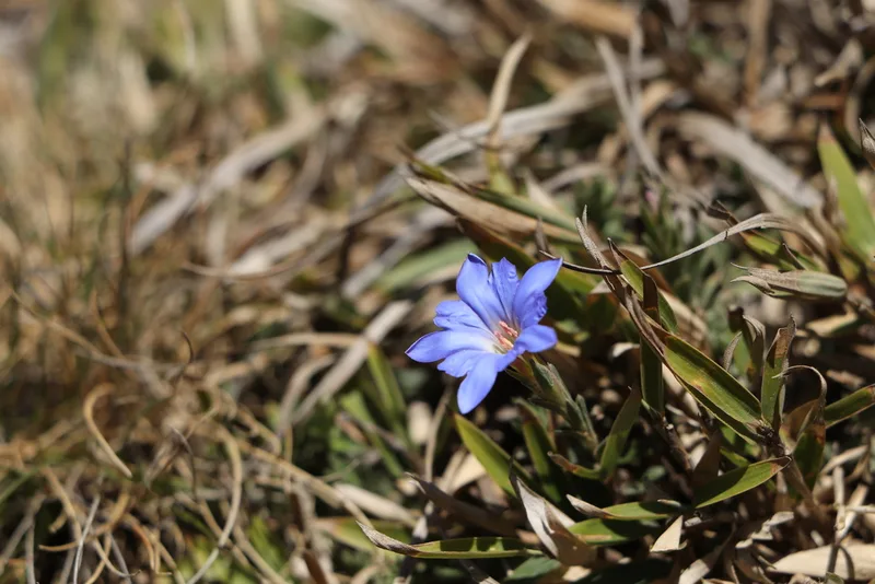
Alishan gentian Gentiana arisanensis -
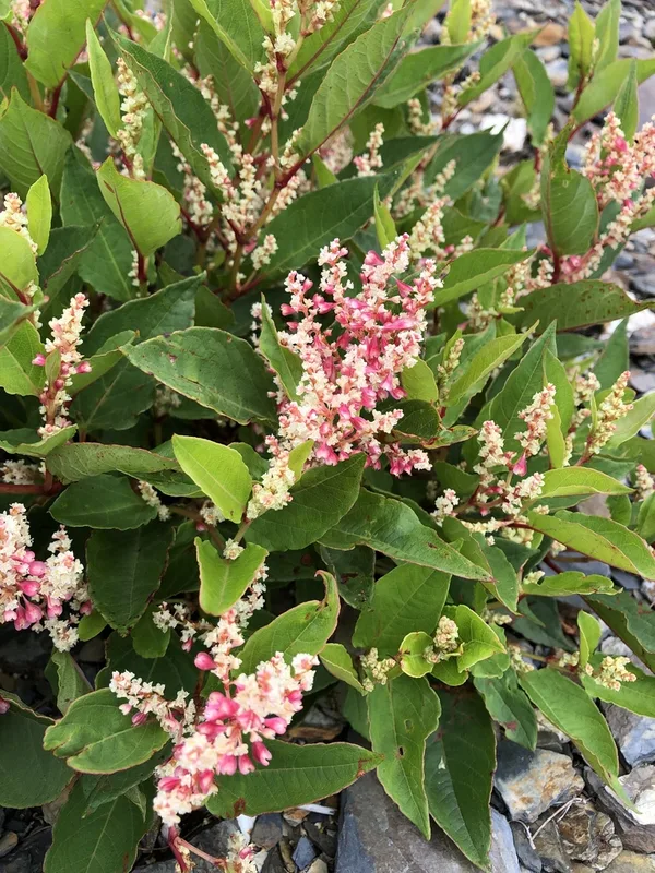
Japanese knotweed Reynoutria japonica -
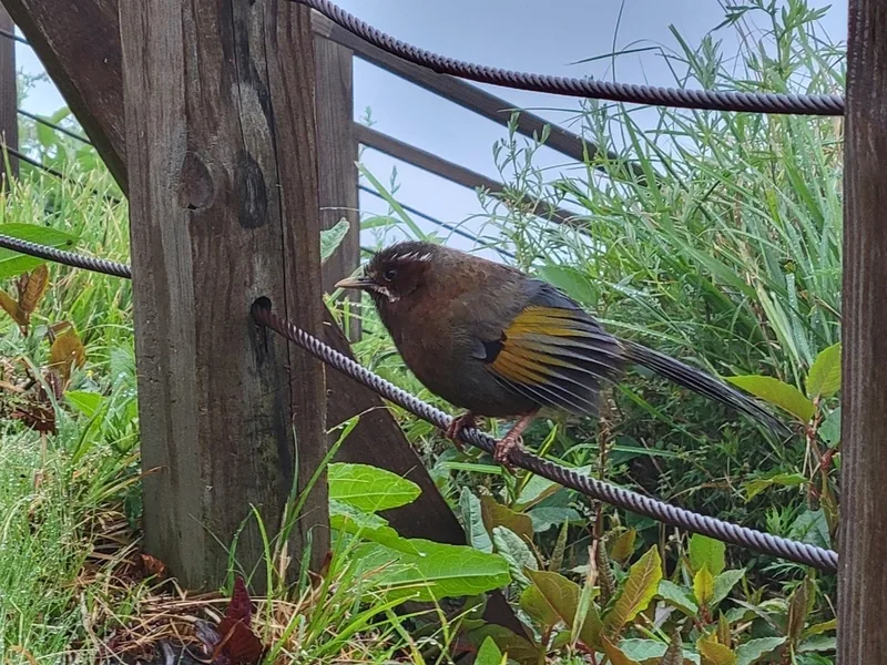
White-whiskered Laughingthrush Trochalopteron morrisonianum -
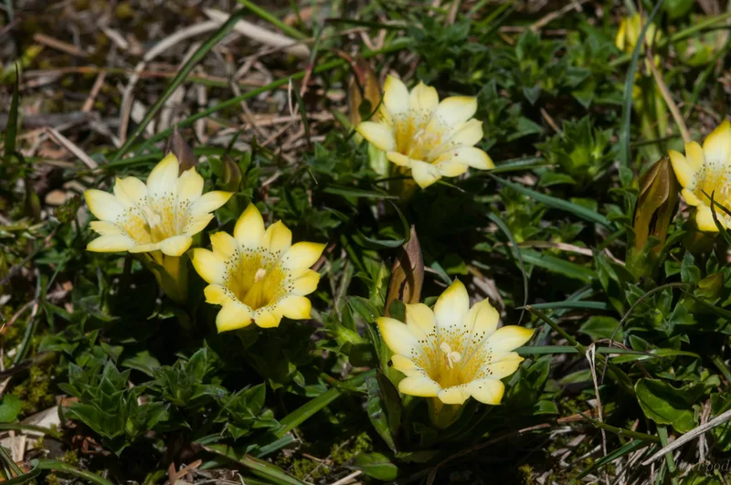
Gentiana scabrida -
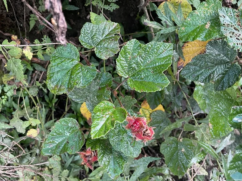
creeping Taiwan bramble Rubus rolfei -
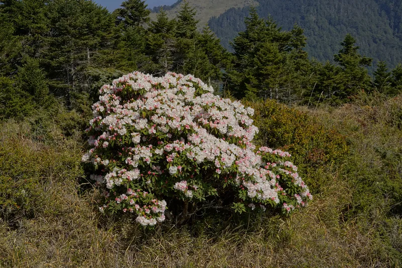
false-gold-flower rhododendron Rhododendron pseudochrysanthum -
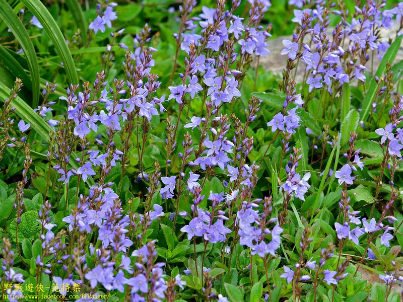
Veronica morrisonicola -
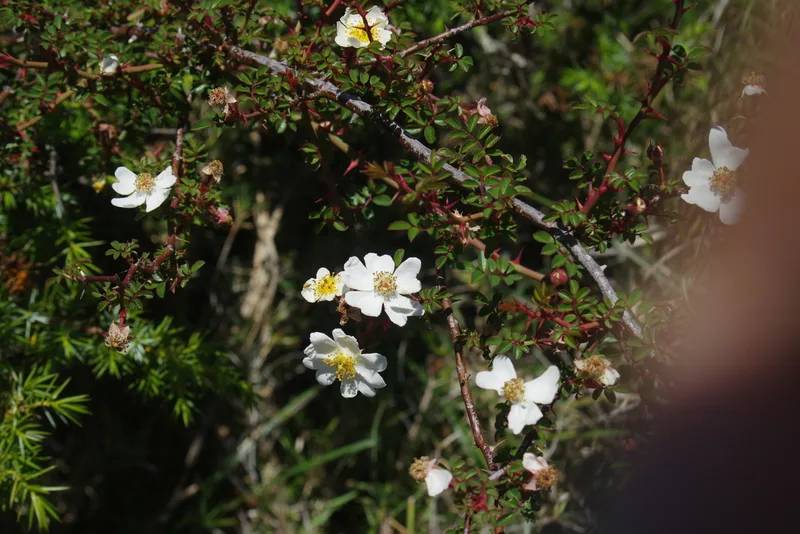
Glandular Rose Rosa transmorrisonensis -
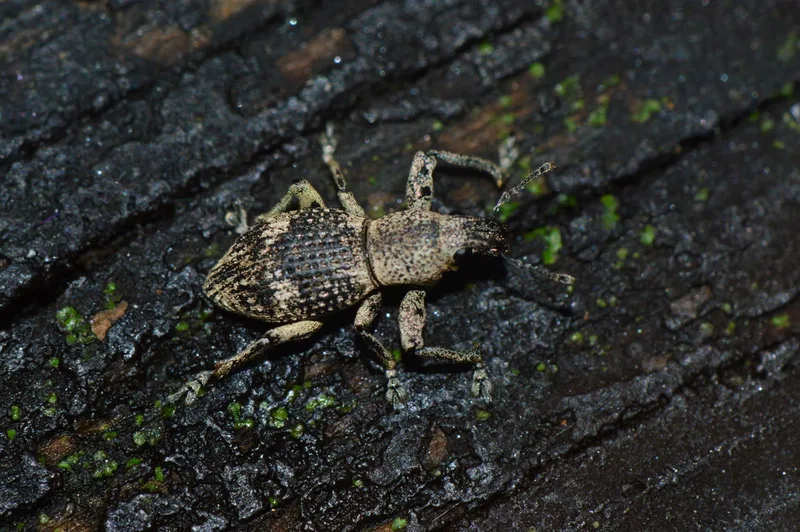
Sympiezomias cribricollis -
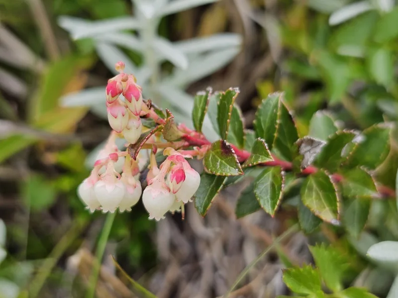
Gaultheria borneensis -
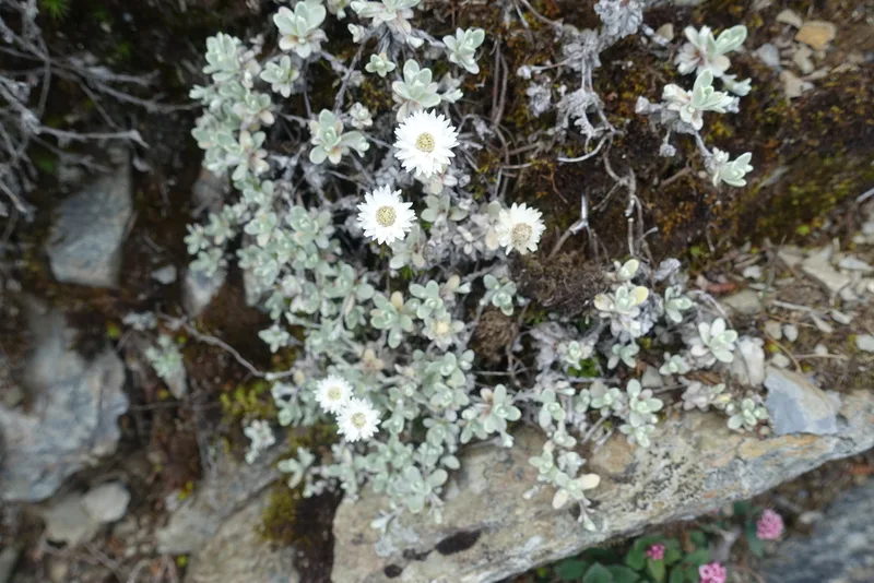
Anaphalis nagasawae
Field Notes · Rivers & Canyons lens · Taroko Gorge · 24.2134, 121.4903