Sunset Crater
Sunset Crater Volcano National Monument · Arizona, USA
A dark flow can be young enough to remember its own shape.
Why here
At Sunset Crater, the volcanic story is close enough to touch with your eyes. A dark cone rises from a forested plateau, and a rough lava field runs away from it in frozen folds. The land is young enough that the original shapes still make sense: vent, cone, flow. Basalt came up, carried gas, broke into cinders, and spread where the ground gave it room. The eruption did not erase the older landscape so much as lay a new one across it. That is why the pine forest and black rock keep appearing together. One belongs to the plateau; the other arrived later. Walk here to see how a small volcanic field can redraw a country without needing to hide what was there first.
The story
The payload places the monument in a belt of basaltic rocks, with older sedimentary rocks beneath and around the volcanic field. Basalt is dark, fluid when hot, and capable of spreading into broad, rough surfaces. Cinders behave differently: they land near the vent and build a cone. The six named stops in this payload make those two habits visible.
Plants return according to the ground they can use. Ponderosa pine and pinyon stand where soil and older surfaces give them a foothold; the newer flow stays more open. Apache plume and other flowering plants occupy the margins and pockets. The human extracts connect Sunset Crater with nearby Wupatki, but this note stays with the volcanic surface itself.
The sites
The eruption in profile
Sunset Crater
35.3641, −111.5030
The cone gives the eruption a center. Its dark sides are made of cinders and other fragments that gathered around the vent, while the surrounding flow spread farther across the plateau. The shape is simple enough to read from a distance, but the nearby forest keeps it from becoming an abstract diagram. Pines occupy the older ground; the cone remains open and angular. Look at the boundary between them as a moving line in time. The forest is not outside the volcano’s story. It is what grows after the lava has cooled.
Find the sharpest edge where the cone meets the trees. The dark slope is loose cinder close to the vent, while the trees mark ground old enough to have soil and roots. Let the boundary stand for the difference between eruption and recovery.
- AccessShort walk
- ExertionEasy
- TimeAn hour
Bonito Lava Flow
35.3719, −111.5241
This flow is the opposite of a cone. Instead of piling up around the opening, lava moved outward and cooled into a broad, broken surface. Its ridges and folds preserve motion: a front that slowed, a crust that cracked, and molten rock that kept pushing underneath. The flow looks fixed now, but its textures are all verbs from the eruption. Walk the edge rather than trying to take it in at once. Short distances reveal changes in surface that disappear from a car window, and the nearby pines show where the lava stopped short.
Look for a low ridge that runs across the flow. It formed as the surface cooled and the material beneath continued to press forward. Follow it with your eyes and imagine the direction the lava was moving.
- AccessShort walk
- ExertionEasy
- TimeAn hour
Reading the older plateau
Bonita Vista
35.3612, −111.5203
Bonita Vista is a place to step back from the eruption and see its setting. The volcanic field sits on a broader plateau of older rock, so the cone and flow are additions to an already layered landscape. From the viewpoint, compare the dark volcanic forms with the softer country around them. The contrast is not just color. Young basalt keeps sharper edges and less soil; older ground has had time to weather, collect dust, and carry trees. The view works as a geological timeline without asking you to memorize names. New land is easiest to understand when the old land stays in the frame.
Choose one black volcanic surface and one vegetated slope in the same view. Compare their outlines. The sharper, more angular form is the younger surface, while the softer slope has had longer to weather and gather soil.
- AccessDrive-up
- ExertionEasy
- TimeAn hour
Walking the flow
Lava Flow Trail
35.3632, −111.5181
The trail gives the eruption a human scale. On foot, the lava stops being a dark patch on a map and becomes a sequence of surfaces: ridged stone, loose fragments, shallow hollows, and places where plants have found a little shelter. Basalt does not need to be smooth to be fluid in its first life. It can cool into a rough field while still showing the direction it took. Take the trail slowly and let the ground change under your attention. The point is not to cover the flow quickly but to see how much movement a motionless surface can hold.
Pick one plant growing in a crack or shallow pocket. The rock has not become soil everywhere, so the plant’s position shows where dust and moisture can collect. Look for another plant on a bare ridge and compare the two sites.
- AccessShort walk
- ExertionModerate
- TimeHalf a day
The neighboring cones
Lenox Crater
35.3603, −111.5297
Lenox Crater is a second volcanic form in the same field, useful because no two vents need to leave the same outline. The crater’s rim and interior make a different shape from Sunset Crater, but the materials still belong to the same family of basaltic eruption: hot rock, gas, fragments, and gravity. A paired view helps separate what is a general volcanic process from what is an accident of one vent. Study the profile, then turn toward the larger field and look for the flow surfaces that connect the cones. The landscape is a family of related events rather than one object.
Stand where you can see the rim and the lower slope together. Find the point where loose fragments give way to a more continuous surface. That change marks the shift from material that fell near the vent to lava that traveled outward.
- AccessShort walk
- ExertionModerate
- TimeHalf a day
When it's best
Spring and early summer are good seasons for seeing the volcanic forms with a little plant life returning around them. The open lava heats quickly in full sun, while the forest gives shade at the edges. Clear days make the cone and flow easiest to read from the overlooks. In colder weather the dark rock still holds the same story, but ice and snow can change the footing on the trails.
Go deeper
The names behind what you saw. The field is mapped chiefly as Holocene to middle Pliocene basaltic rock, with smaller amounts of andesite, dacite, and rhyolite. The trees include Southwestern ponderosa pine, Pinus brachyptera, and Colorado pinyon, Pinus edulis.
To read next. - Roadside Geology: Wupatki and Sunset Crater Volcano National Monuments — a field-oriented account of the paired volcanic and archaeological landscapes.
The names behind what you saw
What lives here, and what it's called. Photographs from open collections — an aid to identification, not decoration.
-
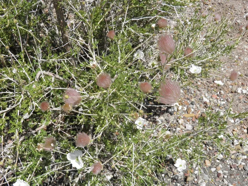
Apache plume Fallugia paradoxa -
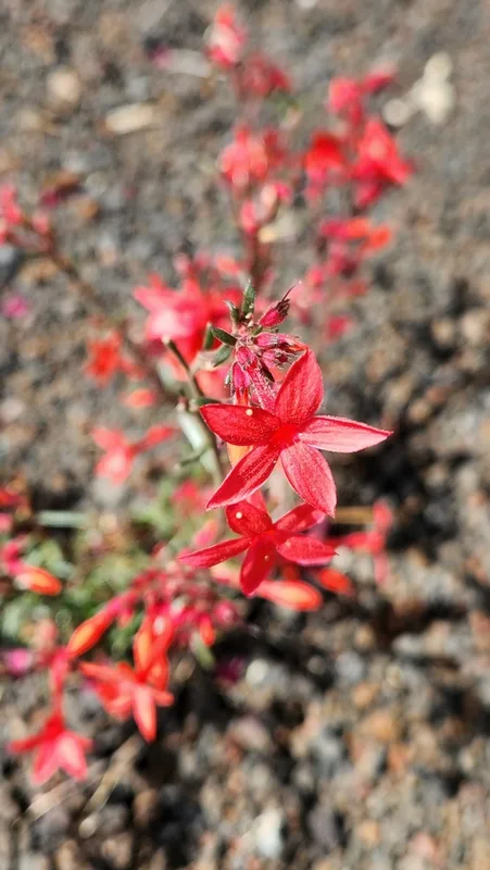
Arizona ipomopsis Ipomopsis arizonica -
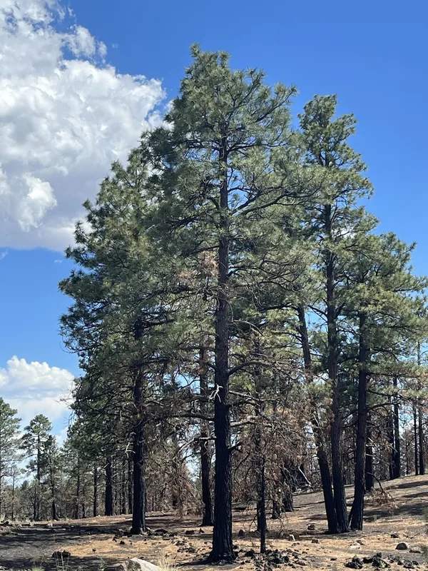
Southwestern Ponderosa Pine Pinus brachyptera -
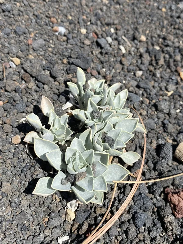
Newberry's Twinpod Physaria newberryi -
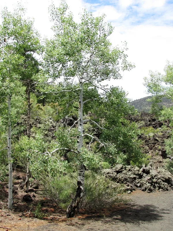
quaking aspen Populus tremuloides -
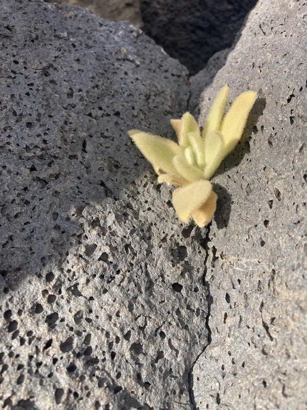
great mullein Verbascum thapsus -
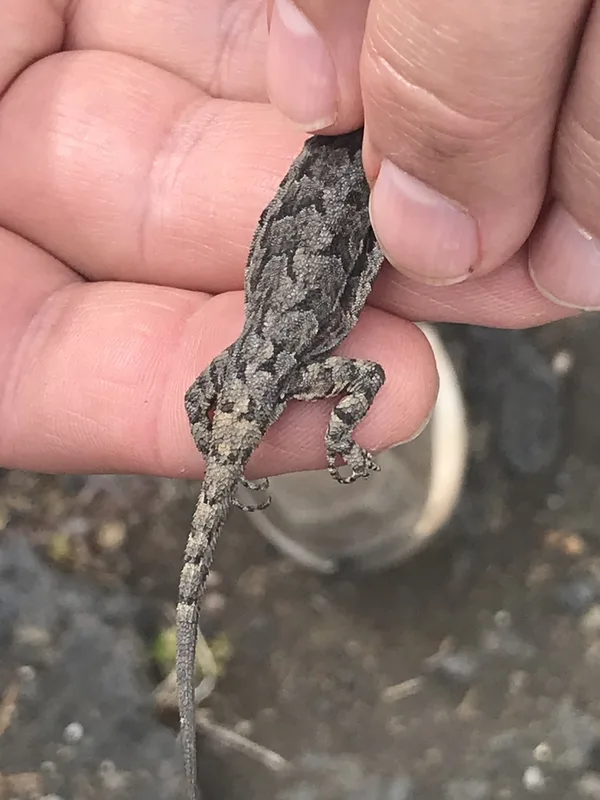
Ornate Tree Lizard Urosaurus ornatus -
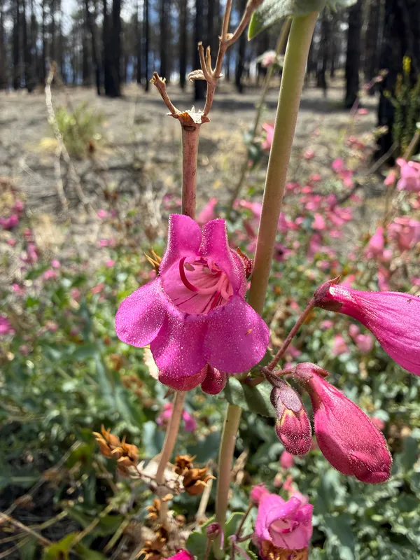
Sunset Crater beardtongue Penstemon clutei -
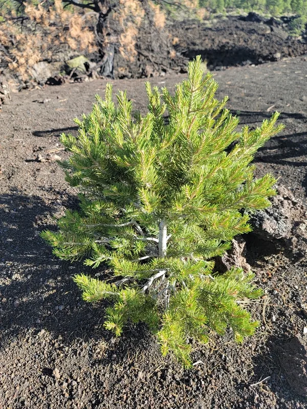
Colorado Pinyon Pinus edulis -
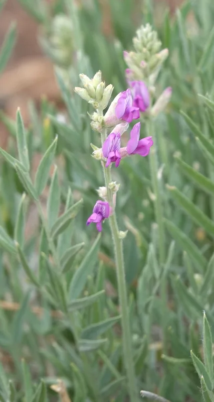
Lambert's Locoweed Oxytropis lambertii -
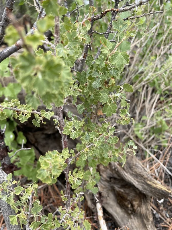
wax currant Ribes cereum -
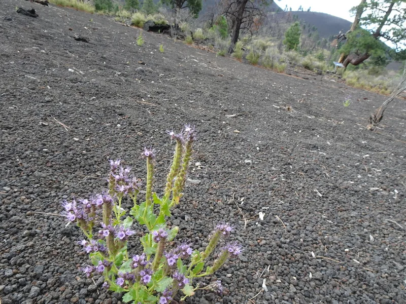
Saw Phacelia Phacelia serrata
Field Notes · Volcanic lens · Sunset Crater Volcano National Monument · 35.3712, −111.5113