The Similan Islands
The Similan Islands · Phang Nga, Thailand
Where the granite stops, the reef begins, and neither one hurries to explain itself.
Why here
Sail far enough west from the Thai mainland and you reach a scattering of granite islands where the water turns from green to a startling glassy blue, and the coast of Thailand quietly gives way to open sea shared with India. The Similans became a national park not for what stands above the waterline — bare granite boulders, thin forest, a few curls of white sand — but for what happens where that granite disappears underwater. Set aside as Mu Ko Similan National Park in 1982, after a year of study, these islands protect a reef built on rock rather than river silt: steep drop-offs, swim-through boulders, and water clear enough to pick out fish color at a distance most coastal reefs never allow. Groupers wait in the shade of overhangs, moray eels work the cracks between stones, and small, brilliant things — nudibranchs, butterflyfish, a whole neighborhood of tangs and parrotfish — go about reef business that has nothing to do with the boats overhead. This note stays mostly underwater, because that is where the Similans actually happen.
The sites
Granite underwater
Elephant Head Rock Island
8.6232, 97.6411
Elephant Head Rock is granite the way the rest of the Similans are granite, except here the boulders keep going underwater, stacking into channels and swim-throughs where sea and stone have worked out an arrangement over a very long time. Boats stop here for the topography as much as the fish: a submerged jumble of rounded rock that current pushes through in one direction, forcing anything living nearby to hold on, tuck into a lee, or ride it. Reef fish use the channels as a corridor — Titan Triggerfish patrol here with the proprietary air of a fish that will investigate anything that swims too close to its patch, and moray eels lie along the base of the boulders with just a head showing, mouth working open and shut, which looks aggressive and is really just how they breathe. Look into the gaps between the biggest boulders rather than out at open water; this is a site that rewards patience with structure over open blue. Current can be strong and shifts with the tide, which is part of why the fish bother showing up here in the first place — a current-swept channel like this one delivers a steady drift of food that a calm reef never gets.
At the base of the largest boulders, look for a moray eel’s head resting in a gap in the rock, mouth opening and closing in a steady rhythm — it is breathing, pushing water over its gills, not threatening you. Wait a few minutes near one gap and count how many different fish pass through the same channel.
- AccessExpedition
- ExertionModerate
- TimeHalf a day
Ko Bon
8.8271, 97.7995
Ko Bon is a long ridge of granite that drops away steeply underwater on its western side, one of several islets in the group where the rock does not taper gently into sand but simply keeps falling. That kind of steep, current-washed wall is exactly the habitat coral groupers favor: they hold near the reef face, in reach of the passing current but close enough to structure to disappear into it fast. The same wall carries butterflyfish working the coral in pairs and the odd Powder Blue Tang grazing algae off exposed rock, unbothered by the traffic of boats moored in the lee of the island. Ko Bon has no beach worth the name and very little forest; the entire point of visiting is the drop-off, which makes it a useful site for understanding how much of the Similans’ richness has nothing to do with the islands themselves and everything to do with the shape of the seafloor around them. Visibility here tends to be some of the best in the group, since there is little land runoff to cloud the water even after rain.
Follow the wall down with your eyes rather than swimming straight out over open water: a Coral Grouper will often be sitting motionless against the rock face, orange-red and covered in blue spots, waiting for something smaller to make a mistake nearby.
- AccessExpedition
- ExertionModerate
- TimeHalf a day
Deep Six
8.5975, 97.6365
Deep Six sits on the edge of one of the Similans’ granite islands, a viewpoint positioned to look straight down a slope of rock and coral into water that gets dark blue fast. It is a good place to understand, from above the surface, what the rest of this note is about below it: the islands are really just the visible tips of granite domes that plunge steeply once they meet the sea, and that steepness is what keeps the water here clear and the reef close to the surface even a short distance from shore. Watching from the rock, it is often possible to make out pale sand patches and darker coral heads scattered across the shallows before the slope drops into blue that swallows detail. It is a short stop by boat, more orientation than destination, but useful before or after time in the water elsewhere in the park — the view answers a question a snorkel mask cannot, which is how the whole shape of the reef fits together from above.
From the viewpoint, trace the line where pale, sunlit shallows give way to darker blue — that boundary marks the edge of the reef shelf around the island, and it usually mirrors the shape of the coastline itself.
- AccessExpedition
- ExertionEasy
- TimeAn hour
Life among the boulders
Ko Miang
8.5677, 97.6358
Ko Miang is one of the larger islands in the group, with enough flat ground to carry thin forest down almost to the waterline, and a shallow, sheltered bay where the reef starts just a few strokes from the sand. That combination — some shade, some flat rock, some living coral — makes it a good place to slow down rather than push into deeper water. The bay’s shallows carry the kind of reef traffic that rewards a long, unhurried look: butterflyfish moving in pairs, parrotfish grinding at coral in audible little bursts, and surgeonfish holding in loose groups over the sand. Look closely at bare patches of rock and rubble rather than only at the coral itself; nudibranchs — small, soft-bodied sea slugs in colors that seem almost too bright to be functional — turn up on exactly this kind of unglamorous surface, grazing on sponges and hydroids that most people swim straight past. Ko Miang rewards this kind of close, slow attention: the big animals are elsewhere, and the small ones are what fill an afternoon here.
Scan the rubble and bare rock at the edge of the coral, not just the coral heads themselves, for a nudibranch — a small sea slug often no longer than a finger, patterned brightly enough to look painted on. They move slowly, so once you find one you have time to actually look.
- AccessExpedition
- ExertionEasy
- TimeHalf a day
Ko Si Mi Lan
8.6489, 97.6453
Ko Si Mi Lan is one of the Similans’ granite islands, and gives a fair sense of what the group’s granite islands look like above the waterline: rounded boulders stacked by weather rather than by hand, a thin cover of forest wherever the slope allows it, and water close enough offshore that the reef begins almost as soon as the beach ends. Fringing reef around islands like this tends to be shallow and sheltered compared with the exposed drop-offs elsewhere in the park, which makes it a more forgiving place to watch reef fish behave rather than just glimpse them in passing. Moorish Idols move through the shallows in their distinctive upright, flattened shape, feeding on sponges along the reef edge, while Redlip Parrotfish work through the same territory a little more roughly, biting at coral rock itself. The granite underfoot and the reef just off it are really one continuous structure, built the same way and shaped by the same weather; the island is simply the part that happens to break the surface.
Where the beach meets the water, look for the granite continuing underneath as a shallow, uneven shelf rather than a smooth sandy slope — that submerged rock is what the fringing reef has grown onto, and it is the same stone the island itself is made of.
- AccessExpedition
- ExertionEasy
- TimeHalf a day
The outer islands
Ko Tachai Bay View Point
9.0737, 97.8128
Ko Tachai sits apart from the main cluster of Similan islands, far enough north that it functions almost as a satellite rather than a full member of the group. From this bay viewpoint, the island shows the same granite-and-forest pattern as its neighbors to the south, but the water around it behaves a little differently: more open ocean lies close by in every direction, and the reef here tends to run to softer corals and sponges rather than the hard coral gardens closer to the mainland side of the park. That difference is worth noticing precisely because it is subtle — nothing about the view announces it, and the only way to register it is by comparing what grows here with what grows on islands visited earlier or later in a trip. Boats that come this far usually treat Ko Tachai as a deliberate detour rather than a stop on the way to somewhere else, its distance from the main group meaning fewer boats pass through on any given day.
From the viewpoint, compare the color and texture of the reef below with what you have seen on other islands in the group — a softer, more textured look usually signals soft corals and sponges rather than hard branching coral, a difference driven by how exposed this particular stretch of water is.
- AccessExpedition
- ExertionEasy
- TimeHalf a day
Ko Hu Yong
8.4808, 97.6464
Ko Hu Yong lies at the southern edge of the group, more exposed to open water than the islands clustered closer to the park’s center, and it shows in a long, pale beach on its western side that takes the brunt of that exposure directly. Underwater, the same openness means the fringing reef here deals with more swell and current than sheltered bays elsewhere in the park, which tends to favor fish built for holding position against moving water: Striped Surgeonfish, territorial and fast, are well suited to exactly this kind of environment, defending patches of algae against neighbors and intruders alike. Because the island sits at the southern limit of the park, it is also a reasonable place to region’s dry months, roughly from around November into April, while the middle of the year brings a wetter, rougher pattern that makes boat crossings less comfortable and underwater visibility less reliable. There is no single best week — the reef does not take a season off — but the calmer months are simply the easier time to see it clearly, and a run of settled weather in the dry season is worth planning around if visibility is the priority. Outside that window, the same fish and the same granite are still there, just harder to watch.
Watch a Striped Surgeonfish defend its patch of algae-covered rock against any other fish that drifts too close — the same dark bands that make it easy to identify also seem to mark the patch as taken, and it will chase off intruders far larger than itself without hesitation.
- AccessExpedition
- ExertionModerate
- TimeHalf a day
When it's best
The Similans sit in open water, which means conditions matter more here than on a sheltered coast, and the working pattern is straightforward even without a calendar: calmer seas and clearer water tend to line up with the region’s dry months, roughly from around November into April, while the middle of the year brings a wetter, rougher pattern that makes boat crossings less comfortable and underwater visibility less reliable. There is no single best week — the reef does not take a season off — but the calmer months are simply the easier time to see it clearly, and a run of settled weather in the dry season is worth planning around if visibility is the priority. Outside that window, the same fish and the same granite are still there, just harder to watch.
Go deeper
The names behind what you saw. The reef fish and invertebrates mentioned in this note, if you want to search further: Coral Grouper (Cephalopholis miniata), Giant Moray (Gymnothorax javanicus), Moorish Idol (Zanclus cornutus), Titan Triggerfish (Balistoides viridescens), Powder Blue Tang (Acanthurus leucosternon), Redlip Parrotfish (Scarus rubroviolaceus), Striped Surgeonfish (Acanthurus lineatus), Red-tailed Butterflyfish (Chaetodon collare), and two nudibranchs worth learning to spot on bare rock: the Blue Dragon (Pteraeolidia semperi) and the Varicose Wart Slug (Phyllidia varicosa).
To read next. - Wikipedia, “Similan Islands” — the park’s 1982 founding and the odd fact that these waters mark a maritime border, the two threads this note pulls on most. - Wikipedia, “Phang Nga province” — the mainland coast and neighboring provinces the archipelago belongs to administratively. - Wikipedia, “Khao Lak” — the mainland village most trips out to the islands set out from.
The names behind what you saw
What lives here, and what it's called. Photographs from open collections — an aid to identification, not decoration.
-
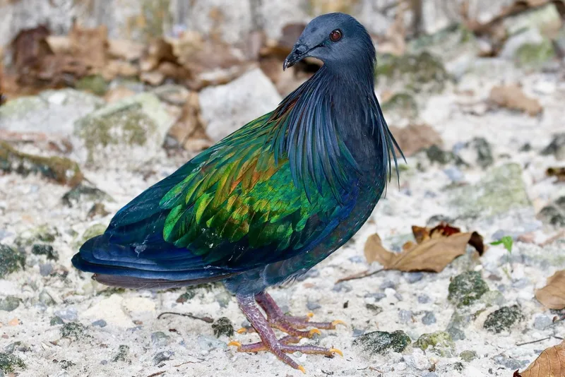
Nicobar Pigeon Caloenas nicobarica -
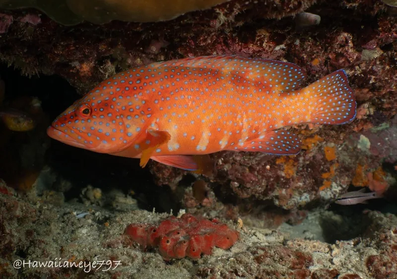
Coral Grouper Cephalopholis miniata -
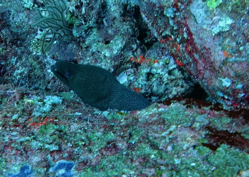
Giant Moray Gymnothorax javanicus -
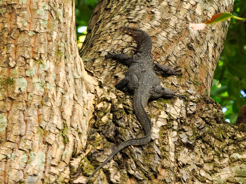
Common Water Monitor Varanus salvator -
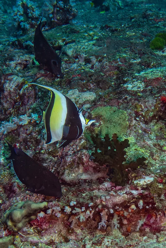
Moorish Idol Zanclus cornutus -
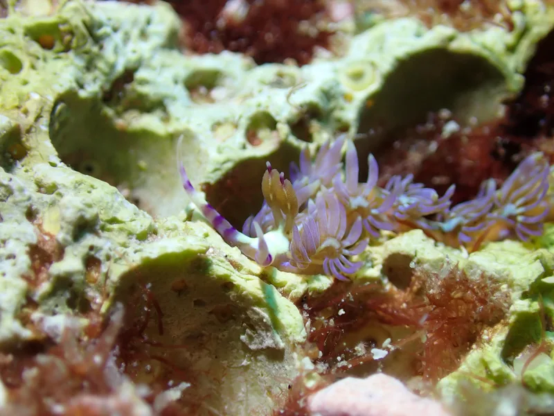
Blue Dragon Pteraeolidia semperi -
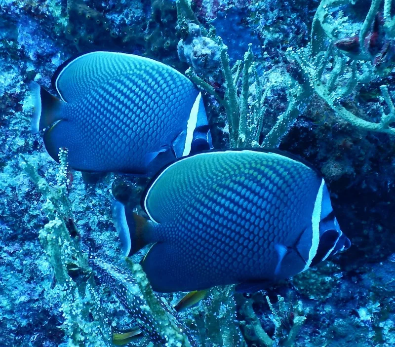
Red-tailed Butterflyfish Chaetodon collare -
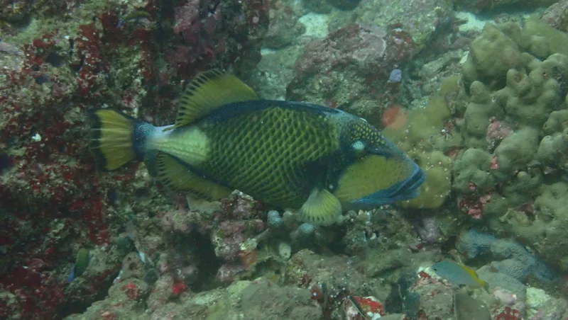
Titan Triggerfish Balistoides viridescens -
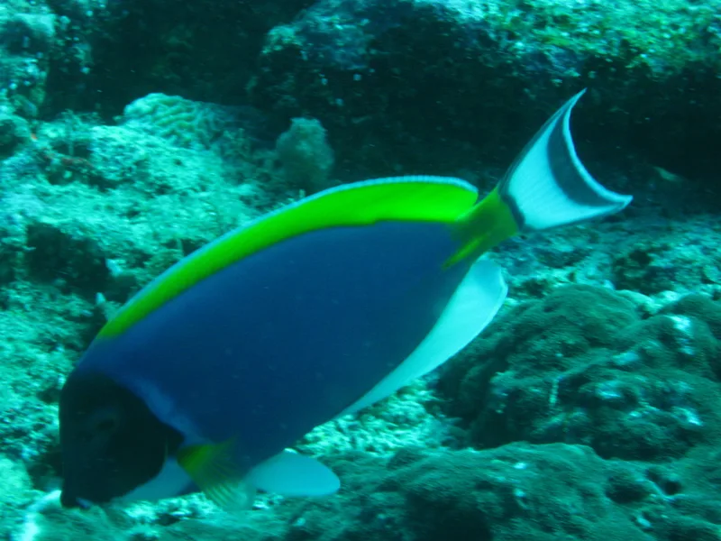
Powder Blue Tang Acanthurus leucosternon -
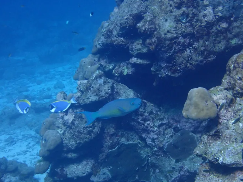
Redlip Parrotfish Scarus rubroviolaceus -
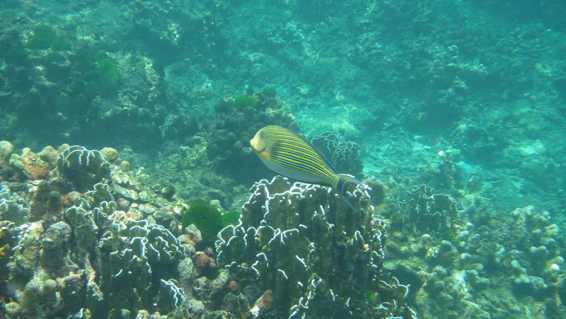
Striped Surgeonfish Acanthurus lineatus -
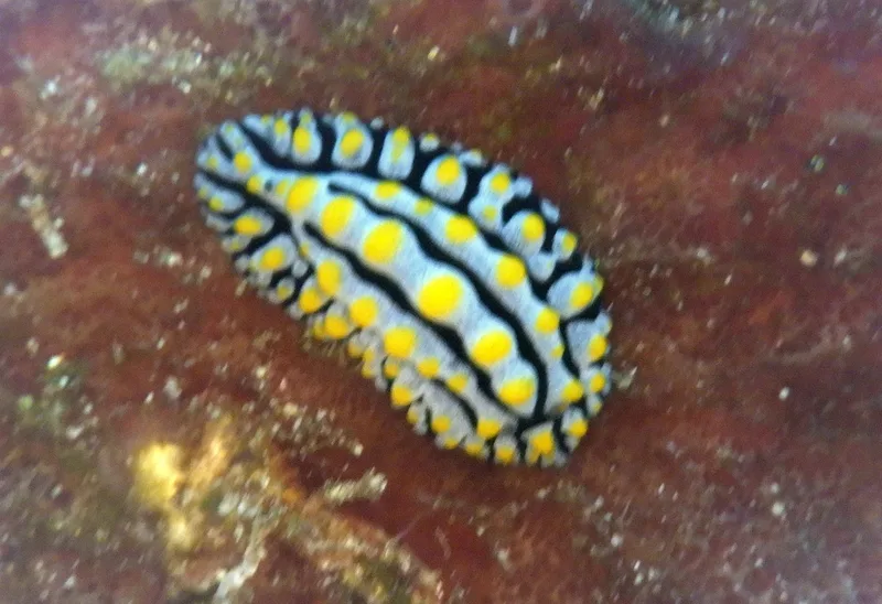
Varicose Wart Slug Phyllidia varicosa
Field Notes · Marine lens · The Similan Islands · 8.5771, 97.6464