Salar de Uyuni
Salar de Uyuni · Potosí, Bolivia
There is nothing between the salt and the stars but eleven thousand feet of thin, dry air.
Why here
Salar de Uyuni is famous for what it does to daylight — a sheet of white salt so flat and so vast that a little rain turns it into a mirror. What the same flatness does after dark gets talked about less, but it’s the more fundamental thing. At roughly 3,656 meters, high enough that the air itself holds less to scatter light, and flat enough that there’s no ridge, no tree, no rooftop anywhere on the horizon to block the view, the salar offers about as close to an unobstructed sky as a person standing on solid ground can get. There’s no trick to it and nothing built for the purpose — just an old lakebed dried down to salt and dust, so featureless that the sky becomes the only thing left with any shape. Every site in this note is, in a sense, the same site: a flat place, a dark night, and the oldest light there is arriving unimpeded. What changes from stop to stop is only how far you’ve gotten from the small amount of light people bring with them.
The sites
Islands adrift in the flat
Incahuasi
−20.2431, −67.6256
Incahuasi rises from the flat like a shipwreck of stone, a lone island in an ocean gone solid. By day it’s crowded with giant columnar cacti and cracked white salt running to the horizon in every direction. After dark it becomes something else: the only high ground for a long way, with nothing between you and a sky that runs unbroken from one rim of the flat to the other. Climb even a short way up the island’s spine and the curvature of the horizon becomes visible against the stars — no trees, no ridgeline, no city glow to interrupt it. The cacti here are slow, old things, growing only a little each year, and the ones crowning the island’s highest point have stood through more clear nights than any visitor could count. Stand among them after the light fades and give your eyes ten or fifteen minutes to adjust; away from the salt’s pale glow, the sky over Incahuasi is dark enough that the Milky Way shows as a real structure — darker lanes braided through the bright band — rather than just a smudge.
Face away from where the sun went down and let your eyes adjust for several minutes without checking a light or phone. Look for the Milky Way’s band arching low across the sky here — at this elevation and this far from any large town, it should show real texture, darker lanes of dust threaded through the bright starfield, not just a pale wash.
- AccessDrive-up
- ExertionEasy
- TimeHalf a day
Cerro Malamala
−20.5323, −67.6989
South of Incahuasi, smaller and far less visited, Cerro Malamala is one of several low outcrops that break the salar’s surface the way a reef breaks open water. There’s no path here beyond tire tracks, and most visitors never make the detour. That’s exactly its appeal for anyone chasing a dark sky: fewer headlights on the flat around you, fewer camps pitched nearby, and a horizon just as complete as Incahuasi’s without the crowd. The outcrop itself is unremarkable rock, but stand on it after nightfall and the whole point of the salar’s flatness becomes obvious — there is nothing anywhere tall enough to hide any part of the sky from you. Bring your own light and your own patience; there’s no information board, no gathering point, nothing but salt, rock, and a very large amount of sky. The quiet here is the kind that makes you notice how loud the human world usually is, even in places that call themselves remote.
From the base of the outcrop, turn slowly on the spot and trace where the horizon meets the sky in every direction. Notice it never rises higher than the flat itself — no distant peak, no tree line — so a planet or bright star can be tracked from the moment it clears one edge of the salt until it sets on the other, with nothing to cut the view short.
- AccessExpedition
- ExertionModerate
- TimeHalf a day
The open salt
Amanecer en el Salar
−20.5837, −67.5607
Its name means simply dawn on the salt flat, and it earns it: this viewpoint sits in the open pan itself, away from any island or outcrop, with nothing around you but hexagonal cracks in dried salt running to a horizon that looks, at this elevation, almost too far away to be real. The reason to come after dark rather than at sunrise is the same flatness working the other direction — no rim, no silhouette, no reference point at all, just the sense of standing on a very large, very still mirror under a sky that has nowhere to hide. It’s disorienting in the best way: with no visual cues for scale or distance, the stars can feel closer than they do anywhere with a normal horizon. If there’s been any recent rain, even a thin film of standing water turns the ground itself into a second sky, doubling the stars underfoot until it’s hard to tell which way is up. Stay through the hours before dawn and you get both halves of the name — the deepest dark, then first light spreading with nothing to block it.
Crouch low enough to sight along the salt’s surface toward the horizon, and check whether there’s a thin sheen of water on the ground. If there is, look for stars reflected in it — the flatter and stiller the film, the more the ground starts to double as a second sky.
- AccessDrive-up
- ExertionEasy
- TimeHalf a day
The rim and the edge
Mirador del Cráter del Volcán Thunupa
−19.8438, −67.6402
Climb to the crater rim of the volcano anchoring the salar’s northern edge and the view changes entirely: instead of standing on the flat, you’re looking down over the whole of it, salt and islands and distant peaks laid out at once, thinning into haze at the edges of sight. The extra elevation matters for the sky as much as for the view — the air here is thinner again than on the salar floor itself, which already sits higher than most of the world’s mountain passes, and thinner air scatters and dims starlight less. It’s a longer, harder way to a dark sky than simply driving onto the flat, but the reward is a horizon defined by real topography rather than perfect flatness: distant summits notching the sky instead of an unbroken line. Get here well before dark, both because the trail deserves daylight and because the transition — the salar losing its color and detail below as the sky above deepens — is worth watching happen slowly rather than arriving to it already finished.
From the rim, pick a fixed point on the salar far below — a break in the salt pattern, a distant island — and watch how much longer it stays visible than the sky above it stays light. The ground holds its last daylight color for a surprisingly long stretch after the first stars appear directly overhead.
- AccessHalf-day hike
- ExertionStrenuous
- TimeA full day
Colchani
−20.3010, −66.9370
Colchani sits at the salar’s eastern edge, the working settlement where salt is raked, dried, and blocked — and, not coincidentally, the easiest place to reach from town. It’s included here for an honest reason rather than a scenic one: this is where you can compare a genuinely dark site against a lit one. Colchani has just enough vehicle traffic and low-level lighting to visibly wash out the faintest stars near the horizon, in a way the open flat or a far outcrop simply doesn’t. Standing here after dark is a useful baseline before heading further onto the salar — a reminder that darkness itself is a resource, thinned by even a small amount of human light, and that the gap between an average night sky and an exceptional one is often just distance from a place exactly like this. If time or logistics keep you close to town, the sky above Colchani is still far better than most places most travelers call dark — just don’t mistake it for the best the salar can offer.
Look toward the horizon in the direction of the nearest lit building or vehicle track, then turn to face directly away from it. Compare how many stars you can pick out near the horizon in each direction — the gap tells you, more plainly than any figure could, how much even modest ground light costs you.
- AccessDrive-up
- ExertionEasy
- TimeAn hour
When it's best
The clearest run of nights on this stretch of the Altiplano tends to fall in the dry months, roughly May through October, when clouds are rare and a clear evening is closer to the rule than the exception. The wetter months, roughly December through March, bring more cloud and occasional rain, though also the chance of the flooded mirror the salar is famous for by day. None of that matters as much as the moon, though: any night near new moon, in any month, will be darker than a full-moon night in the driest week of the year, so if darkness is the whole point, that’s the date worth planning around rather than the season. Whatever month you come, pack for real cold after sunset — the same elevation that thins the air and clears the sky also lets the ground’s heat escape fast once the sun goes down, so warm layers matter here even when the day felt mild.
Go deeper
The names behind what you saw The ground under all of it is Quaternary sedimentary and evaporite rock — mudstone, sandstone, and gypsum, laid down as an ancient lake dried out, mapped locally as part of the Altiplano Basin’s long stratigraphic column. The giant columnar cacti crowning Incahuasi are Trichocereus atacamensis. The volcano behind the northern crater viewpoints is Thunupa.
To read next - Salar de Uyuni (Wikipedia) — the basic vitals: size, elevation, and location, worth reading before anything else here. - Sajsi (Wikipedia) — a short entry on the ancient lake that once filled this basin, the most direct account of where the flatness came from. - Potosí Department (Wikipedia) — places the salar in the wider high, dry plateau it sits on. - Evaluation of LANDSAT-2 (ERTS) images applied to geologic structures and mineral resources of South America (OpenAlex, 1976) — an early satellite-era study that used this same ground as a test case, of interest if you’re curious how remote sensing first looked down at the salar from orbit.
The names behind what you saw
What lives here, and what it's called. Photographs from open collections — an aid to identification, not decoration.
-
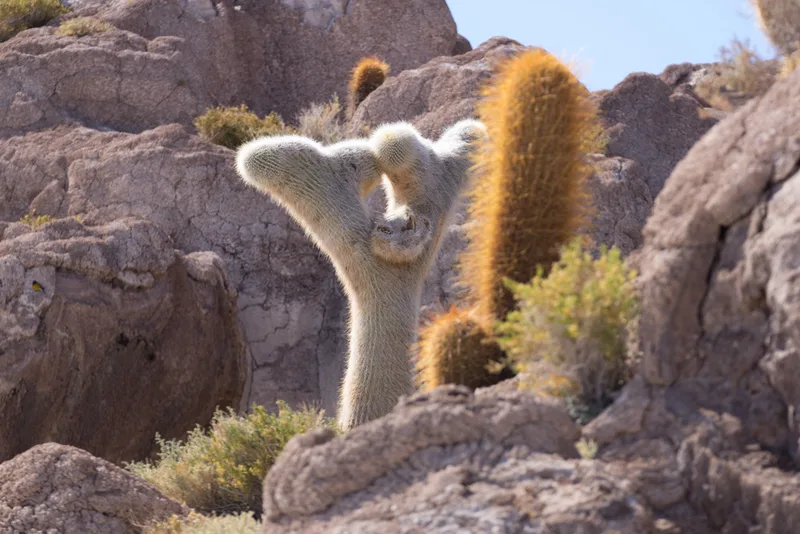
Trichocereus atacamensis -
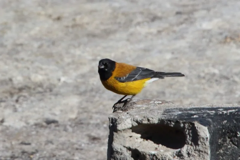
Black-hooded Sierra-Finch Phrygilus atriceps -
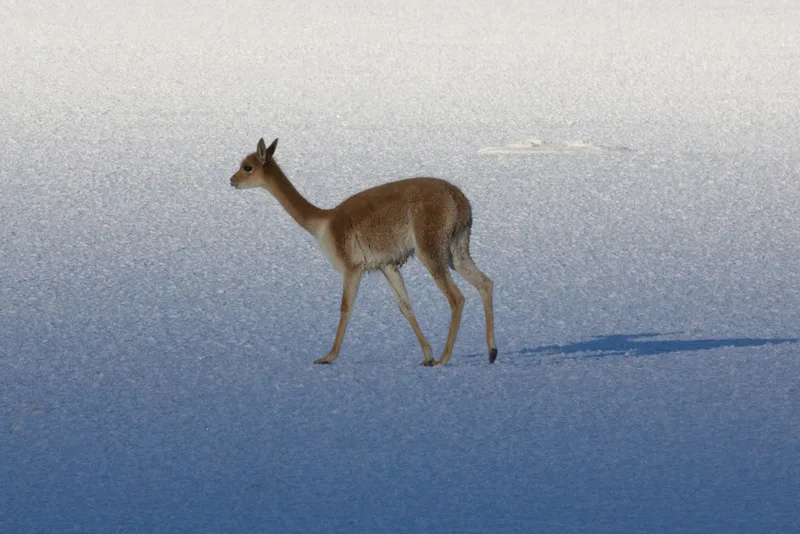
Vicuña Lama vicugna -
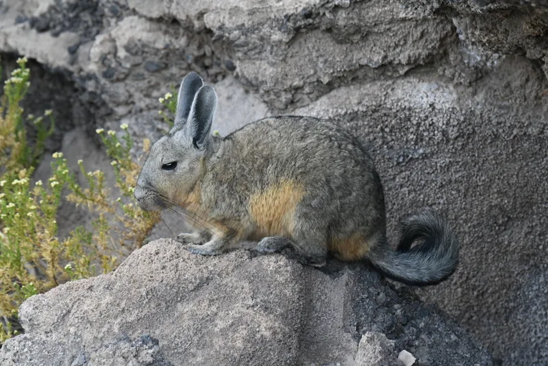
Mountain Viscacha Lagidium viscacia -
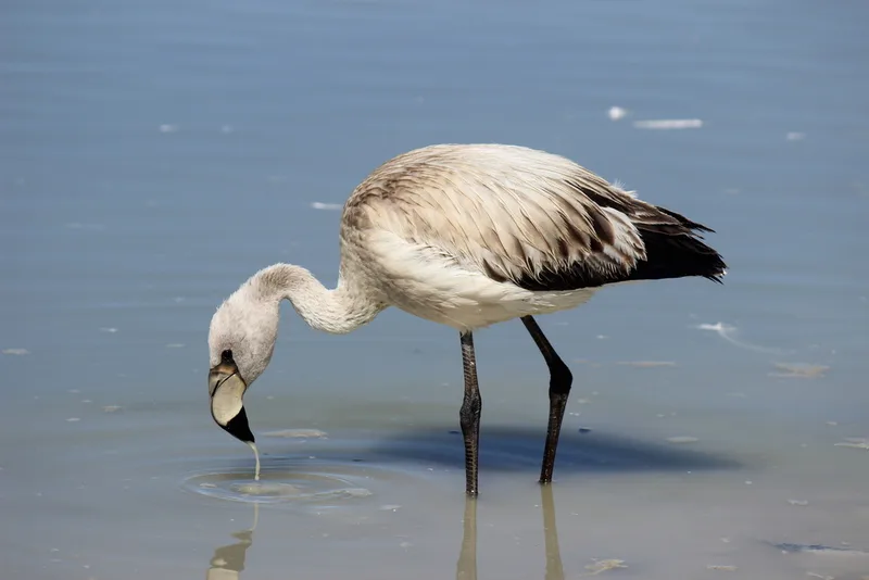
James's Flamingo Phoenicoparrus jamesi -
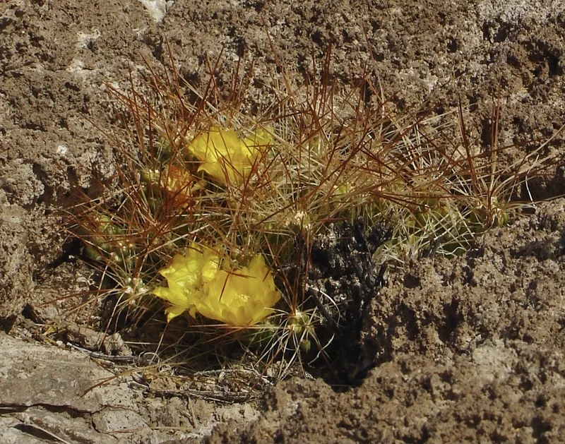
Cumulopuntia boliviana -
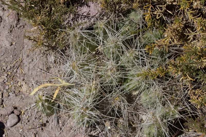
Cumulopuntia chichensis -
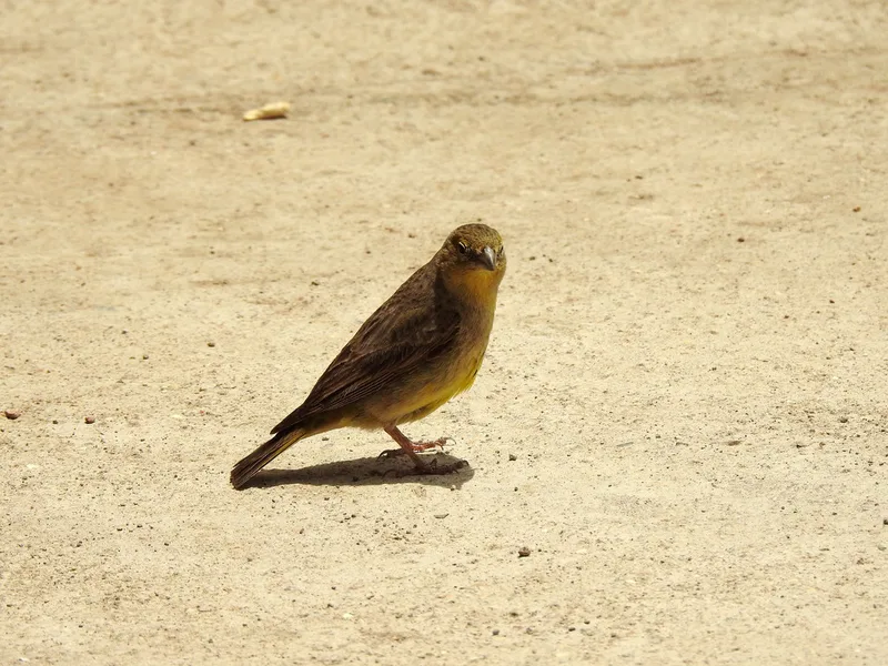
Greenish Yellow-Finch Sicalis olivascens -
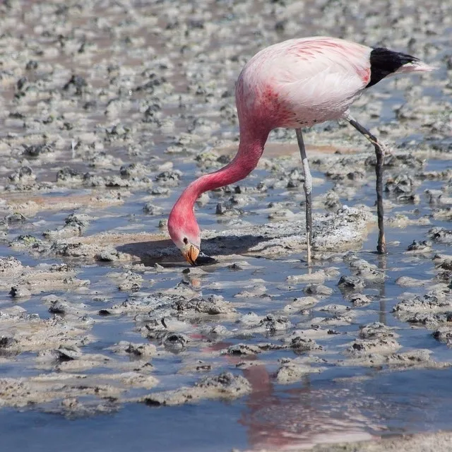
Andean Flamingo Phoenicoparrus andinus -
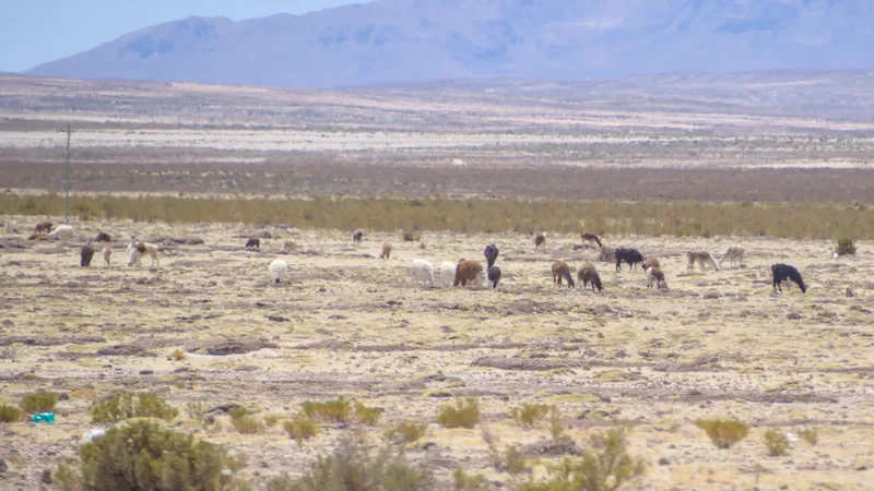
Llama Lama glama -
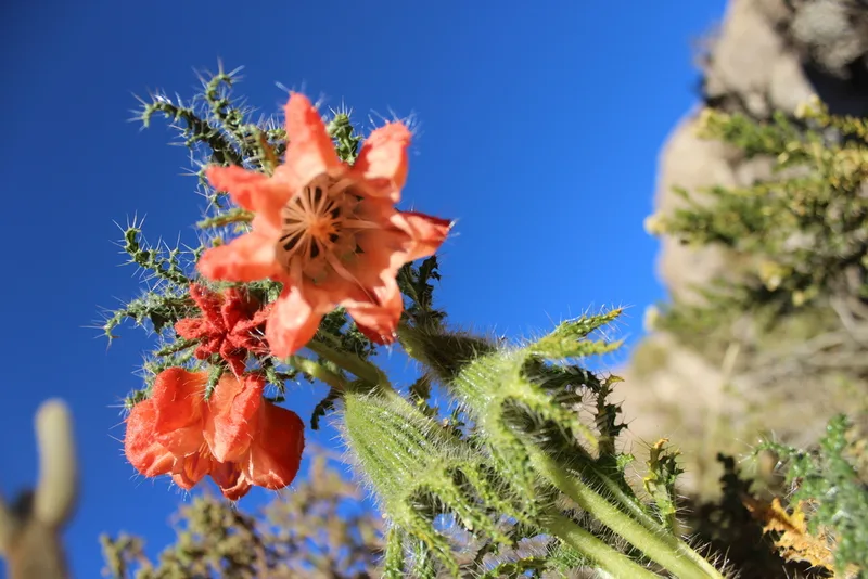
Caiophora chuquitensis -
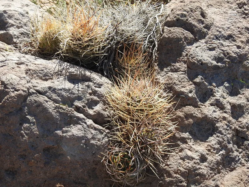
Lobivia ferox
Field Notes · Night Sky lens · Salar de Uyuni · −20.2043, −67.5150