Saguaro
Saguaro National Park · Arizona, USA
In this desert, a plant can be a calendar written in ribs and arms.
Why here
Saguaro is a desert that stores time in living shapes. The cactus stands above the Sonoran ground, while smaller plants gather in the shade and washes around it. The regional rock record is sedimentary, but the visible history is also ecological: a plant grows slowly, survives dry seasons, and changes the way water and animals use the ground around it. Walk among the saguaros without treating them as isolated monuments. Look at the soil, the slopes, and the other cacti nearby. The desert becomes legible when the large form points you toward the small conditions that let it stand.
The sites
Cactus as architecture
Valley View Trailhead
32.2771, −111.1978
Valley View Trailhead opens the saguaro forest as a pattern rather than a collection of individual plants. Tall cacti rise from slopes and washes, with smaller barrel cacti and desert shrubs occupying the gaps. Look for how water changes the spacing. Plants gather more densely where runoff and soil make a better foothold, while exposed ridges stay open. The saguaro is the high point of the view, but the valley below explains how it lives.
Follow a shallow wash and compare its plant density with the ridge beside it. Water moves through the wash, creating a denser line of desert life.
- AccessShort walk
- ExertionEasy
- TimeHalf a day
Camino Loma Alta
32.1331, −110.6872
Camino Loma Alta brings you close to the cactus forms. Saguaros hold their arms and ribs above the ground, but their real story begins below the visible shape, in stored water and roots that wait through dry periods. Fishhook barrel cactus keeps a lower profile and answers the same desert with a different body. Compare the two without turning either into a symbol. They are working plants, built for heat, drought, and brief rain.
Find a saguaro and a barrel cactus in the same view. Their different heights and shapes are two ways of keeping living tissue above or below the desert’s hottest air.
- AccessShort walk
- ExertionEasy
- TimeAn hour
Water in the desert
Amole Peak
32.2720, −111.1547
Amole Peak gives the desert a high perspective. From the slope, washes and ridges form a network beneath the saguaros, and the difference between runoff ground and exposed rock becomes visible. A storm may be brief, but the land remembers its path. Plants take advantage of the places water reaches, and animals follow the cover. Look for the lines that connect a high slope to a lower valley.
Trace a wash downhill and notice where plants thicken. The denser growth marks a route where short storms can leave water and soil.
- AccessHalf-day hike
- ExertionModerate
- TimeHalf a day
Apache Peak
32.2840, −111.1923
Apache Peak places the saguaro forest against open mountain country. The plants hold the lower desert, while rock and exposure limit life higher up. This is a vertical version of the same desert pattern: water and shelter decide where a plant can stay. Look at the saguaros as markers of a climate zone, then look beyond them to the bare slopes where that zone ends.
Find the highest saguaro on the slope and compare it with the bare ground above. The transition shows how temperature, water, and exposure sort the desert by elevation.
- AccessHalf-day hike
- ExertionStrenuous
- TimeA full day
A living desert calendar
Beehive Peak
32.1473, −111.0470
Beehive Peak keeps the large desert shapes in view while giving attention to seasonal change. A saguaro’s flowers, fruit, and branching form belong to different moments in its long life, and the surrounding ground responds to rain in its own brief windows. The peak is a useful place to see time as a pattern rather than a date. Follow one slope from green pocket to dry ridge and notice which plants remain visible after the bloom has passed.
Look for flowers or fruit on a saguaro if the season allows, then inspect the ground below it. The plant’s height supports life above while its shade changes the soil beneath.
- AccessHalf-day hike
- ExertionModerate
- TimeHalf a day
When it's best
Cooler months are easiest for walking the open desert, and spring may bring flowers after useful winter rain. Summer heat makes early hours important. Saguaros remain the central presence year-round, while birds and lizards respond to shade, temperature, and water. The desert rewards slow observation, especially where a wash or sheltered slope creates a different pocket of life.
Go deeper
The names behind what you saw. The payload includes Cenozoic sedimentary rocks. Saguaro, Carnegiea gigantea, and fishhook barrel cactus, Ferocactus wislizeni, are the signature plants.
To read next. - Saguaro’s geological map — for the sedimentary country beneath the desert. - Sonoran Desert ecology material — for cactus growth, water, and animal shelter.
The names behind what you saw
What lives here, and what it's called. Photographs from open collections — an aid to identification, not decoration.
-
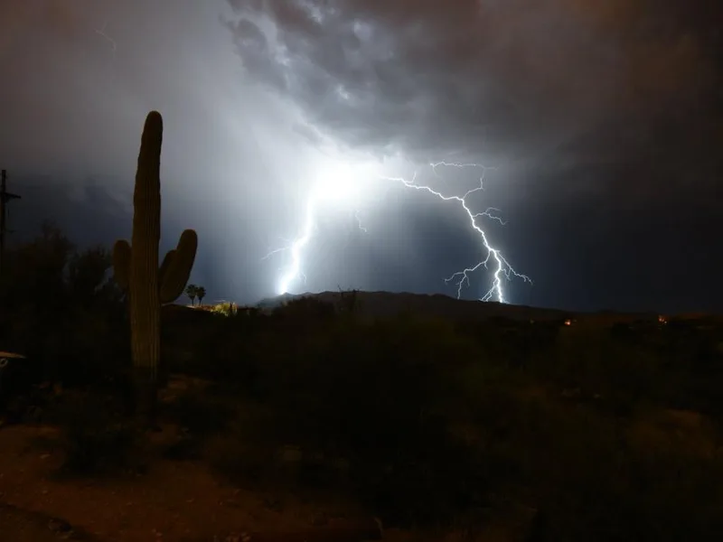
saguaro Carnegiea gigantea -
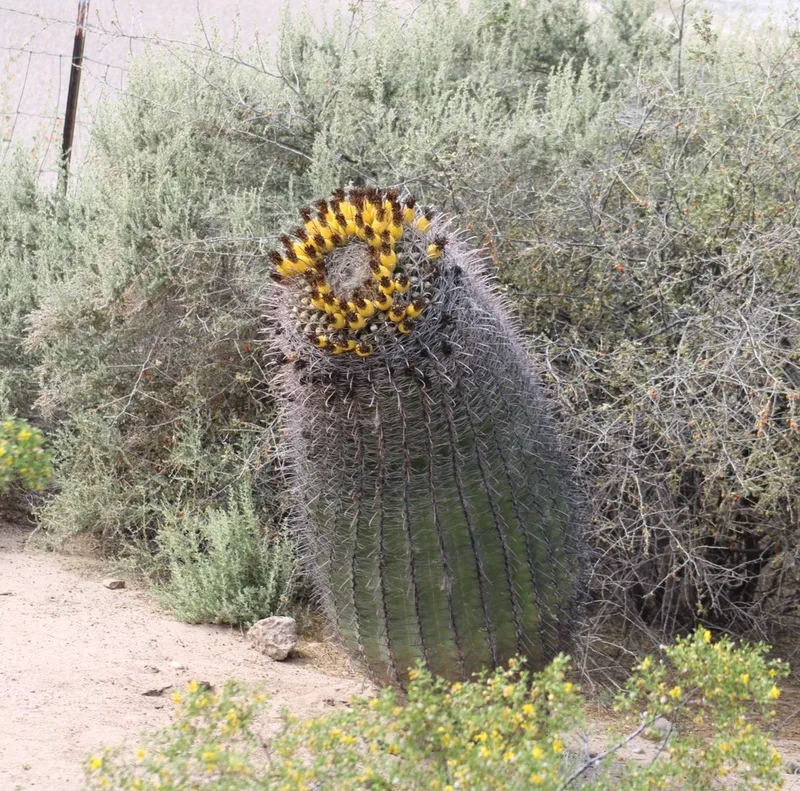
fishhook barrel cactus Ferocactus wislizeni -
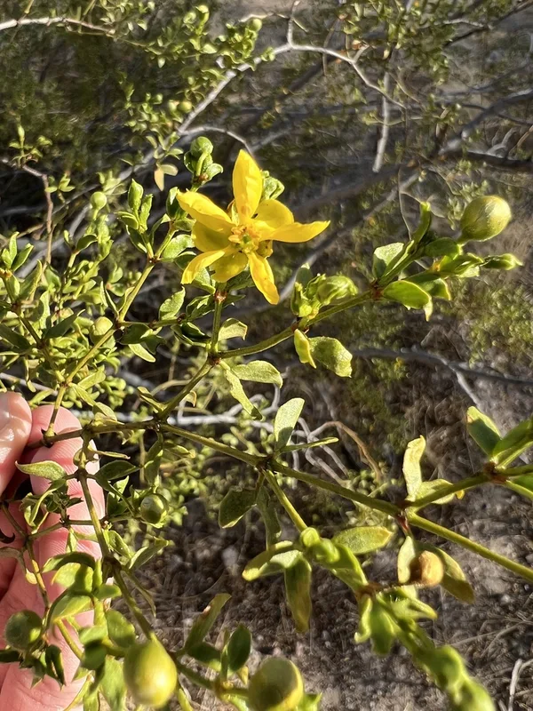
Creosote Bush Larrea tridentata -
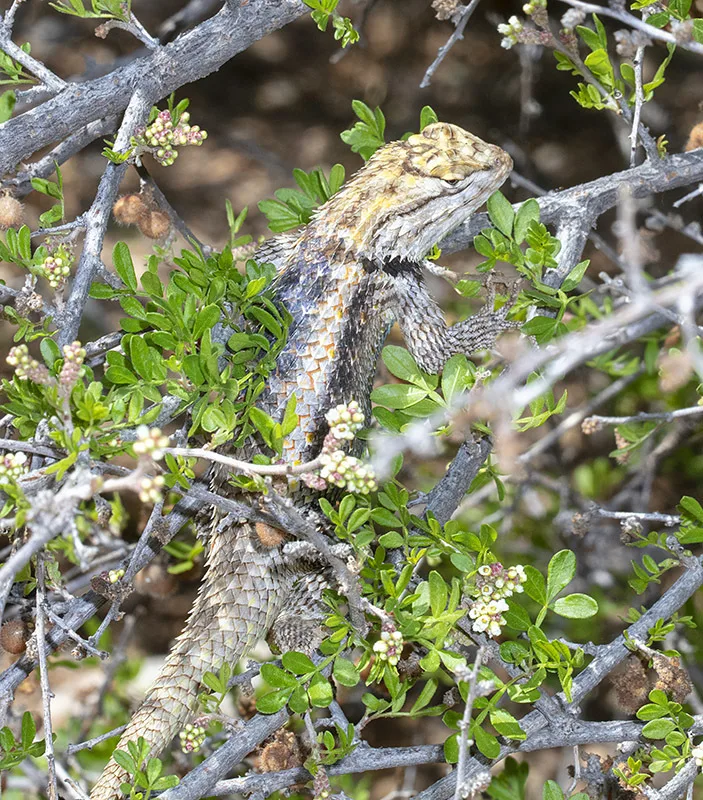
Desert Spiny Lizard Sceloporus magister -
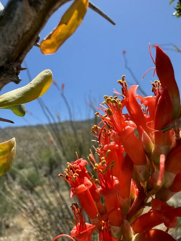
ocotillo Fouquieria splendens -
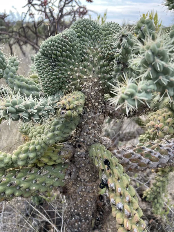
Chain-fruit Cholla Cylindropuntia fulgida -
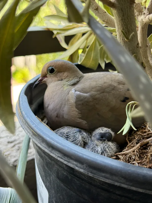
Mourning Dove Zenaida macroura -
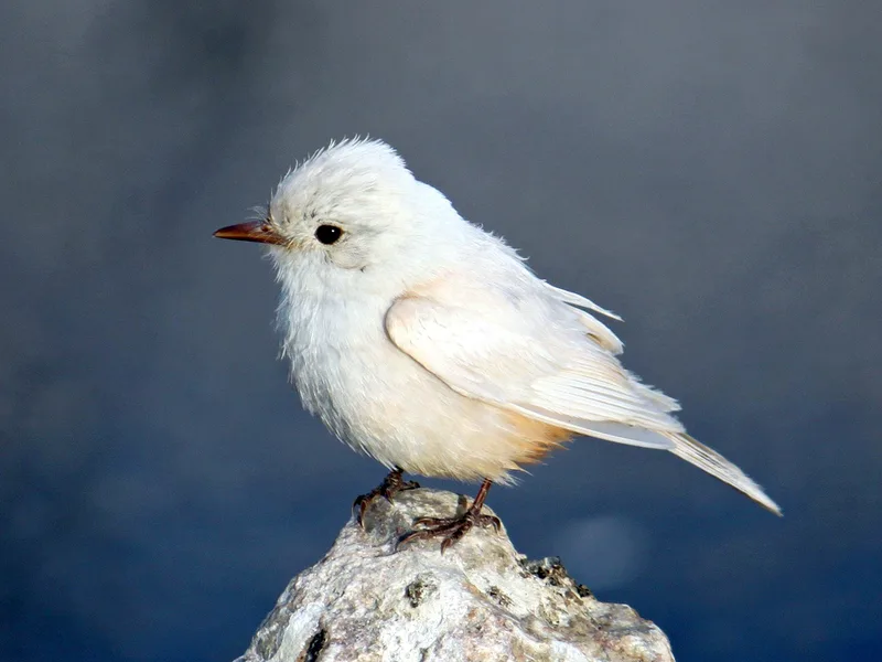
Vermilion Flycatcher Pyrocephalus rubinus -
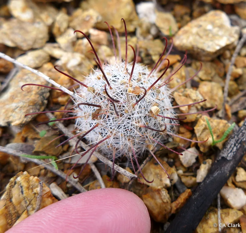
Graham's nipple cactus Cochemiea grahamii -
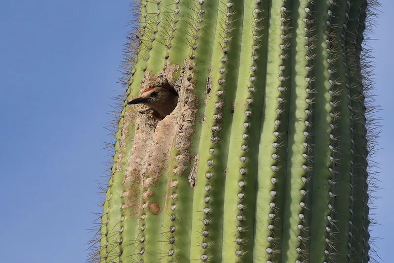
Gila Woodpecker Melanerpes uropygialis -
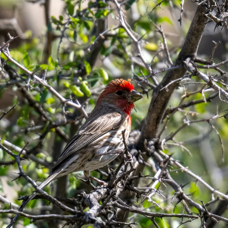
House Finch Haemorhous mexicanus -
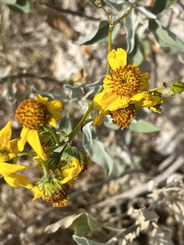
Brittlebush Encelia farinosa
Field Notes · Desert & Deep Time lens · Saguaro National Park · 32.1684, −110.6183