Sagarmatha
Every ridge in this range was a riverbed of ice before it was a trail.
Why here
Stand almost anywhere in Sagarmatha and you are standing on ground the ice made, is still making, or has only just finished making. This is the range that holds four of the six highest points on Earth, but height alone doesn’t explain the shape of the place — cold does. Snow falling on these summits compacts into ice, and that ice does not simply sit still: it flows downhill, carrying rock with it, grinding the valleys wider and deeper as it goes, then dropping everything it carried the moment it finally melts or stalls. Every glacier draining these peaks, on both sides of the range, is doing the same patient work that carved the passes, the U-shaped valleys, and the boulder fields underfoot on the trail. Some of that ice is still there to see. Some of it left only its handiwork — a moraine, a lake, a smoothed slab of bedrock — behind. This note follows both: the ice you can still watch working, and the shapes it left after it moved on.
The story
The rock beneath all of this ice is old and plain: crystalline metamorphic rock, laid down and altered long before there was a Himalaya to sit in, then thrust up into the highest ground on the planet as two continents kept pushing into each other. Ice took over from there. Repeated cold periods carved that uplifted rock into the shapes seen today — sharpened ridges, deep-cut passes, valleys with the characteristic rounded profile only a glacier leaves — and today’s glaciers, smaller than their predecessors, are still finishing the job.
Life holds on at the edges of that ice rather than in the middle of it. Himalayan tahr graze the steep, grassy margins near the snowline; Himalayan monal and blood pheasant work the scrub and rock just below it; a Himalayan griffon riding a thermal can cross more of this glaciated terrain in an hour than a person walking it could cover in a week. None of them live on the ice itself — all of them live in the thin margin the ice hasn’t yet claimed, or has already given back.
People built their lives in that same margin. Villages here sit at altitudes that make them among the highest permanent settlements anywhere, farming short growing seasons squeezed between one winter’s retreat and the next one’s return. The record kept in these sources is quiet on the deeper human history of the ice itself — how any particular community understood or named these glaciers over time — but the villages’ placement, always just below the permanent snow and ice, tells its own plain story of where a life could and couldn’t be built.
The sites
High points the ice built
Kala Patthar
27.9958, 86.8284
Kala Patthar is a black hump of rock, not a proper peak by regional standards, but it stands exactly where a trekker can look straight into the working machinery of a glacier without any technical climbing. From its top the eye runs down onto the broken, debris-covered surface of the Khumbu Glacier, not the clean white river of a postcard, but a churned field of ridges and hollows, streaked grey with rock the ice has plucked off the surrounding walls and is slowly carrying downhill. Every fold in that surface marks a place where the ice below is moving at a different speed than the ice beside it, cracking, sagging in on itself, and refreezing. Look closely and the debris cover becomes a kind of map: thicker where a wall has shed rock recently, thinner and more crevassed where the ice underneath is still moving fast. Few places make the ordinary work of a glacier — grinding, transporting, dumping — so legible in a single glance, because few glaciers anywhere are watched from directly above by so many people.
From the top, follow the glacier’s surface downhill with your eyes and find one long dark ridge of loose rock running the same direction as the ice below it. That’s a moraine — debris scraped from the valley walls and carried along the glacier’s edge. Trace it as far as you can, and you’re tracing the outline of ice that used to fill more of this valley, higher up, before it melted back to today’s level.
- AccessHalf-day hike
- ExertionStrenuous
- TimeHalf a day
Gokyo Ri
27.9615, 86.6831
Gokyo Ri looks out the other direction — west across the valley, over a lake-strewn shelf of turquoise water sitting improbably beside a wall of tumbled ice. The glacier below is one of the reasons the lakes exist at all: retreating ice leaves behind ridges and hollows of rubble, and where a ridge blocks a hollow, meltwater collects and stays, held in place by nothing more than a heap of loose rock. Stand here and you’re looking at a landscape mid-transition — some of what you see used to be solid ice a human lifetime ago, and some of what looks like solid ground is really old ice wearing a coat of rubble that hasn’t melted through yet. The peaks that ring the valley, Cho Oyu chief among them, keep feeding the system from above, but the ice they send down is visibly losing the argument with gravity and warmth by the time it reaches the lakes. That tension, between ice arriving from the heights and ice failing to survive the trip, is most of what a person standing on this summit is actually watching.
Pick one of the lakes below and look at its far shore for a low, humped ridge sitting higher than the surrounding ground — that’s the moraine holding the water in. Follow that same ridgeline uphill, into the ice, and it doesn’t stop at the lake’s edge: it continues as a stripe running up the glacier’s back, marking the old edge of a tongue of ice that has since thinned and pulled back.
- AccessHalf-day hike
- ExertionStrenuous
- TimeHalf a day
रेंजो ला
27.9474, 86.6585
Renjo La sits on a saddle in the range, and crossing it means walking, briefly, across ground that a glacier smoothed and then abandoned. The rock underfoot on the approach is scoured nearly bare in long, shallow-swept shapes, the kind ice leaves when it slides across bedrock carrying grit like sandpaper rather than plucking chunks free. Higher up, the pass narrows into a true col — the low notch between two rising ridgelines where ice, working from both sides at once, has cut the range down to its thinnest point. From the top, the view opens onto peaks on both sides of the divide at once, plus a look back down into the lake-and-ice country the trail just climbed out of. It’s a useful place to feel the scale of the work: not one glacier’s worth of carving, but two valleys’ worth, meeting at a saddle that used to be solid mountain.
At the pass itself, run a hand over the exposed rock underfoot rather than the loose scree beside the trail. Where it feels smooth and faintly grooved in one consistent direction, you’re touching bedrock a glacier polished as it passed, the grooves cut by rock fragments dragged along in the ice like teeth in a file.
- AccessExpedition
- ExertionStrenuous
- TimeA full day
Passes the ice still guards
Cho La
27.9617, 86.7516
Cho La is a working pass in the plainest sense — it connects two villages, and people still cross it to get from one to the other, which means the route has to deal honestly with whatever the terrain gives it. What the terrain gives it, on the western side, is old ice: even in the driest months the descent crosses a slope of hard, weathered snow and ice that never fully clears, a remnant of the same glaciers that carved this notch through the ridge in the first place. The pass sits at real altitude, well above where most plants give up, in a landscape of bare rock, ice, and sky. Coming from either village, the approach climbs through a valley shaped like a shallow U rather than a V — the signature glaciers leave when they carve, rather than the V-shaped notches a river cuts instead. Watching that U-shape resolve into a proper col at the pass is watching the same process that shaped the whole range, at a scale a walking day can cover.
Partway across the pass, look at the valley walls rising on either side rather than the ground underfoot. Where they curve up and over in one continuous rounded sweep, instead of meeting the valley floor at a sharp angle, that’s the signature of a valley ice carved rather than a river cut — a river valley narrows to a V, a glacier’s valley keeps its U shape for a long way.
- AccessExpedition
- ExertionStrenuous
- TimeA full day
Kongma La Pass
27.9297, 86.8362
Kongma La’s approach shows the effort this pass demands: the trail spends a long stretch crossing loose, angular boulders rather than solid path, the kind of jumbled rockfield a retreating glacier piles at its own edges and terminus once the ice beneath finally gives out. Underfoot, almost none of the material has been rounded or sorted the way a stream would sort it — it’s simply dumped, sharp-edged, wherever the ice let go of it, which is the plainest difference between rock moved by ice and rock moved by water. The pass itself opens onto one of the more sweeping high views in the range, peaks in most directions and a long look back down the boulder field just crossed. Take the crossing seriously: the altitude and the terrain both ask more of a walker here than either does alone, and the reward is a clearer sense of how much loose material even a shrinking glacier can leave behind.
Pick up one of the boulders near the pass and look at its edges rather than its size. Sharp and angular, not smoothed or rounded, is the tell that ice carried and dropped it rather than a stream, which tumbles and rounds stones as it moves them. A whole field of edges like that is a glacier’s rubbish pile, left behind wherever the ice finally stopped.
- AccessExpedition
- ExertionStrenuous
- TimeA full day
Faces still hung with ice
Cholatse
27.9196, 86.7652
Cholatse is best watched rather than climbed — its north and east faces are visible from the main trail near Dughla, and what’s visible is a small glacier hanging directly off the mountain’s steep upper section, feeding down toward the valley below. Unlike the broad, slow rivers of ice lower in the range, a glacier perched this high and this steep survives on a knife’s edge: any warmer than it can tolerate and its lower reaches simply calve or melt away faster than snowfall higher up can replace them. That balance, visible from a comfortable distance rather than up close, is one of the more honest lessons this landscape offers about how a glacier actually behaves — not as a fixed feature but as an ongoing argument between snowfall at the top and melt at the bottom, one that’s currently readable, from a safe stretch of trail, just by looking up.
From the trail near Dughla, look at Cholatse’s upper slopes for a patch of ice noticeably whiter and more textured than the surrounding rock and snow. That’s the glacier itself, distinct from seasonal snow cover because it holds its shape and position from one visit to the next rather than coming and going with the weather.
- AccessShort walk
- ExertionEasy
- TimeAn hour
Taboche
27.8973, 86.7794
Taboche stands shoulder to shoulder with Cholatse, joined to it by a long connecting ridge, and from the same stretch of trail near Dughla the two read almost as one mountain wearing ice in slightly different places. Where Cholatse carries its glacier on a steep east face, Taboche’s ice sits in shadowed pockets and gullies higher up its own flanks — smaller patches, tucked into terrain steep and shaded enough to keep one season’s snow surviving into the next season’s accumulation. Seen together, the two peaks make a useful comparison: same range, same general elevation, same basic climate, but different amounts of ice depending on which way a slope faces and how much sun it catches through a day. That’s most of what decides whether a given patch of a mountain keeps its ice or loses it — not altitude alone, but aspect, the simple fact of which direction a slope happens to face.
Compare the two peaks side by side. Note which faces carry visible ice and which are bare rock, then notice which of those faces catch the most direct sun through the middle of the day. Aspect — not just height — is doing most of the work in deciding where the ice has managed to hang on.
- AccessShort walk
- ExertionEasy
- TimeAn hour
When it's best
Even in what counts as early spring here, the cold keeps the ice honest: mornings stay well below freezing, precipitation is sparse, and meltwater that does form during the day usually refreezes solid again by dark. That is the general character of the place through the pre-monsoon months, before the summer clouds arrive — cold, dry, and, for exactly that reason, some of the clearest viewing of the glaciers and the peaks feeding them all year. Autumn, after the summer’s moisture has cleared out, tends to offer a similar clarity from the other direction of the calendar. Midsummer brings cloud and heavier snowfall higher up, burying the moraines and softening the sharp lines the rest of the year keeps visible; midwinter is colder still and quieter, with the ice at its most locked down and the passes at their most serious. There’s no season this landscape stops being made of ice — only a difference in how much of that ice-making is currently hidden under fresh snow.
Go deeper
The names behind what you saw. The pale, ancient basement underlying these peaks is mapped as Precambrian-Phanerozoic crystalline metamorphic rock — search that for the geologic unit. The named ice masses draining this section of the range include the Khumbu and Ngojumba Glaciers on the Nepal side, and the Barun, Rongbuk, and Kangshung Glaciers elsewhere across the massif. Species seen at the ice’s edge: Himalayan Tahr (Hemitragus jemlahicus), Himalayan Monal (Lophophorus impejanus), Blood Pheasant (Ithaginis cruentus), Himalayan Griffon (Gyps himalayensis), Tibetan Snowcock (Tetraogallus tibetanus).
To read next. - “Sagarmatha National Park” (Wikipedia) — the park’s official boundaries and elevation range, useful for orienting everything else in this note. - “Mahalangur Himal” (Wikipedia) — names every major glacier draining this section of the range and which river system each one ultimately feeds. - “Cholatse” (Wikipedia) — the one entry here that names a specific glacier by its own name and the exact trailside spot to view it from. - “Cho La (Nepal)” (Wikipedia) — the pass’s elevation and the two villages it connects, for anyone planning to actually cross it. - “Lobuche” (Wikipedia) — background on the settlement and peak pair closest to the Khumbu Glacier’s snout, including the permitting distinction between the trekking and expedition summits.
The names behind what you saw
What lives here, and what it's called. Photographs from open collections — an aid to identification, not decoration.
-
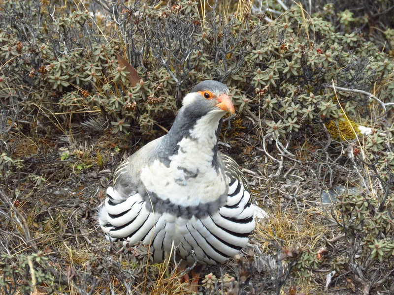
Tibetan Snowcock Tetraogallus tibetanus -
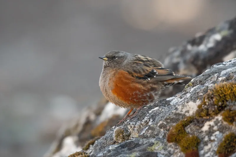
Alpine Accentor Prunella collaris -
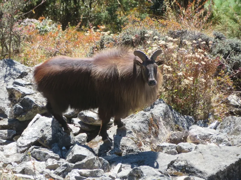
Himalayan Tahr Hemitragus jemlahicus -
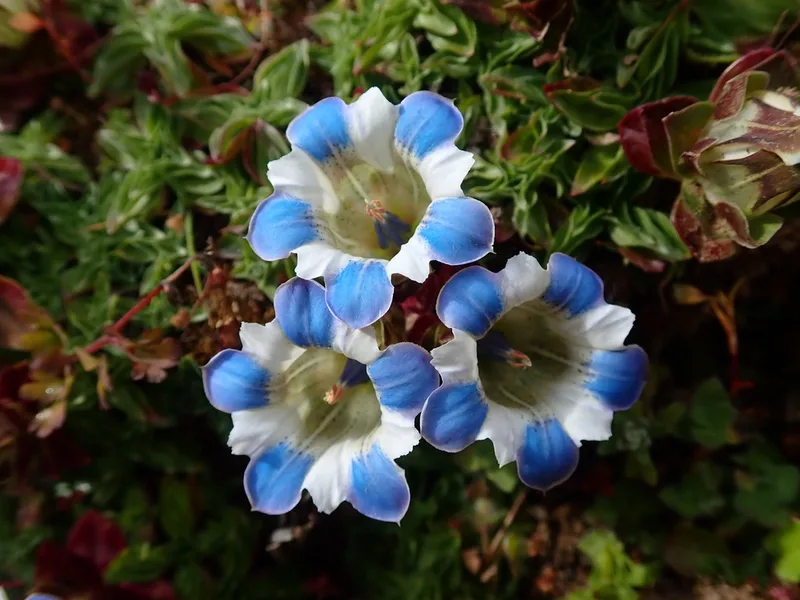
Gentiana depressa -
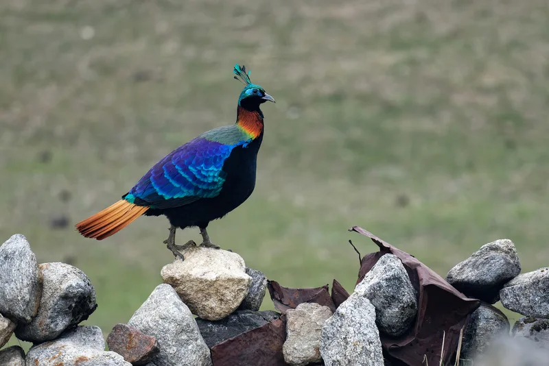
Himalayan Monal Lophophorus impejanus -
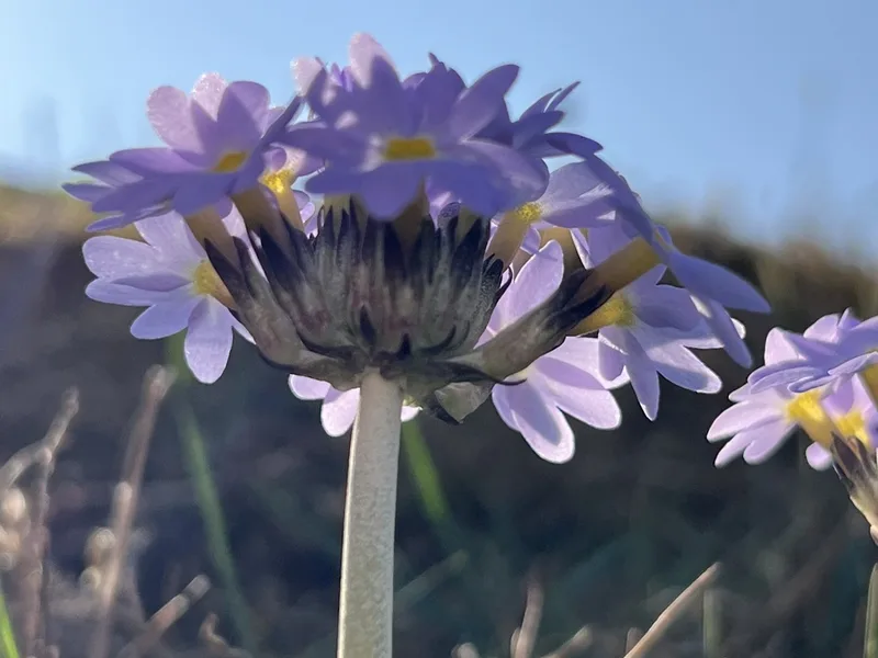
Drumstick Primrose Primula denticulata -
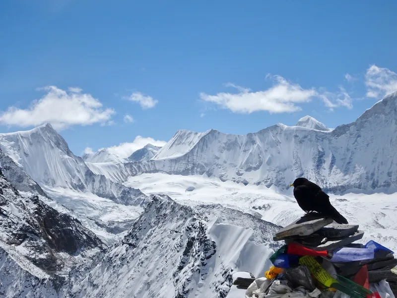
Yellow-billed Chough Pyrrhocorax graculus -
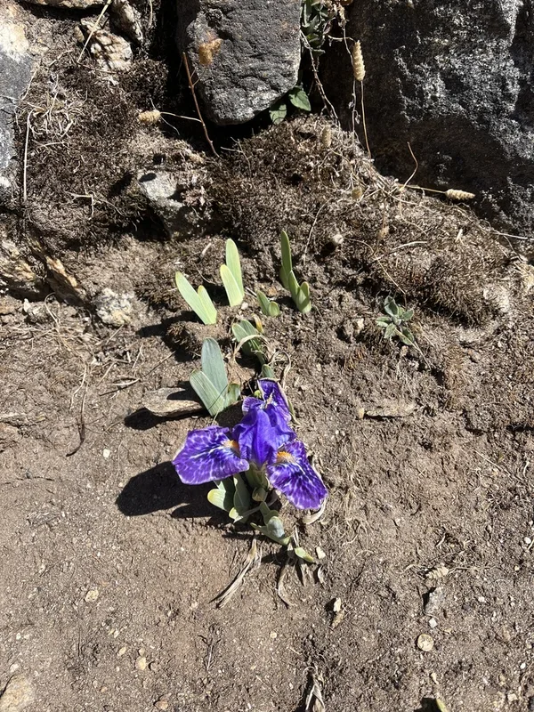
Kumaon iris Iris kemaonensis -
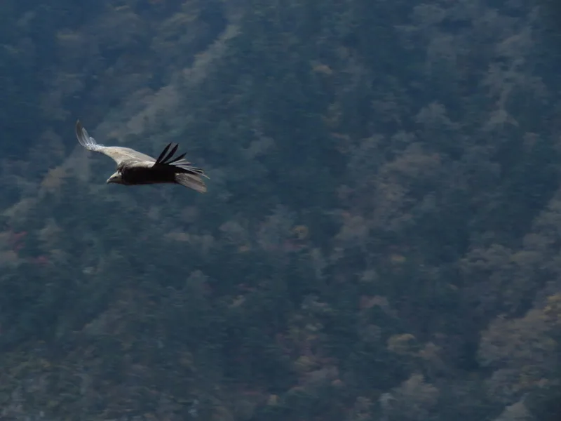
Himalayan Griffon Gyps himalayensis -
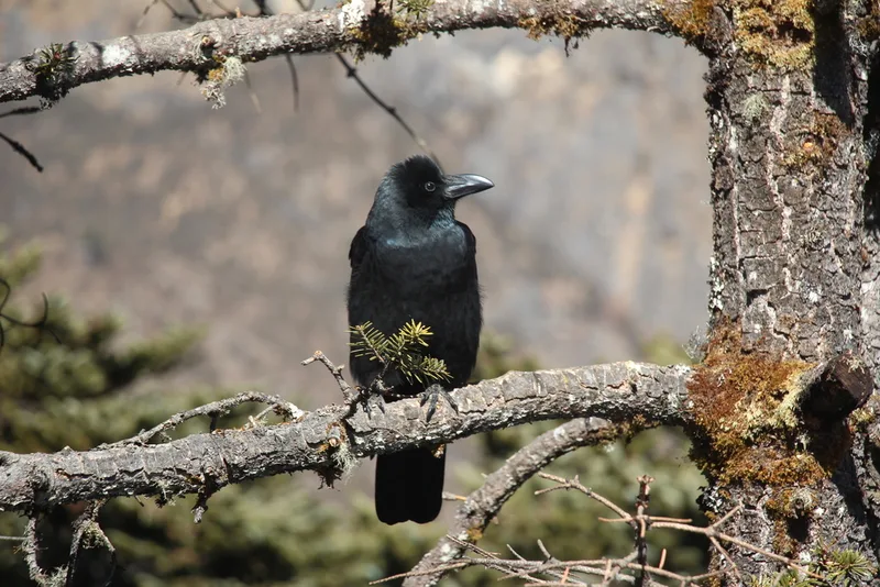
Large-billed Crow Corvus macrorhynchos -
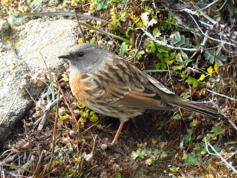
Robin Accentor Prunella rubeculoides -
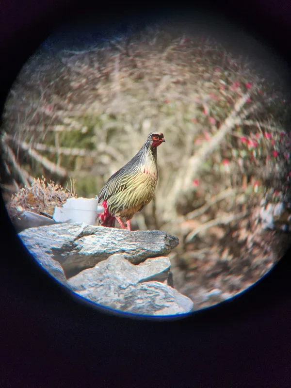
Blood Pheasant Ithaginis cruentus
Field Notes · Ice & Glaciers lens · Sagarmatha · 27.9426, 86.7506