Point Reyes
Point Reyes National Seashore · California, USA
Fog is not weather arriving at the coast. It is part of the coast's way of living.
Why here
At Point Reyes, the ocean reaches inland before the water does. Fog slides over the headlands, wets the grass, and disappears into forest and pasture. The peninsula is a meeting place between exposed coast and sheltered ground, which is why a short drive can move you from wind-bent trees to elk country, from open bluff to a quiet estuary. The geology adds another kind of meeting. Marine siltstone and sandstone underlie a landscape that has been lifted, worn, and opened to the sea. Follow the fog inland and the place becomes legible: moisture first, then plants, then animals, then people making use of the edges. These stops keep returning to that sequence without asking the coast to be one thing.
The story
Point Reyes carries marine sedimentary rock and a mix of beaches, estuary ground, grassland, and forest. The coast’s exposed edge receives the first weather; the inland valleys hold it longer. That difference makes room for distinct communities close together.
Elk and mule deer use open country, while banana slugs and newts belong to damp cover. Northern elephant seals gather at the outer coast, where the surf and wind make a different world from Tomales Bay. The payload also names Kule Loklo and Sogorea Te Land Trust among the human record. The land has never been empty scenery; it has been a lived coast as well as a geological one.
The sites
Fog over living ground
Coast Trailhead
38.0438, −122.8636
The coast trail begins where the peninsula opens fully to wind and fog. From here, the sea is not a distant backdrop but the source of the weather moving across the grass and bluff. Marine sedimentary rock underlies the edge, and the exposed surface shows what wind and water can do to a raised coast. Walk a short way and let the view alternate between near detail and long distance: grass bending, fog whitening a ravine, the ocean appearing and disappearing. The trail is useful because it makes the peninsula’s main exchange visible. Moisture comes in from the sea, and the land answers with plants.
Watch the fog touch the nearest grass before it fills the farther valleys. The first wetness arrives on exposed leaves and blades, giving the coastal plants moisture even when rain is absent.
- AccessHalf-day hike
- ExertionModerate
- TimeHalf a day
Estero Trailhead
38.0814, −122.9141
Estero is the sheltered side of the same coast. Water collects in an estuary rather than meeting the open Pacific directly, and the land around it holds a quieter mix of mud, grass, and shallow water. This is where the fog’s moisture becomes habitat. Birds use the open edges, deer cross the grass, and the trail lets you see how a protected inlet supports life differently from a wave-cut bluff. Keep your attention low as well as wide. The important change is not only the horizon but the line where wet ground ends and higher pasture begins.
Find the boundary between the open estuary and the drier grassland. The change in ground tells you where salt water, fresh rain, and fog meet to make different living conditions.
- AccessHalf-day hike
- ExertionModerate
- TimeHalf a day
The animals of the edges
Elephant Seal Overlook
37.9974, −122.9822
The overlook turns the outer coast into a place of waiting. Northern elephant seals use beaches where they can come ashore, and from this distance the animals may look like pale stones until one shifts or lifts its head. The point is not to approach but to watch the pattern: bodies gathered at the edge of surf, resting between movements, with the sea supplying the cold, food-rich world they belong to. Their presence makes the peninsula’s geography feel larger. The headland is not only a place for people to stand and look outward. It is a threshold used by animals whose lives are mostly offshore.
Use the overlook to scan the beach rather than focusing on one animal. Look for the slow collective movement of the seals and the wide strip of space they keep between themselves and the bluff.
- AccessDrive-up
- ExertionEasy
- TimeAn hour
Kehoe Beach Trailhead
38.1527, −122.9390
The walk to Kehoe Beach moves through a softer coastal edge, where grassland meets sand and the wind has room to rearrange both. This is good country for looking at transitions. A beach is not merely the end of the land; it is a band that receives drift, salt, fog, and the remains of the living sea. Behind it, the grass holds the ground together. The geology is quiet here, but that quiet is useful. Watch how a thin strip of moisture can support a different set of plants from the dry slope just above it. Point Reyes keeps changing by degrees, and the degrees are where its life is.
At the beach edge, compare plants growing in sand with plants growing a few steps inland. The difference in salt, wind, and available moisture makes two small habitats side by side.
- AccessShort walk
- ExertionEasy
- TimeHalf a day
People on the peninsula
Five Brooks Trailhead
37.9974, −122.7578
Five Brooks is an inland doorway into the peninsula’s wet side. The trail enters forest and creek country, where fog that crossed the outer coast can linger in shade and keep the ground cool. This is the setting for banana slugs, newts, and the small signs of water moving under leaves. The trailhead also makes a useful counterpoint to the exposed overlook. Point Reyes is not defined by one dramatic edge. Its character comes from the short distance between dry bluff, damp woodland, estuary, and pasture. Walk slowly enough to notice when the air changes under the trees.
Look beneath damp leaves near the trail for a California newt or banana slug, then look up at the fog-darkened canopy. Moisture is the common thread connecting the forest floor to the air above it.
- AccessShort walk
- ExertionModerate
- TimeHalf a day
When it's best
The coast is often most atmospheric when fog is present, while clear days open the longer views across the headlands and bay. Spring can bring California poppies and other flowers to the grassland; late summer and fall are good seasons for watching the peninsula’s open country settle into warmer light. Elephant seals are easiest to notice when they are gathered on the outer beaches. Wind and fog can change quickly, so keep one sheltered stop in reserve.
Go deeper
The names behind what you saw. The peninsula’s mapped bedrock includes the Purisima Formation, marine siltstone, sandstone, and mudstone. The animals include the California newt, Taricha torosa, and northern elephant seal, Mirounga angustirostris.
To read next. - The geology of Point Reyes Peninsula — a broad introduction to the rocks and landforms behind the peninsula. - Geology of Point Reyes National Seashore and Vicinity, California — a more detailed map-based treatment for readers who want the structure beneath the fog.
The names behind what you saw
What lives here, and what it's called. Photographs from open collections — an aid to identification, not decoration.
-
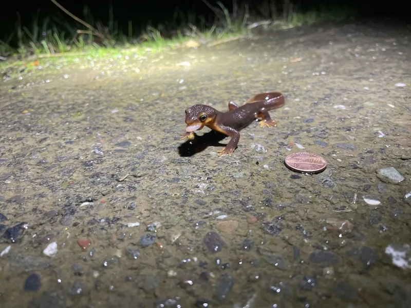
California Newt Taricha torosa -
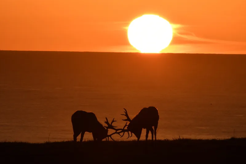
Elk Cervus canadensis -
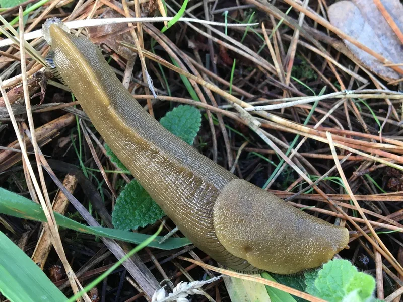
Button's Banana Slug Ariolimax buttoni -
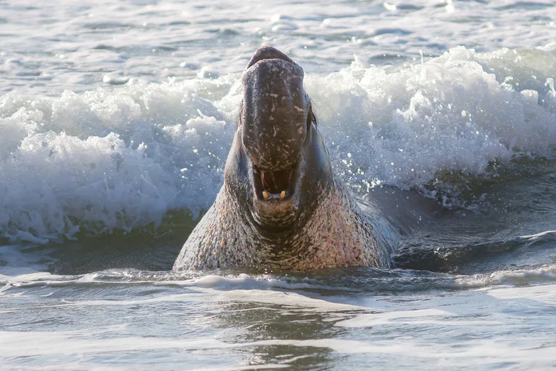
Northern Elephant Seal Mirounga angustirostris -
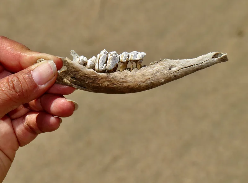
Mule Deer Odocoileus hemionus -
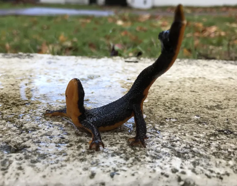
Rough-skinned Newt Taricha granulosa -
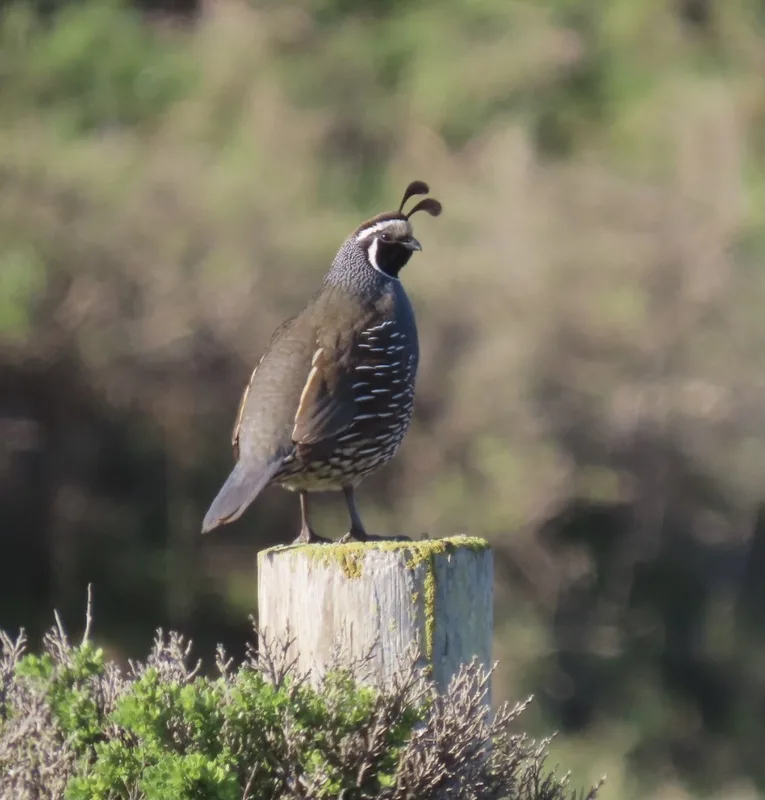
California Quail Callipepla californica -
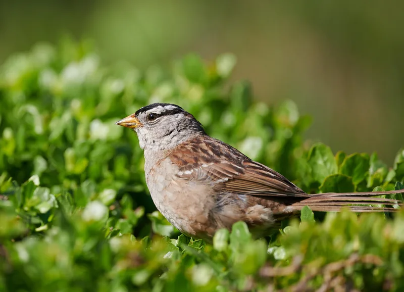
White-crowned Sparrow Zonotrichia leucophrys -
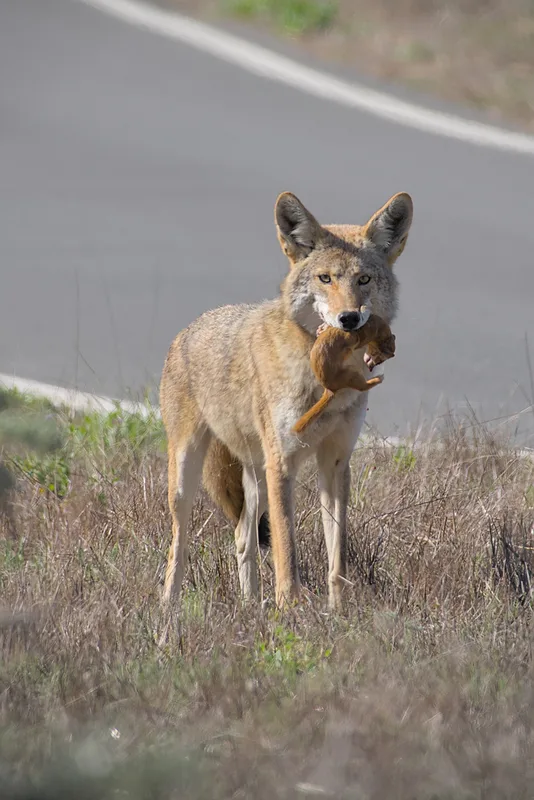
Coyote Canis latrans -
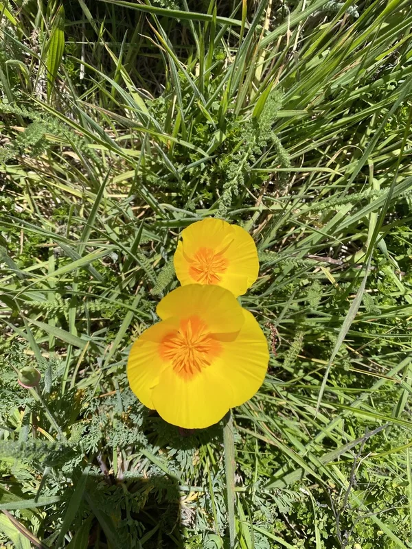
California poppy Eschscholzia californica -
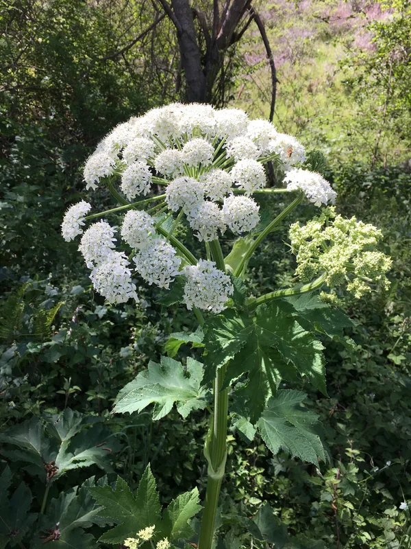
common cowparsnip Heracleum maximum -
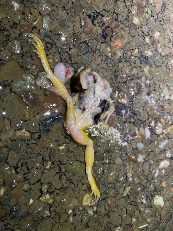
Pacific chorus frog Pseudacris regilla
Field Notes · Fog Coast lens · Point Reyes National Seashore · 38.0705, −122.9176