Plitvice Lakes
Plitvice Lakes · Lika-Senj, Croatia
Every barrier in these lakes was built by the water it holds back.
Why here
Most rivers argue with rock in only one direction: they cut, patiently, until a canyon opens where solid stone used to be. The water moving through Plitvice does that too, eventually, once it escapes downstream — but here, inside the park, it does something stranger first. Flowing over moss, fallen branches and its own limestone bed, the water drops dissolved rock back out of solution and cements it into ridges, building barriers tall enough to hold back entire lakes, one thin mineral film at a time. Lake spills into lake, held apart by walls the water made for itself, until a barrier finally gives out into a waterfall and the whole process starts again downstream. It is construction and demolition running at once, on the same material, by the same water — an argument between flowing and stopping that neither side ever fully wins. This note follows that argument along the chain: barriers going up, water breaking through them, and finally, past the lakes, the older, more familiar habit of a river simply cutting its way out.
The story
The limestone under Plitvice settled first, laid down in shallow seas during the Late Cretaceous, when what is now this park lay somewhere under warm water thick with reef debris — rudist shells among it, the source of the pale rock’s name. That rock sat mostly unchanged for tens of millions of years, then met water again, this time falling as rain rather than covering it as sea, and the two have been negotiating ever since: dissolving here, redepositing there, building barriers as fast as the flow will let them, and cutting through the plateau’s edges wherever it escapes those barriers. The life drawn into that arrangement is almost all water life — chub and pike patient in the cooler lakes, tessellated water snakes working the shallows, beautiful demoiselles hovering at the banks in the warmer months, mallards and herons treating the whole terraced system as one long wetland rather than a chain of separate lakes. People arrived into an already-finished argument and mostly chose to leave it alone: the park earned recognition specifically for the tufa lakes, caves, and connected waterfalls as a linked system, not for any single lake or fall on its own — an unusually accurate piece of praise, since separating one barrier from the water above and below it would misunderstand what is actually happening here.
The sites
The barriers water built
Malo Jezero
44.8749, 15.6028
Malo Jezero is one of the string of lakes strung along this shallow limestone basin like beads on a thread — each held at its own level by a dam the water built itself. Unlike a river cutting a canyon by wearing rock away, the water flowing through Plitvice does something like the reverse: as it moves across mosses, algae and fallen wood, dissolved limestone drops back out of solution and hardens into tufa, cementing debris into ridges that grow, millimeter by millimeter, until they hold back an entire lake. Malo Jezero sits low in that string, near where the whole cascade begins to gather itself before running on toward the Korana river. Stand at its edge and the lake looks static, a sheet of pale green water — but every barrier holding it in place is a living structure, still being built today by the same process that raised it. It is a useful place to start: everything else in the park is a variation on this one argument between water that wants to keep moving and water that keeps stopping itself.
Look at the underwater fringe near the shallow edge, where submerged branches and stones have gone furred and pale. That crust is tufa forming in real time — notice how gritty rather than smooth freshly deposited limestone looks, compared to the water-smoothed stone further out.
- AccessShort walk
- ExertionEasy
- TimeAn hour
Gradinsko Jezero
44.8770, 15.6116
Gradinsko Jezero is the lake to slow down at if you want to see the barrier-building process at its most intricate. Its surface is broken by small wooded islands and knuckles of travertine, each one a tufa barrier in an earlier chapter of its life, colonized by moss and grass until it reads as solid ground rather than mineral scaffolding. The boardwalk trail crosses directly over several of these low barriers, close enough to watch water sheeting across the growing edge in thin, constant films. That film is doing the actual work: moving water loses carbon dioxide fast, which pushes dissolved calcium carbonate to drop out of solution onto anything in its path, including the mosses that then get entombed in it. The result is a lake that is less a fixed basin than an argument still being negotiated, one where the shoreline itself keeps rearranging on a timescale too slow to watch and too fast, geologically, to ignore. Species drawn to the calm water here, like mallards working the shallows, treat the whole system as settled; the rock has other ideas.
Find a spot where the boardwalk runs close to a mossy island edge and watch the water sheet over it. Notice whether the film looks clear or slightly cloudy with sediment — cloudier water after rain is carrying more dissolved rock to deposit downstream.
- AccessShort walk
- ExertionModerate
- TimeHalf a day
Jezero Galovac
44.8753, 15.6079
Jezero Galovac is one of the larger lakes in the chain and a good place to see how much water actually moves through this landscape without ever behaving like an ordinary river. Rivers, left alone, tend to cut a single channel and stick to it. Here the water spreads instead, filling basin after basin behind barriers it built out of its own dissolved rock, so the whole system reads more like a staircase of held breath than a running stream. Galovac sits mid-chain, deep enough to hold color — a blue-green that shifts with mineral content and light — and calm enough, most days, to mirror the wooded slopes around it. Fish drawn to its cooler, food-rich water, among them chub and the occasional northern pike, treat it as settled habitat, even though the barrier at its lower end is, in geological terms, a temporary arrangement. Every lake in this park is downstream of a barrier and upstream of another; Galovac is simply large enough to make that structure easy to see in one glance.
From the shore, trace the lake’s outline to where it necks down toward a lower barrier. That narrowing is the newest ground in the entire lake — the barrier there is still gaining height, a little, most years.
- AccessShort walk
- ExertionModerate
- TimeHalf a day
Where the barriers let go
Galovački Buk
44.8764, 15.6090
Galovački Buk is where the barrier system stops holding water back and lets it go all at once. Whatever calm accumulates in the lakes upstream ends here, breaking across a wide, tiered travertine face into a run of small waterfalls rather than one clean drop — a direct result of the same barrier-building process seen elsewhere in the park, except here the growing tufa ridge has outpaced the water’s patience and split into many channels instead of one. The sound changes before the view does: the flat quiet of lake water gives way to a steady, layered rush audible well up the trail. Up close, spray keeps the rock face wet and dark, which speeds the same mineral deposition that built the barrier in the first place, so the waterfall is, in a slow sense, continuing to build itself even as it falls. It is a good spot to feel the whole argument of the park compressed into one place: water that spent a long, quiet stretch losing to stone is now, briefly, winning outright.
Watch the spray zone just beside the main flow rather than the falls themselves. Look for a pale, crusted rim forming on stationary objects — twigs, stone edges — sitting in that mist; it is tufa depositing in the one place wet and calm enough to hold still.
- AccessShort walk
- ExertionModerate
- TimeAn hour
Veliki Prštavac
44.8781, 15.6088
Veliki Prštavac drops from a noticeably higher ledge than most of the park’s other falls, and the height itself is a clue to how these barriers actually grow. A travertine barrier does not rise evenly; it thickens fastest where moss and algae get the steadiest film of moving water, and thins or stalls where the flow dries out or scours too hard to let anything settle. Over a long enough run of seasons, that unevenness compounds, and a barrier that started as a low ridge can end up standing tall enough to produce a real waterfall rather than a shallow cascade. Veliki Prštavac is that outcome on display — a barrier that won its argument with the water above it decisively enough to hold a serious drop. Below, the plunge pool churns cool and oxygen-rich, the kind of water fish and aquatic insects favor even though it offers them no calm. From most viewing points the fall is loud enough to be heard before the trail brings it into view, a useful cue that a barrier’s biggest moment is usually announced by sound first.
Look at the rock face behind the falling water itself, not just the pool below. Terraced ledges stepping down the face are older barrier lines, each briefly the edge of the falls before the water built past it.
- AccessShort walk
- ExertionModerate
- TimeAn hour
Mali Prštavac
44.8771, 15.6084
Mali Prštavac sits close enough to its larger neighbor to invite comparison, and the comparison is the point: two barriers built by the same water, in the same rock, only a short walk apart, and yet visibly different in height and shape. That difference is a plain lesson in how uneven and local tufa growth really is — it depends on exactly how much moss colonizes a given stretch of barrier, how steady the flow is across it, and how much debris gets caught and cemented in along the way, none of which happens identically from one meter of barrier to the next. Mali Prštavac is smaller and gentler, water fanning down a shorter, wider face rather than concentrating into a single drop, and the pool below it is correspondingly calmer. It is worth pausing at precisely because it is the modest version, a reminder that most of this park’s water is doing quiet, incremental barrier-building work rather than putting on a show, and that the dramatic falls are the exception rather than the rule.
Compare the width of water spreading across the rock here against the narrower flow at the taller fall nearby. A wider, thinner sheet usually means a younger or less consolidated stretch of barrier, still finding its shape.
- AccessShort walk
- ExertionEasy
- TimeAn hour
Where the argument turns to erosion
Špilja Šupljara
44.9000, 15.6121
Špilja Šupljara is a cave, and caves are the other half of the story that the lakes and waterfalls only hint at: water does not only build with dissolved limestone here, it also dissolves the limestone in the first place. The same chemistry that lets water drop calcium carbonate out of solution to build a tufa barrier can run in reverse underground, where slightly acidic water works slowly through joints and bedding planes in the rock until a passage opens. A walk-through cave along the park’s trail system is a rare chance to stand inside that reverse process, in a space carved out rather than built up, cool and shadowed in a way the open lakes never are. It is a useful corrective to reading the whole park as one long story of construction: the same water, the same rock, and two opposite outcomes depending on whether the water is flowing openly across a surface or working invisibly through cracks underground. Bats and other cave-dependent life shelter in spaces like this, drawn to a stillness the rest of the park’s moving water never offers.
Once inside, pause and let your eyes adjust before looking for smooth, rounded wall surfaces versus sharper, more angular ones. The rounded sections mark where water once flowed through at higher volume; the passage was shaped, not just found.
- AccessShort walk
- ExertionEasy
- TimeAn hour
View Korana
44.9488, 15.6611
View Korana looks out over the river that finally carries this whole system’s water away, and it shows the argument’s other face plainly: downstream of the lakes, freed from the barriers that slowed it, the water goes back to behaving like an ordinary river, cutting into the same limestone that the upper lakes were busy building on top of. The Korana runs off the park’s high plateau through a valley shaped by straightforward erosion — a far more familiar process than tufa deposition, closer to how most rivers everywhere carve their way through rock over long stretches of time. Seeing the two processes within a short distance of each other is the real payoff of this viewpoint: upstream, water constructs its own obstacles out of dissolved stone; downstream, the same water, older habits restored, wears away the obstacles it meets. Neither behavior is more natural than the other — both are just what water does to limestone under slightly different conditions of speed, chemistry, and gradient. Long views over the valley here reward patience more than any single detail.
Look for where the river’s course tracks a visibly straighter or more incised line compared to the winding, terraced shape of the lakes upstream. That straightening is erosion reasserting itself once the barriers are behind it.
- AccessHalf-day hike
- ExertionModerate
- TimeHalf a day
When it's best
Late winter into spring tends to be the fullest and coolest water here — rain and snowmelt from the plateau keep the flow high, and the falls below each barrier run harder and louder than they will later in the year. It is also a cool, often damp stretch of the calendar, worth dressing for rather than avoiding. By summer the water settles into a steadier, gentler rhythm, more lake than torrent, and the swallows and martins that nest along the cliffs and eaves come out low over the surface hunting insects through the long evenings. Neither season is really the better one — spring shows the barriers doing visible work, summer shows the calmer lakes those barriers hold in place — and since the underlying process runs year-round regardless of season, there is no wrong time to come watch it.
Go deeper
The names behind what you saw The pale rock everywhere underfoot is Rudist Limestone, laid down in shallow seas around 100 to 66 million years ago, in the Late Cretaceous — the name comes from rudists, a group of reef-building bivalves common in seas of that age. Below and around it lie broader Mesozoic sedimentary rocks spanning roughly 145 to 66 million years. The mineral crust that builds every barrier in the park is tufa, a freshwater form of travertine — calcium carbonate precipitated out of moving water, often with help from mosses and algae that give it something to cement onto. Species named above by their formal names: European Chub (Squalius cephalus), Northern Pike (Esox lucius), Tessellated Water Snake (Natrix tessellata), Beautiful Demoiselle (Calopteryx virgo), Mallard (Anas platyrhynchos).
To read next - Wikipedia, “Plitvice Lakes National Park” — the source of the park’s own framing as a linked system of tufa lakes, caves, and waterfalls, and its 1979 UNESCO listing. - Wikipedia, “Batinovac” — a short entry on one of the Upper Lakes, useful for seeing how the lake chain is grouped and named. - Wikipedia, “Plitvička Jezera” — covers the wider municipality around the park, context for how settled and administered this landscape is beyond the protected core. - Wikipedia, “Plitvice Lakes incident” — a plain account of a 1991 clash at the park during the outbreak of the Croatian War of Independence, for readers who want the human history alongside the geological one.
The names behind what you saw
What lives here, and what it's called. Photographs from open collections — an aid to identification, not decoration.
-
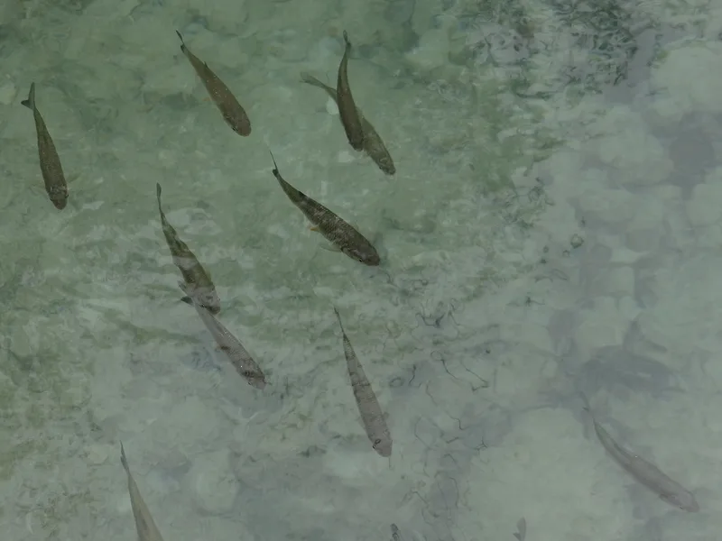
European Chub Squalius cephalus -
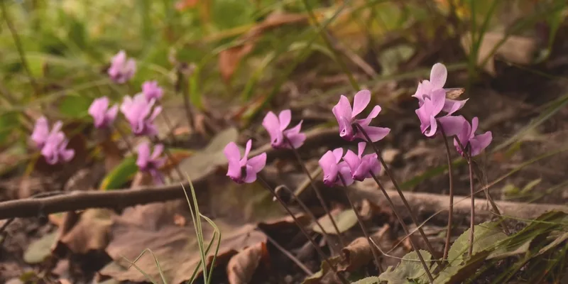
European Cyclamen Cyclamen purpurascens -
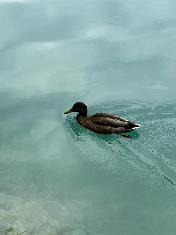
Mallard Anas platyrhynchos -
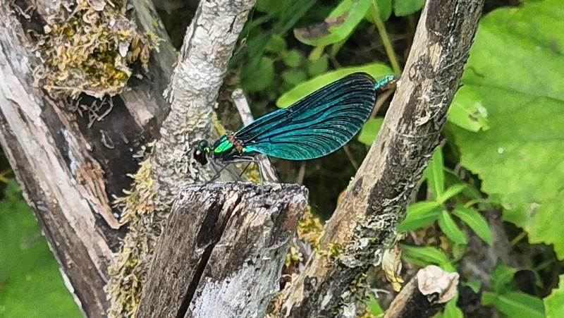
Beautiful Demoiselle Calopteryx virgo -
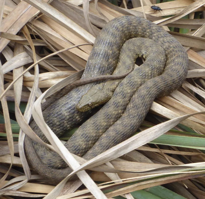
Tessellated Water Snake Natrix tessellata -
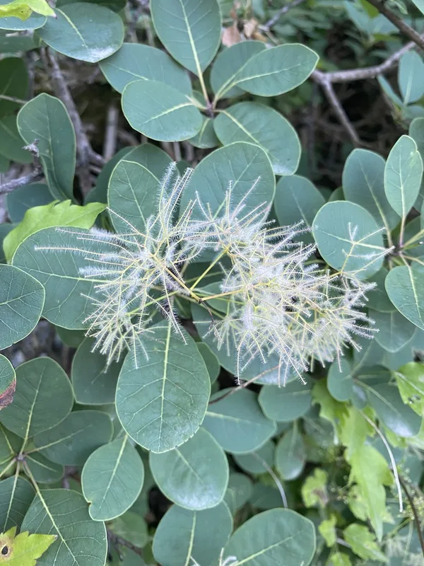
Smokebush Cotinus coggygria -
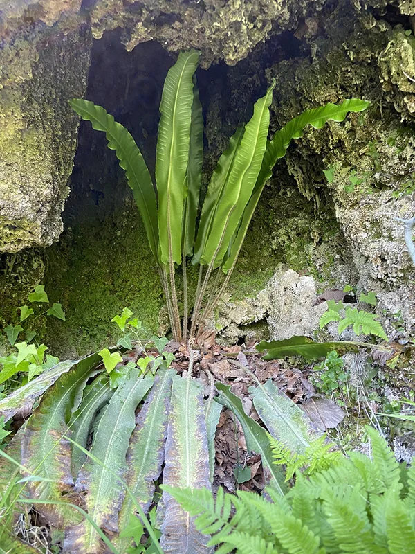
Hart's-tongue fern Asplenium scolopendrium -
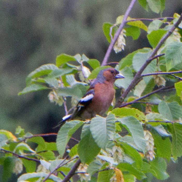
Common Chaffinch Fringilla coelebs -
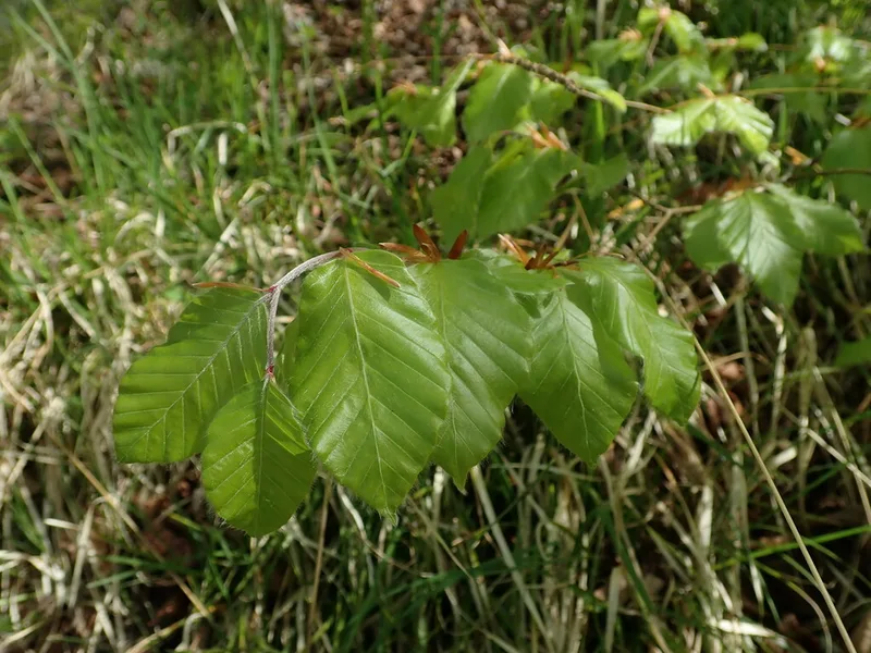
European beech Fagus sylvatica -
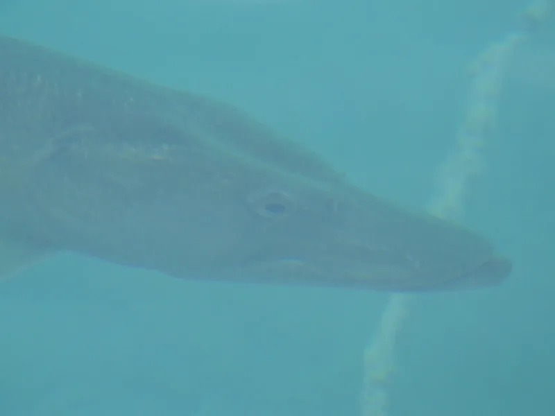
Northern Pike Esox lucius -
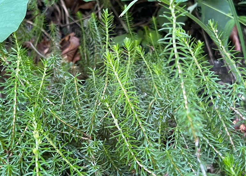
Spring Heath Erica carnea -
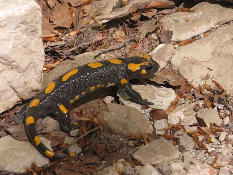
Fire Salamander Salamandra salamandra
Field Notes · Rivers & Canyons lens · Plitvice Lakes · 44.8523, 15.5903