The Oregon Dunes
Oregon Dunes National Recreation Area · Oregon, USA
The coast is always moving here, even when the forest looks settled.
Why here
The Oregon Dunes are a coast caught between wind and water. Sand arrives from the beach, moves inland, piles into ridges, and then meets forests that try to hold it. Fog crosses the whole exchange, cooling the dunes and feeding the green margins. The payload’s sedimentary rocks sit beneath this younger surface, but the visible story is made of movement. A dune is not a hill that happens to be pale. It is a temporary shape in a current of sand. Walk from the lake edge toward the open dunes and watch how plants, wind, and moisture divide the ground into places that move and places that can hold.
The sites
Sand in motion
Drake Dune
43.6332, −124.1901
Drake Dune makes the coast’s movement visible. Wind lifts sand from the beach and carries it inland, where it gathers into a ridge that may look stable until you inspect its surface. The slope, crest, and hollow are temporary arrangements. Look for the way tracks disappear, plants gather at sheltered edges, and bare sand remains exposed on the windward side. Fog cools the surface and softens the distance, but it does not stop the dune from moving. The land here is a process with a shape.
Compare the bare crest with the planted hollow below it. Plants survive where sand moves slowly enough for roots to hold, while the exposed crest keeps shifting.
- AccessShort walk
- ExertionModerate
- TimeHalf a day
Baldy Butte
43.4782, −124.1084
Baldy Butte gives the dunes enough height to read their sequence. Ridges overlap, forests interrupt them, and the ocean remains the source of the sand moving through the scene. The view is a reminder that dunes are not isolated mounds. They form a corridor between water and land, with each ridge responding to wind, moisture, and vegetation. Stand still and look for the edges where green cover stops the sand and where the sand has begun to bury it again.
Follow one dune ridge until it meets forest. The meeting line shows where roots can hold sand in place and where wind still has the upper hand.
- AccessShort walk
- ExertionModerate
- TimeHalf a day
The forest's foothold
Siltcoos Lake Trailhead
43.8690, −124.1333
Siltcoos Lake is the sheltered counterpoint to the open dunes. Water gathers behind the moving sand, and forest grows where moisture and soil can remain long enough for roots to establish. The lake does not end the coastal story; it shows what happens when movement slows. Salal and evergreen huckleberry belong to this green margin, while rough-skinned newts use damp ground and water. Walk the trail with both landscapes in view. The fog coast is made from the exchange between exposed sand and protected water.
Look from the lake toward the nearest sandy opening. The forested edge is a place where water and roots slow the sand’s movement enough for a different community to form.
- AccessShort walk
- ExertionEasy
- TimeHalf a day
Army Hill
43.7021, −124.1684
Army Hill sits among dunes that have begun to carry more cover. The surface still remembers wind, but shrubs and trees create patches of shade and a calmer ground layer. This is not a finished transition. The coast keeps testing the forest with new sand, salt, and moving air. Notice how the plants are arranged rather than simply naming them. Dense growth marks places where the surface can hold; gaps show where exposure remains strong. The dune system is a negotiation between roots and wind.
Find a shrub at the edge of an open patch. The plant slows sand around its base, creating a small sheltered pocket where another plant may eventually take hold.
- AccessShort walk
- ExertionModerate
- TimeHalf a day
Three Mile Lake South Trailhead
43.7456, −124.1695
Three Mile Lake South brings the fog coast to a quiet waterline. The lake and surrounding forest hold moisture that the open dunes lose quickly, and that difference can be felt as soon as the trail leaves exposed sand. Look for the small signs of a wet margin: darker soil, denser cover, and movement in the understory. The sea is nearby even when it is hidden. Wind and fog shaped the dunes outside, while the lake shows the living world that appears when water stays.
Compare the ground beside the lake with a nearby sandy rise. The darker, denser margin shows where water remains available after the wind has dried the dunes.
- AccessShort walk
- ExertionEasy
- TimeHalf a day
When it's best
Cooler, wetter seasons make the fog and forest edge especially legible, while summer offers longer walks across open sand. Wind can make the dunes change character within a single visit. Spring and early summer bring more activity in the coastal plants; rough weather can erase tracks and reshape the ridges. Carry water and let the sand determine the pace.
Go deeper
The names behind what you saw. The underlying record includes Cenozoic sedimentary rocks and interlayered Eocene volcanic and sedimentary rocks. The living edge includes salal, Gaultheria shallon, evergreen huckleberry, Vaccinium ovatum, and rough-skinned newt, Taricha granulosa.
To read next. - The Oregon Dunes geological material — for the movement of sand along this coast. - Coastal-forest ecology resources — for how plants stabilize and inhabit shifting ground.
The names behind what you saw
What lives here, and what it's called. Photographs from open collections — an aid to identification, not decoration.
-
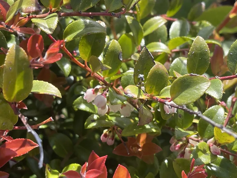
Evergreen Huckleberry Vaccinium ovatum -
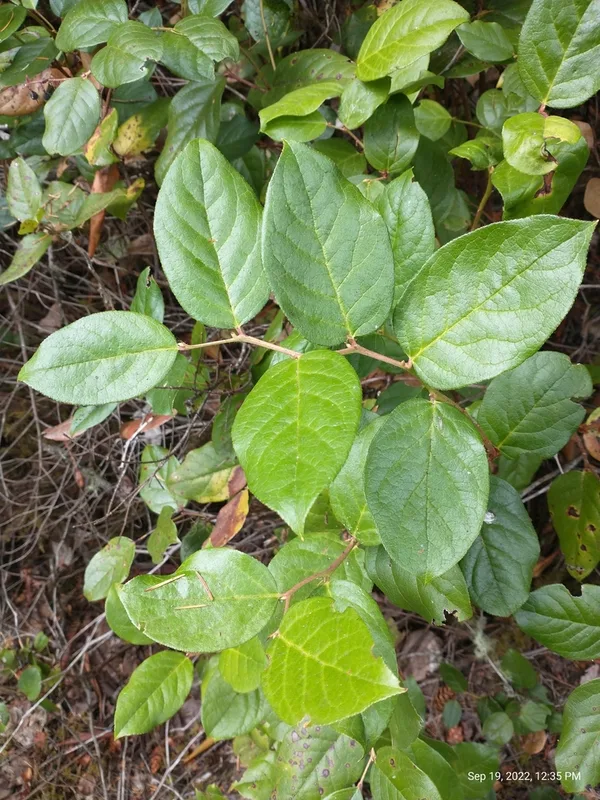
salal Gaultheria shallon -
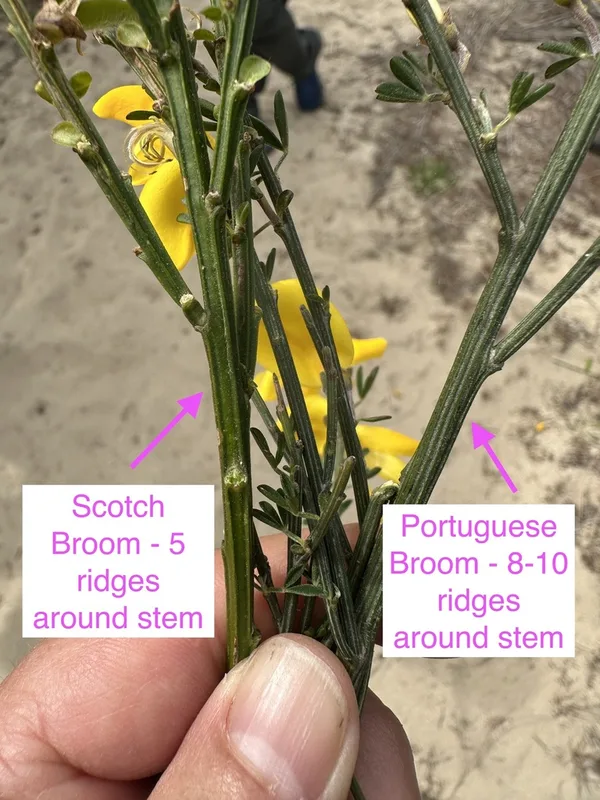
Scotch Broom Cytisus scoparius -
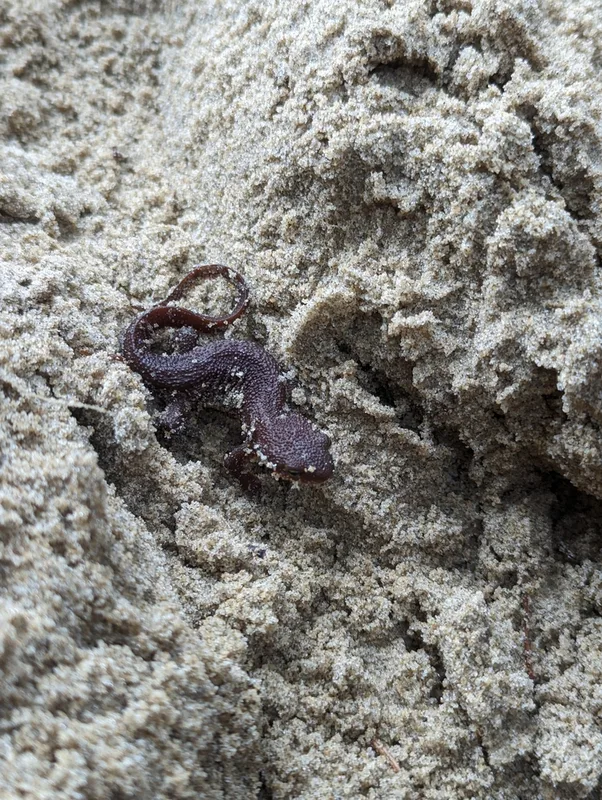
Rough-skinned Newt Taricha granulosa -
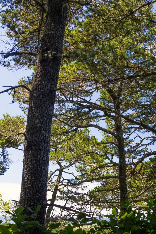
lodgepole pine Pinus contorta -
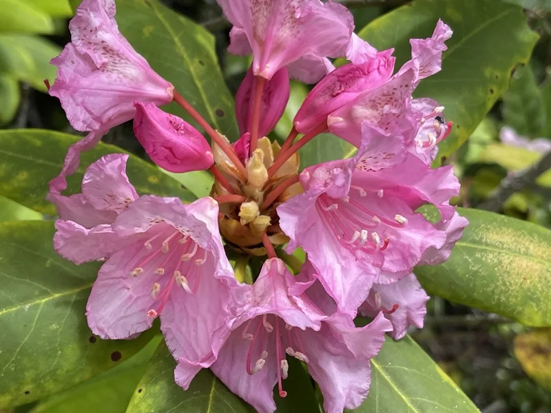
Pacific rhododendron Rhododendron macrophyllum -
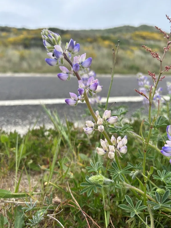
Seashore Lupine Lupinus littoralis -
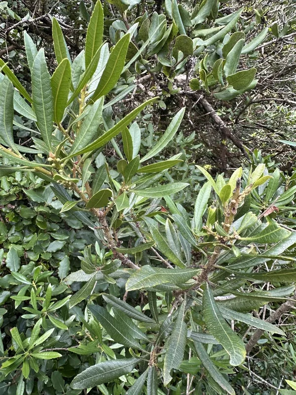
Pacific Wax myrtle Morella californica -
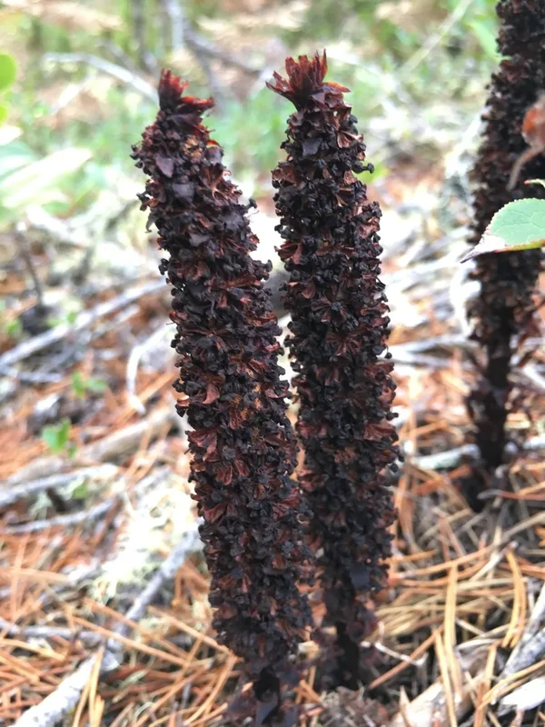
sugarstick Allotropa virgata -
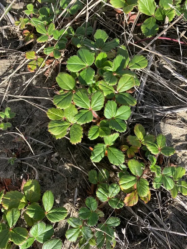
beach strawberry Fragaria chiloensis -
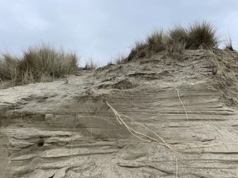
European marram grass Calamagrostis arenaria -
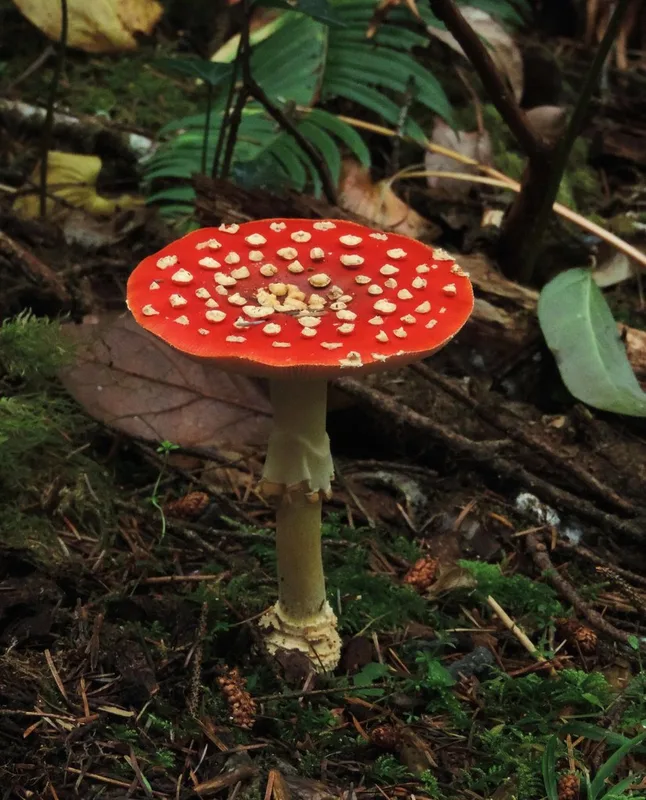
Fly Agaric Amanita muscaria
Field Notes · Fog Coast lens · Oregon Dunes National Recreation Area · 43.5527, −124.2245