The New River Gorge
Fayetteville · West Virginia, USA
Give water enough time against stone, and the stone gives way — one grain, one winter, one age at a time.
Why here
You can stand in the middle of Fayetteville and never guess a canyon is a few minutes away. The land on top is broad and nearly flat, and the New River runs in a deep slot it sawed straight down, out of sight. The rock it cut is hard — thick sandstone laid down with shale and coal something like three hundred million years ago, the kind of stone that would rather make a cliff than move. The river did not go around it. It kept cutting down, one grain of sand at a time, until the gorge was deep enough to hide a river inside it. The hard sandstone still holds the rim and the cliffs; the softer rock below wears back into slopes. That is the shape of the whole place — a level tabletop split by a single narrow cut. Everything in this note is a way of watching one slow argument, water against stone, and seeing who is winning.
The story
Something like three hundred million years ago, this was a low, wet coastal plain — rivers, swamps, and forests that fell and packed down into peat, then coal, buried again and again under sand that hardened into stone. The record here is a layer cake: sandstone, then shale, then coal, then sandstone again, stacked hundreds of feet thick. Only much later did the New River begin sawing down through the whole stack, cutting a gorge and laying every layer bare in its walls.
The forest that grew back drapes the plateau and the cliffs. Rhododendron and mountain laurel form dense thickets that bloom white and pink by early summer; on shaded, damp cliff faces the green salamander flattens itself into the rock cracks; on the water, great blue herons work the shallows and mergansers ride the current.
Then people came for the coal the river had exposed, following the seams down into the gorge. The mining towns that grew along the river have mostly emptied and gone quiet, and the record here says little about the daily lives inside them. What still stands up in Fayetteville is built partly from the gorge’s own sandstone — the same hard rock that gives the canyon its walls, cut and stacked into the town above. Every part of the gorge, stone and coal and cliff-side flower, is a page the river turned over.
The sites
Where you meet the gorge
New River Gorge Bridge
38.0687, −81.0829
The bridge carries the highway across the gorge in a single long arch, and the reason it had to be built so tall and so wide is the whole point of this place: the river runs in a slot cut deep below the level of the land around it. From the overlook near the north end you look down first onto the tops of trees that are themselves growing partway down the wall, and only then, farther still, to the water. The rock the river cut is hard, flat-lying sandstone and shale — the kind that holds a vertical face instead of slumping into a valley. That hardness is why the gorge has walls at all; softer rock would have worn into a wide, gentle bowl long ago. Standing here, the flat plateau on both sides and the deep, narrow cut between them tell you plainly what the river did. It did not carve sideways and wander. It cut straight down and stayed put while it did, deepening one channel instead of widening a valley.
From the overlook, find where the flat top of the plateau breaks into cliff on both rims. Follow one cliff line with your eye — it holds nearly the same height the whole way along, because it is the same hard sandstone layer, the caprock the river had to saw through before it could deepen the gorge below.
- AccessShort walk
- ExertionEasy
- TimeAn hour
Harvey Knob
38.1098, −81.0918
Harvey Knob is a high point on the plateau’s edge, the kind of open rise where you can see a long way and finally feel the shape of the land. From up here the country reads as a broad, slightly tilted tabletop, scored by the dark line of the gorge. In fall, high ridges and knobs like this one turn into flyways: hawks and other raptors ride the updrafts along the rim as they move south, taking free lift wherever wind meets a slope. You do not need to tell one bird from another to enjoy it — on a clear, breezy autumn day the sky simply has more birds crossing it than it should. Bring binoculars if you have them, since much of the passage happens high and far off. Even with an empty sky, the knob earns the climb for the plain lesson it teaches. The gorge is not a valley the land eases down into; it is a single narrow cut set into an otherwise even surface, and from a height like this you can see exactly how sharp that cut is.
On a breezy fall day, stand on the open top and watch the sky over the ridgeline rather than the trees. Raptors moving south hug the high edge to steal lift from wind rising up the slope — a slow, soaring line of them, easiest to catch in mid-morning once the air has warmed. Binoculars help.
- AccessShort walk
- ExertionModerate
- TimeHalf a day
Fayetteville Trailhead
38.0572, −81.0913
This trailhead sits at the ordinary edge of town, where the streets give out and the footpaths begin. It makes a good first stop precisely because it is unremarkable: flat ground, second-growth woods, no view to speak of. That level, wooded top is the plateau the entire gorge is hidden inside. Walk in almost any direction toward the river and the land stays flat for a while, then, without much warning, tips over an edge and drops. The trails from here lead down toward the old mining benches and the water, and even a short way in the grade steepens and the hard sandstone starts to show as ledges and boulders underfoot; the full descents are steep work. The point of pausing here first is contrast. Fix in your mind how flat and plain the top is, so that the depth of the gorge lands the way it should when you finally reach the rim.
From the trailhead, walk a few minutes in and watch the ground rather than the trees. Notice how the soil thins and blocky sandstone begins to break the surface as slabs and low steps — you are walking onto the hard caprock that holds up the rim, the same tough layer that made the river work hardest to cut through.
- AccessShort walk
- ExertionEasy
- TimeAn hour
New River Gorge Bridge
38.0687, −81.0829
The bridge carries the highway across the gorge in a single long arch, and the reason it had to be built so tall and so wide is the whole point of this place: the river runs in a slot cut deep below the level of the land around it. From the overlook near the north end you look down first onto the tops of trees that are themselves growing partway down the wall, and only then, farther still, to the water. The rock the river cut is hard, flat-lying sandstone and shale — the kind that holds a vertical face instead of slumping into a valley. That hardness is why the gorge has walls at all; softer rock would have worn into a wide, gentle bowl long ago. Standing here, the flat plateau on both sides and the deep, narrow cut between them tell you plainly what the river did. It did not carve sideways and wander. It cut straight down and stayed put while it did, deepening one channel instead of widening a valley.
From the overlook, find where the flat top of the plateau breaks into cliff on both rims. Follow one cliff line with your eye — it holds nearly the same height the whole way along, because it is the same hard sandstone layer, the caprock the river had to saw through before it could deepen the gorge below.
- AccessShort walk
- ExertionEasy
- TimeAn hour
The gorge, carried into town
Fayette County Courthouse (West Virginia)
38.0535, −81.1038
In the middle of Fayetteville stands the county courthouse, a brick building set on a stone base. Look at that base: the lowest level is built and faced with sandstone. It is worth a second look, because it is the same kind of rock the river is cutting through a few minutes away — the hard, layered sandstone that caps the gorge rim and stands up in cliffs. People quarried and dressed it for the very reason it makes those cliffs: it holds an edge, shrugs off weather, and carries weight without crumbling. A courthouse is an odd place to read geology, but the link is real and worth carrying with you. The stone that walls the New River’s canyon also underpins the town that sits above it. The river reveals the rock by cutting down through it; people put the same rock to work by building up with it.
Walk to the base of the building and lay a hand on the stone of the lowest level. Feel for the grit and the faint layering in the sandstone — it settled grain by grain in ancient rivers and swamps, then hardened, and it is the same stubborn rock that forces the New River to cut a narrow gorge instead of a wide valley.
- AccessDrive-up
- ExertionEasy
- TimeAn hour
When it's best
Come in late spring and early summer for the songbirds that fill the plateau woods and for rhododendron and mountain laurel blooming white and pink along the rim and the cliff bases, usually by early summer and earlier after a mild winter. Summer is green, humid, and loud with moving water. Fall thins the canopy and sends hawks riding the ridges, with the best days at a high, open knob. Winter strips the leaves and shows the bones of the place — the flat-topped cliffs, the layered walls, the river far below. On the water, great blue herons and mergansers work the shallows through the cooler months.
Go deeper
The names behind what you saw. The gorge’s rock is the Kanawha Formation, part of the Pottsville Group — interbedded sandstone, shale, siltstone, and coal, roughly three hundred million years old. The white- and pink-flowering thickets are great rhododendron (Rhododendron maximum) and mountain laurel (Kalmia latifolia). The amphibian that hides in the cliff cracks is the green salamander (Aneides aeneus). The leafless white stalk of late summer is ghost pipe (Monotropa uniflora), a plant that lives without making its own food.
To read next. The automated reading list for this note came back pointed at other places that share the name Fayetteville — a lake in New York, karst country in Arkansas — and none of it is about this gorge, so there is nothing honest to send you to there. The names above are the better door: start a search with the Pottsville Group and the Kanawha Formation, and the whole layered story of coal, sandstone, and the river’s slow cut opens from there.
The names behind what you saw
What lives here, and what it's called. Photographs from open collections — an aid to identification, not decoration.
-
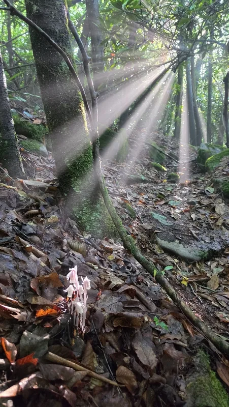
Ghost Pipe Monotropa uniflora -
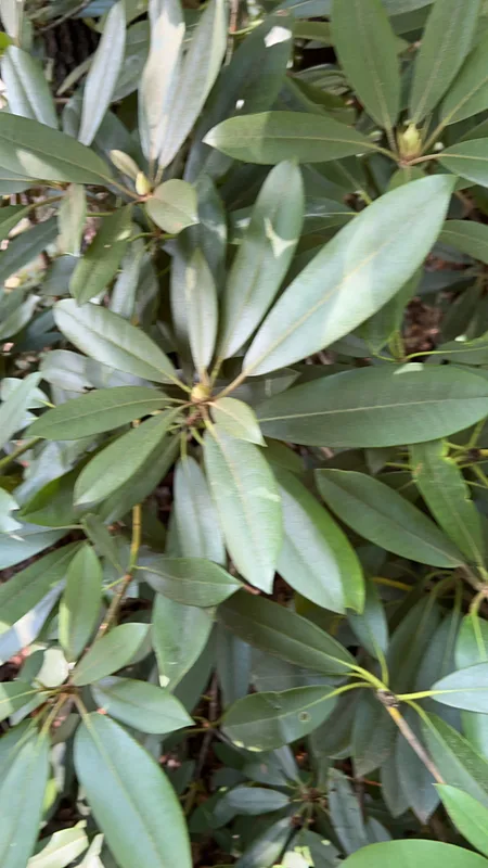
great rhododendron Rhododendron maximum -
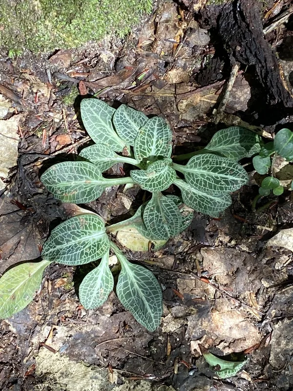
downy rattlesnake plantain Goodyera pubescens -
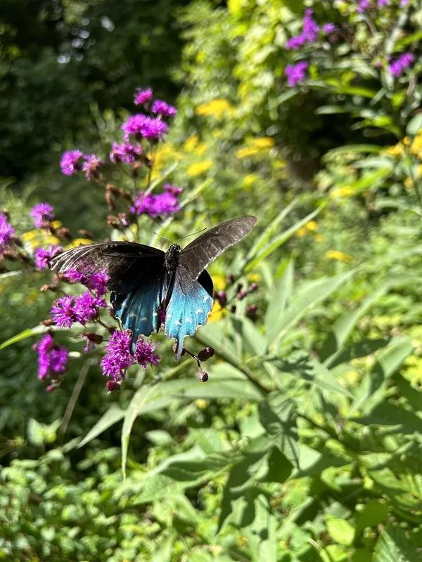
Pipevine Swallowtail Battus philenor -
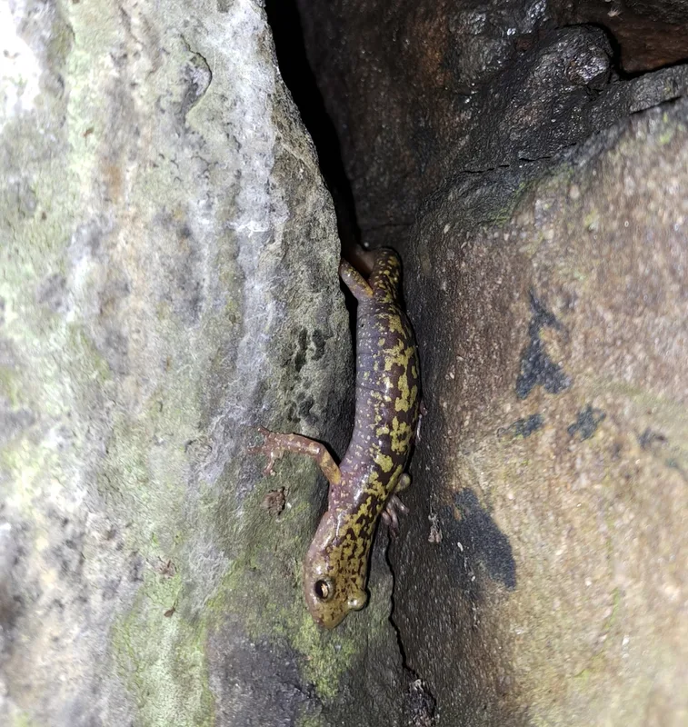
Green Salamander Aneides aeneus -
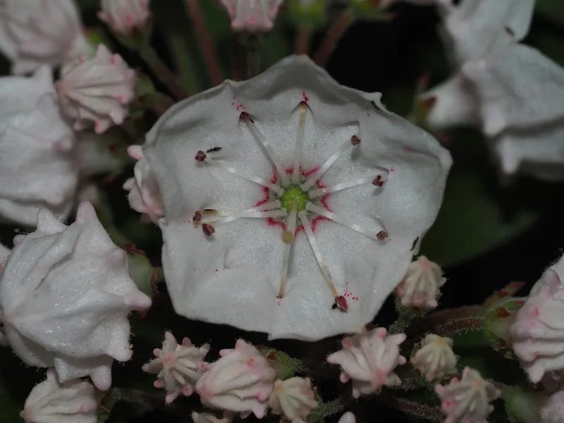
mountain laurel Kalmia latifolia -
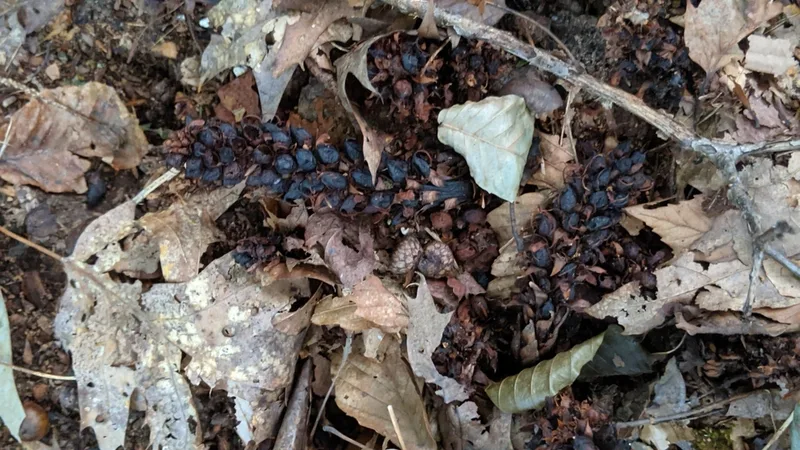
American cancer-root Conopholis americana -
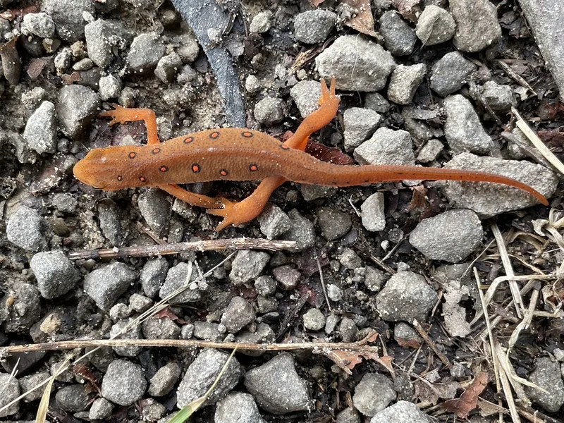
Eastern Newt Notophthalmus viridescens -
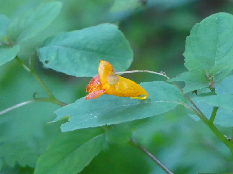
common jewelweed Impatiens capensis -
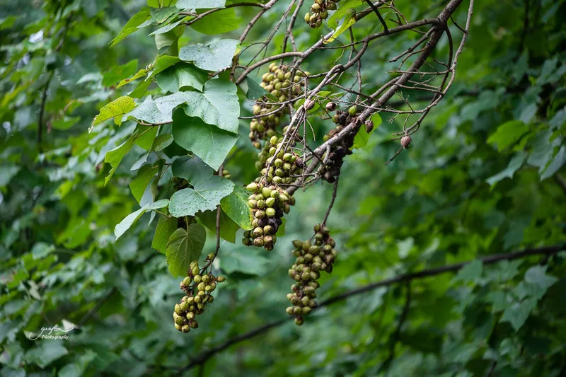
princess tree Paulownia tomentosa -
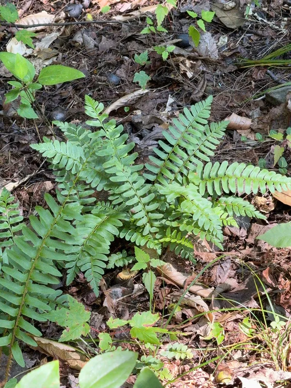
Christmas fern Polystichum acrostichoides -
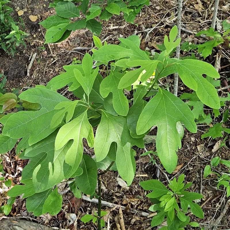
sassafras Sassafras albidum
Field Notes · Rivers & Canyons lens · Fayetteville · 38.0611, −81.0934