NamibRand Nature Reserve
NamibRand Nature Reserve · Hardap, Namibia
Nothing here is tall enough, or lit brightly enough, to get between the ground and the sky after dark.
Why here
Stand on any high point in NamibRand after sunset and count how many directions have a glow on the horizon. In most inhabited places the answer is at least one — a town, a road, a farmstead throwing light up into the haze. Here the honest answer, most nights, is none. That absence is not an accident. The reserve was assembled deliberately, starting in the 1980s, out of what had been working farmland, joined on one side to a much larger national park and, on the other, to a line of mountains, so that roughly two hundred thousand hectares of ground now sit under one continuous, low-development horizon. Darkness this complete is not really about any one dramatic feature; it is the sum of a lot of ordinary restraint — fewer roads, fewer buildings, fewer lights left on. What that restraint buys is simple and rare: a sky with nothing between you and it. Every site that follows is really one more place to stand still and let that sky do the only thing it needs to do, which is be fully, uninterruptedly there.
The story
The land here is older than it looks. Scattered peaks like the ones this note visits are cores of intrusive rock that go back well over a billion years, remnants of stone that has simply outlasted everything softer around it; the flat gravel plains between them are, by geological standards, almost brand new, laid down long after those old peaks were already ancient. Life on top of that ancient-and-new ground runs light rather than heavy: gemsbok and springbok move across the plains in loose groups, drawing exactly as much from this dry country as it can give and no more, while smaller residents — desert lizards, ground squirrels, the sociable weaver building its communal nests, the bat-eared fox working the dark for insects — divide the day and night between them so nothing goes to waste. People arrived at a very different pace. NamibRand became a nature reserve only in the 1980s, when a private landowner began buying up a patchwork of struggling farms and letting the fences come down between them, joining them into one piece of ground large enough to function as wild land again rather than as separate ranches. That reserve now runs on tourism rather than farming, financially self-sustaining, bordered by a much larger national park on one side and a line of mountains on the other. The record here is quiet on anyone who came before the farms; this note does not have that history to tell. What it does have is the result of one modern decision: a stretch of desert deliberately left alone long enough, and left dark enough, for the oldest view there is to still be visible from the ground.
The sites
Named for looking
Wedding Point
−25.1272, 15.9577
Wedding Point already does daytime work as one of the reserve’s marked viewpoints, a place where the wide gravel plains open out in every direction and the eye has nothing to catch on until the mountains at the edge of sight. After dark, the same absence of clutter becomes the point. There is no ridge close enough to swallow the horizon, no stand of trees to cut the sky into pieces — just an uninterrupted dome from one rim of the earth to the other. That kind of unbroken view is rarer than it sounds; most places a person can drive to have at least one direction blocked by a hill, a building, or a stand of trees. Here the reserve was set aside deliberately, joined to a national park on one side and mountains on the other, so nothing has grown up to fill the gaps. Come after sunset and give your eyes a good long while before judging the sky — the fastest way to ruin a first look here is to check a bright screen halfway through and start the adjustment over. Once they have settled, the number of stars that were always there but invisible in a lit place becomes the whole evening’s education.
Face away from where the sun went down and let your eyes adjust for several minutes without checking a light or a screen. Look for the soft, cloud-like band arching overhead — not weather, but the crowded disk of our own galaxy seen edge-on. Trace it slowly from one horizon to the other before you look at anything else.
- AccessDrive-up
- ExertionEasy
- TimeAn hour
Gorrasis
−25.2966, 15.9675
Gorrasis is marked on the map as a survey point, one of a handful of fixed high positions used to anchor measurements across this stretch of desert. Survey points and stargazers want the same thing: an unbroken sightline in every direction, nothing between the marker and the horizon to get in the way. That is what makes this small rocky summit worth climbing after dark as well as by day — the same openness that let land surveyors take their bearings across the plain lets a night visitor take in the whole turning sky, unclipped by any nearer high ground. The rock underfoot is also much older than it looks from a passing glance: these peaks are the hard, resistant remnant of a much older landscape, standing above gravel plains that were laid down long after the peaks themselves had already been ancient. Everything softer around them has worn away in the time since; the peak is what refused to. Sit with that while the sky changes color at dusk, and the ground stops feeling incidental to the view above it.
Once at the summit, turn a slow circle before it gets properly dark and note how low and unbroken the horizon stays in every direction. After nightfall, pick one bright, steady point of light near the horizon and watch how little it flickers compared to the true stars scattered near it — a fair sign you have found a planet rather than a star.
- AccessHalf-day hike
- ExertionModerate
- TimeHalf a day
Satanskop
−25.4553, 15.9144
Satanskop sits toward the southern half of the reserve, another of the high points doubling as a survey marker, its name a reminder that not every landmark here was named gently. However it got its name, the peak earns a visit for a plainer reason: elevation over open ground is rare currency in a landscape this flat, and this summit spends it well. From the top, the reserve’s gravel plains run out toward the horizon in a way that is hard to take in from the valley floor, where every view is foreshortened by the middle distance. At night the same elevation buys a few extra degrees of sky at the horizon that lower ground simply cannot see — the last faint stars a person can pick out low over the mountains to the west, before the atmosphere itself starts absorbing their light. Getting up here takes some real walking over rock and gravel with no marked path, which is part of why the sky stays this dark: little foot traffic means little disturbance, and no infrastructure means no light. Plan to arrive with useful daylight left, because coming down an unmarked slope in full dark is its own kind of test.
From the summit, look low along the western horizon rather than straight overhead. Stars near the horizon dim and redden as their light crosses more of the atmosphere on the way to your eye; compare one low in the sky to one directly above and see the difference for yourself.
- AccessHalf-day hike
- ExertionStrenuous
- TimeHalf a day
High rock in the flats
Losberg
−25.0567, 16.0375
Losberg rises alone in the middle stretch of the reserve, one more solitary peak among grazing land that by day belongs to gemsbok, springbok, and ostrich moving across the open plain below. By night the cast changes. Many of the reserve’s smaller residents — the bat-eared fox chief among them — do their real work after dark, when the desert cools and insects and small prey come out from wherever they spent the heat of the day. A bat-eared fox forages mostly by night, working the ground on oversized ears tuned to catch the sound of insects moving underground, and a quiet climb up Losberg in the last hour of daylight gives a fair chance of watching that shift happen: the day shift of grazing animals drifting toward shelter as the light goes, and a different, quieter set of eyes opening for the night. None of this needs to be seen to be felt. Stand still on the summit as full dark comes on and listen to how the soundscape itself changes, not just the sky. The peak has no trail and no signage, only open rock and the plain falling away in every direction, which is exactly why it stays this quiet after sunset.
As dusk settles, stop moving and listen for several minutes. Desert nights carry sound a long way with nothing to absorb it; even a small foraging animal’s footsteps on gravel can travel farther here than they would anywhere with more cover or clutter.
- AccessHalf-day hike
- ExertionModerate
- TimeHalf a day
Bushman Hill
−25.1073, 15.7983
Bushman Hill stands near the reserve’s western edge, close to where NamibRand’s boundary meets Namib-Naukluft National Park and the protected ground simply keeps going. That matters more here than it would most places: dark skies depend on there being no bright neighbor for a very long way in every direction, and this corner of the reserve has one of the longest unbroken stretches of protected, undeveloped land on any side of it. The climb up is a modest scramble over loose rock rather than a hike on any prepared path, and the reward at the top is less a single dramatic vista than a sense of scale — plain after plain of pale gravel and grass tussock running out toward mountains that from this distance barely register as more than a line. After sunset that same sense of scale turns vertical. With the horizon this open and this far from anything artificial, the sky does not so much appear over the landscape as replace it, becoming the larger and more detailed of the two. Give the climb an early enough start that you are settled at the top well before last light, since the descent afterward is easier managed while there is still some color left in the sky.
Look for where the ground and sky meet along the western horizon, toward the neighboring park. Watch that line rather than straight up as darkness falls; it is usually the last part of the sky to hold any color, and the first place faint stars become visible once it fades to black.
- AccessHalf-day hike
- ExertionModerate
- TimeHalf a day
The far edges
Doppelkuppe
−25.5690, 16.2010
Doppelkuppe sits far toward the reserve’s southeastern corner, closer to the Nubib mountains that mark this side of NamibRand than to anywhere with electric light. Reaching it means real distance and real navigation — there is no trail, and the peak is more a destination for a full day than an afternoon detour. What that distance buys is a horizon with essentially nothing on it: no farm light, no road glow, nothing but rock and grass and, eventually, stars from one edge of the sky to the other. Reserves like this one work because they are large and because the land inside them is left mostly alone, and a summit this far from any of the entry points is where that fact becomes obvious rather than theoretical. Bring more water and more daylight margin than the distance on a map suggests; the ground between here and any track is uneven and slow going, and a late start can turn a comfortable evening climb into a rushed one. The peak rewards patience rather than speed — arrive early, rest, and let the sky come to you rather than racing the last of the light to the top.
Once the sky is fully dark, look for a faint hazy patch rather than a sharp point of light, off to one side of the brightest band overhead. Not every fuzzy smudge is a trick of your eyes — some are distant star clusters, too far and too crowded to resolve into individual stars without binoculars.
- AccessExpedition
- ExertionStrenuous
- TimeA full day
Donnersberg
−24.9087, 16.1254
Donnersberg rises near the reserve’s northeastern reach, another of the granite-hard summits that punctuate this stretch of desert without a marked path to any of them. Getting here rewards the effort with one of the widest uninterrupted views in this part of the reserve, plains falling away east toward the Nubib mountains that form NamibRand’s boundary on this side. The desert here cools quickly once the sun is gone, and warm days can give way to genuinely cold nights, especially with no cloud cover to hold the day’s heat in — the same clear air that makes the stars this sharp also lets the ground’s warmth escape straight up into the sky once the sun sets. Plan layers accordingly, and treat a night on this summit less as a quick errand than as a small expedition, arriving with time to spare and a way down that does not depend on a torch alone. Sit long enough after dark and the rock itself seems to take part, its stored heat draining away into the same clear air that is busy making the stars overhead this distinct.
After sunset, place a hand flat on the rock you climbed and notice how quickly it loses its stored warmth compared to the still-warm air just above the ground. It is a small, physical way to feel the same clear-sky cooling that keeps the night above you this transparent.
- AccessExpedition
- ExertionStrenuous
- TimeA full day
When it's best
Time a visit to the nights around new moon if the sky itself is the point: with no moonlight competing, faint stars and the pale band of the Milky Way both come forward in a way a bright moon a couple of weeks later simply washes out. That lunar rhythm repeats roughly every month, so it is worth checking the moon phase before fixing on dates rather than picking a season. Beyond the moon, this is high, dry desert air for most of the year, which tends to mean warm days and properly cold, clear nights — bring more warm layers after dark than the daytime heat suggests, since it is exactly that clear, dry sky, holding little cloud and little moisture, that keeps the stars this sharp. There is no wrong season here in the way there might be somewhere with a hard rainy period to plan around. The one date worth arranging a trip around is not a month at all, but a moon phase.
Go deeper
The names behind what you saw - Mesoproterozoic intrusive rocks — the ancient, resistant stone (roughly 1,000 to 1,600 million years old) that the reserve’s peaks are the eroded remnants of, still standing above much younger ground. - Quaternary sedimentary deposits — the young gravel and sand of the plains between the peaks, laid down long after that older rock was already ancient. - Dark-sky preserve / International Dark Sky Reserve — the formal, actively maintained designation for places set aside against light pollution; the general term behind NamibRand’s own dark-sky status. - Gemsbok (Oryx gazella), Springbok (Antidorcas marsupialis), Sociable Weaver (Philetairus socius), Bat-eared Fox (Otocyon megalotis) — the signature day- and night-shift residents named in this note.
To read next - “NamibRand Nature Reserve” (Wikipedia) — for the reserve’s founding and scale: how a patchwork of farms became one contiguous protected area bordering a national park. - “Dark-sky preserve” (Wikipedia) — for how dark-sky status actually works, as an active, maintained designation rather than simple absence of city light. - “Protected areas of Namibia” (Wikipedia) — for how NamibRand sits inside Namibia’s wider network of parks and reserves, including the national park it borders.
The names behind what you saw
What lives here, and what it's called. Photographs from open collections — an aid to identification, not decoration.
-
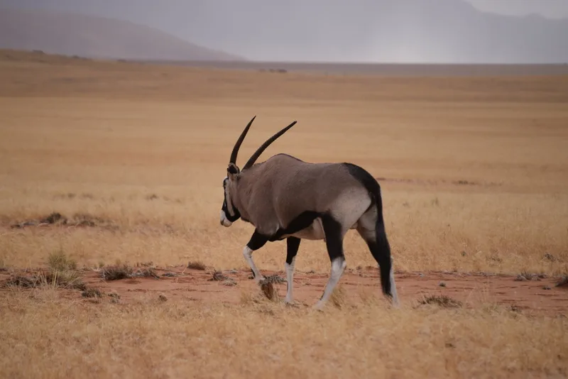
Gemsbok Oryx gazella -
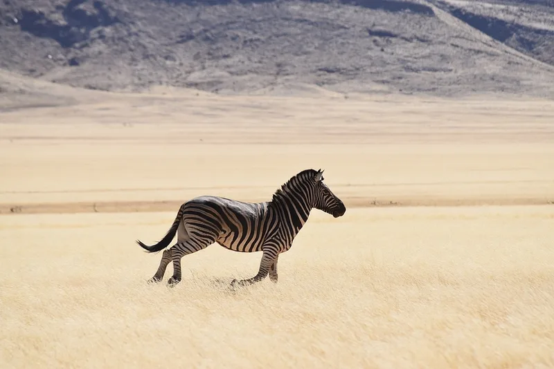
Plains Zebra Equus quagga -
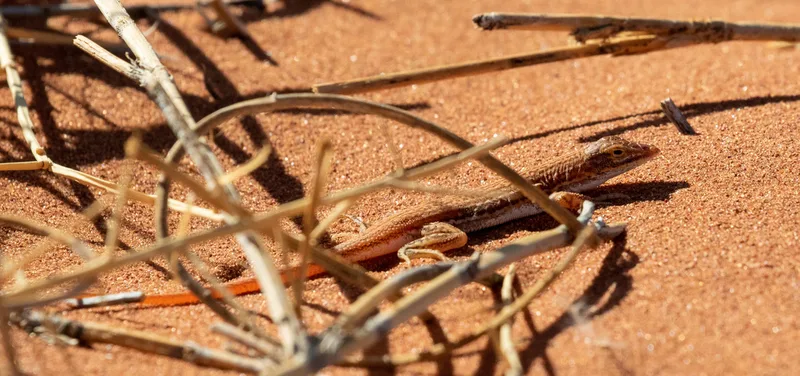
Wedge-snouted Desert Lizard Meroles cuneirostris -
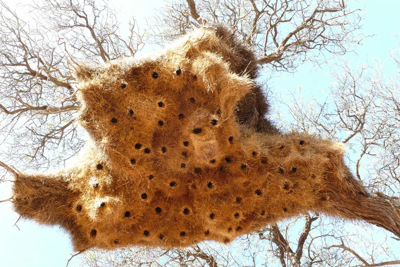
Sociable Weaver Philetairus socius -
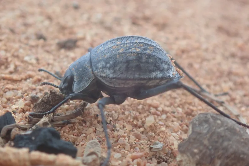
Onymacris rugatipennis -
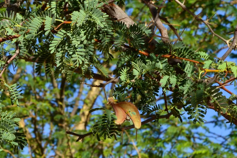
Camel Thorn Vachellia erioloba -
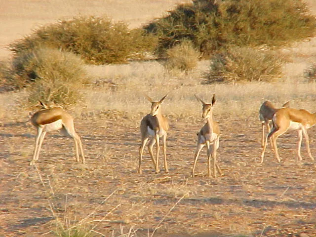
Springbok Antidorcas marsupialis -
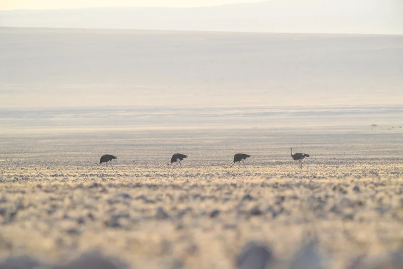
Common Ostrich Struthio camelus -
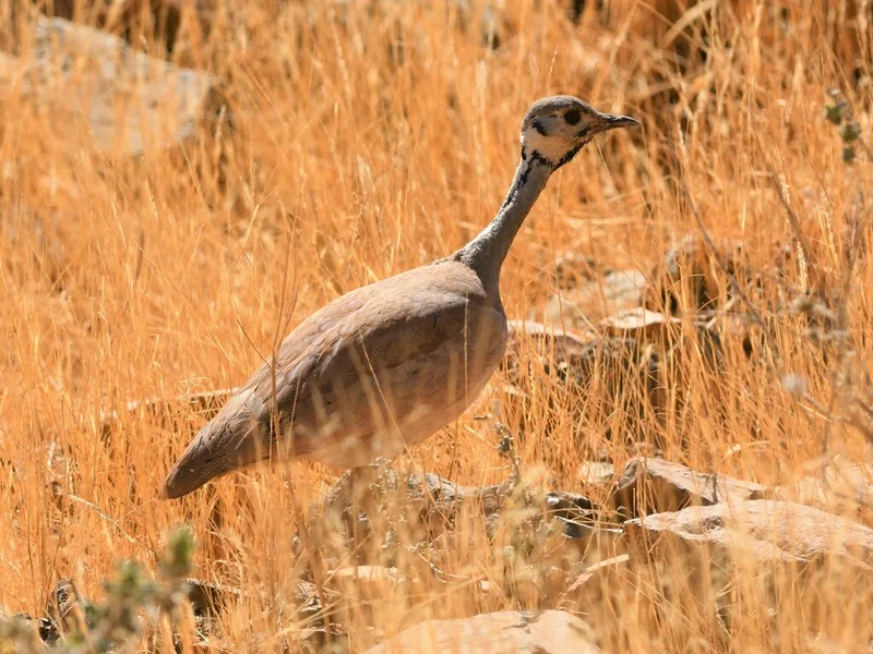
Rüppell's Bustard Heterotetrax rueppelii -
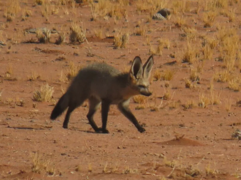
Bat-eared Fox Otocyon megalotis -
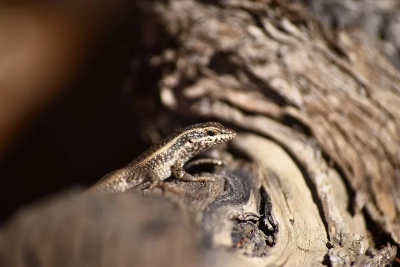
Kalahari Tree Skink Trachylepis spilogaster -
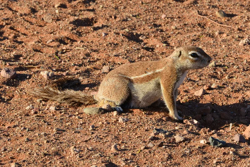
South African Ground Squirrel Geosciurus inauris
Field Notes · Night Sky lens · NamibRand Nature Reserve · −25.2108, 15.9831