Mount St. Helens
Mount Saint Helens National Volcanic Monument · Washington, USA
Most landscapes were finished long before you arrived to see them. This one is still deciding what it will be.
Why here
At 8:32 on the morning of May 18, 1980, Mount St. Helens erupted with a force this country had not seen in living memory — the most disastrous volcanic event in United States history. A sideways blast tore across the land to the north, pyroclastic flows swept the slopes, and in a single morning a familiar mountain became a crater. Most landscapes were finished long before anyone arrived to admire them. This one was remade inside a single human lifetime, and the raw evidence is still everywhere. Two years after the eruption, Congress set the ruined country aside and made an unusual decision: to leave it alone and let it come back on its own, with nothing planted and nothing cleared. So the ground here is some of the youngest anywhere, and the forest returning to it is doing so unaided, plant by plant. This is the rare place where you are not looking at scenery. You are standing in the middle of land still being made, and every stop in this note is another angle on the same unfinished work.
The story
Mount St. Helens is one of a chain of young volcanoes down the Cascades, its slopes built from dark basalt and andesite — the same kinds of lava still being laid down across this corner of Washington. For most of the twentieth century it stood quiet. Then, in March of 1980, the mountain woke: explosions, small blasts of steam, and shudders that went on for weeks. On the morning of May 18 it broke loose in a catastrophic eruption, a sideways blast and pyroclastic flows that made it the most disastrous volcanic event in the nation’s history.
Two men anchor the human story. Harry Truman ran a lodge on the shore of Spirit Lake, just north of the peak, where scout camps and summer lodges had drawn visitors for generations. He refused every order to evacuate and died when a pyroclastic flow buried the site under a hundred and fifty feet of debris. David Johnston, a young Geological Survey scientist watching from a ridge six miles north, was the first to radio that it had begun, moments before the blast swept him away. His body was never found, and a ridge here now carries his name.
In 1982, Congress made the wreckage a national monument and promised something unusual for public land: to leave it be, and let it respond on its own terms. It has been doing exactly that ever since.
The sites
Facing the crater
Johnston Ridge
46.2767, −122.2151
This ridge carries the name of David Johnston, the geologist who was watching the mountain from a post nearby when the 1980 eruption killed him. It faces straight into the crater, across the ground the sideways blast crossed first. No other viewpoint lines up the whole event so plainly.
Face the mountain and find the open crater at its center. Then look at the country between you and it — bare, pale, and slow to green even now. That is the direct path of the blast on the morning of May 18, and this ridge sits near the far end of its reach.
- AccessDrive-up
- ExertionEasy
- TimeHalf a day
Loowit Viewpoint
46.2763, −122.2293
A pullout with a clean, close line into the crater itself. The rock in view is among the freshest anywhere — lava and ash laid down within living memory rather than across the ages. It is the plainest look at how young this ground really is.
Look into the crater and compare the pale, raw rock low inside it with the darker, older walls above. The lighter material is the newest rock, laid bare by the 1980 eruption, while the walls around it are older by far.
- AccessDrive-up
- ExertionEasy
- TimeAn hour
The east rim, above Spirit Lake
Windy Ridge Viewpoint
46.2498, −122.1372
The end of one of the finest drives in Washington, a winding road that climbs the east side to a viewpoint at about four thousand feet. It looks across Spirit Lake to the crater beyond. The whole northern basin of the eruption opens up from here in one sweep.
From the viewpoint, look past Spirit Lake toward the crater. Notice how the slopes facing the mountain are still thin and gray while the ridges behind you hold darker, older forest — the line between them traces how far the blast scoured the land bare.
- AccessDrive-up
- ExertionEasy
- TimeHalf a day
Harry's Ridge
46.2754, −122.1739
A ridge named for Harry Truman, the Spirit Lake lodge-keeper who would not leave. Reaching it takes a walk out along the blast-scoured hills, and it ends looking down on the lake where his lodge once stood.
From the high point, look down at Spirit Lake. Beneath its surface and the debris around it lies the site Harry Truman refused to abandon, buried under roughly a hundred and fifty feet of what the mountain sent down.
- AccessHalf-day hike
- ExertionModerate
- TimeHalf a day
How far it reached
Miners Car Interpretive Site
46.2965, −122.0751
A roadside stop in the northeast corner of the blast zone, far enough from the crater that the ground here once felt safe. The signs mark how far the eruption’s destruction actually carried on May 18. The distance is the lesson.
Read the markers, then look toward the mountain, hidden beyond the nearer ridges. Standing this far out felt like a safe remove in 1980 and was not — the blast reached well past where anyone drew the line.
- AccessDrive-up
- ExertionEasy
- TimeAn hour
Coldwater Peak
46.3003, −122.1816
A summit in the heart of the blast zone that once held a fire lookout and now holds research instruments instead — a fair sign of what this whole country became after 1980. The climb earns a wide view over the ruined and recovering land north of the mountain.
From the top, pick out the patchwork below: bare gray slopes, young green returning in the folds, and the crater to the south. The mix is the monument’s whole experiment in one view — land left alone to find its own way back.
- AccessHalf-day hike
- ExertionStrenuous
- TimeWorth two days
Life coming back
Meta Lake Interpretive Site
46.2959, −122.0783
An interpretive stop beside a small lake in the eastern blast zone, and a good place to read the recovery the monument exists to protect. The plants taking hold on the ash here are the pioneers — among the first life to return to bare volcanic ground.
Walk the short path and look down rather than out. The pink spires of fireweed and the low white clusters of pearly everlasting are among the earliest plants to colonize fresh ash; where they grow thickest, the land is furthest along in coming back.
- AccessDrive-up
- ExertionEasy
- TimeAn hour
Harmony Viewpoint
46.2745, −122.1045
A viewpoint on the east side looking down toward Spirit Lake, the summer place that lay in the eruption’s path. It now overlooks water and shoreline slowly being reclaimed by returning plants and trees.
Look down at the shoreline of Spirit Lake and trace where bare gray gives way to green. That edge is the recovery line — the boundary the returning forest has reached since the mountain wiped the shore clean.
- AccessShort walk
- ExertionEasy
- TimeAn hour
When it's best
Time a visit for the warm months. The high roads and ridges on the east side, including the winding drive to Windy Ridge, hold snow well into early summer and close in winter, so late summer and early fall open the most of the monument at once. That is also when the pioneer plants are at their best — fireweed and pearly everlasting coloring the gray ash where the forest is still returning. Mornings tend to give the cleanest look into the crater; on many afternoons the peak grows its own cap of cloud, so the earlier you stand at a viewpoint, the better your odds of a clear line to the mountain. Autumn thins the crowds and sharpens the air, though the first storms can close the eastern roads without much warning.
Go deeper
The dark rock of the slopes is basalt and andesite, part of the region’s Pleistocene-to-Recent volcanic rocks; the youngest material is mapped plainly as the rocks and deposits of Mount St. Helens, pyroclastic flows of Holocene age. The older regional lava beneath it all is the Columbia River Basalt. The three pioneers named in the body are fireweed (Chamaenerion angustifolium), pearly everlasting (Anaphalis margaritacea), and Cardwell’s beardtongue (Penstemon cardwellii).
A few places to read further (drawn from this note’s own sources): - The 1980 eruption of Mount St. Helens — the event itself, hour by hour. - David A. Johnston — the geologist the ridge is named for, and his last transmission. - Harry R. Truman — the Spirit Lake lodge-keeper who would not leave. - Spirit Lake — the drowned summer place north of the peak. - Coldwater Peak — a fire lookout turned research summit inside the blast zone. - Mount St. Helens National Volcanic Monument — the decision to let the land heal itself.
The names behind what you saw
What lives here, and what it's called. Photographs from open collections — an aid to identification, not decoration.
-
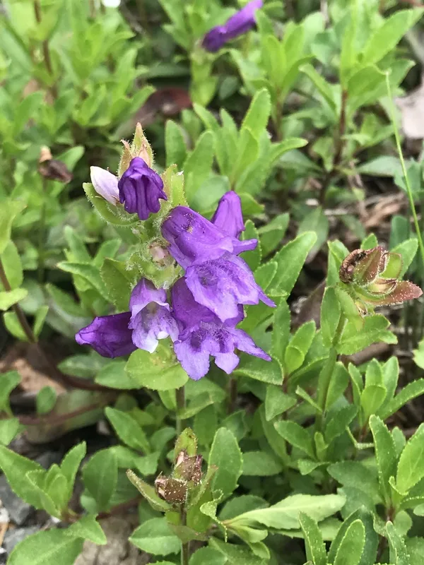
Cardwell's Beardtongue Penstemon cardwellii -
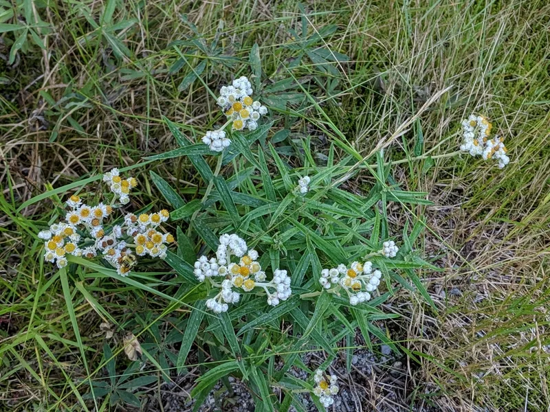
pearly everlasting Anaphalis margaritacea -
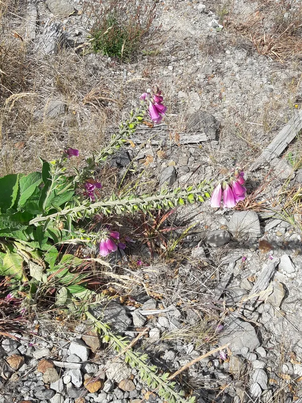
purple foxglove Digitalis purpurea -
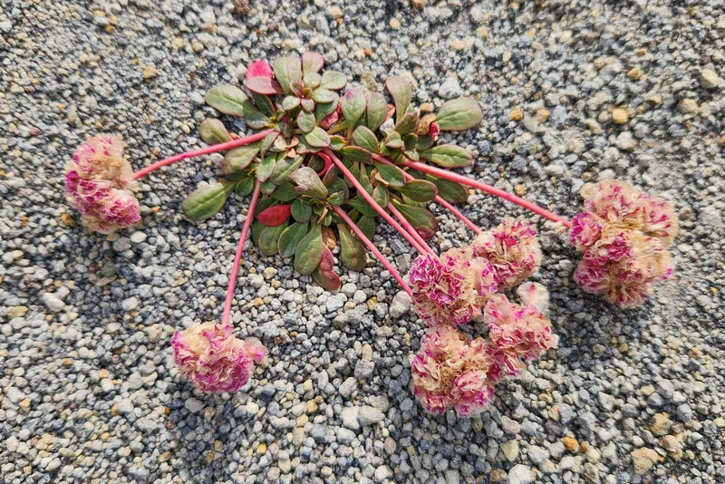
Mount Hood pussypaws Calyptridium umbellatum -
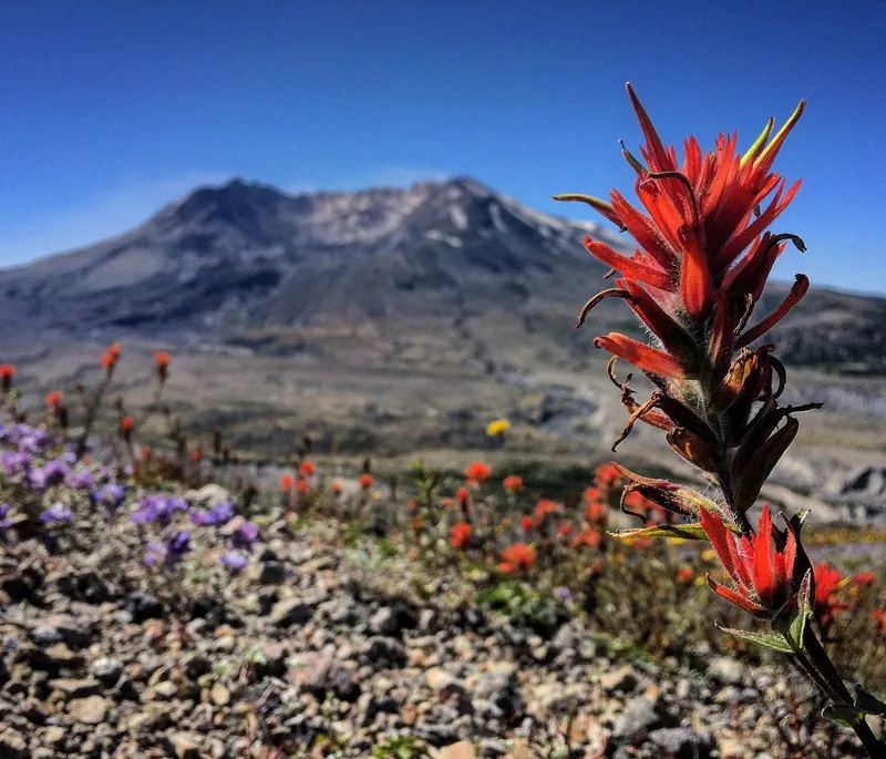
giant red paintbrush Castilleja miniata -
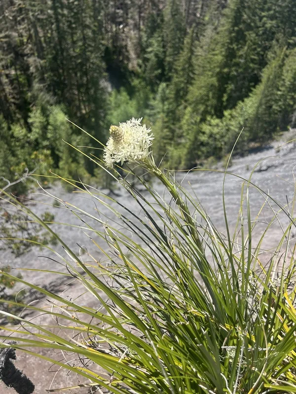
common beargrass Xerophyllum tenax -
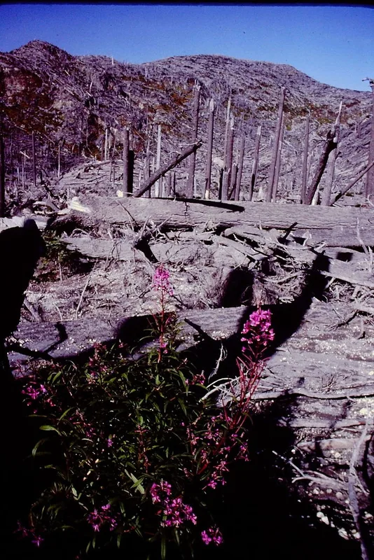
fireweed Chamaenerion angustifolium -
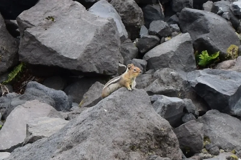
Cascade Golden-mantled Ground Squirrel Callospermophilus saturatus -
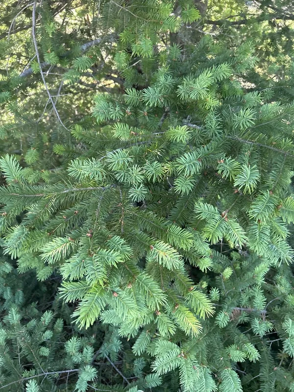
Douglas-fir Pseudotsuga menziesii -
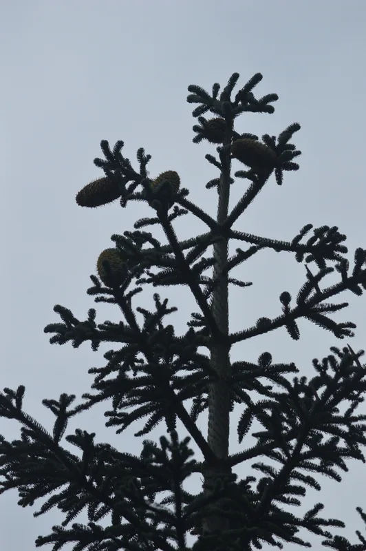
noble fir Abies procera -
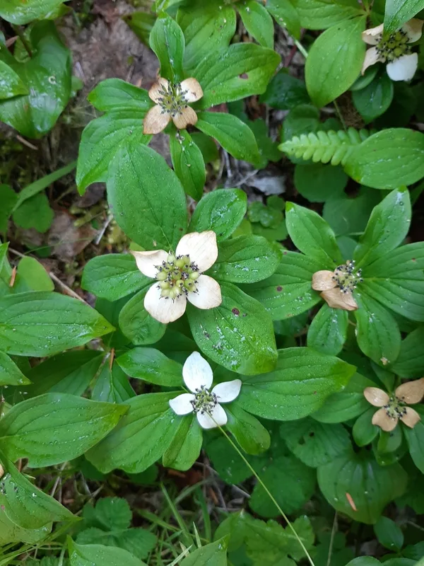
Western Bunchberry Cornus unalaschkensis -
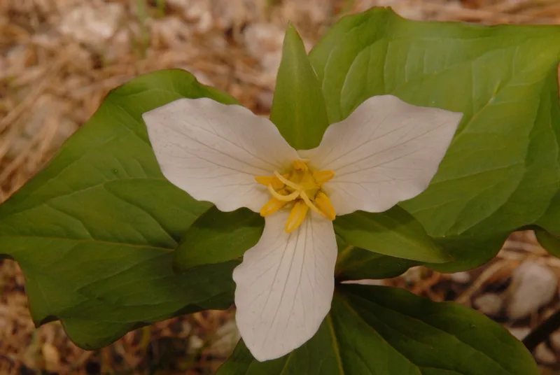
Pacific trillium Trillium ovatum
Field Notes · Volcanic lens · Mount Saint Helens National Volcanic Monument · 46.2537, −122.1870