Mount Kenya
Mount Kenya · Central Highlands, Kenya
On the equator, this mountain still remembers the cold that carved it.
Why here
Mount Kenya sits close enough to the equator that its lower forests never see a frost, yet its summit ridge was shaped by ice. Its two best-known summits, Nelion and Point Lenana, are not the smooth cone you might expect of a volcano. They are a cluster of narrow rock towers, sharp enough that early travelers first doubted a mountain here could ever have carried a glacier. It carried plenty. Long after this volcano stopped erupting, ice grinding down its upper slopes stripped away the loose ash and softer lava that had built a much bigger cone, exposing the harder plug of solidified rock at its core and cutting that plug into the ridges and pinnacles, Point John, Arthur’s Seat, Point Piggott, and a half-dozen more, that now ring the summit like a broken crown. What is left today is a lesson in what ice can do to a mountain: not just decorate a peak, but dismantle one, and hand back only the part too tough to erode. This note follows both what the ice carved away and what it left standing.
The story
Mount Kenya began as a single large volcano, built up by repeated lava flows over a long stretch of the geological past before it went quiet for good. What stands today is not that original shape. Long cold spells since then sent ice down over the upper slopes, stripping away the volcano’s looser outer rock and leaving only its hardest core standing, cut by that ice into the crowd of separate rock towers that now carry the mountain’s summit names.
Below that bare, wind-scoured rock, the cold zone the ice once covered still supports an unusual, slow-growing plant community found on only a handful of East African peaks: giant groundsels holding their rosettes up on thick woody stems, and giant lobelias standing in spikes among the tussock grass, both built to survive nights that freeze and days that can burn within the same day. Rock hyraxes shelter among the boulders here, and the moorland chat, a small bird suited to this cold open ground, treats the zone as ordinary habitat rather than an extreme to endure.
Lower down, on the mountain’s gentler slopes, Bantu-speaking communities including the Kikuyu, Meru, and Embu have long made their homes, drawing on rivers that begin as meltwater and rain higher up. The mountain and its forest were set aside as a national park in the mid-twentieth century and later recognized internationally, both for their beauty and for their role as a water source for the wider region, a role that starts at the ice-cut summit this note has been following.
The sites
The peaks the glaciers left standing
Nelion
−0.1535, 37.3093
Nelion is the second-highest of Mount Kenya’s three principal summits, a spire of bare rock just below Batian, reached only by a technical climb over exposed rock rather than a walk-up ridge. What you are climbing is not the volcano’s original surface. It is what remained after the mountain’s outer layers, the loose ash and softer lava that once built a much bigger cone, were stripped away by ice working over a long cold stretch of the past. Only the solid plug at the volcano’s heart, rock that cooled slowly enough to harden all the way through, resisted. Everything softer around it is gone, carried off down the mountain’s flanks. The result is a summit shaped more like a fist than a dome: narrow, vertical, and defined by cracks and ribs where the rock fractured as it cooled. Climbers on Nelion spend most of a route working around these features rather than over open slope, because there is no open slope left to work with. Ice did not soften this mountain. It sharpened it, cutting away every part of the volcano that ice, water, and time could still move.
Partway up, look at the rock itself rather than the route ahead: find one of the vertical cracks splitting the face. These are cooling joints, formed as the molten rock solidified from the outside in, and they are the reason the mountain broke into blocks instead of eroding into a smooth slope.
- AccessExpedition
- ExertionStrenuous
- TimeWorth two days
Point Lenana
−0.1552, 37.3178
Point Lenana is the summit most people who climb Mount Kenya actually reach: a walkable, non-technical high point a short scramble below Nelion and Batian, the mountain’s two taller and harder peaks. Standing on it, you get the clearest view of what ice did here. The ridge ahead breaks into a crowd of separate rock towers rather than one continuous line, each a stub of a former horn where old ice cut into the mountain from more than one side at once. Below, the ground drops into basins scoured out by ice moving downhill under its own weight, later left as bare rock or filled with meltwater. None of this looks like a volcano is supposed to look. A young volcanic cone is a smooth, even shape; this one has been cut down to a jagged skeleton. Point Lenana sits at the edge of that skeleton, high enough that the cold up here still shapes the ground today, in the freeze and thaw of the rock underfoot, even with the ice long since retreated from where you stand.
From the summit, trace the skyline in either direction and count how many separate rock points you can pick out before the ridge disappears from view. Each one marks a place where ice cut in from two sides and left only a blade of rock standing between them.
- AccessExpedition
- ExertionStrenuous
- TimeWorth two days
A crown of minor points
Point John
−0.1579, 37.3080
Point John is one of a dozen or so named rock points that ring Mount Kenya’s main summits rather than standing apart from them, a subsidiary peak on the same eroded volcanic core as Nelion and Point Lenana. None of these points were ever separate mountains. They are pieces of one original volcanic mass, cut apart by ice working down through cracks and weak seams in the rock until what had been a single block stood as a crowd of individual towers with open air between them. Point John’s position, tucked close against the main summit block, makes it a good place to see how tightly packed this crown of points really is; from many angles two or three named peaks appear stacked almost on top of each other. That crowding is itself the evidence. A ridge shaped by water alone tends to wear down evenly into a single rounded line. A ridge shaped by ice, cutting basins into a mountain from several directions at once, tends to leave behind exactly this: a cluster of separate points where a smoother slope used to be.
Look at the gap between Point John and its nearest neighboring point rather than at either peak alone. The empty air between them is rock that ice removed; the two points are what its erosion had nothing left to take.
- AccessExpedition
- ExertionStrenuous
- TimeHalf a day
Arthur's Seat
−0.1496, 37.2987
Arthur’s Seat takes its shape, and its name, from the broad, seat-like block of rock it forms among the smaller pinnacles that circle Mount Kenya’s summit. Of all the minor points on the mountain, it is one of the less needle-like in outline, more a shoulder of rock than a spire, and that broader shape is worth noticing. Not every part of an eroded volcano wears down into a sharp point. Where the rock was more massive or less fractured, ice left behind a blunter, more rounded form even while cutting knife-edges into the terrain around it. Arthur’s Seat is a reminder that the same ice, working on the same mountain over the same stretch of time, produced two very different outcomes depending on how the rock beneath it was built. Seen from a distance, alongside its sharper neighbors, it breaks up what could otherwise read as a uniform ring of matching towers. Take it as the exception that shows how much the rock itself, and not ice alone, decided the final shape of this summit.
Compare the outline of Arthur’s Seat against a neighboring point on the skyline. One reads as a blunt shoulder, the other as a blade. The same ice cut both; the difference is in how solid or fractured the rock underneath happened to be.
- AccessExpedition
- ExertionModerate
- TimeHalf a day
Point Piggott
−0.1503, 37.3027
Point Piggott sits among the closest-packed of Mount Kenya’s minor summits, part of the same broken ring of rock as Point Thomson and Point John just around the ridge. Taken together, this tight cluster of points is some of the clearest evidence on the whole mountain for how thoroughly ice can take apart a volcano. A cone this size, left to erode by rain and wind alone, would wear down slowly and evenly, keeping roughly one continuous ridge. Instead the summit here reads almost like a broken shell, a dozen separate high points where a single rounded dome would otherwise stand. Ice worked from several sides into the mountain’s core at once, following whatever cracks and weak lines the cooling rock offered, and cut the original volcanic mass into these separate standing pieces. Point Piggott is not remarkable on its own; its value is in belonging to the crowd. Stand near it and take in as many of its neighbors as you can see at once, because the count itself, more than any single point, is the story here.
From Point Piggott, count the separate rock points visible along the ridge in a single sweep. A mountain shaped by rain alone rarely produces this many standing points in so short a distance; ice, cutting in from multiple sides, does.
- AccessExpedition
- ExertionModerate
- TimeHalf a day
Point Thomson
−0.1534, 37.3136
Point Thomson is another of the small rock summits crowded around Mount Kenya’s main peaks, close enough to Point Piggott that from a distance the two can be hard to tell apart. That closeness is the point. These are not separate volcanic vents or independent mountains; they are fragments of one original volcanic core, a single mass of hardened rock that ice cut into pieces as it ate away the softer material that once surrounded and connected them. Point Thomson’s own shape, a narrow tower rather than a broad shoulder, suggests the rock here was more fractured than at a place like Arthur’s Seat, giving the ice more lines of weakness to work along as it cut downward. Walking the ridge past Point Thomson, the ground alternates constantly between solid rock underfoot and sudden drops into the gaps ice has opened between towers. It is an uneven, deliberate kind of erosion, cutting along the mountain’s structural grain rather than smoothing it away, and Point Thomson is one small, legible piece of that larger pattern.
Notice how the ridge underfoot near Point Thomson keeps changing character, solid rock one moment, a sudden gap the next, rather than wearing smoothly from one point to the other. That unevenness is the signature of ice cutting along cracks rather than water wearing down a slope.
- AccessExpedition
- ExertionModerate
- TimeHalf a day
Vantage points on the ice-carved skyline
Western Terminal
−0.1426, 37.3059
Western Terminal is a viewpoint rather than a peak, and it earns its place on this note for exactly that reason: it is one of the better places to step back and see Mount Kenya’s summit as a whole shape rather than one point at a time. From here the crowd of individual towers, Nelion, Point Lenana, Point John, and the rest, reads as a single jagged skyline instead of a sequence of separate climbs. That perspective matters, because up close among the peaks it is easy to experience each point as its own small climb or scramble and lose track of what they add up to. From a distance, the pattern is unmistakable: not a smooth volcanic cone, but a broken crown, cut down almost to its structural bones. Spend a little time here simply looking rather than moving on quickly. The shape of the whole summit, seen at once, tells the ice-carving story more plainly than any single rock face can, because it shows the outcome rather than one piece of the process.
From Western Terminal, trace the entire summit skyline from one end to the other without focusing on any single peak. Notice that no long stretch of it reads as a smooth, continuous ridge; it is a broken line of points end to end, which is what an eroded volcanic core looks like once the softer rock around it is gone.
- AccessExpedition
- ExertionModerate
- TimeAn hour
Mugi Hill
−0.1281, 37.4168
Mugi Hill stands apart from the main summit cluster, out on the mountain’s outer shoulder rather than among the ice-cut peaks themselves. That distance is useful. Seen from Mugi Hill, the jagged summit block sits far off on the skyline, small and toothed against the sky, while the ground in between falls away through the more gently rounded slopes typical of a volcano ice never reached, or reached only lightly. The contrast between the two textures, sharp and broken near the top, smoother and more continuous lower down, marks roughly where the old ice stopped working on the mountain. Above that line, ice cut the rock into towers and basins over a long cold stretch of the past. Below it, ordinary weathering by rain and plant roots has had that same stretch of time to round the slopes off instead. Mugi Hill is a good place to hold both textures in view at once and see, at a glance, how much of Mount Kenya’s dramatic upper shape depends on ice having reached that high, and no higher.
From Mugi Hill, compare the texture of the distant summit ridge with the slopes closer to you. Look for the rough elevation where jagged, broken rock gives way to smoother ground, and take that as roughly where the old ice stopped shaping the mountain.
- AccessHalf-day hike
- ExertionModerate
- TimeHalf a day
When it's best
Mount Kenya’s summit is cold and often unsettled no matter the month: nights near the top routinely dip toward or below freezing, and a dusting of snow or hail on the high rock is ordinary rather than newsworthy. The clearer, more settled stretches for seeing the ice-carved ridge tend to fall in the drier gaps between the region’s two rainy spells, when cloud is more likely to lift off the summit for a full day at a time. Even in a good window, weather at this altitude turns quickly, and a clear morning here is no promise of a clear afternoon. There is no single best season so much as a better chance of visibility in some months than others; the shape ice left on this mountain is there to read in any month you can actually see it.
Go deeper
The names behind what you saw
The hard volcanic core exposed by erosion is classed simply as the mountain’s Cenozoic volcanic rock, in this case an intermediate lava called phonolite; the rock capping parts of the mountain elsewhere is classed as younger Quaternary volcanic rock.
Giant groundsel — Dendrosenecio keniodendron and Dendrosenecio keniensis Giant lobelia — Lobelia gregoriana and Lobelia telekii Rock hyrax — Procavia capensis Moorland chat — Pinarochroa sordida
To read next
- Ice on the Equator: Quaternary Geology of Mount Kenya, East Africa — the single most direct account of exactly what this note is about: how ice shaped this mountain’s rock, and when.
- B. H. Baker, Geology of the Mount Kenya area (1967) — the standard geologic survey of the whole mountain, for readers who want the full rock record underneath the ice story.
- “Contributions to the Geology of British East Africa.—Part I. The Glacial Geology of Mount Kenya,” Quarterly Journal of the Geological Society (1894) — one of the earliest scientific descriptions of the mountain’s glacial features, written when the ice here was still far more extensive than it is now.
- “Ice on the Equator: Quaternary Geology of Mount Kenya, East Africa,” Mountain Research and Development (1991) — a shorter journal treatment of the same ice history, useful where the full book is hard to find.
The names behind what you saw
What lives here, and what it's called. Photographs from open collections — an aid to identification, not decoration.
-
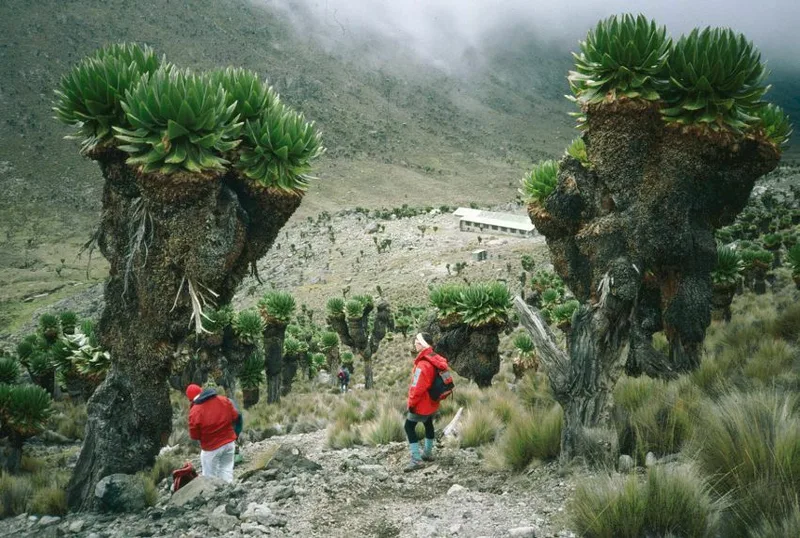
Dendrosenecio keniodendron -
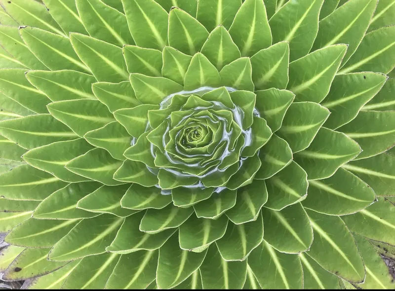
Lobelia gregoriana -
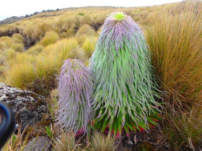
Lobelia telekii -
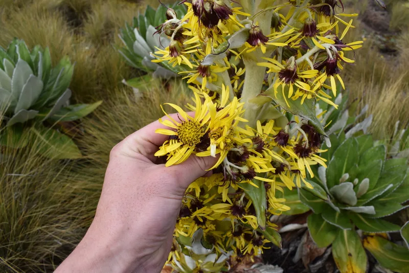
Dendrosenecio keniensis -
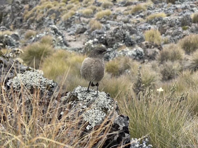
Moorland Chat Pinarochroa sordida -
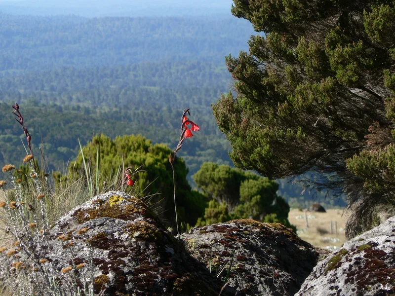
Rift Gladiolus Gladiolus watsonioides -
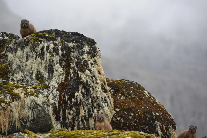
Rock Hyrax Procavia capensis -
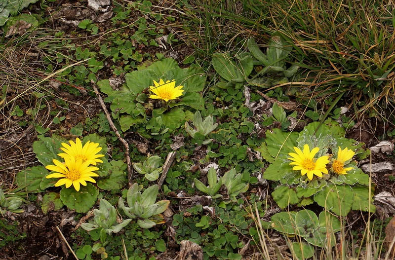
Haplocarpha rueppellii -
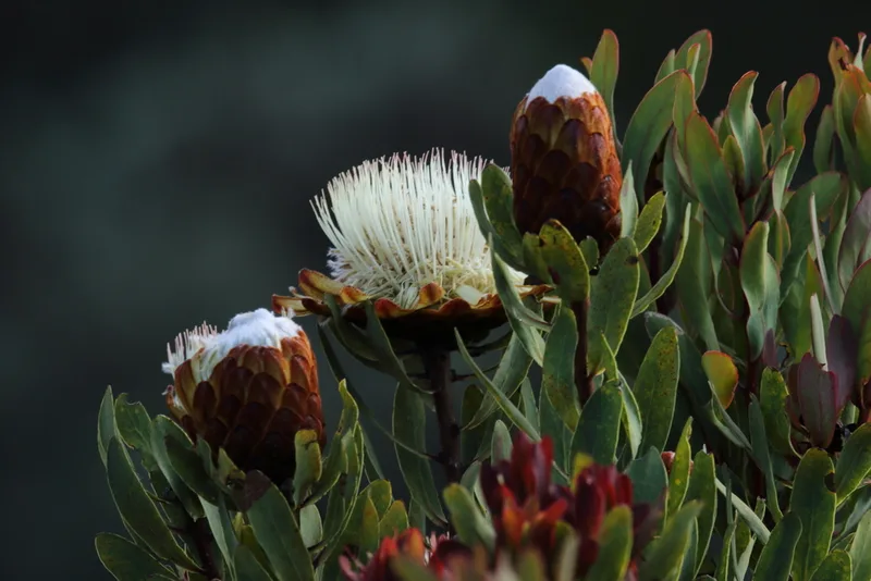
Common Protea Protea afra -
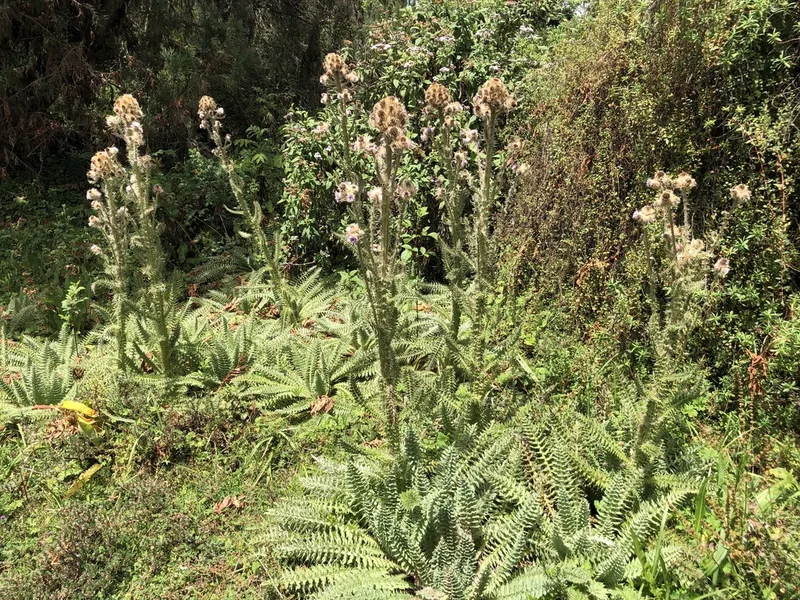
Afroalpine Thistle Afrocarduus keniensis -
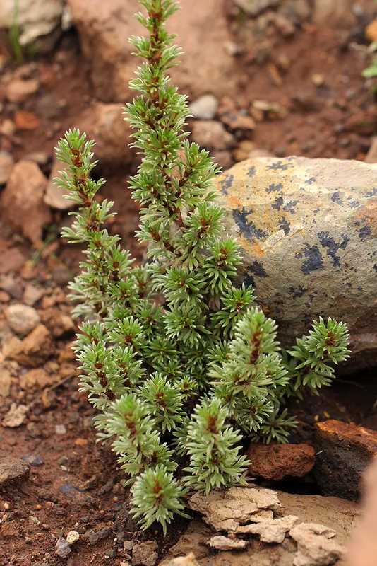
Alchemilla argyrophylla -
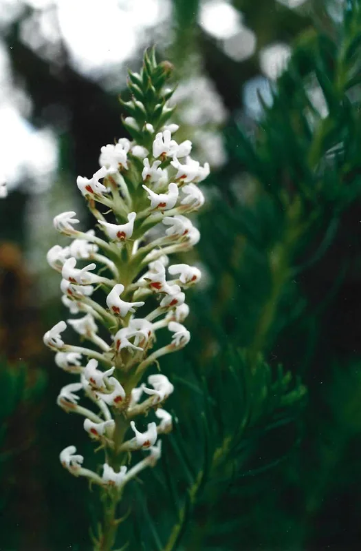
Tropical Slugwort Hebenstretia angolensis
Field Notes · Ice & Glaciers lens · Mount Kenya · −0.1316, 37.3220