Mount Fuji
Some of the rock underfoot here has been in place since long before the mountain existed. Some of it is barely finished cooling.
Why here
Walk into the forest west of the lake and the ground stops behaving like ordinary ground. Roots spread sideways instead of down. The trail buckles over ridges of bare stone. Nothing here has had time to become deep soil, because on the timescale mountains work on, none of it is old. Most of the great peaks people travel to see are ancient, worn down over spans of time too long to picture. Fuji is the opposite kind of landmark: a young volcano standing inside an older landscape, still close enough to its own making that you can find the evidence without digging for it. The forest floor, the shape of the lake basins below, the smooth unbroken slope of the cone itself against the rounder, older ridges around it — all of it is recent, geologically speaking, and all of it still reads as a sequence of events rather than a finished result. This note follows that thread: not a mountain you merely look at, but one you can watch, still being assembled, one flow and one forest at a time.
The sites
The forest grown on stone
富士箱根伊豆国立公園 青木ケ原樹海
35.4767, 138.6586
Aokigahara begins the moment the ground turns hard and uneven, though there’s nothing to announce it — no crater, no ash underfoot. The forest was grown on top of one of Fuji’s own lava flows, and the rock sits close enough to the surface that trees never get a normal grip. The trees here send their roots sideways instead of down, spreading over the stone in thick tangled mats, because there’s nowhere below to dig into. Moss covers the lava in a soft green skin that hides how little soil actually sits beneath it. Walk a few steps off the marked path — the information board at the entrance is the honest place to start, since it tells you plainly you’re entering a national park growing on rock, not soil — and the forest floor stops behaving like a forest floor. It buckles and dips over old lava ridges you can’t quite see for the trees. This is one of the plainest places on Fuji to feel that “land” and “recently made land” are not the same thing to stand on, let alone to grow a forest from.
Crouch near the board and look at how a nearby tree’s roots spread sideways across the surface rather than sinking straight down. Follow one root by eye as far as you can — it is tracing the shape of the lava just beneath the moss.
- AccessShort walk
- ExertionEasy
- TimeAn hour
富士箱根伊豆国立公園 自然歩道(青木ケ原自然歩道)
35.4782, 138.6581
The nature trail through Aokigahara stays close to the ground the whole way, which is the point: this walk is as much about what’s under your boots as what’s around you. The forest sits on a broad sheet of old lava, still riddled beneath with the empty tubes and pockets that form when the outside of a flow cools and hardens while the inside keeps draining downhill. None of that is marked from this trail, but the porous, pitted rock at your feet is the same stone that built it. That same rock also swallows sound. Footsteps go quiet fast, and voices don’t carry the way they would in an ordinary wood, because open pores in cooled lava and thick moss both work like a sponge for noise. People notice the quiet before they figure out why. Walk slowly enough to feel the trail shift underfoot from packed earth to bare, pitted stone in places, and you’re crossing the actual skin of a flow that once moved as liquid rock down this slope.
Stop mid-trail and stand still for ten seconds. Notice how quickly your own footsteps die out — porous lava and deep moss both absorb sound, part of why this forest reads as so unusually still.
- AccessShort walk
- ExertionModerate
- TimeHalf a day
Where lava remade the water
三湖台
35.4879, 138.6825
From this platform the ground drops away toward a scatter of lake basins below, each catching light a little differently depending on the hour. Set them side by side and read them as one idea: this is what happens when repeated lava flows cut across a valley. Older, larger water was carved up as flow after flow reached the lowland and dammed the drainage in new places, leaving separate lakes where there used to be one connected system. None of that reads as a single event from up here — it happened over a long stretch of time, flow by flow — but the shape below is the residue of it: basins that don’t line up the way a river valley usually does, boxed in by low volcanic ridges rather than following one obvious low point. The platform itself sits on the forested shoulder of one of those old flows. Come for the wide view of Fuji when the air is clear, but spend a minute reading the lower ground too — it’s the quieter half of the same story.
Pick two lake basins you can see and compare their shapes. Notice how their edges don’t line up into one obvious valley — each sits behind its own low ridge of old lava, evidence the flows that shaped them arrived at different times.
- AccessHalf-day hike
- ExertionModerate
- TimeHalf a day
天上山
35.5033, 138.7805
A lift climbs from the shore of the lake straight up the forested side of this peak, and the ride does something a trailhead map can’t: it lets you watch the whole volcanic landscape assemble itself in a few minutes, layer by layer. Lake first, held in its basin by old lava underfoot. Then the dark mass of the Aokigahara forest spreading out beyond it, grown on a flow of its own. Then, air permitting, Fuji itself — the source standing behind everything else you’ve just been looking at. The observatory at the top is built for exactly that view, and it’s worth treating the ride up as part of the looking rather than just transport — watch what appears in stages as the lake drops away below you. Few places on this side of the mountain put water, forest, and cone in the same sightline this easily. Cloud can erase the summit from view within minutes even on an otherwise clear day, so if it’s out when you arrive, the lake and forest below are still worth the trip on their own.
From the observatory deck, trace a line with your eye from the lake, across the dark forest, to the summit if it’s visible. You’re looking at three different ages of the same volcano’s output in a single glance — an old lake basin, a younger forest floor, and the cone that fed both.
- AccessShort walk
- ExertionEasy
- TimeAn hour
Reading the cone from the rim
パノラマ台
35.4824, 138.5975
A stratovolcano gets its shape the slow way: a lava flow that cools before it travels far, then a coat of ash from a different kind of eruption, then lava again, each layer thin compared to the mountain’s total height but adding up, over an immense stretch of time, into the tall, evenly sloped cone you see from platforms like this one. That layering is the reason the profile looks the way it does — steeper near the top, where fewer flows reach, gentler on the lower flanks, where ash and lava have had more room to spread and pile up. You can’t see individual layers from here, but you can see their sum: a shape too regular to be the product of one event, too symmetrical to be ordinary erosion working alone. Come on a clear morning if you can; haze softens the outline fastest, and the geometry is the whole point of this stop. Bring nothing more than eyes and a little patience for the cloud to move.
Trace the cone’s outline with your eye from base to summit. Notice any point where the slope angle changes rather than curving evenly — a subtle break like that often marks where a different kind of eruption, ash instead of lava or the reverse, took over for a while.
- AccessHalf-day hike
- ExertionModerate
- TimeHalf a day
御坂峠
35.5564, 138.7837
Stand at this pass and you’re on ground with a different, older history than the mountain filling the view to the south. Fuji is a young volcano by geological standards, built up against a landscape of older hills and ridges that were already standing before the first of its lava reached this far. The pass itself belongs to that older terrain — worn down over a much longer stretch of time into the rounder, more weathered shapes you can see underfoot and along the ridgeline behind you, nothing like the single unbroken cone across the valley. That contrast is easiest to feel right here, at the boundary between the two: old, settled highland on one side, young, still sharp-edged volcano on the other, close enough that you can look from one to the other in a single turn of the head. People have used this pass as a crossing point for a long time, drawn here by the same gap in the ridgeline that now frames the view. The two kinds of ground it separates remain the more interesting fact.
Turn from the ridge behind you to the cone in front of you and compare their silhouettes. One is rounded and soft-edged from a long, slow history of weathering; the other still holds a sharp, largely unbroken slope. You’re looking at two different ages of land in the same glance.
- AccessDrive-up
- ExertionEasy
- TimeAn hour
When it's best
Fuji is a mountain best seen from a distance, and distance is exactly what humidity and haze tend to take away. Cooler months, from late autumn through early spring, generally offer the clearest, sharpest outlines of the cone from these lake-shore viewpoints, with mornings more likely to stay clear all the way through. In mid-March, expect cool, often clear days and nights still cold enough to bite, with only modest rain — decent conditions for the ropeway ride up Mount Tenjō or a walk to one of the ridge viewpoints, though cloud can still swallow the summit within minutes even on a promising morning. Warmer months bring more haze and a real chance the mountain simply isn’t visible, however good the forest and lake views remain regardless. There is no wrong season for the forest floor or the lake basins below — only for the summit itself, which rewards patience and an early start most reliably in the cooler half of the year.
Go deeper
The names behind what you saw - The rock underfoot through this whole note is mapped in the regional geologic record simply as “Cenozoic volcanic rocks” — a span reaching from roughly 66 million years ago up to the current epoch, the Holocene, which is a formal way of saying part of this ground counts as still being made. (macrostrat:unit:3185246) - The evenly layered, steep-then-gentle cone you can trace from the ridge viewpoints is what geologists call a stratovolcano: a mountain built from alternating coats of lava and ash rather than one continuous flow.
To read next - Lake Kawaguchi (Wikipedia) — background on the lake’s elevation and basin, useful for anyone who wants the plain civic facts behind the water you’re looking down at from Mount Tenjō or Sankodai. - Kawaguchiko Mt. Fuji Panoramic Ropeway (Wikipedia) — the practical history of the lift referenced at the Mount Tenjō stop, for readers planning that ride. - Fujikawaguchiko (Wikipedia) — the town that rings the lake and forest this note moves through, for anyone who wants the wider civic picture. - Yamanashi Prefecture (Wikipedia) — the surrounding prefecture’s geography, for readers who want to place this landscape in its larger regional context.
The names behind what you saw
What lives here, and what it's called. Photographs from open collections — an aid to identification, not decoration.
-
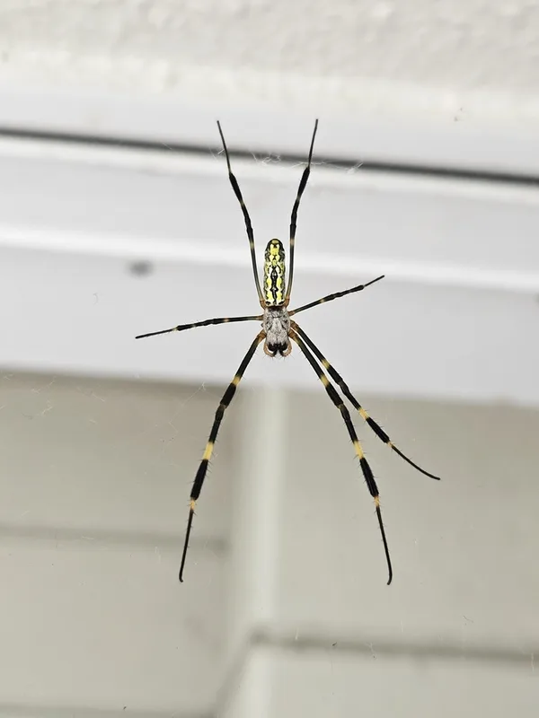
Joro Spider Trichonephila clavata -
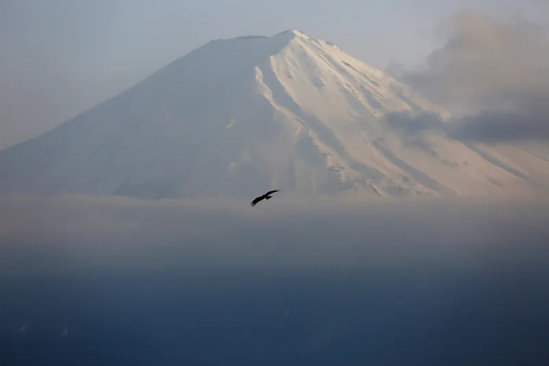
Black Kite Milvus migrans -
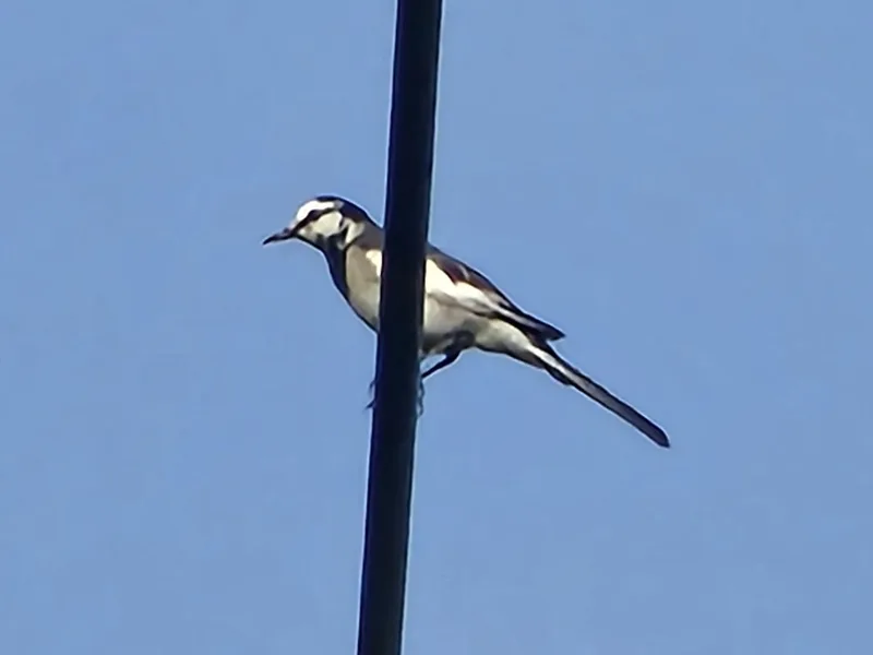
White Wagtail Motacilla alba -
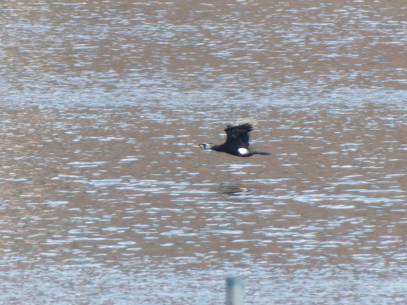
Great Cormorant Phalacrocorax carbo -
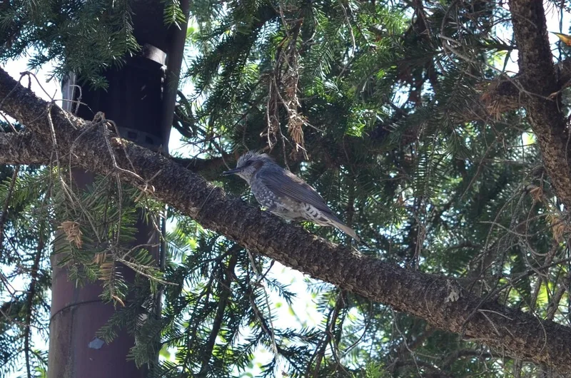
Brown-eared Bulbul Hypsipetes amaurotis -
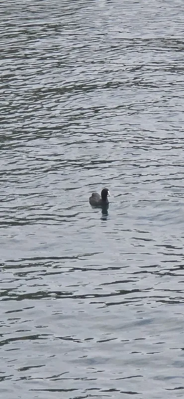
Eurasian Coot Fulica atra -
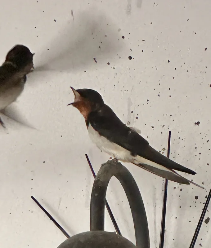
Barn Swallow Hirundo rustica -
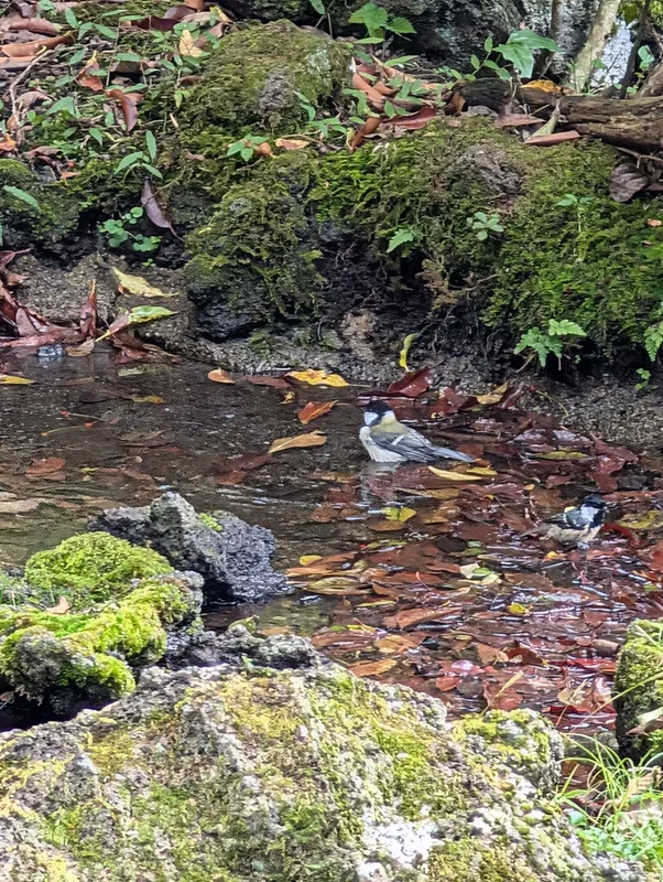
Asian Tit Parus cinereus -
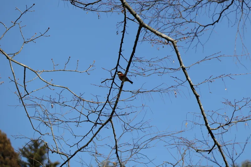
Varied Tit Sittiparus varius -
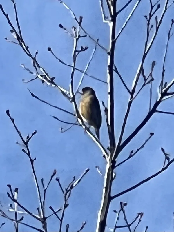
Oriental Greenfinch Chloris sinica -
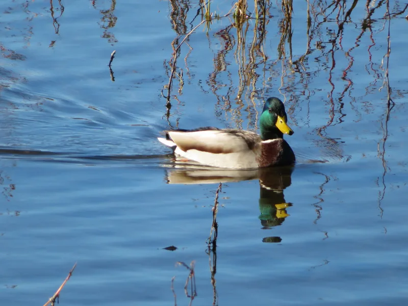
Mallard Anas platyrhynchos -
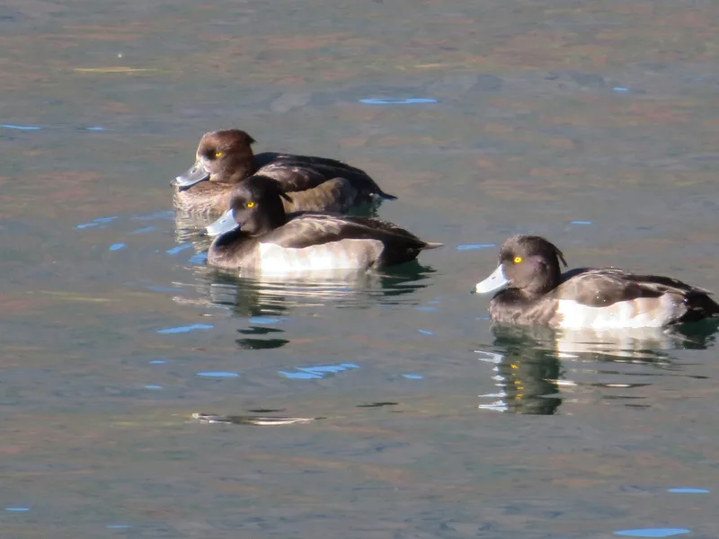
Tufted Duck Aythya fuligula
Field Notes · Volcanic lens · Mount Fuji · 35.5011, 138.7653