Mono Lake
A lake with no way out keeps everything its rivers bring it.
Why here
Snow melts off the Sierra, gathers into streams, and runs down into this basin — and then it has nowhere to go. Mono Lake has no river out. The only way water leaves is by rising into the air, and everything the streams carried in stays behind: salt, minerals, the slow residue of the mountains. Do that for more than seven hundred thousand years and you get water like this — salty, alkaline, a soda lake that grows its own stone. Freshwater springs seep up through the lake floor, meet that mineral-heavy water, and harden into pale limestone towers, built entirely underwater. The same water feeds clouds of small flies at the shoreline and the birds that travel here to eat them. Even the larger island is made of the basin’s leftovers, pushed up by eruptions only a few centuries ago. Everything at Mono Lake follows from one plain fact: this is a lake that keeps whatever comes to it. Read the shore, the stone, and the birds, and you are reading what the water could not carry away.
The story
Start with the water, because the water made everything else. In colder times the lake stood far higher and wider than today — geologists call that older, deeper version Lake Russell — and glaciers ran down from the Sierra to its edge. When the ice pulled back, the lake shrank into the salty remnant you see, leaving old shorelines stranded like bathtub rings on the surrounding hills. Fire worked from below at the same time: eruptions built the islands in the lake, the larger one rising only a few centuries ago from the basin’s own sediments, still warm with hot springs.
On that harsh water, life found a narrow living. Small flies work the shoreline, brine gathers, and migrating birds stop here to feed before moving on. The Kucadikadi, the southernmost band of Northern Paiute, have long lived around this lake and its runs of food.
The most recent chapter is about thirst downstream. Los Angeles reached into this dry country for water, and the long fight over eastern Sierra streams — the California water wars — shaped how much water still reaches basins like this one. The lake keeps everything brought to it, but people decide how much arrives.
The sites
The lake that keeps everything
Mono Lake Tufa State Natural Reserve
37.9780, −119.1328
This stretch of shore holds the lake’s strangest feature: pale, knobbed towers of stone standing in and just out of the water. They are tufa, a kind of limestone, and the odd thing about them is where they grew — entirely underwater. Freshwater springs seep up through the lake bed carrying dissolved calcium, and the moment that calcium meets the lake’s mineral-heavy, alkaline water, it hardens into rock, building slowly upward around each spring like a chimney. Every tower you see marks a spot where fresh water once welled up from below. They stand exposed now because the lake surface sits lower than it once did, leaving the towers stranded in the air, though they were made in water. Walk among them slowly. Their lumpy, cauliflower surfaces are the record of countless small mineral encrustations, laid down grain by grain. Nothing here was carved by hand or piled by wave; it accreted, the way a cave formation does, only out in the open beside a desert lake. This is the clearest place to see the idea behind this whole note — water that keeps what it is given, and turns some of it to stone.
At the base of a tufa tower, look for the small holes and channels threading up through it. Each marks a freshwater spring that once rose through the lake floor and fed the stone as it grew, underwater, around the flow.
- AccessShort walk
- ExertionEasy
- TimeAn hour
Mono Lake Tufa State Natural Reserve
38.0135, −119.1462
From this point the whole basin opens up, and the thing to read is not one rock but the shape of the land itself. Mono Lake is a lake with no way out. Streams run in off the mountains, but no river runs out, so the water can only leave by evaporating — and the salt and minerals it carried stay behind, growing more concentrated over hundreds of thousands of years. That is why the water is salty and alkaline, why it feels slick between the fingers, and why so little can live in it. Look up at the surrounding hills and you may pick out faint horizontal lines or benches on the slopes, well above today’s shore. Those are old beaches. In colder times the lake stood far higher and wider than now, deep enough that glaciers reached down to its edge. Each stranded shoreline marks a level the water once held and later fell from. Standing here, you are at the bottom of a basin that has been filling and shrinking across a span longer than almost anything you can see, keeping a little more of the mountains with every cycle.
Scan the hills around the lake for a faint horizontal line running level across the slopes, well above the water. It is an old shoreline, cut when the lake stood much higher; if you can pick out more than one, each is a separate stand of a larger, older lake.
- AccessDrive-up
- ExertionEasy
- TimeAn hour
Fire beneath the water
Black Point Fissures
38.0274, −119.1001
Black Point is a low, dark hill on the lake’s north shore, and it is made of what the basin produces best after minerals: volcanic rock. It rose as an eruption on the lake floor when the water stood far higher, its dark ash chilling and stacking underwater, and it stands above the surface now that the lake is lower. Along its flat top run narrow cracks — the fissures the place is named for — deep, straight-walled slots, in places just wide enough to step into, opened as the mound cooled and settled. From up here the two islands lie out in the lake to the south. The larger one rose from the basin’s own sediments, pushed up by eruptions only a few centuries ago and still warm with hot springs; the smaller, darker one is older lava. Together with Black Point under your feet, they make one point plain: the fire here is neither finished nor ancient. This lake sits over ground that has erupted well within the time people have lived beside it.
Walk out along the flat top of Black Point and find one of the narrow fissures splitting the rock. Look at how the two walls match, ridge for ridge — the crack opened by the mound pulling apart as it cooled, not by anything washing through it.
- AccessHalf-day hike
- ExertionModerate
- TimeHalf a day
The living brine
Mono Lake Tufa State Natural Reserve
37.9780, −119.1328
Return to the water’s edge and change what you are looking for: not stone now, but life making a living on salt. Where the lake meets the land, the ground can look like it is moving — dark bands of small flies covering the wet shore. These are alkali flies. They do not bite, and they part ahead of your feet and close behind you as you walk. Few creatures can live in water this salty, but the ones that can live in great supply, and that abundance is the reason this lake matters to birds. Gulls nest out on the islands, safe from anything that would reach a nest from shore. In migration, small shorebirds and diving birds stop here to fatten on the brine before moving on. Ospreys, big fish-hawks, build bulky stick nests on the tallest tufa towers, using the surrounding water as a moat against anything that might climb to their young. Harsh at first glance, this is in fact a crowded larder — proof that keeping everything the rivers bring also means keeping a strange, rich table set.
Crouch at the wet shoreline and watch the band of alkali flies open a bare gap just ahead of your feet and fill it in behind you. They are grazing the shore for food few other animals can reach here; the birds working the water’s edge are, in turn, grazing them.
- AccessShort walk
- ExertionEasy
- TimeAn hour
When the sky comes out
Mono Lake Tufa State Natural Reserve
38.0135, −119.1462
Come back to the lake’s edge as the light goes. This is high desert with dry air and little town glow, so once the sun is down the sky over the water fills with stars, and near a new moon the darkness runs deep enough to show the pale band of the Milky Way arched over the basin. The lake turns to a black mirror, and on a still night it doubles the sky above it. This is also a good hour for the birds. Many of the lake’s travelers move and call at dusk, and the flat water carries sound — gulls settling on the islands, the whir of wings over the shallows. Deep time and the present moment sit close together here. Overhead is light that left its stars long before this lake existed; underfoot is a basin that has been filling and drying for a span the mind can barely hold. Bring a warm layer, because even in the milder months the desert night drops cold fast once the sun is off the water.
After full dark on a night near a new moon, let your eyes adjust for several minutes, then find the faint band of the Milky Way and look for its reflection in the still lake below. You are seeing starlight far older than the basin that holds its mirror.
- AccessDrive-up
- ExertionEasy
- TimeAn hour
When it's best
Mono Lake sits high and dry, and its seasons are hard-edged. Spring days are cool and the nights still drop below freezing, with very little rain — clear, sharp weather for walking the tufa shore, though snow can still fall. The high road over the Sierra from Yosemite, Tioga Pass, is closed by snow through the cold months, typically from November into late May, so an early-spring visit means coming up from the desert side rather than over the mountains. Summer is warm and draws the crowds; late summer and fall bring migrating birds to the lake. The desert air stays dry and the skies very dark, so any clear night near a new moon is good for stars over the water.
Go deeper
The names behind what you saw. The lake is a terminal, alkaline soda lake in a closed (endorheic) basin — water enters but leaves only by evaporation, which is why the salts build up. Its ancient, far larger stage is Lake Russell. The pale towers are tufa, a limestone (calcium carbonate) that forms underwater. The rock around the basin includes young volcanic rock; the surrounding ranges expose a much older column, from ancient marine limestone and dolomite up through granite. The larger island is Paoha; the smaller is Negit. The shoreline flies are alkali flies, and among the birds are California gull, eared grebe, Wilson’s phalarope, and osprey.
To read next. - Timothy Tierney, Geology of the Mono Basin — a local field guide to how the lake, tufa, and volcanoes fit together in one place. - The volcanic study of Negit Island — for the volcanic history behind one of the lake’s islands. - The surficial geologic map and geochronology of the Mono–Fish Lake Valley area — for the ages behind the shorelines and flows. - Any solid natural-history reference on Mono Lake — for the closed-basin, soda-lake chemistry laid out plainly.
The names behind what you saw
What lives here, and what it's called. Photographs from open collections — an aid to identification, not decoration.
-
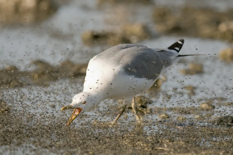
California Gull Larus californicus -
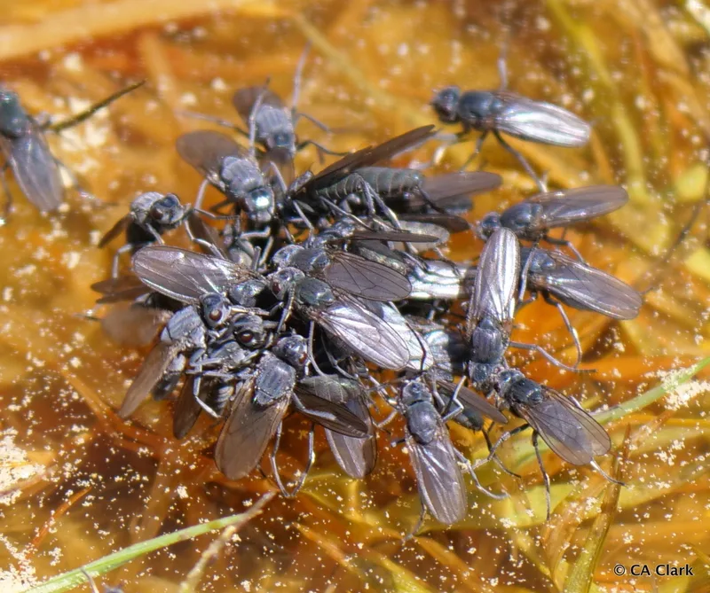
Alkali Fly Cirrula hians -
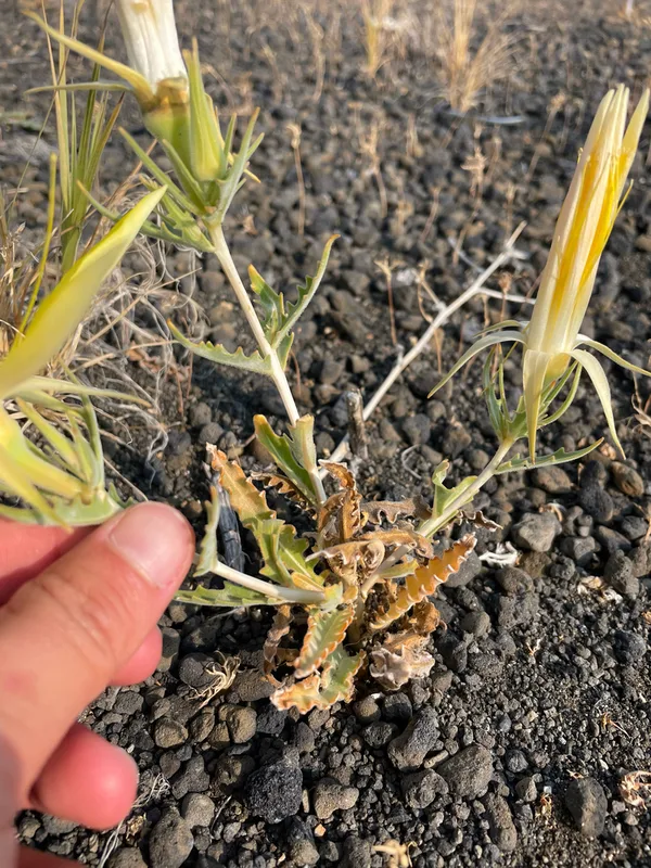
Giant Blazingstar Mentzelia laevicaulis -
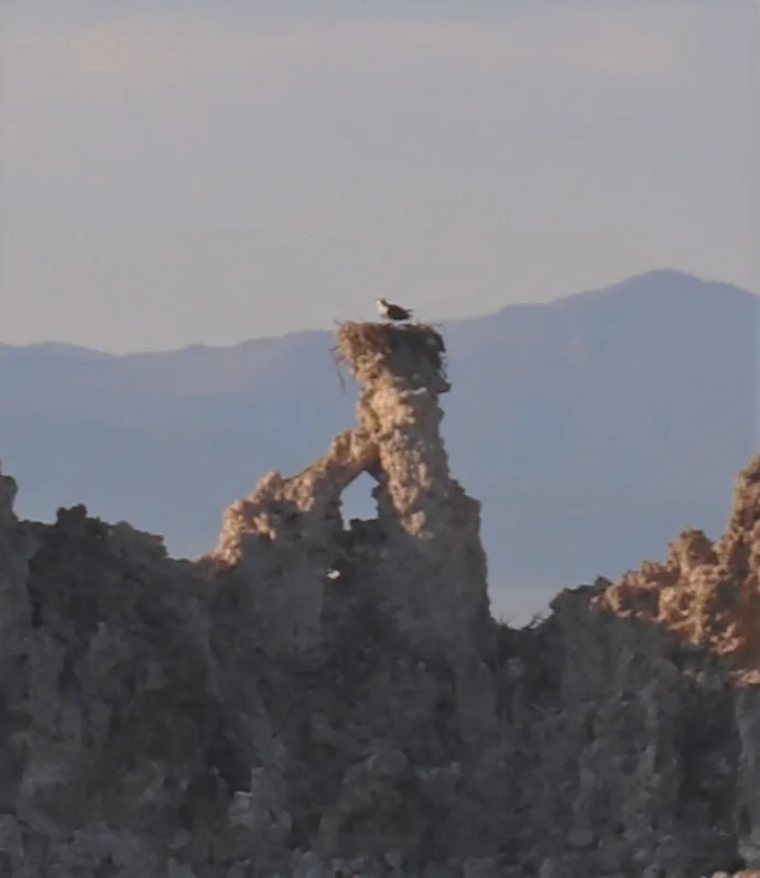
Osprey Pandion haliaetus -
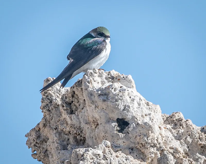
Violet-green Swallow Tachycineta thalassina -
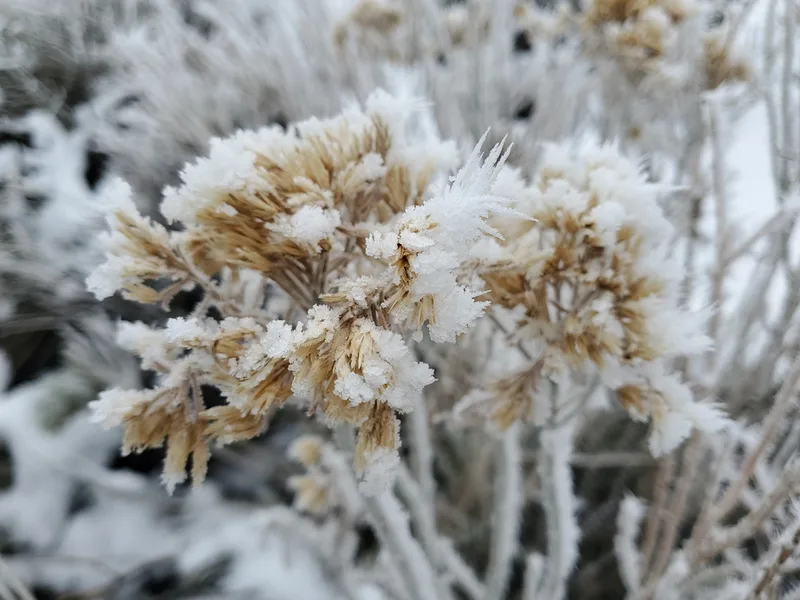
Rubber Rabbitbrush Ericameria nauseosa -
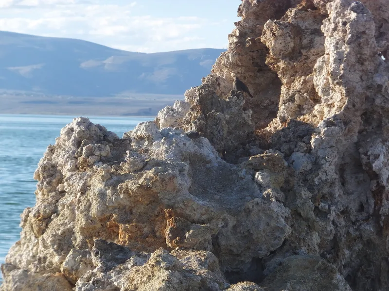
Brewer's Blackbird Euphagus cyanocephalus -
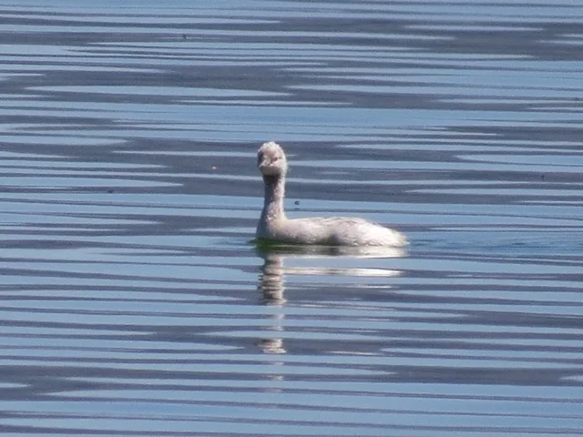
Eared Grebe Podiceps nigricollis -
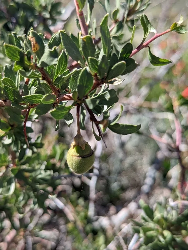
Desert Peach Prunus andersonii -
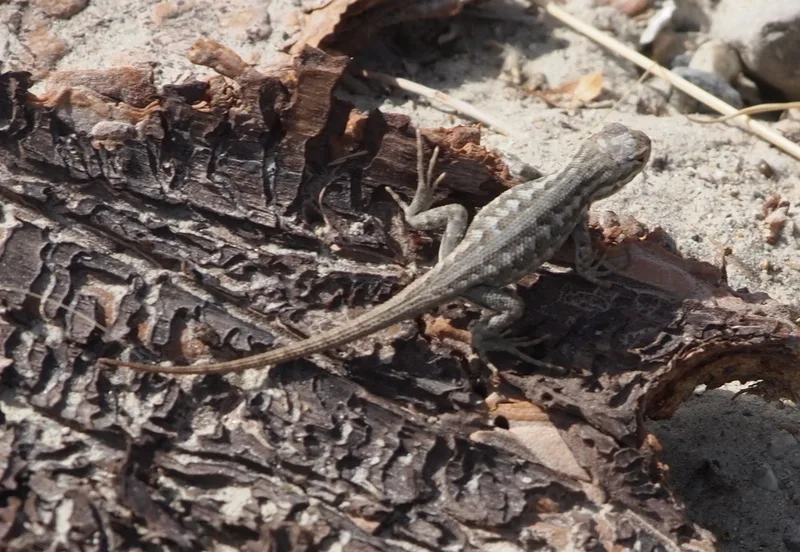
Common Sagebrush Lizard Sceloporus graciosus -
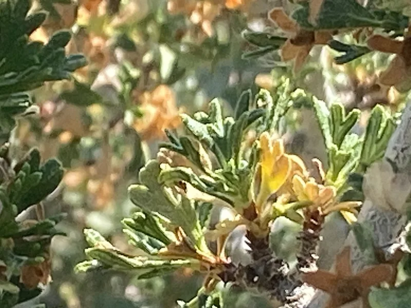
Antelope Bitterbrush Purshia tridentata -
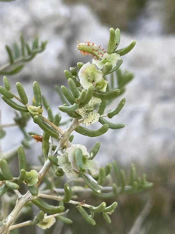
Greasewood Sarcobatus vermiculatus
Field Notes · Desert & Deep Time lens · Mono Lake · 38.0079, −118.9675