Meteora
Every pillar at Meteora is an old riverbed, standing on end.
Why here
Before it was scenery, this rock was rubble. Millions of years before anyone stood beneath these towers and looked up, the material that makes them was loose stone and sand, washing down off some vanished high ground and settling, layer on layer, at the bottom of water. Only later, after tens of millions of years of quiet burial and a slow lift back toward daylight, did it become the hard, cemented rock now carved into freestanding towers hundreds of meters above the valley floor. Look closely at almost any face here and you can still see what it once was: individual rounded stones, some as small as marbles, held together by their own mineral cement, exactly as they settled the day they stopped rolling. Meteora rewards close looking more than almost anywhere: the same rock that reads as one dramatic silhouette from a distance turns, up close, into a plain record of a much slower, much wetter past. This note keeps returning to that trade, grand shape from far away, honest history up close.
The story
The land came first, and it came from water. The rock underfoot began as loose sediment, pebbles, sand, silt, washed into a basin and buried under its own weight until it cemented into solid stone. What followed was slower: the region lifted, exposed rock wore unevenly along its own fracture lines, and softer material fell away from around harder, better-cemented blocks until only the toughest cores were left standing, isolated, as the pillars seen today.
Life arrived once there was somewhere for it to hold on. Kermes oak grows low and tough in whatever crevice offers enough soil, spring anemones and cyclamen root in thin pockets of dirt on ledges too small to farm, and the cliffs themselves became a nesting ground; crag-martins and swifts work the updrafts along the rock faces, using ledges no predator on foot can reach.
People noticed the same thing the birds did. Beginning in the medieval centuries, monks climbed these towers and built directly on several of the summits, choosing sites that were nearly impossible to reach as the whole point. What went up there stayed remote by design, protected less by walls than by the rock itself. Six of the monasteries built this way are still standing, still visible from the paths below, the newest layer in a formation that was already unimaginably old before the first stone of any of them was set.
The sites
The pillars, up close
Κουκουλάς
39.7118, 21.6398
This is one of the freestanding towers that give Meteora its shape, a single mass of rock rising clear of the slope around it, with nothing built on top and nothing to distract from the rock itself. Get close to the base and the story the whole formation tells becomes readable at arm’s length: the surface isn’t smooth or uniform, it’s made of individual rounded stones held together by their own natural cement, exactly as they must have looked the day they stopped rolling in whatever water carried them here. That’s the plain fact underneath all of Meteora’s drama, this is old riverbed and lakebed, not the kind of rock that forms from cooling magma or crushing pressure deep underground. It became stone the ordinary way loose sediment always does: buried, compressed, and slowly cemented, long before anything lifted it back toward the light and erosion carved away everything around it that wasn’t as tough. Stand back far enough and it reads as a silhouette against the sky. Stand close and it reads as a record of a slower, wetter world that no longer exists here.
Walk up to the base and look for individual rounded stones held in the rock’s face — some no bigger than a fist, a few larger. Each one rolled to a stop somewhere in ancient water long before the tower it’s part of ever stood up. Run a hand across the surface and notice where the cement between the stones has worn down more than the stones themselves.
- AccessShort walk
- ExertionModerate
- TimeAn hour
Πυξάρι
39.7135, 21.6224
Pyxari sits at the southwestern edge of the whole cluster of towers, which makes it a useful place to step back and see the formation as a formation rather than a single dramatic shape. From here the towers read less like isolated monuments and more like what they are, the surviving remnants of one continuous mass of rock that once filled this entire valley, cut down over a very long time until only the hardest, most tightly cemented sections remained standing. Every tower in view, from here, is made of the same original rock; what differs is how much of it erosion has already taken away. Some towers still keep most of their original bulk. Others have been reduced to narrow spires, close to whatever their fate eventually is for all of them. The edge position also means the light does something the interior of the cluster doesn’t offer as easily: in the low sun of morning or late afternoon, the layered texture in the rock face shows up more clearly than it does at midday, when flat overhead light flattens everything into one uniform grey-gold color.
From this edge position, look across at several towers at once rather than focusing on one. Notice how much rock survives on each — some still broad and blocky, others narrowed to spires — and read the difference as stages of the same slow process working at different speeds.
- AccessShort walk
- ExertionModerate
- TimeAn hour
Αδράχτι
39.7134, 21.6262
Look up the face of this tower and you’ll likely notice long vertical lines running most of its height, cracks, not layers. Sedimentary rock like this doesn’t just sit as flat sheets; it also breaks along fracture planes, called joints, that form roughly at right angles to the original layering as the rock settles and shifts over time. Those joints matter more to the shape of a place like this than the layering does, because they’re where erosion gets its first foothold. Water finds a crack before it finds a weak spot in solid rock, and once a joint starts to widen, it keeps widening, freezing and thawing, expanding and easing, one slow cycle at a time, until a slab or a whole column separates from what’s around it. Adrachti’s narrow, spire-like shape is a fairly direct result of that process: a rock that was once continuous with its neighbors, isolated along joint lines until only this column-width remained. It’s a smaller, more vertical version of the same erosion visible everywhere in the cluster, worth noticing here because the joint lines themselves are unusually easy to pick out from ground level.
Trace one of the near-vertical lines running up the tower’s face with your eyes, top to bottom. That’s a joint — a crack the rock broke along, not a layer it was built from — and it’s the kind of line erosion follows first.
- AccessShort walk
- ExertionModerate
- TimeAn hour
Rock and air
Θέα Καλαμπάκας
39.7098, 21.6360
This viewpoint looks out over the town of Kalambaka and the open ground between it and the rock cluster, which makes it a good place to notice what’s actually missing rather than what remains. Every gap between two towers, every stretch of open valley, used to be rock, the same rock the towers themselves are made of. What you’re looking at isn’t really a set of objects that grew upward out of flat ground; it’s the last remaining fraction of a single, much larger mass, with everything else already carried away by water and time. From a distance, the height difference between the towers and the valley floor is also easiest to judge here: the town sits at what amounts to the erosion’s finish line so far, while the towers mark how much rock has resisted it, hundreds of meters higher, up to this point. Neither is fixed. The valley floor is still being cut, and the towers are still being narrowed, just slowly enough that a human lifetime can’t see the difference, only the accumulated record can.
Look at the empty space between two neighboring towers rather than at the towers themselves. That gap was once solid rock, continuous with both of them. Try to picture it filled back in, and the whole formation stops looking like separate towers and starts looking like one shape with most of it removed.
- AccessDrive-up
- ExertionEasy
- TimeAn hour
Large Boulder
39.7142, 21.6329
As the name suggests, this is a single large block of rock at ground level rather than a full standing tower, which makes it one of the easiest places in the whole cluster to get close to a broken or weathered face without any climbing. Crouch near it and look at any surface where the rock has fractured or worn away cleanly, and the texture that defines Meteora’s geology is on full display within arm’s reach: embedded stones of different sizes and colors, set in a finer matrix that cements them together. Differences in the stones, some rounder, some more angular, some noticeably paler or darker than their neighbors, reflect different pulses of sediment arriving at different times, each batch settling before the next arrived on top of it. It’s the same information the towers carry at height, just at a scale that doesn’t require craning your neck or squinting against the sky to read.
Find a broken or weathered face on the boulder and look closely at the individual stones set into it. See how many different sizes and colors you can pick out in one small patch — each difference marks a separate pulse of sediment that arrived and settled before the next one buried it.
- AccessShort walk
- ExertionEasy
- TimeAn hour
Where stone meets soil, then people
Αγιά (Αϊά)
39.7117, 21.6244
Agia sits at a point that overlooks the town of Kalambaka below, which makes it a good place to watch the formation’s edge do something the interior towers don’t show as clearly: the transition from bare rock to workable ground. Look down from here and there’s a fairly abrupt line where sheer stone gives way to soil deep enough to support scrub, then trees, then the fields and rooftops of the town itself. That line isn’t decorative, it marks where enough loose material has accumulated for anything to take root, versus rock too hard and too steep for soil to ever build up on it in any useful depth. The towers above stay essentially bare for the same reason a steep roof stays free of moss: nothing loose can sit still long enough to become soil. Everything usable eventually works its way down to where the slope levels out, which is roughly where the town now sits. Kalambaka, from this angle, looks less like a separate place than like the downhill end of the same process that carved the rock above it.
From Agia, follow the slope downward with your eyes until bare rock gives way to green, then to buildings. Notice how narrow that transition band actually is — there’s very little middle ground between stone too steep to hold soil and ground flat enough to farm.
- AccessShort walk
- ExertionModerate
- TimeAn hour
Δούπιανη
39.7222, 21.6206
Doupiani rises within the village of Kastraki, close enough to the hotels and restaurants at its base that the rock and the built town share almost no buffer between them. That makes it one of the more useful stops for seeing how little the geology has been softened or set back for the sake of the town around it, the base of the tower simply meets the street, roughly as directly as a cliff meets a beach. Nothing about the rock changes to accommodate the buildings nearby; it’s the town that has fit itself around the stone, tucking in wherever the ground allows and leaving the rock to keep doing what it’s always done. Up close at the base, the same conglomerate texture visible on the more remote towers is just as present here, it hasn’t been polished or altered by proximity to development, only made easier to reach. Of everywhere in this note, Doupiani is the site that makes clearest how ordinary this extraordinary rock is treated by the people who actually live beside it every day.
Stand where the base of the rock meets the street and look for the line where stone stops and pavement or building starts. Notice there’s no gradual transition — no soil, no scrub, just rock and then town. That abruptness is the same thing that made this rock hard to build on anywhere except where people have not tried.
- AccessShort walk
- ExertionEasy
- TimeAn hour
Monastery of Holy Trinity
39.7130, 21.6380
This marker sits near one of the towers in the cluster that carries a building on its summit rather than bare rock alone, and it’s a fitting place to end a note about geology, because it marks where the rock’s story and the human one visibly meet. Several of these pillars have monasteries built directly on top, reachable only by climbing the same sheer faces described throughout this note, walls that took tens of millions of years to become this solid, and this hard to climb, before anyone thought to try. What people built up there didn’t fight the rock’s shape; it used it, treating the very qualities that make these towers difficult to erode, their height, their steepness, their isolation from the towers around them, as the reason to choose that particular summit over easier ground nearby. Read from this angle, the monasteries aren’t really separate from the geology lens this note has been following. They’re the most recent layer in it: the point where people looked at an already-ancient, already-finished piece of rock and decided its very durability was worth building on.
From this marker, look up at the nearest rock summit and pick out where any built structure meets the natural stone. Notice there’s no ledge or platform carved out to ease the transition — construction simply starts where the sheer rock face happens to allow a foothold.
- AccessDrive-up
- ExertionEasy
- TimeAn hour
When it's best
Meteora doesn’t have an off season in the way a beach or a snowfield does — the rock is the draw, and the rock is here all year. What changes is comfort and company. Late winter into early spring tends to run cool and showery, with the anemones often flowering in ledge pockets by the middle of March, earlier in a mild year. Kermes oak and the other scrub on the slopes stay green year-round, so the towers never look bare even outside bloom. If there’s a single argument for timing a visit, it’s less about the rock than about everything using it: spring brings the clearest run of wildflowers and the most cliff-nesting bird activity, as swifts and crag-martins work the updrafts along the faces. Any season still delivers the one thing this place is actually about — stone you can read with your own eyes.
Go deeper
The names behind what you saw The rock itself is classed in the geologic record as molasse — a general term for the mix of pebbles, sand, and mud that piles up in a basin as a nearby landscape erodes — laid down here across the Eocene and Oligocene epochs, part of a longer sequence geologists trace under the broader label Cenozoic sedimentary rocks. The wildflowers rooted in ledge pockets include the peacock anemone (Anemone pavonina) and ivy-leaved cyclamen (Cyclamen hederifolium); the tough evergreen scrub clinging to crevices is kermes oak (Quercus coccifera). The cliff-working birds are the Eurasian crag-martin (Ptyonoprogne rupestris) and alpine swift (Tachymarptis melba).
To read next - Wikipedia’s entry on Meteora lays out the formation and its monastery complex in one place, a useful starting map of names. - The Wikipedia pages for the Monastery of Great Meteoron and the Monastery of St. Nicholas Anapausas each give a founding history for one of the towers that carries a building on top. - The Macrostrat records for the molasse and Cenozoic sedimentary units behind these towers give the geologic age brackets in full, for anyone who wants the numbers unrounded. - iNaturalist observation records document the spring wildflowers rooted in the rock’s ledges and crevices. - eBird checklists log the crag-martins, swifts, and other cliff-working birds using these faces.
The names behind what you saw
What lives here, and what it's called. Photographs from open collections — an aid to identification, not decoration.
-
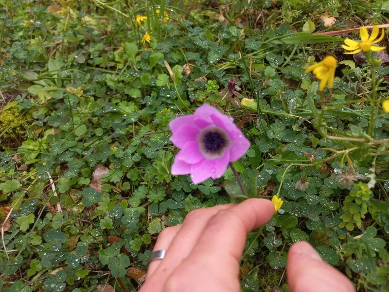
peacock anemone Anemone pavonina -
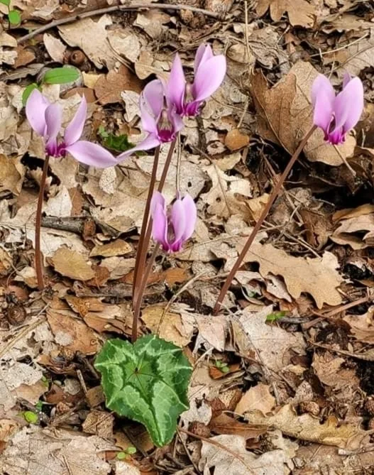
Ivy-leaved cyclamen Cyclamen hederifolium -
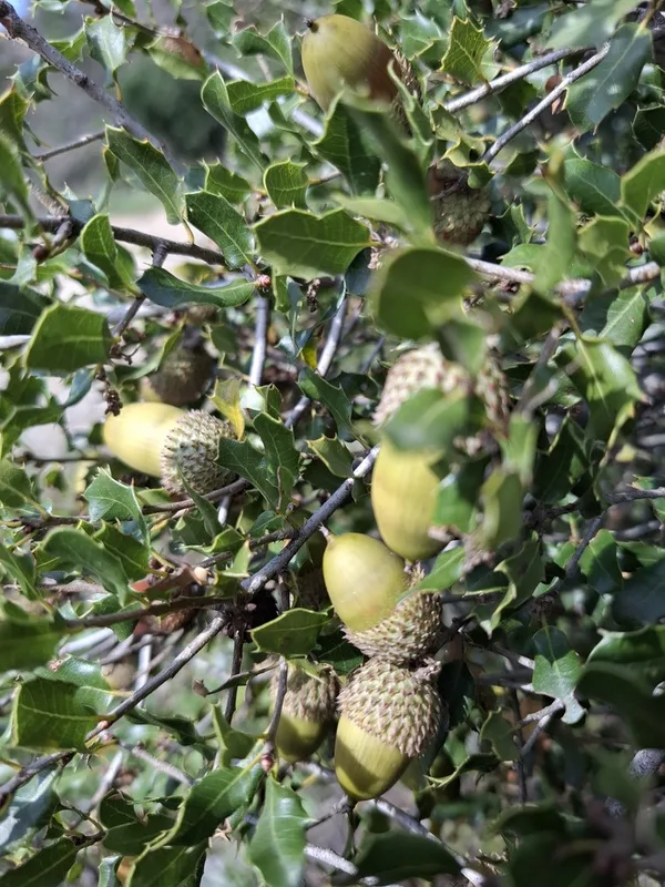
Kermes oak Quercus coccifera -
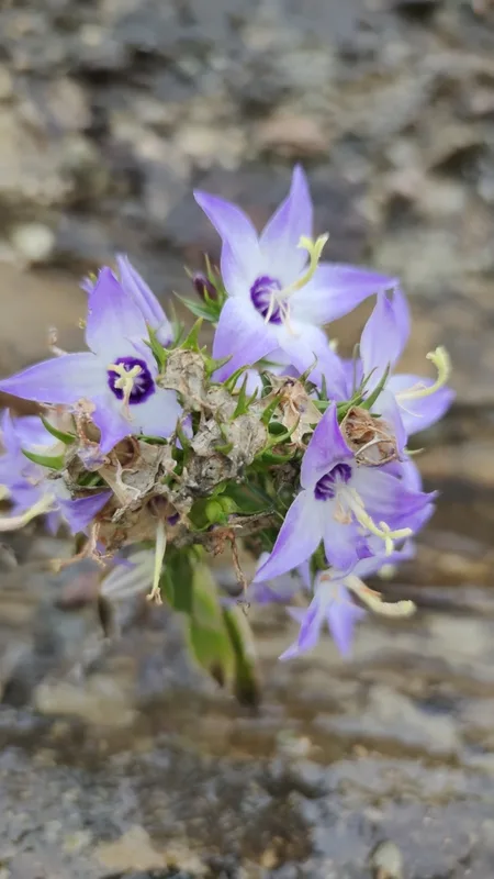
Campanula versicolor -
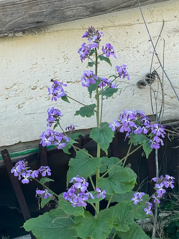
Annual Honesty Lunaria annua -
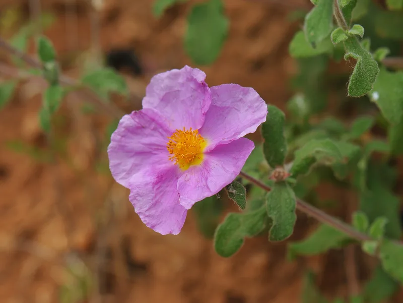
Hoary Rock-rose Cistus creticus -
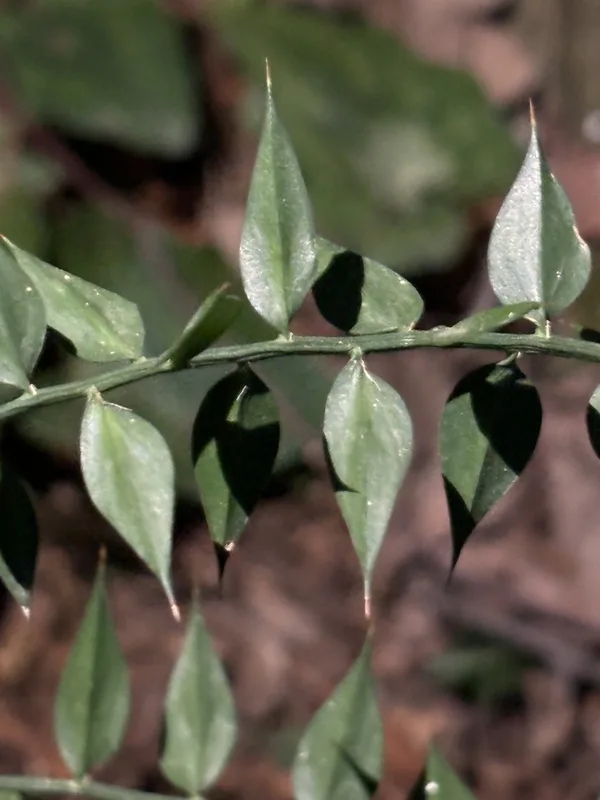
butcher's-broom Ruscus aculeatus -
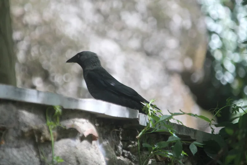
Eurasian Jackdaw Coloeus monedula -
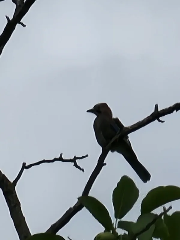
Eurasian Jay Garrulus glandarius -
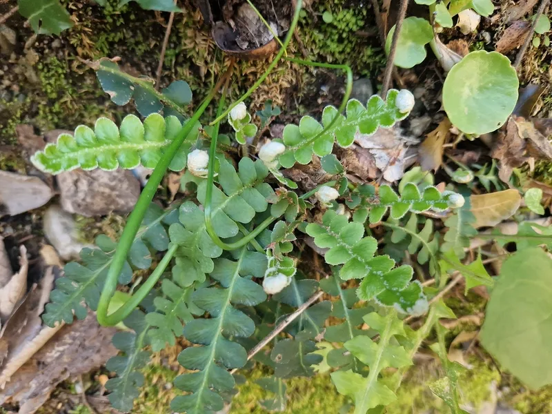
Rustyback Asplenium ceterach -
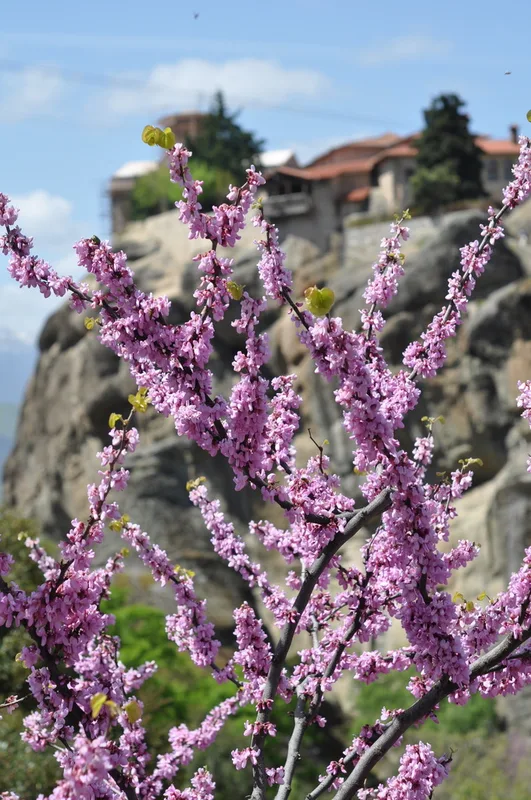
Judas-tree Cercis siliquastrum -
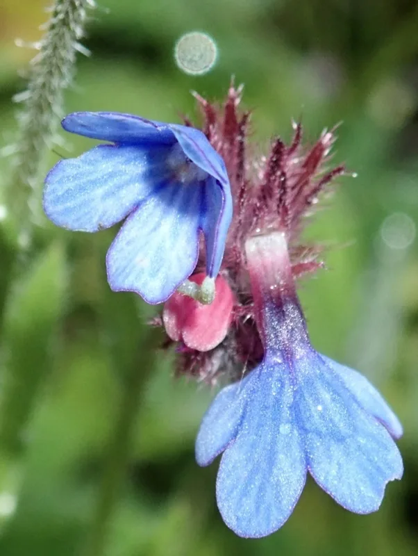
Cretan Alkanet Anchusa cretica
Field Notes · Desert & Deep Time lens · Meteora · 39.7219, 21.6322