Lofoten
The map says Arctic; the water says otherwise.
Why here
Fly a straight line north from Lofoten and you are well inside the Arctic before you reach anywhere colder. And yet the islands rarely feel like it. Peaks here are some of the oldest exposed rock in Europe, forced up long before there was an ocean at this latitude to answer to, and the sea has spent the whole time since figuring out what to do with them: undercutting them at the waterline, wrapping them in cloud, keeping the air around them milder than a map would predict. Villages settled where the water allowed a boat to land rather than where the ground was easiest. Seabirds nest on cliff ledges the rock offers and fish waters the sea keeps open. Even the fog that gathers on the mid-height slopes most afternoons is the sea’s doing, moist air rising off open water until it meets rock cold enough to hold it. None of this is scenery working alone. It is one system, water and stone leaning on each other, and the rest of this note keeps returning to that same relationship from a different angle each time.
The story
The rock under Lofoten is some of the oldest exposed anywhere in Europe, gneiss and a suite of intrusive stone, gabbro and charnockite among them, that had already been standing for a very long time before the Caledonian mountain-building episode that shaped so much of Scandinavia ever got underway. It was pushed up, cracked, and only much later did the sea arrive at anything like its current shape around it, leaving peaks that plunge straight into salt water with almost no gentler ground in between.
The sea itself supplied whatever came after. Seabirds, kittiwakes, oystercatchers, terns, the occasional white-tailed eagle working the cliffs for easier prey than fish, nest on ledges this ancient, broken rock happens to offer, timing their year around when the water is easiest to fish. Along the shore and up the lower slopes, plants like roseroot and black crowberry hold on in thin soil that the sea keeps from freezing as hard as the latitude alone would suggest.
People arrived and did the same math the birds did. Villages like Sørvågen sit exactly where a boat can land and a catch can be brought ashore, not where the ground is flattest or most sheltered from the peaks behind. The record here is mostly quiet on exactly when that pattern started, but it never really stopped, this is still a coastline organized around what the sea provides, with the mountains behind serving mostly as a wall to build a village against.
The sites
The peaks that watch the sea
Reinebringen
67.9278, 13.0714
Reinebringen rises almost straight out of the water above the fishing village of Reine, one of the steepest, most abrupt mountain fronts in an archipelago full of them. The rock underfoot is part of the same ancient basement that runs the length of Lofoten, gneiss and granite intrusions older than almost anything else exposed in Europe, worn down and shoved skyward long before the sea ever reached this latitude. What makes the climb worth the effort is not the peak itself but the moment partway up when the fjord opens beneath you: Reine’s boathouses scattered on a spit of low ground, the sea threading between skerries, and mountains repeating the same sharp profile in every direction, each one dropping to the water with no foothills in between. Cloud tends to gather here before it gathers anywhere else, moist air off the sea meeting cold rock and losing the argument. You can watch it happen from partway up the trail, a slow white collar forming around the middle heights while the peak and the shoreline both stay clear. It is a small daily demonstration of the thing this whole coastline runs on: the sea supplying the moisture, the rock supplying the wall for it to catch on.
Partway up the climb, stop and look for a line of cloud collecting at the mid-height of the surrounding peaks while the summits and the water below stay clear — the sea’s moisture condensing where it meets colder rock. Watch it drift and reform rather than sit still.
- AccessHalf-day hike
- ExertionStrenuous
- TimeHalf a day
Ryten
68.0893, 13.0929
Ryten is a modest peak by Lofoten’s standards, but it stands directly above Kvalvika, a beach reachable by no road, closed in by cliffs on either side and open only to the sea. The view from the top is less about height than about contrast: a pale crescent of sand tucked into a fold of some of the oldest rock in Europe, with the open Norwegian Sea running unbroken to the horizon beyond it. There is no harbor here, no village, just rock, sand, and water working on each other the way they have for a very long time. Weather moves fast across this stretch of coast, and Ryten catches it early; a clear morning can fill with fog rolling in off the water within the hour, erasing the beach below before it reaches the summit. Gulls and other seabirds use the cliffs and the open water beyond as a matter of course rather than as a destination, one more reminder that this coastline supports more life below the waterline than above it. Come for the beach seen from above, but pay attention to how quickly the sea can take the view away and give it back.
From the summit, watch the direction fog moves in off the water below — it usually arrives as a distinct edge rather than a gradual haze, a sign of moist sea air meeting cooler land air over the beach.
- AccessHalf-day hike
- ExertionStrenuous
- TimeHalf a day
Helvetestinden
67.9804, 12.9826
Helvetestinden stands over Bunes, a long beach on the far side of Reinefjorden reachable only by boat and then on foot, which keeps it quieter than its scenery would otherwise allow. The mountain’s name carries an old association with harsh terrain, and the approach earns it, a steep pull up bare rock with the fjord dropping away below the whole way. What is worth the crossing is the view from partway up: Bunes laid out as a pale strip between dark cliffs and blue water, backed by a wall of peaks that plunge to the sea with almost no transition. This is basement rock at its most exposed, gneiss and old intrusive stone that has been standing since long before there was an ocean at this latitude at all, now taking the full weight of Atlantic swell at its base. Seabirds work the cliffs and the open water below in numbers, using ledges the rock offers and a sea that, however cold it looks, rarely freezes even this far north. Go on a clear day if the crossing allows it, the fjord itself is often the first thing to cloud over.
Look along the base of the cliffs above Bunes for seabirds working close to the rock — the cliffs offer ledges above the reach of the surf, and the open water just beyond supplies the fishing.
- AccessExpedition
- ExertionStrenuous
- TimeA full day
Mannen
67.8745, 12.8866
Mannen sits above the villages at the southern tip of Lofoten, and it is the coastline’s simplest introduction to itself: a short climb that trades very little effort for one of the widest sea views in the archipelago. From the top, the mountains that dominate the rest of Lofoten fall away behind you and the open water takes over, skerries, small islands, and the curve of the coast running out toward the archipelago’s final point. This is a good place to take the region’s most durable fact seriously: for its latitude, Lofoten stays remarkably mild, one of the largest such gaps between what the map says and what the thermometer says anywhere on Earth. The sea is why. Ocean water carries heat a long way, and it keeps giving that heat up to the air and the rock around it long after a landlocked place at the same latitude would have gone hard into winter. Stand on Mannen in weather that would be unremarkable much farther south and it starts to make sense why villages, birds, and plants alike have organized their whole existence around staying close to the water rather than retreating from it.
From the summit, note how mild the air feels for how far north you are standing — then look down at the water itself, which is the reason why.
- AccessShort walk
- ExertionModerate
- TimeAn hour
Where the land gives way
Fiskarskjæret
67.9364, 13.1024
Fiskarskjæret is a lighthouse, not a peak, and it marks the opposite kind of place from the summits nearby: not where the land rises highest but where it finally gives out into skerries and open water. Little rock islands and reefs like this one string along the whole Lofoten coast, the low-tide remains of the same ancient basement that builds the mountains, worn down by the sea until only the toughest knuckles of stone still break the surface. A light here does the plain, durable work a light always does, warning boats where rock lies just under or just at the waterline in a stretch of coast where fog can close in with very little notice. It is a good place to stand and consider the coastline at its least dramatic and most honest: no dramatic cliff, no famous beach, just water working patiently at rock for a very long time, and people responding to that fact with the simplest possible tool. Watch how the sea moves differently around a cluster of skerries than it does in open water, quicker, more confused, breaking against things you cannot always see.
Watch the water around the skerries near the light — it moves faster and breaks more irregularly than open water nearby, a sign of submerged rock close to the surface.
- AccessShort walk
- ExertionEasy
- TimeAn hour
Utsikten (Volandstinden)
68.0707, 13.2110
Utsikten means simply the view, and the name is the whole pitch: a viewpoint set below Volandstinden that asks nothing in the way of effort for what it gives back. From here the coastline reads as a single system rather than a series of separate sights, peaks, fjord, open sea, and the low ground where a handful of villages have tucked themselves along the shoreline, all visible from one spot without a long climb to get there. It is worth using this stop as an orientation point before or after a harder hike elsewhere among the peaks nearby: from Utsikten you can trace how consistently every ridge in this stretch of Lofoten runs down to touch the water, with almost no gentle, sloped edges anywhere in view. That pattern is not an accident of scenery. It is what happens when very hard, very old rock is pushed up out of the sea and then left largely alone by weathering except at the waterline, where the sea works on it without pause. Bring patience for weather here as much as anywhere else on this coast, a clear view can fog over within the time it takes to walk back to the car.
From the viewpoint, trace the ridgelines nearby down to where they meet the water — look for how few of them taper gently; most simply stop at the sea.
- AccessDrive-up
- ExertionEasy
- TimeAn hour
Lofotodden varde
67.8350, 12.8621
Lofotodden varde is a cairn, not a summit in its own right, built at the point where the long spine of mountains that defines Lofoten finally runs out and the open Norwegian Sea takes over completely. Getting here means walking the length of the archipelago’s outer edge, past the last of the peaks and down to a headland with nothing between it and the horizon. Cairns like this one are the plainest kind of human mark on a landscape, stacked stone, no more durable than the hands that built it, meant mostly to say that someone else has stood in this exact spot and looked at the same thing. What they looked at does not change much: current, wind, and open water running uninterrupted toward the edge of the map, with seabirds working the updrafts along the final cliffs and very little else moving. This is as complete an answer as the coastline gives to the question of where the land stops trying. Everything you have seen elsewhere in Lofoten, the peaks plunging to the water, the mild air, the birds working the cliffs, arrives here at its plainest statement.
From the cairn, look for seabirds using the updraft along the final cliffs below you — a headland like this concentrates wind the same way it concentrates the view.
- AccessExpedition
- ExertionStrenuous
- TimeA full day
When it's best
Lofoten does not have an off season so much as two very different reasons to come. Through the darker months, the polar night draws in and the long nights bring a real chance at the northern lights, with the sea keeping the coast unexpectedly open and mild even as everything else at this latitude should have gone hard into winter. Through the light months, the sun barely sets and the cliffs fill with nesting seabirds working the open water below, kittiwakes, terns, eagles, and gulls all keeping close to the coast rather than ranging inland. Fog is a near-constant possibility in both seasons on the higher peaks, arriving quickly off the sea and clearing just as fast, so build slack into any plan that depends on a summit view. There is no wrong season here, only a different version of the same relationship between land and water.
Go deeper
The names behind what you saw
- The basement rock under most of these peaks is Proterozoic gneiss, with intrusive charnockite, mangerite, norite, gabbro, and anorthosite forming parts of the range — old igneous and metamorphic rock tied to the wider Caledonian orogenic belt that raised much of Scandinavia’s mountain spine.
- White-tailed Eagle — Haliaeetus albicilla
- Black-legged Kittiwake — Rissa tridactyla
- Eurasian Oystercatcher — Haematopus ostralegus
- Roseroot — Rhodiola rosea
- Black crowberry — Empetrum nigrum
- Swedish Cornel — Cornus suecica
To read next
- Geology and structure of Vestvågøy, Lofoten, North Norway (James F. Tull, 1977) — a close, foundational survey of the basement rock underfoot on the northern islands.
- Geology of the Akkajaure-Tysfjord-Lofoten traverse, N. Scandinavian Caledonides (Lennart Bjorklund, 1989) — places Lofoten’s rock within the much longer mountain-building story that runs the length of Scandinavia.
- Complex fault patterns, transtension and structural segmentation of the Lofoten Ridge, Norwegian margin (Tectonics, 2006) — links what stands above the water to the fault structure running underneath it.
- Vp/Vs ratio structure of the Lofoten continental margin, northern Norway, and its geological implications (Geophysical Journal International, 1996) — a look at what the strait itself is made of, well below anything a hiker could see.
- Geology and age relations on Værøy, Lofoten, north Norway (1978) — extends the same basement story out to one of the outer islands, most exposed of all to the open sea.
The names behind what you saw
What lives here, and what it's called. Photographs from open collections — an aid to identification, not decoration.
-
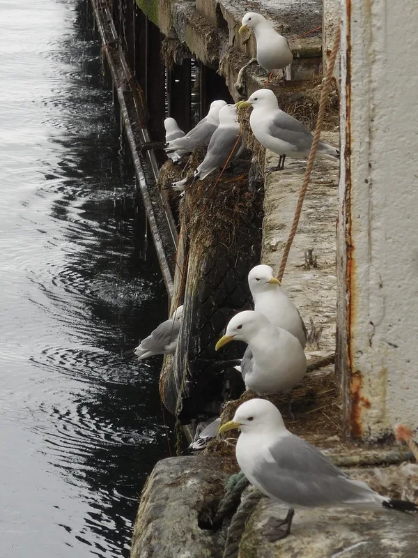
Black-legged Kittiwake Rissa tridactyla -
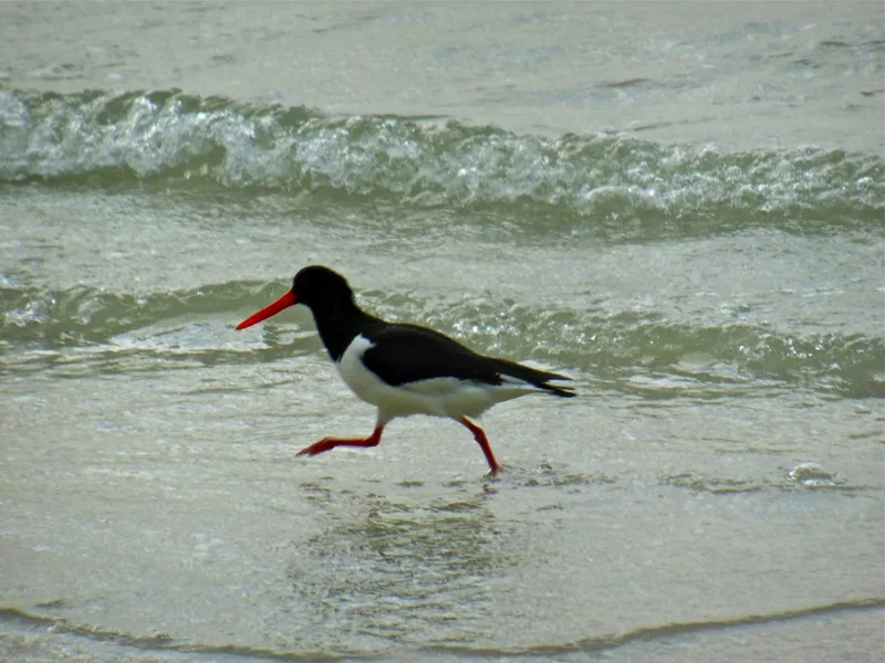
Eurasian Oystercatcher Haematopus ostralegus -
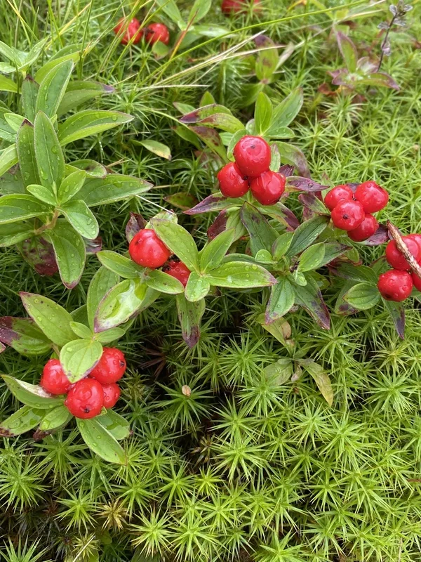
Swedish Cornel Cornus suecica -
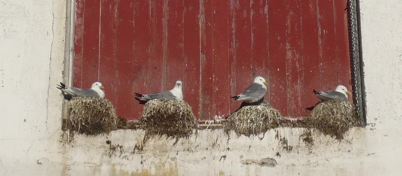
Common Gull Larus canus -
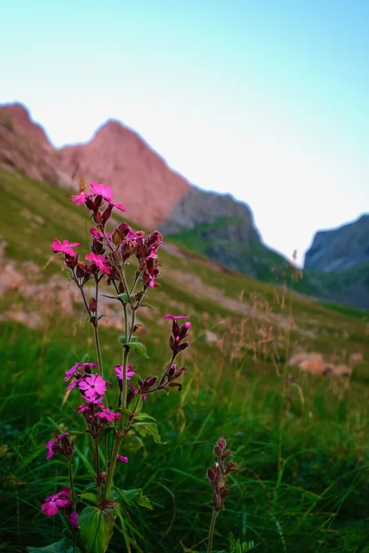
red campion Silene dioica -
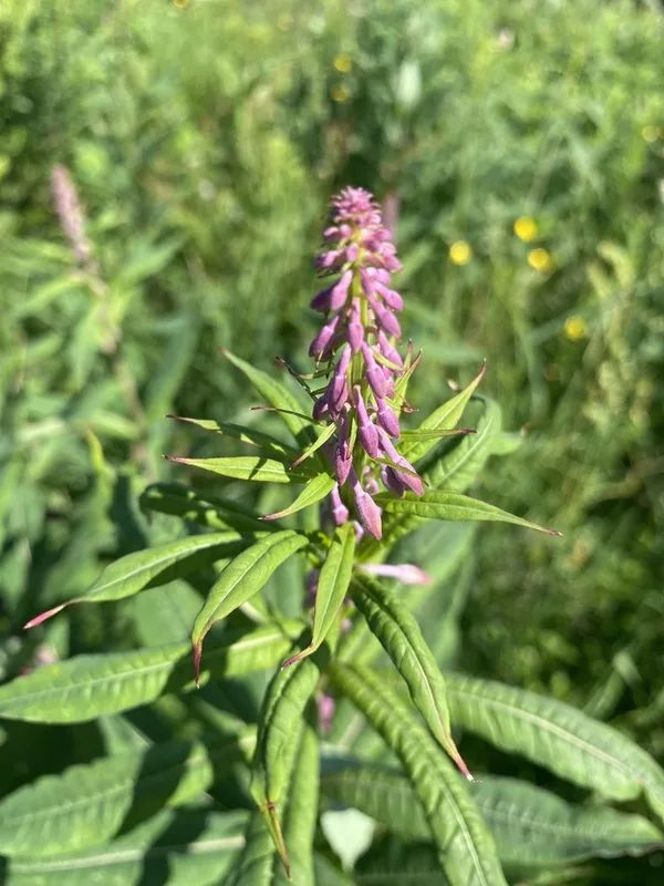
fireweed Chamaenerion angustifolium -
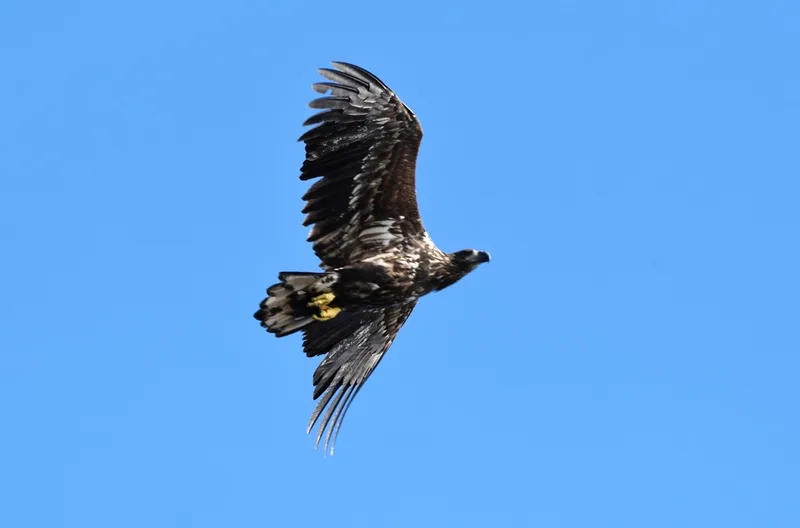
White-tailed Eagle Haliaeetus albicilla -
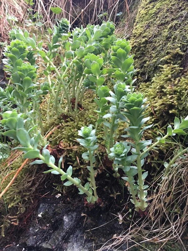
Roseroot Rhodiola rosea -
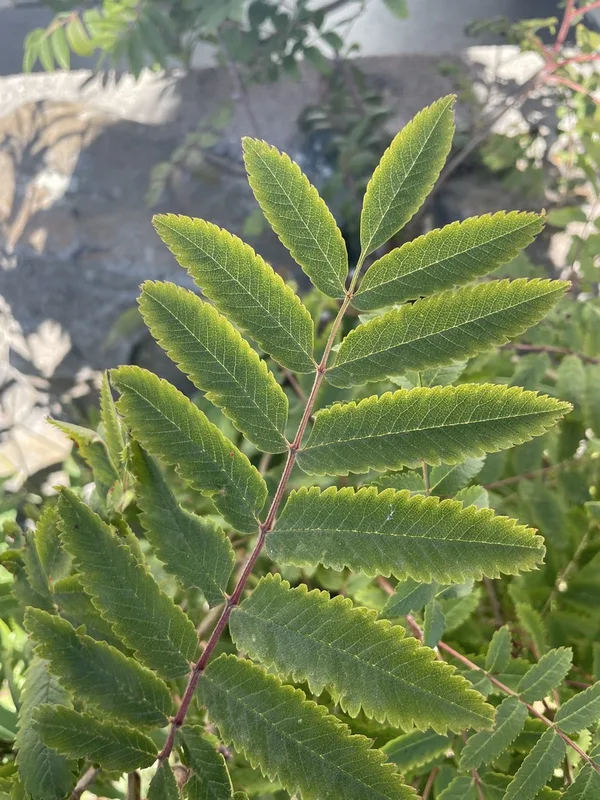
European mountain ash Sorbus aucuparia -
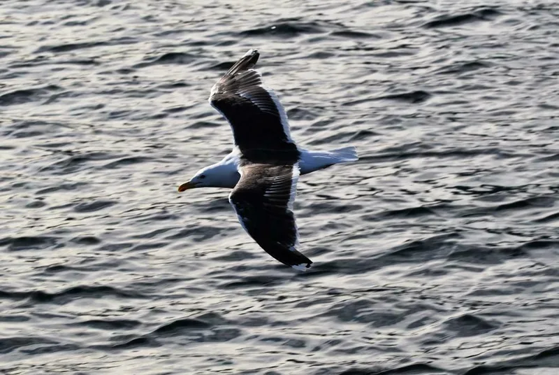
Great Black-backed Gull Larus marinus -
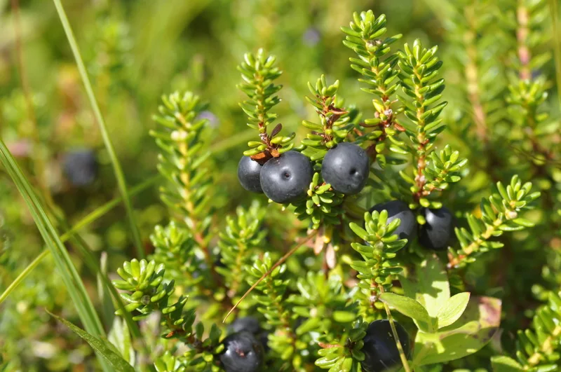
black crowberry Empetrum nigrum -
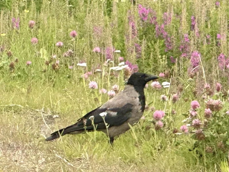
Hooded Crow Corvus cornix
Field Notes · Fog Coast lens · Lofoten · 67.9023, 13.0419