Ladakh
Nothing here grows tall enough to hide the mountain from you. If you want to see the whole shape of a place, come where the desert has left the rock uncovered.
Why here
Stand almost anywhere in Ladakh and you are looking at rock, not scenery. This is a high desert, so dry and so cold that almost nothing grows tall enough to cover a slope — no forest canopy, no thick soil, nothing standing between your eye and the mountain’s actual structure. Elsewhere, geology hides under green; here it simply lies open, ridge after ridge, valley wall after valley wall, for anyone willing to look. The tilt of old layers, the raw grain of rock that once cooled far underground, the places where frost has quietly pried a face apart — all of it is visible from the trail, not locked away in a museum case. Ladakh sits where two great landmasses have spent an immense span of time pressing into each other, and the mountains piled up in that collision are still, largely, unclothed. That bareness is not a lack. It is the whole appeal. Every site in this note is really the same site seen from a different angle: bare rock, doing what bare rock does best — telling you, plainly, how it got here.
The sites
The valley cut open
Indus valley viewpoint
34.1475, 77.4708
From this lookout the Indus valley reads as a single clean cut through the mountains: a narrow green thread on the valley floor, hemmed on both sides by walls of bare rock that rise with almost nothing growing on them. That contrast is the point. In most mountain ranges, forest and soil creep up the slopes and blur where rock ends and cover begins; here the desert air is too dry and too cold for much to take hold above the river’s reach, so the walls stand exposed edge to edge. Look along the rock face rather than down at the water, and you can trace features that would be hidden anywhere greener — bands and breaks running through the cliff, the debris fans where whole slopes have shed rock downhill over a very long time, the places where one kind of rock gives way to another. None of it is explained by a sign. It is simply there, in view, the way it would be for a geologist reading the same wall. Come expecting less a scenic overlook than a cross-section, and the valley opens up as exactly that.
Pick one continuous band or color change on the far valley wall and follow it with your eye as far as you can in both directions. Notice whether it stays level, or climbs and dips — a band that tilts has been pushed out of its original flat-lying position by the same forces that raised these mountains.
- AccessDrive-up
- ExertionEasy
- TimeAn hour
Indus Valley
34.1409, 77.4831
A short distance from the last vantage, this second view over the Indus takes in more of the valley floor and less of the sky — useful, because it’s the floor that carries almost all of the visible life. Sea-buckthorn, a hardy, silvery shrub, lines the water in dense stands, and it is one of the few plants that manages this climate at all; step even a stone’s throw off the valley floor and the ground turns back to open rock and gravel. That sharp edge between green and bare is worth noticing for what it says about this desert: water, not warmth, is what limits growth here. Wherever the river or its irrigation reaches, plants crowd in; wherever it doesn’t, the rock stands uncovered exactly as it has for a very long time. Birds make use of both zones — small songbirds working the buckthorn thickets, larger raptors patrolling the open slopes above — so this is also a good spot to watch how wildlife splits itself between the two worlds rather than roaming freely across all of it.
Find the line where the sea-buckthorn stands stop and bare rock begins, and notice how sharp it is — almost a wall, not a gradual thinning. Watch a few minutes for movement on each side of that line: small birds tend to stay near the green, larger ones patrol the open rock above.
- AccessShort walk
- ExertionEasy
- TimeAn hour
Spituk Parka lookout
34.1070, 77.5420
This lookout sits low enough in the valley to put you close to the rock rather than above it, which makes it a good place to look for the layering inside the cliffs rather than just their overall shape. Watch the walls in low, raking light and you can often pick out faint parallel lines running through the rock — old bedding, folded or tilted rather than lying flat, evidence that these slopes were built up in sheets and later shoved out of position rather than simply piled up loose. Nothing about the process is fast or ongoing to the eye; what you’re seeing is the finished record of movement that happened over an immense span of time, frozen into the angle of the rock. The desert setting is what makes this legible at all — no soil blanket, no root systems, nothing softening the wall’s face. Spend time here rather than rushing past, and the valley starts to read less like a wall of stone and more like a book left open at a page you can actually parse, line by line.
Look for faint parallel lines running through the rock face, most visible in low early or late light. If they run flat and level, that section of rock hasn’t moved much since it formed; if they run at an angle or curve, you’re looking at rock that has been tilted or folded since.
- AccessShort walk
- ExertionEasy
- TimeAn hour
Peaks worn to their bones
Chham Kangri
34.1854, 77.5672
Chham Kangri works both as a peak to climb toward and a viewpoint in its own right, which makes the climb up worth doing even if you stop short of any summit. As you gain height, the vegetation you started among thins out completely, and the mountain’s shape takes over as the whole subject: a ridge worn down not by any single dramatic event but by the patient, repeated work of freeze and thaw, water finding a crack, freezing, and prying it a fraction wider, year after year. The result lower down is scree — loose broken rock that has come free of the peak above and settled into slopes at a steady angle. Higher, the ridge itself narrows into bare, jointed rock with almost no loose material left to shed, because there is nothing left loose to fall. Read the mountain from bottom to top as you climb it, and you are effectively reading backward through how much of it has already been taken apart by weather, and how much still stands whole.
Partway up, stop and compare the scree slope underfoot with the ridge rock still standing above it. Look for a joint or crack in the standing rock that lines up with a gap in the scree below it — that’s very likely where the next piece will eventually let go.
- AccessHalf-day hike
- ExertionModerate
- TimeHalf a day
Rumbag kangri
34.0508, 77.4740
Rumbag Kangri sits toward the quieter, southern edge of this stretch of Ladakh, and the walk in feels correspondingly more remote — fewer viewpoints signposted, more just open desert mountain. That remoteness suits the peak, because what it rewards is unhurried looking rather than a single photograph. Its faces are broken by frost into blocky, angular chunks rather than smooth curves, a texture common to rock that fractures along internal planes of weakness rather than simply crumbling. Different faces of the same peak often weather at different rates depending on which way they face — a slope that gets more sun and more freeze-thaw cycling tends to break down faster than one that stays shaded and frozen solid for longer stretches. Watching Rumbag Kangri from a distance as you approach, then up close once you’re on it, is a chance to see that asymmetry directly: one side of the mountain visibly rougher and more actively breaking apart than the other, for reasons written into nothing more than which way it happens to face the sun.
Compare the sunward face of the peak with its shaded side. Look for which face is more broken into loose blocks and which holds together as smoother, more continuous rock — the rougher side is usually the one that spends more time cycling through freezing and thawing.
- AccessHalf-day hike
- ExertionStrenuous
- TimeA full day
Parcha Kangri
34.0099, 77.4534
Parcha Kangri lies at the southern edge of this note’s ground, and reaching it earns you sightlines that run out over a genuinely large stretch of bare mountain country — ridge behind ridge behind ridge, with almost no tree line to interrupt the view because there is essentially no tree line here to begin with. This is bharal country: the wild sheep Ladakh is known for favor exactly this kind of broken, rocky, sparsely vegetated ground, where their coloring blends into the rock and steep terrain keeps most predators at bay. Scan the slopes rather than the skyline and give it time; a still animal on a rock face can be almost invisible until it moves. The peak itself is a fair introduction to how little separates mountain from desert in Ladakh — the same aridity that leaves the rock bare of plant cover has also shaped this landscape into wide open habitat rather than closed forest, and the animals that live here have adapted to a place where cover means a rock outcrop, not a stand of trees.
Scan the rocky slopes below the ridge slowly, rather than the skyline — bharal are colored to match the rock and often stand motionless. Look for a shape that seems slightly too regular or too pale for the rock around it before you look for movement.
- AccessHalf-day hike
- ExertionStrenuous
- TimeA full day
Where rock meets sky and settlement
Snow Mountain View Point
34.2253, 77.6162
As its name promises, this viewpoint looks toward higher ground carrying snow, and the boundary between snow and bare rock is worth watching closely, because it moves. Through the year that line climbs and falls the slope depending on season and recent weather, exposing or covering the same rock in turn — in colder stretches it creeps well down the mountainside, and in warmer ones it retreats back up toward the highest ridges, always leaving the rock below bare and dry rather than turning green the way a wetter range would. That’s the same aridity at work again, seen from a different angle: even meltwater here mostly can’t support much plant growth once it leaves the immediate valley floor, so what you’re looking at is less a snow line over a green mountain than a snow line over a bare one, in two shades of the same dry rock. Spend a few minutes watching how the light changes the visible edge of the snow through the afternoon, and the whole slope starts to look less static than it does at first glance.
Trace the edge where snow gives way to bare rock and note whether it’s a sharp line or a ragged, patchy one. A ragged edge usually means the snow there is thin and actively retreating; a sharp, even line usually marks somewhere colder or more shaded, where the snow is more stable.
- AccessShort walk
- ExertionEasy
- TimeAn hour
Stupa Viewpoint
34.1880, 77.5936
This lookout shares its high ground with a Buddhist stupa, and the pairing is not an accident of geography so much as a pattern repeated all through Ladakh: settlements and religious structures here are built to take advantage of exactly the bare, open sightlines this note has been following all along. Where a slope carries no forest and no thick soil to block a view, a high point becomes valuable in a way it wouldn’t in a greener landscape, and people have built on these high points accordingly for a very long time. From here you can look back down at the settled valley floor — its narrow band of irrigated green — and compare it directly with the open rock rising all around, the two ways of using this landscape sitting side by side in a single view. It’s a fitting place to end a note about bare rock: the same openness that leaves the mountain’s structure legible to a geologist has also shaped, quite directly, where and how people have chosen to live and build within it.
From the stupa’s high point, pick out the edge of the settled, irrigated valley floor below and trace how closely it hugs the water. Notice how abruptly the green gives way to open rock away from that edge, and how much of the visible landscape, even here near a town, is still bare mountain rather than settlement.
- AccessShort walk
- ExertionEasy
- TimeAn hour
When it's best
Ladakh’s defining trait is not a single season so much as a climate: it is a cold desert year-round, and the dryness that keeps its rock uncovered barely lets up at any point in the calendar. Winters are hard, and the high routes into the region close under snow, which makes the warmer half of the year the practical window for most travel. Within that window, the shoulder months carry a low, raking sun that throws long shadows across ridgelines and valley walls, making the texture and tilt of the rock easier to read than it is under a flat midday light. The same dry, high air that exposes the rock also makes for some of the clearest night skies around — a new moon night, in any month, is the darkest and best for it.
Go deeper
The names behind what you saw. The bare rock across much of this note is mapped as Mesozoic–Cenozoic intrusive igneous rock — material that cooled slowly far underground sometime between the Cretaceous and the Paleogene, only reaching daylight once everything that once lay above it had worn away. The high ground these viewpoints look out over sits near the Indus suture zone, the seam where the Indian and Asian plates met. The wild sheep grazing these slopes is Pseudois nayaur, the bharal; the lizard sunning itself on rock is the Himalayan agama, Paralaudakia himalayana; the partridge underfoot is the chukar, Alectoris chukar. Overhead, the larger silhouettes belong to the golden eagle, Aquila chrysaetos, the Himalayan griffon, Gyps himalayensis, and the bearded vulture, Gypaetus barbatus.
To read next. - D. N. Wadia, Geology of Indus suture zone of Ladakh (1983) — the foundational account of the very seam these viewpoints look across. - A. K. Jain, Geology and tectonics of the Southeastern Ladakh and Karakoram (2009) — sets the local peaks inside the larger collision that built them. - “Geological map of the Karakoram fault zone, Eastern Karakoram, Ladakh, NW Himalaya,” Journal of Maps (2008) — an actual map, for tracing the faults underfoot on paper. - “Geological transect across the Northwestern Himalaya in eastern Ladakh and Lahul” (1993) — lays out, step by step, the model of two continents colliding here. - “Geological observations in the Ladakh area (Himalayas): a preliminary report” (1977) — an early outside survey, useful for seeing how much the picture has sharpened since.
The names behind what you saw
What lives here, and what it's called. Photographs from open collections — an aid to identification, not decoration.
-
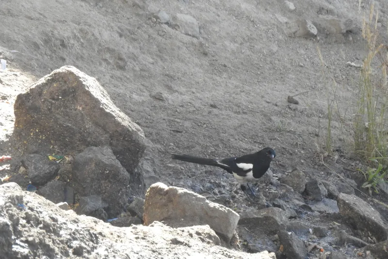
Eurasian Magpie Pica pica -
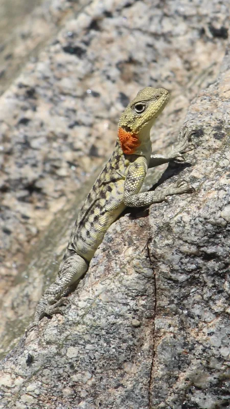
Himalayan Agama Paralaudakia himalayana -
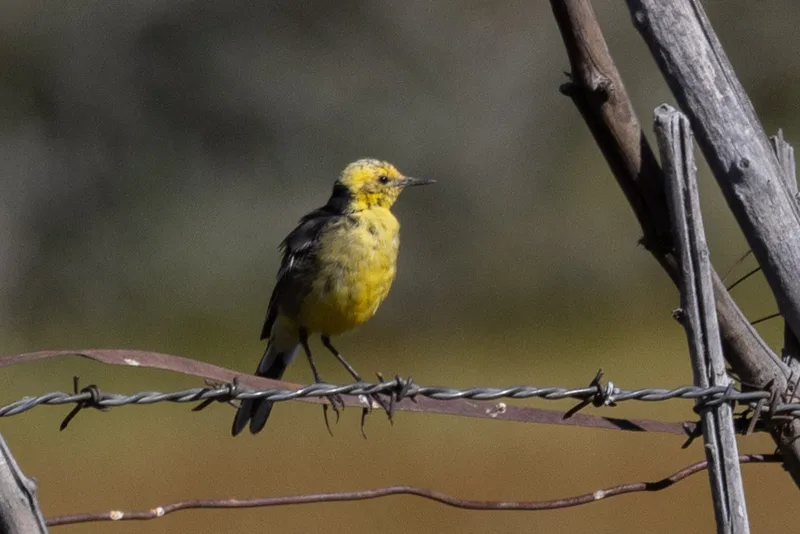
Citrine Wagtail Motacilla citreola -
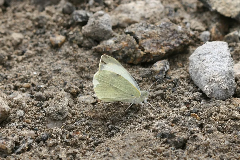
Large White Pieris brassicae -
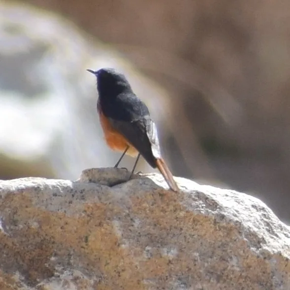
Black Redstart Phoenicurus ochruros -
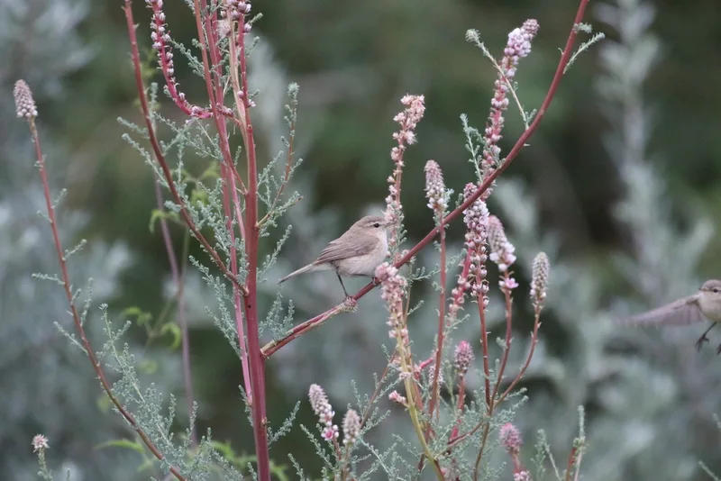
Mountain Chiffchaff Phylloscopus sindianus -
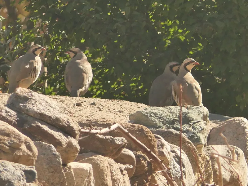
Chukar Alectoris chukar -
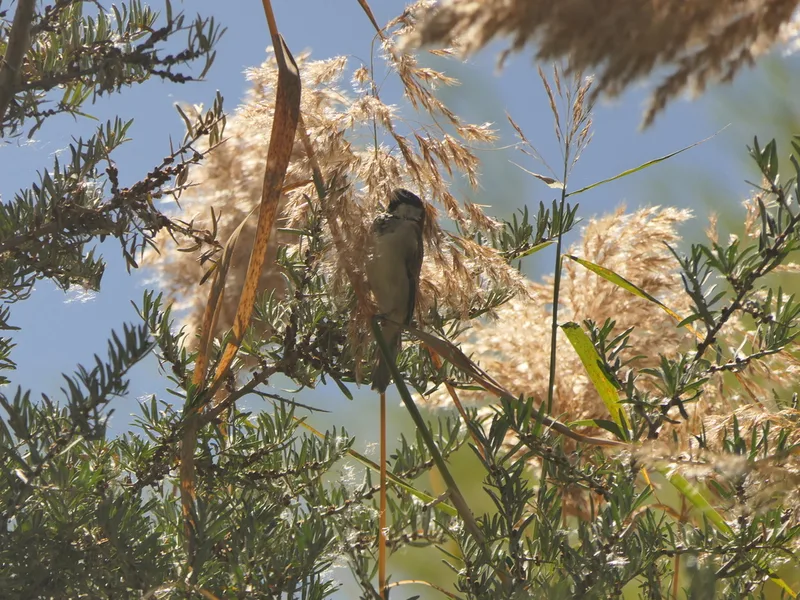
House Sparrow Passer domesticus -
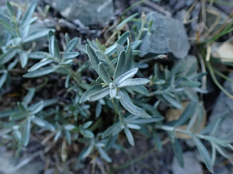
Sea-buckthorn Hippophae rhamnoides -
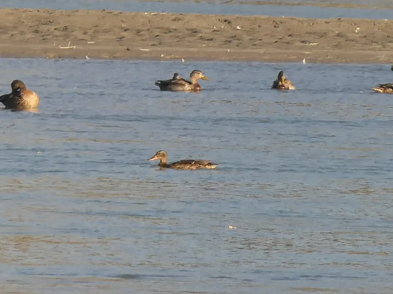
Mallard Anas platyrhynchos -
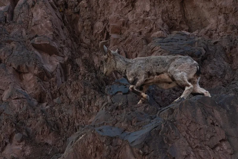
Bharal Pseudois nayaur -
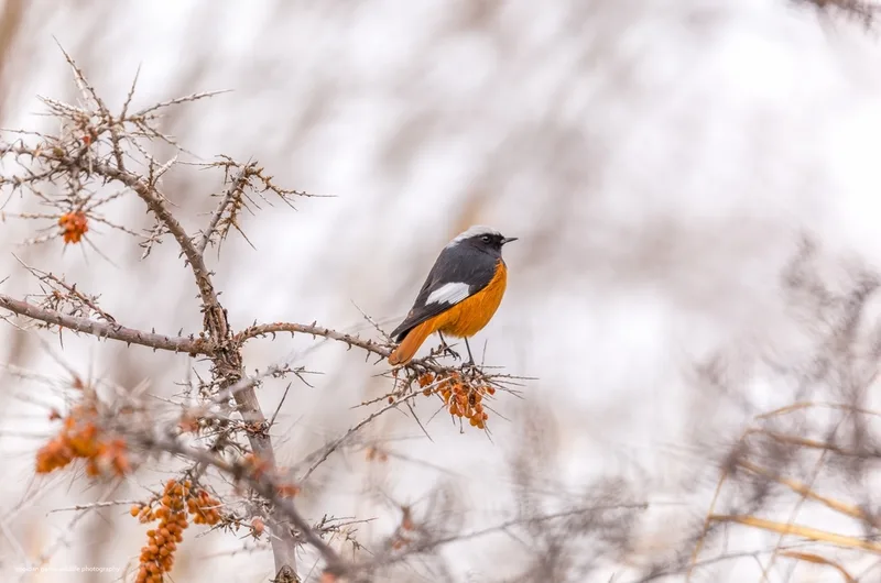
White-winged Redstart Phoenicurus erythrogastrus
Field Notes · Desert & Deep Time lens · Ladakh · 34.1642, 77.5848