Komodo National Park
Komodo National Park · East Nusa Tenggara, Indonesia
The park was named for a lizard, but most of what it protects lives underwater.
Why here
Say the name Komodo and most people picture a lizard sunning itself on a dry hillside. Look at a map of the park, though, and a different picture emerges: of the roughly 1,700 square kilometers under protection here, most of it is water, not island. The dragon got the park its name and its first protections, but the surrounding sea earned its own case for protecting soon after, and the reasoning holds up from any of the park’s clifftop viewpoints. These islands sit in a stretch of ocean where currents from two different seas are forced through narrow channels, and that squeeze does the real work: it keeps the water moving, mixing, and cooler than it has any right to be this close to the equator, which is a large part of why the reefs below carry so much life. You can’t see a reef from a hilltop. What you can see, again and again from the sites in this note, is the moving, changing water that builds one.
The sites
Where two seas meet
Gili Lawa Darat Viewpoint
−8.4734, 119.5594
Climb to this ridge above Gili Lawa and the reason for Komodo’s underwater reputation becomes obvious from dry land. Below, a narrow channel runs between Gili Lawa and Komodo island, and even from this height you can watch the water itself change character: patches of deep indigo where the channel runs deep, streaked with paler seams where two bodies of water are pushing against each other. Komodo’s straits sit where seas meet, and the mixing keeps the water here cooler and richer than the open ocean around it, which is most of the reason the reefs below are so heavily loaded with life. You won’t see the reef itself from up here, but you’ll see the engine that feeds it: the current. White-bellied sea-eagles work this same air, riding the cliff face and channel mouth on set wings, dropping low over the water when something breaks the surface. Time your visit for early morning, when the light is low enough to pick out the current lines clearly and the water hasn’t yet gone glassy and hard to read. It is one of the few places in the park where the mechanics of the whole marine system, not just its inhabitants, are visible at a glance.
From the ridge, look for pale seams or ripple lines cutting across the darker channel water below — these mark where two currents are meeting. Watch a few minutes longer and you may catch a white-bellied sea-eagle working the same channel, riding the air the current pushes up the cliff face.
- AccessShort walk
- ExertionModerate
- TimeAn hour
Makassar Reef viewpoint
−8.5182, 119.5866
This low headland looks out over a reef flat, and the name is a fair description of what you can pick out from shore. At low tide the shallow plate of coral and rubble sits pale and visible beneath clear water, bounded by a sharper line where the seafloor drops into the channel’s deep blue. That color line is the easiest way to read a reef from land: pale and even means shallow coral and sand, dark and uniform means the drop-off has started. Watch the pale water long enough and you may pick out the shapes of reef fish working the shallows — moorish idols and titan triggerfish are common enough on flats like this one that a patient look is often rewarded, though both are easier to see below the surface than from this height. The reef flat is also the part of the system most exposed to tide, sun, and storm, so what you’re looking at is the toughest, most changeable habitat in the park rather than its most sheltered one. It rewards a slow look rather than a quick photo: give your eyes a minute to adjust before the shapes in the shallows separate from the glare.
Follow the tide line where pale, shallow water meets the deeper blue of the channel — that boundary marks the edge of the reef flat. Let your eyes adjust to the glare for a minute or two and look for the flicker of fish moving over the paler water.
- AccessShort walk
- ExertionEasy
- TimeAn hour
Regata Hill
−8.5701, 119.4983
A short climb gets you a wide, low-angle view over the channels west of Komodo island, and it’s a good spot for reading how the sea moves without ever getting in it. The straits here are narrow enough that tide and wind push the water through fast, and from this height you can often see the surface texture change from smooth to rippled exactly where the current picks up around a point of land. Frigatebirds and other seabirds ride the air above these channels, catching the same lift the moving water pushes upward at the cliff edges, so a hillside built for a sunset photograph doubles as a decent place to watch how weather and current shape each other over the course of an evening. The light in the late afternoon is generally kindest for reading the water’s surface, since a low sun catches the ripples and current seams that flat overhead light tends to wash out. Nothing about this view depends on a particular species turning up; the currents and the birds that ride them are dependable enough that the hill rewards an unhurried hour whether or not anything dramatic breaks the surface.
Watch the channel surface change texture as it wraps a headland below — smooth water giving way to a ripple line marks where the current is accelerating around the point. Seabirds often ride the same uplift along the ridge; follow one and see where it circles back to.
- AccessShort walk
- ExertionModerate
- TimeAn hour
Bays built from broken reef
Padar viewpoint
−8.6574, 119.5694
The climb to Padar’s summit ridge is known for one reason: three bays, each holding a differently colored beach, laid out below in a single wide view. The color difference is real and comes from what each beach is made of rather than any trick of light — a beach built mostly from broken coral and shell reads paler or pinker than one built from darker volcanic grains, and the mix depends on which reef sits closest and how exposed the bay is to wave and current. Read the view as a cross-section of the coast’s building materials as much as a scenic overlook: each bay is quietly reporting on the reef that feeds it. The bays themselves are sheltered enough that they tend to hold calmer, shallower water than the open channels nearby, the kind of water where small and young marine life can sit out of the main current. None of that detail is visible from the ridge, but the pattern of color is its visible signature. Go early enough to beat the haze that tends to build over the water by midday, when the bays’ colors are easiest to tell apart from a distance.
Pick out the three bays below and compare the sand color of each beach — paler or pinker sand generally means more crushed coral and shell in the mix, darker sand means more volcanic material. Note which bay looks calmest; that one is usually the most sheltered.
- AccessShort walk
- ExertionModerate
- TimeAn hour
3 Beach
−8.6863, 119.5602
Three coves sit side by side here, separated by narrow spits of land, each a slightly different shade of blue depending on its depth and how much it’s exposed to the open channel. It’s a smaller, quieter echo of the view from Padar, and worth the stop precisely because the differences are subtler and reward a longer look. The most sheltered of the three coves usually holds the calmest, clearest water, since less current gets in to stir up sediment; the one most open to the channel tends to run a deeper, more saturated blue where the water is moving and mixing more. Shallow, calm coves like these can serve as a kind of nursery habitat for small reef life, a place for young fish to grow away from the stronger currents and larger predators that patrol the open channels, even though little of that is visible from the overlook itself. What you’re seeing is the shape of shelter: how a coastline this exposed to strong tidal channels still manages to fold in a few calm pockets of water. Give the light a chance to shift; cloud shadow can change which cove looks calmest within a few minutes.
Compare the color and texture of the three coves below: the calmest, palest one is likely the most sheltered from the channel current, the deepest blue one the most exposed. Watch for a few minutes as cloud shadow moves across the water and see how quickly the read changes.
- AccessShort walk
- ExertionModerate
- TimeAn hour
Life at the water's edge
Rinca island viewpoint over the bay
−8.6584, 119.7161
This overlook sits above a quiet bay on Rinca’s coast, and the water below moves at a different pace than the open channels elsewhere in the park. Bays like this one are sheltered enough that mud and sediment settle instead of washing straight through, which is exactly the condition mangroves need to take hold along the margins. Where the trees fringe the shallows, the tangle of roots below the waterline gives small fish and invertebrates something to hide in, and the calm surface makes wading birds — herons and egrets are the ones most likely to be working these flats — far easier to spot than they’d be in rougher water. Watch the tide if you can: falling water exposes more flat and root, drawing birds in to hunt, while a full high tide pushes the water up nearly to the trees and quiets everything down. Little about this bay demands a dramatic encounter to reward the visit. It’s a good place to slow down and notice how much of what a coastline supports depends on the parts of it doing the least, visibly, at any given moment — the still water, not the surf.
Scan the shallow water at the mangrove edge for a heron or egret standing motionless — they hunt by waiting, not chasing, so give a still shape a minute before deciding it’s not a bird. Note whether the tide is up or down; more exposed flat generally means more birds working it.
- AccessShort walk
- ExertionEasy
- TimeAn hour
When it's best
Komodo’s waters run on two broad rhythms through the year: a windier, rougher stretch and a calmer, clearer one, and exactly when one gives way to the other shifts from year to year rather than landing on a fixed date. The narrow channels between the islands run with strong current in any season, so what the water looks like from a clifftop viewpoint can change within the same morning as the tide turns, regardless of the time of year. There’s no single month that owns this place: the reef flats, the bays, and the coastal birds working the shallows are all worth watching whatever the calendar says. The one dependable, year-round draw is patience with a calm, clear morning — the currents and the life they carry hold up on their own, no particular season required.
Go deeper
The names behind what you saw
- Reef Manta Ray — Mobula alfredi
- Hawksbill Sea Turtle — Eretmochelys imbricata
- Green Sea Turtle — Chelonia mydas
- Clark’s Anemonefish — Amphiprion clarkii
- Moorish Idol — Zanclus cornutus
- Titan Triggerfish — Balistoides viridescens
- White-bellied Sea-Eagle — Icthyophaga leucogaster
To read next
- Komodo National Park (Wikipedia) — the fullest account of how the park’s protections widened from the dragon on land to the sea around it.
- Komodo Biosphere Reserve (Wikipedia) — on the separate reserve designation that overlaps the national park, useful for readers curious how the two statuses fit together.
- Labuan Bajo (Wikipedia) — background on the fishing town that is the gateway to these waters, for context on the working sea beyond the park boundary.
- Padar, Indonesia (Wikipedia) — a short entry on the island behind the three-bay panorama, for the geography without the climb.
- “Geology of Labuan Bajo Area, East Nusa Tenggara” (Berita Sedimentologi, 2025) — a short technical note on the wider region’s rock and sediment, for anyone who wants the deeper science behind how these shorelines are built.
The names behind what you saw
What lives here, and what it's called. Photographs from open collections — an aid to identification, not decoration.
-
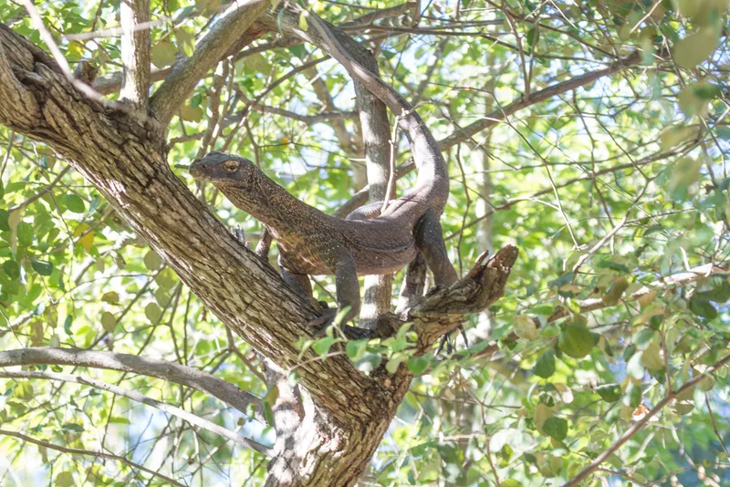
Komodo Dragon Varanus komodoensis -
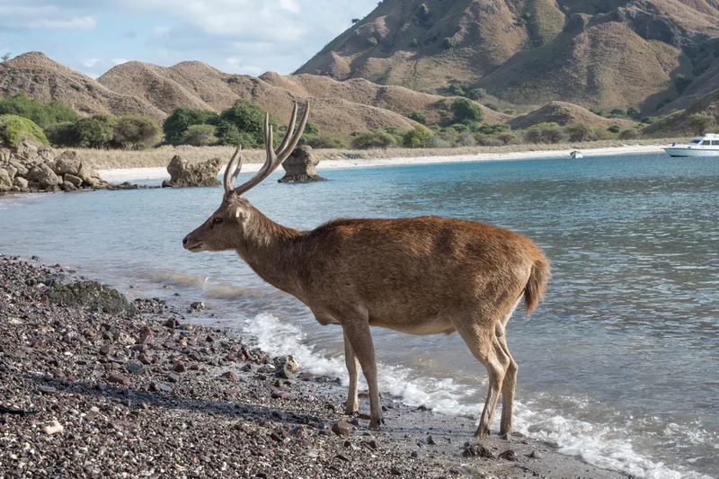
Javan Rusa Rusa timorensis -
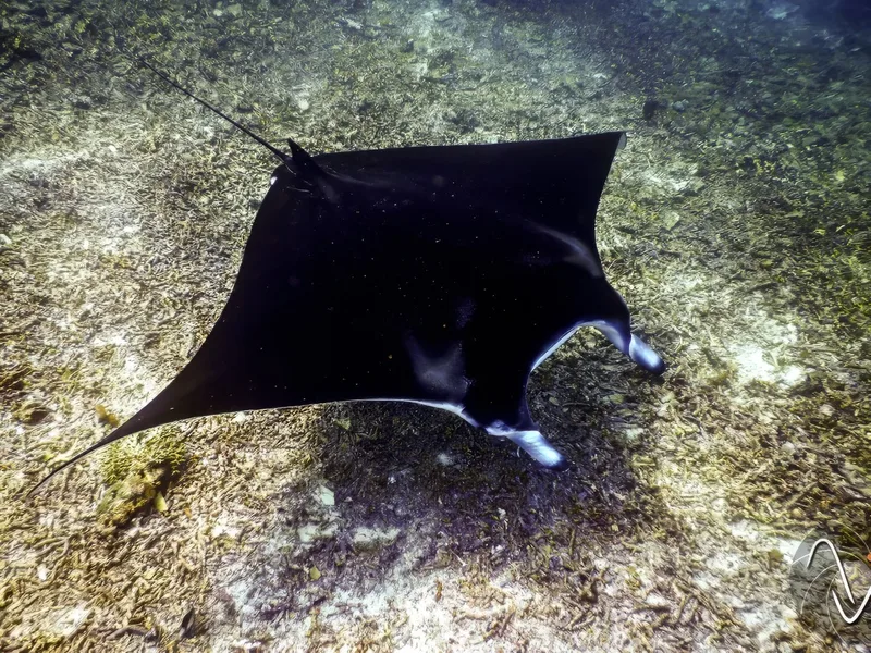
Reef Manta Ray Mobula alfredi -
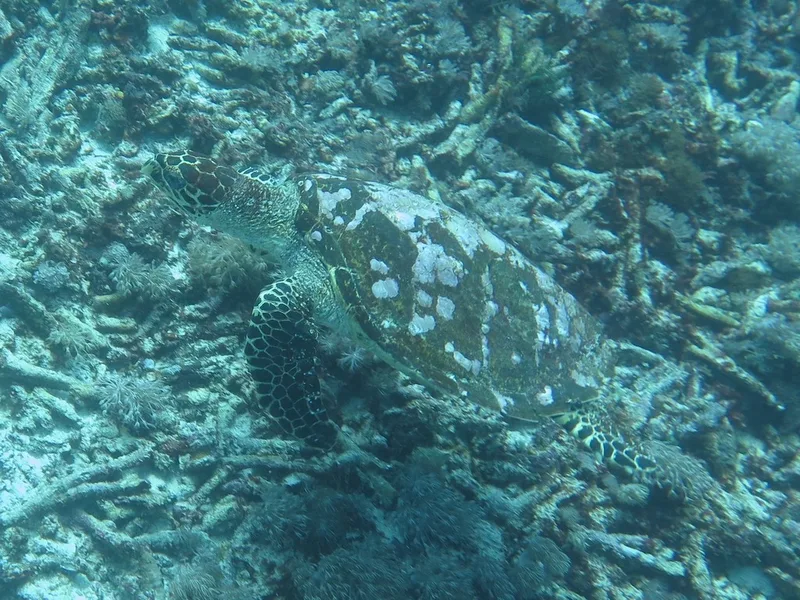
Hawksbill Sea Turtle Eretmochelys imbricata -
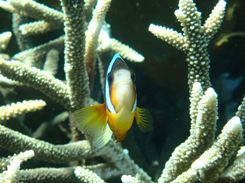
Clark's Anemonefish Amphiprion clarkii -
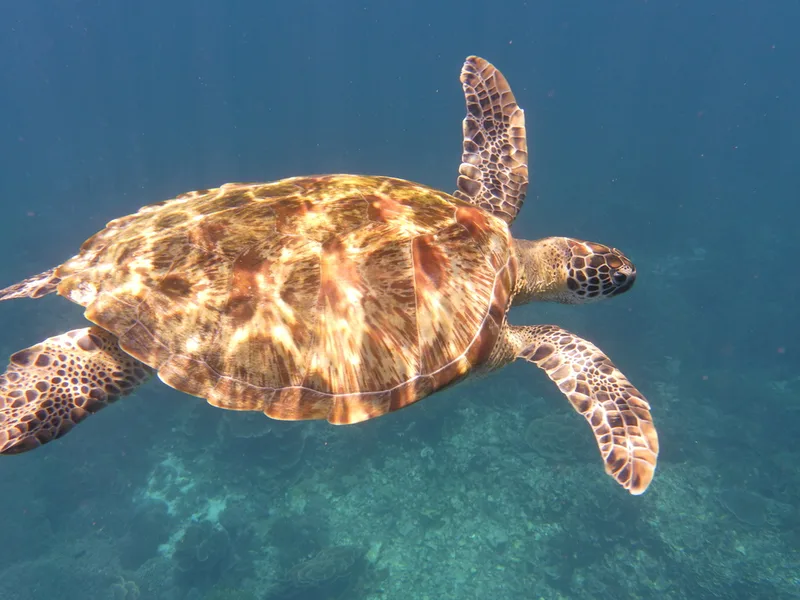
Green Sea Turtle Chelonia mydas -
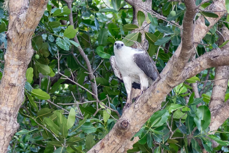
White-bellied Sea-Eagle Icthyophaga leucogaster -
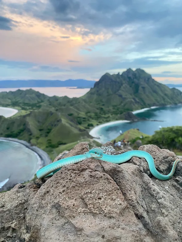
White-lipped Island Pitviper Trimeresurus insularis -
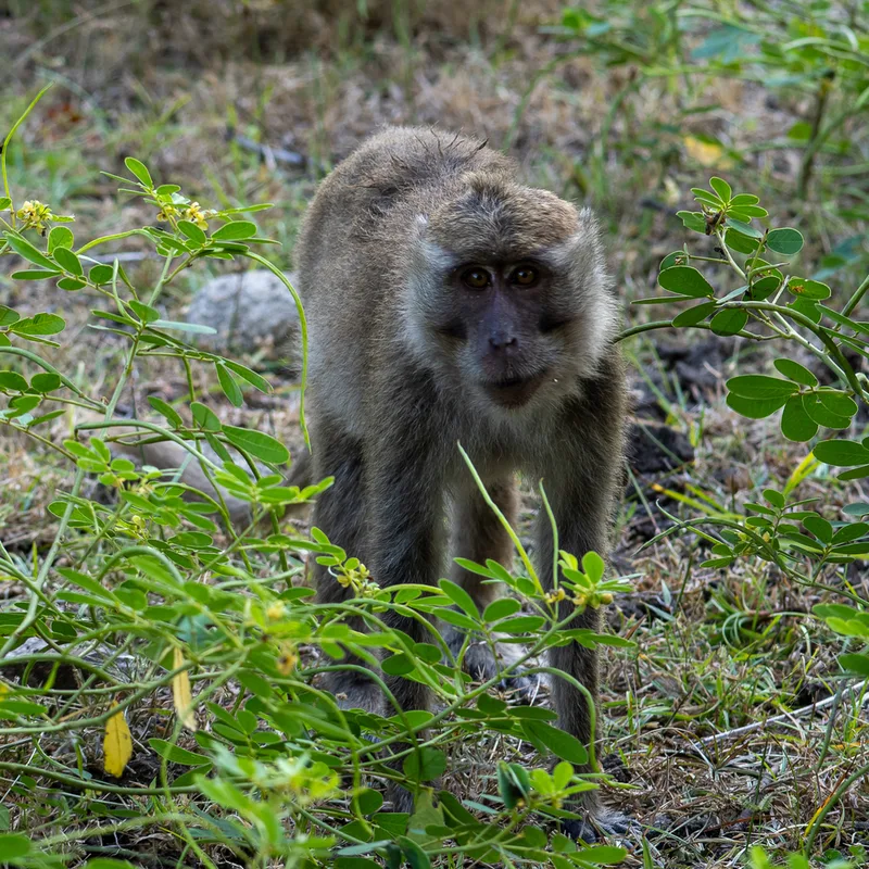
Long-tailed Macaque Macaca fascicularis -
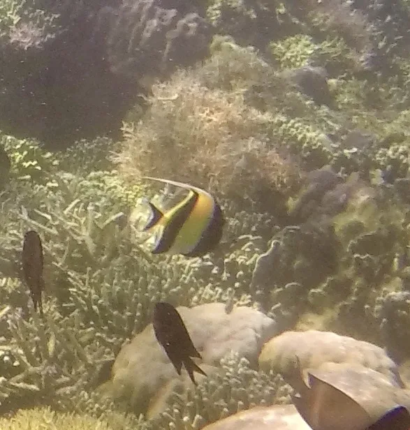
Moorish Idol Zanclus cornutus -
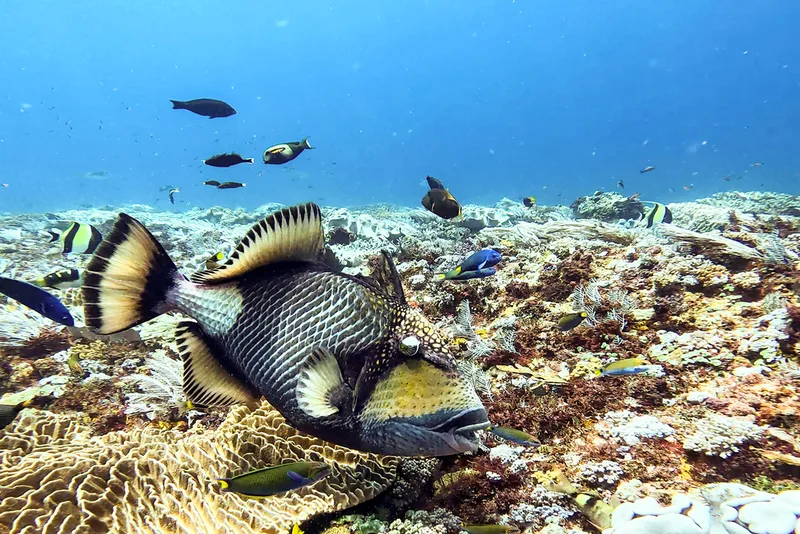
Titan Triggerfish Balistoides viridescens -
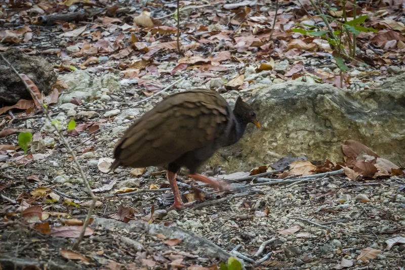
Orange-footed Scrubfowl Megapodius reinwardt
Field Notes · Marine lens · Komodo National Park · −8.6070, 119.5729