Kenai Fjords
A fjord is a valley the ice cut too deep to keep, and the sea moved into what was left.
Why here
Stand at the head of Resurrection Bay and the water in front of you is not a bay in the ordinary sense. It is a valley — one a river of ice ground so deep that when the ice let go, the sea walked in and filled the trough. This is a fjord: a glacial valley with a floor below sea level, and nearly everything you will notice here follows from that one fact. The peaks that wall it were sharpened by the same ice that hollowed the middle. The rock underfoot is older seafloor, scraped up and stacked against the edge of the continent long before the glaciers arrived. And the cold, deep water the ice left behind is why otters raft on the surface and seabirds crowd the walls. The town at the head of the bay, a few hours’ drive from Anchorage, sits where it does because the fjord offers ships a deep, sheltered berth. These stops keep returning to the same idea: read the shape the ice left, and the rest of this coast begins to explain itself.
The story
Start with the rock, because it came first. The dark, banded cliffs around the bay are old seafloor — mud, sand, and the debris of underwater landslides — that was scraped off a sinking ocean floor and jammed against the edge of the continent, then folded and hardened into the tough grey stone the whole coast is built from.
Long after, the ice took over. Rivers of it filled these valleys and ground them deep and straight; when the climate warmed and the ice drew back, the sea flooded the lowest trench and made the fjord. That cold, deep water is the ice’s parting gift. It stays rich enough to feed a crowded coast: sea otters rafting in the kelp, harbor seals on the low rocks, and in the warmer months seabirds packed onto the cliff ledges. The forest that climbs the lower slopes is a wet, dark one — devil’s club and skunk cabbage in the hollows — the kind that grows where rain and snowmelt never stop.
People came late and stayed near the water. The town at the head of the bay grew up around a railroad and a deep-water dock a little over a century ago; it took the name of the statesman who arranged the purchase of Alaska. The record gathered here is quiet on who lived along this coast before them.
The sites
The shape of the fjord
Race Point
60.1099, −149.4741
Race Point stands on the western shoulder near the mouth of Resurrection Bay, and it is the cleanest place to read the whole fjord in one look. From up here the bay stops being water and becomes what it is underneath: a single long trough with a broad, flat floor and steep parallel walls, running straight out toward the open Gulf. That shape is the tell. A river cuts a narrow V as it saws downward; a glacier is broad and heavy and grinds a wide U, planing the floor flat and steepening the sides as it goes. When the ice pulled back, the sea rose into the lowest part of that U and drowned it, which is why the walls plunge straight into deep water instead of easing into a beach. Everything else on this coast — the sheltered harbor, the cold deep water, the crowded seabird walls — sits inside a shape the ice left behind. Read the trough first, and the rest of the stops fall into place.
Look down the length of the bay toward the open sea and follow the line where the steep walls meet the water. Notice that the sides drop nearly straight in, with almost no beach — the ice ground this valley below today’s sea level, and the water simply filled it. Trace the same steep wall on both shores; a river valley would wander, but this one runs close to true.
- AccessHalf-day hike
- ExertionModerate
- TimeHalf a day
Mount Alice
60.1348, −149.2773
Across the bay from Race Point, Mount Alice rises off the eastern shore in one steep sweep, going from tidewater to high rock with barely a foothill in between. Climbing it puts you inside the fjord’s wall rather than looking at it, and the steepness underfoot is itself the ice’s work. As a glacier fills a valley it presses hardest against the sides, undercutting and steepening them, so a fjord’s walls stand far straighter than any slope rain and rivers make on their own. The rock you climb is the same dark seafloor stone as the rest of the coast, here lifted and set nearly on edge. Snow holds in every high bowl and crease well into the warmer months, feeding the streams that chute down the face. This is the fjord’s other wall — the ice’s work standing up rather than laid flat, the same story as the bay floor turned on its side.
As you climb, notice how little gentle ground there is between the water and the high rock — the slope barely eases the whole way up. That near-constant steepness is the ice’s fingerprint; a glacier cuts its own walls back toward vertical. Feel for where the angle finally relents near the top, in the snow-holding bowls where the ice lingered longest.
- AccessExpedition
- ExertionStrenuous
- TimeA full day
What the ice carved and uncovered
Race Point
60.1099, −149.4741
The rock at Race Point is worth a close look, because it came from the bottom of an ocean. These dark, banded cliffs are old deep-sea sediment — mud, sand, and the rubble of underwater landslides — that was scraped off a sinking ocean floor and jammed against the edge of the continent long before any ice arrived. Squeezed and heated in the process, the layers were folded, tilted, and hardened into the tough grey stone the whole coast is built from. The ice, when it came, did not make this rock; it uncovered it, grinding away the softer cover and polishing the hard bedrock bare. Where the stone is clean you can often read the original layering — thin bands stacked like the pages of a book, sometimes bent into folds where the slow collision crumpled them. It is a strange thing to stand on a mountain shoulder above a fjord and find yourself looking at the floor of a vanished sea.
On a bare rock face near the point, look for thin parallel bands running through the stone — the stacked layers of mud and sand from an old sea floor. Follow one band with your eye and see whether it stays straight or bends: where it curves into a fold, the rock is recording the slow collision that scraped it off the ocean bottom and pinned it to the continent.
- AccessHalf-day hike
- ExertionModerate
- TimeHalf a day
Mount Alice
60.1348, −149.2773
The high country on Mount Alice is where the ice did its close work. Below the summits, look for the rounded, steep-backed hollows scooped into the rock — armchair-shaped basins where small glaciers once sat and gnawed backward into the mountain, plucking rock loose and carrying it off. Many still hold snow deep into the warmer months, and a few cradle small ponds. Where one of these hollows opens toward the main valley, its floor often hangs well above the fjord below, cut off cleanly: a smaller glacier could not grind down as fast as the great trunk of ice in the main trough, so its valley was left stranded up the wall. Streams from these high basins reach the bay as steep chutes, and after rain or melt as thin falls down the rock. Every one of these shapes is the same ice at a smaller scale, still writing the same sentence into the mountain.
High on the mountain, find a rounded, steep-walled hollow gouged into the slope, its back wall far steeper than its floor. A small glacier sat here and quarried backward into the rock. If the hollow’s mouth opens toward the bay, look at where its floor meets the main wall — it often hangs above the fjord, cut off, because the ice in the big valley below dug faster and deeper.
- AccessExpedition
- ExertionStrenuous
- TimeA full day
What the ice left behind
Race Point
60.1099, −149.4741
The last thing the ice left is the water itself. A fjord’s floor lies below sea level, so the bay holds a deep, cold, well-stirred body of water that stays rich through the year — and a rich, cold sea feeds a crowded coast. From the point, the surface below is often dotted with sea otters, which float on their backs in the kelp and rarely come ashore, and with harbor seals hauled out on the low rocks or watching from the water with just their heads showing. Along the rockier edges, small dark-and-white ducks ride the chop where meltwater meets salt. In the warmer months the steep walls become seabird cliffs, ledges packed with nesting kittiwakes and murres that fish the same cold water. All of it — the otters, the seals, the birds — is here because a valley the ice dug below the sea became a deep, cold larder that never really shuts down.
Bring binoculars and scan the water below the point. Look first for sea otters lying on their backs among the floating kelp — they almost never leave the water — then for the smooth heads of harbor seals watching from the surface. Both stay because the fjord’s deep, cold water is a full pantry; that same richness packs the cliff ledges with seabirds through the warmer months.
- AccessHalf-day hike
- ExertionModerate
- TimeHalf a day
When it's best
This is a cold-water coast, and the season decides how much of it you can reach. In summer the high routes open, the days stretch long, and the walls fill with nesting seabirds — kittiwakes and murres are easiest to see then. Sea otters and harbor seals work the bay through the year, rafting and hauling out on the rock; a calm morning is the time to find them, binoculars in hand. Come in late winter or early spring and the peaks are locked in snow, the days barely climb to freezing and the nights fall well below, with rain or wet snow common — the ice-carved shapes read most clearly then, stripped bare, but the walking is hard and the daylight short.
Go deeper
The names behind what you saw. The dark coastal rock belongs to the Chugach accretionary complex — old deep-water and slope sediments (greywacke, turbidite, and argillite) scraped against the continent’s edge and stacked along the Border Ranges Fault. The looser material draping the lower ground is unconsolidated Quaternary deposit, the debris the ice and its meltwater left. The signature living things go by these formal names: bald eagle, Haliaeetus leucocephalus; sea otter, Enhydra lutris; harbor seal, Phoca vitulina; black-legged kittiwake, Rissa tridactyla; and the tall, spined understory shrub, devil’s club, Oplopanax horridus.
To read next. The pre-checked reading list for this note surfaced only works about a different Seward — the Seward Peninsula in northwest Alaska and Seward County in the Great Plains — none about this coast, so there is nothing honest to list from it. For the real story, two search terms will take you far: look up the Chugach terrane and the Border Ranges Fault for how this seafloor rock was assembled against the continent, and any overview of Alaska’s fjords for how the ice carved these valleys and the sea drowned them.
The names behind what you saw
What lives here, and what it's called. Photographs from open collections — an aid to identification, not decoration.
-
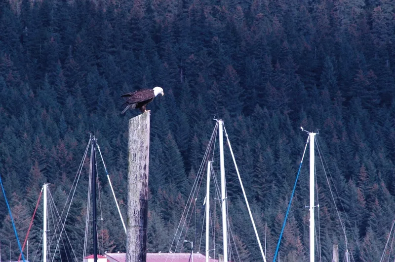
Bald Eagle Haliaeetus leucocephalus -
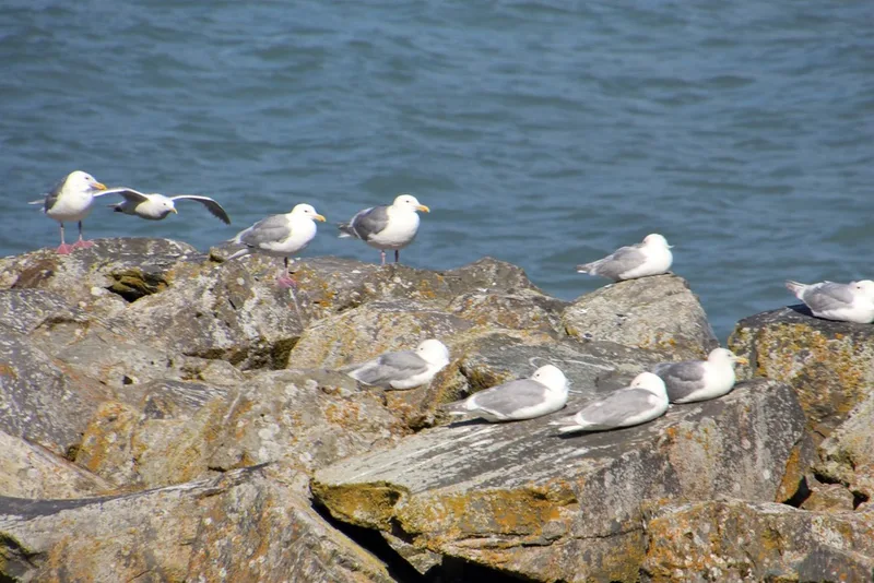
Glaucous-winged Gull Larus glaucescens -
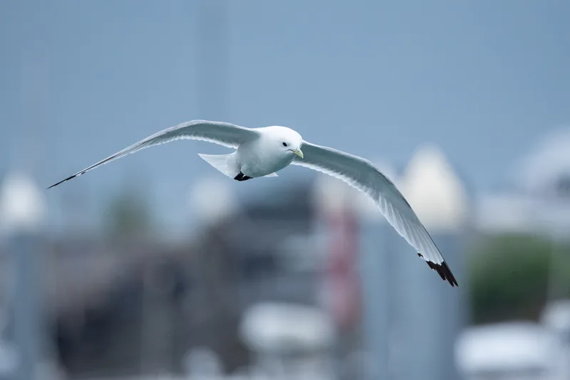
Black-legged Kittiwake Rissa tridactyla -
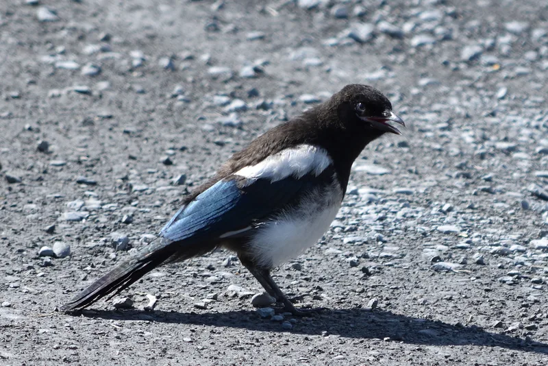
Black-billed Magpie Pica hudsonia -
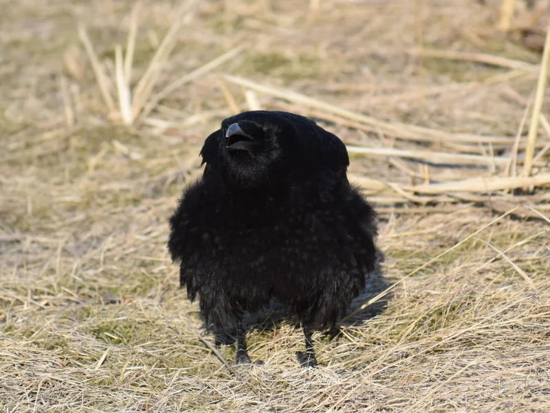
American Crow Corvus brachyrhynchos -
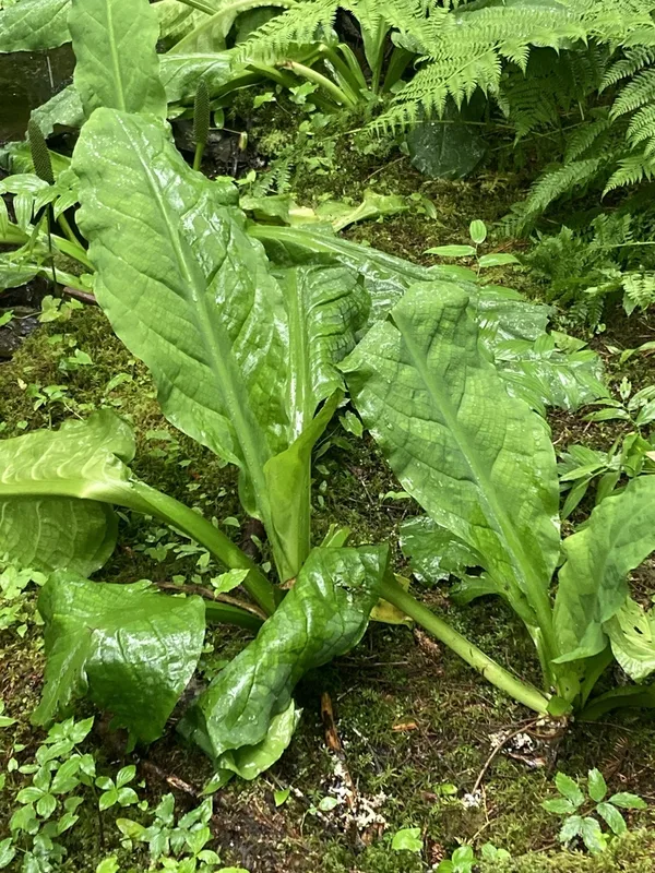
western skunk cabbage Lysichiton americanus -
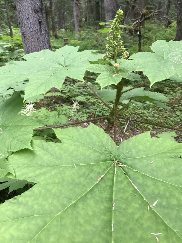
Devil's Club Oplopanax horridus -
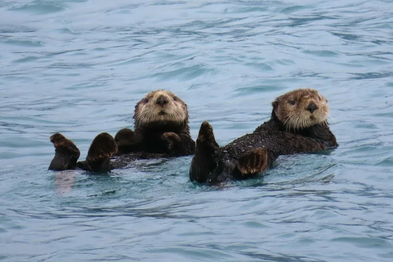
Sea Otter Enhydra lutris -
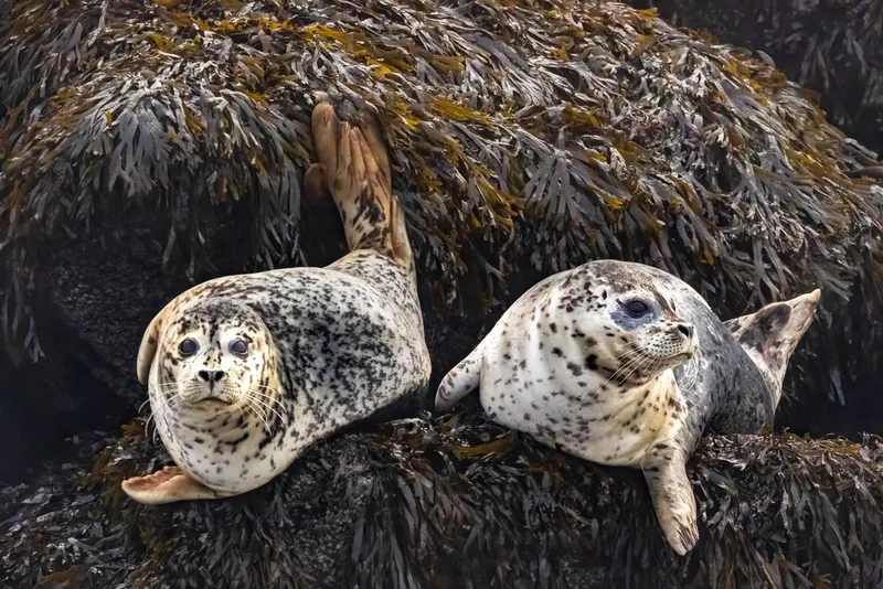
Harbor Seal Phoca vitulina -
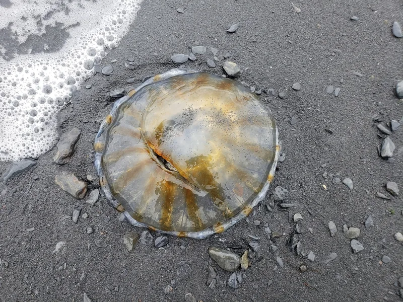
Northern Sea Nettle Chrysaora melanaster -
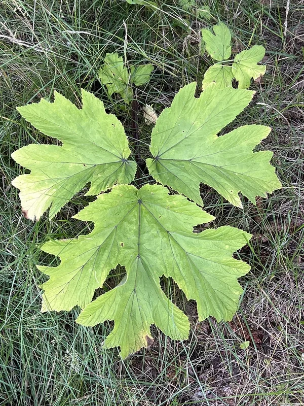
common cowparsnip Heracleum maximum -
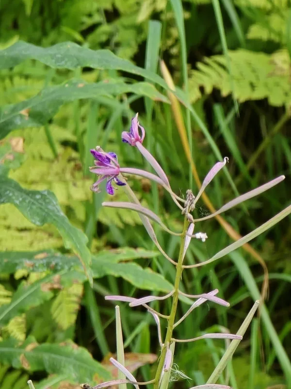
fireweed Chamaenerion angustifolium
Field Notes · Ice & Glaciers lens · Seward · 60.1014, −149.4404