Katmai
The whole valley as far as the eye could reach was full of hundreds, no thousands—literally, tens of thousands—of smokes curling up from its fissured floor. —Robert F. Griggs
Why here
Over three days in June of 1912, the ground here opened and remade itself. Ash poured out of a single vent and ran downhill in a glowing flood, filling a whole valley the size of a small city and packing it hundreds of feet deep. When it settled, thousands of vents steamed from the raw new floor, and an explorer who reached it four years later counted the smokes and gave the valley its name. The mountain the park is named for stands nearby, one of many along this restless line — the peninsula carries as many as eighteen volcanoes, and several have stirred within living memory. This is not old geology you have to infer from worn rock. It is land you can date to three days, still settling under your boots. Everything in this note comes back to that one fact: a place where the earth’s rawest work is recent enough to walk across, and young enough that the people and animals who use it were shaped by it too.
The story
The land came first, and violently. The bones of the peninsula are old sea-floor rock — sandstone, siltstone, and limestone laid down when this was a quiet coast. Onto that floor the volcanoes were built, and in 1912 one of them turned itself inside out, spreading a sheet of ash so thick that beaches on the far coast still turn up its pale pumice. Ice did the slower work between eruptions, grinding out the basins that now hold the park’s long lakes.
Onto this made-and-remade ground come the salmon. Every summer sockeye climb the rivers between the lakes to spawn, and where a low falls slows them, the brown bears gather to fish — sometimes a couple dozen at once, standing in the current for the leaping fish. Few places offer a surer look at a wild bear at work.
People saw what the bears saw. The narrows where the salmon bunch up drew Alaskans to this river more than four thousand years ago, and they kept coming; the banks hold the remains of at least twenty settlements, lived in across four thousand years, from deep antiquity to within memory. The eruption that named the park is only the newest chapter in a long habit here: the land keeps remaking itself, and the salmon, the bears, and the people keep returning to the same few generous places.
The sites
The three days that made the ground
Novarupta
58.2667, −155.1567
This low rise in the backcountry is where the ground came apart in 1912. Everything that buried the valley to the north — the ash, the pumice, the glowing flood of it — came up through this one spot. It is a modest thing to look at now, a broad swelling of rock where you might expect a great crater, and that mismatch is part of what makes the long walk worth it: the scale of what poured out is wildly out of proportion to the quiet mound left behind. Reaching it is a serious undertaking deep in roadless country, and most people who get here come as part of a guided backcountry trip. Stand at the vent and the geography of 1912 clicks into place — the source at your feet, the ash valley spread downhill to the north, the named mountain off to the side. This is some of the youngest rock in the park, ground that simply did not exist before three summer days just over a century ago.
Stand at the vent and look north, downhill. Everything you can see in that direction — the whole pale, flat-floored valley — came up out of the ground where you are standing and ran downslope as a flood of hot ash. Trace the low ground with your eye, and you are tracing the exact path the eruption took.
- AccessExpedition
- ExertionStrenuous
- TimeWorth two days
Valley of Ten Thousand Smokes
58.3939, −155.3853
North of the vent lies the valley the eruption filled — a broad, pale plain of packed ash where a green valley used to be. The ash ran in hot and settled hundreds of feet deep, burying the old floor across an area the size of a small city. For years it steamed: an explorer who crossed it in 1916 found the floor split by countless vents pouring out steam, reckoned them in the thousands, and named the place for them. The smokes have long since died away as the ash cooled, but the flat, treeless floor remains, cut now by rivers slicing narrow canyons straight back down through the soft fill. It is a raw, lunar stretch of country, and walking it you cross ground barely a century old. A guided day trip reaches an overlook, with a descent onto the floor itself for those willing to make it.
From the overlook, look for the rivers that have cut narrow slots into the pale valley floor. The ash went down hot, deep, and soft, and ever since, meltwater has been carving straight back into it. The sheer depth of those young, steep-walled canyons is a direct measure of how much ash came to rest here.
- AccessHalf-day hike
- ExertionModerate
- TimeA full day
Mount Katmai
58.2794, −154.9517
The park takes its name from this mountain, a steep volcano standing back from the vent that did the 1912 work. It is one of a long line — the peninsula carries as many as eighteen volcanoes, and several have been restless within the last century. Katmai itself sits deep in the wilderness, a summit reached only by well-prepared parties on multi-day trips; most people never stand on it, and it belongs in this note as the anchor of the volcanic line rather than an easy stop. Seeing it in context is the real point. From high ground in the backcountry, the volcanoes stand in a rough row down the spine of the peninsula, snow-streaked cones spaced along a single deep crack in the earth where old ocean floor slides down and melts. Katmai is the one they named the park for, yet the eruption that shaped everything here came from a smaller neighbor — a reminder that the biggest name and the biggest event are not always the same peak.
If your route gives you a high, clear view down the peninsula, count the separate snow-covered cones standing in a rough line. They are not scattered at random — each one sits along the same buried crack where one slab of the earth’s crust is sliding beneath another and melting. Katmai is simply the cone they chose to name the park for.
- AccessExpedition
- ExertionStrenuous
- TimeWorth two days
Where the salmon bunch up
Brooks Falls
58.5550, −155.7910
On the short river between two lakes, the water drops over a low ledge about head-high — small as waterfalls go, but big enough to slow a salmon. Every summer, sockeye by the thousands climb this river to spawn, and at the falls they pile up, leaping again and again at the lip. The brown bears know it. They gather here from July into early September, thickest in July when the run is at its peak, and on a good day a couple dozen may be fishing at once — some waiting at the top of the drop with open mouths, some working the pool below. It is one of the surest places anywhere to watch wild bears feeding, and the reason is pure geography: a natural bottleneck where the fish must slow and the bears need only wait. A boardwalk and viewing platform put you close without putting you in the way. This is the volcanic land at work in a quieter key — the same rivers and lakes, set in old glacier-carved basins, running the summer engine that feeds the whole coast.
From the platform, watch the top of the falls, then watch the pool just below it. The bears sort themselves by skill and standing — the practiced ones take the lip where the salmon leap straight at them, the younger ones work the pool for fish that fall back. Pick one bear and watch where it chooses to stand; that spot tells you where it fits in the crowd. Binoculars help, though here you often won’t need them.
- AccessShort walk
- ExertionEasy
- TimeHalf a day
Brooks Camp
58.5546, −155.7775
Where the salmon river meets the lower lake sits Brooks Camp, the park’s main gathering point for people — and, for far longer, the gathering point for everyone else who wanted the fish. The short river here connects two lakes, and its narrows funnel the summer salmon into a bottleneck so dependable that people settled beside it more than four thousand years ago and never really left. The riverbanks hold the traces of at least twenty separate settlements, lived in across four thousand years, from deep antiquity to within memory. Stand here in summer and you are the latest arrival at a place chosen for exactly one reason: the fish come through, and something is always waiting for them. The bears use the same trails and the same fishing spots you walk to reach the falls, which is why the camp runs on a careful etiquette of giving them room. It is the human end of the same story the volcanoes tell — a made, unstable land whose few rich, reliable places have pulled life back again and again for thousands of years.
Walk the river path and look at the flat, low benches of ground along the bank, a little above the water. People built and camped on those same dry shelves for thousands of years, for the reason you would pick them yourself — close to the fish, above the wet.
- AccessShort walk
- ExertionEasy
- TimeHalf a day
When it's best
Come in summer. The park’s great gathering runs with the salmon: the bears crowd the falls from July into early September, thickest in July when the fish are climbing hardest. That same stretch of long, mild days is the window for the backcountry — the ash valley and the volcanoes are a summer proposition, reachable only when the snow is gone. The shoulder seasons close in fast. In the days these notes were drawn from, in the middle of March, the ground stayed frozen and well below freezing around the clock, snow-covered and quiet. Time a trip for the salmon run, and the rest of the country falls open around it.
Go deeper
The names behind what you saw. The vent that fed the 1912 eruption is Novarupta; the ash sheet it laid down is the Valley of Ten Thousand Smokes. The mountain the park is named for, Mount Katmai, is a stratovolcano — a steep cone built of alternating lava and ash. The pale pumice on the outer beaches is fallout from that eruption, mixed into the loose surface deposits mapped along this coast. The bears are brown bears, Ursus arctos; the fish they catch are sockeye salmon. The bedrock underneath is mostly old marine rock of the Alaska Peninsula column — sandstone, siltstone, and limestone with volcanic layers between. The spruce along the river is white spruce, Picea glauca; the tall summer wildflower is fireweed, Chamaenerion angustifolium.
To read next. The automated reading list came back empty for Katmai. The only candidates it surfaced are papers on a mineral deposit in New Brunswick that happen to share the words “Brook” and “Camp” — neither touches this place, so nothing is worth listing here. Instead, let the names above be your reading list: searching Novarupta or the Valley of Ten Thousand Smokes will open the full 1912 story, and the Brooks River Archeological District is the thread to pull for the four-thousand-year human record.
The names behind what you saw
What lives here, and what it's called. Photographs from open collections — an aid to identification, not decoration.
-
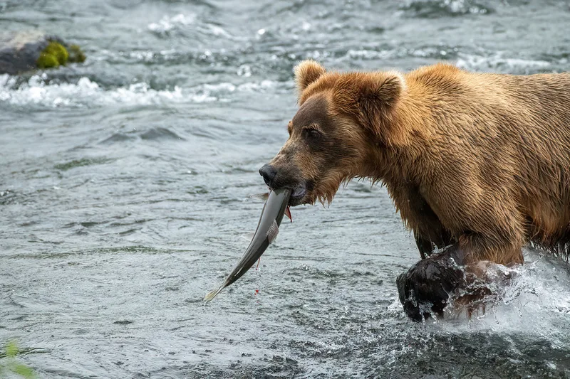
Brown Bear Ursus arctos -
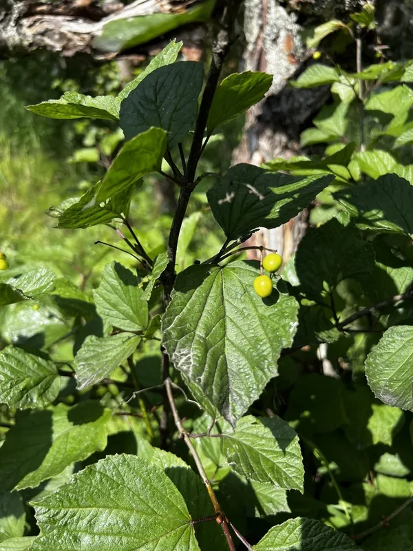
squashberry Viburnum edule -
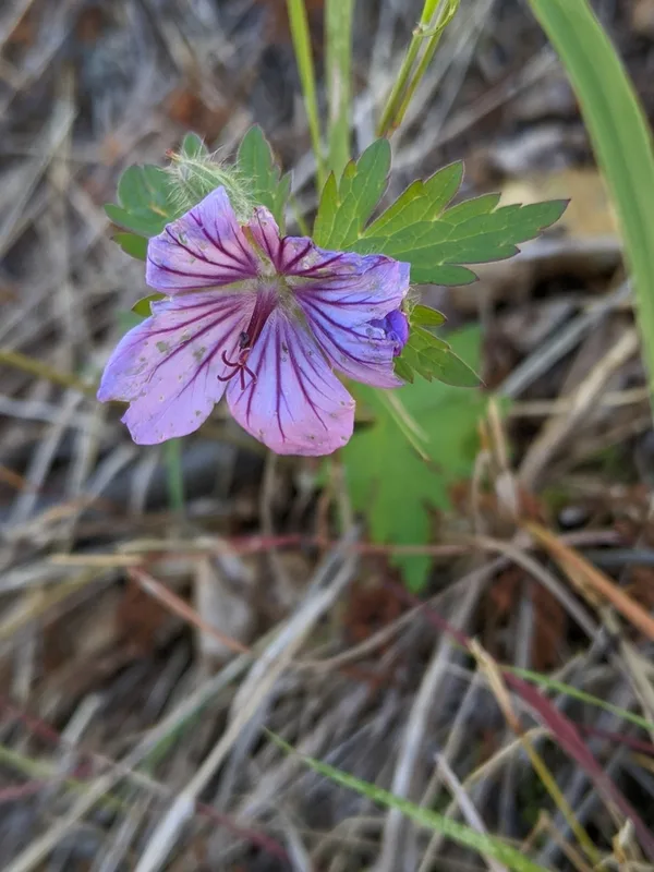
woolly cranesbill Geranium erianthum -
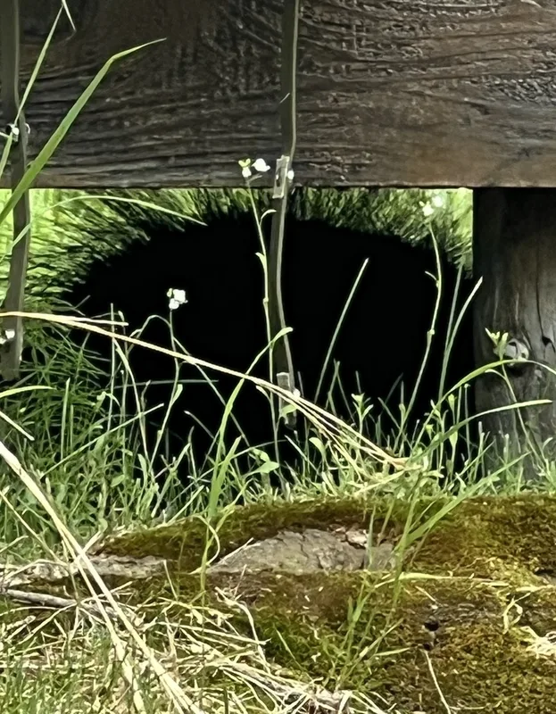
North American Porcupine Erethizon dorsatum -
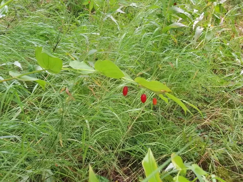
white twisted-stalk Streptopus amplexifolius -
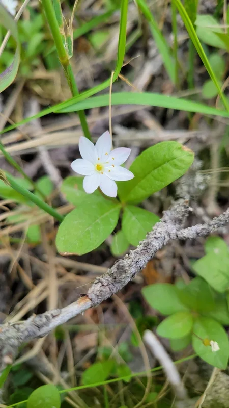
Arctic Starflower Lysimachia europaea -
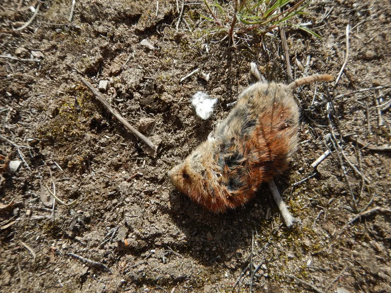
Northern Red-backed Vole Clethrionomys rutilus -
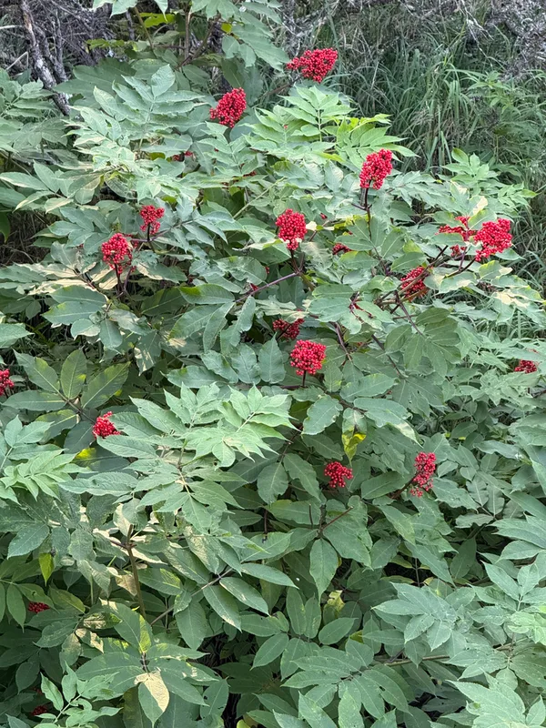
red-berried elder Sambucus racemosa -
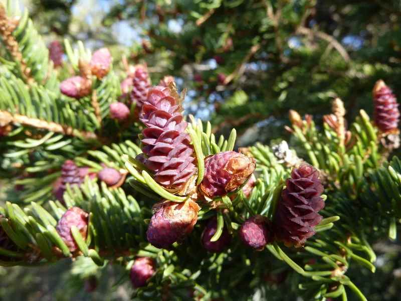
white spruce Picea glauca -
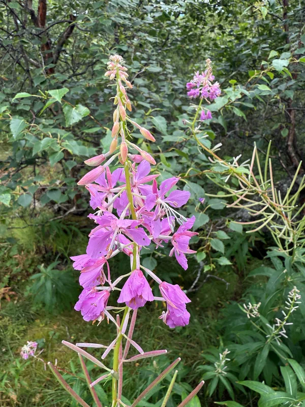
fireweed Chamaenerion angustifolium -
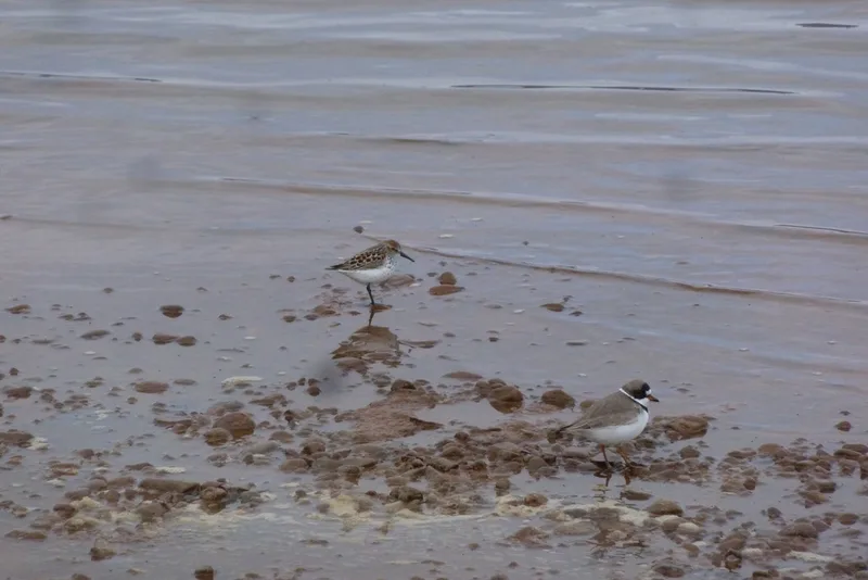
Western Sandpiper Calidris mauri -
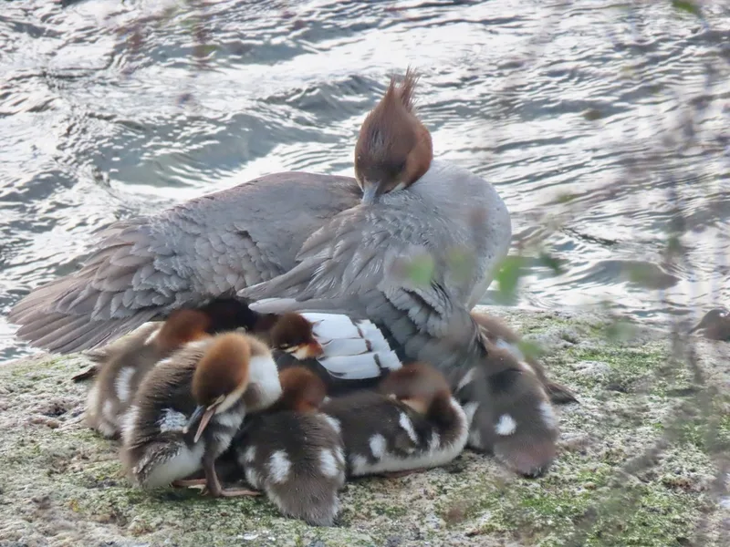
Common Merganser Mergus merganser
Field Notes · Volcanic lens · Brooks Camp · 58.4108, −155.3713