Kaikōura
Kaikōura · Canterbury, New Zealand
Here the mountains come down to a sea that rises from deep water.
Why here
Kaikōura is a coast where the land and sea meet at unusual speed. Mountains stand close behind the shore, while the ocean drops into deep water offshore. That depth brings marine life near the surface and near the town, but the important story is the connection between seafloor, coast, and air. Beaches and terraces record a changing edge; seals and seabirds use the rocks; the lookout lets you see the whole arrangement at once. Walk from Point Kean to the higher view and the place stops being a line on a map. It becomes a vertical system, from mountain to shore to deep sea.
The sites
A shore beside deep water
Point Kean Viewpoint
−42.4240, 173.7162
Point Kean is the clearest meeting place between shore and sea. Rocks extend into the water, giving fur seals places to rest and birds a low platform above the waves. Behind you, the land rises quickly; in front, the ocean opens toward deep water. Stand at the point and turn slowly, keeping both directions in view. Kaikōura’s marine life is close because the whole coast is close to the drop into the sea.
Scan the rocks before scanning the horizon. A resting fur seal can look like part of the shore until it moves, showing how closely marine life uses the boundary.
- AccessShort walk
- ExertionEasy
- TimeAn hour
Point Kean lighthouse
−42.4241, 173.7157
The lighthouse marks a human point of orientation on a coast whose shape is made by movement. Beach deposits and raised terraces record the shore changing position, while the sea below remains active. Look from the light toward the open water and then back along the land. The lighthouse helps you see the coast as a narrow platform between two kinds of depth: deep ocean in front and rising mountain ground behind.
Find a flat terrace or beach surface above the current waterline. It is an older coastal position, a place where the sea once reached before the land and shore changed.
- AccessShort walk
- ExertionEasy
- TimeAn hour
Mountains behind the sea
Kaikoura Lookout
−42.4183, 173.6918
The lookout gives Kaikōura its full vertical profile. Mountains rise behind the town, the coast runs below them, and marine water extends outward beyond the visible shore. This is where the place’s geography becomes more than scenery. The same tectonic country that raises the mountains also shapes the coast and sea floor. Look for the narrowness of the settled land between mountain and water. Marine life is not far from the town because there is very little land separating the two systems.
Trace the line from the mountain base to the sea. The short distance between them is why the coast feels compressed and why the marine edge remains so close.
- AccessDrive-up
- ExertionEasy
- TimeAn hour
Birds at the edge
In the Flightpath
−42.4285, 173.6990
This stop keeps the attention above the water. Gulls and cormorants use the air and rocks around Kaikōura, moving between feeding water and resting shore. A marine coast is not only what is visible below the surface. Birds make the connection between ocean and land easy to follow. Watch where they leave the shore and where they return. Their routes describe the same narrow boundary that the lighthouse and terraces show in rock.
Follow one bird from water to shore if you can. The flight makes the marine system visible as a circuit between feeding sea and resting land.
- AccessShort walk
- ExertionEasy
- TimeAn hour
Water, land, and change
The Flood of 1993
−42.3997, 173.6805
The Flood of 1993 is a human marker for the power of water on this compressed coast. A flood can make the relationship between mountain drainage, town, and sea immediate. It carries sediment downhill, occupies low ground, and reminds you that the coast is still being rearranged. Use the stop as a counterpoint to the slow geological view. Terraces and beach deposits record long change; a flood shows how quickly water can alter the same boundary.
Look for the lowest route through the land toward the sea. Water follows that line during both ordinary drainage and larger floods, making the landscape’s shape visible.
- AccessShort walk
- ExertionEasy
- TimeAn hour
When it's best
The marine life changes with weather, season, and water conditions, but the shore and mountain setting remain readable year-round. Warmer months offer longer time outside, while cooler weather can make the sea and headlands more dramatic. Birds and fur seals may be easiest to notice when the water is calm. Leave room for the coast to set the pace rather than expecting every visit to show the same animals.
Go deeper
The names behind what you saw. The coast includes Late Pleistocene ocean-beach deposits and younger beach and terrace cover. Life includes long-nosed fur seal, Arctocephalus forsteri, silver gull, Chroicocephalus novaehollandiae, and pied cormorant, Phalacrocorax varius.
To read next. - The Kaikōura geological material — for the uplifted shore and deep marine setting. - The marine ecology material in the payload — for seals and birds using the coast.
The names behind what you saw
What lives here, and what it's called. Photographs from open collections — an aid to identification, not decoration.
-
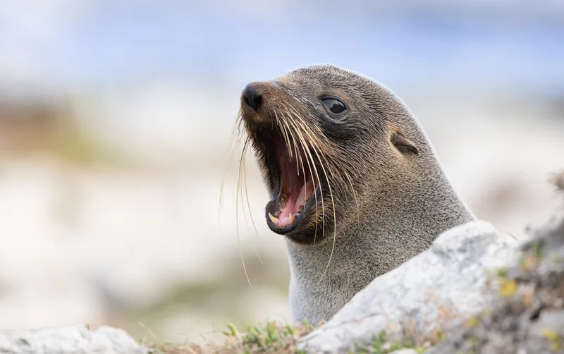
Long-nosed Fur Seal Arctocephalus forsteri -
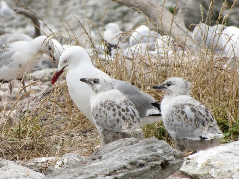
Silver Gull Chroicocephalus novaehollandiae -
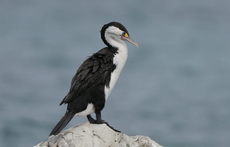
Pied Cormorant Phalacrocorax varius -
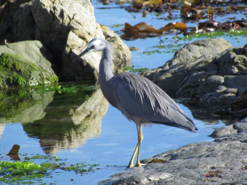
White-faced Heron Egretta novaehollandiae -
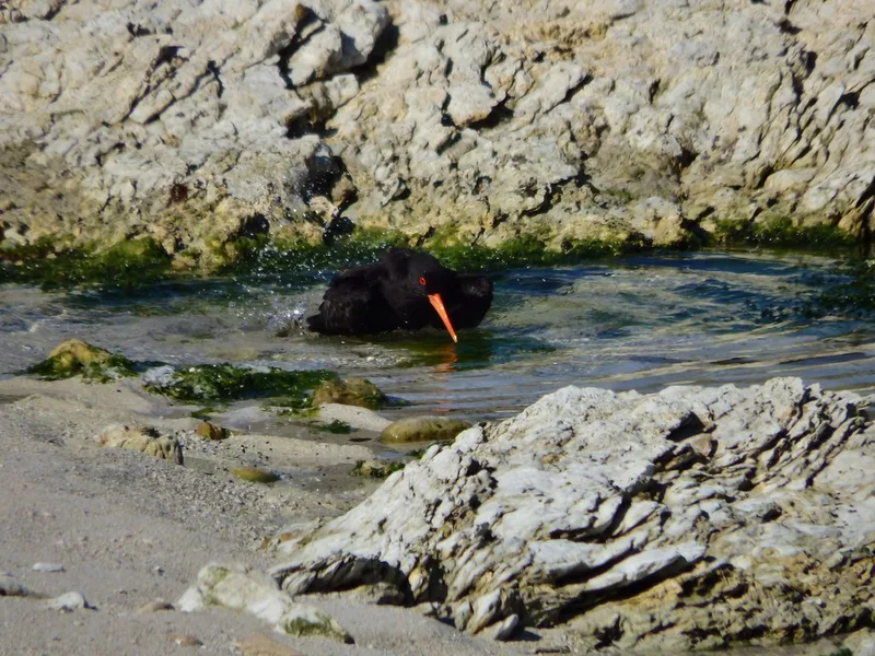
Variable Oystercatcher Haematopus unicolor -
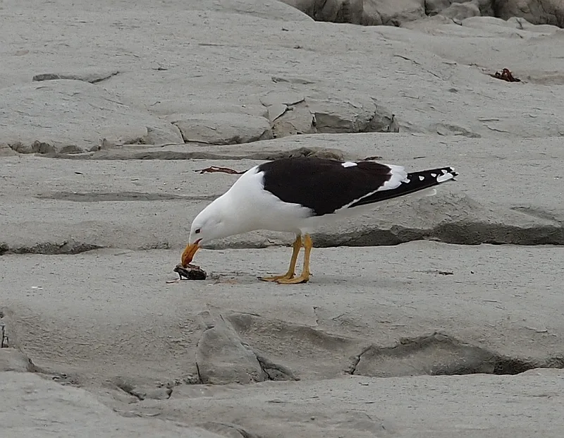
Kelp Gull Larus dominicanus -
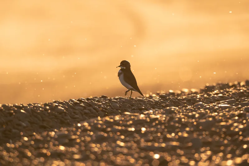
Double-banded Plover Anarhynchus bicinctus -
Denticulate Limpet Cellana denticulata -
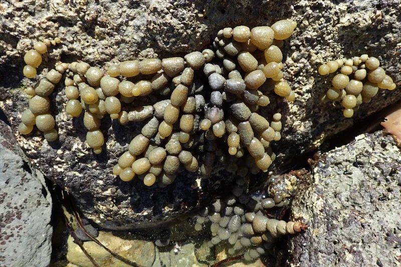
Neptune's necklace Hormosira banksii -
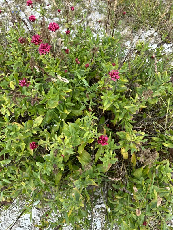
Red Valerian Centranthus ruber -
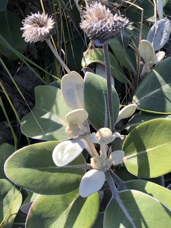
Lowland Rock Daisy Pachystegia insignis -
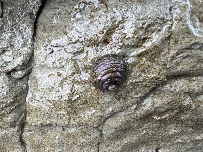
Spotted Top Snail Diloma aethiops
Field Notes · Marine lens · Kaikōura · −42.4006, 173.6811