Jotunheimen
Jotunheimen · Innlandet, Norway
The peaks here didn't rise sharp. The ice cut them that way, one glacier at a time.
Why here
Look at Jotunheimen’s skyline and you see teeth: knife-edge ridges, pyramid summits, bowl-shaped hollows scooped into mountainsides as if a spoon had been dragged through wet sand. None of that came from the rock by itself. The basement rock across this range is ancient — old enough to predate almost anything that has ever lived — and for long stretches since, it has sat under ice sheets and valley glaciers that advanced, lingered, and retreated again and again through repeated ice ages. Where ice pressed a peak from every side at once, it ground the summit into a broad dome. Where two glaciers advanced toward each other along the same ridge, they left behind a blade of rock too narrow to call anything but a knife-edge. The pattern repeats across dozens of summits here, distinct enough to read once you know what you’re looking for, and it hasn’t entirely stopped: snow cornices still build each winter, and glacier-edge flowers still bloom on this year’s retreating snowline. Every site below returns to some version of the same question: what the ice built, what it left standing, and what it’s still doing.
The story
Jotunheimen’s story starts with rock far older than the mountains it now makes up — intrusive rock, mostly hard gabbro and anorthosite-family stone, formed deep underground long before there was complex life to witness it, later folded and uplifted as part of the Caledonian mountain-building event that also raised much of Scandinavia’s spine. For most of that long history, this rock simply sat there, being rock. The mountains as they look today — the horns, the arêtes, the broad-domed summits — are a comparatively recent addition, the work of repeated ice ages grinding and carving that old basement into its current, dramatically uneven shape. Life followed the ice’s retreat rather than waiting it out elsewhere: alpine plants like moss campion and glacier crowfoot now grow in the harsh, thin ground the glaciers left behind, some among the first colonizers of bare gravel within days of snowmelt, built for a growing season measured in weeks rather than months. Caribou range across this terrain today much as they likely have for a very long time, using lingering snow patches through the warm months for relief from insects and heat. People arrived later still, and largely as visitors rather than settlers — this is high, hard ground, better suited to mountaineering and hiking than habitation, and it’s protected today as a national park precisely because so much of it remains close to what the ice left rather than what people built. The record here is a land shaped in deep time, a handful of hardy lives that moved in once the ice allowed it, and people who came mostly to look.
The sites
Old rock wearing a carved face
Galdhøpiggen
61.6365, 8.3124
Galdhøpiggen is the highest point in Norway, part of a tight cluster inside Jotunheimen National Park that also holds Glittertind and Store Skagastølstind — together the three highest summits in Northern Europe. Stand back from the summit itself and the mountain reads differently than its jagged neighbors: broader, more of a massif than a single blade of rock. That shape is not an accident of height. The basement rock across this range is old — older than almost anything that has ever lived — and it has spent long stretches of geologic time under ice sheets thick enough to grind as much as they carved. Where a peak sat at the center of several advancing glaciers, the ice wore it down on every side into something closer to a dome. Where a peak sat at the edge, between glaciers rather than under their full weight, the ice instead left a blade. Galdhøpiggen shows the first kind of ending, its ridges radiating outward rather than converging to one sharp point. It is worth remembering, standing on the roof of Norway, that being the tallest and being the sharpest were never the same contest.
Look at the ridgelines running down from the summit in different directions. Each one marks the boundary between two separate glacial basins that once pressed in from opposite sides — trace where two ridges nearly meet and you’re looking at rock that survived being squeezed from both directions at once.
- AccessExpedition
- ExertionStrenuous
- TimeA full day
Kyrkja
61.5414, 8.2922
Kyrkja means the Church, and the name is a plain description: a single steep pyramid of rock rising clear of everything around it. That shape is what geologists call a horn, and it forms in the opposite way from a rounded summit like Galdhøpiggen. Instead of one ice mass grinding a peak down from above, several separate glaciers form in bowl-shaped hollows, called cirques, that eat backward into a mountain from different sides at once. As each cirque widens and deepens, the ridges between them get whittled thinner, and whatever hard rock survives at the center is left standing alone — steep on every face, because every face used to be the headwall of its own glacier. The old intrusive rock across much of Jotunheimen resists this kind of erosion unevenly, which is part of why some peaks in the range ended up as broad domes and others, like this one, as single sharp points visible from a long way off. A horn like Kyrkja is really a record of how many glaciers, not how much ice, did the work.
From a distance, count the distinct steep faces meeting at Kyrkja’s summit. Each face was once the back wall of its own separate glacier — a peak this sharp usually has three or more, which is why it stands apart from rounder summits nearby.
- AccessExpedition
- ExertionStrenuous
- TimeA full day
Knife-edges where two glaciers met
Storen
61.4613, 7.8720
Storen is the tallest peak in a tightly packed knot of summits — among the most technical, narrow alpine terrain anywhere in Norway, with rock walls and ridgelines that draw serious mountaineers rather than casual hikers. The reason the terrain here is so knife-edged, rather than merely steep, comes down to spacing. Where two glaciers formed close together and advanced toward each other from opposite sides of the same ridge, they didn’t just carve two valleys — they carved toward one another, grinding the ridge between them thinner and thinner until only a narrow blade of rock remained, called an arête. Do that repeatedly, across many parallel ridges packed into a small area, and you get a cluster like this one: peak after peak reduced to edges rather than slopes. The hard, old rock underlying this cluster held its shape well enough to stay standing as these blades rather than crumbling into scree, which is part of why the terrain reads as jagged rather than merely worn. Few places in the range make the difference between a horn and an arête as easy to see.
Pick one ridge running toward a summit and follow it with your eyes from a low col to the top. Note how narrow it looks at its thinnest point — that width is roughly what was left after ice worked both sides of it over repeated ice ages.
- AccessExpedition
- ExertionStrenuous
- TimeWorth two days
Falketind
61.3847, 8.0967
Falketind — falcon peak — stands in the same crowded cluster as Storen, another sharp pyramid visible from its neighbors’ ridgelines. Seen from a distance, the value of Falketind isn’t really the one peak; it’s what the whole skyline around it shows. From here you can pick out several separate horns and arêtes at once, close enough together to compare directly: some peaks broader and more worn, others reduced to single sharp points, some connected by ridges narrow enough to look impassable from below. That repetition is the real evidence for what shaped this place. A single sharp peak could be an odd geological accident. A whole range of them, all cut from similar hard rock by glaciers that advanced and retreated many times over, is a pattern — and patterns are what tell you the story is real rather than coincidental. Falketind is a good place to stop looking at individual mountains and start reading the range as one connected record of ice working the same kind of rock over and over, slightly differently each time depending on how many glaciers pressed in and from which directions.
From a vantage looking across the cluster, count how many distinct pyramid-shaped summits you can pick out in one sweep. Each one is a separate answer to the same question: how much rock survived being surrounded by ice from more than one side.
- AccessExpedition
- ExertionStrenuous
- TimeA full day
Names that still carry the ice
Storbreahøe
61.5895, 8.1449
Storbreahøe’s own name carries a small piece of the story before you ever reach it. In Norwegian, bre means glacier — the same root behind isbre, the ordinary word for the ice itself — so the peak’s name amounts to something like ‘big glacier height.’ Names like this are common across Jotunheimen, left by people for whom orienting by ice was routine rather than remarkable: a peak, a valley, or a pass named for the glacier it sat beside or fed from. Reading the map here is a little like reading an old field notebook — a record of what someone standing in this landscape found worth naming, at a time when a nearby glacier’s presence was part of daily geography rather than distant history. Some of those namesake glaciers have thinned or retreated since; the names persist regardless, still pointing at where the ice used to be, or still is, even after the routes and reasons for crossing this ground have changed. It’s a quieter kind of evidence than a carved horn or an arête, but it’s evidence all the same, written in language instead of rock.
Look for any snow or ice this peak still holds on its shaded, north-facing ground — even well into summer, sheltered hollows like these can be the last places holding on to what gave the mountain its name.
- AccessExpedition
- ExertionStrenuous
- TimeHalf a day
Langeskavltinden
61.4281, 8.1789
Skavl is the Norwegian word for a snow cornice — the overhanging ridge of hard-packed snow that builds up on the sheltered, lee side of a ridge as wind strips snow from the exposed face and deposits it on the other. Langeskavltinden, the ‘long snowdrift peak,’ is named for exactly this feature, and it points at something the ice-age glaciers alone don’t explain: this landscape is still actively shaped by snow and wind every winter, at a much smaller scale than the glaciers that carved the valleys and ridgelines in the first place. Cornices like this can be dangerous to stand on since they overhang open air, so they’re best appreciated from a safe distance rather than walked out onto. Late-lying snow patches on slopes like this one also matter to the animals that live here: caribou use lingering snow through the warmer months as relief from biting insects and heat, bedding down on patches that can survive well past when the surrounding ground has gone bare. The mountain’s name, in other words, describes a process that’s still running.
In early-to-mid summer, scan late-lying snow patches on north-facing or lee slopes for caribou resting on the snow — one of the more visible living links between the animals here now and the ice that once covered far more ground.
- AccessExpedition
- ExertionStrenuous
- TimeHalf a day
Where the ice is still close enough to see
Leirdalen
61.6655, 8.1849
Leirdalen is a broad valley that serves as one of the main approaches up toward Galdhøpiggen and its neighbors, and its shape alone tells part of the story before you’ve gone far. A river cuts a valley into a V, following the path of least resistance and steepening as it goes. A glacier does something different: it fills the whole valley floor and grinds evenly along the bottom and sides at once, leaving behind a broad, flat-floored U once the ice retreats. Walk up Leirdalen and you’re walking the floor of an old glacier, not a river. Higher up, where snow lingers longest into the warm season, look for glacier crowfoot — a small white-to-pink flower and one of the highest-growing flowering plants found in these mountains, opportunistic enough to bloom in bare gravel within days of the snow above it pulling back. It’s a good place to hold both timescales at once: the valley itself is old evidence of ice that has mostly gone, while the flower at your feet is following ice that’s still retreating this year, on a schedule measured in weeks rather than millennia.
Walk the valley floor and look for a low flower with white to pale-pink petals growing in bare gravel right at the edge of a snow patch — likely glacier crowfoot, which colonizes ground within days of snowmelt.
- AccessHalf-day hike
- ExertionModerate
- TimeHalf a day
Breheimen nasjonalpark
61.5587, 7.9551
This information board sits near where Jotunheimen’s peaks give way to Breheimen National Park, and the name is worth pausing on: heimen means home, and bre — the same root as Storbreahøe, the same root behind the region’s other ice-and-snow place names — means glacier. Breheimen: glacier country. It’s a plain, unpretentious name for a landscape next door that carries more visible ice today than most of what you’ve walked through in Jotunheimen itself, a reminder that the peaks here are one chapter in a longer story rather than the whole of it. Everywhere in this note, the ice has mostly finished its main work: carved horns, ground-down domes, U-shaped valleys, cornices still building slowly each winter. Just over the boundary, some of that work is still actively underway on a larger scale. Reading the board here is a natural place to end a note built around ice and rock — not because the story stops, but because the next chapter of it is somewhere else, and this sign points toward exactly where.
From the board, look toward the skyline to the west — flatter, whiter ground than the jagged peaks behind you marks where more of the ice that shaped this whole region is still sitting rather than gone.
- AccessDrive-up
- ExertionEasy
- TimeAn hour
When it's best
Winter here is long, cold, and dry rather than buried under constantly falling snow — typical conditions in March run well below freezing with comparatively little fresh snowfall, so existing snow and ice tend to harden and hold rather than get renewed. That’s when Jotunheimen is most fully an ice-age landscape: peaks and passes locked under snow, horns and cornices at their most complete. By mid-summer the picture changes — snow retreats to shaded gullies and north-facing ground, alpine flowers push up right at the retreating edge, and the high valleys fill with breeding birds working the open ground. That window, roughly the warmer half of the year, is when both the carved rock and the life clinging to what ice remains are easiest to see at once. Some snow rarely leaves entirely — one of the high passes through this range stays snowbound enough that skiing continues there into what counts as summer elsewhere, plain evidence the ice here has never fully gone, just retreated to where the sun struggles to reach it.
Go deeper
The names behind what you saw - Precambrian intrusive rocks — the oldest basement exposed across parts of this range. - Caledonian Orogenic Belt — the mountain-building episode, spanning the Proterozoic into the early Paleozoic, that assembled and uplifted this rock long before any glacier touched it. - Anorthositic intrusive rocks (gabbro, norite, charnockitic-to-anorthositic rocks, granite-to-monzonite gneiss) — the specific family of hard rock that holds a sharp edge well, and so tends to become knife-ridges rather than crumble to scree. - Glacier Crowfoot — Ranunculus glacialis. - Caribou — Rangifer tarandus.
To read next - Tore O. Vorren, Glacial geology of the area between Jostedalsbreen and Jotunheimen, South Norway (1975) — the detailed technical account of exactly how the ice shaped this ground, for readers who want the map behind the sketch. - “Geological evidence in favour of a Jotunheimen Caledonian suture,” Nature (1979) — for the deep-time question of how this basement rock was stitched together before any ice arrived. - Wikipedia, “Jotunheimen National Park” — a quick reference for the park’s scale and its cluster of Northern Europe’s highest summits. - Wikipedia, “Mountaineering” — background on the activity that first mapped and named many of these ridges and horns.
The names behind what you saw
What lives here, and what it's called. Photographs from open collections — an aid to identification, not decoration.
-
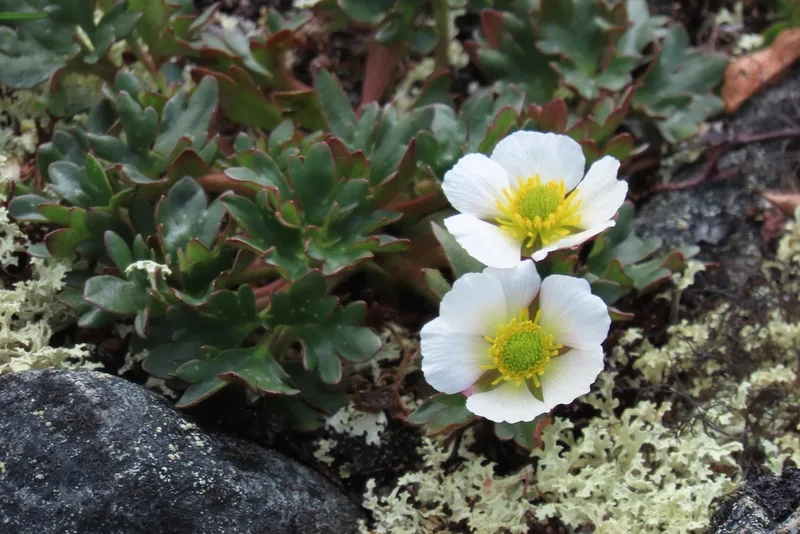
Glacier Crowfoot Ranunculus glacialis -
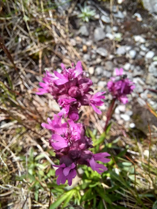
Alpine Catchfly Viscaria alpina -
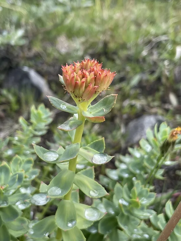
Roseroot Rhodiola rosea -
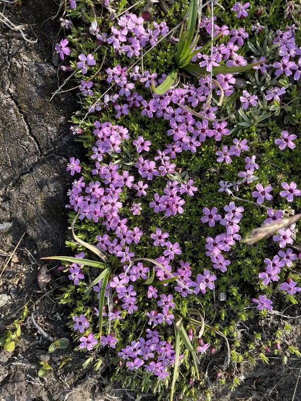
Moss Campion Silene acaulis -
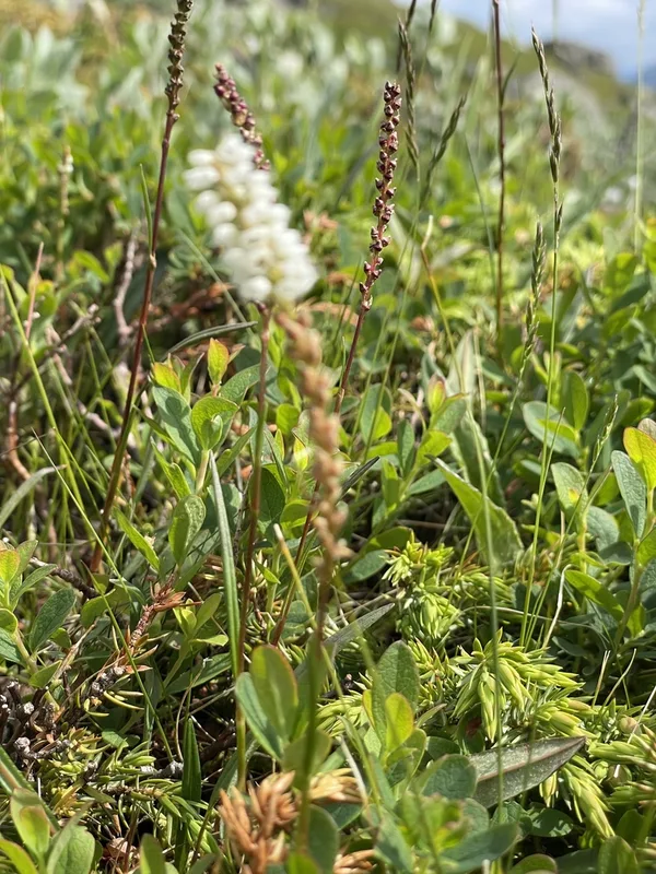
alpine bistort Bistorta vivipara -
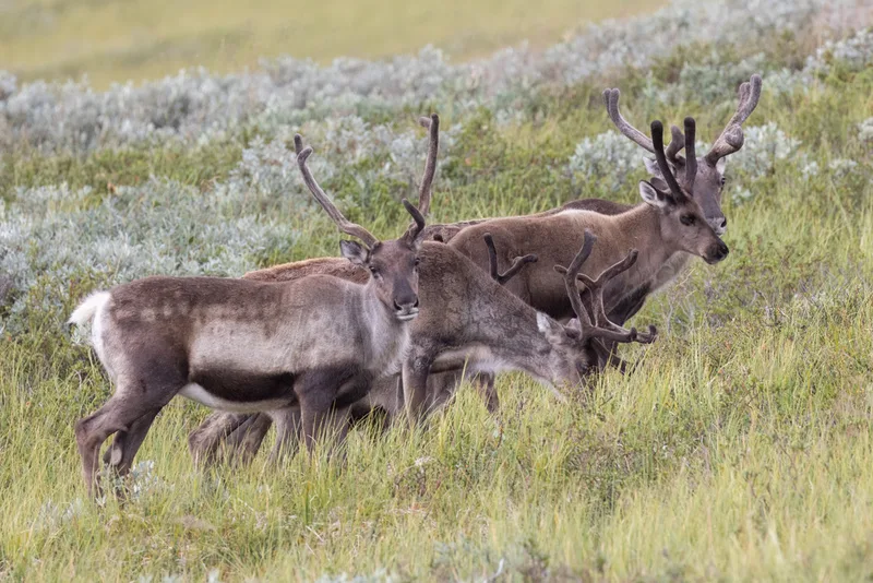
Caribou Rangifer tarandus -
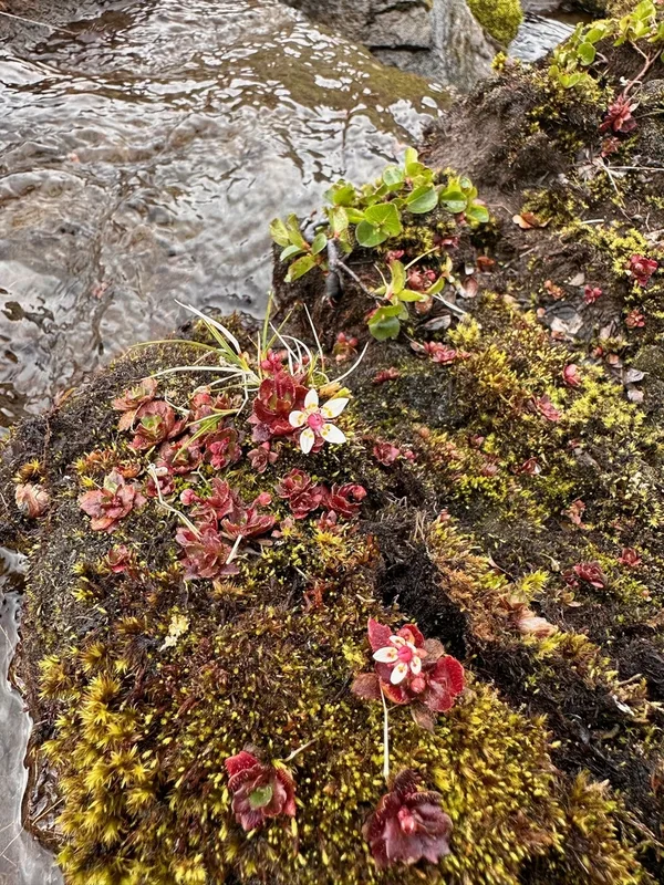
Hairy Kidney-wort Micranthes stellaris -
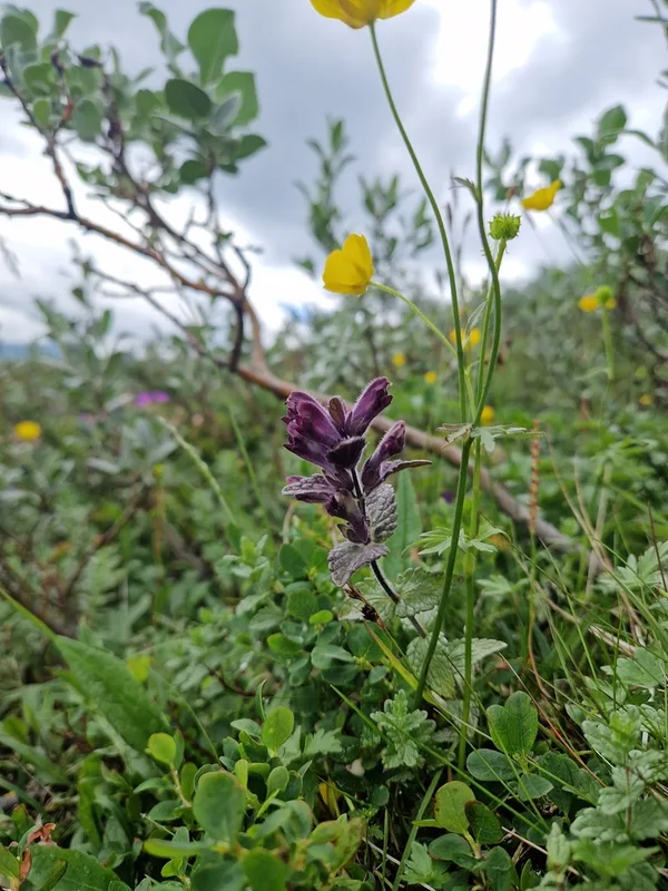
Velvetbells Bartsia alpina -
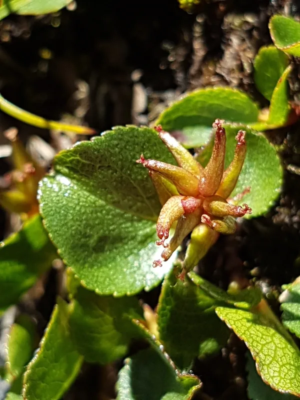
Least Willow Salix herbacea -
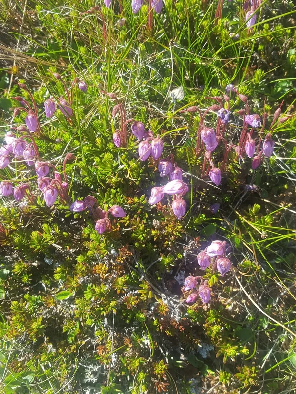
Blue Mountain-heath Phyllodoce caerulea -
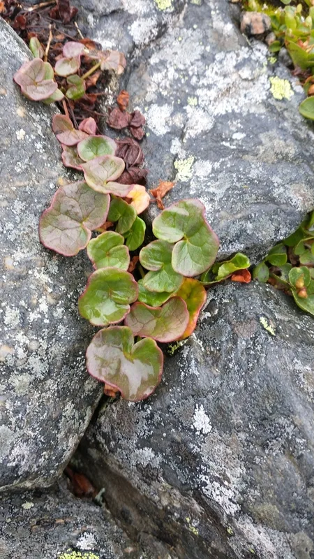
alpine sorrel Oxyria digyna -
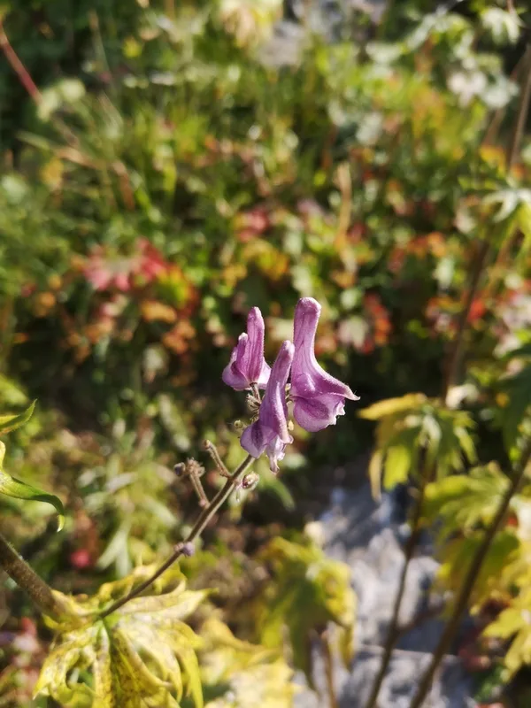
Northern Wolfsbane Aconitum septentrionale
Field Notes · Ice & Glaciers lens · Jotunheimen · 61.5529, 8.5307