Jostedalsbreen
Jostedalsbreen · Vestland, Norway
Under the ice, the rock is older than almost anything that grows on it.
Why here
Say “Jostedalsbreen” to someone who has been here and they may answer with a different name entirely — Briksdalsbreen, Nigardsbreen, Bøyabreen — because that is how the glacier actually introduces itself: one arm at a time, each one draining down its own valley, each looking, from where you stand, like the whole story. It isn’t. Jostedalsbreen is the largest glacier on mainland Europe, a single ice cap sprawled across the high country where five municipalities meet, and everything you can walk to and touch is just its outer edge. The interior is vast enough that most of it never becomes a destination at all — only its fingertips do. This note stays at those fingertips, and at a handful of summits nearby, tall enough that the ice, for all its reach, never quite got to them. Between the two — ice that reached, and rock that stood clear of it — is the whole shape of the place.
The story
The rock under all of this is far older than the ice sitting on it. Long before any glacier existed here, this stretch of Norway was crystalline basement — gneiss and granite forged and reshaped deep underground during an ancient continental collision, then lifted and exposed at the surface over an immense stretch of time. That old, hard rock is what the ice cap has been carving at ever since: quarrying valleys, smoothing ridgelines, leaving a handful of the tallest summits standing clear above it as nunataks while burying everything lower. On the ice cap’s edges, where the ground has only recently come free of moving ice, low meadow plants move in first — heather, crowberry, fireweed, wood crane’s-bill — a thin, hardy cover on ground that was under ice within living memory. Streams running straight off the glacier draw their own life: wagtails and sandpipers working the gravel banks where meltwater runs milky with ground rock. People have lived alongside this ice for a long time, though the record kept here is a quiet, practical one rather than a dramatic one: a small parish chapel built in a side valley in the twentieth century, a visitor center opened decades later, some ten kilometres east of the ice itself, to help people make sense of what they were looking at. None of it explains the ice. It simply sits, as everything here does, in its shadow.
The sites
Where the ice reaches down
Briksdalsbreen
61.6646, 6.8625
Of all Jostedalsbreen’s tongues, this is the one most people mean when they say they have seen the glacier. It sits at the head of Briksdalen, a short side-valley off the longer Oldedalen, and it earns its reputation honestly: no other arm puts a visitor this close to moving ice for this little effort. The walk in follows the valley floor upward, the ground getting rockier and barer as you go, until the trees give out and the ice comes into full view — a broken, blue-white wall filling the head of the valley. It ends, as glacier tongues here tend to, in its own small lake, fed directly by meltwater running off the ice front. That lake sits a little over three hundred metres above sea level, low enough that the walk to reach it never feels like mountaineering, high enough that the valley below still catches every bit of cold air draining off the ice above. What you are looking at is not a fixed thing. The position of that ice front creeps forward or pulls back year to year, a slow bookkeeping of how much snow fell on the ice cap’s interior against how much the following summer took away. The lake, the bare rock apron, the exact line of the ice — none of it is where it was a generation ago, and none of it will stay where it is now.
Stand at the shore of the small lake beneath the ice and look for the line where bare, smoothed rock meets vegetation starting to take hold — that boundary marks roughly how far the ice has pulled back in living memory. Follow it with your eye up the valley wall and you can trace the glacier’s retreat like a tide line.
- AccessShort walk
- ExertionEasy
- TimeAn hour
Nigardsbreen
61.6722, 7.2344
Nigardsbreen drains the eastern side of the same ice cap that feeds Briksdalsbreen on the far side of the park, and standing at either one it is easy to forget they are fed by the same body of ice at all. That is the trick of a glacier this size: from any single valley you only ever meet one finger of it, reaching down through whichever gap in the mountains offers the easiest gradient, looking for all the world like a glacier of its own. The national park around it protects roughly thirteen hundred square kilometres of high country, and the ice itself covers well over half of that — yet no viewpoint anywhere in the park shows you more than a sliver of the whole. What you can read here, up close, is the glacier’s most recent business: a churned, milky stream running off the ice, carrying rock ground to powder under the moving mass; and beyond the current ice edge, a band of bare, scraped rock, smoothed and sometimes faintly scratched, marking ground the ice let go of not long ago.
Follow the meltwater stream with your eye back to where it leaves the ice, and notice its milky, grey-white color — that is rock flour, stone ground to powder under the glacier’s own weight, still suspended in the water long after it left the ice.
- AccessShort walk
- ExertionModerate
- TimeHalf a day
Bøyabreen
61.4835, 6.7517
Bøyabreen is a smaller, lower arm of the same ice cap, and it is worth visiting for one thing in particular: the color. Look at the ice where it is thickest and freshest — not the dirty, broken surface near the front, but a crevasse wall or a clean fractured face — and it reads distinctly blue, not white. That is not a trick of light or reflection off the sky. Glacier ice is old, compressed snow that has had the air squeezed out of it over years of burial under new snow above; without trapped air bubbles to scatter light in every direction, the ice instead absorbs red wavelengths and lets blue pass through and bounce back, the same basic physics that makes deep water look blue rather than clear. Fresh snow, full of air, looks white for the opposite reason. The color is a rough, honest gauge of age and density: the bluer the ice, the longer it has sat under the weight of everything that fell on it since, patiently turning from snow into something closer to rock.
Look for a fractured or crevassed face of the ice, not the dirty surface ice near the front, and check its color against the sky — genuinely old, compressed glacier ice reads a deeper blue than anything else in view.
- AccessShort walk
- ExertionEasy
- TimeAn hour
Kjenndalsbreen
61.7440, 7.0349
Kjenndalsbreen is a fourth face of the same ice cap, tucked into its own valley, and the most useful thing to do here is not just look at the ice but look for what it left behind. A glacier tongue’s front is never still for long; it advances in cold, snowy years and retreats in warm ones, and every position it holds for any length of time leaves a low ridge of dumped rock and gravel at its edge — a terminal moraine — before the ice moves on and abandons it. Walk the ground between the current ice front and the valley’s tree line and you are walking across a rough timeline, each low ridge a season or a run of seasons when the glacier paused. None of it is ancient. Most of what you are standing on here was still buried under moving ice within living memory, and some of the freshest ground has barely had time to grow anything at all.
Look for low, loose ridges of rock and gravel crossing the valley floor between the ice and the trees — each one is a moraine, a stopping point where the glacier’s front held still long enough to dump what it was carrying before retreating again.
- AccessShort walk
- ExertionModerate
- TimeHalf a day
Above the ice: summits it never covered
Lodalskåpa
61.7905, 7.2048
Lodalskåpa is the highest point in this entire stretch of mountains, standing a little over two thousand metres above the sea — taller than every summit the glacier actually covers — and that fact is the whole reason it belongs in a note about ice. A nunatak is a peak that stands clear of an ice cap even at the ice’s fullest extent nearby: not because it escaped the glacier by luck of position, but because it is simply tall enough that the ice surface, thick as it is, never rose to meet its summit. Everywhere around Lodalskåpa, ridgelines and lower peaks disappear under moving ice; here, the summit rock has stood in open air the entire time, weathered by frost and wind rather than ground down by a glacier’s passage. That difference is visible in the rock itself if you know to look for it: ice-scoured stone tends to be smoothed and rounded, its edges softened by centuries of moving ice and grit; rock a glacier never reached keeps a sharper, more broken, frost-shattered character. Reaching the summit means climbing well above where the ice cap’s own surface tops out, a serious undertaking in high, exposed terrain rather than a short walk from any road. The reward is a vantage very few glacier viewpoints offer: the ice cap seen from above and beside, rather than from below and in front of it.
Compare the texture of exposed rock near the summit to rock you saw lower down near the ice’s edge: summit stone here tends to be sharp-edged and frost-broken rather than smoothed, because unlike the lower ground, a glacier has never ridden over it.
- AccessExpedition
- ExertionStrenuous
- TimeWorth two days
Brenibba
61.7645, 7.1943
Brenibba is Lodalskåpa’s quieter counterpart, another summit standing higher than the ice cap’s own highest ice yet never buried by it. Where Lodalskåpa rewards the climb with distance and scale, Brenibba sits closer to the ice cap’s working arms, close enough that from its summit several of the glacier’s separate tongues become visible at once, laid out below like fingers of a single hand rather than the isolated glaciers each looks like from its own valley floor. That is the view this note has been building toward at every stop: not one glacier here and another there, but a single mass of ice sending itself down through whatever gaps in the mountains lie lowest, watched over by a handful of summits it was never quite tall enough to reach. Like its higher neighbor, reaching Brenibba means committing to remote, high terrain well above any road or maintained path — this is not a detour on the way to somewhere else, but a destination worth planning as one.
From the summit, try to pick out more than one glacier tongue at once and trace each back toward the same central ice — from up here the separate named glaciers below reveal themselves as one continuous body, which is easy to miss from any single valley floor.
- AccessExpedition
- ExertionStrenuous
- TimeWorth two days
Taking in the whole ice cap
Glacier View
61.7554, 6.8003
Not every stop needs to put you at the ice’s edge. This one is named plainly for what it does: it gives you the ice cap as a single object, rather than as one arm glimpsed from the bottom of one valley. From here the scale sorts itself out in a way it can’t from underneath a glacier tongue — you are looking at a broad white mass filling the high country as far as the ridgelines allow, the largest glacier on mainland Europe reduced, from this distance, to something you can actually take in with one look. Pick out the darker lines running down through the white and you are seeing the glacier’s own structure: bands where debris and older, dirtier ice have folded into the moving mass, tracing the paths ice takes as it flows downhill under its own weight, the same way water finds its channel. It is a useful corrective after visiting the arms up close, where the ice fills your whole view and reveals nothing of its shape. From a distance, for once, the whole thing holds still long enough to actually see.
Look for dark, curving lines running down through the white of the ice — these are bands of debris folded into the glacier as it flows, and tracing one with your eye shows you the direction the ice underneath is actually moving.
- AccessShort walk
- ExertionEasy
- TimeAn hour
When it's best
The only weather record in hand for this note covers a single window in late March, and it is unambiguous: the high country here is still deep in winter then, days well below freezing and modest snow still falling. That matches the broader pattern of a place built around a permanent ice cap — the glacier’s arms are usually easiest to reach on foot once the snowpack in the lower valleys has pulled back and meltwater is running strong, typically through the warmer half of the year, while the higher nunatak summits want a longer settled stretch of summer weather before they are safely climbable at all. There is no single week to chase here so much as a season to lean toward, and a season to avoid.
Go deeper
The names behind what you saw — The bedrock under all of this ice is mapped as Proterozoic crystalline metamorphic rock (orthogneiss, paragneiss, and metavolcanic gneiss), intruded by granite and trondhjemite from the Caledonian mountain-building period — rock older than almost anything else measured in this note. A peak the ice never covered is a nunatak, the word geologists and mountaineers both use for it. Species recorded in the park’s lower ground include purple foxglove (Digitalis purpurea), fireweed (Chamaenerion angustifolium), wood crane’s-bill (Geranium sylvaticum), common heather (Calluna vulgaris), black crowberry (Empetrum nigrum), blue mountain-heath (Phyllodoce caerulea), and parsley fern (Cryptogramma crispa); birds recorded along the valley’s rivers include the white wagtail (Motacilla alba) and common sandpiper (Actitis hypoleucos).
To read next - Jostedal Glacier (Wikipedia) — the raw scale: the largest glacier on mainland Europe, spanning four municipalities and reaching into a fifth at its northeastern tip. - Jostedalsbreen National Park (Wikipedia) — when the park was established and later enlarged, and how much of its area is actually ice. - Austerdalsbreen (Wikipedia) — a side branch of the main ice cap known for a distinctive fishbone pattern in its lower ice, fed by three smaller glaciers of its own. - Høgste Breakulen (Wikipedia) — the highest point that is still ice, a useful contrast to the nunataks nearby that stand higher without ever being buried. - Breheimsenteret (Wikipedia) — one of three visitor centers for the national park, roughly ten kilometres east of the glacier, a natural first stop before heading toward the ice.
The names behind what you saw
What lives here, and what it's called. Photographs from open collections — an aid to identification, not decoration.
-
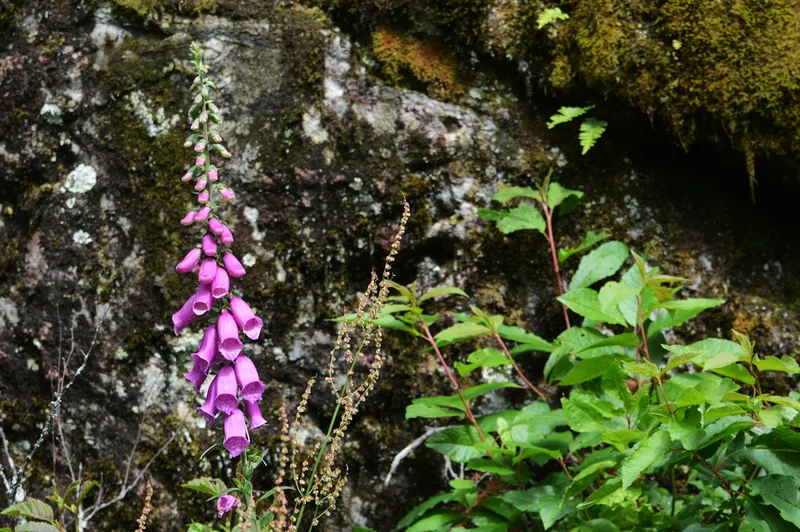
purple foxglove Digitalis purpurea -
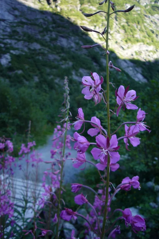
fireweed Chamaenerion angustifolium -
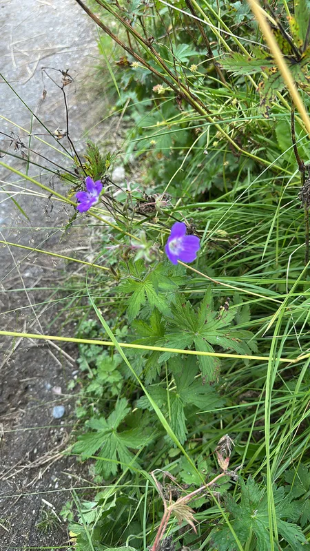
wood crane's-bill Geranium sylvaticum -
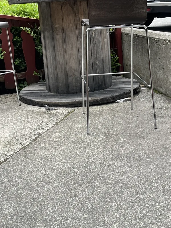
White Wagtail Motacilla alba -
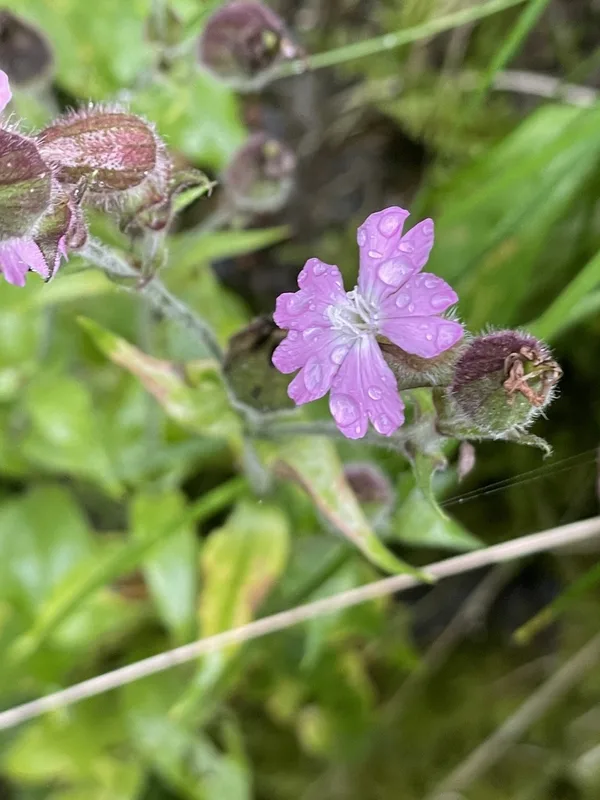
red campion Silene dioica -
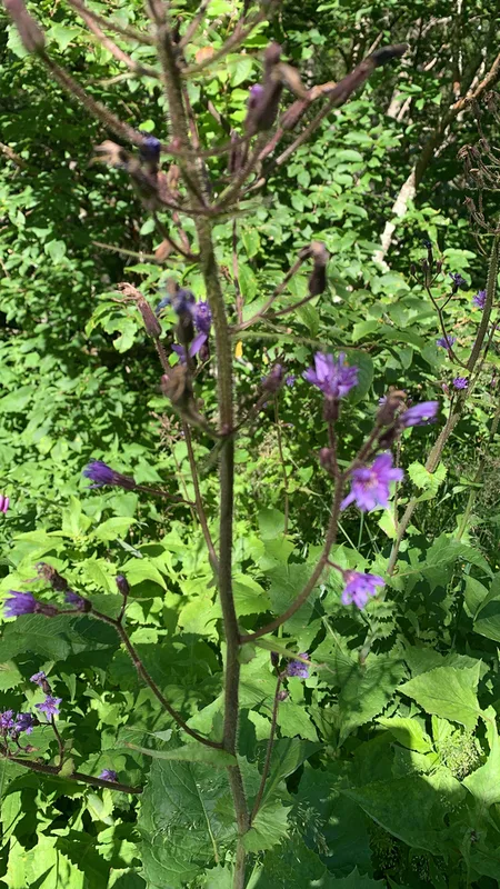
Alpine Blue-sow-thistle Cicerbita alpina -
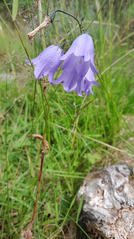
Common Harebell Campanula rotundifolia -
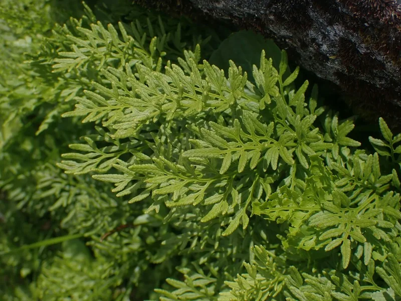
parsley fern Cryptogramma crispa -
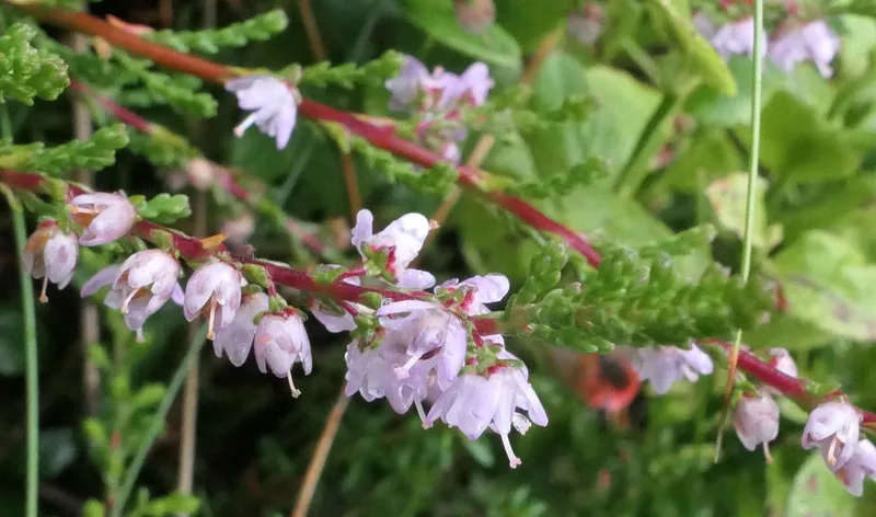
common heather Calluna vulgaris -
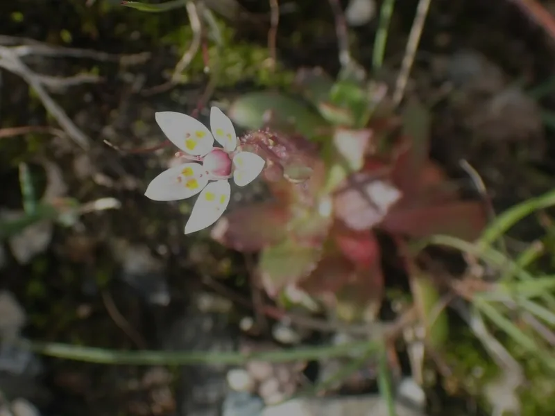
Hairy Kidney-wort Micranthes stellaris -
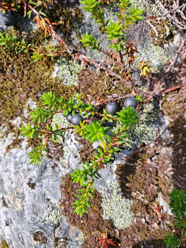
black crowberry Empetrum nigrum -
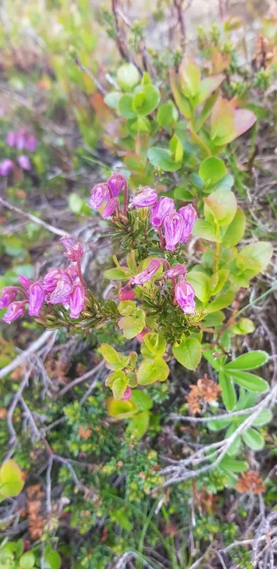
Blue Mountain-heath Phyllodoce caerulea
Field Notes · Ice & Glaciers lens · Jostedalsbreen · 61.6352, 6.9271