The Isle of Skye
The Isle of Skye · Highland, Scotland
On Skye the sea does not stay at the shore. It climbs the ridges as cloud, soaks the moor as rain, and settles into the rock as weather that never quite leaves.
Why here
Nowhere on Skye is very far from the sea. The island’s peninsulas radiate out from a mountainous core, and every one of them ends within a short distance of open water — which means the sea’s influence never really stops at the shoreline. It climbs the peaks as cloud, drawn up when moist air off the water meets rising ground and cools into mist against the rock. It soaks into the moorland as rain that the peat holds onto for days after the sky has cleared. It feeds the seals hauled out on coastal rocks and the seabirds riding the wind above the cliffs, all working the same narrow strip where land and water meet. Even the highest, driest-looking summits here are, in a real sense, coastal — shaped daily by air that started out over open sea a short distance away. This note follows that thread from the peaks down to the water’s edge: not two different Skyes, one mountain and one coastal, but a single island the sea never quite lets go of.
The story
The mountainous backbone of Skye is built from old volcanic rock — repeated layers of lava and ash laid down over tens of millions of years, during a long stretch of eruptions that shaped much of this corner of Scotland. What’s left today, worn down by ice and weather since, is a ridge of dark, resistant rock standing high enough to catch its own cloud. Life took hold on whatever the rock and rain allowed: heather moorland across the lower slopes, bog plants rooted in ground that never quite dries, and along the coast, seals, gulls, and shags making a living where land meets water. People settled the narrow strips between mountain and shore, working small crofts on ground that offered little else. One such settlement, Mugeary, gave its name to a distinctive type of basaltic rock first identified there — a small, specific mark left on the geological record by a place most visitors will never pass through. Elsewhere on the island, Gaelic is still the language of instruction at a college on the Sleat peninsula, and the island’s capital, Portree, grew up around a harbor rather than inland — the pattern holding, from stone to plant to person: everything here settled close to the water because there was rarely a good reason not to.
The sites
The peaks that make their own weather
Sgùrr nan Gillean
57.2483, −6.1930
Sgùrr nan Gillean is one of the sharpest points on the Cuillin ridge, a spine of old volcanic rock that runs through the heart of the island. Its narrow flanks rise straight out of the glen with little in the way of foothills to soften the climb, which is part of why the peak holds its own weather so well. Moist air moves in off the sea, meets the rising ground, and is forced upward — cooling as it climbs until it condenses into cloud right against the rock. On a day when the coast below sits under clear sky, the summit here can still be wrapped in its own private mist, gone as quickly as it formed. Reaching the top asks for a full mountain day and sure footing on exposed, rocky ground; this is not a casual stroll, and the reward is not only the view but the sense of standing at the point where sea-born moisture becomes cloud in real time, a process usually too slow or too high up to watch happen. Give the peak time rather than rushing for the top — the cloud around it changes by the minute, and watching it work is as much the point as reaching the summit.
Find the summit ridge and watch it for several minutes rather than glancing once. Look for a cap of cloud forming, thickening, or breaking apart against the rock — moist air pushed upward by the peak and cooling into mist right where you can see it happen. Time how long a single wisp lasts before it’s gone.
- AccessExpedition
- ExertionStrenuous
- TimeA full day
The Inaccessible Pinnacle
57.2133, −6.2347
The Inaccessible Pinnacle is a blade of rock set high on the ridge, narrow enough that reaching its true top means climbing hand over hand along an exposed edge with a rope, not simply walking up. Seen from below or from a neighboring summit, it reads as a jagged shadow rising out of the ridgeline, and in anything less than perfectly clear conditions it is often only half-visible, its outline breaking apart into drifting cloud and reforming a few minutes later. That flickering visibility is itself a kind of weather report: cloud clings longest to the highest, sharpest points on the ridge, the places where rising, sea-fed air has the least room to spread out before it condenses. Getting close enough to attempt the climb is a serious undertaking, best treated as its own dedicated outing rather than a stop on a longer day. Even without attempting the scramble, a clear view of the pinnacle from a safe distance on the ridge is worth the effort, if only to watch how completely a solid-looking piece of rock can vanish and reappear inside moving cloud.
From a safe distance on the ridge, watch the pinnacle’s outline rather than the wider view: note how much of it disappears into passing cloud and how long it takes to reappear, sharp-edged, once the cloud has moved on.
- AccessExpedition
- ExertionStrenuous
- TimeWorth two days
Blà Bheinn
57.2196, −6.0932
Blà Bheinn stands apart from the main Cuillin ridge, separated by a low pass rather than joined directly to its neighbors, which makes it one of the better places on the island to watch the range as a whole rather than experience it from inside. The approach climbs steadily from the road to open, rocky ground with the sea visible behind you for much of the way. From partway up, the view back toward the main ridge often shows a visible line: cloud sitting on the highest points while lower slopes stay clear, marking the exact height at which rising sea air cools enough to condense. That boundary shifts through the day as the wind and warmth change, so the same view can look completely different an hour later. The climb is a full and strenuous day out on rough, sometimes steep ground, with no easy shortcut to the top, though it does not require the technical rope work some of its neighbors do. Go for the summit if conditions allow, but the mid-height viewpoint back at the main ridge is worth the stop on its own.
Partway up, turn back toward the main ridge and look for a line where cloud sits on the highest ground but not the lower slopes. Watch it for a while — that boundary rises and falls as the day’s air moves, and you can see it shift if you wait.
- AccessExpedition
- ExertionStrenuous
- TimeA full day
The ridge that meets the strait
Beinn Edra
57.5823, −6.2583
Beinn Edra sits on a long, exposed ridge on the island’s northern ground, facing open water with little else to break the wind or the weather moving in off the sea. Because there is so little shelter between the ridge and the water, this is one of the more reliable places to watch a weather system arrive rather than simply be caught in it: fog and low cloud are visible out over the sea well before they reach land, drifting in as a pale bank that thickens as it comes. The walking here is open moorland rather than technical rock, following the line of the ridge with wide views down to the water on the clear stretches. Heather covers much of the ground, and the peat beneath stays damp even through dry spells, holding onto the moisture the sea keeps delivering. It’s a half-day outing on generally good, if often wet and exposed, ground, better suited to sturdy boots and waterproofs than fair-weather footwear. Time your visit for a day with some cloud in the forecast rather than a flawless one — a completely clear sky here has less to show you.
Look out over open water and watch for a pale band low on the horizon — fog or cloud moving toward land rather than already over it. If one is visible, watch how it changes shape and thickens as it approaches, well before it reaches the ridge you’re standing on.
- AccessHalf-day hike
- ExertionModerate
- TimeHalf a day
Meall na Suiramach
57.6430, −6.2815
Meall na Suiramach rises along the same northern ridge system as its neighbors, with slopes covered in heather and the low, tough plants of wet moorland rather than bare rock. Bell heather and common heather both grow here, alongside bog asphodel and heath spotted orchid in the boggier hollows — plants suited to ground that rarely dries out completely, kept damp by the near-constant moisture moving in off the sea. Walking the ground itself is a good way to feel what the geology and the weather do together: press a boot into open peat between the heather clumps and it is often soft and wet, even after several dry days, because the water table here sits close to the surface and the air rarely goes long without adding more. Views from the higher ground take in open sea to more than one side, a reminder of how narrow this stretch of land actually is. The walk is a moderate half-day on established ground, exposed to wind and weather for most of its length, with nothing overhead once you’re above the last of the shelter.
Step off the path onto open peat between heather clumps and press down gently with a boot. Notice how readily it gives and how wet it feels, even if it hasn’t rained recently — a sign of how close to the surface the water sits here.
- AccessHalf-day hike
- ExertionModerate
- TimeHalf a day
Cleat
57.6194, −6.2782
Cleat is a lower, more modest hill on the same ridge system, easier to reach than its taller neighbors and useful for a different reason: from partway up, it’s often possible to look down onto a layer of cloud rather than stand inside one. Low cloud on Skye tends to sit at a fairly consistent height across a given stretch of ridge, shaped by how far moist sea air rises before it cools enough to condense — which means a modest hill can sometimes put you above the cloud line while a taller peak nearby disappears into it. The climb is short enough to manage in an hour or two on clear, well-trodden ground, making it a reasonable stop even with limited time or on a day when heavier weather rules out anything more ambitious. It rewards patience over exertion: arrive, find a place out of the wind, and watch the cloud layer rather than pushing straight back down. The shape and edge of that layer can be more interesting standing still than moving through it.
Look along the ridge at the height where cloud sits, if any is present, and see whether it forms a level line across several summits rather than sitting unevenly. A consistent height across the ridge is the cloud settling at the point where rising sea air has cooled enough to condense.
- AccessShort walk
- ExertionModerate
- TimeAn hour
Where the land runs out into the sea
Ben Tianavaig
57.3910, −6.1426
Ben Tianavaig is a coastal hill with open water on more than one side, a straightforward climb by island standards that trades technical difficulty for a wide, uninterrupted view of how completely the sea surrounds this stretch of land. Gulls and other seabirds ride the updraft along its seaward face, using the same rising air that, on a wetter day, would be carrying cloud up over the same slope. That’s the underlying idea worth carrying up the hill: the birds, the weather, and the shape of the land are all responding to the same simple fact, that moving air hits rising ground and has to go somewhere, usually up. The path climbs from lower ground to open hilltop in a few hours, moderate rather than severe, with grass and heather underfoot for most of the way. Good visibility from the top takes in the wider coastline and the more distant peaks inland, a useful way to see how this one hill relates to the rest of the island’s shape. Choose a breezy day over a still one — the wind is part of what makes the top worth reaching.
Watch for gulls holding a fixed position in the air along the hill’s seaward face, wings barely moving. They’re riding the same rising air current that carries moisture up and over the slope — notice how little effort it takes them to stay aloft in it.
- AccessHalf-day hike
- ExertionModerate
- TimeHalf a day
Sleat Point Lighthouse
57.0183, −6.0179
Sleat Point Lighthouse sits at the water’s edge on the Sleat peninsula, in the south of the island, with no elevation between the site and the sea to soften the weather moving through. This is the most direct version of the idea running through the rest of this note: here, the fog and the coast are the same thing, arriving together with nothing in between. The rocks below the light are a regular haul-out spot for harbor seals, which rest here between trips into the water, and European shags are a common sight perched with wings held out to dry after diving. Sea thrift grows in the thin soil along the cliff edges, one of the few flowering plants able to hold on this close to salt spray and wind. The site is easy to reach and easy to spend an hour at without any particular fitness required, making it a good place to start or end a day that otherwise involves more strenuous ground further inland. Come with patience rather than a checklist — the seals and birds are there on their own schedule, not a visitor’s.
Scan the rocks below the light for a smooth, gray, still shape among the stones — a hauled-out harbor seal is easy to mistake for rock until it moves. Look too for a dark seabird standing with wings held open to the wind, drying off after diving: that’s a shag.
- AccessShort walk
- ExertionEasy
- TimeAn hour
When it's best
Skye doesn’t really have an off season for this kind of watching, since the mechanism behind it — sea air meeting high ground — runs year-round. Early-spring days here tend to be cool and often wet, more days with some rain than without, which is exactly the kind of weather that makes cloud on the peaks and dampness underfoot easiest to notice; a dry, cloudless stretch is pleasant but has less to show you. Expect changeable conditions in any season, since this is a small island fully exposed to the open Atlantic, and pack for rain even on a forecast that looks clear. If there’s a single steady year-round draw, it’s the coast itself — the seals, shags, and coastal flowers are a fixture whatever the month, less dependent on any one season than the moorland plants or the cloud on the high peaks.
Go deeper
The names behind what you saw - The dark rock underlying the island’s mountain core is mapped as Palaeocene basalt and, more broadly, as mafic volcanic and intrusive rocks — laid down in repeated eruptions across a span of tens of millions of years, from the Paleocene into the Paleogene. - A local basaltic rock type, mugearite, takes its name from Mugeary, a small former settlement on Skye where it was first identified. - Harbor Seal — Phoca vitulina - European Shag — Gulosus aristotelis - Sea Thrift — Armeria maritima - Heath spotted orchid — Dactylorhiza maculata - Bog asphodel — Narthecium ossifragum - Bell heather — Erica cinerea; common heather — Calluna vulgaris
To read next - The Geology Of West-central Skye, With Soay, Charles Thomas Clough — an early, ground-level survey of the terrain much of this note’s western sites sit within. - The geology of Skye, Paul Yoxon — a full-island account written for a general reader rather than a specialist. - The geology of northern Skye, F. W. Anderson — the counterpart study covering the island’s northern ridges. - The tertiary igneous geology of the Isle of Skye, George Malcolm Brown — the detailed technical account of the volcanic period that built the mountain core. - An excursion guide to the geology of the Isle of Skye — built for walking the ground itself, not reading about it from a desk.
The names behind what you saw
What lives here, and what it's called. Photographs from open collections — an aid to identification, not decoration.
-
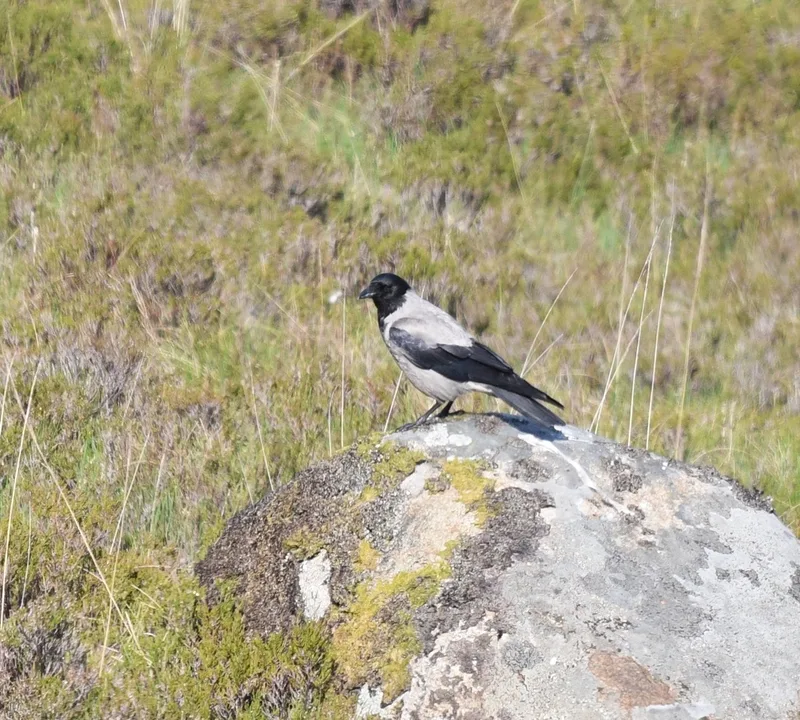
Hooded Crow Corvus cornix -
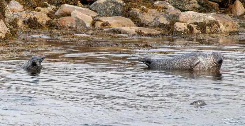
Harbor Seal Phoca vitulina -
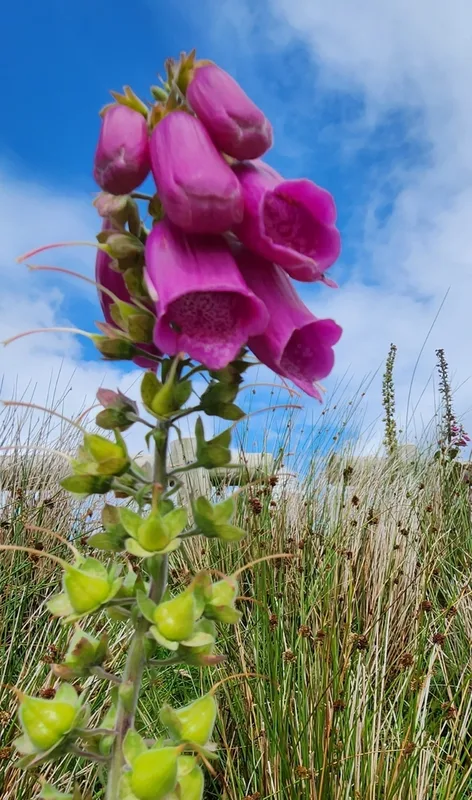
purple foxglove Digitalis purpurea -
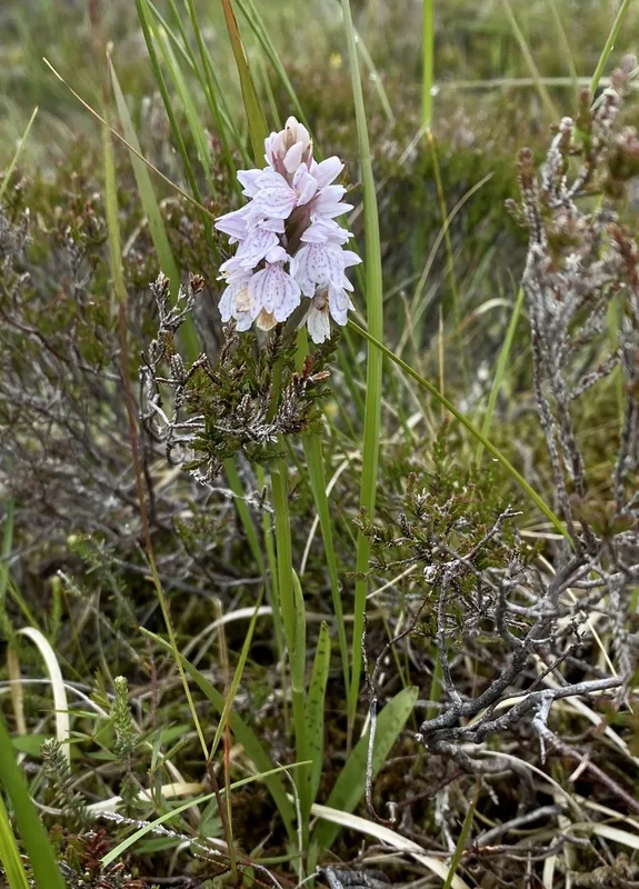
heath spotted orchid Dactylorhiza maculata -
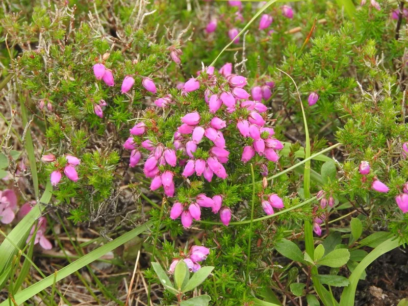
Bell Heather Erica cinerea -
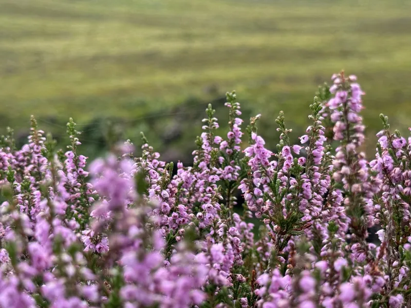
common heather Calluna vulgaris -
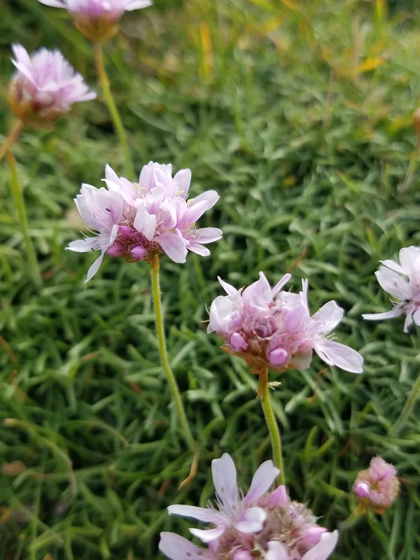
Sea Thrift Armeria maritima -
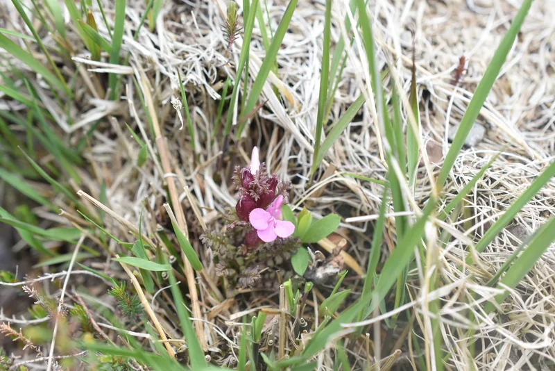
Common Lousewort Pedicularis sylvatica -
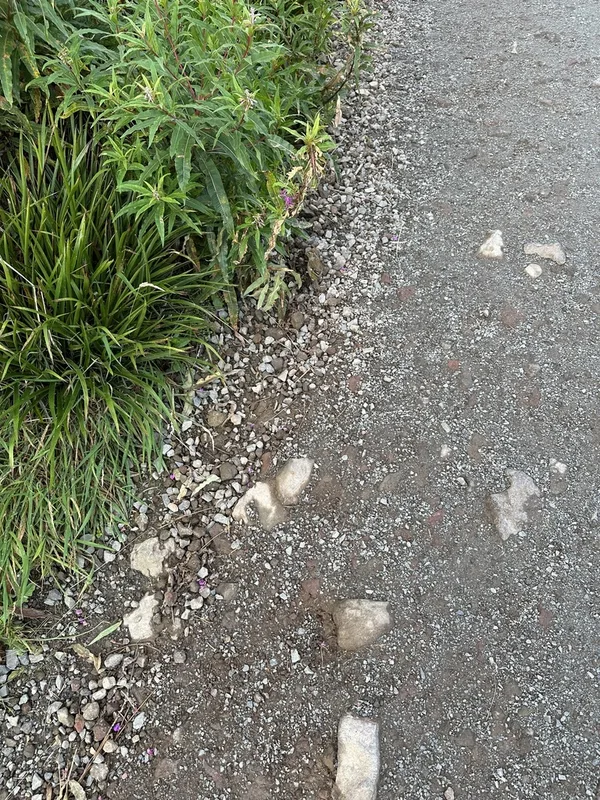
Common Chaffinch Fringilla coelebs -
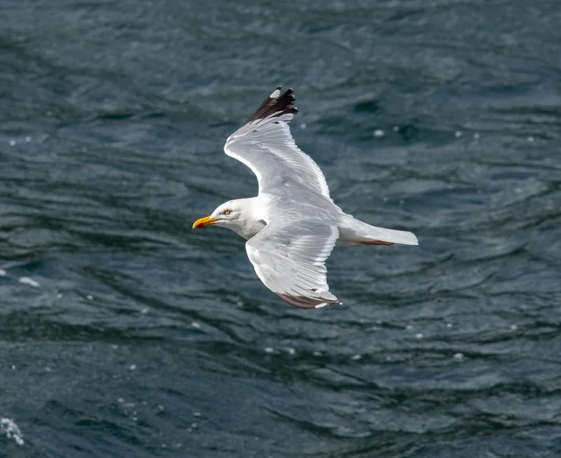
European Herring Gull Larus argentatus -
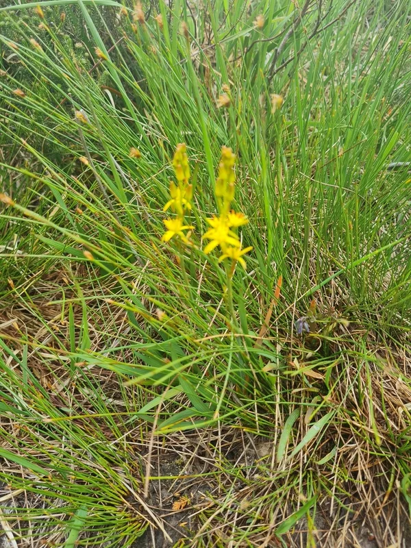
bog asphodel Narthecium ossifragum -
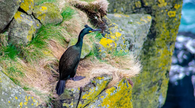
European Shag Gulosus aristotelis
Field Notes · Fog Coast lens · The Isle of Skye · 57.3630, −6.3023